Showing posts with label scenic drives. Show all posts

Thursday, October 5, 2023

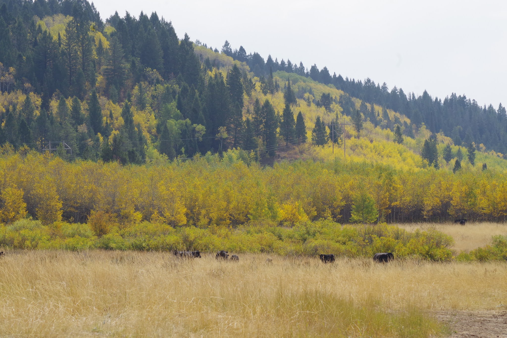
Fall colors are popping in the Idaho Mountains! Time for a scenic drive!

Aspen groves light up the mountains in Upper Reynolds Creek, Owyhee Mountains. 
Photo taken Oct. 5 by Steve Stuebner. 

Hi all,

Fall colors are popping everywhere in the mountains right now. What better way to enjoy the colors than to take a scenic drive? Better yet, combine the drive with a hike or mountain bike ride to see things more up close and soak in the scenery. 

I recently traveled from McCall to Boise, and the aspen trees are lit up, the cottonwoods are turning yellow, and the shrubs are glowing orange, yellow and red, particularly at higher elevations.

Courtesy Anna Gorin on Facebook. Road to Packer John Mountain in Smith's Ferry.

To enjoy the colors, I'm recommending five scenic drives. Click on the links to see the scenic byway detailed descriptions via VisitIdaho:

1. Payette River Scenic Byway - Take Idaho 55 north to McCall to enjoy fall colors along the North Fork of the Payette River and in the Boise and Payette National Forest. Once in McCall, keep going north on Warren Wagon Road toward Upper Payette Lake and Burgdorf Hot Springs to see even more brilliant colors. Bring a swimsuit and towel to enjoy the natural geothermal hot water at Burgdorf. The hot springs won't be accessible by vehicle much longer until snow shuts the road and turns it into a snowmobile highway. That usually happens in late November. Stop for lunch in McCall -- there's a great sushi place as well as multiple other venues with sandwiches and burgers.

Sawtooth Valley (courtesy explore.org)

2. Ponderosa Pine Scenic Byway - Idaho 21 and the Banks-to-Lowman Highway. I saw full mountainsides glowing red this week from tip to tail near Grand Jean and Lowman.

3. Sawtooth Scenic Byway - The Sawtooth Valley is at a higher elevation and thus, the colors are happening big-time right now. Following Idaho State Highway 75 through Ketchum-Sun Valley and then over Galena Summit into the Sawtooth Valley should be spectacular. Do the big loop by combining the Ponderosa Pine Scenic Highway on Idaho 21 from Boise with the Sawtooth Scenic Byway on the way home, going from Stanley to Ketchum and then back to the Treasure Valley via U.S. 20. Stop for lunch in Ketchum. There are many great restaurants to choose from. I personally like the Pioneer, Whiskey Jacques, and Lefty's.

Wood River Valley aglow (courtesy VisitSunValley) 

4. Owyhee Uplands Backcountry Byway - Take a big drive from Grand View to Jordan Valley, Oregon on this scenic byway on backcountry dirt and gravel roads. It's about 100 miles and full day's drive to cover the byway. Beyond the BLM online guide, we provide all the details on this scenic drive in our popular guidebook, The Owyhee Canyonlands - An Outdoor Adventure Guide, by yours truly and fine arts photographer Mark Lisk. There are restaurants and services in Grand View and Jordan Valley. Make sure you top off your gas tank before venturing off into the Owyhees!

Wendy along Jordan Creek in Silver City.

5. Take a scenic drive to Silver City in the Owyhee Mountains. The aspen trees are turning color in the quaint mining ghost town, located near Murphy. There are places to go hiking and mountain biking in Silver City. Details are available in The Owyhee Canyonlands - An Outdoor Adventure Guide. To reach Silver City, go south of Nampa on Idaho 45 to the Snake River and junction with Idaho 78. Turn left to head for Murphy and watch for a signed right-hand turn to Silver City. It's paved road for a while, and then it turns to dirt. Pack a lunch and enjoy the day!

Have fun!
- SS

Thursday, March 2, 2023

Take a scenic drive to see wildlife on Banks to Lowman Road

Be sure to watch the elk from a respectful distance. 

Hi all, 

It's early March, but this weekend is going to feel more like winter than spring. 

With weekend temps barely reaching 40 in Boise, and a chance of light snow, it might be a nice change of pace to take a leisurely scenic winter drive.  

March is a great time of year to visit the Wildlife Canyon Scenic Byway, a.k.a. the Banks to Lowman Highway, watch for deer and elk on the mountainsides (or on the road), maybe go for a short walk, take a nice soothing hot springs soak and then cap it off with a hearty meal in Crouch at the Dirty Shame Saloon.

All of these things are doable in a day trip Boise. The Banks to Lowman road covers 33 miles tip to tail. And most likely, you'll be going out and back.  

How to get there: Take Idaho 55 north from Boise to Banks. Turn right. Now you're on the Wildlife Canyon Scenic Byway. 

Courtesy Boise National Forest

Large groups of elk and deer are typically visible along the two-lane scenic road. Be sure to give the animals a wide berth. Don't spook them or cause them to burn extra energy. It's a vulnerable time of year for them. Deer and elk are drawn to the big, open south-facing slopes on the north side of the canyon because they are snow-free. In the coming weeks, tiny shoots of green grass will begin to sprout.

Be sure to bring your binoculars. You also may see bald eagles, golden eagles and red-tailed hawks flying around. Pack a lunch, snacks and water for the day trip. 

Courtesy Boise National Forest 

Several choices are available for hot springs to visit as part of your trip: 
  • Hot Springs Campground - Just east of the town of Garden Valley, the hot pools are down by the river's edge. Not sure if the campground is plowed. Call the Boise National Forest for more information. 
  • Pine Flats Hot Springs is a beautiful spot along the South Fork of the Payette River that serves as a Forest Service campground in the summertime. The hot springs pools are small, and there's a hot shower you can stand underneath too.  
  • Kirkham Hot Springs is probably the most popular roadside hot springs in Idaho, given its proximity to Boise. There are some nice hot pools next to the river. Bring a swimsuit. Be sure to Pack out what you pack in and leave the area nicer than you found it. 
  • Bonneville Hot Springs is about 20 miles toward Stanley on Idaho 21, east of Lowman. It has some nice larger hot pools and an old wooden shake with a bathtub inside. Because of snow, you'll need to hike in less than a mile to the springs from the highway.   
A couple of other places where you can see wildlife in a scenic drive would be on the Salmon River Road, going upstream from Riggins, or going downstream from North Fork near the town of Salmon. Both areas are promising for seeing bighorn sheep, elk, deer and maybe even mountain goats. 

Have fun! 
- SS

Thursday, September 24, 2020

Take a scenic drive to see fall colors bursting in Idaho's Mountains

Caribou-Targhee National Forest, taken on Tuesday.  

Big-toothed maple trees glowing between Soda Springs and Lava Hot Springs 

Hi all, 

This week for my outdoor tip, I'd recommend taking a scenic drive to enjoy fall colors, which are really starting to pop in the higher elevations! 

I had a business trip to Southeast Idaho this week, and I was surprised and amazed how beautiful the colors were, especially as I went from Lava Hot Springs, south of Pocatello, toward Soda Springs. The big-toothed maple trees in the Portneuf Mountains, Bannock Mountains and other ranges in Southeast Idaho are turning deep red. Aspens are turning yellow, and cottonwoods are also beginning to take on a golden glow. The time is now! 

Visit Idaho lists two scenic drives in SE Idaho. I'd recommend the Oregon Trail - Bear Lake Scenic Highway , which goes from Lava Hot Springs to Soda Springs, Montpelier then Bear Lake. All interesting and scenic spots, a bit off the beaten track. 

With fires burning in the South Hills, the City of Rocks to Oakley scenic byway is out of the question. Fall colors may be popping in the Ketchum-Sun Valley area and Stanley. My friend Cheryl Bennett posted a few pics on a horseback ride this week in the East Fork Big Wood area, and the aspens and cottonwoods were turning a brilliant yellow. 

Courtesy Cheryl Bennett 

Here's a post I did last year on five Idaho scenic drives, which features a number of scenic drives in SW Idaho and N. Idaho. 

Clearwater River country 

Here are scenic drives in Southern Idaho ... see VisitIdaho.com for more information.  

Cobb Peak in the Pioneer Mountains, courtesy Cheryl Bennett 

Wednesday, May 15, 2019

Drive the Owyhee Uplands Backcountry Byway or hike two off-beat locations in the Owyhee Canyonlands

Sheep Creek below Mary's Creek ... very remote spot with plenty of solitude.

Huck checks out Sheep Creek
War Eagle Mountain can been seen in the distance behind Steve. Hiking to the west of Toy Pass is easy with big views.
Hi all,

The weather appears to be turning cool and moist heading into the weekend. Saturday looks like the most promising day to go hiking, with no chance of rain and a high of 65 degrees. Perfect conditions for a hike in the Owyhee Canyonlands!

For people in the know, the Owyhees are a great place to explore in the spring before the summer heat comes to SW Idaho and the rattlesnakes come out in the high desert. And if you don't know much about the Owyhees, you can pick up a copy of my Owyhee Canyonlands guidebook, which features 55 hiking and biking routes in the greater area, plus a guide to the Owyhee Uplands Backcountry Byway.
 
Here are three destinations:


1. Drive the 100-mile Owyhee Uplands Backcountry Byway and enjoy a big-picture overview of the Owyhee Mountains and Owyhee Plateau. The drive can be done in a day. The byway has a good-quality dirt road that travels out into "The Big Wide Open" (no services, BTW) and eventually drops back to civilization in Jordan Valley, Oregon. I recommend starting on the byway in Grand View and traveling in a east-to-west direction to Jordan Valley. Pack a lunch, some beverages and enjoy the drive. The backcountry byway will pass many intriguing areas, such as the Antelope Springs Road, Deep Creek junction, Nickel Creek Table and the North Fork of the Owyhee BLM campsite, the only developed campsite on the 100-mile byway. The byway is suitable for 2WD vehicles. But make sure your spare tire is in good shape. Again, there are no services out there, and no mobile service.

Wendy pretends she's an eagle on top of the Owyhee Mountains near Toy Pass. Bachman Grade Road can be seen below. 
2. Toy Pass - I've got 2 hikes in the Owyhee Canyonlands guidebook that start and finish at Toy Pass, accessed from the Bachman Grade Road, south of the little town of Oreana, between Murphy and Grand View in the Owyhee Front. Toy Pass sits at 5,875-foot elevation, south of Oreana. Drive to Toy Pass, do a day hike from the pass to the mountains on either side of the road, and then either go look for a campsite afterwards or head back home. To reach Toy Pass, take Simco Road to Grand View. Go right on ID 78 in Grand View and travel west to Oreana. Watch for a road sign for the historic Owyhee town. Turn left and drive 2 miles into town. Bear right at Our Lady, Queen of Heaven Catholic Church at the corner, and take the Bachman Grade Road to Toy Pass. It's about 13.5 miles to the top. This road is suitable for 2WD vehicles. Park at the pass and decide which mountain you'd like to climb. See maps below for hiking to the west or to the east. Both routes are about 5 miles.


Map courtesy of Owyhee Canyonlands: An Outdoor Adventure Guide.

3. Mary's Creek/Sheep Creek Wilderness. Mary's Creek is an easy-to-access tributary of Sheep Creek Canyon, which is one of the BLM wilderness areas in the Owyhee Canyonlands. There is a self-support camping area at the "trailhead" next to Roland Road. You could camp there, and then do the Mary's Creek Loop, hiking into the bottom of spectacular Sheep Creek Canyon, and then hike back. You also could backpack into Sheep Creek Canyon and camp there. The full loop detailed in our guidebook is 8.75 miles, with 1,400 feet of vertical gain/loss. Scenic hike and nice spot to camp. To reach Mary's Creek, take ID 51 south of Bruneau about 40 miles to a signed turnoff for the Rowland Road by the old bar and junk yard at Grasmere. Turn left on Rowland Road and follow that 5.2 miles to the Mary's Creek trailhead. There's a BLM kiosk at the trailhead.


Views of Sheep Creek from the rim above.
Map of the Mary's Creek Loop
There you have it!
-SS

Thursday, August 23, 2018

Smoke-free weekend? Sawtooth Salmon Festival or visit South Fork Salmon River

South Fork Salmon River Road is about as wide as a driveway. Great place for a secluded road bike ride.
Caution: Vehicles should go slow around blind corners! 
Chinook spawning on the Salmon River near the Sawtooth Hatchery. Those fish take my breath away!
They travel 800+ miles to reach Stanley from the Pacific Ocean. SS photo.  
Hi all,

Smoke from all the wildfires has been depressing to me, but it appears that we might get a break this weekend! I hope that's the case!

For this week's outdoor tip, I wanted to share a few details about the Sawtooth Salmon Festival going on Saturday, Aug. 25, in Stanley this weekend, and some thoughts about road biking, camping and sight-seeing in the South Fork Salmon River area and Warm Lake area.

The Sawtooth Salmon Festival is a long-standing event, sponsored by Idaho Rivers United, for people to come up to Stanley and see Chinook salmon spawning, learn about how Chinook and sockeye salmon runs are doing right now (not well), enjoy live music, drink beer from Sockeye Brewing, and of course, you can vector off to go hiking, biking or camping in arguably the most scenic part of Idaho.

Tours of the Chinook spawning grounds will occur every two hours at 11 a.m., 1, 3 and 5 p.m. on Saturday. According to the fish counts at Lower Granite Dam, 38,500 Chinook salmon have crossed through the dam and are heading upriver to Idaho. The 10-year average to date is 80,800. There should be some Chinook salmon spawning down below Sunbeam Dam in shallow gravels, where it's easy to see the magnificent fish. About 1,000 Chinook have returned to the Sawtooth Hatchery, a few miles south of Stanley. That's another place where I've seen a lot of Chinook swimming in the gravels, directly below the Sawtooth Hatchery, north of Stanley.

If you go, this is a great teachable moment for your kids to observe salmon spawning and learn about the salmon life cycle. The way the Idaho salmon and steelhead fish numbers have been crashing lately, you have to wonder how long the fish can survive. The lower Snake and Columbia dams cause most of the mortality to our salmon and steelhead runs, in both directions, while we have hundreds of miles of pristine spawning habitat in the Salmon River and its tributaries that are awaiting the adult fish to arrive and spawn the next generation.

To paraphrase what someone once said about this situation, we have a 5-star hotel for salmon and steelhead in Central Idaho -- some of the best habitat remaining in the whole Columbia River Basin. The lights are turned on, but most of the bedrooms are empty. Sad tale, indeed.

Near the top of the climb, the forest has transitioned into an old burn zone. 
Now, on to the South Fork Salmon River ... Wendy and I went over to the South Fork Road from McCall via Lick Creek Road last Saturday to put in some training miles on our road bikes. We're training for Cycle Oregon. The smoke wasn't too bad. The South Fork paved road is exactly 31 miles from Lick Creek to the Warm Lake highway. It's a single-lane paved surface with pullouts, so it's kind of tight for a vehicle, but perfect for a bike.

What struck me during our ride was how quiet, desolate and beautiful it was back there on the South Fork. Perhaps the smoke was keeping everyone closer to home. I'm sure a ton of people were out and about earlier this month during the Yellow Pine Harmonica Festival. But we did not see hardly a soul  back there until we got within a mile or so of Warm Lake.

Deep green pools are visible as you ride along the South Fork 
Before early October, when rifle deer season starts, consider checking out the South Fork for a quiet camping spot next to a beautiful river, go hiking, mountain biking, hot-springing or do a road bike ride. I found the ride to be especially nice in the first 15 miles, where we rode through big green ponderosa pines and Douglas firs, and pedaled close enough to the South Fork that we could see the river. Later, you ride in a giant burn zone, and it seems like a bomb went off back there and stripped away all the forest cover. It's still super raw many years after those forest fires.

I was looking for spawning salmon, but I didn't get out and peer into the deep pools. I stayed on my bike because we had a lot of miles to clock. Our plan was to go over to Warm Lake and back for a 65- mile ride. It took us longer than expected to cover the first 31 miles to Warm Lake. There are several big climbs to Profile Summit, and it's generally uphill going from Lick Creek to Warm Lake. My GPS said I'd burned 2900 calories by the time we reached North Shore Lodge! We were ready for a burger! Seemed like I drank 3 quarts of water during lunch.

A couple of happy anglers at Warm Lake.
The main cafe, cabins and picnic tables by the North Shore Lodge. 
North Shore Lodge is a great destination, BTW. They've got a beach, docks, a place to launch your boat, a bar and cafe, cabins for rent, supplies -- just a great place located there right on the shoreline of Warm Lake. People were having a great time chilling next to the lake, hanging by the beach, having a beer on the outdoor deck of the cafe, or hanging out by the cabin. We sure enjoyed our time chilling there, and topped it off with a big huckleberry ice cream cone.

At that point, our truck seemed like a world away! I knew Wendy couldn't ride all the way back, she had some hot spots on her feet (new riding shoes), and I didn't really feel like doing the whole thing either. Lucky for us, some hot-springers offered to take us half-way down the South Fork, and then we had an easy 16-mile ride mostly downhill to the truck.

Hard-core road riders that do the 90-mile version of the Cascade 4 Summit Challenge ride do most of the South Fork road after they scale Big Creek Summit. If you're super fit, riding the South Fork both directions is totally doable in a day. For more casual road riders, you might try riding one-way from Warm Lake to Lick Creek, it's much easier that way. Place a shuttle rig at Lick Creek Road, or have a friend run a sag wagon and pick you up. Maybe they could soak in a hot springs, go fishing or hiking while you're out on the ride.

If you'd like to explore the South Fork Salmon River area, consult a Boise National Forest and Payette National Forest map to plan your trip. The South Fork actually is split between the Boise and Payette forests. Maybe you have online mapping software. The developed campgrounds back there are Buckhorn, Camp Creek, Poverty Flat, and Penny Spring. From the Lick Creek side, you're only 15 miles from Yellow Pine, which is definitely worth a visit. Salmon spawning season is just beginning on the South Fork, according to IDFG, and if you'd like to see some fish spawning, look for them in the Stolle Meadows area.

I feature a fun mountain bike loop on the South Fork in my Mountain Biking in McCall book. It's called the Teapot Mountain Loop. It's a narrow two-track four-wheeler trail, 11 miles in length that circumnavigates Teapot Mountain. The ride features 2,100 feet of gain. Travel time is 1.5-2 hours. The ride goes from Buckhorn Creek to Jakie Creek and then you circle back on the South Fork road.

Hope we all have a weekend with no smoky skies!
- SS

Thursday, November 17, 2016

Try Death Valley as a winter destination to explore unique canyons, dunes and peaks

Mosaic Canyon ... getting into the marble zone 
Red Pass is down where our white pickup truck rental is parked.
On our way to Thimble Peak. 
Thimble Peak 
On the summit. We got out early and beat the heat. 
Titus Canyon 
Hi all,

I took Wendy to Death Valley National Park recently for a quick 4-day getaway, and I was impressed. I'd never been there before. I had heard that it's a great winter destination -- the ideal time to visit a place that has temperatures in the 130s in mid-summer. In early November, we experienced lows in the 60s and highs in the 80s in the afternoons. It's even cooler in December and January.

We stayed at the Furnace Creek Ranch for about $150/night. We liked that spot quite a bit. There's a large swimming pool for ranch guests to use, plus tennis courts and a bacce ball court. Wifi was kind of lame, but you're supposed to be on vacation. There are three restaurants and a general store in Furnace Creek where you can find suitable eats and supplies. There also are many different campgrounds in the national park where you could park an RV or tent camp.

Here are a few places that I'd recommend visiting:

  • Mosaic Canyon - There are some neat rock formations in Mosaic Canyon -- really old limestone rock that dates to 700 million years old is overlain by much more recent compacted sediment and gravel that occurred just several thousand years ago. The old limestone rock eventually changed to dolomite and then marble over the years. About 1 mile up Mosaic Canyon, you get into the smooth marble rock in the canyon walls, and the canyon narrows as you hike upstream. Continue up the canyon, the views and geology keep getting better. 
    Golden Canyon above the valley floor 
  • Golden Canyon - We really liked Golden Canyon. It's close to Furnace Creek, and it's a beautiful hike into Golden Canyon in the morning or evening when the low-elevation light punctuates the topography. The geology in the Golden Canyon area is more fine silt, sand and ash-flow tuff layers from volcanic eruptions. It's a mixture of beige, tan and much older rocks above the silt and tuff layers. You can do an out-and-back hike in Golden Canyon, climb to Zabriskie Point or do a 5-mile loop with a vehicle shuttle. 
    View from Zabriskie Point as the sun was going down 
  • Zabriski Point - This is a super-cool point of interest off the main highway leading into Furnace Creek. It's a very short walk to a gorgeous overlook of the Golden Canyon area. If you go there at sunrise or sunset, the colors are spectacular. We got there near sunset and took a lot of pictures as the sun went down. 
    Loved the twilight from Zabriskie Point 
  • Badwater Salt Flats - Given that this is the lowest point in North America (282 feet below sea level), it's worth visiting Badwater Basin just to say you've been there. It's a salt flat with a trail that goes out into Badwater Basin in the middle of Death Valley. Perfect for a selfie photo. 
    Badwater Salt Flats 
  • Mesquite Flats Sand Dunes - The dunes near Stovepipe Wells Village are quite extensive, a larger dune complex than Bruneau Dunes State Park. We didn't explore the dunes but they looked like fun to explore when the temperatures are moderate. 
  • Titus Canyon - Thanks to some friends, we got a cool tip to go climb Thimble Peak off of Red Pass as part of doing a big driving loop. The canyon is so tight that the whole route is one-way. We drove the Daylight Pass road from Death Valley into Nevada (about 30 minutes), and then drove a dirt road up to Red Pass to start our day hike to Thimble Peak. We climbed up a ridge to a shorter mountain (6,100 feet elevation) and then scaled Thimble Peak (6,500 feet). The 360-degree view was totally spectacular up there. We climbed back to our rental pickup truck, and then drove down Titus Canyon back to Death Valley. You go through an old mining area on the narrow two-track road. Glad we had a high clearance rig! Highly recommend doing that drive and then taking some side-hikes along the way. 
There are many other canyons and peaks to explore in Death Valley. This was just our first trip. But I'd recommend visiting the area in the winter and enjoy a vastly different experience than other canyons and peaks in the West.

FYI - We took a direct flight from Boise to Vegas on Southwest Airlines, rented the pickup truck from Enterprise Rental, and were in Death Valley by around noon. Very easy to get there from Boise, we thought. Many people drive down in their camping rigs so they can camp out and enjoy the area in that fashion. I've heard that when it gets windy down there, camping isn't much fun because of the blowing sand. 
-SS

Thursday, September 22, 2016

Five scenic drives in Southwest Idaho where you're guaranteed to see fall colors

Scenic vistas of the Sawtooth Mountains (courtesy iexplore.com) 
Upper Payette River along the Ponderosa Pine Scenic Byway
Classic scene at the Rainbow Bridge on Idaho 55, Payette River Scenic Byway
Idaho scenic byway routes in Southern Idaho
North Fork Owyhee River canyon 
Silver City - hiking up Jordan Creek with Wendy
Hi all,

The cooler weather and rain this week should make the colors really pop this weekend when the sun comes back to shine on a beautiful display. Aspen trees, tamaracks and cottonwoods are turning yellow, and different species of shrubs are glowing orange, yellow and red, particularly at higher elevations.

To enjoy the colors, I'm recommending taking a drive in the mountains on some of Idaho's scenic byways. Here are five recommendations - click on the links to see the scenic byway detailed descriptions via VisitIdaho:
Fire closure area in the Boise National Forest.
(click on map to enlarge)

1. Ponderosa Pine Scenic Byway - Idaho 21 and the Banks-to-Lowman Highway are both open now after the 188,404-acre Pioneer Fire has moderated and is hopefully getting close to full containment after the cool weather and moisture this week. This would be a good opportunity to not only see fall colors where things didn't burn to a crisp, but also gauge the fire damage in some of your favorite recreation areas. There is a large closure area in effect at the moment off the highway. See the map below.
2. Sawtooth Scenic Byway - The Sawtooth Valley is at a higher elevation and thus, the colors are happening big-time right now. Following Idaho State Highway 75 through Ketchum-Sun Valley and then over Galena Summit into the Sawtooth Valley should be spectacular. Do the big loop by combining the Ponderosa Pine Scenic Highway on Idaho 21 from Boise with the Sawtooth Scenic Byway on the way home, going from Stanley to Ketchum and then back to the Treasure Valley via U.S. 20. Stop for lunch in Ketchum. There are many great restaurants to choose from. I personally like the Pioneer, Whiskey Jacques, and Lefty's.

3. Payette River Scenic Byway - Take Idaho 55 north to McCall to enjoy fall colors along the North Fork of the Payette River and in the Payette National Forest. Once in McCall, keep going north on Warren Wagon Road toward Upper Payette Lake and Burgdorf Hot Springs to see even more brilliant colors. Bring a swimsuit and towel to enjoy the natural geothermal hot water at Burgdorf. The hot springs won't be accessible by vehicle much longer until snow shuts the road and turns it into a snowmobile highway. That usually happens in late November. Stop for lunch in McCall -- there's a great sushi place as well as multiple other venues with sandwiches and burgers.

4. Owyhee Uplands Backcountry Byway - Take a big drive from Grand View to Jordan Valley, Oregon on this scenic byway on backcountry dirt and gravel roads. It's about 100 miles and full day's drive to cover the byway. Beyond the BLM online guide, we provide all the details on this scenic drive in our popular guidebook, The Owyhee Canyonlands - An Outdoor Adventure Guide, by yours truly and fine arts photographer Mark Lisk. There are restaurants and services in Grand View and Jordan Valley. Make sure you top off your gas tank before venturing off into the Owyhees!

5. Take a scenic drive to Silver City in the Owyhee Mountains. The aspen trees are turning color in the quaint mining ghost town, located near Murphy. There are places to go hiking and mountain biking in Silver City. Details are available in The Owyhee Canyonlands - An Outdoor Adventure Guide. To reach Silver City, go south of Nampa on Idaho 45 to the Snake River and junction with Idaho 78. Turn left to head for Murphy and watch for a signed right-hand turn to Silver City. It's paved road for a while, and then it turns to dirt. Pack a lunch and enjoy the day!

Have fun!
- SS