Thursday, July 27, 2023

Check out three unsung, flatwater paddling trips on the N. Fork of the Payette River

North Fork Payette River, south of McCall  
Hi all, 

For this week's outdoor tip, I wanted to highlight three, unsung flatwater sections of the North Fork Payette River that are most suitable for canoes, inflatable kayaks, sit-on-top-kayaks and SUPs. 

All of these trips would be ideal right now as a way to stay cool and see some new scenery. I just reprinted my Paddling the Payette river guide, now 5th edition; all three of these day trips are featured in the guide. 

The trips are as follows: 

  • North Fork Payette from Sheep Bridge in McCall to Heinrich Lane or Smylie Lane 
  • North Fork arm of Lake Cascade near Donnelly and Tamarack Resort
  • Cascade to Cabarton Bridge   

Wendy and her friend Liz paddled the North Fork from Sheep Bridge to Heinrich Lane last Sunday, and had a great time. I've always thought it's a really scenic and fun place to paddle with great opportunities for seeing ospreys flying around and potentially diving for fish. This section is decent for rainbow trout fishing as well. 

The put-in is at Sheep Bridge is by the Smokejumper Base on Mission Street, south of downtown McCall. Leave a shuttle at your takeout spot on Heinrich or Hartsell Bridge, off Smylie Lane. 

Liz Paul taking a break on the North Fork. She paddled with Wendy in our Mad River canoe.  

You might see other wildlife too like great blue herons, kingfishers, bald eagles soaring overhead and many different types of songbirds -- we even found some frogs on shore. You might see white-tailed deer hanging out in the riparian zone along the river, too.

The shorter trip to Heinrich Lane could take you about 3 hours, and the longer trip to Hartsell Bridge and Smylie Lane is a full day, usually about 5.5-6 hours. In the longer trip,  you'll need to portage around some big logs that block the river. It's pretty obvious when you approach that spot. 

Here's a shot from 10 years ago with Ellie in the kayak and Rosie in the canoe. 

Wendy and I have paddled our 16-foot Mad River Explorer canoe on this reach. It's a perfect boat for this river section. At 250 cfs, the river is pretty low and slow, but there should be enough cushion to make it through small riffles. You do have to pay attention to your lines through the riffles to stay in the deepest water (usually part of the tongue).

Check out this unsung section of the North Fork sometime when you have a full day of time and good weather. It's a treat.

This happy family paddles sit-on-top kayaks on Lake Cascade (courtesy Tamarack Resort)

North Fork arm of Lake Cascade -
You could start at Tamarack Falls, Poison Creek Campground or or one of the other campgrounds with lake access from Tamarack Falls to Tamarack Resort. If you don't have your own gear, you could rent watercraft from Tamarack Resort for a 2-hour tour. Try to go in the morning or evening when the reservoir is not as choppy from boat traffic. 

In the upper arms of the reservoir, the water channels are more narrow and thus are more enjoyable to paddle in a lake kayak, canoe or Stand Up Paddle Board. The North Fork arm, Lake Fork arm and Gold Fork arm are all worth exploring. 

Trip time and length is up to you. 

Here Wendy is paddling her big whitewater canoe on the Cascade to Cabarton trip.  

Cascade to Cabarton Bridge
- This is another one of those unsung, flatwater trips on the Payette River. Trip distance is 9 miles. Travel time is 3-5 hours, depending on flow and wind. 

The North Fork moves faster in the Cascade-to-Cabarton reach because in mid-summer, it is flowing at about 1,800 to 1,900 cubic feet per second, with the flows coming out of Lake Cascade upstream. You put in at the south bridge of Idaho 55 (parking and access are fine in that location) and take out at the Cabarton Bridge boat ramp, where the next Class 3 whitewater river section begins.

For people who would rather avoid whitewater and want a more relaxing paddling trip, this is a great option. Pack a lunch for your journey. The river winds through the valley and gives you broad views of West Mountain and East Mountain and the cattle pastures in between. 

You're likely to see herons, kingfishers, bald eagles, ospreys and other birds of prey.      

Fishing can be decent in this reach with rainbows that have washed out of the reservoir.

There you have it! Have a great weekend! 
- SS   

Thursday, July 13, 2023

Just in time for the July heat! 5th edition of "Paddling the Payette" is hot off the press!

New cover for 5th edition 

Hi all, 

Here in Idaho, we are blessed with many outstanding river systems, and the Payette River is one of our true and trusty gems, just 30-45 minutes from Boise.

I've been paddling the Payette River personally since the mid-1980s. I started with whitewater rafting, kayaking and canoeing, and then things have evolved to Stand Up Paddle Boarding (SUP) as well. 

My first guidebook on the Payette River was published in 1995. I just reprinted the book in July 2023, creating the 5th edition, now hot off the press! New price is $19.95. Books will be  available at Idaho River Sports, Alpenglow Mountain Sport, Rediscovered Books, Cascade Raft, River Gear at Kelly's Whitewater Park, Amazon, other outdoor retailers and my web site

John Poole paddles Swirly Canyon on his SUP

The Payette River system is a special gift because it has such wonderful diversity -- including lakes, Class 2 streams, and full-on, world-class whitewater. The Payette is extremely accessible. Many roads and highways lead to your favorite paddling adventure, and no permits are required. All you need to do is gather up your boating gear and go, or call an outfitter and go. 

My book provides details on 23 day trips in the Payette River system - something for all abilities - rafting, kayaking, sit-on-top kayaks, SUPs and canoes.  

More than 20 of the day trips on the Payette River are suitable for SUPs - from tranquil easy-going floats on lakes to Class 3 whitewater.  

The South Fork "Canyon" run has non-stop action. This is Lone Pine Rapids. 
(Courtesy Cascade Raft)

Two large reservoirs, Lake Cascade and Deadwood Reservoir, provide season-long flows on the Payette River. The dams store irrigation water for farmers downstream. River flows are slowly released throughout the summer to water crops. This flow regime benefits boaters of all kinds throughout the summer. When other streams in the West dry up or are too low to float in August, the Payette is still running strong. 

Steve guiding a paddle raft through "Howard's Plunge" at the end 
of the Cabarton section, North Fork Payette River in Smith's Ferry.  

Overall, the Payette River promises to deliver lots of fun, as long as you are well-prepared for the journey. I don’t know how many times I’ve gotten up on a beautiful summer morning – no clouds in the sky – packed up the boating gear and whispered to myself, it’s going to be an all-Idaho day on the Payette – guaranteed fun. You feel the excitement on the way to the put-in, and you know it’s going to be an awesome day. 

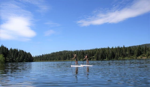
Two women SUP on a large pond near McCall. (photo by Steve Jones) 
Enjoy!

- SS 

Thursday, July 6, 2023

Highly recommend the new Brundage to Bear Basin Trail - Awesome addition to the McCall trail network!

The B2BB trail winds through beautiful open mountain meadows 

Hi all,

I had the privilege of riding the new Brundage to Bear Basin Trail last Saturday, and I must tell you that it's an AWESOME addition to the McCall trail network! 

Hats off to the Central Idaho Mountain Biking Association, which partnered with the Payette National Forest and Brundage Mountain Resort to permit and build the trail. 

A post from CIMBA credited the following funding partners: 

  • One Track Mind Foundation 
  • Albertson's Foundation
  • Recreational Trails Program grant via Idaho Department of Parks & Recreation
  • IMBA Dig-In Grant 
  • Idaho Community Grants
  • City of McCall Local Option Tax
  • Individual Donations
  • Several Large Donors & Receipts from past Idaho Gives Campaigns through CIMBA
Pretty awesome community support! 

CIMBA is a really active mountain bike club, based in McCall. They've shown amazing leadership over the years to add significant new trails to the McCall trail network, such as the Bear Basin network of trails for all abilities, Jug Mountain Ranch trails and the extension of the Payette Rim trail out to North Beach on the west side of Payette Lake. 

Last weekend, I wanted to finish demolishing our deck at our cabin in McCall. My son Quinn and I made fast work of that with our chainsaw on Friday. So that left Saturday free to ride the Brundage to Bear Basin Trail (B2BB). 

Passing by Temptation ski slope on Growler 

I had planned on taking the Bluebird quad to the top of Brundage, but learned that morning that the chairlift was down until further notice (a new part is on order). So I had Wendy drop me off at the base area, and I climbed Growler to the top. Growler is a sweet singletrack trail that climbs Brundage at a pretty moderate grade for most of the climb. Very rideable. There are a few heinous, steep-ass sections in the dark trees with deep roots thrown in for sport. But that's the way trails can be in McCall! Get used to it! 

Passing by 45th and Temptation in the summer makes me smile because in the winter I'm usually flying down those groomers at top speed. 

You hit the B2BB junction on the southern shoulder of Brundage where Growler meets the Lakeview Vista trail. And then you're off and running! 


I had no idea what to expect - just that it was 6.5 miles downhill with 1,700-feet of vertical descent. Pretty quick, I encountered some tricky rock features and a rock wall that I walked, but then the trail weaved down an open mountainside full of wildflowers for several miles, and that was glorious. I stopped to snap some pics of the views where you could see the Little Lake, Payette Lake, Long Valley to the south, New Meadows and Seven Devils to the west. Similar to the views you get skiing at Brundage, but different. 

The open mountain meadows seemed to last quite a while and then you enter the forest and ride through a long series of switchbacks - seemingly a million well-sculpted, fun banked corners that you'll find on Berm and Ernie at JMR and Bogus Basin, and the Around the Mountain Trail at BB or the West Drain at Bear Basin. As I rode through all of those banked corners, it felt like the ATM trail x 10 because of the 6.5 miles of entertaining singletrack. 

After those initial challenging rock sections, the rock features on the trail were set up in a way that they flowed with the trail - you could needed to coast or cruise over the top of them with the downhill momentum.  

The trail contractors did a great job, I thought. The dirt surface was really buffed for the first year of use. But I'm one of the first ones to ride it! After the Bluebird chair gets cranking, it's going to get a lot more use! 


B2BB finally descends into Ditch Witch in the Bear Basin trail system, and it's well-signed as you transition into the BB trails. Ditch Witch is very narrow and climbs at a steep pitch out of a dark hole in the forest but you just grind it out and pop out on Polar Express. I headed east from there toward Bear Basin Road since I had to pedal back to my cabin. 

Wendy went off to hike Granite Mountain with Huck while I did my ride.

All in all, I thought it was a great new trail! My arms were worked from all of the braking and banked corners and such, but those features make for entertaining riding while you're cruising through the mountains. 

I've got a pretty good feeling for the McCall trails as the author of the Mountain Biking in McCall (now only available as an ebook). My first edition of that book came out in 1995. I love all of the trails around the McCall area, but if there's any weakness in the system, there needs to be more trail options close to town. 

The B2BB trail does a nifty job of tying together the popular Bear Basin trail system with Brundage Mountain trails. Now you can do some pretty amazing rides from McCall incorporating those trails. You'll have multiple options to choose from as to how you reach the top of B2BB. It's really up to you and your riding friends as to how far you go! 


Strava tracks. 16 miles from Brundo to McCall. 1,200 feet of climbing, gotta be close to 2,500 feet of descent. 
    

Don't forget the Boise Twilight Criterium on Saturday in downtown Boise! 
- SS