Thursday, March 31, 2022

Amazing convergence of perfect weather, water levels makes a guy feel lucky on the Owyhee River

Pruitt's Castle rises from the sagebrush on the Owyhee River. 

Hi all, 

It's a special thing when you can escape to a never-never land like the Wild and Scenic Owyhee River, tune into the nature channel all around you, and enjoy some very special moments that stay with you long after the trip.  

Pulling out of camp, floating on a quiet section of the river, it's mesmerizing to just sit back and listen to the river, the birds, and the bugs, while dipping your oars in and out of the water in a rhythmic motion. 

And then the rapids come up around the corner. You're greeted by a thunderous sound of whitewater in a tight canyon, and it's time to focus on the river!    

Katie Metzger on the sticks in the cataraft; Make and Shane on the SUPs

Over 25+ years of doing spring trips on the Owyhee River, I feel like I've experience such an amazing array of challenging conditions with any combination of stiff headwinds, torrential rain storms, horizontal snow, muddy roads, even medical evacs. 

But in my most recent trip, March 22-25, the stars aligned for the most perfect conditions imaginable - conditions that I'm sure will never happen again! But we had a combination of solid river flows, perfect weather and ... shhhhhhhhhhhhhhhh no wind!  

OMG, that never happens on the Owyhee River! 

Bruce and Norm are pumped about the river trip at the put-in ... 

I'd been watching the river gauge daily, and I knew with a flow of 2,000 cfs in mid-March, that flow would not last long with 70 percent snowpack! 

And I'd been watching the weather daily, and the Rome, OR, forecast that week was amazingly nice and sunny with afternoon highs in the 70s. 

So I pulled together a trip in a matter of days. I got commitments from my friends Katie Metzger and Dan Popkey immediately. They both have their own rafts, so that meant we had 3 boats including mine, and our trip was a go! Just had to fill in with passengers. We were really lucky to get a bunch of super fun people together who could take off Tuesday-Friday during the middle of the week. 

Shane and Mark getting into their dry suits at the put-in.

My longtime friend Bruce Reichert, Mr. Outdoor Idaho, jumped at the chance to join us, as did my friend Norm Nelson. Morley Nelson's oldest son, Norm's spirit soars when we see golden eagles, prairie falcons and hawks flying above. Mine does too! We ended up seeing a ton of eagles, falcons and hawks! So special! 

My friend Mark Anderson and fellow SUP expert Shane Preston paddled their SUPs while I carried their gear. And Katie invited her friend Eric, a BSU math professor, to join us and ride in her cataraft. 

Natural hot springs along the way ... 

We had a crew of 8. Everyone took turns cooking. We ate like kings and queens every night. 

The trip: We floated 48 miles from the BLM put-in at Rome to the BLM takeout at the old Birch Creek Ranch. This section is known as the Lower Owyhee. You hire locals to drive your shuttle. It's a pretty gnarly 4WD high-clearance road to go from the Birch Creek takeout back to U.S. Highway 95, so you need a solid vehicle for the river trip. It's all pavement to the put-in. 

Norm does an oil painting of Pruitt's Castle in camp 

Trip map
: BLM river guides are available for all of the forks of the Owyhee River and the Jarbidge-Bruneau river.  

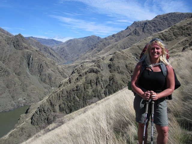
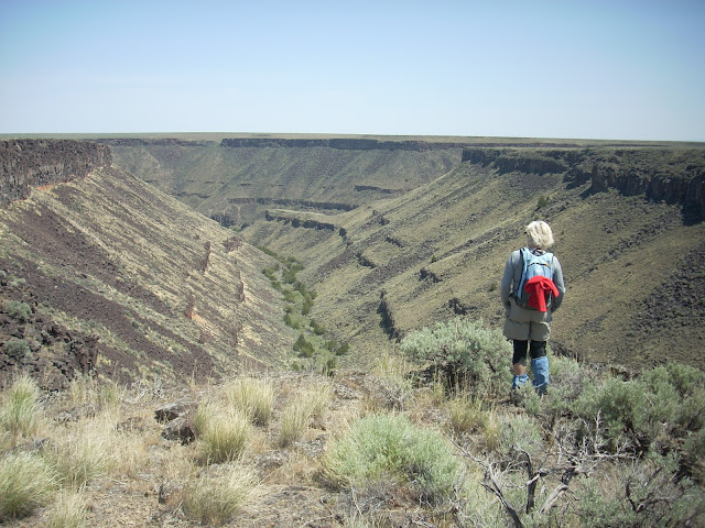
I'm just going to share a few photos from our trip. Not much more needs to be said about the Owyhee River canyon's beauty. The pictures do the talking. 

Bruce works on his Chicken piccata dish with plenty of butter, garlic and morels in the Dutch oven.   


Katie is talented with her magical colored balls at night ... check out the video. 

Many local boaters know about the Owyhee River. But if you don't have your own gear, plan a trip with an Idaho outfitter. There are several that do the Owyhee, including ROW Adventures, Far & Away, Barker River Expeditions, and Wilderness River Outfitters

- SS

Dan made delicious salmon filets on night 3, combined with mushroom
risotto  and salad. Pineapple upside down cake for dessert in the D.O. 

Another angle on that camp ... pretty much paradise to me!  


Thursday, March 17, 2022

Three Sweet Hikes that Shine in the Spring - Hells Canyon, Rapid River and Mary's Creek/Sheep Creek!

Denise Lauerman enjoys a spring backpack trip in Hells Canyon. 

Hi all, 

Spring is just four days away on Sunday, March 20, so the actual spring season according to the official American calendar is upon us. The trails and roads in the low country are beginning to dry out - in between rain storms - and the weather is warming up into the 60s at times. That gets people antsy for an outdoor adventure. 

For my outdoor tip of the week, I'm recommending three sweet hikes that shine in the spring in SW Idaho:

- Snake River National Recreation Trail in Hells Canyon, starting from Pittsburg Landing. 

- Rapid River Trail in Riggins. 

- Mary's Creek and Sheep Creek in the Bruneau River country.

The weather forecast for this weekend looks sunny on Friday with a high near 60, cloudy and rainy on Saturday, and then clearing and sunny on Sunday with a high of 50. That's the forecast for Boise and Riggins. Even if this weekend doesn't work to visit these destinations, you could wait and visit one of them at another time. 

Snake River National Recreation TrailA few years ago, I wrote about hiking or backpacking 6 miles (one way) from Pittsburg Landing to the Kirkwood Historic Ranch. A friend of mine, Denise Lauerman, and two of her friends backpacked to Kirkwood, and spent a couple of nights camping in Hells Canyon before returning to the trailhead in Pittsburg Landing. 

"It was a great trip -- I can't wait to go back," Denise said.

Hells Canyon, the deepest gorge in North America at over 7,000 feet, stradles the Idaho-Oregon border for more than 100 miles. The mighty Snake River flows through the heart of Hells Canyon and continues on to Lewiston. Hells Canyon is usually the warmest spot in Idaho, and it's also drier than many areas, so it's a good bet for a spring trip. Ditto in the fall. In the middle of the summer, it gets sizzling hot; hence, the name. The austere black rocky canyons also have contributed to the name.

The trip starts with a 4.5-hour drive from Boise to Pittsburg Landing, the trailhead, via ID 55 to New Meadows, U.S. 95 to Whitebird, and then a well-maintained, steep gravel road from Whitebird over Pittsburg Saddle to the trailhead at Lower Pittsburg Landing. Signs will guide you the whole way from Whitebird. Four-wheel-drive is not required.

Kirkwood Museum 

It's 6 miles from the trailhead to Kirkwood Ranch. Denise and her friends drove in on a Friday, backpacked to Kirkwood in the afternoon (allow 2.5-3 hours travel time) and base-camped on the grass next to the Kirkwood Museum, where former Idaho Gov. Len B. Jordan and his wife, Grace, ran a sheep ranch in the 1930s.

The museum is definitely worth visiting. Behind the ranch, there is a two-track gravel road that climbs Kirkwood Creek for more than 3,000 feet to a high saddle. This is a great side-hiking opportunity that Denise and her friends climbed on Day 2, seeing all kinds of cool wildlife and landscapes along the way.

On Day 3, they side-hiked to Suicide Point along the Snake River, came back to Kirkwood, strapped on their backpacks, and hiked out. Suicide Point provides great views of the river canyon.

For more information, go to the Hells Canyon National Recreation Area web site. You can purchase maps at the Hells Canyon NRA office in Riggins.

See the full post Hells Canyon hiking 

Rapid River Trail (courtesy Hiking Project

Rapid River Trail in Riggins

This is a beautiful hike along Rapid River when things are greening up and coming to life in Riggins. Here's a description from All Trails. Full length is 8.6 miles out and back. You may not be able to go to the top of the hike, but you could likely hike a couple of hours to a high point that works for you. The trail winds along the river and then climbs up on a high ridge. Great views of the surrounding area. 

Trailhead is next to the Rapid River Hatchery on the south end of Riggins. Watch for signs on U.S. 95 to the hatchery.

Barb Cochran looks into Mary's Creek canyon, a tributary of Sheep Creek.

Mary's Creek and Sheep Creek
 

Mary's Creek is one of the easiest places to access in the Jarbidge-Bruneau Wilderness. You can do a 8.75-mile loop hike from the Mary's Creek Trailhead to Sheep Creek canyon and back. The route I recommend in my Owyhee Canyonlands book takes you along the edge of Mary's Creek canyon, which features large black lava rock,  and then you drop quickly into Sheep Creek canyon (rhyolite and basalt) where you can have lunch or camp out next to the creek. And then retrace your tracks back to the trailhead. 

You also can camp at the Mary's Creek trailhead or in other BLM dispersed camping areas off the Roland Road.

Getting there: Take I-84 to Mountain Home, then Idaho 51 to Bruneau. Head south on Idaho 51 toward Duck Valley. It's about 40 miles from Bruneau to the signed turnoff for Roland Road on the left side, just past the old bar and junk yard in Grasmere. Go left on Roland Road and take that good-quality gravel road 5.2 miles to Mary's Creek Wilderness trailhead. 

Huck checks out Sheep Creek. 

- SS

Thursday, March 10, 2022

R2R green-lights lower foothills trails east of Bogus Basin Road; Beautiful weekend ahead! I'm going spring skiing ...

Spring season is opening in the Boise Foothills! Spring can bring windy days!
Breezy conditions at the Corrals-Scotts jct. prepared Huck for liftoff,
with Wendy Wilson.   

Hi all,

After months of cold weather and muddy trails, hikers, runners and mountain bikers will delight in knowing that Ridge to Rivers is green-lighting lower Boise foothills trails this week - trails east of Bogus Basin Road including Table Rock, Military Reserve, .

Here's the R2R Trails Report on Thursday: "Things are drying out, and trail repairs are beginning in the Foothills. There are long, lingering sections of mud on mid-elevation trails, primarily west of Bogus Basin Road where overall we have soils with a higher clay content (ie. Sweet Connie, Peggy's, Chukar Butte, Polecat Loop). East of Bogus Basin Road you can stay on dry trails all the way up to the top of Scott's Trail in the central Foothills, and to Lucky Peak Trail out east.

Expect to encounter trail maintenance along Cobb Trail and West Highland Valley Trail in the Boise River WMA currently.
NOTE: We are also in the middle of repairing a large cavity in the trail along Lower Hulls Gulch #29, so expect the need to negotiate that project for at least a week."

Doug Lawrence and Huck climbing from Military Reserve to Crestline trail. 

I personally rode Military Reserve to Shane's Summit on Wednesday morning, just after a light skiff of snow fell overnight, and everything was dry and rideable.

MARCH 9TH TRAIL R2R CONDITION REPORT:
"It looks like it's going to be a cool and cloudy day in the foothills. There is even a slight chance of snow this morning. Trail conditions will mostly remain the same as we've seen over the last few days. Corrals from the Scott's Junction down is clear and dry. Scott's is mostly dry with a few snow patches and some mud when the sun warms the tread up. Military Reserve, Hulls Gulch and Table Rock trails are clear and dry. You may encounter short sections of mud - be sure to walk through and not around. Happy Trails!"

So, the warm weather we had last week, plus winds, helped dry out the trails. The forecast for this weekend in Boise calls for warmer days each day, with high temps near 50 F on Friday, 60 on Saturday and 55 on Sunday. Wow! Enjoy!

Jane Rohling captured friends Matt and Alayne on horseback in the Wilson Creek area.  

Please BE KIND to Owyhee County trails, too!

I worked with the Owyhee County Commissioners to craft a press release about roads and trails that went out today. Here are some quotes from that release:
"MURPHY – (March 10, 2022) – Recreationists may be eager to get outside and enjoy the great outdoors as things begin to thaw in March, but it’s crucial that they respect the land in Owyhee County, stay off muddy trails and roads, practice proper trail etiquette, stay on designated trails and follow the rules set forth in Bureau of Land Management travel management plans, officials said.

“When Ridge to Rivers tells people to stay off muddy trails in the Boise Foothills, people often come out here in the Owyhee Front and look for trails and roads to ride as an alternative,” said Jerry Hoagland, an Owyhee County Commissioner and rancher. “But it’s just as important to avoid tearing up the trails and the land in Owyhee County as it is anywhere else.”

“We expect outdoor recreationists to treat the land and other trail users with respect when they’re out here in Owyhee County,” Hoagland said. “It’s really important that people do their homework before they come here to know where it’s appropriate for them to recreate and do it responsibly.”

Taking a moment in Reynolds Creek canyon on the Northwest Passage Loop. 
With L-R Quinn Stuebner, Steve Schneider, Ziggy and Jim Giuffre. 

Owyhee County is one of the most spectacular locations in the state of Idaho for exploring 4.9 million acres of public lands – canyons, high plateaus, lava features and more. Some of the most popular destinations are the Off-Highway Vehicle (OHV) Trails near Murphy, Wilson Creek non-motorized trails, Bruneau Canyon overlook, Big Jacks Creek, and the 100-mile Owyhee Canyonlands Backcountry Byway from Grand View to Jordan Valley, Ore.

Key issues that Owyhee County Commissioners are concerned about with regard to outdoor recreation in Owyhee County, include:

·     The need for mountain bikers to practice proper trail etiquette on non-motorized singletrack trails in the Wilson Creek area. Mountain bikers riding at high speed on the trails can spook horses and cause potential safety issues. The number of people mountain biking in the Owyhees has increased dramatically, officials said. Be sure to keep your speed down in case you encounter hikers or horseback riders on the trail.

The proper procedure is as follows: If mountain bikers encounter horseback riders on the trail, step off the trail, talk to the horseback riders so the horses know you’re human, let the horseback riders pass by, and continue your ride.


· Stay off muddy trails (universal for all users)."

See the Owyhee County Recreate Responsibly web page for more information. Please be a good trail ambassador and practice good trail etiquette when you're out enjoying the Owyhee trails. Thank you!

Great weekend for Spring Skiing too!


With the weather warming up dramatically this weekend, it should be a great time to go spring skiing at Bogus Basin, Tamarack Resort or Brundage Mountain. I'm planning on skiing Brundage on Saturday, when formal wear is encouraged for people like to dress-up! I'll be doing a live forecast for OpenSnow.com Saturday morning. I see Bogus is having an Atomic Demo Day on Friday, and Tamarack is hosting an Atomic and Armada Demo Day on Saturday.

There's a big storm coming next Tuesday, that could bring significant snow to Idaho statewide. See my latest forecast: Idaho Daily Snow.

Look for me in my white coat, red vest and red bow tie at Brundage on Saturday.

Have fun! - SS

Thursday, March 3, 2022

North Idaho tour of Schweitzer, Silver and Lookout Pass a winning combo!

Skiing/riding Schweitzer on a sunny day has quite the "wow" factor. Lake Pend Oreille.

Hi all, 

Wendy and I celebrated our 20th anniversary by taking a N. Idaho ski stay-cation during a week of postcard days and spring snow. 

My story about that trip is being featured by Ski Idaho: "Triple swing to Schweitzer, Silver and Lookout a must-do tour for the skiing, culture, food - it's got the whole package."

Click on that link to see the full story. I talked about where we skied, my favorite runs, where we went for dinner each night, and the lodging properties where we stayed.  

That's my outdoor tip this week ... to do that North Idaho ski tour ... it's well worth it! We have 45 days of the ski season left. Still plenty of time to plan a trip. 

- SS 

Walk by the lake ... Wendy is like, the sun is too bright! 

Statue of Liberty by Sandpoint City Beach.

Dave Lindsay, Wendy and Randy Bell at Lookout Pass. 

Skiing the sunny south-facing groomers at Lookout. 


No lines at Lookout! 

Big views of the CDA River watershed and Bitterroot Mountains ... Montana is to the right. 
Took this shot at the top of Silver Mountain. 

Base area of Silver Mountain by the gondola in Kellogg.