.PNG) |
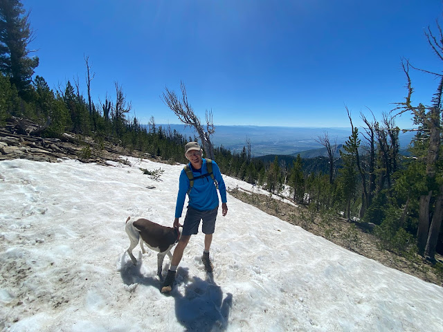
| Top of St. Mary's Peak, 9,321 feet above sea level |
Hi all,
Wendy and I decided to take an outdoorsy vacation in the Bitterroot Valley last week. It's only a day's drive there from Boise via Lost Trail Pass, north of Salmon or the Lochsa River corridor, north of Grangeville. It took us 6.5 hours from McCall, driving along the Lochsa River.
The Bitterroot Valley is a gorgeous place with the Bitterroot River drawing S-curves through the center of the valley, the Bitterroot Mountain Range running north-south to the west and the Saphire Range bookending the views to the east.
Even though I'm a Montana griz alum, to be honest, I haven't spent much time in Western Montana since I graduated from the UM Journalism School in 1981, 40 fricking years ago! Not to date myself at all!
 |
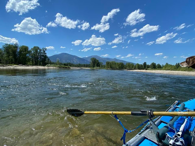
| The Bitterroot River with Don, Huck and Wendy |
The Bitterroot Valley was literally a key part of my old stomping grounds in the five years I went to UM. My friend Don Lewis, a Journalism School classmate and I used to throw Don's aluminum canoe on top of his VW bug, and we'd zip down to Florence or Stevensville and float and fish the Bitterroot River.
We hiked as many of the Bitterroot drainages as we could, and we bagged a number of the peaks, including Trapper, Lolo, St. Mary's and more. Truth be told, you could easily spend a whole summer in the Bitterroot Valley and still just scratch the surface of all the outdoor opportunities in the area.
For our base camp, Wendy and I rented an inexpensive yurt via AirBnB at the foot of Blodgett Canyon, west of Hamilton. The yurt was literally 1.5 miles from the Blodgett Canyon trailhead. Most evenings, we went up to the trailhead to see the steep vertical canyon walls glow at sunset.
On a Tuesday, we met up with former Idaho Statesman chief photographer Tom Shanahan, who lives in Stevensville, MT, and we climbed St. Mary's Peak. It's a relatively easy climb to the top with a well-engineered moderate grade leading you to the 9,321-foot summit in 3.5 miles.
 |
| Tom Shanahan with Huck |
Tom and I caught up on old times hiking on the trail, while my pointer Huck chased squirrels and birds and Wendy looked/listened for songbirds.
We reached the lookout and summit in less than 2 hours. The views on top were absolutely glorious! St. Mary's Peak is in the north end of the range, so you can look 50 miles to the south at all of the Bitterroot Peaks, plus peer into the vast interior of the Selway-Bitterroot Wilderness. We soaked up those views, and enjoyed a wonderful cool breeze for at least an hour on top, while eating lunch, etc.
 |
| Looking south, down the Bitterroot Mountain Range |
On the hike down, Tom and I continued to chat while we cruised down the trail. And then, suddenly, I tripped on a rock with my left foot and I fell face-down in a microsecond. I managed to soften the blow of the fall with my arms and right shoulder, avoiding any face/head injury, but unbeknownst to me, I hit a watermelon-sized granite rock really hard with my right thigh/quad muscle on the way down. I could barely feel my right leg!
I sat down, took a breather, and Tom fed me some cold water. I tried to walk a bit. Thank goodness I had trekking poles with me. I could kind of walk half-speed without too much pain. I limped down the trail the rest of the way, taking half steps and babying my right leg. We figured if I could walk on it, I hadn't broken the bone. It would be too painful to walk on a fractured femur.
So hey, the lesson here is to watch your step and take your time on mountain trails!
I iced the heck out of my leg when we got back to the yurt, took some pain killers, and drank merrily in the evening. Could have been worse.
 |
| Lake Como (courtesy VisitBitterrootValley.com) |
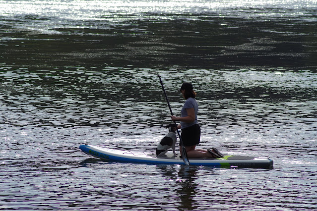
On Wednesday, we visited Lake Como, a sweet spot in the Bitterroots just to the south of Hamilton. You can camp by Lake Como, plus you can go boating there, swimming, SUP'ing, canoeing and kayaking. There's a large beach as you approach the lake by a large dam that creates the lake. Wendy went for a long swim while I read my book and stayed off my sore leg.
While in the south end of the valley, we drove by the Chief Joseph Ranch in Darby, the movie set of the hit TV series "Yellowstone." We gawked and took pics.
 |
| Yellowstone Ranch near Darby. They were filming new episodes, so no entrance allowed. |
Our friends Don and Sue Lewis drove down from their home in Whitefish to meet up with us Wednesday afternoon at the yurt. They brought their AIRE 14-foot raft for floating the Bitterroot River on Thursday.
We had dinner at the Edge in Hamilton that evening. They have a full menu, plus cocktails, beer and wine. I had seared Ahi and a salad. Great food and drink, I thought.
On Thursday, we floated the Bitterroot River from the Stevenville bridge to the Florence bridge, an 11-mile stretch. There are many sections of the Bitterroot that you could float, depending on the objective. See fishing/boater access map.
We had another postcard-clear day to enjoy on the river. We stopped and fly-fished in a number of places by braided gravel bars with multiple water channels to fish and wade. Just a beautiful river, running quite clear. We saw a fair bit of dry fly activity on the water surface, but did not land any fish. It's fair to say that we did not hit it very hard, since we had dogs in the boat, plus Wendy and Sue.
 |
| Bitterroot River is mostly class 1-2, with lots of wood to dodge in the channel. |
These were the core activities that we did in the Bitterroot Valley. We headed home via Lost Trail Pass and Salmon. We hiked the xc ski trails a bit on Lost Trail Summit just to stretch our legs, and went swimming on the Salmon River, east of North Fork, before over-nighting in Salmon and then driving home to Boise.
We really enjoyed our time in the Bitterroot Valley. Hope you do too someday.
- SS


