Thursday, November 19, 2020

Avoid the Foothills! Eight alternative bike rides in the greater Boise area

Did a Greenbelt ride out to Lucky Peak today. Mostly nice afternoon till the squall came!

Hi all,  

Temperatures have been rising into the mid-40s this week, and often barely freezing at night, and so we're seeing a lot of damage being done to muddy trails in the Boise foothills. 

Trust me, if the temperatures are above freezing, you are going to be damaging foothills trails no matter whether you're hiking, running or biking. Please think about alternatives for your outdoor outings!

One of the best alternatives is to jump on your road bike or mountain bike and do a scenic ride on the Greenbelt Loop, or knock out a road-biking loop. In my outdoor tip this week, I'm recommending eight alternative destinations for biking. 

Before you go, be sure to dress warmly for your hike, run or ride. Dress in layers. Wear a light shell for a jacket for wind protection. I've been wearing a head band this week on my road rides to keep my ears warm, and a light pair of gloves to keep my hands warm.  

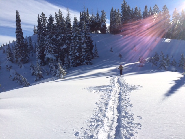
On a ride from Municipal Park to Lucky Peak today, I had an awesome tail-wind out to the dam, riding in sunshine the whole way, and then I had a vicious head-wind going back, especially in the canyon by Diversion Dam. A fresh squall started to rain and hail, and I thought, that's life in the mountains! It's November 19th! But I was glad to have my rain/wind shell on to keep me dry inside.

Just to refresh your memory, here are eight Greenbelt and road rides close to home in the Boise area:

1. Municipal Park to Barber Park Loop - Rated easy. 10 miles. Ride time: 1 hour. Start from Municipal Park in east Boise, near Idaho Fish and Game headquarters on Walnut Street. Go east on the Greenbelt 4.2 miles. Turn right and take the path to Barber Park. Follow the paved path to the left of the park entrance and follow that through a number of neighborhoods for several miles. Ride on the detached pathway along ParkCenter Blvd., turn right on River Run Driver, follow the bike lane to the paved Greenbelt access and ride to Broadway bridge. Cross the river at Broadway, turn right, and return to Municipal Park.

Nice afternoon at Discovery Park at the foot of Lucky Peak

2. Municipal Park to Discovery Park (foot of Lucky Peak Dam) - Rated easy to moderate. 9 miles one-way, 18 miles round-trip. Ride time: 1 to 1.5 hours. Start from Municipal Park near Warm Springs and Walnut. Go east on the Greenbelt 9 miles to Discovery Park. It's slightly uphill - 140 feet of gain. But wind will be a much bigger factor on the ride. In the winter, you may ride into the teeth of an east wind on the way out, and zoom back with a tail-wind. In the summer, it's the reverse. Take a breather at the park; do some stretching, have a snack, drink some water, and ride back to Municipal Park.

3. Municipal Park to Hilltop Summit and back - Rated strenuous. 27 miles round-trip. Ride time: 2.5 hours at a recreation pace. Now is a good time to ride to Hilltop because the traffic isn't nearly as heavy as it is in the summer. Watch for mule deer and elk. Start from Municipal Park near Warm Springs and Walnut. Go east on the Greenbelt 9 miles to Discovery Park. Jump on Idaho Highway 21 and climb the grade to the top of Lucky Peak, and keep going to Hilltop Summit. It's an additional 4.5 miles from Discovery Park to Hilltop.

4. Boise Bench Airport Tour - Rated moderate. 21.2 miles. Ride time: 2 hours. This is a good tour of the upper Boise Bench. It can get really windy out on Gowen Road so be ready for that. Start at Municipal Park near Warm Springs and Walnut. Go east on the Greenbelt 6.7 miles and turn right on the Idaho 21 connector to Gowen Road. There is a good shoulder. At the junction, with Gowen Road at mile 10, go straight and beeline to Orchard. Enjoy the tour of the National Guard facilities and the Boise Airport. At mile 14.3, go right on Orchard. Go three miles and turn right on Kootenai, a leafy neighborhood on the bench. At mile 19, go straight on Protest, drop down the hill, follow Beacon over to Broadway. Turn left on Broadway, cross the river, and take the Greenbelt back to Municipal Park.
 
5. Spin it on Hill Road - Hill Road has a good shoulder, and you can ride as far as you want, going west. Once you get to old Horseshoe Bend Road, head over to Floating Feather Road or Beacon Light Road and continue riding west to Eagle Road, Idaho Highway 16 or Star for the hard-cores. It's 40 miles out and back to Star. Wind will be a factor.
 
Rural roads are a natural place to "social distance." This is Hubbard Lane.

6.  City to Farm - 25 miles. Rated moderate. 1.5 to 2 hours travel time. The great thing about riding in this area is that there is almost NO TRAFFIC. Start at Five Mile and Overland. Park in the shopping center parking lot. Take Five Mile south to Lake Hazel, turned right on Lake Hazel for one mile to Cloverdale, Cloverdale south to Hubbard, left on Hubbard to Ten Mile, and ride that beautiful open valley to South Cole. Then go south on Cole to Kuna-Mora, right on Kuna-Mora to Cloverdale, and retrace your tracks back to the start/finish. Caution: Kuna-Nora road is almost always very WINDY! 

7. Cartwright - Three Summits Loop - Climber's special. This loop is about 18 miles and takes about 1.5 hours at a recreational pace. It's also fondly called the "Dump Loop," because it goes by the Ada County landfill. It features several in-your-face steep climbs on Cartwright. You can ride it clockwise or counterclockwise. Start at Hill and Bogus Basin Road. Go west on Hill to Seaman's Gulch. Go right and climb Seaman's Gulch past the landfill over to Hidden Springs. Turn right on Dry Creek Road and enjoy a spin through that valley and then climb the first big hill on Cartwright to Pierce Park. Go left and climb the next hill (short but kind of steep), and then enjoy a really fast downhill past the Owyhee Motorcycle Park. Gear down for the last hill to the initial Cartwright summit, and zoom down past the LDS church to Bogus Basin Road, turn right to the start/finish.
 
8. Lake Lowell Loop - 26 miles. It's a pretty easy ride with no significant hills (380 feet of verticle climbing the whole ride), and you circumnavigate Lake Lowell and enjoy the bird life. Start and finish at the Lake Lowell Boat Ramp. See the Boise Road Cycling Guide for directions.
 
A quick word about the Boise Road Cycling Guide if you haven't seen it. It's a full color, two-sided foldout map with Olympian Kristin Armstrong on the cover. The map features more than 30 rides in the Boise Valley. It's waterproof and tear-proof. It costs $12.50, and it's available at Idaho Mountain Touring, Boise REI or stevestuebner.com. It's the only road biking map available for the Boise area.
 
FYI - The City of Eagle is looking for four people to serve at-large positions on a BLM Advisory Board. Follow this link for more information.  
- SS

Thursday, November 12, 2020

Six destinations near Boise for a boot hike, xc ski, snowshoe in the snow!

Deer Point service road leading to the Boise Ridge Road (taken 11-11-20)

Hi all, 

In less than a week's time, we've had an amazing amount of snow piling up in the Idaho mountains! Wendy and I went for a boot hike on the Deer Point service road on Wednesday afternoon (11-11), and we were amazed to be walking through nearly a foot of snow as we neared the high saddle between Deer Point and the Boise Ridge. 

The Mores Creek snowtel site shows 12 inches of snow at Mores Creek Summit, and there's at least 3-6 inches around McCall and Stanley, depending on elevation. Snow is beginning to build in the mountains, and starting tonight, there's a huge base-making storm descending on Idaho that could dump another 1-2 feet of snow in the Boise Mountains, West Central Mountains and Central Mountains. Woo hoo! 

Read my latest post in OpenSnow.com that details the weekend storm. 

Our snow hike yesterday just felt really invigorating on a sunny but brisk afternoon. The temperatures were in the low 20s. No wind. The late-afternoon sun created a cobalt-clear postcard sky with heavily snow-flocked trees in the background. Just gorgeous! 

Wendy and I are from the Midwest originally, so we always are eager to get out and play in the snow after the first significant snow storm. The Deer Point road is one of the best places to go boot-hiking, snow-shoeing, or xc skiing to access the Boise Ridge and enjoy a backcountry experience just a few minutes away from Bogus Basin Mountain Resort. The parking area is near mile 13 on Bogus Basin Road. Good place for dogs, too.

My outdoor tip this week highlights five other destinations where you could take a walk in the snow in the greater Boise area.

1. Bogus Basin Nordic Highway and Mores Mountain - The front side of Bogus Basin ski area is off-limits to backcountry skiers/snowshoers (see message here). People are being directed to the Nordic Highway, which is perfect for xc skiing and snowshoeing. Drive to the Nordic lodge to begin your adventure. Backcountry skiers are being steered to Superior, Pine Creek and Mores Mountain. 

New trail leading from BB Road over to Sweet Connie/Stack Rock jct. About 3 miles one-way.

2. New trail to Sweet Connie/Stack Rock - Park at the pullout on Bogus Basin Road (near mile 10) and take the new trail going over to Sweet Connie and Freddy's Stack Rock Trail. Good place for an out-and-back boot hike. Snowshoes will be suitable after the snow gets deeper. Dogs are A-OK.

3. Mores Creek Summit - Take Idaho 21 to Idaho City and continue to Mores Creek Summit, trailhead for Pilot Peak and Sunset Mountain. This is a popular spot for snowmobile riders going up to Pilot Peak and backcountry skiers and snowshoers. Also a fun spot for kids to play in the snow in the parking lot. Both of the snow roads taking off from Mores Creek summit are steep and continuous, but definitely doable. 


4. Idaho City Park n Ski areas - Idaho Parks and Recreation officials said that grooming won't start until December 1st in the park n ski areas, but anyone could still break their own trail at any of the trailheads. After Friday's storm, the park n ski parking lots may not be plowed until Saturday ... you might call the ITD shop in Idaho City to check on status.

5.  McCall/Bear Basin - People are skiing on the McCall Golf Course, and it should be possible to xc ski or snowshoe at Bear Basin as the snow gets deeper after Friday's storm system passes through. If you were thinking about skinning up Brundage Mountain, Brundage officials have specific guidance on skinning hours at the resort (before 9 a.m. or after 4:30 p.m.). See details here.

Have fun!
- SS