Thursday, March 30, 2017

Mount Kepros is a delightful, 10-mile hike - part of the Boise Grand Slam!

Summit of Mt. Kepros, elevation 5,428 feet ... Big views for 360 degrees! 
View from Kepros looking back at the two-track road going back toward Peak 5380.
Three Point Mountain is the next ridge to the east.  
T
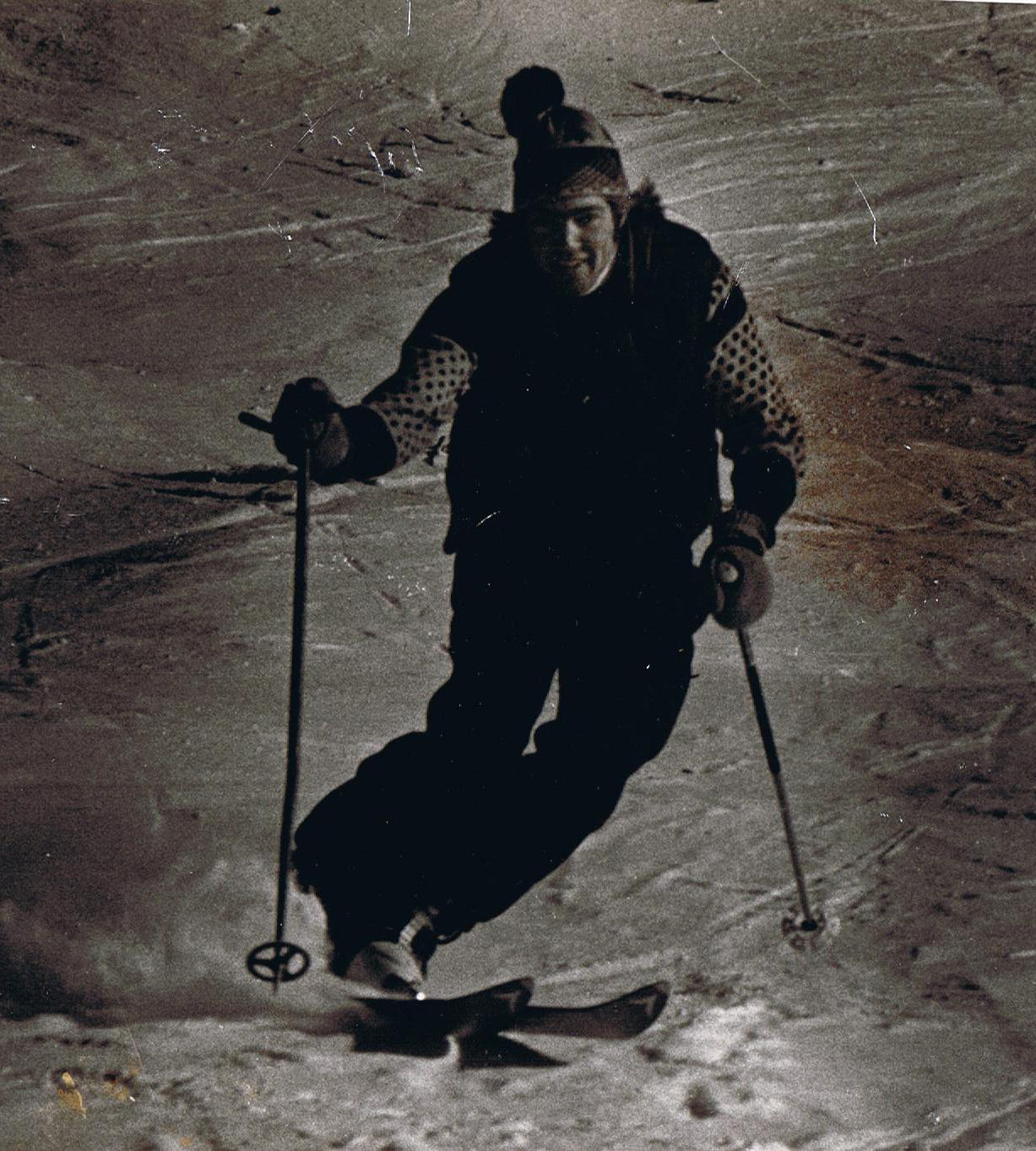
The trail is steep in places ... and steep coming back! I used hiking poles to take some of the stress off my knees. 
Hi all,

I had a nice window of time last Saturday afternoon for a long hike. It'd been a pretty rainy week, so I hadn't gotten out much, and my pointer Huck was totally chomping at the bit to get outside and do some serious miles. And I was too!

I had been thinking about the Boise Grand Slam -- a concept created by Tom Lopez, author of Idaho - A Climbing Guide -- and trying to knock off either Mt. Kepros or Mt. Heinen. I emailed Tom to see what he recommended, and he wrote back, saying he was half way out the ridge on the way to Kepros, and the trail was great! Ha! What a coincidence!

Great to run into Tom Lopez on the trail! 
Tackling the Grand Slam peaks in the spring presents an opportunity to jump-start getting your body in shape for the summer hiking and backpacking season. Mt. Cervidae, near Spring Shores Marina at Lucky Peak, usually dries out first, so that can be the first one on your list. Lopez recommends Kepros as the next trip. Shaw Mountain or Lucky Peak are No. 3. And Mt. Heinen is the last, and often the last to be snow-free. All of them are strenuous hikes, but that's the whole point, right?

I put together a quick lunch, some Clif bars, and packed up my Osprey hiking pack for the 10-mile hike. I looked up a topo map of Mt. Kepros on Caltopo and printed it out for navigation. I zipped out to Black's Creek Road on I-84, a few miles east of Boise, and drove about 10 minutes to the first summit on the way to Prairie. That's the trailhead for Kepros (elevation 4,800 feet).

On the west side of the road, there's an old motorcycle trail that marches straight up the mountain. That's your trail. The route climbs 400 vertical feet to an initial saddle next to Three Point Mountain (optional side trip). And then the singletrack vectors off to the northwest, following a series of Camel's back ridgetops over to Peak 5380.

There are some cool granite outcroppings along the way
I ran into Tom Lopez in this section. He mentioned that there are a number of bypass trails along the route, short-cutting the main trail that goes over a bump on the ridge and then dives down the other side, losing most of the elevation. The bypass trails are marked by rock cairns in some cases. But they do save you energy. Great to know!

It took me about an hour to reach Peak 5380 -- actually I took the bypass trail to the right to avoid hitting the summit -- and Mt. Kepros looked like a LONG ways away, even though it was only 2.5 miles away. Worse, the road I would be following now to the north actually was going downhill, losing elevation, and then I could see I would have to make up that elevation again to summit Kepros. Watch for bypass trails.

It took me about another hour to summit Kepros (elev. 5,428). Huck flushed several small groups of chukars and one big blue grouse along the way. That's always a rush to hear a big blue take off right next to you, scaring the holy hell out of you.

The ridge walk to Kepros is really delightful. You can see Bogus Basin and Boise off to the west, the Boise National Forest to the north, the sparkling waters of Lucky Peak Reservoir down below, and the Trinities, all smothered in snow, off to the east. On a sunny afternoon, without much wind, it's just beautiful out there. A friend told me that the wildflowers on the ridge can be spectacular in May.  

Please see Tom's Grand Slam post or my Grand Slam post for more details about the other mountains. I have the hike to Mt. Cervidae detailed in my Boise Trail Guide: 90 Hiking and Running Routes Close to Home That one is much more of a quick trip, than Kepros.

It took me about 4 hours to do the hike out and back at a brisk pace. The hike features at least 1,700 feet of elevation gain. My GPS malfunctioned, so I don't have the exact numbers. There are many spots where you could stop for lunch. I decided to pull over in a grassy spot where the pines trees came up to the ridge road, about a half-mile below Kepros.

It's always cool to learn about a new hike in your backyard. I highly recommend Mt. Kepros and the Boise Grand Slam!
- SS

Thursday, March 23, 2017

Seize the day and plan a trip on the Owyhee River! You've got a little over a month to do it!

Wendy and Huck as we leave camp on Sunday morning ... the sun came out a few minutes later ... 
Now we can see some sunshine deep in the Owyhee River Canyon ... 
Caves to explore next to a potential camp site a few miles from the Birch Creek take-out
Hi all,

Spring is finally coming to SW Idaho after such a long winter ... and all of the luscious powder we enjoyed in the mountains is flowing down the mountains and into our favorite rivers. Last weekend, Wendy and I saw a decent weather window opening up last Friday-Sunday, so we seized the day and floated the lower Owyhee River, from Rome to Birch Creek, a 45-mile scenic trip just across the Idaho border in Eastern Oregon.

We had three rafts and six people. It's always cool to float with a small group when you're doing an impromptu trip. That makes the prep so much easier -- especially if you're going with experienced people who have all the necessary gear.

It's a 1.5- to 2-hour drive to the BLM put-in by the Owyhee River bridge on U.S. 95 in Rome. We stopped in Jordan Valley to buy 2017 invasive species permits at the hardware store. That was a smart move because an Oregon State Police officer was checking for them at the put-in ... didn't see anyone from the BLM.

We launched on a sunny day on Friday, with temperatures in the low 70s, and the river was running in excess of 6,000 cubic feet per second -- a sweet, fast flow. The Owyhee already has peaked this year in February, when it rocketed to 20,000+ cfs when we had that big warm up period, and rain on snow. That melted a lot of the low-elevation snow.

Last year, the Owyhee and the Bruneau rivers had a nice long season, but I was busy running off to my son's out-of-state hockey tournaments or work trips. So this year, I was not to be denied! And if you run the Owyhee in March, chances are you might be able to run it again in April or early May!

If you've always thought about running the Owyhee River, this is a great year to do so. The river may be peaking about now, according to the snow survey experts. The Mud Flat Snotel site has melted out, and more than 30 percent of the snow has melted from South Mountain -- those are the typical indicators when the river peaks, according to the experts. But the Owyhee should have boatable flows through April, and possibly early May, depending on how much more precipitation we get, how warm it gets and how fast the river runs off.


Why float the Owyhee? To see and experience the Owyhee Canyonlands, a vast landscape full of hidden caves, slot canyons, big canyons like the Owyhee River, spires, hoodoos and more. The scenery and geology are spectacular ... be sure to bring a book along like "Roadside Geology of Oregon," to learn about the volcanic episodes that dominated the Owyhee region for millions of years, plus the various basalt lava flows and rhyolite lava flows and outcroppings.

And bring your camera and video camera to document your trip.

For me, another key attraction is camping out on the river. It's so easy to haul all of that stuff on your boat, and you can camp in style with the big camp table, Dutch oven meals, lawn chairs, iced coolers full of your favorite drinks, and dry boxes to carry all of your dry goods.

I just love camp fire in the evening on a March river trip ... the regulations are to pack-in your own firewood.
The Rome-to-Birch Creek section is pretty friendly in terms of whitewater ... the rapids are mostly Class 2 and 3 on a scale of 1-6, with 6 being a steep waterfall. Because the river was moving so fast, and bank-full, we made great time on the water, traveling at least 5 mph without even trying to push downriver. With fast pushy water, however, you do need to anticipate your moves well in advance, and sneak the inside corners when you can see hazards on the outside corners when you're approaching rapids. Whistling Bird and Montgomery are typically the biggest rapids on the river, but at 6,000-7,000 cfs, Whistling Bird was super easy, and Montgomery was the typical pull to the right to avoid the wall and hole at the bottom.

The BLM has an excellent map booklet available that provides a mile-by-mile guide to the lower Owyhee River, as well as the other forks of the Owyhee and the Jarbidge-Bruneau. You can find the river map at the BLM State Office on Overland and Vinnell in Boise, or also at Idaho River Sports. I highly recommend it. The map marks all the rapids and the designated campsites.

If you don't have your own river gear, there are a number of outfitters that do Owyhee River trips, including Far & Away Adventures, Barker River Expeditions, Wilderness River Outfitters, and ROW Adventures. All of those outfitters are really solid and put on great trips! Be sure to get in touch and reserve a date before their trips fill up.

For vehicle shuttles, we used Eva Matteri, 541-586-2352. The cost was $160/vehicle. Well worth it!
-------------------
Notes: In case you missed the Facebook post earlier this week, my blog, Stueby's Outdoor Journal was selected as one of the Top 20 outdoor blogs in the Northwest by the Outdoor Authority. I thought you'd enjoy seeing some of the other blogs mentioned in the top list. They all sound really good. My friend Mike Lanza's The Big Outside always has quality content, featuring world-class trips and a lot of tips about outdoor gear.

Greenbelt underpass closures and flooding closures: If you're been looking for a comprehensive list of Greenbelt closures, the Statesman had a story in today's paper with the latest closures. The river is supposed to go up to 8,000 cfs today ...

Bogus and Brundage winding down: Brundage's last day of operation is Sunday, April 9th, with a pond-skimming event set for April 8th. The last day of operations at Bogus will be Sunday, April 16th. The last opportunity for night skiing is this Saturday. Nordic operations will close following this weekend as well.
- SS

Wednesday, March 15, 2017

Spring skiing rocks at Jackson Hole Mountain Resort - double it up with Targhee!

Hard-cores hike a boot trail to bowls on the backside of Jackson Hole 
Jackson Hole is a skier's mountain! 
Big groomer boulevards are super fun to ski in the sunshine. Heading down to the Thunder Chair. 
Hi all,

I managed to break away to ski Jackson Hole recently, and it was a real treat! I've got a lot of great memories from skiing Jackson over the years, even going back to when I was a high school senior and skied 6 days of fantastic spring corn in April ... an experience that cemented my feelings about going to college out West.

And then there was that time when I blew out my ACL on the first run of an 18-inch powder day in the 90's, but that was a mere blip in the whole time horizon.

I visited on a bluebird day, Friday, March 3rd, and it was so great to be there on a day when you could see the Tetons in all of their splendor, and experience the whole 360 degree view of being in Jackson Hole. It's definitely one of the most beautiful spots on the planet, in my opinion. And Jackson is pure and simple, a skier's mountain. They have something for everybody, including plenty of beginner and intermediate terrain for destination skiers from all over the nation, if not the world, but they have a ton of black diamond terrain, double black diamond steep shots and chutes, hike-to chutes and big powder basins for the experts.

On top of that, Jackson has 4,139 feet of vertical, so it's like more than 2X the vertical of Bogus or Brundage ... you might try to ski top to bottom, but it's going to eat your legs, even more so than Sun Valley.

To start, I took the Bridger Gondola up the east side of the mountain, and took a cat track over to the Thunder Chairlift, one of my all-time favorites. While we're riding up the gondola, there was a young ski instructor who had two of his own kids in there with us, and he's talking about how easy it was to jump into Corbet's Couloir for his kids, who were maybe 6 and 9? I'm like you've got to be kidding me! He's like, "Oh there's so much snow this year, it's easy to drop in."

It's true about the snow ... Jackson had a chart on its web page indicating that it had received something like 499 inches of snow, compared to Alta in the 450 range and others in the 400 range ... so they really got nailed this year. And now they're celebrating "March Radness" 500+ inches of snow. The routine is to "Shred Party Repeat" day upon day upon day.

From the Thunder chair, I skied the Thunder bump runs, taking me back to my teens, and then I hit the Alta chutes and other fun black diamonds from the Sublette quad. There wasn't any fresh powder, so I avoided the Hobacks, but boy, they can be something else with lots of fresh snow. HUGE amounts of open glades and tree skiing with a steep fall line. I toured around Casper quad, the Teton quad and the Apres Vous quad as all of the snow was turning to perfect easy-skiing spring conditions. And there was no one around on those lifts, compared to Thunder and Sublette and the Tram.

In my mind, it's great to experience different ski areas to gain different perspectives on skiing. Jackson will test your skills in a way that few mountains will. Enjoy the photos and reserve time to ski Jackson and maybe hit Targhee on a double-dip spring weekend to put a nice exclamation point on your ski season.

See the Jackson Hole Chamber for information on food and lodging. Hopefully there are some special spring deals to be had! Jackson Hole is open through April 9th.

More hike-to terrain visible from the main ski area ... ready to drop in? 

Looking up the barrel of Corbet's Couloir ... 

Broader view of Corbet's Couloir 

Looking back toward Jackson and Snow King Resort  
Sleeping Indian Chief across the valley in the Gros Ventres Mountain Range 
Beautiful bowl all skied up from fresh powder earlier in the week 
Salute to the Grand Teton and the Teton Range 
Have fun!
- SS

Wednesday, March 8, 2017

Go visit Shoshone Falls - the Niagara of the West! Plus, spring hike at Centennial Park

Shoshone Falls in 2011, with big flows coming over the 212-foot drop. 
Hi all, 

With snowpack in the Upper Snake River region ranging from 130% to 160% of normal -- that's really big folks -- the Bureau of Reclamation has been releasing flood-control water from all of its Upper Snake reservoirs, bringing the Snake River flows to 10,000 cfs in the Middle Snake region, as of today. That means 212-foot Shoshone Falls is gushing with life in a big, thundering way!

The City of Twin Falls just opened Shoshone Falls Park yesterday, and they're open for the season, 7 a.m. to 9 p.m. My recommendation is to go see the impressive falls for a fun day or weekend trip. Maybe hit a hot springs along the way, go to the Twin Falls Sandwich Company for lunch, or select from this Trip Advisor menu of top local dinner spots. If you'd like to RV camp or grab a hotel room, here's a listing of RV options and hotels.

Sharing this drone video of Shoshone Falls from Reeder Flying Service, shot in February when all of the low-elevation snow came off and flooded the region:


I'm recommending this trip this weekend because the snow level is expected to go over 7,000 feet on Thursday and stay there for several days, so that will make the skiing iffy if that snow-level holds true. Keep your eyes on the weather because things could change ... no matter what, there will be a ton of snow at high elevations. Watch for avalanche danger as well.

If this weekend doesn't work for Shoshone Falls, know that the flows will continue to be coming over the falls for at least the next three weeks, according to the BOR. I'd guess that it's going to run strong for the next 8-10 weeks, given the deep snowpack. I'm just guessing ... no guarantees. But it will be interesting to see how high the flow gets ... if it gets into the 20,000 range, that will be epic ... not only for viewing Shoshone Falls but also for running the Class 4 Murtaugh reach of the Snake River. Idaho Guide Service offers guided trips in that area, and I can tell you, it's a kick-ass float trip for the adventurous! Big rapids, big roaring whitewater.

Closer to home, I'd also recommend an early-spring outing at Celebration Park, south of Nampa. I liked former Idaho Statesman outdoors writer Pete Zimowsky's blog post about five things to do in the canyon via Celebration Park. The 4-mile hike to Halverson Lake is detailed in my book, Boise Trail Guide: 90 Hiking & Running Routes Close to Home. Centennial Park is a great place for kids and families. There are lots of petrglyphs on the big boulders in the parking lot, providing a teachable moment.

Did you see the article about summer plans for Bogus Basin in the Statesman? General Manager Brad Wilson has a great vision for the future of Bogus, in my opinion. Hats off to the whole board of directors as well! They are going to reinvent Bogus as a four-season resort, and snowmaking is part of the mix.

BTW, if you head out for a Greenbelt hike this weekend, remember that many places along the pathway are getting flooded, so use caution! The Boise River is ripping fast and strong right now.

- SS

Wednesday, March 1, 2017

Take a stand for Idaho's public lands Saturday, plus Les Bois Film Festival

Skiing Snow Bowl in the Lolo National Forest circa 1978. Note cheap ski attire ... wool pants and mittens.
Selway-Bitterroot Wilderness circa 1979
Hi all,

I'll never forget the first time I visited a national forest. I was 16 years old, a junior at Minnetonka High School (Minnesota), and a good friend had invited me to travel to Red Lodge, Montana with his family over Christmas vacation. It wasn't a great snow year, at least in December. And I had brand new skis, Dynamic Freestyle 180 cm, for hot dogging around the resort.

We skied Red Lodge Mountain and absolutely shredded our skis from hitting rocks -- multiple cuts through the petex layer to the core. Damn! The metal edges were trashed. But we were there for a week. My buddy's brother suggested we go hiking in the nearby Beartooth Mountains in the Custer-Gallatin National Forest.

We drove up to a trailhead, saw a sign for a trail, and took off. Coming from the suburbs of Minneapolis, I couldn't believe that there was no entrance fee or parking fee. You could just show up and go! It was FREE! And I was FREE! It just blew my mind!

We hiked up the trail a ways, found a spot next to the creek and built a fire. We hung out all afternoon, and I just loved it. Montana was for me!

I ended up going to the University of Montana as an 18-year-old and totally immersed myself in the outdoors. I climbed peaks, paddled rivers, backpacked everywhere in NW Montana, skied Snow Bowl, Big Mountain, Bridger Bowl, and rode my road bike to Lolo Pass and on century rides. I felt like I was living! I saw grizzly tracks, bull moose, bull elk and bald eagles. We explored the Mission Mountains, the Rattlesnake, the Anaconda-Pintler Wilderness, the Bob Marshall Wilderness and the Absaroka-Beartooth Wilderness, all very close to Missoula. All of those areas are in the national forest system.


My captivation with the mountains and nature completely changed my life. It steered me down the path of getting a journalism and history degree at Montana and led to a fulfilling career as an environmental/outdoor/natural resources writer, author and video producer. My passion for the outdoors has always been a vital part of my life with my partner Wendy and our kids as well.

It's a gift that keeps on giving -- as long as we have our public lands!

On Saturday, at 11 a.m., there's a major Public Lands Rally at the Statehouse to make a very important and spirited statement to our elected officials in Idaho and Washington D.C. that we want to keep our federal lands and national wildlife refuges in federal hands -- the U.S. Forest Service, Bureau of Land Management (BLM) and U.S. Fish and Wildlife Service. While those agencies have their issues, trying to transfer ownership to the states is a wrong-headed idea that has no legal merit.

The state of Idaho can't afford to take ownership of 32 million acres of federal lands in our state -- that's 20M acres of Forest Service land and 12M acres of BLM land. One mega forest fire or range fire would break the state budget. It costs $435M for the feds to manage their lands in Idaho. Knowing the state can't afford to manage the lands, the agenda of state takeover advocates would be to eventually sell off our public lands to greedy developers, oil and gas interests, etc. That's the big hidden bugaboo with the state takeover campaign.

The Public Lands Rally is being co-sponsored by the who's who of Idaho's outdoor conservation organizations, including the Idaho Conservation League, Conservation Voters of Idaho, Trout Unlimited, Wilderness Society, Backcountry Hunters and Anglers, and many more.

Put on a funny outdoorsy costume and make yourself heard! The event runs from 11 a.m. to 2 p.m. For more information, see the ICL events page.

Also on Saturday, the Les Bois Film Festival, a fundraiser for the Land Trust of the Treasure Valley, will be offering an afternoon and an evening show this year. I highly recommend it. The afternoon session starts at 2 p.m., so you could go to the Public Lands Rally and then head over to watch some great short films about nature. See the event schedule for details about the films.


Here's a link to the trailer for the event.

If the weather cooperates this weekend, and you're up for a hike, try scaling Cervidae Peak near Lucky Peak. It's featured in my Boise Trail Guide. It's 2 miles straight up, and 2 miles down, 2,000 vertical feet of climbing. Great workout! Take a pair of hiking poles with you. The hike is in the Boise River Wildlife Management Area, so be aware that it's winter deer and elk range. Leave dogs at home.

Have fun!
- SS