Thursday, July 25, 2013

Five easy-to-access kid-friendly high mountain lakes in McCall to keep you cool, plus 4 Summit Challenge

Starting area, 4 Summit Challenge in Cascade 
Four Summit Challenge, riders heading to Warm Lake Road 
Trail to Josephine Lake ... hiker friendly 
Wendy at Josephine Lake. The water was refreshing, but not freezing cold.  
The wildflowers are happening in the alpine zone.
Louie Lake (courtesy Mike Huston)
Boulder Lake 
Duck Lake (courtesy Mike Huston)
Hi all,

OK, it's been hot, it's July in Idaho, so we all know what that means, especially in the low-elevation valleys like Boise and the Treasure Valley -- temperatures hovering near 100 degrees practically every day! This week's outdoor tip is tailored for families with young kids who might be interested in getting out of town, and heading to a cool high mountain lake near McCall for a day trip, fishing, camping or whatever.

Below, I've got 5 great options that feature close access by vehicle and short hikes to the lakes ...

But first, I want to remind the road cyclists out there -- and even cross-bikers and mountain bikers -- that the Four Summit Challenge is happening Saturday in Cascade. This is a super-cool event that's been growing in popularity since it started several years ago. It's organized by Mike Cooley of George's and the community of Cascade; everyone raves about the hospitality provided by the good folks in Valley County.

The Four Summit Challenge is open to 750 riders. I've heard from the organizers that they're over 500 right now, but there's room for more, if you want to go at the last minute. The courses are set up for variable distances to accommodate just about any age and ability. There's an 8.5-mile course for families, a 30-mile course (1 summit), a 50-mile course (2 summits), a 60-mile course (3 summits) and a 75-mile course (4 summits and 7,500 verts). A scrumptious BBQ, beer garden and live music follow the ride. For more information, go here.

Now, about those lakes ...

1. Boulder Lake - This is an easy hike to a pretty lake in the Payette Crest. You take Idaho 55 almost to McCall. Watch for a right-hand turn on Elo Road before town. Take Elo to Boulder Lake Road and follow that to the trailhead by Boulder Meadows Reservoir. It's a short hike, about 1.5 miles, to Boulder Lake from there. Once at the lake, if you want to hike farther, you can continue on the trail several miles Buckhorn Summit, and several smaller lakes are located near that summit.

2. Louie Lake - From the same trailhead, you can hike uphill to Louie Lake, have a nice swim and picnic, and go fishing if you like to do that sort of thing. It's about 1 mile from the trailhead to the lake. I've even ridden my mountain bike to Louie Lake, but it's quite steep and rocky, and kind of a pain if you're carrying a day pack with a fishing pole, etc. There are definitely some nice fish in that lake. I've seen 'em.

3. Josephine Lake - North of McCall, just past Secesh Summit on the way to Burgdorf Hot Springs, there's a Forest Service road that peels off to the left and takes you up to a trailhead for Josephine Lake. The road is about 3+ miles of rough, rocky tread ... best for a truck, but a Subaru could make it, too. Just go slow so you don't get a flat. The rocks are sharp! The trail to Josephine is about 1 mile to the lake. It's a nice big lake, great for swimming, camping, and fishing. You also could car camp at the trailhead.

4. Duck Lake - This is one of the most accessible lakes off of Lick Creek Road, east of McCall. The trailhead is just on the other side of Lick Creek Summit. There's a parking area and rest room at the trailhead. Duck Lake is about a 1/2-mile hike from the trailhead. You could camp at the lake or at the trailhead, or just go up there as a day trip. Duck Lake has fish in it.

5. Upper Hazard Lake - The trailhead for Upper Hazard is at main Hazard Lake off the Goose Creek Road. You access Goose Creek from the paved road to Brundage Mountain. Proceed up the bumpy Goose Creek road to Hazard Lake. Then hike a little less than 2 miles to Upper Hazard Lake. You'll see fewer people up there, and you can camp and fish at that lake, too.

All of these lakes should be easy to find with these directions, but a Payette National Forest map would be most helpful as well. You can pick them up at the McCall Ranger District office in McCall.

If you want a cup of coffee in McCall, stop by the Hub, it's a great jump-off spot before you head into the backcountry. They have knowledgeable people on staff who can assist with any questions about your outing, and they have a huge topo map on the wall of the McCall area. They also have overnight lodging. Gravity Sports and Hometown Sports also have outdoor gear and experienced staff that know the area.

If you don't want to camp, and prefer doing day trips in McCall, check into lodging at the McCall Chamber of Commerce, InIdaho.com, or vrbo.com.

Have fun!
- SS

Thursday, July 18, 2013

Try any of these three backpacking destinations in Central Idaho ... they're Idaho classics!

Fishfin Ridge in the Bighorn Crags (courtesy Summit Post) 
Wilson Lake, Bighorn Crags (courtesy Will Whelan)
Scenic hiking! Bighorn Crags
Alice Lake, Sawtooth Wilderness 
Hatchet Lake, Boulder Chain Lakes, White Cloud Mountains (courtesy Idaho Alpine Zone)
Hi all,

It's mid-July, nearly all of the snow has melted in the high-country, so the backpacking season is in full swing. This week, I'm going to highlight three backpacking trips in Central Idaho that I'd call "Idaho classics." Try to make plans and pick these off when you can. They are all stunningly beautiful and certainly worth the effort!

All of these backpacking trips end up at high mountain lakes where you can cool off and go swimming and/or go fishing. That's the big payoff. Plus, you have the option of hiking to high peaks or ridges above the lakes for a big view.

1. Alice Lake-Toxaway Lake Loop in the Sawtooth Wilderness. This loop is approximately 18-miles long, with 3,250 feet of elevation gain and loss. The trailhead starts from Pettit Lake, south of the Smiley Creek Lodge. A three-day trip for this loop would be great to allow time to enjoy the high mountain lakes before hiking back to your rig, but it certainly can be done in two days. I'd rate the hike strenuous.

Alice-Toxaway Loop (click to enlarge)
2. Boulder Chain Lakes in the White Cloud Mountains. This trip is also strenuous, but well worth it to get into the Boulder Chain Lakes in the Little Boulder Creek drainage. It's about 8+ miles to the first group of lakes, and another mile and more elevation to the upper lakes. Elevation gain is 3,500 feet to the upper basin. The cool aspect of this destination is the amazing choice of so many lakes to explore and consider for that premium lakeshore camp site. There are more than 10 lakes in the general area, once you reach the Boulder Chain Lakes Basin.

The only drawback to this trip is the time it takes to get to the trailhead. The best way to do it is to drive to Stanley on a Friday evening, and keep going toward Challis to the East Fork of the Salmon River Road (Forest Road #120) near Clayton. Go right up the East Fork Road and camp at the trailhead. It's about 4 hours to the trailhead.

Boulder Chain Lakes in the Little Boulder Creek drainage. 
3. Bighorn Crags in the Frank Church-River of No Return Wilderness. The drive to the Crags is even longer ... it takes at least a half day to get there, so it's best to plan a trip in the Crags for 4-5 days, or even a full week. Drive to Challis, go north of town, and turn left onto the Morgan Creek Road. Take the Morgan Creek Road over a summit into Panther Creek, then go left on Forest Road #112 in Cobalt and climb up to the Crags Campground Trailhead. It's 47.6 miles of dirt road to the trailhead.

From there, it's a strenuous hike of 7+ miles to Wilson Lake and Fishfin Ridge, a good place for the first night's camp. The main destination that a lot of people seek is Ship Island Lake, a huge, long lake that's set deep in the heart of the Crags. Like I said, allow plenty of time to explore the area.

Crags campground to Ship Island Lake (click to enlarge)
Here's what my friend Will Whelan says about the Crags:

 "The Crags are fairly similar to the Sawtooths, but a couple of differences stand out: 1) The Crags are embedded in a huge wilderness, and it takes hours of driving on dirt roads to even get there. As a result, the place has a really remote feel. No lights at night. 2) The free-standing vertical spires at places such as Fishfin Ridge are really remarkable. In places, they are tightly stacked together, making for very entertaining hiking as you pass in and around the jumbled landscape."

When it comes to backpacking, Idaho has a ton of great adventure opportunities throughout the state. There are many other places you can go, but these three are some of my all-time favorites. They are challenging to be sure, but the payoff in terms of scenery and fishing make everything worthwhile.

Have fun!
- SS

Thursday, July 11, 2013

Try floating, camping and fishing on the South Fork Snake River in E. Idaho; beautiful canyon!

Wendy, Lucas and Zach 
Huck, Drew and Steve 
Look at the size of this camp in Lufkin Bottom! Night 2
Wendy loves the South Fork because of all the bird activity! 
Steve has a fish on ... 
Courtesy of South Fork Anglers 
South Fork bald eagle 
Hi all,

This week's topic is about floating the South Fork of the Snake River, located about 30 minutes east of Idaho Falls. Wendy and I met some friends from Utah over there for a three-day float last week, and after I posted some Facebook pics, several people remarked that they'd never heard of boating on the South Fork Snake ... so here's the skinny.

We floated from Conant Boat Ramp in Swan Valley to the Byington takeout in Heise, a distance of 25 miles, including the prized South Fork roadless canyon. The canyon reach is the most spectacular portion of the whole river trip, because of the scenery and solitude, but the fishing can be good all the way from Palisades Dam to Byington.

What amazes me about the South Fork recreation and boating activity is that nearly all the locals zip through the canyon in a day, fishing, fishing, fishing, and hardly anyone camps overnight in the canyon, creating lots of space for the folks who are taking their time on a multi-day trip. This is a special place that deserves to be absorbed slowly, like a glass of fine wine.

Here's why it's special:

"The South Fork supports the largest riparian cottonwood gallery forest in the West and is among the most unique and diverse ecosystems in Idaho," according to the Bureau of Land Management, which oversees the management of the South Fork. "It is also home to 126 bird species, including 21 raptors, meriting a "National Important Bird Area" designation. The river also supports the largest native cutthroat fishery outside of Yellowstone National Park. The corridor is home for an impressive array of other wildlife including moose, deer, elk, mountain goats, mountain lions, black bears, bobcats, coyotes, river otter, beaver, fox, and mink."

All told, I think the South Fork has 20+ bald eagle nesting territories along the cottonwood-lined river corridor. We saw bald eagles every day. 

Consider the South Fork as a great alternative place to do a multi-day river trip with the family and kids, or a group of friends. Take 3 or 4 days from Palisades Dam or Conant to Byington, and enjoy camping in these huge cottonwood groves adjacent to the river. In our three-day trip last week, we saw only one other party staying overnight anywhere in the canyon. It's an under-appreciated treasure! And there are tons of designated camps along the river sitting there empty. 

During the day, the river gets busy with lots of outfitters guiding fly fishing guests on the South Fork, so the native cutthroat trout and brown trout get fished hard every day. I stopped in the South Fork Outfitters fly shop to see what the fish are biting, and stocked up on the latest hot dry flies, my favorite way to fly fish. The South Fork Outfitters also do vehicle shuttles. Ours cost $30 from Conant to Byington. Not bad at all. 

It's fun to fish the South Fork because the fish bite on big flies, salmon flies, large caddis, pale morning duns, and a variety of big hoppers. Those big flies carry some weight on the end of your fly rod, and you can really cast a long ways to land the fly right next to the shoreline, and watch the gin-clear water for a fish rising up to take the fly. Zzzzzzzzzzzzzzzzzzzzzzzzzzzzzzz! Fish on! 

You have to pay close attention to your fly, and cast downstream as much as possible as you're floating along, because the South Fork rips! It's a big river, and lately, it's been running 13,700 cubic feet per second on a daily basis ... so it doesn't take long for the boat to zip by the eddies and bury your fly underwater.   

Even though the river runs fast and high, it's table-top flat the whole way, so it's a good float trip for families and kids. You can pick campsites with slow water next to camp so the small kids can play in the water safely. 

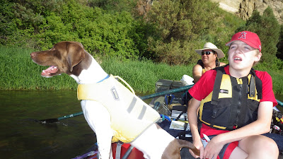
Another cool feature on the South Fork is that there are many islands along the way, and you'll see these narrow channels flowing next to the islands. Many of these are wide enough and deep enough for a boat full of gear, and they are quiet, intimate places to fish, plus see wildlife. I'll never forget pulling into one of those narrow oxbows one time, and around the corner, a huge bull moose was right there on the water's edge. Our springer spaniel was in the bow, with its paws up on the tubes. She got a real good look at that bull moose, and even "boofed" a timid little bark as we went by ... She could have been a lunch snack for the moose! :) 

How to get there: Take I-84 to Idaho Falls. Take Yellowstone Blvd. through town to Idaho Highway 26 to Swan Valley. After about 30 minutes, you'll see the South Fork Outfitters fly shop on the left hand side of the road as you're heading for Swan Valley. If you don't have your own boat, you can book a trip with these guys and you'll catch a lot of fish with their expert guides. Otherwise, you can choose from putting in below Palisades Dam (39 mile trip to Byington), Spring Creek by the highway bridge, or Conant. 

River map: I purchased a South Fork Snake River Boaters Guide from the BLM State Office in Boise in the map room for $7.

Equipment: Be sure to bring your fire pan and porta potty for overnight camping.

Permits: Self-issue permits for floating the South Fork and camping in the canyon are available at the put-in.

Information: See the BLM South Fork Snake River web site
----------------------------------
In other outdoor news, Bogus Basin is hosting a clean up day on its Nordic trails on Saturday from 10 a.m. to 1 p.m. Registration required. Contact Shelley Pursell at spursell@winterwildlands.org to sign up.

Don't miss the Boise Twilight Criterium on Saturday afternoon and evening!

Save the date: The annual wood-splitting weekend for the Idaho City Park n' Ski Yurts is set for July 26-28. Contact Leo Hennessy for more information: leo.hennessy@idpr.idaho.gov.

Have fun!
- SS