Thursday, September 28, 2017

Fall is the time to push your limits on the mountain bike - 5 rides suited to the task

Doug Lawrence on Bear Pete Trail at 8,000 feet. Bear Pete is a classic fall ride. 
Looking south deep into the Owyhee Canyonlands from the Silver City Skyline Tour, above Silver City  
Hi all,

I love the cool weather in the fall ... it's really the best time of the year for active outdoor adventures of any kind. You don't sweat nearly as much on the climb, and it's a beautiful time of year to enjoy fall colors.

This week, I'm recommending five advanced and strenuous mountain bike rides in Boise, Silver City and McCall. Everyone has been riding all spring and summer, and the fall is a great time to push your legs perhaps farther than they've gone this year and knock off some big rides. Get some friends together and go get 'em!

1. Dry Creek - Hard Guy - Dry Creek Loop - For advanced rides, Dry Creek is a favorite destination. You just need some time to ride it! It's a tough climb up Hard Guy but the payoff is big riding down Dry Creek and the new bridges, etc. Distance: 20 miles. Vertical gain: 3,500 feet. Rated advanced (strenuous climb). Travel time: 3-5 hours. Start at the Dry Creek Trailhead on Bogus Basin Road. Climb Dry Creek through the rocks to a creek crossing and junction with the trail spur to Hard Guy about 1.5 miles up the trail. This portion of the trail has been improved recently. Climb Hard Guy to the Ridge Road. Take your time and conserve energy. Take a break on top! Go left and ride 2 miles to the Dry Creek junction. Turn left off the Ridge Road on a singletrack that wraps around a ridge and hairpins into the densely timbered headwaters of Dry Creek. Stay right at the Shingle Creek junction. Proceed with caution. There can be downfall and various hazards on the way down the trail. It's 7 miles of fun and adventure descending Dry Creek. Ride through the rocky features and return to Bogus Basin Road. Whew! Time for a beer!

Dry Creek has multiple bridges installed for crossing the creek. Courtesy Idaho Statesman. 
2. Corrals-Scott's-8th Street-Ridge Road-Trail #4-Sidewinder-Crestline-Red Cliffs Loop -Here's another big foothills tour that'll take you to the top of the Boise Ridge climbing via Corrals, Scott's and 8th Street, and then descending on the wide, sandy, dished-out Trail #4 motorcycle trail until you reach Sidewinder, and then it's a fast and smooth downhill from there. Distance: About 18 miles. Vertical gain: 3,600 feet. Rated advanced (strenuous). Travel time: 2.5-3.5 hours. Ride up Bogus Basin Road or the Highlands Trail to Corrals. Climb Corrals to Scott's, go left, and climb the steep singletrack to 8th Street. Ride another 1.5 miles on 8th Street to a junction for Trail #4 on the right. Follow Trail #4 connector over to Trail #4 and hang on for the tricky descent. Keep your weight back and plane through the sand! Trail #4 eventually returns to Sidewinder summit. Descend on Sidewinder to Crestline and then go right on Red Cliffs to complete your ride. Take Red Fox and Chickadee Ridge to Camelsback and you're done! Again, time for a beer!

3. Silver City Skyline Tour in the Owyhees - It's rated strenuous/advanced in my book, The Owyhee Canyonlands - An Outdoor Adventure Guide. Distance: 16.8 miles, 2,750 feet of vertical gain. I love the ride because it provides a rooftop tour of the mountains surrounding Silver City, and it's nifty that you start and finish in downtown Silver City. Be sure to bring plenty of food and water. The old hotel in Silver City might be open (on weekends) for drinks after the ride. After the ride, there are lots of places to camp just outside of Silver City or along Jordan Creek, you make the call. 

Directions: Drive to Silver City and park off to the side of Main Street near the old hotel. To get there, go south of Nampa on ID 45 to Murphy. Watch for signs for Silver City on ID 78 as you're heading for Murphy, and follow the paved and dirt road to the historic mining town. 

Mile 0 - Ride back toward New York Summit from Silver City. 
Mile 1.2 - Turn right on BLM Road F483. This is your main route for the first half of the ride.
Mile 2.4 - Bear right on Road F483 at Y junction and climb.
Mile 4.7 - Reach junction with service road to the top of War Eagle Mountain. It's a short, but steep sidetrip to check out the summit. Check out the old buldings and mine shafts at the Poorman Mine near this junction ... it's a short sidetrip.
Mile 5.9 - Back at War Eagle junction. Bear right on Road F483 and cruise on your middle ring to the ridges and mountains to the south.
Mile 6.7 - Bear right at Y junction next to livestock watering area. Bear right again shortly afterward and climb a steep hill with lots of mobile rocks.
Mile 7.9 - Come to sweet overlook to the left of the main road. Cruise over to the trees to enjoy views looking out toward Triangle and the big wide open country of the Owyhees.
Mile 8.4 - Pass through barbed-wire gate.
Mile 9.2 - Bear right.
Mile 9.4 - Ignore trail going downhill on the right. Stay on the ridge.
Mile 9.6 - Pass through barbed-wire gate.
Mile 11.1 - Bear right and pass through gate. Going downhill now on ATV track.
Mile 11.8 - Come to 4-way junction. Take a hard right and climb super-steep ATV trail to a saddle at 12.6. Parts of the climb are rideable; some parts not. Go left at the junction and climb a little more until trail flattens out.
Mile 14.0 - Come to 4-way junction. Turn right and descend into Long Gulch on a jeep trail. It's a fun descent back to Silver City. There are a number of creek crossings.

Mile 16.8 - Arrive in downtown Silver City. You made it!     

Riding Elk Trail at Brundage Mountain ... great views of nearby Granite Mountain! Courtesy Visit Idaho
4. Bear Basin-Brundage Lookout-Elk Trail-Growler-488 Road Loop - We're moving on to the McCall area now. I did this ride a couple of weeks ago and it worked out splendid! This is a cool tour of the Bear Basin area on a climb to the top of Brundage Lookout, then you descend Brundage ski area on Elk Trail, and then take a trail and a road back to Bear Basin. Great tour! Distance: 18.2 miles. Vertical gain: 2,600 feet. Rated advanced (strenuous in places). Start by taking Bear Basin Road about 1.5 miles to a wooden fence by the east portal to the Bear Basin non-motorized trails. Park. The ride starts here (by all means, ride from town if you want!). Climb Bear Basin Road 9 miles to the top of Brundage Mountain. The road gets pretty soft and sandy near the top. Just grind out the climb. Once at the lookout, ride over to the Bluebird Chair and pick up the top of Elk Trail. Descend Elk Trail about 6 miles to a point near the bottom of the ski area. You'll see a trail on the left at a split called Growler. Go left on Growler and climb the singletrack through open slopes and deep woods until you climb a super-steep section in the woods and pop out into the open on Temptation. Take Growler across the grassy trail and then bear right as the singletrack continues to climb. You'll see an unmarked two-track road taking off laterally from the ski area. This is Forest Road #488. It's downhill all the way back to Bear Basin now -- enjoy it! Watch for tight corners in a few spots, but generally, you can let it rip on the wide gravel road. Head into McCall and grab a burger and a beer!

Mark Anderson above Josephine Lake.
Almost there! 
5. Bear Pete Trail - The McCall locals always do at least an annual pilgrimage to tackle Bear Pete Trail, and I often gather up some buddies to do the same thing. Everyone loves the ride because it does test you, makes you work hard, and sometimes hike-a-bike is required! The cool thing about Bear Pete is that it starts at a high elevation and after you make the big climb to the top of Bear Pete Mountain, you'll be riding at 8,000 foot elevation on the mountain for a number of miles, going up and down, with huge views off to the west (French Creek) along the way. Distance: 17.5 miles. Vertical gain: 2,500 feet. Vertical gain: 3,500 feet. Rated advanced (strenuous). Travel time: full day. Bear Pete Trail is located north of McCall via Warren Wagon Road. Past Upper Payette Lake, watch for a turnoff to Cloochman Saddle. This road takes you to the trailhead. You also should plant a vehicle at the north end of Bear Pete, north of Burgdorf Hot Springs, if you don't want to ride a long dirt road slog back to your vehicle at the trailhead. At the saddle, climb trail #142 Bear Pete and grind for a couple of miles to the ridgetop. You'll ride up and down along the high mountain ridge for several hours. There are a few junctions but stay on the main trail. On the north end, the trail plunges downhill to Forest Road #246, the road to Burgdorf Hot Springs. You made it! Bring your swimsuits and take a soak at Burgdorf after the ride! Always a good call! There are a number of places where you could camp along the Brundage Road, if necessary.

The Idaho Whitewater Association is looking for helpers for their 2nd annual ID 55 highway cleanup effort on Oct. 7th. See their Facebook event invite for more information.

Have fun!
- SS

Wednesday, September 20, 2017

Three yurts in Idaho City Park n' Ski system are open for rent! Make reservations now!

Fresh powder near Stargaze Yurt
Getting ready to shred some *pow* with Quinn 
Hi all,

After lots of hard work by Idaho Parks and Recreation officials and volunteers, three of the popular yurts in the Idaho City Park n' Ski system are available for rent as of today! Make reservations as soon as you can! 

The three yurts that will be open this winter are Stargaze, Skyline and Rocky Ridge.

You can make reservations online by going to: https://idahostateparks.reserveamerica.com or by calling 1-888-922-6743. Agents are available 7 days a week, Monday-Friday from 8 a.m. to 7 p.m. Mountain Time, or Saturday and Sunday, 9 a.m. to 5 p.m. The online system is handy because you can see what dates are booked, and which ones are not.

The Boise National Forest is working on salvage logging in the area at the current time. It's not clear exactly what xc ski and snowshoe trails will be open in the Idaho City Park n' Ski system, says Leo Hennessy, non-motorized trail coordinator for IDPR, but the access trails to all three yurts will be open for sure by the time winter season kicks in.

Leo also expects that the Gold Fork Loop and Skyline Loop will be groomed for winter xc skiing, snowshoeing and snow-biking this winter. It's also possible that the Banner Ridge and Elkhorn Loops may be open later in the winter. Loggers are cutting fire-killed trees in there right now.

It's great news that the three yurts will be open for the public to enjoy this winter after the wildfire closures in the aftermath of the Pioneer Fire.

Since I posted this blog on Wednesday morning, many of the open dates for the Idaho City yurts have been reserved. There are still some mid-week openings on the online calendar.

But rest assured, if you'd like to go yurting this winter, there are more options!

  • Sun Valley Trekking has many different yurts and wall tents available for rent in the Smoky Mountains north of Ketchum/Sun Valley and they also have locations in the Pioneer Mountains and in the Sawtooths. 
  • Galena Lodge has four yurts that you can rent in the forested mountains adjacent to miles upon miles of xc ski and snowshoe trails. If you like to xc ski, Galena Lodge is manna from heaven. 
  • Sawtooth Mountain Guides - The Williams Peak yurt is very hard to book because a lot of dates are booked a year in advance. But what the heck, see what they've got available! I see some open dates in December ...  

- SS

Wednesday, September 13, 2017

Five September hikes close to Boise - guaranteed to please!

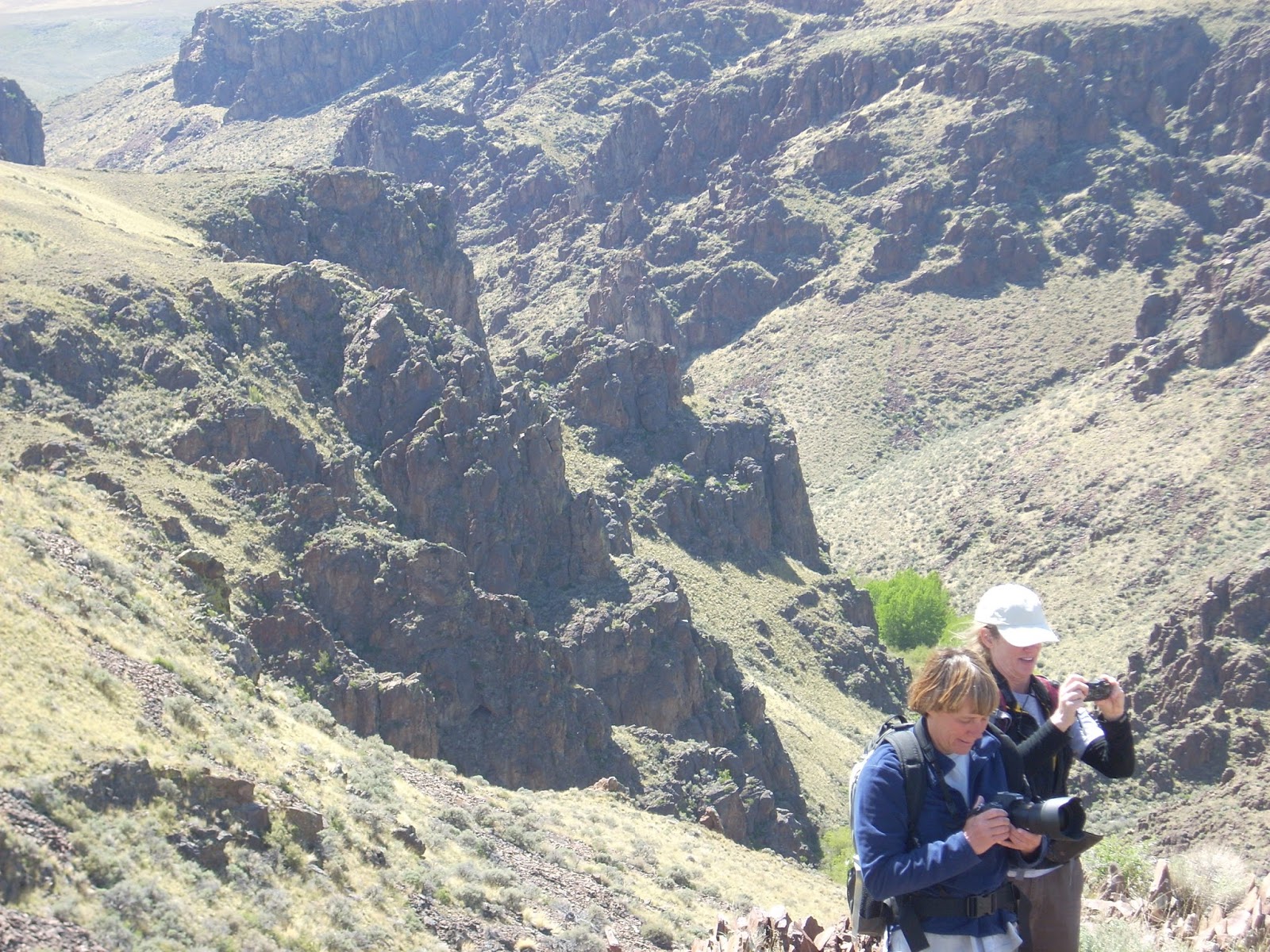
Amy and Robin apparently thought this spot was photogenic! Between the Creeks in the Owyhees. 
Wendy getting ready to take flight on top of a mountain above Toy Pass in the Owyhees 
Hi all,

It's SO NICE to see the hot weather moderating and the skies clearing of smoke! The Boise forecast is calling for highs in the 60s on Friday and Saturday, and 70s on Sunday. That's almost unbelievable considering the string of HOT weather we've had nearly continuously through July and August ...

So my recommendation is to enjoy the cool temperatures and plan a hike this weekend in the Boise Foothills or the Owyhees. All of these hikes are detailed in my guidebooks, Boise Trail Guide: 90 Hiking & Running Routes Close to Home, and The Owyhee Canyonlands, an Outdoor Adventure Guide. 

Here are my recommendations for five hikes guaranteed to please:

1. Hulls Gulch National Recreation Trail - Distance: about 5 miles or less. Difficulty: Moderate. Time travel: You make the call. Take the kids and the dog and go for a hike on the Hulls Gulch National Recreation Trail, starting from the BLM motorcycle parking lot about 3 miles up Eighth Street from the North End of Boise. Take the singletrack trail up the gulch, pausing to learn tidbits about geology and nature from the interpretive signs. Eventually, you'll come to a fork on the trail, go right to see the headwaters. Maybe the creek will be running? Turn around and return the way you came.

Exploring granite outcroppings above Hulls Gulch 
2. Dry Creek Trail - Distance: You make the call. Difficulty: Moderate to strenuous. Time Travel: You make the call. It's a stout hike to hike on the Dry Creek Trail from the trailhead on Bogus Basin Road to the top of the Boise Ridge, but you really don't have to go that far. Just walk up the creek as far as you'd like, and enjoy the day in the cool, creekside, shady environment. Pack a lunch and enjoy the day! For the hard-cores, it's 6.8 miles to the top of the trail, if you want to do a 15-mile day and power walk it.

3. 5 Mile Creek-Watchman-Three Bears Loop - Distance: 6 miles. Difficulty: Moderate to strenuous. Time Travel: 2.5-3 hours. Drive up Rocky Canyon Road from the end of the pavement to the Five Mile Trailhead on the left. The hike starts here. The loop brings you right back to your rig. Pretty cool. Hike up Five Mile Creek several miles to the Orchard Junction, keep going straight along the creek, and the trail turns into Watchman at the top of the steep hill. Follow Watchman as it contours around the mountain, visits another creek, and then descends to the top of the Three Bears grade. Make sure you go left at the junction with Trail #6. Take a breather at the top of the grade, and then it's all downhill to Three Bears junction at the saddle, go left and drop down to Rocky Canyon Road. Go left on the road, and your car is around the corner.

Three Bears Trail heading back to Rocky Canyon Road rounds out the Five Mile-Watchman Loop 
4. Between the Creeks Loop, Owyhee Canyonlands - Distance: 8 miles. Difficulty: Moderate to strenuous. Travel time: 5 hours. See my blog post for photos and details of this hike ... it's one of my all-time favorite hikes in the Owyhees, especially because it's relatively close to Boise. Allow 1.5 hours to reach the trailhead, depending on how fast you drive. The scenic hike takes you on an upland tour of West Shoofly Creek and East Shoofly Creek on top of a plateau, hence the name, "Between the Creeks." The rhyolite canyons are craggy and beautiful.

Top of the mountain to the west of Toy Pass
5. Toy Pass, Owyhee Canyonlands - Should be beezy and cool up on Toy Pass this weekend, making for great hiking conditions. Two optional hikes take off from Toy Pass in the Owyhee Front, near Oreana, starting at 5,875 feet. One hike is 5.3 miles exploring the mountain to the east of the pass, and the other is 4.5 miles, exploring the small knob on the west side of the pass. Take I-84 to the Simco Road exit. Turn right on Simco Road and proceed to the state highway. Turn right at the highway and proceed to Grand View. Turn right on ID 78 in Grand View and then take the second left-hand turn to Oreana. Drive through the little town and go past the Basque church, then bear right on the signed Bachman Grade Road. Follow the well-maintained dirt road to the top of Toy Pass (about 13.5 miles). Park at the pass, and decide which mountain you'd like to climb from there. There are some nice car-camping spots on the south side of the pass, heading toward Triangle.
- SS

Thursday, August 31, 2017

Stueby's last-minute camping and river-floating tips for Labor Day weekend

Stay cool! Go boating on the Cabarton reach of the Payette River! 

How about a spin around Redfish Lake? 
Sit on top kayaks are a perfect choice for the weekend ... 
Lick Creek Summit area, Payette National Forest ... near McCall.
Hi all, 

Labor Day weekend is upon us, the typical last weekend of camping in the summer season, so I'm dishing up some last-minute tips for the three-day weekend. 

Before we get into the camping ideas, both Bogus Basin and Brundage Mountain have some fun stuff going on this weekend. 

This Saturday, Sept. 2, marks the final Music on the Mountain at Bogus Basin for the summer. The event, sponsored by 10 Barrel Brewing Co., will feature live music throughout the afternoon in the newly landscaped base area outside of the Simplot Lodge. Fun Zone activities, including summer tubing, bungee trampoline, gem panning, and climbing wall, will operate from 11 am to 7 pm., and so will the Deer Point Chairlift. Single ride tickets are $15 and a full-day pass is $30. Get up there early in the morning, do a hike or a bike ride, and then kick back in the afternoon and enjoy some live music. 

The music lineup is as follows: 
1:00 – 2:45 pm Sono Fuego
3:00 – 4:45 pm Hot Pursuit
5:00 – 7:00 pm Voice of Reason
At Brundage, the Bluebird Chair will be running from 9:30 am to 4:30 pm Thursday through Monday. Lift fees are $15 for one ride, and $35 for a full day. 

On Friday night, Sept. 1st, Brundage is hosting a Dinner and Music event, featuring the Emily Stanton Band, a Soul R&B artist. The event starts at 6 p.m. They're serving a cajun crawfish boil for dinner. The event costs $25 each. 

Now, on to the camping ideas and other Labor Day ideas ... since it's going to be warm in Boise this weekend, with temperatures in the high 90s Saturday and Sunday and maybe 100 degrees on Monday, it would be nice to cool off at higher elevations in the national forest! You might even want to go paddling or boating on a lake or a river!

Cabarton run on the Payette River as it flows below the Rainbow Bridge ID 55
  • Float Cabarton on the Payette River one more time - The flow is 1,500 cfs, which is the typical summertime flow on the North Fork of the Payette River. Get a group of friends together or hire an outfitter and go float Cabarton, the best day trip in SW Idaho. It's got a little whitewater, swimming in the flatwater sections, and great lunch spots along the way. 
  • Float the Boise River, Swirly Canyon on the South Fork Payette, or the Main Payette. There's only a few more days of raftable flows on the South Fork Payette Canyon and Staircase runs, so it'd be good to nail those runs before the flows go away. These are Class 4 runs best done with outfitters or experienced boaters. See my guide, Paddling the Payette for information and waterproof maps. If you run the Main Payette, use caution at Go Left, and scout it from the highway on the way to the put-in. Lots of rafts are flipping in there.

  • Cascade area - Stolle Meadows and Landmark are my favorite camping areas in this neck of the woods. There are tons of primitive car-camping spots in both locations, east of Cascade, off the Warm Lake Highway. Plus, there are hot springs in the vicinity. The main road to Stolle Meadows #474 is closed due to a bridge washout, but you can take the Warm Lake cutoff #427 to the meadows. Once there, you can take the road south up to a trailhead for Rice Lake and Rice Peak. Nice and easy hike up to Rice Peak, and you can explore ridge tops from there ... In the Landmark area, there's a little-known mountain bike loop from the McClure Trail to the Buck Creek Trail ... it's kind of obscure, so not sure how much downfall is on the trail. 
    Lick Creek area in the Payette National Forest 
  • McCall area - Camping, hiking and backpacking in the Lick Creek area NE of McCall should be fabulous. Some of the nice mountain lakes up there include Box, Snowslide, Duck, Hum, Enos and Thirty-three lakes. Pick up a Payette National Forest map or a McCall Adventure Map to get the details for access. Also, check my blog from earlier this summer on five easy-to-access kid-friendly mountain lakes in the McCall area. 
    Stanley Lake 
  • Stanley area - I'm sure the Stanley area will be hopping with lots of campers at Stanley Lake, Redfish Lake, Pettit Lake and points along the Salmon River. Backpacking in the White Clouds should be dandy, particularly from the East Fork side, being a three-day weekend and all. Don't forget the Marsh Creek Trail as another potential destination ... great hiking and fly fishing spot. Hike up to the junction of Bear Valley and Marsh Creeks, and there's a huge glory hole right there. 
    North and Middle Forks of the Boise River ... car-camping mecca 
  • Idaho City area - The North and Middle Forks of the Boise River work great for car camping. See my post from last week.  
  • Salmon River beaches - Should be fab upstream of Riggins. Pick your spot, bring your rafts and kayaks, and your volleyball and bocce ball sets. Get there early! The prime beaches will be taken early. 
If you're staying in town, I'm hearing that some people will be taking in the Spirit of Boise Balloon Classic, going on from Thursday through Sunday. There are supposed to be more than 5,000 balloon launches.

Also, Labor Day weekend is chock full of big sales at your favorite outdoor retailers in the Boise area, places like Idaho Mountain Touring, George's CyclesBoise REI, Greenwood's, McU Sports, Alpenglow Mountain SportIdaho River Sports, and Shu's Idaho Running Companyall have some fantastic clothing and gear on sale right now. Great deals! Go get 'em! 
- SS

Thursday, August 24, 2017

Five fall car-camping destinations sure to please in the Boise National Forest

Top of Whitehawk Mountain with Quinn (elevation 8,500 feet) 
Early-morning fog hovered over the tall -grass meadows in Bear Valley ...
We awoke to a chorus of sandhill cranes every morning ... 
Ah, the Middle Fork Salmon River ... Huck wanted to catch fish
Hi all,

Last weekend was quite the scene for the solar eclipse on Monday ... what a thrill to see that from the top of a mountain like so many others did in Idaho ... I took my son Quinn to Bear Valley to see the eclipse on Whitehawk Mountain (elev. 8,450 feet), which was right in the bull's eye for 100% totality.

We went up to Bear Valley on Saturday morning to get a choice car-camping spot near the lookout road in a tall-grass meadow that's full of sandhill cranes. There weren't hardly any people up there on Saturday, and a few more dribbled in on Sunday. Bear Valley is a sweet spot for car-camping that's only about 1.5-2 hours from Boise. The #582 road from Lowman was freshly graded as of last week. At elevation 6,700 feet, Upper Bear Valley is nice and chilly at night, and warm during the day.

Side trips: You can hike, bike or run to the top of Whitehawk Mountain, or drive to other potential trails in the vicinity. Being close to Boundary Creek, we had to scoot over to the Middle Fork Salmon (45 minutes), visit Dagger Falls and fish the Middle Fork. We spent most of Sunday over there, mesmerized by the pristine beauty of the pure water rolling downriver from Boundary Creek. Almost strange to be there, and not be launching on the river!

On Monday, we biked to the top of Whitehawk Mountain (tough, continuous climb, about 4-5 miles, 2,000 feet of gain). Get into a low gear and grind it out! When Quinn was 12, I dragged him to the top of Whitehawk Mountain on his mountain bike, and he toughed out the climb, stopping for breaks, and made it to the summit. I was really proud of him, because it was his first mountain summit on a bike. Now at 19, Quinn is in top shape. He totally dusted me on the climb to the top, which is fine with me! That's the way it should be!

Anyway, for my outdoor tip of the week, I'm recommending five fall camping spots for you, your friends and family, including Upper Bear Valley. Even though the kids are back in school, there's still 4-6 weeks of fall camping remaining before the weather turns winter-like in October or November. Gather up your camping stuff and get the kids out in the mountains while you can! Remember to dress warm, and hopefully the Stage 1 fire restrictions will be lifted so you can have a camp fire!

2. Dagger Falls Campground - There's only a few camping spots at Dagger Falls, but most people are camping across the way at Boundary Creek, getting ready for Middle Fork trips. When we visited Dagger Falls last Sunday, there was only 1 party camping there. You can see Dagger Falls Rapids from the campground, and the Middle Fork is just a hop, skip away! Side trip: Go hiking on the Middle Fork or fish the nice holes between rapids in the top 1.5 miles of the river. USFS web site.
Getting there: Take Idaho 21 past Banner Summit to Boundary Creek turnoff on the left. Follow signs to Boundary Creek and Dagger Falls.

3. Deadwood Reservoir - The long drive to Deadwood Reservoir -- many miles of dirt road from the Banks to Lowman Road -- deters a fair number of people from visiting Deadwood Reservoir, but it's a super cool place to go where you can camp on the waterfront, go swimming, fishing, and bring your SUPs, kayaks, blow-up toys, whatever! USFS web site.

This Forest Service video gives you a sense of the setting at Deadwood Reservoir


There are multiple official fee campgrounds around the lake to choose from. Side trips: Several hiking and biking trails vector off from the lake on the west side and south side. Getting there: Take Forest Road #555 from the Banks to Lowman Road to the reservoir. Take your time.

4. North Fork Boise River - This is a car-camping mecca along the North Fork, with potential hiking and biking opportunities in the neighborhood. Black Rock Campground is the main developed campground in the area, but there are scores of primitive sites available for self-support car-camping. Barber Flat is a choice spot, and so is Deer Park, farther to the east. Can't go wrong! Side trips: Fishing on the North Fork, try adjacent logging roads for walking or biking. Getting there: Go to Idaho City and take Forest Road #327 over the Rabbit Creek grade into the North Fork canyon.

Nothing like hanging out by the campfire in the fall! 
5. Middle Fork Boise River - This is another car-camping mecca relatively close to home. The Middle Fork is worth visiting because the fishing is markedly better than on the North Fork. There are many car-camping spots to choose from, plus developed campgrounds such as Badger Creek, Troutdale, and Neinmeyer. Side trips: Fishing, hiking on the Sheep Creek Trail or Cottonwood Creek Trail, explore old logging roads that you may encounter.

With Quinn on top of Whitehawk Mountain the first time we went up there together! 
There you have it! It really already feels like fall if you head into the mountains right now. It can get downright chilly at night! That's a nice break from the 90 degree weather in Boise.

If you'r looking for something to do Friday night, Aug. 25? The Land Trust of the Treasure Valley is hosting their annual dinner and fund-raiser in the Dry Creek Valley in Hidden Springs. I support the Land Trust for all of the benefits that they've brought to our community, including the purchase of Harrison Hollow, easements in Dry Creek and Shingle Creek, and access to Stack Rock. They are a worthy organization to support big-time!
- SS

Thursday, August 17, 2017

Some last-minute tips for how to maximize on the Solar Eclipse 2017 in Idaho

A sneak-peek at what we'll see ... (Courtesy Astronomy Magazine) 
Eclipse path through Idaho ... the red line is the bull's eye (screenshot from NASA Interactive Eclipse Map) 
Hi all,

I remember experiencing the last solar eclipse to occur in the Pacific Northwest in 1979, and I can tell you it wasn't nearly the big deal they're expecting it to be this year in Idaho and the U.S.

I was going to college at the University of Montana at the time, and a friend and I drove east toward Great Falls to see the eclipse in the best place possible under the "Big Sky." But we didn't really "see" the eclipse, because of course, that would have ruined our eyes. So upon the advice of experts, I fashioned a box with a pinhole to watch the moon block out the sun entirely. I don't remember how long it lasted, but because I couldn't watch it with a pair of super cool eclipse glasses, it wasn't really that spectacular ...


This time around, it should be more interesting ... I've got my eclipse glasses ready to go, and I'm hoping to see the eclipse from a mountain top in the prime zone where you get to view a 100 percent total eclipse.

The question many people have had, I'm sure, is where to see the eclipse? How to avoid the masses? Or is that possible? I'm providing tips for this question and more below.

On the question of where to see it, I would refer you to the NASA Interactive Eclipse Map. Zooming into the map, you can see where the 100% eclipse path is located across Idaho, and it spans from Weiser to Stanley to Rexburg, and then Jackson Hole, Wyo. What a cool deal to have this happening so close to home!

Cross-reference the Interactive Eclipse Map with your topo and Google Earth mapping sources to zero in on potential camping areas and landing spots for you and your group.

I think it's pretty obvious that it's going to be super crowded in Weiser and Stanley, where 15,000 to 30,000 people are expected. The Redfish Lake camping areas and Redfish Lake Lodge have been sold out for weeks. I wonder how many people will be backpacking in the Sawtooths and White Clouds? Probably quite a few ...

  • Pick a spot that's off the beaten path where you can camp/stay for several days. The worst traffic jams are expected to be on the morning of the eclipse on Monday, Aug. 21, and after the eclipse. 
  • Leave at least a day early (if not sooner) to pick your spot for the eclipse and don't try to drive home until Tuesday. 
  • Check road conditions anytime on ITD's 511 site
  • Wear approved eclipse glasses with the proper ISO rating. I got mine from the Boise State Physics Department when they presented at the Idaho Environmental Forum. 
  • Take enough food and water with you for several days. 
  • Be ready to watch on Monday morning ... The eclipse begins at 10:10 a.m., with the total eclipse starting about 11:25 a.m. and running about 2 minutes. The eclipse ends about 12:48 a.m.
  • Call ahead and check with the Forest Service to double-check access to trails, camping areas and roads. Call the local ranger districts for the best information closest to where you plan to go. Here's a general USFS web site that leads to specific national forest web sites. 
  • Can I take a photo of the eclipse with my mobile phone? I've seen varying answers to this question ... and some experts say that taking a photo of the eclipse could cause lasting damage to your phone. If you have a way to filter the brightness, that makes it safer. See here for more info. 
I hope everyone has a great time watching the eclipse! 

See more information at the Boise State eclipse web site, which also has links to NASA web sites ...

Here's another link to 25 facts that you should know about the eclipse  from Astronomy Magazine before you go ... 
- SS 

Thursday, August 3, 2017

Come walk, run or bike in McCall for the Mountain Pathways Celebration on Saturday

Hi all,

Valley County Pathways and St. Luke's McCall are teaming up on a new event, the Mountain Pathways Celebration, on Saturday, Aug. 5th, from 8 a.m. to noon. Please come if you're in the 'hood! 

This is a family friend, kid-friendly non-competitive event with a Bounce House at the Start/Finish and live music from a local DJ pro. 

We want to celebrate pathways in the greater McCall, Valley County and West Central Mountains region by hosting an event on McCall city pathways and the North Valley Trail. You can walk, run or bike for 1, 2.5, 5 or 10 miles. Entry fee is $5/person. You can pre-register online. Same-day registration is OK, too.  

For the 5-mile course, we'll shuttle people out to the south end of the North Valley Trail in the outskirts of McCall, so they can experience the full sweep of the beautiful trail along the tree-lined old railroad line, pass by the Activity Barn, McCall Airport and Smokejumper Base, and then cruise into downtown McCall on city pathways to the Start/Finish area behind City Hall. 

The event is a fund-raiser for Valley County Pathways, a non-profit group that's been working on developing a system of valley-wide trails that would connect the communities of Cascade, Donnelly, Lake Fork and McCall. 

Trail of the Coeur d'Alenes 
We all know how cool it is to experience long-distance pathways in beautiful settings such as the Trail of the Coeur d'Alenes in North Idaho, the Boise River Greenbelt, and the Wood River Trail from Bellevue to Ketchum/Sun Valley. 

In the early- and mid-2000s, when I was working in government affairs for Tamarack Resort, I joined a number of citizens who wanted to put together a plan for long-distance trails in Long Valley. We wrote the first Master Plan in 2005. Since February of this year, I've been working on updating the Master Plan, with a new map and fresh priorities. The plan was approved by Valley County P&Z in March, and Valley County Commissioners in July. Big milestone for VC Pathways! We had 108 letters of support! 

The West Central Mountains' America's Best Community campaign asked us to update the Master Plan, and they see further pathway development as a big priority for the region in a 21-point economic revitalization plan. Now that our plan is approved, we can move forward with working on future pathways in high-priority areas throughout the valley. 

Back to the Mountain Pathways Celebration event ... the trail is nearly flat the entire way with a couple of short uphills and downhills. Very kid friendly for all ages. Seniors too!

We want folks to have fun at this event! Costumes are encouraged. We'll have music at the 
Start/Finish area, coffee, fruit and muffins. We'll have multiple aid stations with fun activities or treats. Scavenger hunts are planned for kids. 

Here's another reason to come ... we have some great raffle items from McCall businesses, including:  
  • Hala Hoss SUP $1,100.00 value, donated by River Gear, a paddle shop in Cascade. 
  • Yeti cooler, $199 value from May Hardware
  • Cheap Thrills ½ day Wave-Runner rental $175 value
  • Four passes to open skating at Manchester Ice Center
  • Two gift certificates for three movie rentals at Sunset Video
  • Two ½-day SUP rental from McCall Sports Exchange
  • Two $25 G.C.’s to McCall Jewelry 
  • Lift tickets to Tamarack Resort
  • Ski tune packages from Kurt Wolf 
  • Full-day mountain bike rental from Gravity Sports
We'd also like to thank our event co-sponsors Mida Gold and McCall Parks & Recreation for their support.

Prizes: Bring a prize to share at the event ... toys or stuffed animals for kids, used recreation gear, hats, whatever you think someone else might want!

To make things go smooth on the course, we plan on starting the walkers/runners first, and the cyclists afterwards. 

Bring your own water bottle, please! You can refill at our aid stations. 

For more information, go to valleycountypathways.org.