Showing posts with label Three Fingers. Show all posts

Thursday, April 1, 2021

Super Duper spring weekend coming up! Two hikes and Wilson Creek bike ride in the Owyhee Canyonlands + Spring Skiing!

Stopping to check out the cool rock formations along Bingo's Trail, #500,
heading over to Reynolds Creek Canyon. Paul Hilding enjoys the views. 


Hi all, 

Similar to last week's weather, we are seeing warm afternoon temperatures rising a bit more each day to a big crescendo on the weekend. This week, that situation is especially true, with a high temperature of 75 forecast on Friday, 80 degrees on Saturday and 77 on Sunday! WOW! 

Looks like a great weekend to do just about anything outdoors! 

For my outdoor tip of the week, I'm recommending a two hikes and a mountain bike ride in the Owyhee Canyonlands, the last weekend of spring skiing at Tamarack Resort (closing at the end of day, Sunday, April 4), the next-to-last weekend of spring skiing at Bogus Basin, Brundage Mountain and Sun Valley (all closing April 11), and lower Boise Foothills trails.

A few key points from Ridge to Rivers when visiting Boise Foothills trails: 

A few key points to remember:
1) The trails are busy with lots of folks looking for the same experience you are - happiness and relaxation in the Foothills. As such spring time is the perfect opportunity to take the Happy Trails Pledge: https://www.ridgetorivers.org/happy-trails/
2) As you venture higher into the Foothills, you will still encounter sections of muddy trail. Remember to travel through these, not around them so that you don't widen the trails. And please turn around if you encounter longer stretches of mud - there are lots of dry opportunities available in the lower and mid-Foothills.
3) Trail crews and Adopt-A-Trail groups are out maintaining trails now. Please slow down and say hello when you encounter these folks - they are working hard for you.
Enjoy the beautiful spring weather!

Lower-elevation trails in the Owyhee Canyonlands are in great shape right now. A lot of people have been flocking to Wilson Creek for hiking and biking, which is a fine idea. Here's a blow-by-blow description riding the Wilson Creek Northwest Passage Loop, starting from the lower trailhead on Wilson Creek Road. This trail is a strong intermediate/advanced ride, 16.25 total mileage, ride time is 3+ hours, depending on length of stops for lunch, snacks and scenic locations.

Two other locations that I'd recommend in the Owyhees are Succor Creek State Park and climbing Three Fingers nearby. Both of these areas are featured in my guidebook to the Owyhee Canyonlands.

Succor Creek State Park is a popular spot, about 30 minutes from Homedale, Idaho, for families and kids to do a little hiking, exploring caves, checking out the creek and hanging out. You can camp there overnight. Get there early if you want a spot!

Things look quite interesting as you approach Succor Creek State Park. 

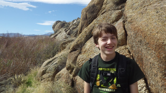
Drew had fun with us exploring Succor Creek. Note how the creek is at flood stage. 


Climbing Three Fingers is an easy hike for families and kids. This could be a side trip while you're camping at Succor Creek park, or a day trip destination. You'll continue driving past Succor Creek park for several miles up a hill, and then turn right at an unsigned right-hand junction. Follow that dirt road toward the top, and you'll see a two-track road appear on the left side of McIntyre Ridge Road. This is your two-track trail leading to the top of Three Fingers mountain.

Distance is 2.4 miles round-trip. 833 feet of vertical gain. Time required is about 1.5 hours, depending on how long you hang out on top. We found that it's possible to hike into the trough of the middle finger area for a cool place to hang out and enjoy the view. There was a little notebook inside a canister in that area. Make a note about your group so you can enjoy seeing that in a few years from now.

The two-track trail to Three Fingers 

Great views of "The Big Wide Open" from the top of Three Fingers. 

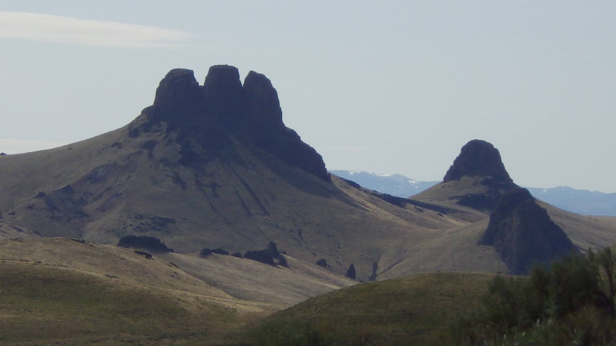
Three Fingers when dressed in velvety green (courtesy Summit Post) 

Have fun and enjoy the sunshine! Don't forget the sun screen!
- SS

Thursday, October 22, 2020

Crisp fall weekend on tap - great time to hike in the Owyhee Canyonlands!

Have you climbed Three Fingers in the Owyhees? 

Hi all, 

Boy, it's getting downright nippy this weekend! Fall is definitely getting a grip on Idaho! I'm seeing a possibility of snow showers in McCall and Stanley on Saturday, and low temperatures in the single digits! Sounds like a great forecast for elk hunting in the mountains. 

But if you were interested in going out for a nice hike, I'd recommend heading for the Owyhee Canyonlands. I'm seeing high temperatures in the 50s for Homedale, which is just 30 minutes from Succor Creek State Park, and a high of 60 in Grand View, at the beginning of the Owyhee Backcountry Byway

Picking just a few of my favorite hikes from my Owyhee Canyonlands adventure guide, I'd recommend Browns Canyon near Oreana, visiting Succor Creek State Park, Climbing Three Fingers near Succor Creek, or visiting Leslie Gulch, one of the most scenic locations in the Owyhee Canyonlands tucked inside the Oregon border. 

Browns Canyon 

1. Brown's Canyon Overland Tour, Owyhee Front, near Oreana. Distance: 5.2 miles. Difficulty: Moderate. Travel time: 3+ hours. This is an interesting hike in the sagebrush and rocks of the Owyhee Front until you come across Brown's Canyon, a hidden jewel. In my Owyhee Canyonlands guidebook, I detail a hike inside the slot canyons of Brown's Canyon, and a hike that goes around the slot canyon (thereby avoiding cold, deep-water pools) but you can still see it from above.

How to get there: Take I-84 East to Simco Road. Turn south on the highway to Grand View. Turn right on Idaho 78 in Grandview and head for the tiny old town of Oreana. There's a sign on the highway for a left-hand turn into town near MP 43. Make a note of your odometer. Drive down the hill straight into town, go past the old church (2.25 miles from the highway) and go straight on the Oreana Loop Road until it takes a hard left. Make the corner and take an immediate right on Alder Creek Road. Follow the bumpy dirt road six miles to a signed right-hand turnoff for BLM Road 700. Proceed down the grade to an old corral at a two-way junction. Park. The hike starts here.

Drewby liked Browns Canyon 

The Hike
: Go west on BLM Road 700 and climb a moderate grade over to a bluff that overlooks Browns Canyon. At mile 1.4, bear right on a two-track and drop down to the Browns Creek draw. This is a pretty area that's full of shrubs and aspens. The first slot canyon with blondish rock begins at mile 1.7. Cross over to the left side of the draw, as you go downstream, and walk overland through the blond rocks staying above the canyon. You'll break out into an open sage flat at mile 2.0. When the next slot canyon begins, climb up the slope to the left until you reach the top of the rim, and then hike along the rim as close as you feel comfortable to check out the slot canyon as you move along. In a half mile, the canyon breaks open by a draw, and you'll need to lose elevation. Hike into the bottom of the gully and climb back on top of the rim. There's a nice overlook when you reach the top again at mile 3. Continue on the left side of the canyon until you come to the dirt road crossing, and then turn right onto the dirt road at mile 3.6.  Follow the road to mile 4.0 at a two-way junction. Turn right again at a fence gate, and follow the two-track road (BLM Road #710)  back to the trailhead. Feel free to explore Antelope Springs along the way. It's another tight canyon.  

Wendy at Succor Creek 

2. Visit Succor Creek State Park - Succor Creek State Park lies in the bottom of an incised canyon, surrounded by cool rock features left over from rhyiolite and basalt lava flows that occurred many millions of years ago. There aren't many official trails in the area, but cross-country hiking is a great way to explore it. Kids will enjoy the caves, in particular, and playing around by the creek.

We started our outing with a casual walk along Succor Creek. We walked a half mile downstream before we got cliffed out and had to turn around. Near the pedestrian bridge that goes across the creek in the campground, there is a small slot canyon you can explore. There's also a jeep trail that climbs above the slot canyon and provides a nice view of the campground below. We could peer into the slot canyon and walk along the top of the rim as far as we wished. Up on top, you could climb much higher if you wanted to get a huge view of the Owyhee Mountains.

We saw at least 10 different caves that one could explore. A very large cave lies next to Succor Creek Road. It has a big dirt floor and there were some small animal bones and such that we found inside.

How to get there: Take I-84 to the last exit in Nampa. Take ID 55 west toward Marsing. Turn right on Chicken Dinner Road, then left on Homedale Road, and go to Homedale. Follow State Highway 19 west of Homedale, and then Highway 201 in Oregon, to a signed turnoff for Succor Creek State Park on the left. Follow the good dirt road to Succor Creek State Park, it's about 20-30 minutes to the park from the highway. 


Hike to Three Fingers 
The dirt road access for Three Fingers is a few miles south of Succor Creek State Park. A good all-wheel-drive vehicle with high clearance is recommended for this trip, but it's not that gnarly of a road (when it's dry). A Subaru Outback should be fine, too. Watch for a right-hand turn after climbing the grade south of Succor Creek State Park. Turn right on the primitive road, and continue 3.9 miles on the dirt road to "the trailhead" for Three Fingers, a high point in the road. You'll see a steep two-track headed to the west over a hill. There is a fiber optic cable post across the road at this spot. I parked my Ford F-250 in a pullout and hiked from there.

It's about 1.2 miles to the top of Three Fingers from the trailhead, or 2.4 miles total. Bring a lunch and some water to enjoy on the summit. You can't see Three Fingers from the trailhead, but you'll see it on the dirt road as you're approaching it. It's a basalt cap on top of a grassy knoll with three distinctive knobby fingers.

From the trailhead, we followed the two-track ruts to the top of the first ridge at .3 miles. From there, a grand view of the Owyhee Plateau opened up before our eyes. The two-track bends to the north toward Three Fingers. We cruised over there, and then followed footpaths toward a gap behind the rock between the first finger and the second finger. Sure enough, it was possible to scramble to the top from there. I had to lift my puppy over a few steep spots, but a dog should be fine on the hike.

Once on top, we could see for more than 50 miles in all directions. We discovered several unexpected pleasures on our trip. First, my friend Norm spied a gold eagle nest on the backside of Three Fingers. With the binoculars, he could see an eagle chick in the nest. There might have been more chicks in the nest, yet to hatch.

Bones for Huck to sniff 

The second thing was that someone has placed a silver canister at the summit of the first finger containing a number of notebooks inside. Several summit journals contain people's thoughts over the last 10 years. That's pretty cool. I made a few notes in one of the notebooks.

If you've got a copy handy, bring along Roadside Geology of Idaho by David Alt and Donald Hyndman in your day pack. It's a great reference for a hike in the Owyhees. It explains the rhyolite volcanic eruptions and the oozing basalt lava flows that shaped that countryside. It's pretty easy to imagine those events when you're sitting in a catbird seat on Three Fingers, enjoying a quiet moment surrounded by the beauty of nature.

Enjoy the Owyhees! 
- SS 

Wednesday, October 9, 2019

Brrrrrrr! Feels like Fall! 5 rock-solid Fall Hikes Part 2

Three Fingers Rock (courtesy Summit Post) 
Hi all,

Whoa baby, the Cool North Wind was blowing like a son of a gun today, and it's got me thinking about fall hiking for the weekend.

Pulling a few of my recommendations from a program I gave tonight at Boise REI, I'm recommending five sure-fire fall hikes for my outdoor tip of the week. Consider this Fall Hikes Part 2, following the fall hiking post I did recently. In addition, there are oodles of options to choose from in my guides, the Owyhee Canyonlands - an Outdoor Adventure Guide, and Boise Trail Guide: 95 Hiking and Running Routes Close to Home.

This afternoon, Wendy, Elena and I took a walk on Red Fox and Chickadee Ridge, and hiking on the elevated ridge was quite brisk! The rabbit brush was still popping bright yellow, and Huck flushed quail everywhere! Sometimes a quick outing in the super accessible Boise Foothills is a great option when you only have an hour or so.

To that end, we start with:

1. Castle Rock - Table Rock "Foothills on the Rocks" - Distance: 4.3 miles; Difficulty: moderate to strenuous; Vertical gain: 952 feet; Hiking time: 1.5 hours. Start from behind the Bishop's House by the Old State Pen, where there is public parking. Hike Trail #15 to Castle Rock Trail #19 and loop around to the top of Castle Rock. Take a moment to enjoy the view. Continue to the east on Trail #15 and climb to the top of Table Rock. Look out into the city and take a breather. Then descend on Trail #16 and #17, which wrap around the cone of Table Rock, and retrace your tracks back to the start.

2. Marianne Williams - Barber Park Loop - Distance: 3.6 miles; Difficulty: easy to moderate; Travel time: 2 hours; Start either in Bown Crossing or Barber Park. Cap off your trip with some coffee or a beer in Bown Crossing.


Mountain biking on the old Oregon Trail in east Boise 
3. Oregon Trail going out toward Bonneville Point from BLM trailhead on Idaho 21. The trailhead for this hike is just to the east of Surprise Valley off of the Idaho 21 connector to Gowen Road. It's a nice walk to take the trail to the east, climb to the top of the bluff overlooking Diversion Dam and the Boise River, and if you're super ambitious, you could hike all the way to Bonneville Point. But often, I'm just walking the dog and getting some fresh air and an easier out-and-back experience is all I do. I reserve the trip out to Bonneville Point for my mountain bike.

4. Huckleberry Trail, Ponderosa State Park - The colors are turning on "the Huck" and it's a relatively easy walk around the peninsula of Ponderosa State Park. Distance: 5 miles; Difficulty: moderate; Travel time: 2-3 hours. Trailhead is a Ponderosa State Park. If you've got a state trails pass, you can enter for free.

Bear Basin Trails would be another good choice when the snow melts in McCall this weekend, if it melts!

Photo courtesy Carolyn Dickinson of McCall
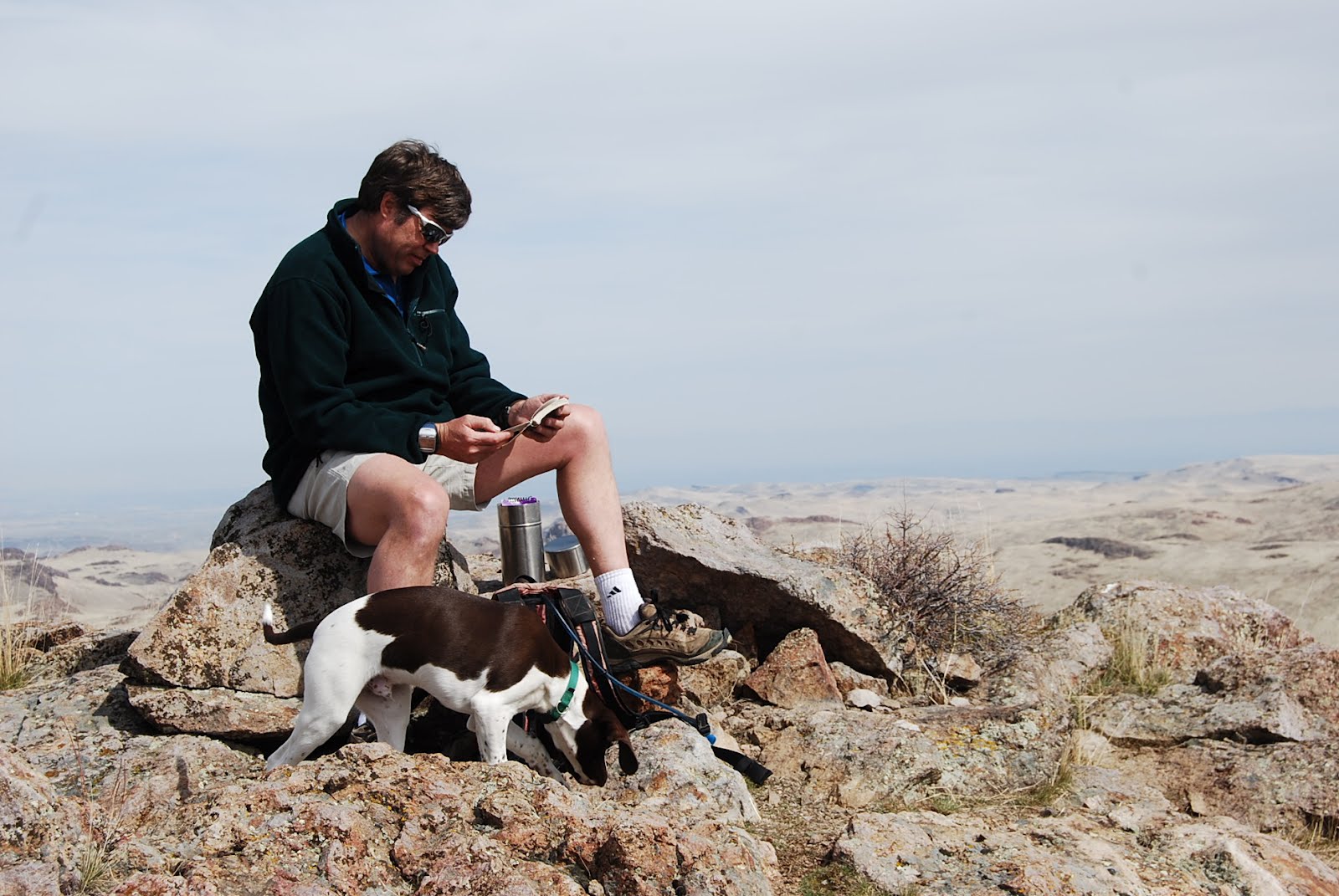
Norm Nelson takes a breather at the top of Three Fingers. 
5. Climb Three Fingers in the Owyhees - Distance: 2.4 miles; Difficulty: easy to moderate; Travel time: 1.5 hours; Vertical gain: 833 feet. The hardest part about the hike to Three Fingers is to find the trailhead, and that's not that hard. Follow directions in a previous detailed post about hiking to Three Fingers. You should allow 1.5-2 hours to get to the trailhead on the McIntyre Springs Road from Boise. Once you're there, the hike to the top is pretty quick, very kid-friendly, and you'll be amazed at the big views of the Owyhee Canyonlands from the top. You might even see some bighorn sheep.

Be aware that rifle deer hunting season has begins statewide in Idaho on Thursday, Oct. 10, so wear bright colors in your outdoor outings, and put bright colors on your pups.
- SS

Thursday, April 5, 2012

Three Fingers Rock is an easy hike for families and kids in Eastern Oregon

Reading people's thoughts about being on top of Three Fingers

Three Fingers (courtesy Summit Post)
The Big Wide Open

Looking toward Owyhee Reservoir to the west (and Norm Nelson)

A bighorn sheep skull

Between the fingers
Three Fingers from a distance (note two-track trail to the right)
Heading over the first ridge
Unmarked trailhead

Trip map (click to enlarge)
Hi all,

The weather looks promising for a desert outing this weekend. No rain is in the forecast, can you believe that? So it'd be a good time to venture out for a hike in the Owyhee desert.

As part of an ongoing series of sneak-peeks at new hiking and biking routes that we'll be including in a forthcoming guidebook on the Owyhee Canyonlands, I would recommend heading for Three Fingers Rock near Homedale, Idaho.

The dirt road access for Three Fingers is a little ways past Succor Creek State Park. A good all-wheel-drive vehicle with high clearance is recommended for this trip, but it's not that gnarly of a road. A Subaru Outback should be fine, too.

How to get there: Take I-84 to the last exit in Nampa. Take ID 55 west toward Marsing. Turn right on Chicken Dinner Road, then left on Homedale Road, and go to Homedale. Follow State Highway 19 west of Homedale, and then Highway 201 in Oregon, to a signed turnoff for Succor Creek State Park on the left. Head south on the dirt road. It's 21 miles to the unsigned turnoff to reach Three Fingers. You'll go past Succor Creek State Park (a possible camping location for the weekend), and it's the first major right-hand turn after the park at a saddle. It's 3.9 miles on the dirt road to "the trailhead" for Three Fingers, a high point in the road, where you'll see a steep two-track headed to the west over a hill. There is a fiber optic cable post across the road at this spot. I parked my Ford F-250 in a pullout and hiked from there.

It's about 1.2 miles to the top of Three Fingers from the trailhead, or 2.4 miles total. Bring a lunch and some water to enjoy on the summit. You can't see Three Fingers from the trailhead, but you'll see it on the dirt road as you're approaching it. It's a basalt cap on top of a grassy knoll with three distinctive knobby fingers.

From the trailhead, we followed the two-track ruts to the top of the first ridge at .3 miles. From there, a grand view of the Owyhee Plateau opened up before our eyes. The two-track bends to the north toward Three Fingers. We cruised over there, and then followed footpaths toward a gap behind the rock between the first finger and the second finger. Sure enough, it was possible to scramble to the top from there. I had to lift my puppy over a few steep spots, but a dog should be fine on the hike.

Once on top, we could see for more than 50 miles in all directions. Three Fingers Gulch below looks very intriguing, and I plan to hike that draw down to Owyhee Reservoir to see what kinds of treasures can be found there. Looking through the binoculars, we saw some very cool rock formations near the reservoir. My buddy Norm thought it was Leslie Gulch, but I am quite sure it's not, giving that Leslie Gulch is a number of miles to the south of Three Fingers Gulch. We will have to go there and see.

We discovered several unexpected pleasures on our trip. First, Norm spied a gold eagle nest on the backside of Three Fingers. With the binoculars, he could see an eagle chick in the nest. There might have been more chicks in the nest, yet to hatch.

The second thing was that someone has placed a silver canister at the summit of the first finger containing a number of notebooks inside. Several summit journals contain people's thoughts over the last 10 years. That's pretty cool. I made a few notes in one of the notebooks.

If you've got a copy handy, bring along Roadside Geology of Idaho by David Alt and Donald Hyndman in your day pack. It's a great reference for a hike in the Owyhees. It explains the rhyolite volcanic eruptions and the oozing basalt lava flows that shaped that countryside. It's pretty easy to imagine those events when you're sitting in a catbird seat on Three Fingers, enjoying a quiet moment surrounded by the beauty of nature.

Three Fingers isn't that far from Leslie Gulch if you'd like to consider camping out at Leslie Gulch for the weekend. As I mentioned, Succor Creek is a good camping spot as well. The only downside with Succor Creek is that sometimes I have seen so many OHV users in that park, a non-motorized group might feel a bit overwhelmed. On our way back to Homedale two weeks ago, I saw an adult male doing donuts on an ATV in the main portion of the park. People ought to know better than that. Too bad Oregon doesn't have a camp host at the park. They need one.

FYI - A big campout is planned at Leslie Gulch April 13-15 with the Idaho Outdoors Yahoo Group people, including trip leader Leo Hennessy and group moderator Owen Jones, who has a power boat that will shuttle people to canyon hikes from the reservoir. Leo says he's got over 65 people signed up so far. Should be a big party! Better get there early to find a decent camping spot!

Have fun!
- SS