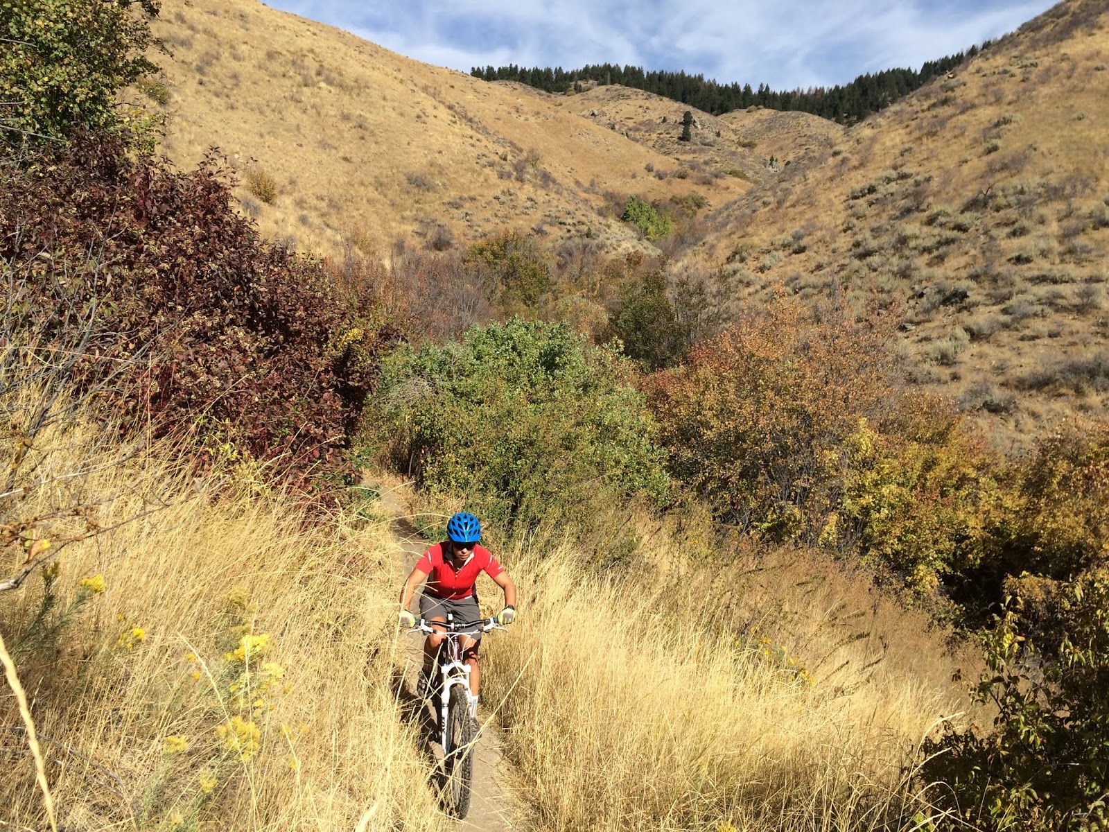
Showing posts with label Boise Foothills trails. Show all posts

Thursday, April 1, 2021

Super Duper spring weekend coming up! Two hikes and Wilson Creek bike ride in the Owyhee Canyonlands + Spring Skiing!

Stopping to check out the cool rock formations along Bingo's Trail, #500,
heading over to Reynolds Creek Canyon. Paul Hilding enjoys the views. 


Hi all, 

Similar to last week's weather, we are seeing warm afternoon temperatures rising a bit more each day to a big crescendo on the weekend. This week, that situation is especially true, with a high temperature of 75 forecast on Friday, 80 degrees on Saturday and 77 on Sunday! WOW! 

Looks like a great weekend to do just about anything outdoors! 

For my outdoor tip of the week, I'm recommending a two hikes and a mountain bike ride in the Owyhee Canyonlands, the last weekend of spring skiing at Tamarack Resort (closing at the end of day, Sunday, April 4), the next-to-last weekend of spring skiing at Bogus Basin, Brundage Mountain and Sun Valley (all closing April 11), and lower Boise Foothills trails.

A few key points from Ridge to Rivers when visiting Boise Foothills trails: 

A few key points to remember:
1) The trails are busy with lots of folks looking for the same experience you are - happiness and relaxation in the Foothills. As such spring time is the perfect opportunity to take the Happy Trails Pledge: https://www.ridgetorivers.org/happy-trails/
2) As you venture higher into the Foothills, you will still encounter sections of muddy trail. Remember to travel through these, not around them so that you don't widen the trails. And please turn around if you encounter longer stretches of mud - there are lots of dry opportunities available in the lower and mid-Foothills.
3) Trail crews and Adopt-A-Trail groups are out maintaining trails now. Please slow down and say hello when you encounter these folks - they are working hard for you.
Enjoy the beautiful spring weather!

Lower-elevation trails in the Owyhee Canyonlands are in great shape right now. A lot of people have been flocking to Wilson Creek for hiking and biking, which is a fine idea. Here's a blow-by-blow description riding the Wilson Creek Northwest Passage Loop, starting from the lower trailhead on Wilson Creek Road. This trail is a strong intermediate/advanced ride, 16.25 total mileage, ride time is 3+ hours, depending on length of stops for lunch, snacks and scenic locations.

Two other locations that I'd recommend in the Owyhees are Succor Creek State Park and climbing Three Fingers nearby. Both of these areas are featured in my guidebook to the Owyhee Canyonlands.

Succor Creek State Park is a popular spot, about 30 minutes from Homedale, Idaho, for families and kids to do a little hiking, exploring caves, checking out the creek and hanging out. You can camp there overnight. Get there early if you want a spot!

Things look quite interesting as you approach Succor Creek State Park. 

Drew had fun with us exploring Succor Creek. Note how the creek is at flood stage. 


Climbing Three Fingers is an easy hike for families and kids. This could be a side trip while you're camping at Succor Creek park, or a day trip destination. You'll continue driving past Succor Creek park for several miles up a hill, and then turn right at an unsigned right-hand junction. Follow that dirt road toward the top, and you'll see a two-track road appear on the left side of McIntyre Ridge Road. This is your two-track trail leading to the top of Three Fingers mountain.

Distance is 2.4 miles round-trip. 833 feet of vertical gain. Time required is about 1.5 hours, depending on how long you hang out on top. We found that it's possible to hike into the trough of the middle finger area for a cool place to hang out and enjoy the view. There was a little notebook inside a canister in that area. Make a note about your group so you can enjoy seeing that in a few years from now.

The two-track trail to Three Fingers 

Great views of "The Big Wide Open" from the top of Three Fingers. 

Three Fingers when dressed in velvety green (courtesy Summit Post) 

Have fun and enjoy the sunshine! Don't forget the sun screen!
- SS

Thursday, October 18, 2018

Hike Celebration Park and see birds of prey artwork, plus Sweet Connie and Boise trails

Norm Nelson, son of Morley Nelson, has some beautiful oil paintings on display
at the Celebration Park Visitor Center. 
We did a group hike to Halverson Lake last spring for the 25th anniversary of the final protection of the
Morley Nelson Snake River Birds of Prey National Conservation Area. 
The golden eagle eyes piece is one of my favorites. The other two are quite something, too! 
Hi all,

Well, the weather forecast this weekend is pretty darn stellar for October! Nothing but clear skies and temperatures in the high 60s or 70 Friday-Sunday in the Boise area. How can you go wrong?

The weather should be great for just about anything outdoors! I'm sure some families will be taking their kids to corn and hay mazes for Halloween. But I'm going to recommend four destinations close to home for a fun adventure.

1. Go hiking at Celebration Park next to the Snake River, and while you're there, check out the birds of prey artwork in the Visitor Center. My friend Norm Nelson has some of his oil paintings on display, and there are other works there as well. You can enjoy a very moderate 6-mile round-trip hike to Halverson Lake and enjoy some fall colors next to the Snake. Driving directions: From downtown Boise, take I-84 west to Nampa. Take the Franklin Road exit (City Center) in Nampa. Go left. Follow Franklin to the intersection with 11th Street. Turn right and take 11th into downtown Nampa. Follow signs for ID 45 south. Proceed several miles south to Walters Ferry at the Snake River. Just before the river crossing, turn left on Ferry Road. Follow Ferry to Hill Road. Go right on Hill. Follow Hill to Sinker Road; turn right on Sinker and proceed to Celebration Park. You can see petroglyphs on boulders next to the parking lot, and learn about the Bonneville Flood. The artwork on display can be seen between 10 a.m. and 2 p.m. daily. 

2. Head to Bogus Basin to go hiking or biking. The conditions are perfect for fall hiking and biking right now! You can do my Bogus Basin Contour Special (6 miles round-trip, rated moderate to strenuous for hiking), or ride Around the Mountain, a 10-mile ride that IMBA rated as the best in Idaho. Both rides start at the base of Bogus Basin by the lower lodge.

3. Do a super-cool grand descent bike ride. Go up to the Eastside Trailhead (Mile 12 on Bogus Basin Roads), and ride Eastside over to Stack Rock, and at the junction, keep going straight and do a grand descent on Sweet Connie and then turn onto Chukar Butte to gravity ride all the way to Hidden Springs. Leave a shuttle rig at Hidden Springs and shuttle your way to the Eastside Trailhead (or be a stud and do it all by bike). I'm not sure how many miles that is, but somewhere in the 20-mile range. Advanced riding skills required. Here's a cool video of the Chukar Butte trail.

4. Hike or ride a trail in the Boise Foothills to enjoy the fall colors. Hulls Gulch, Military Reserve, Corrals Trail, Cottonwood Creek, Dry Creek and Watchman are all good bets!
Watchman Trail as the colors are beginning to turn ... 
Want to learn more about the Idaho Centennial Trail? Go to an ICT discussion at 4 p.m. Saturday at the Foothills Learning Center on 8th Street.

Have fun!
- SS

Thursday, September 4, 2014

Try these two hikes/rides close to home: Polecat Gulch and Watchman Loop

Wendy and I ran into Dave Kordiyak on the Polecat Trail,
overlooking the Terteling Ranch. 

Polecat Gulch near Quick Draw junction
There's almost always water for dogs in Five Mile Creek.
These are my boys Quinn and Drew 
New Polecat Gulch Trailhead. Looks pretty snappy! 
Hi all,

I rode the Polecat Gulch Loop on Monday, and I was pleased to see that the City of Boise had completed the new trailhead for Polecast via North Collister off of Hill Road! This will make it much easier to access Polecat Gulch for many people in Northwest Boise. It's also a good reason to talk about the benefits of hiking, running or biking in Polecat Gulch in my outdoor tip of the week.

This week, I'm also going to suggest doing a long hike or ride on the Watchman Loop in NE Boise. The cool weather has been fabulous for foothills recreation this week, and it appears that it will continue this weekend, at least in the mornings. The highs this weekend in Boise are projected to be in the mid-80s in the afternoons.

Both of these hikes/rides are a little off the beaten path because they're not in the Central Foothills where many people go day after day. I'm recommending these hikes/rides close to Boise because the kids are back in school, so it's harder to get out of town for many people. If you can escape, it should be fabulous weather for a high country adventure in McCall, Stanley or Sun Valley.

Let's start with Polecat Gulch. This area was a key new 834-acre open space reserve purchased by the City of Boise in 2002 with funds from the 2001 Foothills Levy. It opened up a great system of trails in an area that had been previously unaccessible because its private land status. The trails in Polecat are more moderate than many in the foothills, so that's another draw. This area also is home to albino mule deer. I've seen them myself!
Polecat Gulch map (click to enlarge)
How to get there: Take Hill Road to N. Collister in NW Boise. Turn north on N. Collister and proceed to the Polecat Trailhead at the end of the road. There is a restroom in the parking lot.

The Polecat Gulch "finger" loop as I call it in my guidebooks, Boise Trail Guide and Mountain Biking in Boise, is approximately 6 miles long. It circumnavigates the whole gulch. I call it a finger loop because the trail snakes around little ridges that extend like a finger from the top of the gulch. It takes about an hour to do the loop on a bike, 1.25 hours for trail-runners, and several hours if you're hiking.

There are shorter loops you can do, too ... For instance, you could hike/ride up the bottom of Polecat Gulch from the N. Collister trailhead, and take QuickDraw to the top of Doe Ridge, and come back via the Polecat Loop trail. That would be about 2.5 miles.

Go visit Polecat from either the N. Collister side or the Cartwright Road trailhead ... you'll like it!


The Watchman Loop is one of the best hikes/rides in Boise IMHO. Starting from the bottom of Rocky Canyon Road, the loop is 10.2 miles long. It takes me a little less than 2 hours to ride it fast. It'd be a much longer trip if you're hiking -- about 4 hours. I rate the mountain bike ride advanced, and I rate the hike strenuous. The route features 1,900 feet of climbing. It's a fairly challenging route, but the views and the countryside you tour make it a four-star experience in my book.
Five Mile - Watchman Loop (click to enlarge)
Directions: Start at the bottom of Rocky Canyon Road at the end of the pavement. Proceed up the dirt road 2.5 miles to the Five Mile Creek Trail on the left. Climb Five Mile to a junction with the Orchard Gulch connector. Go straight and climb the steepest section of the trail for the next quarter-mile. The junction with Watchman comes up after you cross a creek at mile 4.2. The hard part is over!

Watchman Trail contours along Five Mile Creek canyon, offering big views of Rocky Canyon. Then it takes you over to another un-named canyon, and then you zoom downhill to Three Bears and follow Curlew Ridge all the way back to Shane's Summit in Military Reserve. Ignore the right-hand junction with Trail #6 before you hook up with Three Bears.

Bring plenty of water and food and enjoy the day!
--------------------------------
I saw two volunteer opportunities coming up that looked fun and important:
1. Volunteers are needed for Greenbelt surveys to be held later in September. Contact Jerry Pugh, jpugh@cityofboise.org or call 608-7617.
2. Volunteers are needed for bike counts on Boise city streets. The Treasure Valley Cycling Alliance is coordinating the effort. Go to their web site to sign up: www.biketreasurevalley.org

-SS