Showing posts with label Bruneau Canyon. Show all posts

Thursday, May 12, 2022

Weather drying out in the Bruneau Desert this weekend; Three trips worth exploring!

Courtesy Roots Rated web site CKnowles. 

Hi all, 

What an amazing week it's been! The freak snowstorm on Monday dropped 18" of new snow at Bogus Basin, and backcountry skiers flocked to the ski area to enjoy the fresh *pow.*

I found myself cutting up giant tree limbs and branches that fell off big maple trees around our house for the next 2 days! Did 4 runs to the Ada County Landfill on Tuesday morning. All of the tree services were booked out for weeks! Got 'er done! 

The weather looks wet in the mountains in this weekend (more backcountry skiing?), but there should be some weather windows to enjoy the Boise foothills trails at least by Sunday, when a high temperature of 82 degrees is forecast. 

I rode the Cartwright 4 Summits road ride yesterday (the dump loop), and the bitterbrush was beginning to bloom with some sunshine in the afternoon. Arrowleaf balsamroot is blooming everywhere as well along with some lupine and other flowers. 

Courtesy Roots Rated site/CKnowles

I'm not seeing any rain in the forecast in the Bruneau or Grandview areas this weekend, and they may see a high temp of 85 degrees on Sunday, so I'll share a few ideas to try in that direction.  

1. BLM Shoofly Oolite Interpretive trail - This is a great spot for young kids and families and anyone who'd like to explore some cool rock formations and learn more about the region's geology (ever heard of the ancient Lake Idaho?). How to get there - Go to Grandview, go left on ID 78, then right on the Owyhee Backcountry Byway. The Oolite site is 10.3 miles up the byway, on the right-hand side of the road. 

West Fork Shoofly Loop

2. West Fork Shoofly Quick Loop - This is a little discovery hike that I pioneered when researching the Owyhee book. Click on the link to an earlier blog post with all the details. The trailhead is located 18 miles off of the Owyhee Backcountry Byway, turning left off the main road onto a two-track road (AWD vehicles OK) that leads over to a trailhead in the Little Jacks Wilderness. Distance: 5.5 miles; travel time: 3 hours; 850 feet of vertical gain. The hike requires some navigation so be sure to print out the map before you go. 


3. Bruneau Overlook - If you've never been to the Bruneau Overlook, it's a spectacular sight to behold. Definitely worth the trip. Click on the link for driving directions. It's easy to get there, and you don't need a 4WD vehicle to navigate the good gravel road. Bring a lunch and plenty of water and enjoy the views. You can walk along the rim to see more of the canyon if you want. 


BTW - For trip-planning purposes, you might want to know that the weather gods are expecting that we will have continued wetter-than-normal weather, and cooler-than-normal weather in May.


Have fun! 
- SS 

Thursday, October 7, 2021

Ever tried a Rim-to-Rim hike in the Bruneau Canyon? Four ways to experience the Bruneau River Canyon in SW Idaho

Bruneau River Canyon at low water (courtesy Joanie Fauci)

Hi all, 

A cooler weekend is coming our way here in October, following a bit of rain on Friday. High temperatures near 60 degrees are forecast in Boise, and it'll be much cooler in the mountains. I'm seeing highs in the low 50s in Stanley and lows in the teens! 

Cooler temperatures in the fall always make me think about heading out into the Owyhee Canyonlands for a nice hike, bike ride or scenic drive.  

For my outdoor tip of the week, I'm recommending three hikes and a scenic drive in the Bruneau River country. 

The Rim2Rim hike is only doable in the fall, when the water is low.

A friend, Joanie Faucie, recently posted some pics of her Rim2Rim Bruneau Canyon hike going from the west rim to the east rim on the Roberson Trail, and I thought that was worth sharing for sure! The road to the east rim of the Roberson Trail is quite rough, so if there's a smoother alternative, it's worth checking out! Plus, we've all heard of people doing the more epic Rim-to-Rim hike in the Grand Canyon. 24 miles one-way, 6,000 feet of descent and 4,500 feet of climbing, and then retrace your tracks back to the start. 

I haven't heard often of people doing the Bruneau Canyon Rim-to-Rim hike! Joanie said it took her only two hours total round-trip! The hike features more than 600 vertical feet of drop into the river canyon, and almost 700 feet on the way up to the east rim. Actual hiking distance is a short. little over 2 miles to descend and ascend the canyon, from rim to rim, and 2 miles back, or 4 miles total. 

Courtesy Summit Post

Joanie is in good shape and an experienced hiker. If you don't mind braving the primitive roads out in the Bruneau desert with a solid 4WD, you could give this one a try. 

To reach the west rim, go south from the town of Bruneau on Idaho Highway 51 and then turn left on Broken Wagon Flat Road. Follow that road across the desert about 10 miles to the edge of the rim and trailhead. Ignore minor ranch roads along the way. Two wooden posts mark the trailhead by the rim. 

Joanie said the river was really shallow at the trail-crossing. About ankle-deep or so. 

Courtesy BLM

Bruneau Overlook 

To reach the Bruneau Overlook, follow the Hot Springs Road south of town to the Hot Springs junction. Bear left on the Cover-Three Creek Road and climb up onto a sagebrush plateau. The signed turnoff to the Bruneau Overlook is about 15 miles from the town of Bruneau. You'll go another three miles over to the viewpoint at the rim, where you can park, have a picnic and enjoy the spectacular views!  

Best time to visit is in the spring when everything is green and blooming. But it's totally spectacular year-round, quite honestly.

Rim to Rim option 2, East Rim to West Rim

From the Bruneau Overlook, go back toward the main road and then go right on a rough secondary 4WD road for several miles to the Roberson East Trailhead. Some people have hiked 4 miles from the overlook to the Roberson Trail or rode mountain bikes. Here's a description in All Trails. They rate the out-and-back as being "moderate" and note the trail was built by the Civilian Conservation Corps. 

Map to Roberson Trail East

Summit Post
describes the option of hiking cross-country from the Overlook along the rim over to Roberson Trail East.

I also describe the Roberson Trail East hike in my Owyhee Canyonlands guide. 

There you have it! 

Remember that general deer season will be opening on Oct. 10 statewide. Be sure to put bright colors on you and your dog when head outdoors!

Have fun!
- SS

Wednesday, April 12, 2017

Five early spring kid-friendly hikes in the Boise Foothills, Boise N.F. and the Owyhees


Bruneau River Canyon, courtesy Chad Case 
Shoofly Quick Loop, Owyhee Canyonlands 
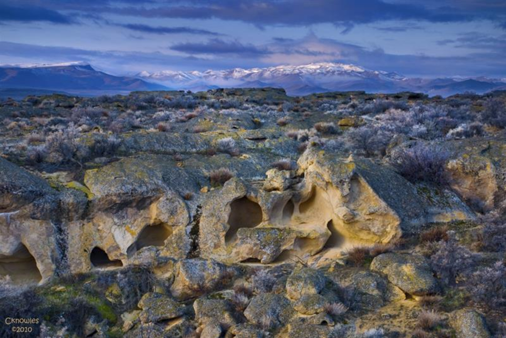
On top of the Owyhee Plateau before dropping into the West Fork of Shoofly Creek. 
Hi all,

If the weather forecast holds, it should be a pretty nice weekend for early spring hiking. It's supposed to be mostly sunny on Saturday with highs in the upper 50s, and even warmer on Sunday, with highs in the mid-60s.

I've picked out five of my favorite hikes that would work well at this time of year (you shouldn't run into any snow), they're all kid-friendly, and they're in diverse locations in the Boise Foothills, Boise National Forest and the Owyhee Mountains. Two of the hikes are drawn from my Boise Trail Guide: 90 Hiking and Running Routes Close to Home, and three are pulled from my hiking and biking guide on the Owyhee Canyonlands.

Indian Paintbrush in Shoofly Creek
All of these hikes can be done as a day trip. Dress in layers, bring a shell or light jacket for wind-protection and warmth, pack a lunch and plenty of water, take your hiking shoes, and head for the hills! Hiking poles are recommended for the Shoofly hike and Station Creek.

1. Five Mile Creek-Orchard Gulch, Boise Foothills - Distance: 5.35 miles. Hiking time: 2.5 hours. Elevation gain: 1,149 feet. Rated moderate to strenuous. Drive up Rocky Canyon Road 2.5 miles to the Five Mile Creek Trail junction. Go slow and watch out for Robie Creek runners and mountain bikers. Park by the trailhead. It's a beautiful hike up Five Mile Creek on a singletrack trail. There are several creek crossings. Look for animal tracks. It's about 1.5 miles to Orchard junction (signed). Go right and climb to a small pass, where you'll drop into Orchard Gulch. Follow the trail down several switchbacks and hike back to Rocky Canyon Road. It's 1.2 miles of gradual downhill on the dirt road back to the Five Mile Trailhead.


Great views of the Boise National Forest from the Station Creek Trail 
Top of Bald Mountain in Garden Valley
2. Hike Station Creek Trail to the top of Bald Mountain, Boise National Forest - Distance: 7.2 miles. Hiking time: 3.5-4 hours. Elevation gain: 2,000 feet. Rated moderate to strenuous. This is one of the best hikes with an actual trail in the Boise National Forest close to Boise. It takes about an hour to drive to the trailhead. Take Idaho 55 to Banks. Turn right and follow the Banks to Lowman Road to the Garden Valley Ranger Station. Look for a primitive road on the left side of the highway, directly across from the ranger station. That leads to the Station Creek Trail. It's a sweet hike on a singletrack trail through ponderosa pine trees to the top of the ridge. Ignore the short-loop junction on the way up the hill. Once on top of the ridge (mile 2.1), you'll see Bald Mountain looming off to the right (east). It's another 1.5 miles one-way to the top of the mountain, but not that much elevation gain. Easy-going stroll to the peak. There's a goofy looking steel four-legged thing on top of the peak. Do a selfie on top, and retrace your tracks back to the trailhead.

3. Bruneau River Overlook - This is more of a driving tour, than a hike, but there are places to hike once you reach the overlook. The reason to go there is to see the jaw-dropping chasm of the Bruneau River and rushing water below. Allow several hours to reach the overlook. Take I-84 to Mountain Home. Take the first exit and go south to the town of Bruneau. Make note of your odometer reading or zero your trip odometer. Go south on the Hot Springs Road. It's paved for several miles and then turns to dirt. 8.5 miles from Bruneau, go left on the Clover Creek-Three Creek Road. This is a good-quality gravel BLM road. Proceed south on the road to a signed right-hand turn (mile 15.7) for the Bruneau River Overlook. It's three miles to the canyon. Bring your camera and your binoculars. Look for eagles and hawks. You might even see some whitewater boaters running Five Mile Rapids below. There are several two-track roads next to the overlook that you can explore for some short hikes. Watch your footing next to the canyon! It's a long ways down!

Three Fingers from a close distance ... the road cut provides a trail to the top 
4. Hike to Three Fingers Mountain - Three Fingers is an easy hike to the top of a basalt-capped mountain in the big wide open country of the Owyhee Canyonlands. Distance: 2.4 miles out and back. Hiking time: 1.5 hours. Elevation gain: 833 feet. Rated easy to moderate. The hardest part of this trip is getting to the trailhead, and that's not too hard. A 4WD rig is recommended. Follow the directions in this blog post,  which provides driving directions to the trailhead, and also directions on the hike. This hike is located near Succor Creek State Park, so if you feel like taking your car-camping stuff, by all means, do that and stay overnight at the park. There is a rest room in the park and more hiking nearby.

The Big Wide Open, Owyhee Canyonlands in Eastern Oregon. Norman Nelson soaks in the view. 
5. West Fork Shoofly Quick Loop - Distance: 5.5 miles. Hiking time: 3 hours. Vertical gain: 846 feet. Rated moderate. This is a pretty easy hike that takes you into the Jacks Creek Wilderness. It requires a little bit of route-finding, so be sure to bring a map. I pioneered this hike when I was working on the Owyhee Canyonlands guidebook, and it turned out to be a keeper. Follow the directions in my blog post, which provides driving directions and hiking directions. You might want to bring a GPS to make sure you're on track. You'll climb up onto the Owyhee Plateau and see the Shoofly Canyon in the "Between the Creeks" area, another favorite hike that's longer and has a different trailhead.

My friend John Robison did this hike with his wife and twin daughters when they were 15 months. This is what he said about the hike: "Great hike! The directions were spot-on! The last two miles of side-hill hiking were not ideal ... I would rate the hike as "moderate" because of this. Having hiking poles definitely helped."

There you have it! Hope you can get out and enjoy the sunshine this weekend!
- SS

Thursday, April 28, 2016

Weekend weather looks perfect for exploring Bruneau Dunes, Bruneau Canyon & Big Jacks

Steve on top of the dunes. Wearing boots and gators to keep sand out of shoes.
Big Jacks Creek photographed from the Parker Trail
Bruneau Canyon upriver 
Bruneau River Canyon from the Overlook (courtesy VisitIdaho.org)
Hi all,

The weekend weather promises to be partly cloudy and relatively cool, with highs in the low 70s -- perfect for hiking in the Owyhees. Last week, I recommended Wildcat Canyon near Marsing. This week, I'm recommending three outings in the Owyhees near Bruneau, south of Mountain Home.

I'm recommending Bruneau Dunes State Park, the Bruneau Canyon overlook, and Big Jack's Creek, the Parker Trail. All of these destinations are knock-your-socks-off scenic with fun exploring opportunities and optional camping. All of these destinations are detailed in my guide, Owyhee Canyonlands: An Outdoor Adventure Guide,. which features 55 hikes and bike rides in the vast, 5-million-acre area south of the Treasure Valley. 

So let's get to it!
  • Bruneau Dunes State Park - Go visit North America's tallest single-structured dune, 470 feet high. It's easy to climb up there and cross the top sandy ridgeline of the dune, and check out the other smaller dunes in the area. There's also some fishing there at the park, and the camping at Bruneau Dunes is absolutely first-class with services. Distance: 3 mile loop. Travel time: 1-2 hours at a very leisurely pace. Bring the kids! Great place for them to play. Pack a lunch. Bring plenty of food and water. Trail map here. Buy a $10 state parks pass with your vehicle registration so you can get free entry into any of Idaho's state parks year-round. Awesome deal! How to get there: Take I-84 to Mountain Home. Take the first exit and go south on Idaho 51 towards Bruneau. Cross the Snake River and then turn left and follow signs to the park.
  • Bruneau Canyon Overlook - This is another family friendly adventure to go see the yawning Bruneau River Canyon, 18 miles south of the town of Bruneau. The canyon is 800 feet deep from the top of the rim down to the rushing river. It's super cool to check out the layer-cake like geology of the canyon. Multiple layers of volcanic basalt and rhyolite are exposed in the canyon. If you don't have a copy of "Roadside Geology of Idaho," I heartily recommend it. How to get there: Take I-84 to Mountain Home. Take the first exit and go south on Idaho 51 to Bruneau. Pick up any last-minute items at the market in town, then turn left on Hot Springs Road and follow that south of town. After 8.5 miles, go left on the Clover Creek-Three Creek Road, a good-quality gravel road. 15 miles south of Bruneau, you'll see a BLM sign on the right, indicating the turn for the overlook. You could self-support camp in that area. You also could hike or bike on the two-tracks next to the overlook.  
  • Big Jack's Creek, Parker Trail - Distance: 2.5 miles; rated moderate to strenuous. Travel time: 2 hours or more. Pack a lunch and make a day out of it! Big Jacks Creek is a gorgeous, vertical redrock canyon, carved out of rhyolite lava. The Parker Trail is a rare developed trail anywhere in the Owyhee Canyonlands where a person can follow a trail tread from the canyon rim to the creek-bottom. It's about 1.25 miles down to the bottom. You'll come to a nice rock outcropping 1 mile down the trail, a nice spot for a photograph. There's a sweet campsite at the bottom of the trail next to Big Jacks Creek. So this trip has backpacking and camping potential. 


    How to get there
    From Boise, take I-84 east to Mountain Home. Take the first exit. Follow signs for Idaho State Highway 51 and Bruneau. After you reach Bruneau, take note of your odometer. Stay on Idaho 51, going south, for approximately 27 miles. You'll be watching for a right-hand turn on a good dirt road, called the Wickahoney Road, just past milepost 45. The road is not signed, but it's a BLM public road. Follow the Wickahoney Road 4.9 miles to a T-junction by Wickahoney Creek. Turn right and go 2.8 miles to the Parker Trailhead. The road is rougher for the last 2.8 miles. Higher-clearance AWD recommended. 
Have a great weekend!
-SS