Friday, April 17, 2015

Pick up the new Boise Trail Guide to tap into 90 hiking & trail-running trips close to home!

The Station Creek hike in Garden Valley would be primo right now. 
Five Mile Creek in the East Foothills is a great trail to explore just about anytime ... 
Get the kids out hiking before they even know they're hiking ... 
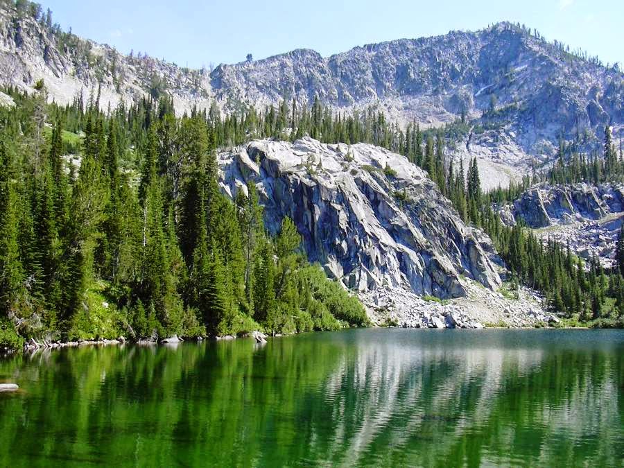
Jennie Lake is one of 15 new hikes added to the book.  
Ultrarunner Dennis Ahern on the way up to Observation Peak in the Sawtooth Wilderness ... 
Hi all,

Hikers and trail-runners can rejoice in the launch of the 2nd edition of Boise Trail Guide, which has been one of my most popular books of all-time. Now it features 90 -- count 'em, 90! -- hiking and running routes close to home. Woo-hoo!

Even the fact that it's possible to feature 90 hiking/running routes in the greater Boise area shows how lucky we are to have such a huge diversity of trails and terrain that we can explore close to home, whether it's on the Boise River Greenbelt, in the Boise Foothills, the Owyhees, the Boise National Forest or Idaho State Parks.

We are BLESSED, people! I tried to maximize your enjoyment by serving up the most trails featured in a single hiking and running guide in Boise history!

The first shipment of books have arrived from the printer. Rediscovered Books, Idaho Mountain Touring, Shu's Idaho Running Company and Bandanna Running & Walking in Boise, and the Pulse Running and Fitness Shop in Meridian all have books in stock. Boise REI and Sierra Trading Post will be carrying the book in the coming days. It's also available at Amazon.com and at SteveStuebner.com.

As always, on my web site, you can buy the book in paperback ($19.95), or as a color ebook ($24.95), or you can buy individual trail descriptions and maps for 99 cents each, or for discounted prices in lots of five, 10, 25, etc. You can do this for any of my guidebooks at SteveStuebner.com.

For this weekend, I'd recommend:
  • All Greenbelt and Parks Trails. The new edition features 15 Greenbelt Loops and Parks Trails, showing folks how to navigate every stitch of the Greenbelt system from Eagle to Lucky Peak, including multiple loop possibilities using pedestrian and street bridges. Recently, in this blog, I've featured the Eagle Island State Park loops (5 miles) and the Marianne Williams Park - Barber Park nature trail loop. 
  • Nearly all 17 of the Easy Mountain Trails. These trails typically cover short distances in loops where possible without much vertical gain. They're easy trips like the Red Fox-Owl's Roost Loop out of Camelsback Park, Bruneau Dunes State Park, Jump Creek Canyon and Succor Creek State Park hikes. A few short hikes in the Idaho City Park n' Ski Areas and Crooked River are probably still snowed in. 
  • Many of the 23 Moderate Mountain Trails. These trips span from moderate hikes in the Eagle Foothills and Hidden Springs, to the Polecat Gulch loops in NW Boise, and Central Foothills favorites like the Crestline-Hulls Loop, the new Highlands-Corrals-Bob's Loop, and moderate trails at Bogus Basin and in the Boise National Forest, like the Station Creek Loop. That'd be perfect this weekend. 
  • Many of the 26 Strenuous Mountain Trails. Some of these are snowed-in still, but most would be snow-free. There are more than 20 foothills favorites in here, plus a long Hillside to the Hollow Loop, Watchman Loop, Orchard-Five Mile Loop, Around the Mountain at Bogus, Cervidae Peak, and Hike to Jennie Lake ... too early for that, though.  
  • Most of the 7 Epic Mountain Trails. The Boise Ridge Climber's Special, Stueby's Death March, Race to Robie Creek course, Homestead - Trail #8 - Trail E Loop would be all doable. You'd still run into snow in the other epics in the Sawtooth Wilderness and the Boise National Forest. 
Have a great weekend!
- SS

Thursday, April 2, 2015

Give Back to the Land: How to plug into trail projects with groups in Southwest Idaho

SWIMBA trail event in the Owyhees
Selway-Bitterroot Frank Church Foundation trail project 
Land Trust of the Treasure Valley volunteers 
Idaho Hiking Club volunteers worked on Table Rock trails for R2R

Hi all,

Spring is coming early this year. Hikers, dog-walkers, runners and bikers have been hitting the trails with a vengeance. I've been doing that, too!

Spring is also a time when the weather can be cool and moist, a good time for working on dirt trails before they get baked by the summer heat. It's a great time to put some love into the trails with a little sweat-equity.

This year, I'm flat impressed with all of the trail projects on tap in Boise and the greater SW Idaho area. Here's a quick list of six groups that have multiple projects on tap:

  1. The Land Trust of the Treasure Valley has a number of volunteer trail projects coming up, starting on Saturday in Dry Creek. They're already full for that session, but more projects are happening on April 14th, May 2nd and May 6th. They need volunteers to build a new trail in Harrison Hollow on May 2nd, in cooperation with Boise REI, and they're doing trail-enhancement work on April 14 and May 6. Go to the Land Trust of the Treasure Valley or Boise REI to sign up online.
  2. The Idaho Trails Association has a full slate of trail projects on the calendar for the entire year. This is a solid group with leaders who have experienced know-how to teach folks how to maintain existing trails and build new ones. There's a trail project planned in the Owyhee Canyonlands on June 6th, National Trails Day, East Fork of Lake Fork in McCall on June 27, Box Lake Trail in McCall, June 28, Alice-Toxaway Loop in the Sawtooths July 19-25, and much more. Check out this map for all of their projects planned this year.

    The ITA is having a fun Volunteer Appreciation Party on April 18th at the Ann Morrison Old Timers Shelter from 5-9 p.m. In the Wild Chef Steve Weston is going to be cooking up some excellent D.O. fare, and I'm hoping to join the party and cook up one of my favorite D.O. desserts, Devil's Tooth Cheesecake. They'll have some craft beer on tap. See you there!
  3. You can always count on the Southwest Idaho Mountain Biking Association (SWIMBA) to dial up a bunch of trail projects every spring. SWIMBA has four work days set up this month -- April 4, 18, 21, 25 -- to work on Peggy's Trail in the Daniel's Creek area near Polecat Gulch. Just like ITA, SWIMBA has a lot of strong leadership in the trail-maintenance and -building department. Plus, you can count on some beers after the work day!
  4. Our beloved Boise Foothills take a beating from all of the public use, so it's always a great idea to give back to the foothills trails by signing up with Ridge to Rivers for a volunteer trail project. Watch the Ridge to Rivers web site and Boise Foothills Trail Conditions Facebook page for upcoming trail events. Sam Roberts handles volunteer projects for Ridge to Rivers, sroberts@cityofboise.org.  
  5. How about a little love for the rivers? The Idaho Whitewater Association is hosting a riverbank cleanup on May 9th along Idaho Highway 55 from Cascade Kayak to the Beehive Bend boat launch. People are meeting at Beehive Bend at 8 a.m. More information here. 
  6. Last but not least, the Selway-Bitterroot Frank Church Foundation dishes up a bevy of trail projects every year for volunteers to benefit the wilderness resource. These projects require more of a time commitment in terms of a week-long backpack in "the Frank" or the Selway-Bitterroot that also involves trail-maintenance work with the assistance of crew leaders, pack stock, tools and materials. The Foundation also has opportunities for cabin and lookout hosting! Contact the Foundation for more information.

    Think about what a privilege it is to enjoy our public lands in Idaho. Pitching in on these volunteer projects will make a difference! Have fun!
    - SS

Thursday, March 19, 2015

Five spring hiking destinations inspired by new edition of Boise Trail Guide


Rick Gerrard pauses to enjoy the view on the way up to Cervidae Peak.
2,000-foot climb in 2.2 miles. Steep!  
Look how the trail goes directly up the ridgeline ...
That'll get the heart pumping! 
Another steep section ... watch for elk and deer 
Rocky rims lord over Shoofly Creek in the Owyhees
Steve hiking the Shoofly Quick Loop 
Wonder if the wildflowers are going to bloom early this year? 
Hi all,

Well, the weather looks pretty fab once again in the low country this weekend, with temps in the 70s on Friday, slight possibility of rain Saturday, and a slightly cooler day on Sunday, with temps in the 60s, but clear skies. And then rain on Monday.

So I'm recommending five spring hikes inspired by the 2nd edition of Boise Trail Guide, my hiking and trail-running book which is expanding from 75 hiking and running routes to 90. There's a whole new book cover, new photo spreads inside, and more. The 224-page book should be available for retail sales in about 3-4 weeks (mid-April). A full-color ebook will be available as well.

Here are the hikes!

1. Hike to Cervidae Peak near Lucky Peak Reservoir and Spring Shores Marina. Rated strenuous. Distance: 2.2 miles up; 2.2 miles back. 4.4 miles total. Travel time: 2.5-3 hours. Vertical gain: 2,000 feet. Take Idaho 21 east of Boise. Cross the Mores Creek high bridge. Turn right after the bridge and go 2.2 miles up the road (you'll go by the Spring Shores Marina) and park in a large pull-out on the right. Cross the road and pick up a jeep trail that climbs up to a ridge and then you're on the trail to Cervidae. It's a steep hike that goes directly to Cervidae Peak, climbing 2,000 vertical feet in about 2 miles. Leg-burner and lung-burner! It's hard on the knees on the way down. Go easy. Trekking poles would help soften the blow. Good hike for strong kids. Great views at the top of the peak.
Trail map for Eagle Island State Park. Enjoy! 
2. Eagle Island State Park in Eagle - Rated easy to moderate. Distance: up to 5.5 miles. Travel time: You make the call. Take State Street west, past Eagle Road, to Linder. Follow the signs for Eagle Island State Park. Park at the trailhead. There's a hiking/trail-running circuit that you can do at the park that follows the north channel of the Boise River, crosses the park, and then follows the South Channel of the Boise River, before returning across a field to the trailhead. The park has hand-out maps of their trail system. Their trails are open to hiking, running, horseback riding and mountain biking. I enjoyed the Eagle Island leafy setting.

3. West Fork Shoofly Quick Loop - I detailed this hike in a previous blog post when I was working on my guide The Owyhee Canyonlands: An Outdoor Adventure Guide with Mark Lisk. But it will be included in the new version of Boise Trail Guide. Rated moderate. Distance: 5.5 miles. Travel time: 3-4 hours. I like this hike because the trailhead is less than an hour from Boise near Grand View. It's a scenic location, but it's an adventure hike, involving some route-finding and bushwacking. Read my blog post for a trip map, photos and details.
Harrison Hollow trail is popular with families and dogs 

Great views of the city from the ridge above Harrison Hollow 
4. Highlands - Corrals - Bobs Loop, Boise Foothills - The recent completion of Highlands Trail #1 makes this loop possible for hikers and trail-runners. You used to have to shuttle a vehicle to do this loop as a hike/run. But not any longer! Rated easy to strenuous. Distance: 8 miles. Travel time: 3.5 hours. Vertical gain: 1,328 feet. Take Bogus Basin Road north to Curling Drive. Go left on Curling, left on Braemere, go up the hill, then take a left on Hearthstone. Go to the end of Hearthstone and park at the trailhead at the end of the road. This hike provides a mixture of terrain. It starts out kind of steep on the Highlands Trail and then moderates on a steady uphill climb to the junction with the Corrals Trail. Then the walking is moderate on Corrals for about a mile or so before trail gets steeper to reach Corrals Summit. Turn right at the top of the hill to reach Corrals Summit and then follow Trail #31 downhill for a couple of miles to Bob's Trail. Make a sharp right on Bob's and enjoy the rock-dodge down the trail.  

5. Harrison Hollow Loop - Rated easy. Distance: 2 miles or more. Travel time: 1 hour. Take Bogus Basin Road north from Hill Road. Turn left at Highlands Hollow Brew House next to Healthwise and follow the paved road to the parking area. Cruise into the Harrison Hollow area on the all-weather trail provided by the Land Trust for the Treasure Valley. Take a right and climb up to the ridge. Go left on the ridge and follow the ridge trail for a mile. It winds toward a saddle next to some large homes. Climb to the saddle to check out the view. Return to the trailhead via the main trail that goes down the bottom of the gulch. There are many other options in this area, depending on how much time you have, and you much climbing you'd like to do. Once at the saddle, you also could climb uphill to the Buena Vista Trail, which winds around the south side of the hills and heads over to Hillside Jr. High. There are several ways to return to Harrison Hollow.

There you have it! Have a nice weekend!
- SS

Thursday, March 12, 2015

Spring hiking, biking in full swing in Boise Foothills, Owyhees; camping would be good, too!

The Morley Nelson Snake River Birds of Prey National Conservation Area
is an ideal spring destination for hiking, biking, boating and birding.
Hi all,

Mayor Bieter will be reporting on city affairs during my normal time on The River 94.9 FM tomorrow morning (7:30ish), so I don't have a new blog for this week.

Instead, I'll recommend some great spring trips from previous blogs:


  • Hiking, biking and trail-running in the Boise Foothills is in full swing! Here's a blog I wrote about five recommended spring hikes, a cross-foothills biking trip and Watchman trail. From last March, the headline was "Boise Foothills dry up fast, ready for hiking, biking, trail-running; Have fun!"  Sound familiar? 
  • Hiking, biking and camping in the Owyhees would be perfect this weekend. Here's one destination that is worth checking out near Succor Creek State Park, near Homedale. It's called Sage Creek. 
  • Six spring camping recommendations - Bruneau Dunes State Park, Morley Nelson Snake River Birds of Prey National Conservation Area, Celebration Park, Succor Creek State Park, Leslie Gulch and Steens Mountain. How can you go wrong? 
There you have it! 

I'm holding a yard sale for my son's AA travel hockey team on Saturday from 8 a.m. to 5 p.m. if you'd like to stop by. See our Craigslist ad for details ... 

I'm also working on finalizing a new version of Boise Trail Guide, which is growing from 75 hiking and running routes close to home, to 90 hiking and running routes close to home. The book will have a new cover and new photos inside as well. I'm hoping the book will be available for retail sales by mid-April. 

Have a good weekend!
-SS

Friday, February 27, 2015

Hit the groomers at Sun Valley, check for best lodging deals; plus beer bus to Brundage

Perfect corduroy for carving turns ... 
What happened to those nice wool ski sweathers? 
Great views of the Pioneer Mountains ... 
Groomers galore in Sun Valley! 
Hi all,

It's looking like another weekend where we're going to have a fresh dusting of snow in the mountains, including Brundage, Sun Valley and Tamarack, and then sunshine on Sunday. Could be a good time to hit the slopes!

I've been hearing great things about the conditions on Bald Mountain in Sun Valley. They have a very sophisticated computerized snow-making system that dishes out new snow overnight, and Sun Valley's groomers smooth it out for some ego-boosting turns. No obstacles to worry about. No potato rows between the groomer paths.

I love the feeling of being on top of Bald Mountain, taking in the splendor of the surrounding mountains, and then zooming down College or Ridge to the mid-mountain chair. Maybe Christmas Bowl is skiable? That's a hoot. You also can go top-to-bottom on Warm Springs, experiencing the full 3,300-foot vertical foot plunge to the bottom, and feel your thighs burn with every turn as you cruise downhill. Seattle Ridge is another place to let it rip on wide groomed runs. The challenge is to pace yourself so you've got enough strength and energy to put in a full day ... even after a full half-day, your legs might feel zapped.

When you're skiing downhill, feel your edges carve on the snow. The Sun Valley slopes are perfect for this. Open up your speed and ride the edges of your skis. The faster you go, the more you'll feel the beauty of the carving turn. Make big arcs with your edges, stay on top of your skis, meaning keep your weight forward, and let the skis carve the snow.

The big challenge with Sun Valley is to find discounted lift tickets and affordable lodging. Ski-and-stay packages are a great way to save money. The best deal offered by Sun Valley today is $162/night for a stay-and-ski package for two. Considering that day tickets cost $109, that's a pretty good deal! But there are lots of other stay-and-ski packages available. Try the Ketchum-Sun Valley Chamber for their deals, and InIdaho, too.

Another way to save money on Sun Valley lift tickets is to buy them online in advance. 

On Saturday, there's a beer bus that's heading up to Salmon River Brewery in McCall for a quick beer tasting and brunch. Then they're hitting the slopes at Brundage for the day, and capping it all off with a big feast and wonderful craft beer at Salmon River Brewery. Kate McGuire of K-106 is organizing the trip, and they still have a few openings. Cost is $81 per person. There are a total of 45 spots available. See Kate University Brew Bus for more information or to book your seat.   

There's some rain/snow in the forecast for the Boise Valley on Friday and Saturday, so that may muck up the trails in the Boise Foothills. I've been enjoying the trails this week, and it's been so GREAT to be out there on our wonderful trail system. Please watch the Ridge to Rivers web site and Facebook page for the most updated information on trail conditions this weekend.

If conditions are wet, my recent blog on exploring Marianne Williams Park and the Eagle Greenbelt are great alternatives where you can't go wrong.
-----------------------
Check out this YouTube video that I took earlier today, mountain biking the Sidewinder-Fat Tire-Trail #5 Loop with my pointer Huck. It's so much fun to watch him fly through the sagebrush, especially when we're going downhill. So I brought the GoPro today and got some footage. You might like the biking footage too!


Thursday, February 19, 2015

Five springtime road bike rides that'll get your heart pumping; or ski the dust on crust

Get some friends together for a fun road ride! Drafting is good! 
The Cartwright Three Sumits Loop always delivers. 
Selfie on Swan Falls Road ... very little traffic 
The nasty Swan Falls grade  
Hi all,

We've got a little weather moving in on Friday that might bring a little rain in Boise and a little snow in the mountains.

The forecast for Brundage Mountain looks promising with at least 1-3 inches of snow expected on Friday and a little more on Saturday, then sunshine on Sunday. Less accumulation is forecast at Bogus Basin, Tamarack and Sun Valley, but I'm sure they all will take what they can get.

If a little bit of new snow gets you excited about hitting the slopes, you could ski some new dust on crust on Friday or Saturday, and then hit a bluebird day on Sunday with some fresh fluff! The same drill goes for cross-country skiing. A little bit of new snow will be a welcome change.

However, if you'd prefer to stay closer to home, I'm recommending five springtime road bike rides from my Boise Road Cycling Guide.

The word from Ridge to Rivers is that the freeze-thaw cycle we're in this week has caused a lot of moisture to rise up on the foothills trails, creating big patches of muddy trails. Check out the trail report as of today (thursday).

But with the nice weather we've been having -- more of that 50ish weather is expected next week -- it's time to dust off your road bike, if you haven't already, and get it ready for some spring rides.

I'm motivated by being part of a team that's participating in the Lyle Pearson 200 in late May. There are lots of other road cycling events this year, including the Bob LeBow Blue Cruise in late June and the Cascade 4 Summit Challenge in late July.

Here are my five springtime rides:

1. Ride the Boise River Greenbelt from Municipal Park to Discovery Park. Distance: 9 miles out, 9 miles back; 18 miles round-trip. Travel time: 1 hour. Moderate to strenuous. Take Warm Springs Avenue to Walnut, turn right, and park in Municipal Park on the left. Take the Greenbelt east out to Discovery State Park. This is a good warm-up ride. The biggest factor is always wind, because the trail is mostly flat. Note that the ride includes brand new smooth greenbelt through Marianne Williams Park. Big improvement!

2. Cartwright - Three Summits Loop aka "the dump" loop - 17.7 miles. Travel time: 1:15 - 1:30. Strenuous. Start at the junction of Hill Road and Bogus Basin Road. Go north on Bogus Basin to Cartwright. Turn left and climb to the first, short summit. The second summit is much harder ... it's like a fricking vertical WALL. Fly downhill from that summit, bear right on Cartwright, and cruise through the Dry Creek Valley before conquering the last summit on Seaman's Gulch Road. Turn left on Hill, and return to the start.
Lake Lowell Loop 
3. Lake Lowell Loop, Nampa - 26 miles. Travel time: 1.5-2 hours. Easy to moderate, depending on the wind speed. Vertical gain is 381 feet. Start/finish at the Lake Lowell boat ramp. I suggest doing the ride in a clockwise direction, but either way works. You'll jig-jog on several streets going around the east side of the lake, and then when you turn onto Lakeshore Drive, you'll ride through the most scenic section next to the Deer Flat National Wildlife Refuge.

4. Ride to Swan Falls, Kuna - 42 miles. Travel time: 3+ hours. Vertical gain: 1,710 feet. Strenuous. I love this ride, even though it can be painful at times in big winds. Start/finish at the Kuna Visitors Center as you drive into town. Go south on Swan Falls Road and ride the waves of sagebrush fields out to the Snake River rim (take a break if you wish at the BLM interpretive site) or drop down to Swan Falls Dam. Bring a lunch and plenty of water. Climb up that steep heinous grade and crank it back to Kuna.

5. Snake River Canyon Scenic Loop - 41 miles. Travel time: 2.5 hours. Vertical gain: 1,000 feet. Start/finish at Walters Ferry. Ride ID 45 to Map Rock Road, go left and ride along the Snake River. Hopefully the wind isn't that bad (go early to avoid heavy afternoon winds). Ride west to Marsing. You'll jig-jog to Chicken Dinner Road and pull into Marsing. Cross the Snake River and then take ID 78 on the south side of the river back to Walters Ferry. You should have a tailwind for this part of the ride, assuming the wind is from the west.

There you have it! These are all great springtime rides to get those legs in shape for bigger rides coming up!

The Boise Road Cycling Guide is available at most bike shops in the valley. It's also available via my web site, stevestuebner.com. It features over 30 road rides in the Boise Valley for all abilities. It's a full-color tear-proof, waterproof fold-out map made out of organic paper. Cost is $12.50.
- SS

Thursday, February 5, 2015

Weekend forecast looks crummy; take a chance on snow or don the rain gear and hike

It's going to be a warm, soggy weekend. 
Hi all,

Well, the weather forecast is looking ridiculously warm for early February here in the valley. The high is supposed to hit 60 degrees F in Boise on Saturday, so if you want to play in the snow, you need to head north to Brundage or Tamarack and hope for the best and enjoy the last weekend of the Winter Carnival. Looks like it's going to be rainy and marginal at Bogus this weekend, so I wouldn't go there unless you are a glutton for punishment.

Below, I'll recommend two hikes close to home that would be doable in the rain. There's no bad weather, just bad gear, right? :)

The judges will be awarding prizes for the snow sculptures in the Winter Carnival, there is an ice show at the Manchester Ice and Event Centre on Friday and Saturday night, there will be fireworks and closing ceremonies on Saturday night, and a number of other activities such as the beer garden, live music, entertainment and more are happening this weekend.

The weather forecast for Brundage looks pretty wild on Friday and Saturday with lots of new wet snow in the forecast, plus high winds. Ditto for Tamarack. The Summit lift should be above the rain.

Cross-country enthusiasts may be heading over to Sun Valley for the Nordic Festival. The Boulder Mountain Tour is set for Saturday.

With all of the rain forecast for Boise, I'd recommend two hikes next to the Boise River that feature walking on gravel trails. I'd still wear your best muck boots to be on the safe side. And don't forget your rain gear! (Please stay off the foothills trails).

1. Hike a 4-mile loop through 72-acre Marianne Williams Park on the north side of the river from Bown Crossing and then cross the Eckert Road bridge and hike back along the south side of the river on the nature trail from Barber Park to Bown Crossing. And then find an eatery of your choice in Bown Crossing for a hot drink and a meal and get out of the rain!  

GPS map from the loop.
Here's a YouTube video I took several years ago featuring Marianne Williams Park.


2. Take a 5-mile hike on the north or south side of the Eagle Greenbelt. Check to see if the new pedestrian bridge is under construction near the Riverside Village area. Construction is supposed to start on Friday, according to Garden City officials. If you do the whole loop on both sides of the river, that'd be a 10-mile loop. You could hike it or bike it. Head for the Eagle Bardenay after your outing and enjoy some great food and drink!

Eagle Greenbelt Loop. You can start near Eagle Road or Glenwood. 
Have fun and stay dry!
- SS