Thursday, May 24, 2012

Some suggestions for Memorial Day weekend

The Crooked River trail starts from the Edna Creek Road, north of Idaho City.
On top of Bogus Basin, looking north to Mores Mountain 
North Valley Rail-Trail in McCall 
Hot springs may be the ticket this weekend ... this is Kirkham near Lowman 

Hi all,

After all of this beautiful, warm weather we've had in May, it's too bad that Memorial Day weekend is starting off wet and cold.

Checking on the forecasts, I see McCall is supposed to have highs in the low 50s, and a 50 percent chance of rain or snow until Monday. In Stanley, it's supposed to be colder, with 60 percent chance of rain or snow. In Idaho City, it may hit 60 by Sunday, and a 40 percent chance of rain. Geez isn't that inspiring!

But hey, last year at this time was WAY worse. There was a lot more snow at low elevations, and the weather was horrible all weekend. My recommendations could be summed up in one sentence: "Party under the tarp."

Those sage words of advice will hold true again this weekend. If you're going camping, I'd recommend choosing a location that's in the lower elevation zone to avoid getting buried by snow. Definitely bring a good tarp. Pack a ton of firewood; keep it covered and dry. Dress warm.

The Idaho Statesman outdoor staff had a great roundup in today's edition on camping conditions in  Southwest Idaho. If you haven't tried it yet, you might look for a Forest Service cabin rental or an Idaho State Park cabin rental for the weekend. That would be warm and cozy.

In the meantime, I'll suggest a couple of hiking and biking trails that may be good bets for this weekend:

  • Bogus Basin Contour Tour - This is a moderate hike or mountain bike ride. It's 5.75 miles start to finish. You circumnavigate Bogus Basin ski area by taking Deer Point Trail #91 to Elk Meadows Trail #94. Take Elk Meadows around the backside of Bogus to Lodge Trail, return to the Pioneer Lodge area, and then descend on Sunshine Trail and Shindig Trail back to the main parking lot. See my previous blog on this loop for details.  
  • Two Trails that start with the letter "C" - Crooked River and Cottonwood Creek. Both of these trails are in the Boise National Forest. Crooked River is between Idaho City and Lowman, and Cottonwood Creek is near Arrowrock Reservoir. See my previous blog on these trails for details. 
  • Station Creek Trail - I'm taking my kids hiking on this trail on Sunday. My 14-year-old son is going to be working on a trail crew this summer, and he needs to get his boots broken in. The Station Creek Trail is located directly across from the Garden Valley Ranger District office, on the Banks to Lowman Highway, just east of the town of Garden Valley. The hike is about 4.5 miles long. As an optional addition, you can hike to the top of Bald Mountain. That's what we're going to do. 
  • Bear Basin or North Valley Rail-Trail - If you're in McCall, these are two low-elevation options close to town that are guaranteed to please. These two hikes/rides are featured in my book Mountain Biking in McCall. Click on the free sample rides for details. The Bear Basin Trails are in the Payette National Forest and the North Valley Rail-Trail runs south of McCall on the old railroad right of way. Both trails are kid-friendly. 
If you're camping in the Garden Valley or Idaho City areas over the weekend, one thing you could do is to watch the Exergy Tour stage race on Sunday. It's a 60-mile race from Garden Valley to Idaho City. It starts at noon, and it's expected to finish around 3 p.m. in Idaho City. It's called the "Queen's Tour."

On cool and wet weekends like this, another great alternative is to hang out at a hot springs. I expect that Gold Fork, Burgdorf, Baumgartner, Bonneville, Kirkham and others will be popular spots.  

Try to stay warm and dry, and above all else, have fun! 
- SS

Steve shares his weekly outdoor tips with Ken and Tim on 94.9 FM The River each Friday morning in Boise at approximately 7:10 a.m. Here's the audio from this blog topic. You can hear archived audio segments on River Interactive.com. Detailed descriptions and color maps of Steve's hikes, bike rides and paddling trips are available for 99 cents each at www.stevestuebner.com, plus the full ebooks and hard-copy guidebooks.

Thursday, May 10, 2012

Have you ever wanted to ride across America on a bike or a horse? Here's some inspiration ...

Wayne, left, Frosty and Howard upon arrival at Chris Brady's in Boise
Hi all,

I had the pleasure of meeting two extraordinary gentlemen last week who are in the midst of riding their bicycles across America. They're brothers -- Frosty Wooldridge and Howard Wooldridge. They're retracing the route that Howard followed in 2002 on his pinto paint horse from Savannah, Ga, to Newport, Ore. -- a distance of about 3,100 miles. Howard called it "Misty's Ride."

Howard Wooldridge on his horse Misty
Frosty says about 350-500 people ride bikes across America every year. But Howard is "definitely the only guy to ride both a horse and a bike across the country," he says.

I don't know about you, but I've always dreamed of riding a bike across America. I've just never taken the time. I could have done it after finishing college, but I was broke and wanted to get a newspaper job in the worst way and start a career in journalism. And I did. Now I'm up to my ears in work, kids and family. But someday, I really hope to do the ride. Frosty and Howard are my inspiration and maybe yours too. They're not average Americans by any stretch. These guys take life by the horns and go BIG!

Frosty taking a roadside break 
Frosty Wooldridge has pedaled 100,000 miles around the world and covered six continents. He's the author of many books, including How to Live a Life of Adventure. This is the 6th time he's riding his bike across America, mainly to accompany his brother Howard on his quest to fulfill an item on his bucket list, and talk to the media about his cause -- overpopulation.

Unchecked immigration is a huge problem, Frosty says. "We've got 46 million people living on food stamps in America right now. We must create 95,000 jobs every month to take care of our legal obligations to immigrants coming into America. I call it slow-moving national suicide."

Frosty doesn't believe our nation can possible take care of all of the legal immigrants, much less the illegal ones, plus he worries about the impact of overpopulation on our natural resources. But none of our nation's political leaders will touch the issue, he says, calling their lack of action "thundering silence."

Howard's cause is fighting the prohibition of illegal drugs. He's an ex-cop and a lobbyist on
Capital Hill who feels that it's a big waste of money to continue the war on drugs. His organization is called Citizens Opposing Prohibition or COPS. The T-shirt he rides in says "COPS SAY LEGALIZE POT. ASK ME WHY." His feeling is that the war on drugs/drug prohibition has been the "most destructive, most dysfunctional and most immoral policy since slavery and Jim Crow."

Working in Washington D.C. is tough these days, Howard says, because everyone in Congress is bought by special interests. The true needs of the nation are ignored while special interests run the show. "I come home from work every day covered with slime," he says. "I have to take a shower to try to get rid of it."  Howard says he's going to retire in the next year or so because he can't stand being around the corruption much longer. Kudos to him for working on the cause, nevertheless.

Now, back to their cross-country ride. They're riding on a pace of about 50-65 miles a day, depending on terrain to stay on track for a timetable of completing their ride in 9 weeks. They're operating on a budget of about $15/day. They're carrying about 60 pounds of gear, and they camp out on most nights.
Cycling across America takes "true grit" Frosty says 
A third man, Wayne, is riding with them. Wayne is 70 years old, Howard is 60 and Frosty is 65. They're all happy and fit as can be.

One reason that fewer than 500 people ride bikes across America each year is that it's hard! "You gotta have true grit," Frosty says. "It takes a lot of toughness. Nature will throw all kinds of s--- at you and you've got to deal with it -- wind, rain, sleet, hail, heat, you name it."

But the benefits are big. "Bicycle touring will show you that you're alive in a grand way," Frosty says. "It's a spiritual zen experience. It makes you peaceful, happy and purposeful. We all have a powerful exploratory urge if you open your mind to the possibilities. It's in our human DNA to explore."

Penny-Farthing bike. Very easy to sail over the handlebars and land on your head.
Frosty and Howard are inspired by other people's stories, too. Consider the guy who rode a penny-farthing bicycle from San Francisco to New York in 29 days! Those are the one speed bikes with a big front wheel. Thomas Stevens of England was the first person to ride around the world on a bike (a penny-farthing) in 1884-1886. "Think how primitive things were at that time -- that guy could have died in a thousand ways!" Frosty notes.

Cross-country riders often are inspired to make the big trip because of some kind of adversity that has struck their lives. "Divorce and death are a catalyst to doing extraordinary things," Howard says.

One of the biggest rewards of riding across the country is how friendly people will come to your aid time and time again. Howard has experienced it on his horseback ride and on a bicycle. Frosty has experienced it all over the world. "I've been invited into hundreds of homes," Frosty says. "People figure that you have to have character and integrity to ride a bike across the country."

"The world conspires to help you succeed," Howard says.

Howard recalls riding Misty into the Stage Stop about 10 miles east of Boise on I-84. He needed hay and grain for his horse in that dreadful piece of road between Mountain Home and Boise. A rancher just happened to pull into the service station with fresh hay and grain in the horse trailer. He wouldn't let Howard pay for any of it. The next day, another rancher helped Howard with a broken horse shoe, brought a horse trailer over to haul the horse to their ranch to fix the shoe and fed Howard a hearty meal. "People just come out of the woodwork to help you. It's uncanny."
Go see the country! 
If you want to track Howard and Frosty's adventure, Howard has a twitter handle @cannabiscop where he provides a daily update. You can follow along on Frosty's blog as well. They plan to complete their journey in Savannah, Ga., by the first week of July. Right now, they're on Day 19 in SLC, Utah.

I want to thank my friend Chris Brady for giving me an impromptu phone call, inquiring about the best route for the guys to take from Parma to Boise. That led to a dinner invite at Chris' house last week to meet these characters and learn about their life. Chris has known Howard since they were college students at Michigan State in 1970. They worked at Domino's Pizza together, and have stayed in touch ever since. Ha!

Have a great adventure guys! Wish I could be riding with you.

Two other things of note I wanted to mention this week:

  • Don't forget, next week is Boise Bike Week! Lots of events and activities planned. Try to park your car and ride your bike for work, errands, trips, etc. next week. 
  • This Saturday at Eagle Island State Park, there is a Fishing Paddle Craft Demo Day and Casting Tournament. Runs from 9 a.m. to 4 p.m. Over 25 different models of fishing craft that you can demo. Experts and sales reps will be on hand to answer questions about gear.
    - SS

Thursday, May 3, 2012

Here's an easy way to explore the new Big Jacks Creek Wilderness near Bruneau, Idaho

Here's Steve in the Big Jacks Creek Wilderness
Hi all,

It's going to be a bit wet heading into the weekend, but at least by Sunday, the weather appears very favorable for spring hiking.

As part of an ongoing series of sneak-peek blog posts about hikes and bike rides that we'll be including in a forthcoming guidebook on the Owyhee Canyonlands, I'd like to share an easy hike in the new Big Jacks Creek Wilderness, near Bruneau, Idaho.

The BLM has developed a trailhead and a marked trail to access Big Jacks Creek. It's called the Parker Trailhead. The hike is 2.5 miles out and back. There's a sweet campsite at the bottom of the creek, where a group could stay overnight.

Big Jacks Creek is a gorgeous canyon. Go see it and judge for yourself.

Driving map for Parker Trailhead
The hardest part of the whole trip, like many in the Owyhee Canyonlands, is finding the trailhead. A good 4WD vehicle or a high-clearance Subaru is recommended for the drive, once you hit the dirt roads.

How to get there: Take the freeway to Mountain Home. Take the first exit. Follow signs for Idaho State Highway 51 and Bruneau. After you reach Bruneau, take note of your odometer. Stay on Idaho 51 for approximately 25 miles. You'll be watching for a right-hand turn on a good dirt road, called the Wickahoney Road, just past milepost 45. The road is not signed, but it's a BLM public road.

Parker Trailhead 
Follow Wickahoney Road 4.9 miles to a T-junction by Wickahoney Creek. Turn right and go 2.8 miles to the Parker Trailhead. Park and hike from there.
Leo Hennessy follows the Parker Trail into the Big Jacks Wilderness

You'll follow a two-track road over to the rim of the canyon, walk over a barbed-wire fence via a wooden step-over gizmo, and descend into Big Jacks Creek. Take your time, take some photos and enjoy the scenery. There's a foot path going down into the canyon; it's marked by rock cairns along the way.

Once at the bottom, you can explore a little and eat lunch by the campsite area. Return the way you came.
Rock cairns help mark the foot path in Big Jacks canyon 

For more adventurous folks who like to walk down wet creek-bottoms, you might want to try starting the hike at Wickahoney Creek, follow Wickahoney down to Big Jacks, walk down Big Jacks to the Parker Trail and come back. That would be a longer loop, about 7 miles. Big Jacks has water in it in the springtime, so it'd be best doing that hike in Tevas or Chacos, or some kind of sturdy sandles. Flip flops would not work.

Have fun!
- SS

Steve shares his weekly outdoor tips with Ken and Tim on 94.9 FM The River each Friday morning in Boise at approximately 7:10 a.m. If you miss the program, you can hear the segments on 
River Interactive.com. Detailed descriptions and color maps of Steve's hikes, bike rides and paddling trips are available for 99 cents each atwww.stevestuebner.com, plus the full ebooks and hard-copy guidebooks.

Thursday, April 26, 2012

Flatwater kayaking/canoeing is a relaxing alternative to whitewater boating in Idaho

Lynda with a friend on the Payette River near Emmett
Ditto 
Steve and Wendy paddle Cascade to Cabarton on the Payette R. 

Hi all,

I did a clinic at Sierra Trading Post this week about flatwater boating in SW Idaho, so I thought I'd make that my tip of the week. The weather this weekend may be a little cool for that, but it's an idea you can file away for when the weather gets a little warmer AND the rivers have dropped below flood stage to a post-peak-flow summer slumber.

Before we get into the flatwater boating discussion, I'd like to remind folks that the biggest used river gear sale in Boise is happening Saturday at Idaho River Sports. It's a great event.

Flatwater boating is a nice and relaxing alternative to whitewater boating in Idaho. It's a hoot to go out with a bunch of friends and paddle in a pond, lake, reservoir or river, watch for wildlife and relax. We're fortunate to have numerous fabulous, scenic flatwater paddling destinations in SW Idaho. But first, a few thoughts about gear.


I met Lynda from Emmett the other night. They're hooked on flatwater boating. Lynda really likes her 12-foot sit-on-top flatwater kayak. It's an Ocean Peekaboo model, named as such because it's got a window in the bottom of the hull for looking at fish and other stuff in the water below.

"I just love it," Lynda says. "Every time we get a chance, we're out on the water. It's just so peaceful and relaxing -- it's so awesome to be out on the water after a stressed-out day at work."

So if you'd like to get into the sport, what kind of craft do you need?

The general options are a canoe, inflatable kayak, sit-on-top kayak or a sea kayak with an enclosed cockpit. The ideal craft depends on where you'd like to go paddling (river, lake or ocean?), the size of your family, how much you expect to use your boat, what kind of performance you're looking for, and of course, your budget.

Personally, I've been canoeing for years, having grown up in Minnesota. I've often used a canoe for flatwater outings on rivers, lake tours and extended trips in the Boundary Waters Canoe Area and Quetico Provincal Park in Canada. Canoes can carry a significant amount of gear, and they're relatively easy to paddle with instruction and experience.

The downside with canoes is that you need to take a class to learn proper paddling techniques, and they are tippy ... it's very easy to flip a canoe in tricky river currents or when you get into a situation with heavy wind and big waves on a lake. 

I've used inflatable kayaks (IK's) on rivers, and they're super easy to maneuver. They won't flip unless you get into big whitewater. Another advantage is that IK's deflate, so they're easy to transport in a small vehicle or pack on a plane. IK's that do well on rivers don't track that well on a lake, however, and in a stiff headwind, it's hard to make any headway.

Sit-on-top kayaks are cool because they're easy to maneuver, and they take very little instruction, if any. They're hardshell boats, so they are smooth and move fast on the water. Stan Kolby, co-owner of Idaho River Sports, notes that 70 percent of his summer rentals at Quinn's Pond in Boise are sit-on-top kayaks. The customers like them best for cruising around the pond on a scenic tour.   

For sea kayaking, I've used the sit-on-top singles and doubles, and they're pretty bomber. If you're interested in doing lots of trips and tours in island chains and such, higher performance models with enclosed cockpits might be the trick. If you're planning on traveling a long distance, for example, a high-performance boat is going to be less-demanding.

"In a sea kayak, you're going to take about 1,000 strokes per mile," Kolby says. "Depending on the performance of the boat, it might be 900 strokes per mile or 1,200 strokes per mile."

I'm definitely no expert on flatwater paddling equipment. But I'd recommend trying out a boat before you buy it, see how your body fits the boat and make sure it's comfortable. See how it maneuvers, and think about what kind of bodies of water you expect to paddle, and see if it's the right thing for you. Plus, get a nice paddle(s) to go with it. Quality paddles are worth the investment.  

As for where to go flatwater boating, there are a number of locations that rise to the top, like whipped cream. Many of these trips are featured in my guidebook Paddling the Payette (PTP). The Payette River is noteworthy for its world-class whitewater, but the river system also has some premium flatwater trips. In fact, 14 of the 24 trips I feature in the book are flatwater tours.

Now for the flatwater top list:
·    In Boise, Quinn's Pond next to Idaho River Sports, ParkCenter Pond off of ParkCenter Blvd., or Veterans Pond in Veterans State Park off of Veterans Parkway.
·    Montour section of the Payette River. Very easy flat section of the Payette River, starting from the Montour Bridge in the Montour Wildlife Management Area. It's 3.5 miles from the bridge to Black Canyon Reservoir. A bike shuttle is easy. Featured in PTP.
·    "The Meanders," starting from North Beach on Payette Lake near McCall. This is a premium paddling location. There is no current in this old river channel that feeds Payette Lake. It's 4.5 miles from one end to the other. You'll see lots of wildlife, including possibly the resident moose, ospreys, bald eagles, possibly mink, muskrat or beaver, and more. Featured in PTP.
·    Little Payette Lake near McCall. Very sweet paddling location. No motorized craft are allowed on the lake, so it's quiet and hardly anyone goes there in my experience. Featured in PTP.
·    Upper arms of Lake Cascade. I learned about these paddling locations when I worked at Tamarack. I hadn't ever really considered them before that. But they are nice. The Lake Fork Arm, Boulder Creek Arm or North Fork Arm of the lake are the best options when the lake is full in May or June. There are a number of boat ramps in the upper arms. Featured in PTP.
·    Swan Falls Reservoir, starting from Swan Falls Dam south of Kuna in the Morley Nelson Snake River Birds of Prey National Conservation Area. Put in at the park next to the dam and paddle around and look at birds of prey. Watch out for the wind!
·    Cascade to Cabarton section on the North Fork of the Payette River, starting from the south bridge in the City of Cascade. This section is 9 miles long with a float time of 3-5 hours. It's totally flat with no rapids anywhere. Featured in PTP.
·    North Fork Payette River from McCall to Hartsell Bridge. This section is 9 miles long, there is at least one portage about a log jam, and it takes a full day to float. Lots of meanders. Good fishing. Featured in PTP.
·    Middle Fork Payette River Tie Creek section. This is a fun trip starting from Tie Creek Campground north of Crouch and Garden Valley. This is an 8-mile trip that takes about 2-3 hours. It's fun to observe the funky cabins that line the Middle Fork as you float through. Featured in PTP.

If you like to go flatwater boating, considering hooking up with the Idaho Canoe Club. They traveled to Silver Creek near Picabo for their last trip, and they'll be floating the Middle Fork Tie Creek run on Mother's Day, May 13. 

Informal flatwater trips also are planned through Denny Mooney at Alpenglow Mountainsport.  

Have fun! 

-SS

Thursday, April 19, 2012

Here are 5 kid-friendly hikes near Boise for Unplug and Be Outside Week

My boys Drew and Quinn at Camelsback Park

Red Fox Trail above Hulls Ponds

A Dad and two kids hike in Surprise Valley on the way to Oregon Trail Reserve

Hi all,

It's Earth Day on Sunday, and a full week of activities kick off Saturday for Unplug and Be Outside week in the Treasure Valley. So I thought I'd suggest five kid-friendly and family friendly hikes close to home for the upcoming weekend. After kind of a soggy week, the weather this weekend looks fabulous! Temps in the 80s! OMG!

First I'd like to wish all of the Race to Robie Creek runners and walkers the best of luck participating in the "toughest half-marathon in the Northwest" on Saturday. Hat's off to you.

The whole point of Unplug and Be Outside is to get your kids outside (leave the headphones and cell phone at home, please), and discover the wonders of nature. When you're out doing whatever activities you choose this weekend, look for little "teachable moments" when you can teach your kids little tidbits about nature. Maybe you can identify a wild flower, a shrub, a plant or a tree. Show them how to remember that species.

Take a sample of water from a pond or a creek and put it in a jar at home. See what's swimming around in the water and learn about it. Put it under a microscope if you have one.

Spend some time just sitting on a hillside and watch the clouds go by. Look for birds of prey flying above. If you look close, you're likely to see a kestrel, a red-tailed hawk or maybe even a cooper's hawk. Bring a pair of binoculars, a bird book and a wildflower book on the hike to help with identification.

Here are the kid-friendly hikes, all drawn from my book: Boise Trail Guide: 75 Hiking and Running Routes Close to Home.

1. Owl's Roost-Red Fox Loop. This is an easy 2.2-mile loop in the Central Foothills, starting and finishing from Camelsback Park (13th and Heron) in Boise. Rated easy. This one is great for infants or toddlers in the backpack or young kids who might be able to walk that far. Start from behind the tennis courts in the east side of the park or on the north end of 9th Street. Go north on Red Fox Trail, cross 8th Street, and come back on Owl's Roost. You'll find Owl's Roost next to the Foothills Learning Center.

2. Castle Rock - Table Rock Loop. This hike is called "Foothills on the Rocks" in my guidebooks. It's best done on foot because the trails are quite steep in a few places, especially in the approach to Table Rock on the south face. Trip distance is 4.35 miles. Travel time is 1.5-2 hours. Rated strenuous. Take Warm Springs Avenue east to the Old Penitentiary. Park behind the Bishop's House at the public trailhead. Take Castle Rock Trail #19 to the top of Castle Rock. If you have small kids, this can be your destination and loop back to the trailhead. Otherwise, take Trail #15 from the top of Castle Rock and climb to the top of Table Rock. Enjoy the view. Do a loop of Table Rock on Trails #16 and #17 and then retrace your steps back to the trailhead. It's a good workout.

3. Surprise Valley - Oregon Trail Loop. It's 2.6 miles and 1 hour hiking time. Rated easy. Start from Trinity Presbyterian Church in Surprise Valley (don't park there on Sunday morning). The church is on the right side as you drive into the Surprise Valley area on Surprise Way, off of Boise Avenue or Amity. Go behind the church and pick up the public trail that runs along the base of the basalt cliff, follow that for a mile or so, and then go up the Kelton Ramp, a rocky two-track where Oregon Trail wagons descended into the Boise Valley. Once on top of the rim, you can follow a trail that stays close to the rim, or several others on the flat portion of the Oregon Trail Reserve Park, and complete the loop.

Learning about Oregon Trail history is the teachable moment on this trail. This is what one of the interpretive signs says: Standing here, you are only a short hike away from original Oregon Trail ruts. Pioneers by the thousands walked and rode through this very country. Turning wagon wheels represented more than simply a people moving West; as the wheels turned so did the pages of our history, uniting our nation from coast to coast."

4. Military Reserve Double Ridge Loop. The loop is 3.7 miles long. About 2 hours travel time with small kids. Rated moderate to strenuous. Take Reserve Street north from Fort Street, and turn left on Mountain Cove Road. Follow the road for over a mile around a corner and park at the trailhead. Take Central Ridge Trail #22 and climb up on the middle ridge in Military Reserve Park for a mile or so. At the top of the ridge, turn right on Ridge Crest Trail #20A and go downhill to Cottonwood Creek. Go left at the bottom of the hill, cross the creek, and go left on Eagle Ridge Trail #25. Follow that trail to the toe of the ridge, and drop down to the trails by the flood control cells next to Reserve Street. Turn right and hike back to the trailhead. If you want to shorten this route for young kids, do a short loop on the Toll Road Trail #27A and Cottonwood Creek Trail #27 (total distance is slightly over 1 mile).

5. Seaman's Gulch Loops. This is a sweet and easy loop off of Seaman's Gulch Road in NW Boise. On the way to the Ada County Landfill, you'll see a trailhead, rest room and parking area on the right next to a large brown water tank. There are two short loop hikes you can do here. The loop on Trail #110 is one mile, and the loop on Valley View Trail #111 is three miles. I recommend Valley View -- it has a great bird's eye view of the city up on the hill. Rated easy.

All of these hikes and many more are featured in my book Boise Trail Guide: 75 Hiking and Running Routes Close to Home.

For tips on hiking with children, the Statesman featured Boise dad and Outside correspondent Mike Lanza this week. Mike had some great tips on getting your kids started out early in the outdoors ... and how to get them started out right ...

Beyond the hikes, check out the activities for Unplug and Be Outside week. On Saturday, they've got golf clinics, a scavenger hunt at the World Center for Birds of Prey, rock climbing at a climbing gym and a story trail at the Foothills Learning Center. There are all kinds of activities going on all week!

BTW - I will be teaching a flatwater kayaking clinic at Sierra Trading Post in Meridian on Monday and Thursday nights of next week, if you'd like to know more about places where you can paddle in a non-threatening environment in SW Idaho and what crafts to use for these kinds of paddling adventures.

For more information on kid-friendly activities, see the Be Outside Children in Nature web site and Be Outside videos.

Have fun!
- SS

Steve shares his weekly outdoor tips with Ken and Tim on 94.9 FM The River each Friday morning in Boise at approximately 7:10 a.m. If you miss the program, you can hear the segments on River Interactive.com. Detailed descriptions and color maps of Steve's hikes, bike rides and paddling trips are available for 99 cents each atwww.stevestuebner.com, plus the full ebooks and hard-copy guidebooks.

Thursday, April 12, 2012

New ID online trail map a great trip-planning tool, plus Barking Spider & Hungry Miles

Wild Rockies' Barking Spider race is coming up Saturday

100 hungry miles (see below)
Image from the new Idaho interactive trail map - trails.idaho.gov
Hi all,

This week's post focuses on a new Idaho interactive trail map created by the Idaho Department of Recreation. It's a super-cool Google-based mapping resource that will help you plan your next recreation outing. The web address is:http://trails.idaho.gov.

I don't know about you, but it always seems that when I'm planning a trip outside of the sphere of SW Idaho, I can't find the hard-copy map I need. (And my map library fills 5 drawers in a large filing cabinet!) With the new Idaho interactive trail map, you can plan your adventure from any computer hooked up to the Internet. Once you've decided on a loop route, you can export the map to a GPS unit, Google Earth, a printer or send a link to a friend.

How cool is that? Same goes for BLM maps. IDPR took trail map information from the Forest Service and the BLM and built the trail data base from there.

Here's a video showing folks how to use the trail map web site:

Idaho is the first state to provide an interactive online mapping resource of this kind, says Troy Elmore of IDPR. "This is a first. We are the first state to produce an interactive Google-based statewide online trail map. It's been a lot of work putting it together. We've had some bugs to work out, but we're pretty excited about it now."

Click on any part of Idaho, and the online map zooms into the trail networks that exist in the area. People can zoom into a particular trail, learn the name of the trail, the trail number, and the online map tells you what kind of trail it is through color coding (motorcycle, ATV, jeep trail, non-motorized trail, road, etc.). It tells you how long the trail segment is, what season of use is allowed, and more.

The online maps provide a diversity of viewing opportunities for checking out Idaho's trails and roads. People can choose from an aerial photography view, topographic map view, terrain map view, or a hybrid view.

It'll even give you point-by-point directions to the trailhead from your home!

Just think if you're trying to plan a cross-Idaho hike from Hells Canyon to Montana ... what route are you going to take? The online map will be fabulous for stuff like that. Or how about a trip across the Frank Church-River of No Return Wilderness? Same deal. Zoom in and pick your route.

The Google-based map resource was funded with Idaho off-highway vehicle sticker funds. Thanks to IDPR for putting together such an awesome resource!

Two other things coming up are worthy of note:

1. The Wild Rockies Barking Spider running and mountain bike race on the front side of the Owyhees near Walter's Ferry will be held on Saturday. It's the first Wild Rockies race of the year. Pre-registration will be open through tomorrow on the Wild Rockies web site. Registration fees range from $20 for beginners to $40 for pros. Darren Lightfield of Wild Rockies said 180 people are registered so far, and that number usually doubles by race day. But he really encourages folks to pre-register so they have enough food and beer. The Barking Spider 9-mile course is a blast ... there's one section toward the end where the trail funnels down through a gulley that feels like a tunnel. No matter what kind of shape you're in, you'll enjoy the race.

2. Next Tuesday night at 7 p.m. at the MK Nature Center at Idaho Fish and Game on Walnut Street, the Idaho Mountain Recreation Club is hosting a presentation by Kerry McClay called "The Hungry Hundred: Backpacking and Foraging from Boise to Redfish Lake." McClay and a small group of friends backpacked to Redfish Lake and ate only edible plants along the way for sustenance. Holy smokes! It should be quite interesting to learn how they did, what they ate, and whether they recommend it to others. The presentation is free and open to the public. I'll be there -- I gotta hear about that trip!

Have fun!
--SS

Thursday, April 5, 2012

Three Fingers Rock is an easy hike for families and kids in Eastern Oregon

Reading people's thoughts about being on top of Three Fingers

Three Fingers (courtesy Summit Post)
The Big Wide Open

Looking toward Owyhee Reservoir to the west (and Norm Nelson)

A bighorn sheep skull

Between the fingers
Three Fingers from a distance (note two-track trail to the right)
Heading over the first ridge
Unmarked trailhead

Trip map (click to enlarge)
Hi all,

The weather looks promising for a desert outing this weekend. No rain is in the forecast, can you believe that? So it'd be a good time to venture out for a hike in the Owyhee desert.

As part of an ongoing series of sneak-peeks at new hiking and biking routes that we'll be including in a forthcoming guidebook on the Owyhee Canyonlands, I would recommend heading for Three Fingers Rock near Homedale, Idaho.

The dirt road access for Three Fingers is a little ways past Succor Creek State Park. A good all-wheel-drive vehicle with high clearance is recommended for this trip, but it's not that gnarly of a road. A Subaru Outback should be fine, too.

How to get there: Take I-84 to the last exit in Nampa. Take ID 55 west toward Marsing. Turn right on Chicken Dinner Road, then left on Homedale Road, and go to Homedale. Follow State Highway 19 west of Homedale, and then Highway 201 in Oregon, to a signed turnoff for Succor Creek State Park on the left. Head south on the dirt road. It's 21 miles to the unsigned turnoff to reach Three Fingers. You'll go past Succor Creek State Park (a possible camping location for the weekend), and it's the first major right-hand turn after the park at a saddle. It's 3.9 miles on the dirt road to "the trailhead" for Three Fingers, a high point in the road, where you'll see a steep two-track headed to the west over a hill. There is a fiber optic cable post across the road at this spot. I parked my Ford F-250 in a pullout and hiked from there.

It's about 1.2 miles to the top of Three Fingers from the trailhead, or 2.4 miles total. Bring a lunch and some water to enjoy on the summit. You can't see Three Fingers from the trailhead, but you'll see it on the dirt road as you're approaching it. It's a basalt cap on top of a grassy knoll with three distinctive knobby fingers.

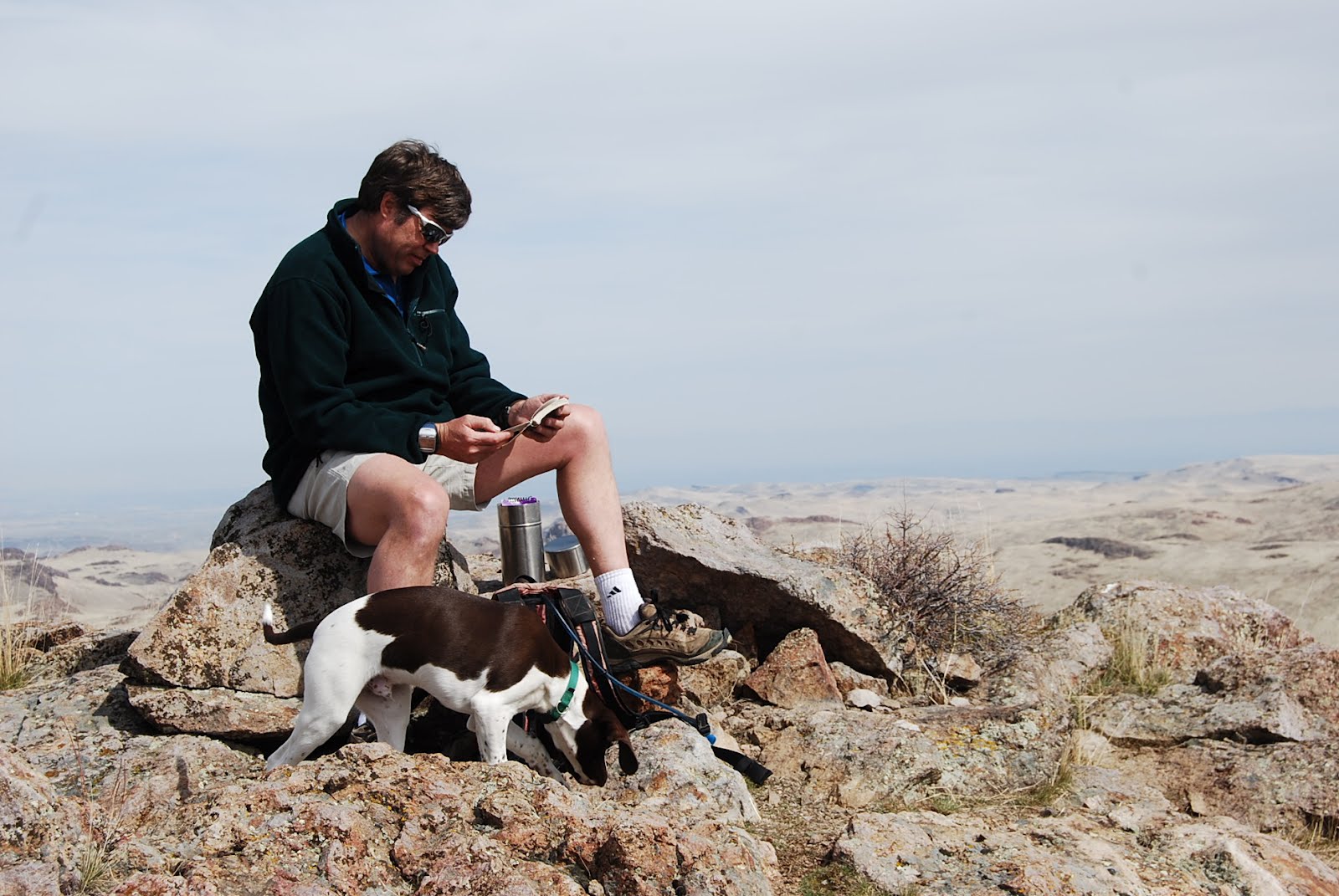
From the trailhead, we followed the two-track ruts to the top of the first ridge at .3 miles. From there, a grand view of the Owyhee Plateau opened up before our eyes. The two-track bends to the north toward Three Fingers. We cruised over there, and then followed footpaths toward a gap behind the rock between the first finger and the second finger. Sure enough, it was possible to scramble to the top from there. I had to lift my puppy over a few steep spots, but a dog should be fine on the hike.

Once on top, we could see for more than 50 miles in all directions. Three Fingers Gulch below looks very intriguing, and I plan to hike that draw down to Owyhee Reservoir to see what kinds of treasures can be found there. Looking through the binoculars, we saw some very cool rock formations near the reservoir. My buddy Norm thought it was Leslie Gulch, but I am quite sure it's not, giving that Leslie Gulch is a number of miles to the south of Three Fingers Gulch. We will have to go there and see.

We discovered several unexpected pleasures on our trip. First, Norm spied a gold eagle nest on the backside of Three Fingers. With the binoculars, he could see an eagle chick in the nest. There might have been more chicks in the nest, yet to hatch.

The second thing was that someone has placed a silver canister at the summit of the first finger containing a number of notebooks inside. Several summit journals contain people's thoughts over the last 10 years. That's pretty cool. I made a few notes in one of the notebooks.

If you've got a copy handy, bring along Roadside Geology of Idaho by David Alt and Donald Hyndman in your day pack. It's a great reference for a hike in the Owyhees. It explains the rhyolite volcanic eruptions and the oozing basalt lava flows that shaped that countryside. It's pretty easy to imagine those events when you're sitting in a catbird seat on Three Fingers, enjoying a quiet moment surrounded by the beauty of nature.

Three Fingers isn't that far from Leslie Gulch if you'd like to consider camping out at Leslie Gulch for the weekend. As I mentioned, Succor Creek is a good camping spot as well. The only downside with Succor Creek is that sometimes I have seen so many OHV users in that park, a non-motorized group might feel a bit overwhelmed. On our way back to Homedale two weeks ago, I saw an adult male doing donuts on an ATV in the main portion of the park. People ought to know better than that. Too bad Oregon doesn't have a camp host at the park. They need one.

FYI - A big campout is planned at Leslie Gulch April 13-15 with the Idaho Outdoors Yahoo Group people, including trip leader Leo Hennessy and group moderator Owen Jones, who has a power boat that will shuttle people to canyon hikes from the reservoir. Leo says he's got over 65 people signed up so far. Should be a big party! Better get there early to find a decent camping spot!

Have fun!
- SS