 |
| It's going to be wet in March! 40-50% chance of above-average precipitation |
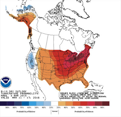 |
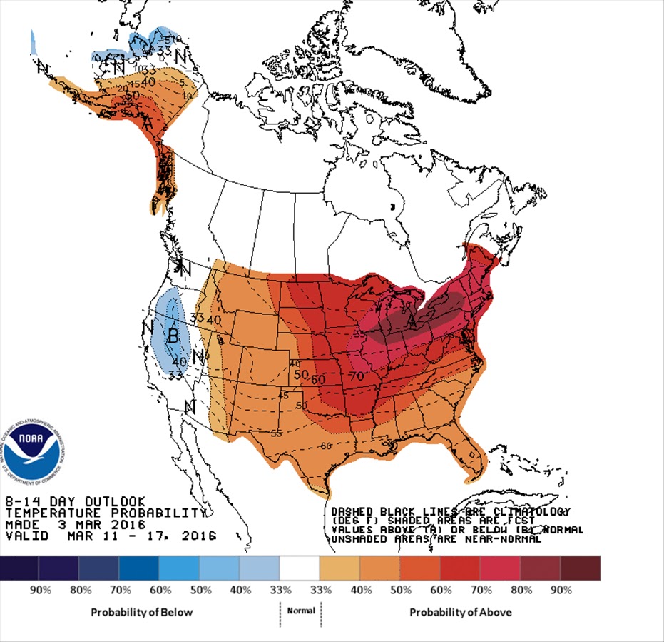
| But ... 30-40% chance of above-average temperatures. How will this play out? |
 |
As of March 2nd, much of Idaho is at 100% of normal.
There's still a ton of snow in the mountains!
|
Hi all,
Well, just as I invited folks to get out and
enjoy the trails in the Boise Foothills last week, it looks as if it's going to be wet this weekend and a major wet weather pattern is heading our way in the next couple of weeks. However, tomorrow (Friday) should be fabulous for spring skiing or playing in the foothills, with a high forecast in the mid-60s in the valley and clear skies. Enjoy that while you can.
Looking ahead into March, it's going to be a challenging balance between chasing fresh powder in the mountains or hiking, biking, trail-running, road biking, playing golf or tennis in the valleys below. Even spring camping in the Owyhee Canyonlands may be difficult depending on how much rain we get in the next few weeks. Wet mucky roads = getting stuck and stranded in a super remote place.
PLUS, rising rivers put another wrinkle on things for people who like to kayak, raft, SUP, etc. The Owyhee River has cut loose and it's running 4,000 cubic feet per second today, a sweet level for the Lower Owyhee River, starting at Rome and paddling down to Birch Creek, a 3- or 4-day trip. The Payette River and Salmon River are rising as well. The steelhead bite is on. More about the rivers in a moment.
My outdoor tip this week will focus on weather conditions expected in the next couple of weeks to give folks a sense of what to expect in planning their weekend outings or spring break.
An abnormally warm second half of February has people thinking winter is over, but I know it's too early for that! After all, I grew a beard this winter to DARE the snow gods to remain in our sphere for a full ski season, and that means at least another month of skiing! But I've been curious about what's in store for the next few weeks. Here's what I found:
The National Weather Service Climate Prediction Center forecast for the next two weeks calls for above-average precipitation and above-average temperatures:
 |
| 50-60% chance of above-average precipitation March 9-19 |
 |
30%-40% chance of above-average temperatures
|
In my experience, these forecasts are very accurate. Just to ground-proof it a little, I contacted the National Weather Service in Boise to get their take on things. The forecaster I spoke with indicated that, indeed, they are expecting a wet pattern to come in with gusto with strong winds. High temperatures will be in the mid- to high 50s in the Boise area, while mountain temperatures will vary according to elevation and microclimates.
We all hope for powder snow and no rain, and that will depend on
snow levels with each storm. The NWS forecaster said he expects snow levels to be in the 4,000-5,500-foot range for colder storms coming soon, or maybe as high as 7,000 to 8,000 feet by March 11th. It's hard to say for sure, of course, but these are the predictions.
If you're a true skier and a powder hound, you'll watch the weather like a hawk and be in position to pounce when the gettin' is good! If you'd rather avoid the snow and winter weather at this point, you may have to endure a fair number of rainy days in the valley. Please watch the
Ridge to Rivers web site or the
Boise Foothills Trail Conditions Facebook page for the latest trail conditions and above all else, heed their advice!
Two of my favorite destinations for times when it's rainy in the valley and foothills trails are muddy:
- Marianne Williams Park - Barber Park - Bown Crossing Loop. 4 miles. Rated easy. Click on link for details and maps. This is a hiking trip, no bikes allowed on the nature trails.
 |
| Eagle Greenbelt Loop |
- Eagle Greenbelt Loop - 6 miles. Open to hiking, running or biking. Park by the Greenbelt and Glenwood Bridge parking lot on Glenwood Avenue in Garden City or at Bardenay near Eagle Road. I like to start from the Bardenay area. Head east on a paved trail that gives way to dirt after a while and then becomes paved again on your way to the new pedestrian bridge crossing the Boise River. Cross the bridge and head west on a paved path that later turns to dirt as you get close to Eagle Road. When you emerge at Eagle Road, walk or bike across the bridge spanning the south channel, and then walk/bike in the swale to the north channel of the river. Pick up the Greenbelt there, head east a short ways, cross two pedestrian bridges, and then turn left to return to Bardenay. Walkers or runners could do a longer loop by going all the way to Glenwood before crossing the river and returning west on the trail.
Now, back to the rivers, if you're looking to run the Owyhee this spring, here's a graph from NRCS Snow Survey that shows how the Owyhee River may flow in the coming weeks ... it could be peaking soon!
 |
Right now, the Owyhee is tracking close to the 1998 season, when it was
runnable through May. What happens with spring precipitation and heat
will determine how the rest of it runs off.
|
Hope that information helps for what you may be planning in the coming weeks! Have fun!
- SS






 Posts
Posts


