 |
| Matt Leidecker is a professional photographer and explorer. I recommend his new guide on the Boulder-White Cloud Mountains |
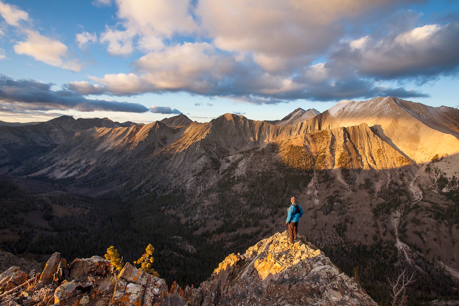 |
| Matt checks out the scenery in the BWC's. He covered 526 miles and 127,000 verts in researching the guide for hiking and biking. |
 |
| Top of Jerry Peak (Matt Leidecker photo) |
 |
| Sapphire Lake (Matt Leidecker photo) |
 |
| Castle Divide and Castle Peak (Matt Leidecker photo) |
 |
| Big Boulder Lakes (Matt Leidecker photo) |
After a wonderful week of cool unstable weather, things are smoothing out this weekend, at least on Friday and Sunday. A small chance of rain (20%) is forecast for Saturday, with highs in the 70s in Boise, but I wouldn't let that keep you from going out to watch the North Fork Championships on the single gnarliest section of the North Fork of the Payette River, near Banks, Idaho.
Here's a video teaser about the event.
It's amazing to watch these world-class kayakers leap into the North Fork from the Red Bull boat ramp, right at the top of Jacob's Ladder Rapids, and not only negotiate the steep, chaotic rapids, but also follow a distinct line through slalom gates to win points ... or not. Any slight change in the river currents or a paddle stroke can screw up your line!
The event starts at 1 p.m. Saturday along Jacob's Ladder Rapids, about 8 miles north of Banks, on Idaho 55. Get there early to get a sweet viewing spot on the banks of the river! Tomorrow afternoon, there's a BoaterX race on S-turn rapids on the North Fork, starting at 3 p.m. Six kayakers race through the rapids and the fastest two advance to the next round. Should be wild!
 |
| Matt Leidecker |
He's been running a Kickstarter campaign in hopes of raising $4,000 to cover printing costs of the guide, and lo and behold, he's surpassed his goal with $6,252 in contributions -- presales revenues for people who pre-ordered books, maps, note cards, photographs, etc. It's a great concept to fund a guidebook via Kickstarter. It worked also for Mark Lisk and me to cover printing costs for our award-winning book, The Owyhee Canyonlands - An Outdoor Adventure Guide.
As anyone knows who has a Matt Leidecker paddling or hiking/biking guide, he really digs into the subject matter and produces a very comprehensive guide, with all of information you would expect about each trail, high-quality photographs, maps, history and geology. The BWC guide is no exception. He covered 526 miles, climbed 127,000 vertical feet on foot or bike over 50 days of exploration. "I wanted to give people the best overall picture of what's out there," he said in an interview with Boise State Radio.
He has detailed descriptions and maps to every drainage in the Boulder-White Clouds area, inside and outside the wilderness, including the new Jim McClure-Jerry Peak Wilderness between the East Fork of the Salmon River and Trail Creek Road, an area that many hikers haven't explored. I look forward to doing some trips in that area in the future. You can tell from all of Matt's descriptions that he's been there. Besides following trails, he provides off-trail hiking suggestions in places. I also liked a concise wildflower guide in the back of the book with color photos - that's handy!
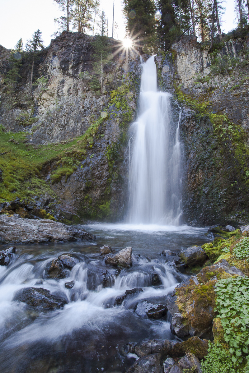 |
| East Pass Falls (Matt Leidecker photo) |
For destination backpacking in the White Clouds, consider heading into the backcountry from the Fourth of July trailhead and hiking to Chamberlain Lakes. Take a side trip to climb Castle Peak! Or, hike the Little Boulder Trail to the Boulder Chain Lakes -- this is a very popular area in July and August. Same goes with the Big Boulder Creek Trail to Walker Lake and then Sapphire and Cove Lakes above there.
While those sterling high mountain lake areas are tough to beat, get a copy of Leidecker's guide to discover some more off-the-beaten path locations in the BWC area. I've always wanted to do the Big Casino-Little Casino loop on my bike (19.4 miles, 3,976 verts), or try to climb the Boundary Creek Trail to the Casino Lakes. I've hiked Boundary Creek just part way up until we hit snow, and the views into the Sawtooths across the valley is spectacular! All of those trails are rated "H" for "Hard."
The other place you have to go in the BWC's is Railroad Ridge! I did a post about driving up there in my Ford F-150 after Wendy had knee surgery several years ago. I also included RR Ridge in my Top 5 car-camping spots last summer. We got there when the wildflowers were peaking, and it was utterly spectacular! I scrambled down to Crater Lake to fly fish, while Wendy hung out and enjoyed the flowers. And then we camped at 11,000-plus feet there on the bare ridge, feeling like we were on top of the world. Very cool place!
 |
| Railroad Ridge with flowers going off everywhere! SS photo. |
- SS


No comments:
Post a Comment