Thursday, July 13, 2023

Just in time for the July heat! 5th edition of "Paddling the Payette" is hot off the press!

New cover for 5th edition 

Hi all, 

Here in Idaho, we are blessed with many outstanding river systems, and the Payette River is one of our true and trusty gems, just 30-45 minutes from Boise.

I've been paddling the Payette River personally since the mid-1980s. I started with whitewater rafting, kayaking and canoeing, and then things have evolved to Stand Up Paddle Boarding (SUP) as well. 

My first guidebook on the Payette River was published in 1995. I just reprinted the book in July 2023, creating the 5th edition, now hot off the press! New price is $19.95. Books will be  available at Idaho River Sports, Alpenglow Mountain Sport, Rediscovered Books, Cascade Raft, River Gear at Kelly's Whitewater Park, Amazon, other outdoor retailers and my web site

John Poole paddles Swirly Canyon on his SUP

The Payette River system is a special gift because it has such wonderful diversity -- including lakes, Class 2 streams, and full-on, world-class whitewater. The Payette is extremely accessible. Many roads and highways lead to your favorite paddling adventure, and no permits are required. All you need to do is gather up your boating gear and go, or call an outfitter and go. 

My book provides details on 23 day trips in the Payette River system - something for all abilities - rafting, kayaking, sit-on-top kayaks, SUPs and canoes.  

More than 20 of the day trips on the Payette River are suitable for SUPs - from tranquil easy-going floats on lakes to Class 3 whitewater.  

The South Fork "Canyon" run has non-stop action. This is Lone Pine Rapids. 
(Courtesy Cascade Raft)

Two large reservoirs, Lake Cascade and Deadwood Reservoir, provide season-long flows on the Payette River. The dams store irrigation water for farmers downstream. River flows are slowly released throughout the summer to water crops. This flow regime benefits boaters of all kinds throughout the summer. When other streams in the West dry up or are too low to float in August, the Payette is still running strong. 

Steve guiding a paddle raft through "Howard's Plunge" at the end 
of the Cabarton section, North Fork Payette River in Smith's Ferry.  

Overall, the Payette River promises to deliver lots of fun, as long as you are well-prepared for the journey. I don’t know how many times I’ve gotten up on a beautiful summer morning – no clouds in the sky – packed up the boating gear and whispered to myself, it’s going to be an all-Idaho day on the Payette – guaranteed fun. You feel the excitement on the way to the put-in, and you know it’s going to be an awesome day. 

Two women SUP on a large pond near McCall. (photo by Steve Jones) 
Enjoy!

- SS 

Thursday, July 6, 2023

Highly recommend the new Brundage to Bear Basin Trail - Awesome addition to the McCall trail network!

The B2BB trail winds through beautiful open mountain meadows 

Hi all,

I had the privilege of riding the new Brundage to Bear Basin Trail last Saturday, and I must tell you that it's an AWESOME addition to the McCall trail network! 

Hats off to the Central Idaho Mountain Biking Association, which partnered with the Payette National Forest and Brundage Mountain Resort to permit and build the trail. 

A post from CIMBA credited the following funding partners: 

  • One Track Mind Foundation 
  • Albertson's Foundation
  • Recreational Trails Program grant via Idaho Department of Parks & Recreation
  • IMBA Dig-In Grant 
  • Idaho Community Grants
  • City of McCall Local Option Tax
  • Individual Donations
  • Several Large Donors & Receipts from past Idaho Gives Campaigns through CIMBA
Pretty awesome community support! 

CIMBA is a really active mountain bike club, based in McCall. They've shown amazing leadership over the years to add significant new trails to the McCall trail network, such as the Bear Basin network of trails for all abilities, Jug Mountain Ranch trails and the extension of the Payette Rim trail out to North Beach on the west side of Payette Lake. 

Last weekend, I wanted to finish demolishing our deck at our cabin in McCall. My son Quinn and I made fast work of that with our chainsaw on Friday. So that left Saturday free to ride the Brundage to Bear Basin Trail (B2BB). 

Passing by Temptation ski slope on Growler 

I had planned on taking the Bluebird quad to the top of Brundage, but learned that morning that the chairlift was down until further notice (a new part is on order). So I had Wendy drop me off at the base area, and I climbed Growler to the top. Growler is a sweet singletrack trail that climbs Brundage at a pretty moderate grade for most of the climb. Very rideable. There are a few heinous, steep-ass sections in the dark trees with deep roots thrown in for sport. But that's the way trails can be in McCall! Get used to it! 

Passing by 45th and Temptation in the summer makes me smile because in the winter I'm usually flying down those groomers at top speed. 

You hit the B2BB junction on the southern shoulder of Brundage where Growler meets the Lakeview Vista trail. And then you're off and running! 


I had no idea what to expect - just that it was 6.5 miles downhill with 1,700-feet of vertical descent. Pretty quick, I encountered some tricky rock features and a rock wall that I walked, but then the trail weaved down an open mountainside full of wildflowers for several miles, and that was glorious. I stopped to snap some pics of the views where you could see the Little Lake, Payette Lake, Long Valley to the south, New Meadows and Seven Devils to the west. Similar to the views you get skiing at Brundage, but different. 

The open mountain meadows seemed to last quite a while and then you enter the forest and ride through a long series of switchbacks - seemingly a million well-sculpted, fun banked corners that you'll find on Berm and Ernie at JMR and Bogus Basin, and the Around the Mountain Trail at BB or the West Drain at Bear Basin. As I rode through all of those banked corners, it felt like the ATM trail x 10 because of the 6.5 miles of entertaining singletrack. 

After those initial challenging rock sections, the rock features on the trail were set up in a way that they flowed with the trail - you could needed to coast or cruise over the top of them with the downhill momentum.  

The trail contractors did a great job, I thought. The dirt surface was really buffed for the first year of use. But I'm one of the first ones to ride it! After the Bluebird chair gets cranking, it's going to get a lot more use! 


B2BB finally descends into Ditch Witch in the Bear Basin trail system, and it's well-signed as you transition into the BB trails. Ditch Witch is very narrow and climbs at a steep pitch out of a dark hole in the forest but you just grind it out and pop out on Polar Express. I headed east from there toward Bear Basin Road since I had to pedal back to my cabin. 

Wendy went off to hike Granite Mountain with Huck while I did my ride.

All in all, I thought it was a great new trail! My arms were worked from all of the braking and banked corners and such, but those features make for entertaining riding while you're cruising through the mountains. 

I've got a pretty good feeling for the McCall trails as the author of the Mountain Biking in McCall (now only available as an ebook). My first edition of that book came out in 1995. I love all of the trails around the McCall area, but if there's any weakness in the system, there needs to be more trail options close to town. 

The B2BB trail does a nifty job of tying together the popular Bear Basin trail system with Brundage Mountain trails. Now you can do some pretty amazing rides from McCall incorporating those trails. You'll have multiple options to choose from as to how you reach the top of B2BB. It's really up to you and your riding friends as to how far you go! 


Strava tracks. 16 miles from Brundo to McCall. 1,200 feet of climbing, gotta be close to 2,500 feet of descent. 
    

Don't forget the Boise Twilight Criterium on Saturday in downtown Boise! 
- SS 

Thursday, June 22, 2023

Grand Ronde River's velvety green canyon shines once again on a 4-day trip in June

Steep-ass hike from our camp below has quick dividends - big views and flowers galore

Hi all, 

The Grand Ronde River in Eastern Oregon is one of my all-time favorite springtime getaways in a wilderness setting. 

Last year, we had a good trip at flood stage, 13,000 cfs, but we had to endure lots of torrential rainstorms - all under the comfort of my killer tarp, I might add. 

But this year, we had beautiful weather, with highs in the 70s and just a few random thundershowers while in camp. We did a 4-day trip on June 12-15 from Minam, Ore., to Powatka Bridge (Wildcat canyon), covering about 39 miles. The Minam Store ran our shuttle for $170. Easy to set up online. 

Wendy and Huck on Day 4, a little cooler than the previous 3 days. Background shows
the aftermath of a wildfire in 2021.   

The Grande Ronde is a great choice in the spring because the countryside is soooooooooooooooooooo velvety green and beautiful, the river flows are high enough to cover the rocks and make navigation really easy, and wildflowers are blooming everywhere. Self-issue permits are easily obtained at the put-in, and there are dozens of sweet forested campsites to chose from as you float the canyon. 

In terms of difficulty, the Grande Ronde is rated Class 2-3, which is pretty low key on the whitewater scale. For our trip, we had about 5,000 cubic feet per second (cfs) of river flow, allowing you to scoot along and clock river miles with ease. Just put the oars under your knees, kick back and sip a beverage while enjoying the scenery and wildlife along the way. 


The Minam Store also has rafts and gear for rent if you'd like to do your own trip. 

From Boise, it takes about 4 hours to get to the put-in -- 3 hours via I-84 to La Grande, and an hour on two-lane paved roads to Minam, a little roadstop next to Minam State Park, a gorgeous place to camp the night before you launch, if you wish.

One of our favorite campsites 

One of the neatest parts of floating the Grande Ronde is staying in those beautiful, grassy riverbank campsites amid ponderosa pine and Douglas fir trees. On night #2 of our trip, we stayed at a scenic campsite that's easily as cool as some of the best camps on the Middle Fork of the Salmon River. Picture a large grassy meadow, a big kitchen area shaded by large trees, a steep hike up a ridge behind camp, and lots of wildflowers.

Here are a few other pics from our trip ... 

Up near the top of the canyon, about 1,000 vertical feet above our camp.
With Keith and Ann from Portland. Gorgeous views, gentle breeze, and bird song. Below, Huck is still climbing mountains at age 11. 


----------------------------------------
I had the privilege to appear on KTVB-TV Channel 7 on the 4 p.m. news Wednesday to share some tips about hiking, information about my Boise Trail Guide - 95 Hiking and Running Routes Close to Home, and camping this summer. 


Have a great weekend! 
- SS 

Thursday, June 8, 2023

Camas Lilies blooming at Centennial Marsh, morels popping, and ski areas opening soon

Photo by Steve S.

Hi all, 

Beauty is surrounding us this spring with colorful wildflower blooms, verdant mountains everywhere and rushing water in streams. 

One of those memorable scenes is the camas lily bloom at the Camas Prairie Centennial Marsh near Fairfield. Fields of the lavender flowers carpet the landscape for as far as your eyes can see. It's also a great place to see songbirds, water birds and birds of prey. See post on Southern Idaho Tourism for details. Easy day trip. 

Upper meadow bloom, looking north from the highway 

Watch out for the weather on Friday, if you're planning to get out and about ... looks dicy! High chance of rain, hail, you name it! Similar forecast for Saturday, but more afternoon than morning, according to the National Weather Service.  

I'm seeing that the morels are popping right now in fire zones burned last summer like the Four Corners Fire area near Cascade. But truth be told, I don't want to hear about it! Been too busy to get out foraging myself, so that's been driving me nuts! Be sure to get out soon while the picking is good! I've been wondering how the picking is in the Moose Fire zone near Salmon ... has to be productive, too! 

I've been curious when our local ski areas will be opening for the summer season. You won't have to wait too much longer! Here's what I discovered: 

  • Brundage Mountain Resort opens Friday, June 16 for summer operations. Lift-served hiking and biking available, yoga sessions and more. Summer concert series starts on July 7. See band lineup to the left. See event calendar for more details.  

  • Tamarack Resort opens for summer operations on Saturday, June 17. Tam has lift-served hiking and biking, waterfront boat, kayak and SUP rentals, and a zip line course. See events calendar for details on summer activities, live music and more. 

  • Bogus Basin opens for summer ops on Friday, June 23. They have lift-served biking and hiking, music on the mountain, music on the patio, yoga, guided nature hikes, the glade runner, climbing wall, bungee trampoline, gem panning and summer tubing. food and beverage on the patio and more. See summer event calendar for details. 

Have fun! 
- SS 


Thursday, June 1, 2023

Spring green up and wildflowers are spectacular right now! Three hikes where you'll enjoy nature's beauty in Boise

Quinn Stuebner on the trail to Mt. Kepros, lit up by lupine and arrowleaf balsamroot. 

Hi all,

After the super long and cold winter, the spring green up and wildflower display in the hills surrounding the Treasure Valley has been spectacular! 

I hope you've been out to see it! If you're looking for more destinations with flowers in bloom, here are six suggestions close to home in the Boise area: 


  • 5 Mile - Watchman Loop, Boise Foothills - 6-10-15 miles. Difficulty: Moderate to strenuous. Hiking time: 2.5-3 hours if you hike up 5 Mile to Watchman and drop out back to Rocky Canyon Road by the 5 Mile parking area on the Three Bears spur. It's a beautiful walk with water in 5 Mile Creek for the puppies. 


  • Watchman - Three Bears bike rideThis is still one of my all-time favorite rides in the Boise Foothills. After you make the initial climb to Watchman, when you come around a corner into the next draw, the whole mountainside is blooming with arrowleaf balsamroot. Gotta see it. 
  • Start and finish at the bottom of Rocky Canyon Road for the 10-mile version of this ride. Or start from Military Reserve Park for a longer version that clocks in at 15 miles. Vertical gain 2,500 feet. Rated advanced. Travel time: 3 hours. Start in Military Reserve. Take the Mountain Cove Trail along Freestone Creek to Ridgecrest #20 and climb to Central Ridge Trail. Climb Central Ridge to the Bucktail junction. Go straight, climb a short distance and then contour over to Rocky Canyon Road on Shane's. Climb Rocky Canyon Road to the Five Mile Trail and Creek. Climb Five Mile to Watchman. Follow Watchman across the foothills and go left at the junction with Three Bears/Curlew Ridge/Trail #6 and follow Three Bears down the spine of Curlew Ridge (super fun downhill with one technical section) back to Shane's Junction. Descend back to the bottom of Military Reserve however you like ... I always have to ride Bucktail and cruise the super-cool GS turns.

    Courtesy Matt Clark 

  • Station Creek Trail, Garden Valley - This is also one of my all-time favorite hikes in SW Idaho. Just saw some pics on Facebook from Boise friend Matt Clark, and the green meadows under the Ponderosa pine trees are aglow with color with multiple wildflower species in bloom! The Station Creek hike is featured in my book, the Boise Trail Guide: 90 Hiking & Running Routes Close to Home. I rate it "moderate" in terms of difficulty. It's a sweet singletrack that climbs 1,300 feet over several miles to the top of the ridge overlooking the broad valley. It's a 4.5-mile hike round-trip. Travel time is 2+ hours. Pack a lunch for the top. If you have time, I highly recommend climbing Bald Mountain, located just above the ridge. You'll add maybe 45 minutes to an hour to the trip, round-trip. Plus, always better views from the top of peaks. 

    The trailhead is about 1:15 from Boise on the Banks to Lowman Road. Take ID 55 to Banks, turn right to Garden Valley. Proceed past the town of Garden Valley to the Garden Valley Ranger Station. Station Creek Trail is directly across the road from the station. There's parking there but no rest room. 

    On the way down from Mt. Kepros peak ... the trailhead is way the heck off to the south! 

  • Hike Mt. Kepros, one of four Boise Grand Slam peaks. It's a 10-mile, moderate to strenuous hike, but worth the effort. Travel time: 4-6 hours. Doing the hike in May and early June, the flowers are spectacular! Trailhead is off of Black's Creek Road, east of Boise on the freeway. See details on directions and highlights along the way in my post on hiking Mt. Kepros.   

---------------------------
Outdoor notes:

Noteworthy events going on this weekend:

  • Big water blowout on the Salmon River in Riggins, Saturday, June 3. The Salmon is running 47,000 cfs as of Thursday at Whitebird. Gonna be big! 
  • Eagle Rec Fest at Eagle Island State Park, Saturday, June 3. Free entry to the park! Great place to take the kids for some fun activities! Plus there's 5 miles of trails at the park, ponds and other things for the kids to play on. 
  • Snake River Raptor Fest - Saturday, June 3, 12-5 at the Indian Creek Winery in Kuna. 
Have fun! 
- SS 

Friday, May 26, 2023

Always blessed to float the Owyhee River!

Floating by Pruitt's Castle and Chalk Basin with Liz and Wendy in the bow. 

Hi all, 

We managed to escape for 4-day trip on the Lower Owyhee River two weeks ago under mostly sunny skies. Felt lucky to be out there in one of my favorite spots with my partner Wendy, my son Quinn rowing his own raft, and several other friends, Liz Paul and Norm Nelson. 

We launched on a Thursday morning, so it wasn't too busy at the boat ramp in Rome. There must have been at least 200 vehicles in the parking lot, though, so clearly, the Owyhee River has been popular this spring season! 

Because of deep snow in the Owyhee and Jarbidge-Bruneau river basins last winter (285% of normal snowpack in the Owyhee and 268% in the Bruneau watershed as of April 20), this spring offered a rare chance to float those rivers for a longer window of time than normal when the water is high enough to go (March - June). If you don't have your own raft and whitewater gear, consider going with an outfitter. 

I'd recommend Far & Away Adventures, Wilderness River Outfitters, Barker River Expeditions, and ROW Adventures. Please see a press release and blogpost that I wrote for the Idaho Outfitters and Guides Association.

Wendy enjoys the Owyhee River canyon at our campsite below Montgomery Rapids. 

Closing in on Memorial Day weekend, the Owyhee River has dropped to 1,600 cfs and it's continuing to slowly decline, so the window for rafting the river is closing over the next few weeks. Once it drops below 1,000 cfs, it's very rock and slow. The Bruneau River, however, is still running high at more than 2,000 cfs, so the window of time to run that river will extend well into June.  

One of the big advantages of floating the Lower Owyhee is that you follow a paved road (U.S. 95) to the boat-launch site in Rome, Oregon. To float the upper forks of the Owyhee, you have to drive for many miles on unimproved 4WD dirt roads that turn into major quicksand-like gumbo after lots of rain. So we had no worries about being able to reach the river last week, even though it had been wet. 

We took four days to float 48 miles to the Birch Creek takeout, upstream of Owyhee Reservoir. At a flow of 3,000 cubic feet per second (cfs), with hardly any wind, it was not too hard to make our river miles. 

The weather turned a bit on Day 4 with clouds and cooler temps in the morning.

I watch the weather closely for our trips on the Owyhee because when it's nasty out there, it's not fun. I've encountered driving rain, headwinds, thunder and lightning in previous trips. But we nailed the nice weather window this time around. Grateful for that!  

At 3,000 cfs, many of the rocks were covered with cushy flows. From a whitewater perspective, it's a pretty easy and mellow level with good current and fun waves.

The Lower Owyhee has mostly Class 2 rapids, with a few Class 3's and one Class 4, called Montgomery. I would rate that Class 3+ personally. Montgomery is not that hard. You have to pull away from a left-side wall as the current races around a left-hand bend. It's a pretty straight-forward maneuver, compared to Class 4 rapids that require multiple maneuvers around rocks or holes.

Quinn cooked up a feast of eggs, sausage and blueberry pancakes on the morning of Day 2. 

We had four major highlights on our trip:

1. Birds of Prey were everywhere! Golden eagles, kestrels, northern harriers, prairie falcons and red-tailed hawks were flying around the cliffs, diving toward the water and nesting in the cliffs. Plus, we saw pairs of geese on virtually every corner, some with goslings, a few pairs of mergansers and some mallards.

2. Volcanic rock formations on the Lower Owyhee are spectacular. The types of rock spans from black basalt lava similar to the Jordan Craters, to rhyolite red cliffs, basalt cliffs and many spires, hoodoos and other formations. It's fun to just stare in awe at these features and feel small.

3. Deep snow and April rains made the desert landscape the deepest shade of green imaginable. We must have caught the green-up at its peak. But the flowers were just starting to pop. Arrowleaf balsamroot was blooming everywhere.  

4. Camping out, campfires, S'mores, great meals and great people. I love camping out in general. Hanging out and relaxing in camp is one of my favorite things. My son Quinn cooked up a feast for a dinner and breakfast; that was nice to have him pitch in like that. He's put a lot of effort into learning new recipes. 

If you go, make sure you have enough time to do some side-hiking. The area around Pruitt's Castle is a great place to hike, Hike-out camp is another sweet hiking spot early in the trip, and below Whistling Bird Rapids, there's a sweet campsite with a way to hike to the top of the rim and enjoy big views of the canyon. From that viewpoint, it's amazing how small you can feel, being a tiny little speck amid the giant Owyhee River Plateau.

All I can say is getting away on an Owyhee or Jarbidge-Bruneau trip is good medicine for the soul. And you know, right at that moment, that you're extremely fortunate to experience it.

Side hiking around Pruitt's Castle

- SS

Thursday, May 4, 2023

Support Valley County Pathways in its quest to build a valley-wide trail system from Cascade to McCall

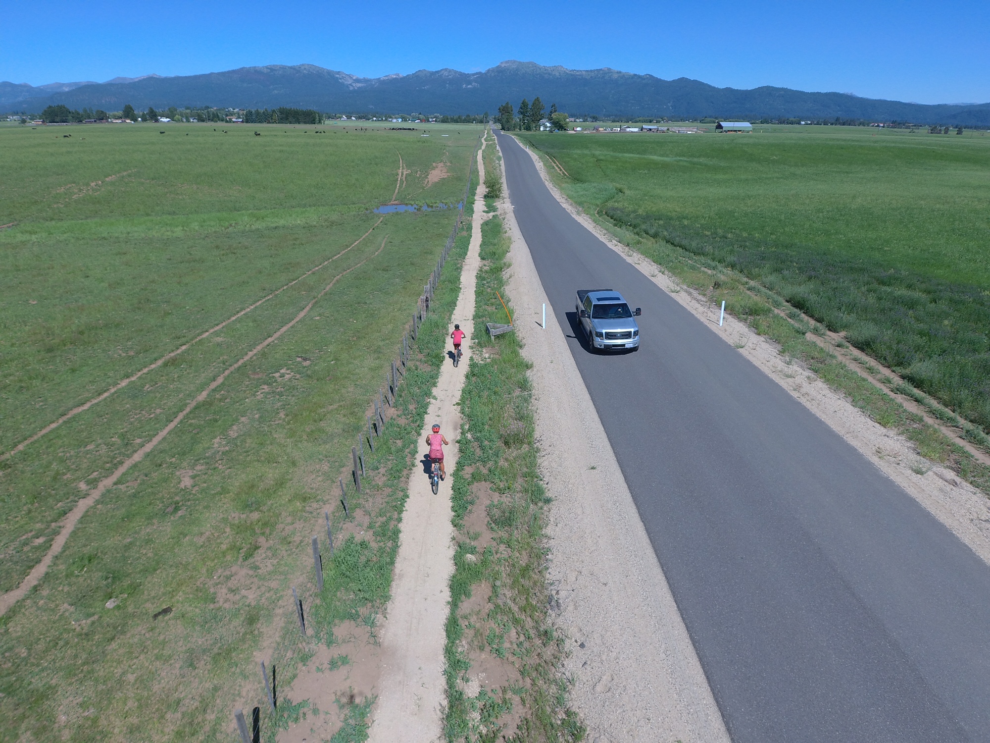
New "singletrack sidewalk" trail along Heinrich Lane, south of McCall 

Hi all,

On the fourth and final day of Idaho Gives, I'd like to encourage you to support Valley County Pathways, a nonprofit group I've been leading for almost 20 years.  

Our vision is to build a 70-mile, valley-wide trail system from Cascade to McCall and New Meadows, where we could connect to the Weiser River Trail. 

Put another way, our quest is to build a trail system that matches the grandeur of Long Valley.

For this year's Idaho Gives campaign, our goal is $15,000. We've received a pledge from a trail supporter who will match all of our contributions up to $15,000, for a total potential of $30,000. 


Our new video tells our story. 

We are inspired by the Boise River Greenbelt, the Wood River Trail and the Trail of the Coeur d'Alenes. Those long-distance trails are the pride of their communities, and anyone and everyone can enjoy them. 

My feeling is we have 10 years to get a valley-wide trail system in place in Valley County, or we may never get it done. We need to act now! And that takes money! 

I got started with Valley County Pathways in 2004, not long after the first $10M open space measure passed for the Boise Foothills. I was heavily involved in that open space campaign, and I still feel like it's one of the most important things I've done in my life. It was so cool to be part of a broad grass-roots effort that got embraced by the whole Boise community. 

From that experience, I learned that we can shape and enhance our communities and landscapes with new trails, open spaces and wildlife habitat with a LOT of DEDICATION and HARD WORK! 

I've been trying to walk the talk for 30 years. In 1992, I was the founding president of the SW Idaho Mountain Biking Association (SWIMBA), when Ridge to Rivers was just getting started. We all wanted to improve our trail systems. SWIMBA partnered with Boise REI and R2R to build Shane's Trail, Sidewinder, Trail #1 over to Bob's, Redtail Ridge, and Seaman's Gulch trails in the 1990s. 

Erin and Ed Roper ride in the grand opening of trails in McCall, a VCP event. 

At the same time, I was producing new trail guides like Mountain Biking in Boise, Mountain Biking in McCall, and Mountain Biking in Idaho (80 rides statewide).  

So I was a pretty well-traveled trail guy when I started working full-time for Tamarack Resort in government affairs in 2003. I knew there was an abandoned railroad line that ran through the middle of the valley, and I saw the abundance of public land along the western shoreline of Lake Cascade. I read that the Bureau of Reclamation recommended a walking/biking trail around Lake Cascade in a resource management plan, and my eyes just about popped out of my head! 

We started Valley County Pathways at a time when the Rails to Trails movement was taking off big-time nationwide. 

Eleanor Putman speaks at the trail dedication in 2006
on the north end of the Crown Point Trail.  

But it turned out that the old rail line from McCall to Cascade had been abandoned in 1979, pre-dating national legislation that gave railroad companies tax incentives to gift rail lines to nonprofit groups for conversion to recreation trails. The old railroad line in Valley reverted to private ownership in many locations, so that has made our work much more difficult. 

A few landowners, including the Putman Family and the Whiteman Family, have gifted old RR line property to Valley County Pathways, for which we're eternally grateful.

Long story short, since 2004, we have built the bookends of a trail system in Cascade and McCall. Now we're working on bridging the gaps in the middle of the valley. 

Hugh Fulton, right, and Damon Yerkes on the Boulder Creek Trail. 

Currently, we are partnering with Valley County Parks and Recreation to craft a 5-year and 10-year build-out plan for the valley-wide trail system. We know the price tag will exceed $5M.      

I'm super excited about the whole thing. 

There's a ton of state and federal money available right now for trail projects. We need private funds to provide match for projects, provide steady upkeep on our trails, and to assist with trail construction. We also partner with our friends with the Central Idaho Mountain Biking Association, the West Central Mountains Economic Development Council, the McCall Chamber of Commerce, the City of McCall Parks and Recreation Department, the City of Donnelly, and the community of Cascade to stretch our trail dollars as far as possible. 

I don't usually ask people to donate to any particular cause in my blog, but this is a case that's dear to my heart. Please do what you can for Valley County Pathways! 

Thank you! 
- SS 
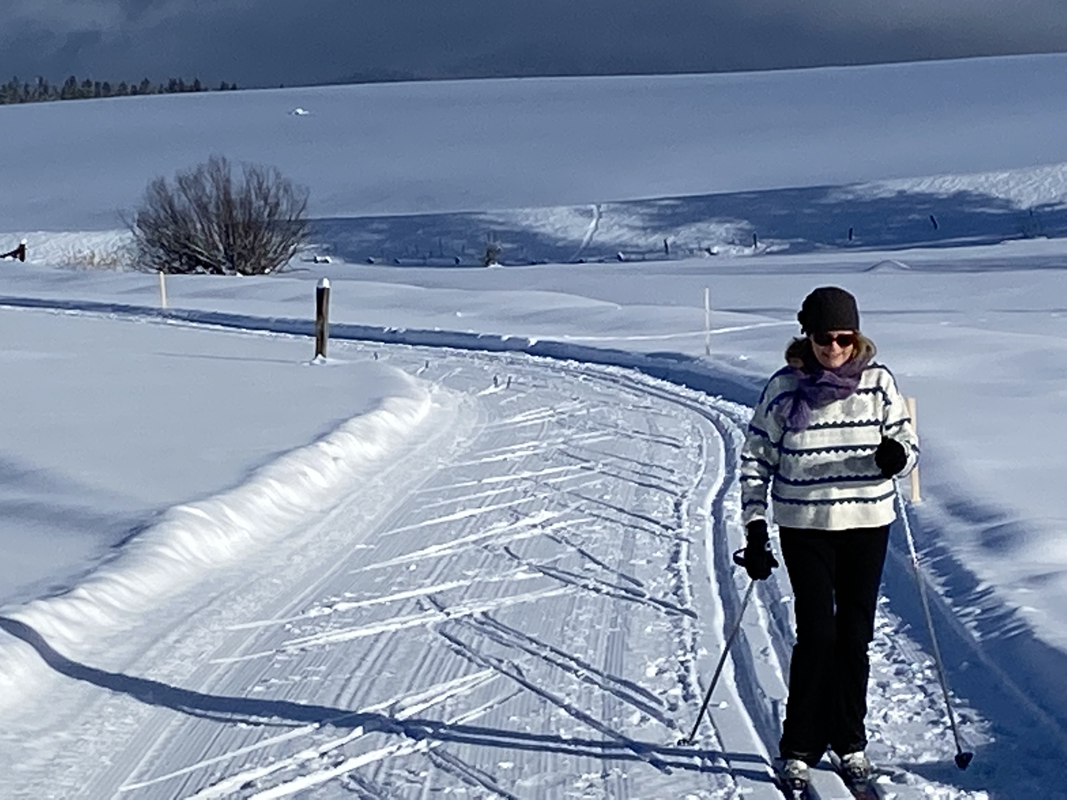
The North Valley Rail-Trail doubles as a xc ski, snowshoe and snow bike trail.