Thursday, September 24, 2015

Explore five hikes in the Owyhee Mountains; Colors should be fab in Silver City!

Wendy and Huck in  a January hike in Brown's Canyon 
Wendy soars in a brisk wind on top of a mountain above Toy Pass
Great skyline views from the mountains above Toy Pass
The quakies should be golden in Silver City 
High on the saddle overlooking Silver City and surrounding area ... 
Sheep Creek canyon ... you'll have it to yourself. 
Gearing up for our ride in Silver City. 
Hi all,

It looks as if it's going to be a beautiful late September weekend in SW Idaho, with daytime highs in the low 80s and night-time temps in the high 40s or low 50s, depending on elevation. It'll be a great weekend for hiking, biking or camping in the Owyhee Canyonlands.

I've been thinking a lot about the Owyhees lately because of the 285,000-acre Soda Fire, and the subsequent recreation closure of multiple trailheads in the Owyhee Front. I also am giving a REI clinic on exploring the Owyhees next Wednesday at 7 p.m. (still openings available at press time), and I've been checking into the extent of the burn zone to share with folks who want to know!

So for my outdoor tip this week, I'll detail five places to go outside of the burn zone. Keep these in mind for the coming weeks in October as well. All of the trips are drawn from The Owyhee Canyonlands: An Outdoor Adventure Guide. 

Also, Avimor is hosting their fall Demo Days event from 10 a.m. to 4 p.m. on Saturday. There will be show-me rides, food, music and beer. The event provides a great chance to demo various new mountain bikes on the market. George's peeps said that demo trucks from Trek and Specialized will be there with 2016 models for people to test out. Idaho Mountain Touring, Ridgeline Sports, Broken Spoke, Kore North and Boise Bike Wrench will be there with more bikes to demo as well!

Now, back to the Owyhees ... See the burn map below for a big-picture view of the Soda Fire burn zone (click to enlarge):
Soda fire perimeter
Generally, the Owyhee Front between U.S. 95 and Reynolds Creek Road all lies inside the burn zone and the Bureau of Land Management is asking for recreationists to stay off these lands this fall. These areas include Jump Creek Canyon, Wildcat Canyon, Squaw Creek, and Wilson Creek. Areas around Silver City were left unscathed.

In Eastern Oregon, the fire spread to points east of the Succor Creek Road, but none of it crossed Succor Creek itself or the road, leaving everything to the west in good shape, including Three Fingers, Sage Creek, Painted Canyon, Carlton Canyon, the Honeycombs, Leslie Gulch, etc.

So here are my 5 recommendations for the weekend:
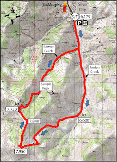
1. Hike or bike in Silver City - Try the Silver City Sawpit Peak Loop (8.5 mile hike; strenuous) or the Skyline Mine Tour (16.8 miles; advanced). Travel to Silver City via Nampa; take Idaho 45 to Walter's Ferry. Go left at the fork after crossing the Snake River and watch for the signed turnoff for Silver City on the right. It's about 20 miles to Silver City on paved and dirt roads. A high-clearance 4WD vehicle is best for the last 5 miles or so to the old mining burb. Even if the hike or ride sound like more than you'd like to bite off, go to Silver City and enjoy the yellow aspens and walk around town. You can take a hike up Jordan Creek south of town for several miles and climb to the ridge on two-track roads to a great overlook. This is the route for the Sawpit Peak Loop, but then it continues to wrap clockwise around the big mountain, descending back to Silver City via Sawpit Gulch. See detailed instructions in the Owyhee guidebook. There are multiple car-camping opportunities just north of Silver City.


2. Brown's Canyon Overland Tour - This is a nice, new 5.2-mile loop that circumnavigates the slot canyon hike in Brown's Canyon. You can look into the slot canyon without having to navigate the poison ivy, nettles, deep-water pools and thick brush. The hike starts and finishes in the Oreana area, west of Grand View. Rated moderate; travel time: 3+ hours. Getting there: Take I-84 to the Simco Road exit. Turn right on Simco Road and proceed to the state highway. Turn right at the highway and proceed to Grand View. Turn right on ID 78 in Grand View and then take the second left-hand turn to Oreana. Make a note of your odometer. Drive through the little town and go past the old church on the Oreana road until it takes a hard left. Make the corner and then take an immediate right on Alder Creek Road (no sign). Follow the road six miles to BLM Road 700. Turn right on 700 and drive to an old corral at a two-way junction. The hike  starts here. Continue west on BLM 700 and climb a moderate grade to a bluff that overlooks Browns Canyon. At mile 1.4, bear right on a two-track and drop into Brown's Creek draw. Walk down the draw until it begins to closeup in a blond slot canyon. Work to the left side of the draw and walk overland on the blond rocks staying above the draw. The canyon opens up at mile 2.0. Walk down the draw until the canyon closes up again, and then walk on the left rim of the canyon above the slot canyon. Walk around the small canyon when you come to that, and stay on the left rim until the slot canyon ends. Turn right on the dirt road at the end of the canyon at mile 3.6. Follow the road to a two-way junction at mile 4.0, turn right at a fence gate, and follow the two-track road BLM #710 back to the trailhead. Ending mileage is 5.2 miles. This hike would be great for kids and family. Bring sturdy shoes, plenty of water and a lunch.

3. Toy Pass - Two optional hikes take off from Toy Pass in the Owyhee Front, starting at 5,875 feet. Perfect for the fall! One hike is 5.3 miles exploring the mountain to the east of the pass, and the other is 4.5, exploring the small knob on the west side of the pass. Take I-84 to the Simco Road exit. Turn right on Simco Road and proceed to the state highway. Turn right at the highway and proceed to Grand View. Turn right on ID 78 in Grand View and then take the second left-hand turn to Oreana. Drive through the little town and go past the Basque church, then bear right on the signed Bachman Grade Road. Follow the well-maintained dirt road to the top of Toy Pass (about 13.5 miles). Park at the pass, and decide which mountain you'd like to climb from there.

4. Mary's Creek Canyon, south of Bruneau - Follow directions in a previous blog post on finding the Mary's Creek trailhead. This area is part of the Sheep Creek Wilderness on BLM land. The full loop is 8.75 miles, walking along the rim of Mary's Creek Canyon, dropping into the Sheep Creek Canyon, and then looping back to the trailhead. Travel time: 4-5 hours. You could do this as a backpacking trip and camp in Sheep Creek canyon. Be sure to pack your own drinking water and plenty of food.

5. Big Jack's Creek - The hike into Big Jack's from the Parker Trailhead is well east of the Soda burn zone, and it's a quick and easy way to get into the Big Jack's Wilderness, south of Bruneau. The directions, map and photos for this hike can be found in a previous blog post. It's 2.5 miles out and back. Rated moderate to strenuous (steep downhill into canyon; steep back out). Good hike for hikes and families.

Have fun!
- SS

Thursday, September 17, 2015

Five must-do mountain bike rides for the Fall; Weekend weather looks fab!

Nice light on Sweet Connie (courtesy MTB Project) 
Cool stock pond that you'll see riding the new trails that connect to Sweet Connie
in Daniels and Dry Creek over to Hidden Springs 
Back of Beyond Three Fingers! Gorgeous scenery up-canyon! 

Back of Beyond Three Fingers ... 
Paul Hilding rides through the red rocks 
Hi all,

I wrote about five high-elevation hikes suitable for the fall recently, so this week I'm dishing up five must-do mountain bike rides for the fall. The mountains are becoming colorful with the huckleberry bushes and other shrubs turning deep red, and yellow and orange quaking aspen waving in the breeze.

Several of these rides are "levy specials," meaning the rides are possible because of the $10 million foothills open space levy that Boise voters passed back in 2001. Boise Parks & Recreation staff did a masterful job of stretching those dollars and selecting the best open space areas for acquisition, including some of the trails that I'll describe.

A new $10 million open space levy is on the Nov. 3 ballot, as I wrote last week. Thanks to everyone who came to our party last week. We raised more than $4,000 for the campaign. Consumed the big keg full of tasty craft beer, too! Thanks Highlands Hollow! Go to the official Boise Water and Open Space levy campaign site to endorse the campaign and find out how you can help.

Most of these rides are featured in Mountain Biking in Boise, available at most bike shops. It's available as an ebook on my web site and individual digital rides go for 99 cents each.

Now, the rides!

1. Sweet Connie from the top, levy special - With the new trails just opened up in Northwest Boise, it's possible to ride Sweet Connie from Stack Rock all the way to Hidden Springs and Cartwright Road. Rated: Advanced; Mileage: 15-20; 2,500-foot descent. Sorry, I don't have a full GPS map of this ride ... only the lower portion. Here's a link to a map on MTB project showing Sweet Connie coming down the foothills to the pullout on Bogus Basin Road. For the full enchilada, take Eastside from the left-side pullout on Bogus Basin Road about 12 miles from Boise, and ride out to Stack Rock. At Stack Rock junction, bear left to peel off on Sweet Connie down the foothills. Ride about 5 miles to the junction with the new trails in Daniels Creek and Dry Creek. Turn hard right where Sweet Connie heads over to Bogus Basin Road, and follow the new trail over to a big stock pond and then snakes down through sagebrush and rocks to Cartwright Road and Hidden Springs area. A shuttle will be necessary to fetch your rig at the Eastside Trailhead. This video of Eastside to Sweet Connie gives you an idea of what to expect in the upper end.
Map of new trails in Daniels Creek and Dry Creek that connect to Sweet Connie
The short route from Polecat to Hidden Springs is about 10 miles. 
2. Back of Beyond Three Fingers Loop - This is one of my favorite rides in the Owyhees on the Oregon side, near Carlton Canyon and Painted Canyon. The scenery is gorgeous -- you'll see neat canyons, hoo doos and other rock features, similar to what you see at Leslie Gulch. Distance is 22 miles. Rated strong intermediate/advanced. Tread: All two-track roads. Travel time: 3.5-5 hours. Bring plenty of water and a lunch. Getting there: Go to Succor Creek State Park, and continue south 6 miles to an unsigned dirt road on the right at the top of a grade. This is McIntyre Springs Road. Go right and follow the dirt road 3 miles to an unsigned two-track on the left. This is your trailhead. Follow the directions on the map below. The scenery is gorgeous on this ride -- you'll see neat canyons, hoo doos and other rock features. Detailed directions are in my book, the Owyhee Canyonlands - An Outdoor Adventure Guide. Bring a BLM map, topo map and a GPS for best navigation.

Map for Back of Beyond Three Fingers Loop. After
you do the ride, climb to the top of Three Fingers!  
Wendy and Huck take a breather on the Watchman Trail 
3. Ride the Watchman Loop, Levy Special - This is a super sweet ride in the NE Foothills of Boise. When the city purchased the land around Five Mile Creek and Orchard Creek, the Ridge to Rivers crew built Watchman Trail, which provides great view of the foothills and the city, while touring several creek-bottoms. Distance: 10.2 miles. Rated advanced (strong intermediates could do it). Riding time: 2-3 hours. Tread: Dirt road, mostly singletrack once you're off Rocky Canyon Road. Getting there: In east Boise, take Reserve Street to Shaw Mountain Road and then follow that to the top of the hill. Turn left on Rocky Canyon Road and follow that to the end of the pavement. Park. The ride starts here. Ride up Rocky Canyon Road 2.5 miles to the Five Mile Creek Trailhead. Turn left and climb the trail along the nice creek for a mile or so. At mile 3.9, pass the junction to Orchard Gulch. Go straight and climb a steep rocky pitch to the Watchman Junction. Now the trail contours more across the hills for several miles. When the trail descends fast, go left at the Trail #6 junction on Three Bears. Follow Three Bears all the way down Curlew Ridge to Shane's Jct. That downhill is a hoot! Go left at Shane's, return to Rocky Canyon Road, go right and ride back to your vehicle.
 
Watchman Loop map. You can add some singletrack by starting in Military
Reserve and climbing over to Shane's and Rocky Canyon Road. 
4. Corrals-Hard Guy-Dry Creek Loop, Levy Special - This is one of my all-time favorites. It's a tough climb up Hard Guy, but a hoot of a downhill coming down Dry Creek. There's some new bridges up there. Still, it's usually a wet shoes ride. Rated: Advanced. Distance: 22 miles. Travel time: 4-6 hours. Tread: dirt road and mostly singletrack. Vertical gain/descent: 3,513 feet. Connect with Corrals Trail on the right, 1.8 miles up Bogus Basin Road. Proceed on Corrals to the Hard Guy Jct on the left at mile 3.2. Climb Hard Guy to the Boise Ridge Road. It's five miles of tough climbing on singletrack, some of it sandy. Turn left on the ridge road and ride two miles to the Dry Creek junction (mile 10.3). Descend into Dry Creek on the singletrack and enjoy the shady ride in the trees and water crossings. You'll hit Bogus Basin Road at mile 17.7. Ride the pavement back to town. This is a levy special because there's public easement now all the way down Dry Creek thanks to the Grossman Family and the Land Trust for the Treasure Valley.
Lower Dry Creek 

Upper Dry Creek 

Hard Guy-Dry Creek Loop is one of the major primo rides in Boise 
Polecat Loop Trail 
5. Polecat Gulch, Levy Special - Polecat Gulch was one of the first open space aquisitions that the city made after the first levy passed, creating a much-need open space reserve and public trail system in NW Boise. Now there's a public trailhead on the south and north ends of Polecat Reserve. The Polecat Loop is 5.75 miles around the perimeter. Rated: Intermediate. You can mix in some additional loops when you're there to increase the mileage by several miles. Getting there: Take Hill Road west to N. Collister in NW Boise. Go up Collister about a mile or so to the trailhead. Ride up Polecat Gulch, take your first left, and climb up on top of the finger ridges that lord above the gulch. It takes about an hour to follow the Polecat Loop Trail around the reserve and then it's a fun downhill down the gulch to the trailhead.

Polecat Gulch Loop 
There you have it! Have fun!
- SS  

Thursday, September 3, 2015

It's time to step up and support the Boise Water, Open Space and Recreation Levy

Bucktail Trail is one of the additions made possible by the foothills open space levy. 
Where else can you get instant access to the hills like you can in Boise?
Now we have a chance to enhance our access even more! 
Steve hiking the Five Mile Creek trail in 1997 with
son Quinn, 4 months old, in the backpack. Now Five Mile is
official city property, leading to one of my favorites,
Watchman Trail ... 
Hiking, biking or running to Stack Rock is another opportunity made
possible by the levy and generous donor Fred Alleman.  
Hi all,

Everyone once in a while, we do something right. That's what happened in May 2001 when residents of Boise passed the first $10 million foothills open space levy by a 60% margin. Foothills recreationists banded together with the Idaho Conservation League, Boise Parks & Recreation former Chairman Chuck McDevitt and Republican Mayor Brent Coles to wage an awesome city-wide grass-roots campaign that put us across the finish line in a winning position.

I was running the Southwest Idaho Mountain Biking Association (SWIMBA) at the time along with Tom Baskin. We saw the foothills levy as the single most significant thing our group could work on to increase trail access, acquire new open space reserves, and make connections between trails at the foot of the valley with BLM and Forest Service lands above.

Wendy and Dave Kordiyak enjoying the new trails in Polecat Reserve.
Polecat Reserve and the trailheads on Cartwright Road and N. Collister
were made possible by the foothills levy. 
I still remember the night when I went to a meeting about the levy with Mayor Coles, and he told about 20 of us with great vigor that he wanted to partner with recreation and conservation forces to pass the levy. He wasn't sure he could get the Boise Chamber of Commerce to go along with us, but he was going to go for it anyway. We applauded mightly and agreed with him. Let's go for it!

Shortly afterwards, SWIMBA organized a free beer and pizza party at Noodles downtown and packed the house. Baskin and I made big speeches, imploring the rank and file of the hiking, biking and running community to step up and support the levy. If there was ever a time to get involved, the time was now!

Suddenly we had several hundred volunteers who plugged in to work on the campaign in many different capacities, and ultimately, we got the voters to the polls and passed the levy. It was one of the most gratifying things I've ever been a part of. I still feel being part of the campaign team was the single most important thing I've done in my life.

The $10 million levy fund is almost depleted after the City of Boise purchased more than 10,800 acres of land and easements worth more than $37.7 million in the last 14 years. So Mayor Bieter and the City Council have put a new $10 million levy on the ballot for Nov. 3 -- that's less than two months away! It's called the Boise Water, Open Space and Recreation Levy.

Once again, it's time for recreationists and conservation folks to band together to pass the new levy. Wendy and I are hosting a house party next Wednesday, Sept. 9 5:30-8 p.m. to raise funds, inform folks about the campaign, and sign up people to help. There will be free beer, wine, food and music courtesy of the Land Trust of the Treasure Valley, Conservation Voters for Idaho, the Trust for Public Lands and Steve and Wendy.
Areas shown in dark green were purchased
with funds from the open space levy.
(click to enlarge) 
This is an open invitation event to hikers, dog-walkers, bikers, trail-runners, horseback riders -- recreationists of all kinds -- to party with your friends, drink some cheer, shake a leg, learn about the campaign, contribute as you feel appropriate, and plug-in if you wish.

The cool thing about the open space levy is that it's a two-year measure ... it raises property taxes by $2.39 a month for two years to raise the $10 million, and then it sunsets. A very small price to pay for such a huge benefit. Here's a presentation from the city with more details.

When I go hiking or biking on the Bucktail Trail in Military Reserve, tying the park's trails to Shane's Loop, I remember how that was one of the first purchases made after the $10 million levy passed. Back in 2000, I took the TV news people to the fenceline at the north edge of Military Reserve Park and talked about the potential to connect to Shane's. The whole Polecat Reserve was another key purchase. The Five-Mile Creek reserve and Watchman Trail were a HUGE addition. Stack Rock, Eastside, Hillside to the Hollow, the new trails in Daniels Creek and Dry Creek. The list goes on ...

Many of us use the foothills trails several times a week. Think about how cool it would be to add even more open space reserves and trails in the foothills or the Boise River corridor to enhance the recreation experience for us, our children and our grandchildren.

This is a big opportunity for everyone in Boise to step up to improve our community's quality of life for future generations. We have to get people to the polls on Nov. 3. Let's seize the day and make it happen!

If you can't make our party, here's the campaign web site and how to donate.
-- SS

Thursday, August 27, 2015

Five high-elevation hiking destinations guaranteed to please close to home

View looking south from Observation Peak (courtesy Idahosummits.com) 
View of Baron Peak from the top of Observation Peak (courtesy Idahosummits.com) 
Hi all,

Well, the weather forecast looks pretty fab this weekend for hiking! Temps should be in the 70s in the higher elevations in the afternoon on Saturday, so it seems like a perfect weekend to bag a peak or hike to a high mountain lake.

Drawing from my recently updated Boise Trail Guide: 90 Hiking & Running Routes Close to Home (Spring 2015), here are five high-elevation hiking destinations guaranteed to please close to home:

  • Observation Peak (9,151 feet), Sawtooth Wilderness - This is the only peak in the Sawtooth Mountains accessible by an actual trail. The view of the Sawtooth Range from here is truly SPECTACULAR! The route from Grand Jean is 12.5 miles ... you can go out and back in a day. Travel time is 5-7 hours. Difficulty: Strenuous! (Over 4,000 feet of gain!) How to get there: Go to the Grand Jean trailhead in the Sawtooth Wilderness, east of Lowman, and take the Trail Creek Trail to Observation Peak. After climbing several miles, go left at the junction with the Trail Creek Lakes trail and climb to a saddle, At a three-way junction, go left to climb Observation Peak. Bring a lunch and enjoy your time on top! Retrace your tracks to the trailhead. 
    Jennie Lake 
  • Hike to Jennie Lake, northeast of Idaho City - It's 9 miles out and back to Jennie Lake, with 1,950 feet of elevation gain. Bring your backpack and camp at the lake if you have the time. Hiking time is 2.5-3 hours one-way. It's a beautiful pine-scented hike to Jennie Lake. Good one for kids over 8 years old, too. Getting there: Take Idaho 21 past Idaho City and Mores Creek Summit to Edna Creek Road (USFS Road #384). Turn right and follow #384 for over seven miles to the trailhead. When you get to some hairpin turns, watch for a spur road on the left leading to the trailhead. Follow Trail #197 to Jennie Lake. 
    Tripod Peak Lookout 
  • Hike to Tripod Peak on West Mountain, near Smith's Ferry - It's almost 12 miles out and back to Tripod Peak. The hike is rated strenuous, featuring 3,160 feet of elevation gain from the trailhead. Travel time is about 5-6 hours out and back. West Mountain Trail is shady in the lower elevations, and then you break into the open in the last mile or so to the peak. Once on top, you can enjoy 360-degree views of Long Valley and the country north of Emmett to the west. Getting there: Take Idaho 55 to Smith's Ferry. Turn left on USFS Road #626 toward Sagehen Reservoir. Follow the dirt road about three miles to a signed trailhead on the right for West Mountain Trail. This is your route to the top of Tripod. 
    Huck likes Around the Mountain just as much as I do ... 
  • Hike the Around the Mountain Trail at Bogus Basin - Enjoy a cooler, forested environment at Bogus on this wonderful loop around Shafer Butte. It's probably even more fun to bike this route than to hike it, but it's a great hiking loop, too. It's 9.2 miles to do the loop, with 2,440 feet of elevation gain. Hiking time is approximately four hours at a robust pace. You'll enjoy multifaceted views of the Boise National Forest from the trail as it wraps around the mountain. Bring plenty of food and water. Getting there: Park at the lower lodge. Take Deer Point Trail #91 uphill about a mile or so to a junction with the Around the Mountain Trail. Follow the well-marked trail as it loops around the mountain. When you emerge at the Pioneer Lodge, you'll have several options for the final descent to the lower lodge. Take your pick. 
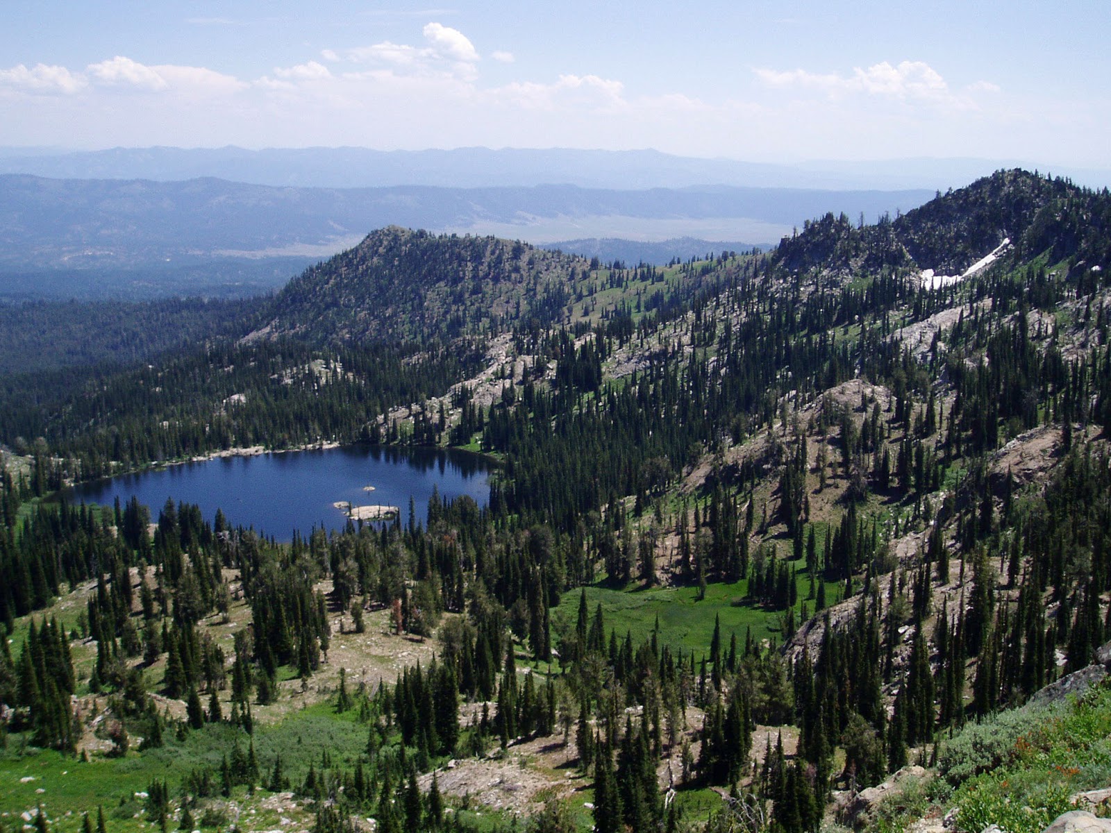
    Blue Lake! 
  • Hike to Blue Lake - This is the easiest hike by far of the group I'm recommending this week. I call it the "Blue Lake Family Special" in Boise Trail Guide. It's only 1.3 miles round-trip to the lake and back from the Snowbank Road. The trail descends .65 miles to the lake. Hang out at the lake, go swimming or fishing, and then hike back. Bring a lunch and some drinks to enjoy your time at the lake. Getting there: Take Idaho 55 to the Cabarton Road turnoff, next to Clear Creek Station, several miles north of Smith's Ferry. Follow Cabarton Road to USFS Road #435, the road to Snowbank Mountain. Drive 10.5 miles to the trailhead/parking area for Blue Lake.
There you have it!
--------------------------
Couple of other tidbits:
  • McCall is hosting a mountain bike festival this weekend, Saturday and Sunday! There will be group rides, shuttles, BBQ, beer and family fun. See the 2015 Festival Program. This is a great opportunity to learn about riding opportunities in McCall.  
  • The Owyhee Mountains are closed to public use inside the burn zone until next year. BLM officials said they're asking the public to stay out of the burn zone so they can work on rehabilitation efforts and for public safety. This includes the Wilson Creek area and Jump Creek area. The Soda fire area is the nation's top priority for rehab work according to the BLM National Director, Neil Kornze, who was in Boise yesterday. Succor Creek and Leslie Gulch were not affected by the fires. 
  • Ridge to Rivers is looking for volunteers to survey foothills users Sept. 19th and 26th. You can sign up online here.  
  • There's still time to participate in the Treasure Valley Cycling Alliance's Goathead Contest. See details at their Facebook page. Basically, you post a picture of the largest goat head plant you've pulled, and the whole pile of goat head plants you've pulled and you could win a growler of beer, bike decals, a bike bell and more! Plus, bragging rights of course! 
Have fun!
- SS

Thursday, August 13, 2015

Super fun biking events coming up! Tour de Fat Saturday! Food and wine road ride, too!

I donated to BBP to get that nice Double D bra at Tour de Fat 

Elena, right, looks charming in her flower hat 
Hi all, 

Imagine 20,000 bicycle wheels rolling down the streets of downtown Boise for the 2014 Tour de Fat parade. Were you there? I was dressed up as Captain America with a red cape and not much else. Ten-thousand cyclists -- all dressed up in some kind of wild and wacky costume, some of them quite clever -- showed up and set a record for the biggest participation in the Tour de Fat event in Boise since it started 14 years ago. 

Now here's your chance to make the 2015 Tour de Fat even bigger than ever! The goal is to have at least 12,000 participants in the parade and raise $90,000 for your favorite cycling non-profits -- Treasure Valley Cycling Alliance, Southwest Idaho Mountain Biking Association (SWIMBA) and Boise Bicycle Project (BBP). Get your costume together, drag your friends and everyone in your household down to the parade, and partake in the state's largest bike event! Do this while sporting a really big grin, show off your cool costume and drink plenty of beer to help the cause.
One of the many cool things
you'll see at Tour de Fat 
Bicyclists for as far as you can see in the Tour de Fat parade ... that's so cool! 
Spending $$ on beer = $$ for better cycling opportunities in our community. The funds go directly to new trails, cycling-advocacy activities, bike donations to children and families in need, and bike education. Over the last 14 years, the event has raised approximately $400,000 for the non-profits mentioned above. That's HUGE people. Let's keep growing this event! 

See the 2015 Tour de Fat web site for the music lineup and event details. Hint: The parade starts 
at 11 a.m. at Ann Morrison Park. Have fun!

Also on Saturday, the 43rd annual Bogus Basin Hill Climb is happening for ambitious road cyclists. Start time is 9:30 a.m. You can register online. Not sure who's showing up, but the really strong riders can ride to Bogus in roughly an hour or less. Total animals! My best time in my 20s was 1 hour, 20 minutes. It's always a great workout to ride to Bogus, and it's a hoot to ride back downhill! 

Here's a bike-racing calendar in case you'd like to plan for future events. 

I'll be in Coeur d'Alene on Saturday, picking up my packet for a week of road rides in the Idaho Panhandle courtesy of RideIdaho. This is the first year I've participated in RideIdaho. It's a fully supported ride that covers about 400 miles in a week. This year's route starts and finishes in Coeur d'Alene, doing a big triangle across the Panhandle into Western Montana, and then up to Moyie Springs and Bonner's Ferry before going south to Lake Pend Oreille, Sandpoint and Coeur d'Alene. 
Hope we don't run into too much smoke from the fires! 

The Treasure Valley Food Coalition is sponsoring a 50-mile food and wine ride called "Fruitful Fields" on Sunday, Sept. 20th in SW Idaho. The loop ride will begin at Hat Ranch Winery on Plum Road at 9:00 a.m. and take cyclists on a tour of farms and wineries throughout Canyon County. Along the way, you will taste fresh, local fruit, grilled (lamb) merguez sausage, grilled fingerling potatoes, local cheese and crackers, and sample some of Idaho’s award-winning wines.  

Upon returning to Hat Ranch Winery, you will be treated to a catered luncheon from Three Girls Catering, featuring local meats and produce while Hat Ranch pours wine for tasting. All participants will receive a reusable jute shopping bag filled with local produce, tokens to use at the Boise Farmer’s Market, and coupons for the Boise Co-Op.

The bike route will take you along the Snake River, past Lake Lowell, and through the rolling farmland, vineyards and orchards of Canyon County. Three rest stops along the way will provide tastings, water, medical reserve corps volunteers and pink porta-potties! The event costs $65. Register on the Treasure Valley Food Coalition web page. 

Have fun and have a great ride!
- SS 

Thursday, August 6, 2015

Family Reunion recreation tips from Stueby - Our Fabulous Experience in McCall


Wendy and Ellie on the beach 
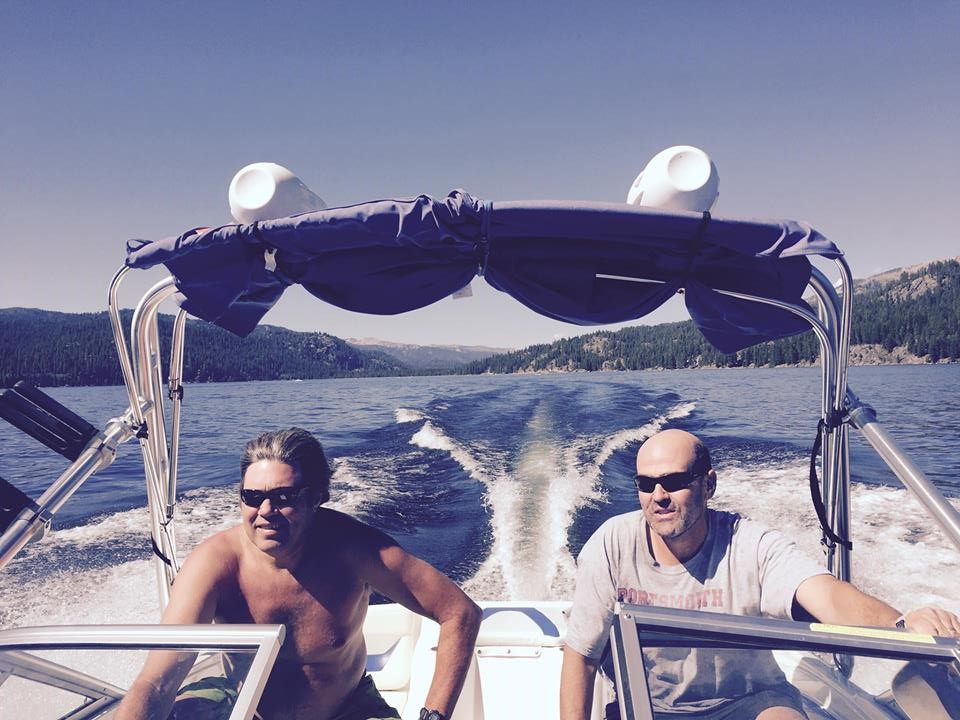
Steve and cousin John cruising around on Payette Lake 
L-R, Theo Coonen, Haiti and France, Peter Damon, L.A., John Damon, R.I.
Greg and Sandra Coonen, Andora on the Stueby raft 

Back of the boat: Steve, Drew and Jack Damon  

My sister, Kathy, Minnesota, Nolan and Andrew Stuebner, Maine  

Jonesy at the helm

Hi all,  

Almost 40 Stuebner relatives from all over the globe flocked to McCall last week for seven days of non-stop fun. Our family members just RAVED about the beauty in McCall, and thoroughly enjoyed the mix of structured outdoor activities and hang-loose time as well. 

I wanted to share our experience in terms of the recreation activities, rental toys and rental homes that we lined up in case this might be useful for other folks planning a reunion in McCall. Just to give you a flavor, we had a welcome dinner Sunday night, I took folks mountain biking on Monday morning and then Burgdorf Hot Springs in the afternoon, we did a 4-hour horseback ride with Yahoo Corrals on Tuesday, we went whitewater rafting on Cabarton Wednesday, and capped things off with a catered dinner Thursday night. Friday was an open day for lake activities and beach time, and then folks departed on Saturday.  

First and foremost, the McCall location has it all -- big Payette Lake right there front and center, Ponderosa State Park so close by, top-flight lodging at Shore Lodge, the Payette National Forest all around town, Bear Basin Trails 5 minutes from town, the Payette River down the valley, lift-served activities at Brundage Mountain, great trails and shuttles at Jug Mountain Ranch, ditto at Tamarack, Paul's Market and Ridley's -- both big grocery stores -- plus, excellent outdoor stores, restaurants, shops, ice skating, and many rental properties for lodging.

So, I had confidence that McCall would blow people away with its stunningly beautiful scenery and amenities. We set up a full week for the reunion, July 27-Aug. 1. I encouraged family members to come for the whole time ... and almost everyone did. They all flew into the Boise airport, rented cars and zipped to McCall. We did try to car-pool to the maximum extent possible with our fleet of vehicles.   
Kathy Damon, R.I., Sandra Coonen, Andora, Kathy Stuebner, my sister,
Bryn Stuebner, Mountain View, CA, in the big log cabin in Luck's Point.  
Key things to pin down early: 

1. Rent a lakefront home or several lakefront homes six months in advance or more. I knew my cousins from Rhode Island, Los Angeles, France and Andora would want beach-front access. My Mom rented a beautiful lakefront home a stone's throw from Ponderosa Park. We got lucky on another place, renting a large log cabin in Luck's Point, which had private beachfront space and a boat slip for our use 24/7. The more reasonably priced homes go fast! Expect to pay $500/night or more for lakefront. Check with InIdaho.com and vrbo.com for options. 
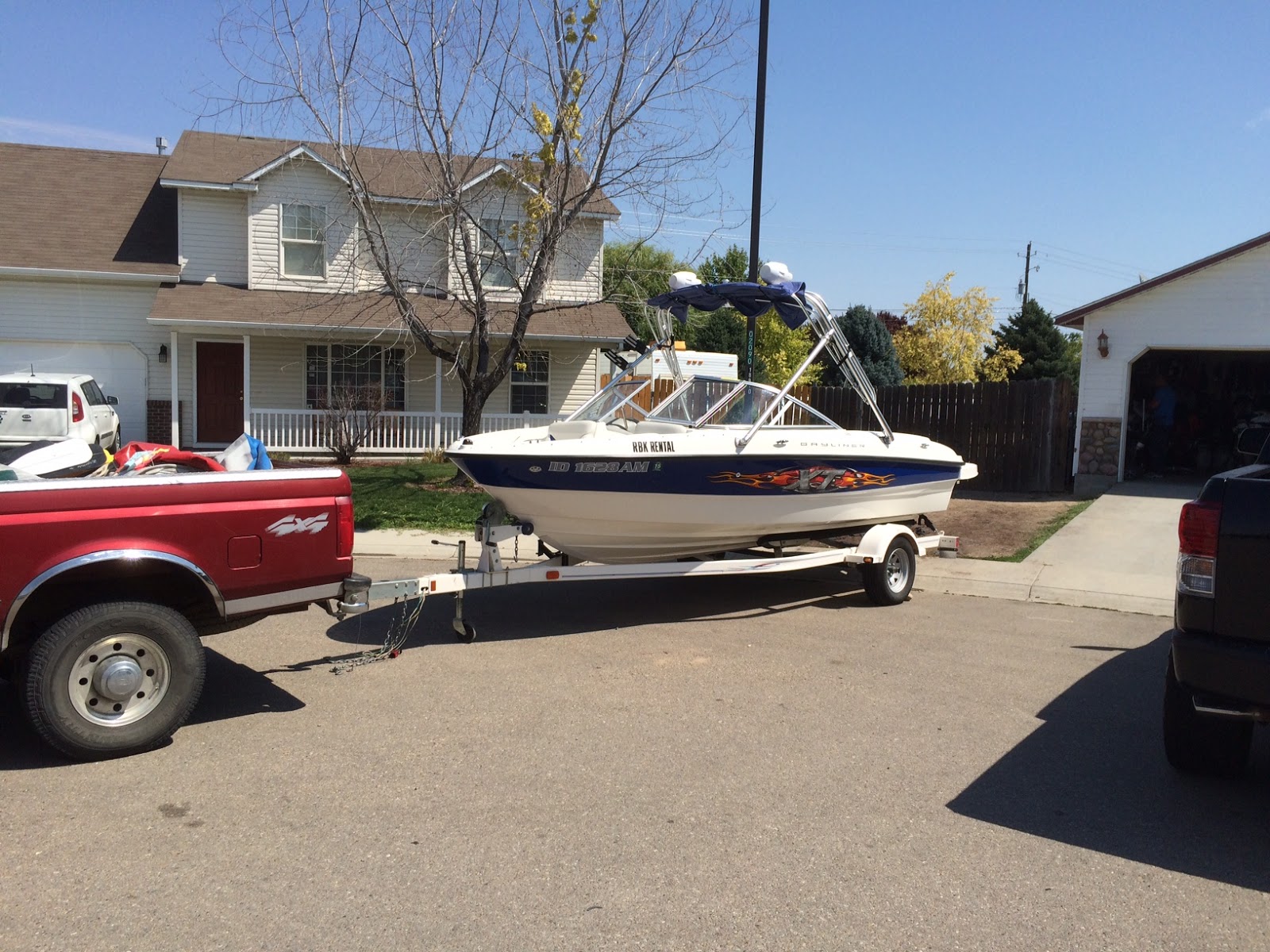
18-foot Bayliner from RBK Power Sports Rentals rocks! 
2. Rent a power/ski/tube/surf boat that you can use 24/7. Having a powerboat at your disposal with lakefront property and a dock is positively LIVING LARGE in McCall. I tried to rent local in McCall but the vendors up there wouldn't let me keep the boat overnight. So I kept looking and found RBK Power Sports Rentals in Nampa. They have a nice 18-foot Bayliner with a 4.3-liter inboard/outboard engine for $250 a day. I put a 50% deposit down on the boat in the spring, and paid the balance when I picked it up on July 27. I towed the boat to McCall with my truck. Very smooth ride. We had so much fun on that boat -- tubing, water skiing and touring around the lake. 

3. Book early at Shore Lodge for the July time period, which is super high summer season. My aunt and uncle stayed there, plus my brother Jim and his wife, Bryn, stayed there to enjoy some alone time on the week of their anniversary. Getting a tee time was tough for my aunt and uncle but they did play one day on the Whitetail course and loved it. They also enjoyed playing golf at Jug Mountain Ranch.
Group shot in a tall-grass meadow 
Chloe, Peter, Drew, Liz, Tristan and Bridget  

Riding into the meadow 
4. Horseback riding with Yahoo Corrals. We had a large group, thinking initially that we'd have as many as 29 people going on the horseback ride. As it turned out, we had 20. I booked our trip early, and they didn't require a down payment. That was cool since everyone in our group would pay their way on the ride. It was $110/person for a 4-hour horseback ride plus BBQ dinner. Great value for the cost! 

And boy, they took us on a sporting horseback ride! We started at Yahoo Corrals on the west side of Warren Wagon Road, and rode right out onto trails from there. We rode up some steep uphills and downhills, requiring you to lean way forward on the saddle on the uphills or putting all the weight on the stirrups on the downhills. I was so proud of my son, Drew ... it was his first horseback ride and he rode like a champion for 4 hours! Half way through, we rode into a gorgeous mountain meadow and took pics of the group on horseback. Very cool! 

In retrospect, I thought a 2-hour ride would have been plenty, but I didn't want to short my sister, Kathy, Wendy, or my niece, Liz, all of whom love to ride! My only complaint with Yahoo Corrals is that they didn't provide optional beer/wine with dinner. We had to zip back to town to take care of that! No biggie! We were mighty thirsty after the ride! 

5. Finding guides and boats for whitewater rafting. We had 25 people to take rafting, but instead of calling an outfitter, I tried to organize the trip by using my own raft, borrowing more rafts, and persuading my whitewater friends to bring a boat or guide one of them. You have to start early pinning down river guides because they're often busy doing more important trips during the summer 
months. I was fortunate to get Steve Jones, Doug Lawrence and Howard Miller to be our guest guides. Top flight! Wendy and I were the other guides, and it all worked great! The shuttle vehicle situation was too complicated to pull off in one fell swoop, but oh well. Everyone had a great trip on Cabarton. Some of my family had never rafted before. We used all paddle rafts, except Jonesy rowed an oar raft, which are perfect for taking young kids on the river. 

If you don't have your own stuff, try Cascade Raft & Kayak, Bear Valley, Idaho Whitewater Unlimited or Tamarack for booking a Cabarton trip. 

6. Reserve a great spot for a special catered dinner as a grand finale for the guests. We booked a beautiful spot behind the Ponderosa Park Visitor Center. The shelter is shaded. It looks out onto a spacious lawn, large trees and Payette Lake. The cost was about $200.00, very reasonable for a large group. We used Incahoots BBQ as the caterer. They served Tritip and wild salmon, scalloped potatoes, vegetables, salad, and brownies and cobbler for dessert. Yum! 

As the sun set faded into a rouge glow over the distant treetops that evening, my sister Kathy led us all in some wonderful songs with her angelic voice and folk guitar to cap off a memorable evening. 

I must confess that I was unexpectedly emotional as I stood up to give a toast to all of the Stuebner/Damon/Coonen/Salzman relatives that evening. The deep love I have for McCall and everything around it merged with the deep love I have for my family, and I guess it was a little overwhelming. But it was just so cool and gratifying to me that everyone came to McCall, and had such an awesome time. 

Ultimately, at family reunions,it's about the family, renewing bonds and friendships, and catching up on everyone's lives. Quality time! If everyone hadn't shown up, it wouldn't have been the great success that it was. Everyone in my family shows up! And they do it consistently. I love that! 

I'm looking forward to the next reunion! Who knows where it'll be! But I will be there! 
-- SS