 |
| View looking south from Observation Peak (courtesy Idahosummits.com) |
 |
| View of Baron Peak from the top of Observation Peak (courtesy Idahosummits.com) |
Well, the weather forecast looks pretty fab this weekend for hiking! Temps should be in the 70s in the higher elevations in the afternoon on Saturday, so it seems like a perfect weekend to bag a peak or hike to a high mountain lake.
Drawing from my recently updated Boise Trail Guide: 90 Hiking & Running Routes Close to Home (Spring 2015), here are five high-elevation hiking destinations guaranteed to please close to home:
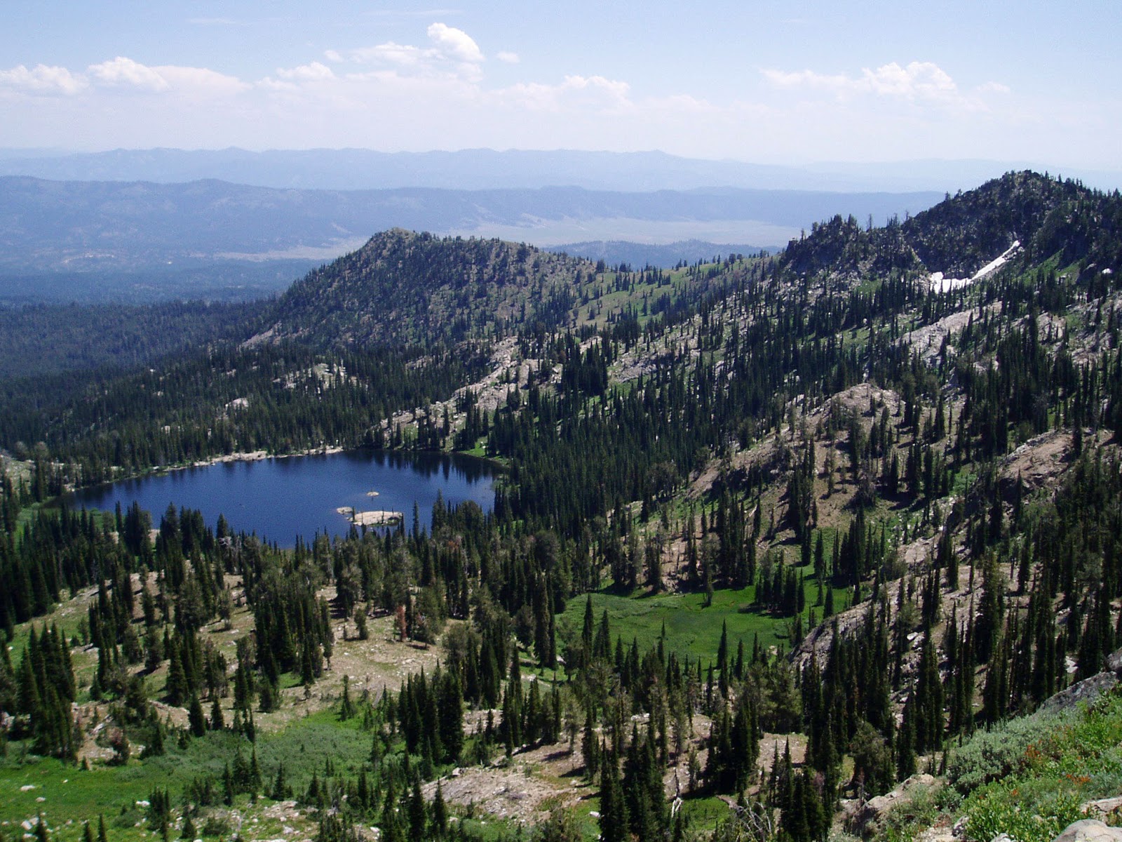
- Observation Peak (9,151 feet), Sawtooth Wilderness - This is the only peak in the Sawtooth Mountains accessible by an actual trail. The view of the Sawtooth Range from here is truly SPECTACULAR! The route from Grand Jean is 12.5 miles ... you can go out and back in a day. Travel time is 5-7 hours. Difficulty: Strenuous! (Over 4,000 feet of gain!) How to get there: Go to the Grand Jean trailhead in the Sawtooth Wilderness, east of Lowman, and take the Trail Creek Trail to Observation Peak. After climbing several miles, go left at the junction with the Trail Creek Lakes trail and climb to a saddle, At a three-way junction, go left to climb Observation Peak. Bring a lunch and enjoy your time on top! Retrace your tracks to the trailhead.

Jennie Lake - Hike to Jennie Lake, northeast of Idaho City - It's 9 miles out and back to Jennie Lake, with 1,950 feet of elevation gain. Bring your backpack and camp at the lake if you have the time. Hiking time is 2.5-3 hours one-way. It's a beautiful pine-scented hike to Jennie Lake. Good one for kids over 8 years old, too. Getting there: Take Idaho 21 past Idaho City and Mores Creek Summit to Edna Creek Road (USFS Road #384). Turn right and follow #384 for over seven miles to the trailhead. When you get to some hairpin turns, watch for a spur road on the left leading to the trailhead. Follow Trail #197 to Jennie Lake.

Tripod Peak Lookout - Hike to Tripod Peak on West Mountain, near Smith's Ferry - It's almost 12 miles out and back to Tripod Peak. The hike is rated strenuous, featuring 3,160 feet of elevation gain from the trailhead. Travel time is about 5-6 hours out and back. West Mountain Trail is shady in the lower elevations, and then you break into the open in the last mile or so to the peak. Once on top, you can enjoy 360-degree views of Long Valley and the country north of Emmett to the west. Getting there: Take Idaho 55 to Smith's Ferry. Turn left on USFS Road #626 toward Sagehen Reservoir. Follow the dirt road about three miles to a signed trailhead on the right for West Mountain Trail. This is your route to the top of Tripod.

Huck likes Around the Mountain just as much as I do ... - Hike the Around the Mountain Trail at Bogus Basin - Enjoy a cooler, forested environment at Bogus on this wonderful loop around Shafer Butte. It's probably even more fun to bike this route than to hike it, but it's a great hiking loop, too. It's 9.2 miles to do the loop, with 2,440 feet of elevation gain. Hiking time is approximately four hours at a robust pace. You'll enjoy multifaceted views of the Boise National Forest from the trail as it wraps around the mountain. Bring plenty of food and water. Getting there: Park at the lower lodge. Take Deer Point Trail #91 uphill about a mile or so to a junction with the Around the Mountain Trail. Follow the well-marked trail as it loops around the mountain. When you emerge at the Pioneer Lodge, you'll have several options for the final descent to the lower lodge. Take your pick.

Blue Lake! - Hike to Blue Lake - This is the easiest hike by far of the group I'm recommending this week. I call it the "Blue Lake Family Special" in Boise Trail Guide. It's only 1.3 miles round-trip to the lake and back from the Snowbank Road. The trail descends .65 miles to the lake. Hang out at the lake, go swimming or fishing, and then hike back. Bring a lunch and some drinks to enjoy your time at the lake. Getting there: Take Idaho 55 to the Cabarton Road turnoff, next to Clear Creek Station, several miles north of Smith's Ferry. Follow Cabarton Road to USFS Road #435, the road to Snowbank Mountain. Drive 10.5 miles to the trailhead/parking area for Blue Lake.


--------------------------
Couple of other tidbits:
- McCall is hosting a mountain bike festival this weekend, Saturday and Sunday! There will be group rides, shuttles, BBQ, beer and family fun. See the 2015 Festival Program. This is a great opportunity to learn about riding opportunities in McCall.
- The Owyhee Mountains are closed to public use inside the burn zone until next year. BLM officials said they're asking the public to stay out of the burn zone so they can work on rehabilitation efforts and for public safety. This includes the Wilson Creek area and Jump Creek area. The Soda fire area is the nation's top priority for rehab work according to the BLM National Director, Neil Kornze, who was in Boise yesterday. Succor Creek and Leslie Gulch were not affected by the fires.
- Ridge to Rivers is looking for volunteers to survey foothills users Sept. 19th and 26th. You can sign up online here.
- There's still time to participate in the Treasure Valley Cycling Alliance's Goathead Contest. See details at their Facebook page. Basically, you post a picture of the largest goat head plant you've pulled, and the whole pile of goat head plants you've pulled and you could win a growler of beer, bike decals, a bike bell and more! Plus, bragging rights of course!
- SS


1 comment:
How come we've never done Observation Peak together? - I didn't even know about it! Not that I LOVE 12 mile days - but I can do them without a pack. Maybe make Huck carry my lunch?
Post a Comment