Showing posts with label Biking. Show all posts

Thursday, May 4, 2023

Support Valley County Pathways in its quest to build a valley-wide trail system from Cascade to McCall

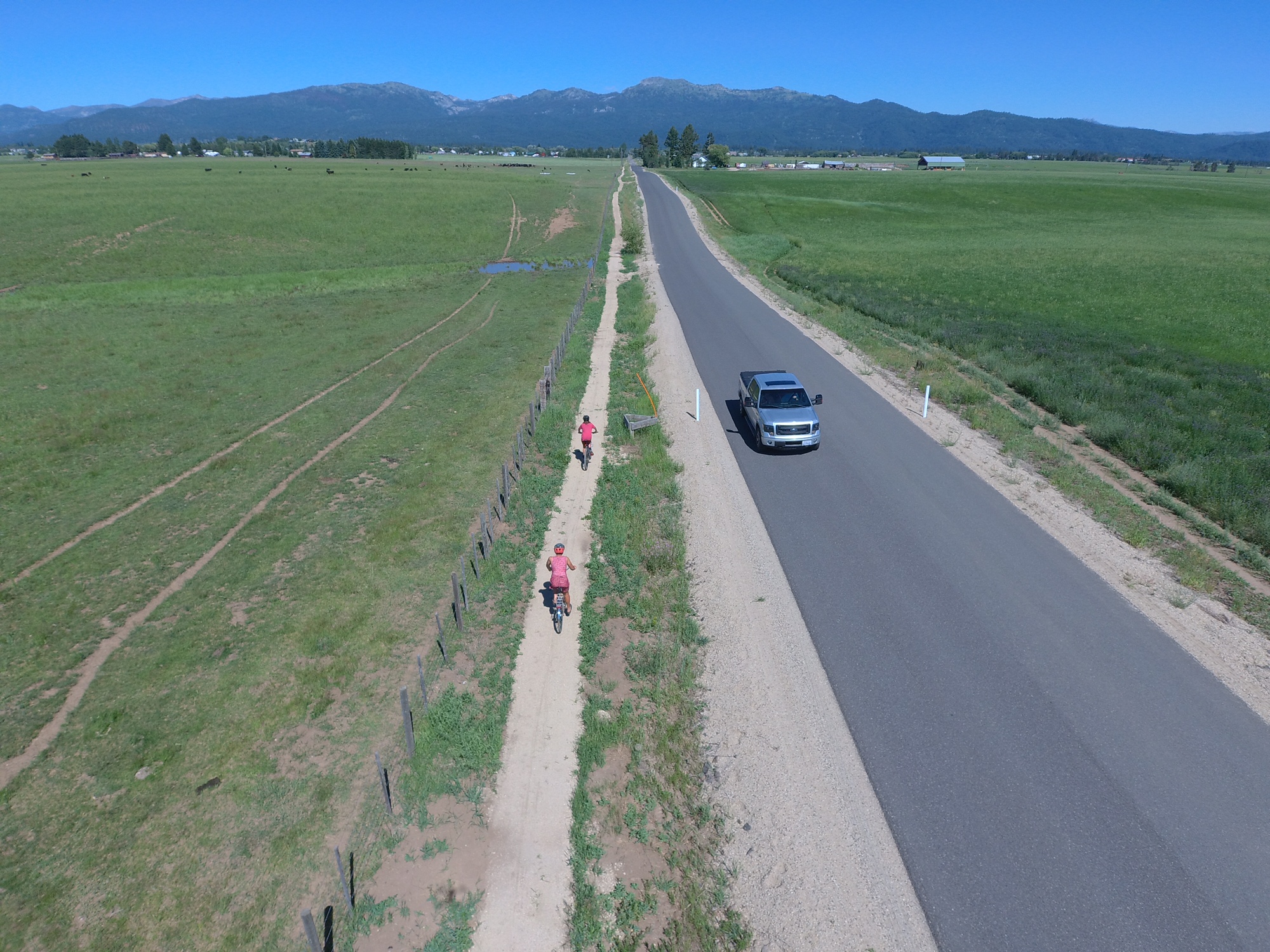
New "singletrack sidewalk" trail along Heinrich Lane, south of McCall 

Hi all,

On the fourth and final day of Idaho Gives, I'd like to encourage you to support Valley County Pathways, a nonprofit group I've been leading for almost 20 years.  

Our vision is to build a 70-mile, valley-wide trail system from Cascade to McCall and New Meadows, where we could connect to the Weiser River Trail. 

Put another way, our quest is to build a trail system that matches the grandeur of Long Valley.

For this year's Idaho Gives campaign, our goal is $15,000. We've received a pledge from a trail supporter who will match all of our contributions up to $15,000, for a total potential of $30,000. 


Our new video tells our story. 

We are inspired by the Boise River Greenbelt, the Wood River Trail and the Trail of the Coeur d'Alenes. Those long-distance trails are the pride of their communities, and anyone and everyone can enjoy them. 

My feeling is we have 10 years to get a valley-wide trail system in place in Valley County, or we may never get it done. We need to act now! And that takes money! 

I got started with Valley County Pathways in 2004, not long after the first $10M open space measure passed for the Boise Foothills. I was heavily involved in that open space campaign, and I still feel like it's one of the most important things I've done in my life. It was so cool to be part of a broad grass-roots effort that got embraced by the whole Boise community. 

From that experience, I learned that we can shape and enhance our communities and landscapes with new trails, open spaces and wildlife habitat with a LOT of DEDICATION and HARD WORK! 

I've been trying to walk the talk for 30 years. In 1992, I was the founding president of the SW Idaho Mountain Biking Association (SWIMBA), when Ridge to Rivers was just getting started. We all wanted to improve our trail systems. SWIMBA partnered with Boise REI and R2R to build Shane's Trail, Sidewinder, Trail #1 over to Bob's, Redtail Ridge, and Seaman's Gulch trails in the 1990s. 

Erin and Ed Roper ride in the grand opening of trails in McCall, a VCP event. 

At the same time, I was producing new trail guides like Mountain Biking in Boise, Mountain Biking in McCall, and Mountain Biking in Idaho (80 rides statewide).  

So I was a pretty well-traveled trail guy when I started working full-time for Tamarack Resort in government affairs in 2003. I knew there was an abandoned railroad line that ran through the middle of the valley, and I saw the abundance of public land along the western shoreline of Lake Cascade. I read that the Bureau of Reclamation recommended a walking/biking trail around Lake Cascade in a resource management plan, and my eyes just about popped out of my head! 

We started Valley County Pathways at a time when the Rails to Trails movement was taking off big-time nationwide. 

Eleanor Putman speaks at the trail dedication in 2006
on the north end of the Crown Point Trail.  

But it turned out that the old rail line from McCall to Cascade had been abandoned in 1979, pre-dating national legislation that gave railroad companies tax incentives to gift rail lines to nonprofit groups for conversion to recreation trails. The old railroad line in Valley reverted to private ownership in many locations, so that has made our work much more difficult. 

A few landowners, including the Putman Family and the Whiteman Family, have gifted old RR line property to Valley County Pathways, for which we're eternally grateful.

Long story short, since 2004, we have built the bookends of a trail system in Cascade and McCall. Now we're working on bridging the gaps in the middle of the valley. 

Hugh Fulton, right, and Damon Yerkes on the Boulder Creek Trail. 

Currently, we are partnering with Valley County Parks and Recreation to craft a 5-year and 10-year build-out plan for the valley-wide trail system. We know the price tag will exceed $5M.      

I'm super excited about the whole thing. 

There's a ton of state and federal money available right now for trail projects. We need private funds to provide match for projects, provide steady upkeep on our trails, and to assist with trail construction. We also partner with our friends with the Central Idaho Mountain Biking Association, the West Central Mountains Economic Development Council, the McCall Chamber of Commerce, the City of McCall Parks and Recreation Department, the City of Donnelly, and the community of Cascade to stretch our trail dollars as far as possible. 

I don't usually ask people to donate to any particular cause in my blog, but this is a case that's dear to my heart. Please do what you can for Valley County Pathways! 

Thank you! 
- SS 
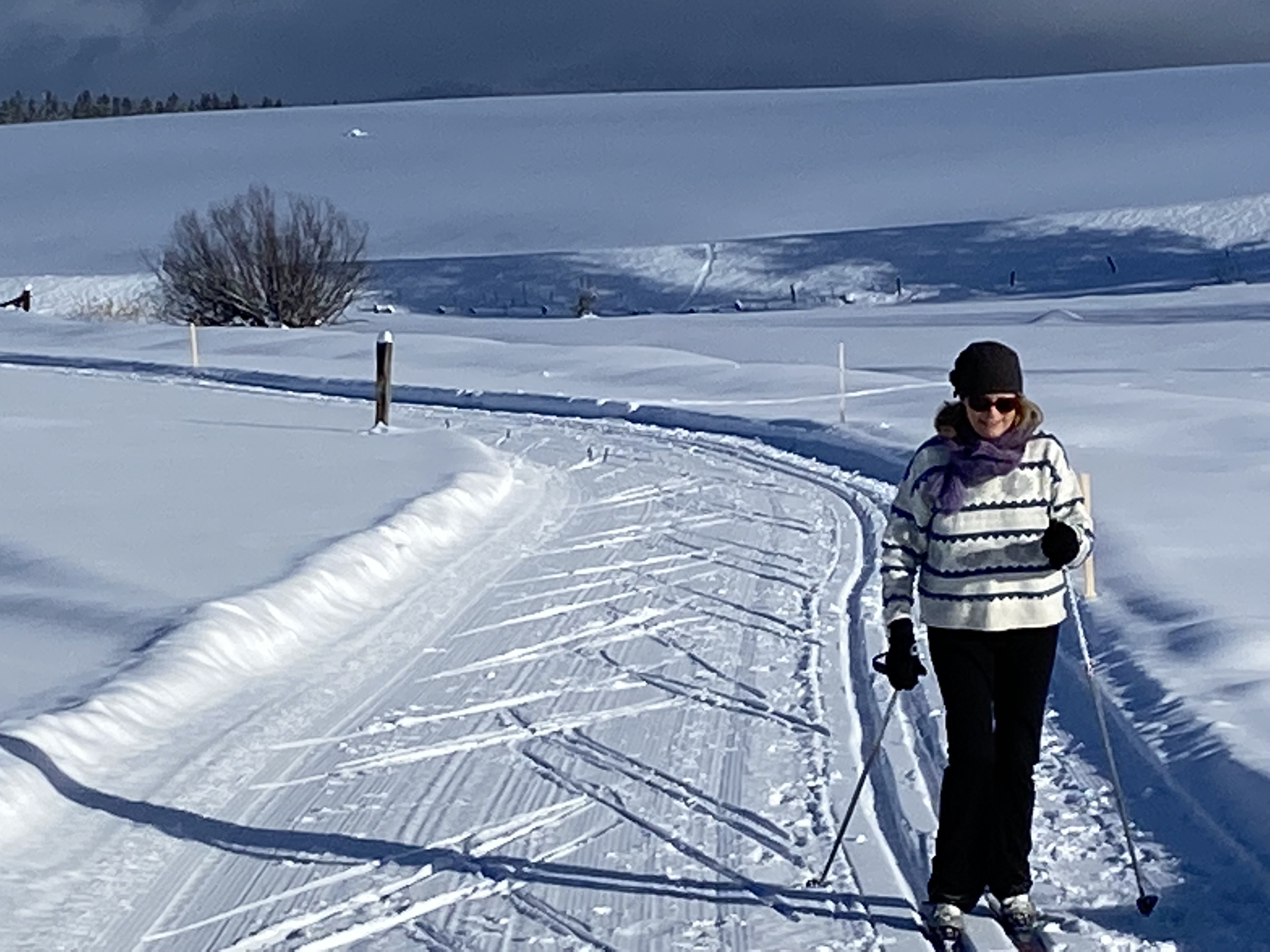
The North Valley Rail-Trail doubles as a xc ski, snowshoe and snow bike trail. 


Thursday, April 27, 2023

OMG! Five days of 80 degree weather moving into May! Five outdoorsy ideas for Spring!

Wow! 

Hi all, 

For the first time this spring, we've got a wave of really nice, sunny warm weather coming our way for multiple days in a row! In the Boise Valley, I'm seeing high temps of 80 degrees 5 days in a row from Saturday through next Wednesday. Wow! What a change! 

Now we can stop whining about the long, cold, snowy, icy winter, and look ahead to springtime outdoor activities! 

Here are my Top 5 ideas: 

Arrowleaf Balsomroot beginning to bloom in the Hillside to the Hollow Reserve 

1. Hit the trails! Go hiking! Lower to mid-range trails in the Boise Foothills are stellar right now. See the Ridge to Rivers web site for maps and ideas of where to go. Trails in the Owyhee Front Range and Wilson Creek area in particular would be perfect as well! 

The Owyhee River - Pruitt's Castle 

2. Plan a spring desert river trip on the Owyhee or Bruneau River with friends, if you have experience and your own equipment, or book a trip with an outfitter. Here's a list of outfitters who run the Jarbidge/Bruneau canyon and the Owyhee. 

See my post about the 2023 River Outlook for IOGA. With deep snowpack, this is an excellent year to do a trip on the Owyhee or Bruneau when the season will be longer than usual!      

3. Tackle the Boise Grand Slam Peaks - hike to the top of four mountains nearby - Cervidae, Kepros, Shaw Mountain and Heinen Peak. With this warmer weather ahead, I'd expect the wildflowers to start popping and those hikes should be fantastic! One thing's for sure, they're always a workout! See my post about hiking the Boise Grand Slam Peaks

Leslie Gulch 

4. Go self-support camping in the Snake River canyon, Succor Creek State Park or Leslie Gulch areas in the Owyhee Canyonlands. 

5. Go biking on the Greenbelt, do a nice long road bike ride, or take your gravel grinder bike for a spin on the Owyhee Backcountry Byway. Do something kind of epic and enjoy the sunshine!  

Have fun! Don't forget the sun screen! 
- SS  

Thursday, June 30, 2022

10 must-see, must-do outdoorsy ideas for the 4th of July holiday and Summer 2022

If you've got a suitable 4x4, truck camping in hard-to-reach places can be gratifying! 

Hi all, 

The 4th of July long weekend is coming up! Many people have already made plans, but in case you haven't and need some inspiration, I am recommending 10 must-see, must-do activities not only for this weekend, but for the whole summer season:

1. Float a river (day trip) - we're blessed with so many options here, but the summer season is now open on the Boise River! See details about floating the Boise River, renting a raft, etc. Warm summer weather also gets people jazzed about floating the Payette River, either the Main Payette, South Fork Payette or Cabarton run on the North Fork. Check with Cascade Raft & Kayak, Bear Valley RaftingIdaho Whitewater Unlimited and the Payette River Company about guided trips. The Payette's calmer sections are great for stand-up paddle boarding (SUP), sit-on-top kayaking and canoeing. See my post about 10 premium locations to go kayaking or SUP'ing in SW Idaho. 

Float a river! This is on the Cabarton stretch of the Payette River. 

2. Climb a mountain - The pinnacle is to climb Mount Borah, but there are so many other options in Idaho, with dozens of peaks over 10,000 feet and 8 peaks over 12,000 feet. See Idaho mountain expert Tom Lopez's list of recommended mountain peaks. McCall mountain expert John Platt also has an extensive list of peaks and mountains that he's climbed. 

3. Ride the ski lift to the top of Bogus BasinBrundage Mountain, Tamarack Resort or Sun Valley and go hiking or biking from there.

4. Take your kids fishing - See the list of Idaho Fish and Game's Family Fishing Waters to find some great recommendations close to home.

5. Go backpacking in the Sawtooths, White Clouds, Pioneers or Big Lost Mountain Range. Snow levels are at roughly 7,500-8,000 feet in the Sawtooths, creek crossings are high and hazardous, See Michael Lanza's recommended hikes in the Sawtooths in his blog, the Big Outside. See a recommended major loop in the White Clouds in Backpacker mag. For a great hike in the Pioneers, see my blog post about hiking Broad Canyon. For the Big Lost range, see this overview in Summit Post.com.   

6. Sleep under the stars in a dark sky venue like Bear Valley in the Boise National Forest, the Owyhee Canyonlands or outside of Stanley.

Catch a trout on the Middle Fork Salmon River. 

7. Fly into the Middle Fork of the Salmon River and go fly-fishing for native cutthroat trout. Air taxi services in Boise, Cascade or McCall can take you into the Middle Fork in less than an hour. All fishing is catch and release.


8. Go mountain biking on a classic loop trail like Fisher-Williams in the White Clouds, Loon Lake north of McCall or Around the Mountain at Bogus Basin. 

Climbing up a short hill to finish the Fisher-Williams Loop (courtesy Salsa cycles)

9. Go SUP'ing, boating or swimming in a refreshing, natural Idaho mountain lake like Payette Lake, Redfish Lake, or Priest Lake. See my post on 10 perfect paddling destinations for kayaking and SUPs in SW Idaho for ideas. 

10. Go car camping in the Middle Fork Boise River area, North Fork Boise River area, the Middle Fork of the Payette River area or Bear Valley. There are some reservable fee campgrounds and some dispersed camping areas. See the Boise National Forest, Payette National Forest or Sawtooth National Forest web sites for more information. 

For further enrichment on Idaho bucket list trips, see an Idaho bucket list post from Boise State radio, and a post that I did listing another 30 bucket list trips that they didn't cover. 

Remember: Be smart about Fire Safety this weekend ... we put out a post yesterday from Recreate Responsibly Idaho reminding folks that no fireworks are allowed on public lands, no exploding shooting targets, and be sure to put out your campfire before you leave the site ... make sure it is completed out, cold to the touch. 
- SS

Thursday, March 10, 2022

R2R green-lights lower foothills trails east of Bogus Basin Road; Beautiful weekend ahead! I'm going spring skiing ...

Spring season is opening in the Boise Foothills! Spring can bring windy days!
Breezy conditions at the Corrals-Scotts jct. prepared Huck for liftoff,
with Wendy Wilson.   

Hi all,

After months of cold weather and muddy trails, hikers, runners and mountain bikers will delight in knowing that Ridge to Rivers is green-lighting lower Boise foothills trails this week - trails east of Bogus Basin Road including Table Rock, Military Reserve, .

Here's the R2R Trails Report on Thursday: "Things are drying out, and trail repairs are beginning in the Foothills. There are long, lingering sections of mud on mid-elevation trails, primarily west of Bogus Basin Road where overall we have soils with a higher clay content (ie. Sweet Connie, Peggy's, Chukar Butte, Polecat Loop). East of Bogus Basin Road you can stay on dry trails all the way up to the top of Scott's Trail in the central Foothills, and to Lucky Peak Trail out east.

Expect to encounter trail maintenance along Cobb Trail and West Highland Valley Trail in the Boise River WMA currently.
NOTE: We are also in the middle of repairing a large cavity in the trail along Lower Hulls Gulch #29, so expect the need to negotiate that project for at least a week."

Doug Lawrence and Huck climbing from Military Reserve to Crestline trail. 

I personally rode Military Reserve to Shane's Summit on Wednesday morning, just after a light skiff of snow fell overnight, and everything was dry and rideable.

MARCH 9TH TRAIL R2R CONDITION REPORT:
"It looks like it's going to be a cool and cloudy day in the foothills. There is even a slight chance of snow this morning. Trail conditions will mostly remain the same as we've seen over the last few days. Corrals from the Scott's Junction down is clear and dry. Scott's is mostly dry with a few snow patches and some mud when the sun warms the tread up. Military Reserve, Hulls Gulch and Table Rock trails are clear and dry. You may encounter short sections of mud - be sure to walk through and not around. Happy Trails!"

So, the warm weather we had last week, plus winds, helped dry out the trails. The forecast for this weekend in Boise calls for warmer days each day, with high temps near 50 F on Friday, 60 on Saturday and 55 on Sunday. Wow! Enjoy!

Jane Rohling captured friends Matt and Alayne on horseback in the Wilson Creek area.  

Please BE KIND to Owyhee County trails, too!

I worked with the Owyhee County Commissioners to craft a press release about roads and trails that went out today. Here are some quotes from that release:
"MURPHY – (March 10, 2022) – Recreationists may be eager to get outside and enjoy the great outdoors as things begin to thaw in March, but it’s crucial that they respect the land in Owyhee County, stay off muddy trails and roads, practice proper trail etiquette, stay on designated trails and follow the rules set forth in Bureau of Land Management travel management plans, officials said.

“When Ridge to Rivers tells people to stay off muddy trails in the Boise Foothills, people often come out here in the Owyhee Front and look for trails and roads to ride as an alternative,” said Jerry Hoagland, an Owyhee County Commissioner and rancher. “But it’s just as important to avoid tearing up the trails and the land in Owyhee County as it is anywhere else.”

“We expect outdoor recreationists to treat the land and other trail users with respect when they’re out here in Owyhee County,” Hoagland said. “It’s really important that people do their homework before they come here to know where it’s appropriate for them to recreate and do it responsibly.”

Taking a moment in Reynolds Creek canyon on the Northwest Passage Loop. 
With L-R Quinn Stuebner, Steve Schneider, Ziggy and Jim Giuffre. 

Owyhee County is one of the most spectacular locations in the state of Idaho for exploring 4.9 million acres of public lands – canyons, high plateaus, lava features and more. Some of the most popular destinations are the Off-Highway Vehicle (OHV) Trails near Murphy, Wilson Creek non-motorized trails, Bruneau Canyon overlook, Big Jacks Creek, and the 100-mile Owyhee Canyonlands Backcountry Byway from Grand View to Jordan Valley, Ore.

Key issues that Owyhee County Commissioners are concerned about with regard to outdoor recreation in Owyhee County, include:

·     The need for mountain bikers to practice proper trail etiquette on non-motorized singletrack trails in the Wilson Creek area. Mountain bikers riding at high speed on the trails can spook horses and cause potential safety issues. The number of people mountain biking in the Owyhees has increased dramatically, officials said. Be sure to keep your speed down in case you encounter hikers or horseback riders on the trail.

The proper procedure is as follows: If mountain bikers encounter horseback riders on the trail, step off the trail, talk to the horseback riders so the horses know you’re human, let the horseback riders pass by, and continue your ride.


· Stay off muddy trails (universal for all users)."

See the Owyhee County Recreate Responsibly web page for more information. Please be a good trail ambassador and practice good trail etiquette when you're out enjoying the Owyhee trails. Thank you!

Great weekend for Spring Skiing too!


With the weather warming up dramatically this weekend, it should be a great time to go spring skiing at Bogus Basin, Tamarack Resort or Brundage Mountain. I'm planning on skiing Brundage on Saturday, when formal wear is encouraged for people like to dress-up! I'll be doing a live forecast for OpenSnow.com Saturday morning. I see Bogus is having an Atomic Demo Day on Friday, and Tamarack is hosting an Atomic and Armada Demo Day on Saturday.

There's a big storm coming next Tuesday, that could bring significant snow to Idaho statewide. See my latest forecast: Idaho Daily Snow.

Look for me in my white coat, red vest and red bow tie at Brundage on Saturday.

Have fun! - SS

Thursday, September 9, 2021

Cooler temps this weekend will make hiking, biking in the Snake River canyon a dandy choice!

Old homestead by the Snake River canyon trail.

Hi all, 

A cold front will pass through Idaho on Friday, bringing a 50% chance of rain that afternoon, but the rest of the weekend looks dandy, with cooler temps in the high 60s and low 70s in the mountains, and nudging 80 degrees in the valley. 

For my outdoor tip this week, I'm recommending several hikes in the Morley Nelson Snake River Birds of Prey National Conservation Area. The weather in the Snake River canyon looks really nice Saturday and Sunday, with low temps in the 50s and highs around 80 degrees.

Golden eagle on the Snake River Rim ... Courtesy BLM

We are moving into mid-September by next week, temperatures are moderating into fall mode, and that means fall hiking and biking in the Snake River area and the Owyhee Canyonlands will be prime-time in the next couple of months. 

1.  Hike or bike on the Snake River canyon trail to an abandoned homestead - Distance: 4.3 miles from the east trailhead. Difficulty: Easy. You can also access this trail from Celebration Park. The trail is mostly flat and easy to walk or ride. It's sandy in places. Bring a lunch, and hang out at the abandoned homestead with a view of the Snake River. When I visited the trail, I rode from the east trailhead over to Celebration Park and went back to the east trailhead, probably closer to 8 miles or so, but still an easy ride because the terrain is mostly flat.

Directions: Drive to Kuna. Take the paved Swan Falls Road to Swan Falls Dam, south of town. Take the dirt road running along the north side of the canyon several miles to the trailhead. The dirt road ends at the trailhead. The hiking and biking trail is non-motorized.  

The abandoned homestead is located near the ruins of a mud-and-rock house once occupied by a hermit named Doc Hisom. He died at age 94 in 1944 and was buried in Canyon County. He lived on the two-room rock house in a place called "Halverson Cove" about 20 yards from the Snake River. People visited him frequently. Something to think about when you visit.

More information about Doc Hisom courtesy Boise State University. 

From Boise State Powerpoint presentation about Doc Hisom

2. Hike to Halverson Lake from Celebration Park. You can enjoy a very moderate 6-mile round-trip hike to Halverson Lake and check out the petroglyphs on the rocks at Celebration Park. The park is managed by Canyon County. Great place to take kids. Teachable moment about the Bonneville Flood by the parking lot. 

You'll walk along a sandy trail next to the Snake River for several miles and then hang a left to walk through a series of large basalt boulders to Halverson Lake, next to the Snake River rim. 

Hike to Halverson Lake features an easy-going walk along the Snake River.

Driving directions: From downtown Boise, take I-84 west to Nampa. Take the Franklin Road exit (City Center) in Nampa. Go left. Follow Franklin to the intersection with 11th Street. Turn right and take 11th into downtown Nampa. Follow signs for ID 45 south. Proceed several miles south to Walters Ferry at the Snake River. Just before the river crossing, turn left on Ferry Road. Follow Ferry to Hill Road. Go right on Hill. Follow Hill to Sinker Road; turn right on Sinker and proceed to Celebration Park. You can see petroglyphs on boulders next to the parking lot, and learn about the Bonneville Flood. The artwork on display can be seen between 10 a.m. and 2 p.m. daily.

Halverson Lake

Celebration Park also is near Guffy Bridge, where you can do some hiking and exploring.


3. Explore the trails around the Guffey Bridge.


About the Guffey Bridge
(from the Idaho Heritage Trust) - The Guffey Bridge is Idaho’s largest historic artifact and was entered into the National Register of Historic Places in 1978. The bridge is the only Parker-Through-Truss Railroad Bridge in Idaho. It was designed to facilitate the hauling of gold and silver ore from Silver City mines at the turn of the century. The 450-ton steel structure is 70 feet tall and spans 500 feet over the Snake River. The cost of construction and other circumstances concerning the Boise, Nampa and Owyhee Railroad precluded hauling any ore across the bridge but it was instrumental in the agricultural development of the area. The bridge was abandoned in 1947, saved from demolition in the1970s and purchased and restored by Canyon County in 1989.

Here are more details about Snake River canyon hikes from All Trails.  

- SS

Thursday, August 12, 2021

Plan a fall trip to Priest Lake, and go camping, boating, SUP'ing, fishing, biking or hiking!

Riding the shady Lakeshore Trail on a warm summer day at Priest Lake. 

Hi all, 

It's no secret that Priest Lake is one of Idaho's crown jewels, nestled in the Idaho Panhandle. A recent trip to Priest Lake reminded me what a truly special place it is! For one thing, it's a BIG lake! Almost 20 miles long and 4.4 miles wide, with lots of coves and bays. Just a gorgeous place to be.

I went swimming, mountain biking and fishing on this particular trip, which was mainly a work trip. The boating is fantastic on the lake, and a newly deepened Thorofare channel provides clear and easy access for SUPs, kayaks, canoes and power boats to Upper Priest Lake.

The Thorofare Channel provides an intimate experience on the way to Upper Priest Lake.

But my oh my, Priest Lake has definitely been discovered! I couldn't believe how booked all of the lodging properties were at Priest Lake when I inquired in mid-June about 2 nights in late July. Nothing. Zilch. Everything was booked solid through Labor Day weekend. 

This September or October would be a great time to plan a road trip to Priest Lake. Try to reserve a spot at Beaver Creek Campground, book a spot at one of the State Park units on the east side of the lake, or reserve a cabin/room at Hill's Resort or Elkin's Resort. Beaver Creek CG provides excellent access to the Thorofare channel, as does the Lionhead unit of Priest Lake State Park. However, it looks like only on the Indian Creek unit of the park will be open this fall because of road construction.

Some things I'd recommend doing while you're visiting Priest Lake: 

  • Go mountain biking on the Lake Shore Trail. It's a 7-mile intermediate ride along the west shoreline of Priest Lake to the northern end of the lake. The singletrack trail winds through the dark shadowy cedar forests above the lakeshore and then drops down to the lake, where you can take a swim, and then climbs again into the trees. The trail is pretty smooth with some roots and rocks. Super fun! 
  • At the end of the Lake Shore Trail, you can keep going on the Priest Lake Navigation Trail, a singletrack which continues in a northerly direction and connects to Upper Priest Lake. The Navigation trail runs for about 5 miles to a dead-end at Upper Priest. Turn around, and retrace your tracks to the trailhead. Take your time and enjoy it! It's just so unusual to be able to ride along the shore of a beautiful lake, without it being a suffer fest like so many other Idaho mountain trails!
    The newly deepened Thorofare channel is popular with all kinds of boaters.


  • Paddle or SUP the Thorofare to Upper Priest Lake. It's only about 2.5 miles to the upper lake.  
A kayaker comes equipped to go fishing at the tip of the new Breakwater feature.

Priest Lake Flickr page shows the Breakwater feature prior to the lake refilling this spring.
  • Go boating on Priest Lake. For folks who have their own power boat or sail boat, it's a big lake to explore! With 80 miles of shoreline, the lake also has many sandy beach type areas where you can pull up, hang out and go swimming or whatever.  
    Craig Hill of Hill's Resort tows a waterskier on an early morning sheet of glass on Priest Lake.

  • Stay at Hill's Resort or Elkin's Resorts and live it up a little! Both provide comfortable lodging,  outdoor dining and boat access to the lake. Hill's also has golf. 
  • Bring your fishing pole. Priest Lake has a mix of warm water and cold water fish species that you can catch including cutthroat trout, small mouth bass and lake trout. Thanks to IDFG for the information. 
    Upper Priest River Trail (courtesy Dave 'n Kathy's Vagabond Blog)


  • Hike or bike the Upper Priest River Trail - This is a 16-mile out-and-back trip or 20 miles total to a natural waterfall and pool at the Canadian border. The Upper Priest River Trail is also the northern-most section of the Idaho Centennial Trail. It's a super cool hike/ride through cedars and rotting old-growth trees on the ground that have blondish lichens growing on them. Sometimes I thought I was seeing a grizzly out of the corner of my eye when I rode that trail. 
That ought to keep you busy for a while! Have fun!
- SS


Thursday, March 11, 2021

R2R gives Green Light to select lower foothills trails! Spring skiing is perfect right now!

Nice late-afternoon light on Three Bears Trail above Rocky Canyon Road   

Hi all, 

On March bluebird days like these, it's a tough call for me ... should I go hiking, biking or skiing! 

Today, on Thursday, March 11, I read on the Ridge to Rivers Facebook page that they were green-lighting sandy trails in the lowest part of the Boise Foothills like the whole Military Reserve complex of trails, leading up to Central Ridge, Shane's Loop and Bucktail.  

Since that's one of my favorite go-to mountain bike loops with my pointer Huck, we knocked out that 6-mile ride this afternoon. And it was not only dry, but bone dry! There were a few dog puddles on Bucktail on the way down but that trail was mostly dry all the way. Yee-haw! 

I've been avoiding the foothills all winter -- skiing my tail off, hiking and riding my road bike. So it's always a thrill for me to get back on my mountain bike and ride in the Boise footies! Plus, in the brisk wind on top of the ridge, 55 degrees, it's perfect conditions for Huck to run like a gazelle and comb the country. Love to see him lift his sniffer into the wind ...     

Shane's Loop near the top ... good place to go right now. 

Starting at the base of Military Reserve Park, I like to start out on the Mountain Cove trail along Freestone Creek, where there's water for dogs right now. And then climb Ridge Crest to Central Ridge, take Central Ridge to Shanes/Bucktail jct., then ride Shane's clockwise back to Central Ridge jct., and then zip down Bucktail, enjoying the S-curves like a finely carved GS turn on skis. 

The whole Figure-8 route is a generally a gradual climb compared to other harder, steeper trails in the Boise Foothills. Hence, it's a good place to start working in your legs before tackling the harder stuff. 

Quoting from the R2R Facebook page, here are some other options to hike, run or ride: 

"Some of the trails that we know are good to go at this point and might also make nice little loops for folks would include: 8th St. to the access road down to the Bob's dam, up Bob's to Urban Connector, back around and down Highlands, up Bob's back to the dam and retracing your steps back up the access road and down 8th St. From the Foothills Learning Center this makes a 6.75 mile lollipop.

Also, loops or figure 8's with some combination of the Military Reserve trails and around Bucktail and Shane's Loop are opened up as well. The main Table Rock trail is also good to go at this point, although our best guess is that you will find some lingering wet spots down on the Old Pen trail."

It was cool to see a guy exercising a horse and a mule on Curlew Ridge ... he had both saddled up.

Crestline Trail, Sidewinder, Fat Tire Connector out to the wet spot, and Freestone Ridge are some other possibilities. The trails out by Surprise Valley on the old Oregon Trail should be drying out, too. Over by Seaman's Gulch, I hiked the Valley View Trail the other day and it was mostly dry, and it has fetching views of NW Boise, as always.

Here's a link to the R2R Interactive Trail map.

More than a week of sunshine, steady winds, and longer days are drying out the trails fairly quickly in the lowest part of the foothills. Farther up, it's going to be ice and snow.

Skiing/riding freshly groomed corduroy is a treat. (Courtesy Brundage Mountain)   

Speaking of which, Spring Skiing is absolutely fabulous right now at the alpine resorts. I checked in with Bogus Basin, Brundage, Tamarack and Sun Valley, and they all have online day tickets available for week days or weekends at the moment.

So even if you don't have a season pass, now is a great time to get out and ski/ride in the warm sunshine. High temperatures will be in the mid-30s to mid-40s at those resorts this weekend. Ski area snow depths and snow bases are in peak form. See my latest post on the Idaho Daily Snow.

Enjoy the weekend, and remember to set your clock to spring forward an hour on Saturday night. - SS