Showing posts with label hiking. Show all posts

Thursday, December 21, 2023

A few ideas for Christmas-New Year's break in SW Idaho - skiing, snowshoeing, hiking and hot springs!

The scene at the top of Deer Point Chair on Thursday afternoon in the sunshine. 

Hi all, 

Mother Nature has been quite stingy when it comes to delivering the snow so far this year. Ullr the Norwegian snow god may very well still be in a deep sleep!

So that makes it a little more difficult to find things to do this Christmas-New Years holiday break. Here are a few outdoorsy ideas that I've been thinking about:

  • Downhill skiing at Bogus Basin, Brundage, Sun Valley or Tamarack. All four resorts are open 7 days a week. Check on the latest conditions and see what runs and lifts are open to make your choices. 2-3" of new snow are forecast on Friday PM/Saturday. Sunny skies are forecast on Christmas Eve and Christmas Day. 
    • I skied the front side of Bogus on Thursday, and Ridge and Showcase seemed to have the most continuous snowpack thanks to snow-making and north-facing slopes. Bogus may reopen the backside this weekend. Warm temperatures above the inversion are making things challenging. It was 44 degrees up there today. Felt nice! 

    • Sun Valley just opened the Warm Springs side of the mountain with top-to-bottom skiing. The River Run side of the mountain was open to start off the season. 
      People skiing on lower Warm Springs when the new lifts opened
       on Wednesday. (Courtesy Sun Valley)  

    • Brundage is waiting for more snow before opening the new Centennial quad chairlift, but it's operating 7 days a week with the Bluebird Express, Bear Chair and bunny hill. 
    • Tamarack is running the Summit chair for 1,000 verts on the upper story of the mountain and the Discovery beginner chair.     
  • Go find your own hiking adventure on snowshoes, snow boots or hiking shoes and trax for gripping in the ice. Head for a mountain pass where you can find access to your own adventure. I saw that Mores Creek Summit has a snow depth of 17 inches as of today, 2 less than several days ago. It's been warm up there too ... 44 degrees today. I've seen people hiking Mt. Cervidae over by Lucky Peak (go early when the trail is frozen)  
  • All-weather trails on Ridge to Rivers trails or my expanded list of all-weather trails in the region. My list includes Bruneau Dunes State Park and Eagle Island State Park trails. 
    Gold Fork Hot Springs on a quiet day. 

  • Go soaking in a hot springs ... Gold Fork is accessible by vehicle (vax cards are required), you need a snowmobile to reach Burgdorf (rentals can be arranged in McCall), and there are others to consider such as Zims near New Meadows, Miracle Hot Springs near Hagerman, Mundo Hot Springs near Cambridge and the Springs in Idaho City. Reservations are required for many of these developed hot springs. And then there are other primitive springs such as Kirkham and Bonneville and others in the Boise National Forest. 
There you have it! Hope everyone has a marvelous Christmas holiday! Here comes 2024! 
- SS  

Thursday, October 19, 2023

Last blast of gorgeous fall weather this weekend! Time to get after it!

Payette Rim Trail in McCall 

Hi all,

We've been blessed with gorgeous fall weather recently, and my main outdoor tip this week is to get out and ENJOY IT NOW! 

The weather is making a sharp turn next week toward colder and potentially winter-like conditions in the mountains. So this weekend is the time to capitalize on an outdoor outing, whatever works for you! 

I rode the Payette Rim Trail loop this afternoon in McCall to soak in the colors and enjoy a ride that always gets my heart, lungs and legs pumping! The aspen trees and the tammies are turning golden simultaneously right now, so that's a pretty sight to see in the fall low-angle sunlight.

Tammies glowing everywhere! 

After climbing for the first half of the ride, you drop into a singletrack trail that winds along through a series of flattish tree-lined benches above Payette Lake. Today, the sun had warmed from 38 degrees F in the morning to 70 or 75 at that moment. Pure blue sky above the Payette Crest Mountains and a mirror of that cobalt blue sparkled below on Payette Lake and Little Payette Lake.

As I descended on the rocky, snaky singletrack, the tammies and aspens were most brilliant approaching Bear Basin. Those colors should hold through the weekend. 

There's the moose. 

I jumped a bull moose on my ride today! That was a charge! A big black moose, but only a 2-year-old or so, didn't have a big rack. I flushed it out of the woods as I came down the trail. It ran across the trail and doubled-back to look at me like critters often do. We stared at each other for a few minutes and then he wandered off. Glad I didn't run into momma and her calf!         

Fetching views of Payette Lake from the trail.

All of the hiking and mountain bike trails in the greater McCall area would be a great call this weekend, as would be the Ridge to Rivers Trails in the Boise Foothills, Wilson Creek in the Owyhees, the Sawtooths in Stanley or the Wood River Trails in Ketchum.

You will encounter rocky features on the Rim Trail. 

A few Outdoor notes: 

  • Chemical treatment to eradicate quagga mussels on the Snake River in Twin Falls has run its course, and now the Idaho State Department of Agriculture and partner agencies will be closely monitoring and testing the water to see if they eradicated the mussels. Some portions of the Snake River below Auger Falls have re-opened. See the ISDA quagga page for the latest information.         
  • The McCall ski swap is this weekend Oct. 20-21 at the Payette Lakes Middle School. 
  • Boise Ski Swap is on Nov. 3-4 at the Expo Center at the Western Idaho Fairgrounds.
  • See my post about Idaho El Nino winters and Idaho Winter Preview on Opensnow.com 

- SS 

Thursday, June 1, 2023

Spring green up and wildflowers are spectacular right now! Three hikes where you'll enjoy nature's beauty in Boise

Quinn Stuebner on the trail to Mt. Kepros, lit up by lupine and arrowleaf balsamroot. 

Hi all,

After the super long and cold winter, the spring green up and wildflower display in the hills surrounding the Treasure Valley has been spectacular! 

I hope you've been out to see it! If you're looking for more destinations with flowers in bloom, here are six suggestions close to home in the Boise area: 


  • 5 Mile - Watchman Loop, Boise Foothills - 6-10-15 miles. Difficulty: Moderate to strenuous. Hiking time: 2.5-3 hours if you hike up 5 Mile to Watchman and drop out back to Rocky Canyon Road by the 5 Mile parking area on the Three Bears spur. It's a beautiful walk with water in 5 Mile Creek for the puppies. 


  • Watchman - Three Bears bike rideThis is still one of my all-time favorite rides in the Boise Foothills. After you make the initial climb to Watchman, when you come around a corner into the next draw, the whole mountainside is blooming with arrowleaf balsamroot. Gotta see it. 
  • Start and finish at the bottom of Rocky Canyon Road for the 10-mile version of this ride. Or start from Military Reserve Park for a longer version that clocks in at 15 miles. Vertical gain 2,500 feet. Rated advanced. Travel time: 3 hours. Start in Military Reserve. Take the Mountain Cove Trail along Freestone Creek to Ridgecrest #20 and climb to Central Ridge Trail. Climb Central Ridge to the Bucktail junction. Go straight, climb a short distance and then contour over to Rocky Canyon Road on Shane's. Climb Rocky Canyon Road to the Five Mile Trail and Creek. Climb Five Mile to Watchman. Follow Watchman across the foothills and go left at the junction with Three Bears/Curlew Ridge/Trail #6 and follow Three Bears down the spine of Curlew Ridge (super fun downhill with one technical section) back to Shane's Junction. Descend back to the bottom of Military Reserve however you like ... I always have to ride Bucktail and cruise the super-cool GS turns.

    Courtesy Matt Clark 

  • Station Creek Trail, Garden Valley - This is also one of my all-time favorite hikes in SW Idaho. Just saw some pics on Facebook from Boise friend Matt Clark, and the green meadows under the Ponderosa pine trees are aglow with color with multiple wildflower species in bloom! The Station Creek hike is featured in my book, the Boise Trail Guide: 90 Hiking & Running Routes Close to Home. I rate it "moderate" in terms of difficulty. It's a sweet singletrack that climbs 1,300 feet over several miles to the top of the ridge overlooking the broad valley. It's a 4.5-mile hike round-trip. Travel time is 2+ hours. Pack a lunch for the top. If you have time, I highly recommend climbing Bald Mountain, located just above the ridge. You'll add maybe 45 minutes to an hour to the trip, round-trip. Plus, always better views from the top of peaks. 

    The trailhead is about 1:15 from Boise on the Banks to Lowman Road. Take ID 55 to Banks, turn right to Garden Valley. Proceed past the town of Garden Valley to the Garden Valley Ranger Station. Station Creek Trail is directly across the road from the station. There's parking there but no rest room. 

    On the way down from Mt. Kepros peak ... the trailhead is way the heck off to the south! 

  • Hike Mt. Kepros, one of four Boise Grand Slam peaks. It's a 10-mile, moderate to strenuous hike, but worth the effort. Travel time: 4-6 hours. Doing the hike in May and early June, the flowers are spectacular! Trailhead is off of Black's Creek Road, east of Boise on the freeway. See details on directions and highlights along the way in my post on hiking Mt. Kepros.   

---------------------------
Outdoor notes:

Noteworthy events going on this weekend:

  • Big water blowout on the Salmon River in Riggins, Saturday, June 3. The Salmon is running 47,000 cfs as of Thursday at Whitebird. Gonna be big! 
  • Eagle Rec Fest at Eagle Island State Park, Saturday, June 3. Free entry to the park! Great place to take the kids for some fun activities! Plus there's 5 miles of trails at the park, ponds and other things for the kids to play on. 
  • Snake River Raptor Fest - Saturday, June 3, 12-5 at the Indian Creek Winery in Kuna. 
Have fun! 
- SS 

Thursday, April 27, 2023

OMG! Five days of 80 degree weather moving into May! Five outdoorsy ideas for Spring!

Wow! 

Hi all, 

For the first time this spring, we've got a wave of really nice, sunny warm weather coming our way for multiple days in a row! In the Boise Valley, I'm seeing high temps of 80 degrees 5 days in a row from Saturday through next Wednesday. Wow! What a change! 

Now we can stop whining about the long, cold, snowy, icy winter, and look ahead to springtime outdoor activities! 

Here are my Top 5 ideas: 

Arrowleaf Balsomroot beginning to bloom in the Hillside to the Hollow Reserve 

1. Hit the trails! Go hiking! Lower to mid-range trails in the Boise Foothills are stellar right now. See the Ridge to Rivers web site for maps and ideas of where to go. Trails in the Owyhee Front Range and Wilson Creek area in particular would be perfect as well! 

The Owyhee River - Pruitt's Castle 

2. Plan a spring desert river trip on the Owyhee or Bruneau River with friends, if you have experience and your own equipment, or book a trip with an outfitter. Here's a list of outfitters who run the Jarbidge/Bruneau canyon and the Owyhee. 

See my post about the 2023 River Outlook for IOGA. With deep snowpack, this is an excellent year to do a trip on the Owyhee or Bruneau when the season will be longer than usual!      

3. Tackle the Boise Grand Slam Peaks - hike to the top of four mountains nearby - Cervidae, Kepros, Shaw Mountain and Heinen Peak. With this warmer weather ahead, I'd expect the wildflowers to start popping and those hikes should be fantastic! One thing's for sure, they're always a workout! See my post about hiking the Boise Grand Slam Peaks

Leslie Gulch 

4. Go self-support camping in the Snake River canyon, Succor Creek State Park or Leslie Gulch areas in the Owyhee Canyonlands. 

5. Go biking on the Greenbelt, do a nice long road bike ride, or take your gravel grinder bike for a spin on the Owyhee Backcountry Byway. Do something kind of epic and enjoy the sunshine!  

Have fun! Don't forget the sun screen! 
- SS  

Thursday, April 20, 2023

New guidebook features 80 dog-friendly hiking trails, urban walks and parks in the Treasure Valley

Watson on Charcoal Gulch trail in Idaho City.
(all photos courtesy Matt Clark and Diana Burrell)

Hi all,

Boise friends Matt Clark and Diana Burrell have created a new hiking guidebook for dog lovers in the Treasure Valley area.

Titled Treasure Valley Dog Hikes and Walks, the book details over 42 hikes, 14 urban walks and 25 dog-friendly parks within 90 minutes of the Treasure Valley.

This is what Matt and Diana have to say about their new book:

“We love hiking with our rescue dogs, Watson and Berry. We have every hiking guide about trails and urban pathways in and near the Treasure Valley. Generally, the only dog-related information in the guides is whether a trail was on - or off-leash, so we occasionally found ourselves on trails that were not well-suited for our four-footed hiking pals. With the number of dog lovers in our area, we knew we weren’t alone in our search for the best dog friendly trails.

“Watson and Berry inspired the trails, paths, and parks featured in Treasure Valley Dog Hikes and Walks. They made us think about the kinds of wildlife you’ll see, availability of shade, whether the tread is too jagged for paws.

“On hikes, we made notes on whether there’s enough water nearby? Is the access to water easy enough for Watson’s arthritic hips (he’s nearly 14)? Is the hike long enough for Berry to get her zoomies out (she’s part border collie)? We avoided heavily travelled motorized and mountain bike trails (a speeding bike, a blind corner, and an off leash dog can be disastrous for everyone).

We follow Stueby's Outdoor Journal and always appreciate Steve's all-season approach to finding adventures. We wanted to do the same for dogs and their people so they can enjoy outings year-round. Berry and Watson have added their perspectives to many of the trails, paths, and parks in the descriptions. With their help, and after many miles of exploration, we identified 42 hikes, 14 paths, and 25 dog-friendly parks that inspire human-canine bonding and adventure for all ages, energy levels, and seasons.

Matt Clark with the pups on the ParkCenter pedestrian bridge. 

“We aren’t dog trainers or veterinarians, but we have learned some lessons the hard way. Always carry extra water—dogs can overheat quickly. Not all dogs who are off leash should be off leash, and even the best dogs can have bad days. We even learned how to get our 80-pound dog off a mountain four miles from the vehicle when he became lame.

“We hope our tips in this guide will help others from having to learn the same hard lessons. The introduction to Treasure Valley Dog Hikes and Walks includes advice on appropriate dog (and human) gear, safety, and trail etiquette and helpful “in-fur-mational” tips are scattered through the guide.

“Our goal with this book is to help dog lovers and their Best Furry Friends (BFFs) have a “paw-some” time together in nature while being good stewards of the land and respectful trail users. Now grab that leash and get going—your BFF is waiting!

Where to buy the book: Treasure Valley Dog Hikes and Walks is currently available at both Rediscovered Books locations, all three Flying M coffee shops, both Co-Op locations, Boise REI, Idaho Mountain Touring, Shu’s Idaho Running Company, and Telaya Wine Company.

A portion of the sale proceeds from the book will be donated to local organizations that remove dog waste and perform trail maintenance on many of the trails and paths in this guidebook.

Thanks to Matt and Diana for creating  another important information resource for your outdoor bookshelf! 

Diana and Matt out on an Idaho adventure. 

- SS 

Thursday, October 27, 2022

Try this trio of Boise foothills hikes with fetching, elevated views of the city - nice to see fall colors!

View of Boise from Central Ridge Trail in Military Reserve Park.

Hi all, 

After a nice cool and wet week to turn the page toward fall seasonal norms, the weather this weekend looks quite nice for some weekend outings! Afternoon high temps will be about 57 degrees F and sunny - a bit chilly but you can dress for it.  

Now that the fall colors are beginning to happen in the Boise Valley, for my outdoor tip of the week, I'm recommending three hikes close to home where you can enjoy some fetching views of the City of Trees and the wide variety of colors visible as far as the eye can see! All of these are kid-friendly. 

Full Sail Trail heading over to Buena Vista (courtesy BoiseTrails.com)

Hike #1 - Buena Vista Trail, Hillside to the Hollow.
Difficulty: Moderate. Start either at the Harrison Hollow trailhead by Healthwise or behind Hillside Junior High along Hill Road. Buena Vista Trail has a very nice and moderate contour as it winds across the outer-front of the Boise Foothills, and it feels like you can reach out and touch the community below. Yet, you're at least 500 vertical feet above the city, so it's a great vantage point! If you do an out-and-back walk on Buena Vista, you'd cover several miles over an hour or so. 

Spring shot of Harrison Hollow looking down at the city.

Hike #2 - Central Ridge Trail, Military Reserve Park.
Difficulty: Moderate. Start at the Military Reserve trailhead where Mountain Cove Road bends sharply to the right going west into the foothills. There's a large parking area on the right and a trail map. You can start by walking along the Mountain Cove trail along Freestone Creek for about a mile or so. Then, you can turn to the right and climb up on Central Ridge to that initial summit. Then walk south down the backbone of Central Ridge back toward the trailhead. On Central Ridge Trail, it looks like you're going walk right into the State Capitol building and downtown Boise. Kind of a cool selfie opportunity before you drop down to the trailhead. Travel time for this one would be 1-1.5 hours at a leisurely pace.

Great views of the city from Valley View Trail 

Hike #3 - Seaman's Gulch Loop.
Difficulty: Moderate. Start at the Seaman's Gulch Trailhead off of Seaman's Gulch Road and Hill Road in West Boise. You have the option of hiking a short loop for 1 mile, or you can hike a longer loop for 3 miles with more views. In my Boise Trail Guide, I called this route "Seaman's Gulch Double Loop." The trails contour nicely across the landscape; you never have to work too hard to climb uphill. 

Short loop: Follow the left-hand fork of Trail #110 and climb to an initial ridge. Bear left at the top on Phlox Trail #112. That'll bring you back to the trailhead. 

Longer loop: Follow the same directions to start with, but once you reach the initial ridge, take Valley View Trail #111 as it wraps around the front of the Boise Foothills, super close to the edge of the city. Once the trail loops around the hills, it ties into Phlox Trail on a ridgetop, and you can head back to the trailhead on Phlox. The longer loop is 3 miles and features 500+ feet of vertical gain. Travel time is 1.5 hours. Take your time and enjoy it! 

All three of these hikes and 92 more are featured in my Boise Trail Guide: 95 Hiking and Running Routes Close to Home. The book is available at stevestuebner.com, Idaho Mountain Touring, Boise REI, and Rediscovered Books. 

Ken and Melissa will be giving away a free copy of Boise Trail Guide on 94.9 FM The River tomorrow (Friday) morning at approximately 7:40 a.m. Tune into my radio gig, and you can call in to win the book at 208-287-2949. 

Have a great weekend! More moisture forecast next week! More snow for the mountains! 
- SS 

Thursday, September 8, 2022

Dodging the fire smoke could be a challenge in the Idaho Mountains! Silver City in the Owyhees might be a good call?

Screenshot of fire/fire smoke situation Thursday afternoon via AirNow.gov
Hi all, 

It seems challenging at best to plan a trip to the mountains with the fire smoke issue being a moving target throughout the state of Idaho. 

Above, you can see the latest smoke map from airnow as of Thursday afternoon ... in McCall, we've gone from nearly clear skies and sunny weather this morning to more smoke haze and less healthy conditions outdoors in the afternoon.  

Weekend forecasts are calling for mostly clear conditions Saturday and Sunday in McCall, Stanley and Ketchum/Sun Valley, with more of a northerly airflow, and still very warm temperatures in the high 70s and mid-80s. But all of that depends on how the fires burn in the coming days between now and then and where the smoke plumes go.  


One thing we do know is that you'll want to avoid the Four Corners Fire zone west of Cascade, and points north of Ketchum from Baker Creek to the Sawtooth Valley because of the Ross Fork Fire, now burning more than 30,000 acres in the Sawtooth Range. See article in the Mountain Express about that blaze.  

Area closure map for Ross Fork fire 
Be aware that the Ross Fork Fire has closed a number of trailheads in the Sawtooth National Recreation Area. See news report with full list of the closures here

If you want to avoid smoke altogether, you might consider heading up to Silver City in the Owyhee Mountains. I've detailed several hikes and bike rides in that area in my blog and Owyhee Canyonlands guidebook. 

Sawpit Mountain Loop - 8.5-mile hike, rated moderate to strenuous. Start and finish in Silver City. See my post and article in the Idaho Press with details about that hike. This hike is featured in my guidebook on the Owyhee Canyonlands.  

Jim Young on the Silver City Skyline Tour (SS photo) 

Silver City Skyline Tour
- This is a 16.8-mile advanced mountain bike loop that circumnavigates the Silver City Valley on the ridgetops and mountain tops above ... super scenic ride! See my post with details and a map about that ride.  

------------------------
A cool volunteer opportunity is coming up in the second half of September to sweep and check on trails and camping areas in the Sawtooth National Recreation Area. It's a collaborative project led by the Idaho Conservation League, the Sawtooth Society, Idaho Rivers United, the Sawtooth NRA and more! See flier below for signup info. 

I also just blogged about ICL's Wilderness Steward program ... that may be something else people would like to get involved in next year.  

-SS 

Thursday, June 30, 2022

10 must-see, must-do outdoorsy ideas for the 4th of July holiday and Summer 2022

If you've got a suitable 4x4, truck camping in hard-to-reach places can be gratifying! 

Hi all, 

The 4th of July long weekend is coming up! Many people have already made plans, but in case you haven't and need some inspiration, I am recommending 10 must-see, must-do activities not only for this weekend, but for the whole summer season:

1. Float a river (day trip) - we're blessed with so many options here, but the summer season is now open on the Boise River! See details about floating the Boise River, renting a raft, etc. Warm summer weather also gets people jazzed about floating the Payette River, either the Main Payette, South Fork Payette or Cabarton run on the North Fork. Check with Cascade Raft & Kayak, Bear Valley RaftingIdaho Whitewater Unlimited and the Payette River Company about guided trips. The Payette's calmer sections are great for stand-up paddle boarding (SUP), sit-on-top kayaking and canoeing. See my post about 10 premium locations to go kayaking or SUP'ing in SW Idaho. 

Float a river! This is on the Cabarton stretch of the Payette River. 

2. Climb a mountain - The pinnacle is to climb Mount Borah, but there are so many other options in Idaho, with dozens of peaks over 10,000 feet and 8 peaks over 12,000 feet. See Idaho mountain expert Tom Lopez's list of recommended mountain peaks. McCall mountain expert John Platt also has an extensive list of peaks and mountains that he's climbed. 

3. Ride the ski lift to the top of Bogus BasinBrundage Mountain, Tamarack Resort or Sun Valley and go hiking or biking from there.

4. Take your kids fishing - See the list of Idaho Fish and Game's Family Fishing Waters to find some great recommendations close to home.

5. Go backpacking in the Sawtooths, White Clouds, Pioneers or Big Lost Mountain Range. Snow levels are at roughly 7,500-8,000 feet in the Sawtooths, creek crossings are high and hazardous, See Michael Lanza's recommended hikes in the Sawtooths in his blog, the Big Outside. See a recommended major loop in the White Clouds in Backpacker mag. For a great hike in the Pioneers, see my blog post about hiking Broad Canyon. For the Big Lost range, see this overview in Summit Post.com.   

6. Sleep under the stars in a dark sky venue like Bear Valley in the Boise National Forest, the Owyhee Canyonlands or outside of Stanley.

Catch a trout on the Middle Fork Salmon River. 

7. Fly into the Middle Fork of the Salmon River and go fly-fishing for native cutthroat trout. Air taxi services in Boise, Cascade or McCall can take you into the Middle Fork in less than an hour. All fishing is catch and release.


8. Go mountain biking on a classic loop trail like Fisher-Williams in the White Clouds, Loon Lake north of McCall or Around the Mountain at Bogus Basin. 

Climbing up a short hill to finish the Fisher-Williams Loop (courtesy Salsa cycles)

9. Go SUP'ing, boating or swimming in a refreshing, natural Idaho mountain lake like Payette Lake, Redfish Lake, or Priest Lake. See my post on 10 perfect paddling destinations for kayaking and SUPs in SW Idaho for ideas. 

10. Go car camping in the Middle Fork Boise River area, North Fork Boise River area, the Middle Fork of the Payette River area or Bear Valley. There are some reservable fee campgrounds and some dispersed camping areas. See the Boise National Forest, Payette National Forest or Sawtooth National Forest web sites for more information. 

For further enrichment on Idaho bucket list trips, see an Idaho bucket list post from Boise State radio, and a post that I did listing another 30 bucket list trips that they didn't cover. 

Remember: Be smart about Fire Safety this weekend ... we put out a post yesterday from Recreate Responsibly Idaho reminding folks that no fireworks are allowed on public lands, no exploding shooting targets, and be sure to put out your campfire before you leave the site ... make sure it is completed out, cold to the touch. 
- SS

Thursday, May 12, 2022

Weather drying out in the Bruneau Desert this weekend; Three trips worth exploring!

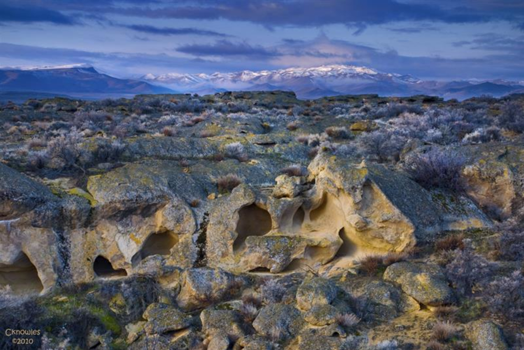
Courtesy Roots Rated web site CKnowles. 

Hi all, 

What an amazing week it's been! The freak snowstorm on Monday dropped 18" of new snow at Bogus Basin, and backcountry skiers flocked to the ski area to enjoy the fresh *pow.*

I found myself cutting up giant tree limbs and branches that fell off big maple trees around our house for the next 2 days! Did 4 runs to the Ada County Landfill on Tuesday morning. All of the tree services were booked out for weeks! Got 'er done! 

The weather looks wet in the mountains in this weekend (more backcountry skiing?), but there should be some weather windows to enjoy the Boise foothills trails at least by Sunday, when a high temperature of 82 degrees is forecast. 

I rode the Cartwright 4 Summits road ride yesterday (the dump loop), and the bitterbrush was beginning to bloom with some sunshine in the afternoon. Arrowleaf balsamroot is blooming everywhere as well along with some lupine and other flowers. 

Courtesy Roots Rated site/CKnowles

I'm not seeing any rain in the forecast in the Bruneau or Grandview areas this weekend, and they may see a high temp of 85 degrees on Sunday, so I'll share a few ideas to try in that direction.  

1. BLM Shoofly Oolite Interpretive trail - This is a great spot for young kids and families and anyone who'd like to explore some cool rock formations and learn more about the region's geology (ever heard of the ancient Lake Idaho?). How to get there - Go to Grandview, go left on ID 78, then right on the Owyhee Backcountry Byway. The Oolite site is 10.3 miles up the byway, on the right-hand side of the road. 

West Fork Shoofly Loop

2. West Fork Shoofly Quick Loop - This is a little discovery hike that I pioneered when researching the Owyhee book. Click on the link to an earlier blog post with all the details. The trailhead is located 18 miles off of the Owyhee Backcountry Byway, turning left off the main road onto a two-track road (AWD vehicles OK) that leads over to a trailhead in the Little Jacks Wilderness. Distance: 5.5 miles; travel time: 3 hours; 850 feet of vertical gain. The hike requires some navigation so be sure to print out the map before you go. 


3. Bruneau Overlook - If you've never been to the Bruneau Overlook, it's a spectacular sight to behold. Definitely worth the trip. Click on the link for driving directions. It's easy to get there, and you don't need a 4WD vehicle to navigate the good gravel road. Bring a lunch and plenty of water and enjoy the views. You can walk along the rim to see more of the canyon if you want. 


BTW - For trip-planning purposes, you might want to know that the weather gods are expecting that we will have continued wetter-than-normal weather, and cooler-than-normal weather in May.


Have fun! 
- SS 

Thursday, April 28, 2022

Middle Fork Payette-Garden Valley hikes opening up for spring!

Station Creek winds through ponderosa pines on the way up a long ridge. 

Hi all, 

Wendy and I thought we'd hike the lovely Station Creek Trail in Garden Valley last Saturday to enjoy a 6-mile day hike in a forested setting. 

We were delighted to see the lower-elevation mountains in Garden Valley greening up for springtime recreation. We didn't encounter any snow on our hike up Station Creek Trail to the initial high point and saddle, or on the way up to Bald Mountain - another mile farther and an extra 500 feet of elevation gain. 

We dodged small squalls that were happening from time to time, but generally, it was a perfect day for spring hiking, with cool temps in the high 40s to low 60s, depending on the moment. 

If Station Creek Trail is in prime shape for hiking, then I'd also recommend two other nice hikes nearby - One Spoon and Lightning Ridge Trails. I've blogged about all three before. 

Steve and Huck on top of Bald Mountain ... elk sign everywhere! 

So that's my outdoor tip of the week - go check out any one of those three trails and enjoy hiking in a forested setting with creek water flowing below, wildflowers and shrubs beginning to bloom, and maybe even some morels popping up if you're lucky! 

The Trailhead for Station Creek is directly across from the Banks-Lowman Highway from the Garden Valley Ranger Station. It takes about an hour to get there from Boise. You can stop at the Garden Valley Chevron for any last-minute supplies before you head for the trailhead. 

Travel time on the Station Creek is about 5-6 hours, out and back. It's shorter if you just go to the initial high point about 2 miles up the trail. I rate the hike "moderate to strenuous" because there are some short, strenuous pitches.

Lunch on a big slab of granite near the top of the One Spoon hike with Wendy, Mark and Laurie. 

One Spoon Trail - Click on a previous post where I wrote about hiking One Spoon, including a map and driving directions, and also tips on floating the Middle Fork Payette River, Tie Creek section. The hike is 6 miles round-trip with up to 2,600 feet of vertical gain. You'll walk through ponderosa pine trees and see lots of cool big granite rocks along the way.  

Lightning Ridge affords vast views of the Boise National Forest

Lightning Ridge Trail - Wendy and I hiked Lightning Ridge Trail last spring. This trail goes for quite a ways, so the distance is kind of up to you. We went about three miles up the trail to an initial high point, turned around and came back to the trailhead. 

Difficulty: Moderate to strenuous

Driving directions: Take ID 55 to Banks. Go left in Banks and take the Banks to Lowman Road to the Crouch turnoff. Head up the Middle Fork Payette River Road (USFS #698) to a marked junction with USFS Road #611, the Lightning Creek Road, on the right. Follow the dirt road about five miles to the trailhead where an earthen barrier prevents further vehicular traffic. 

Have a great time exploring these trails! Bring a lunch and plenty of water for your day trip.   

Both Station Creek and One Spoon are featured in my guidebook, "Boise Trail Guide: 95 Hiking and Running Routes Close to Home." 

- SS 

Thursday, April 14, 2022

It's been snowy, rainy and wet! Five rock-solid ideas for all-weather hiking trails this weekend!

Bruneau Dunes State Park

Hi all, 

It's been quite the rebound to winter-like conditions in the Boise Valley and greater Southwest Idaho in the last 10 days, plus plenty of spring rain, hail and graupel. That's an awesome thing for our water supply! 

It should be obvious that many of the Ridge to Rivers trails are wet and soggy, and thus it's best to search for alternatives. Stay in tune with the latest conditions on R2R Trails here.  

Looking ahead to the weekend, the weather forecast looks sunny and cool on Friday, rainy on Saturday, and sunny and cool on Easter Sunday. 

New snow (1-3") is forecast at Bogus Basin for a special bonus day on Saturday. Sun Valley is operating 7 days a week through Sunday, April 17.  

So if you're itching to make a few more turns, the skiing/riding conditions should be great at Bogus and Sun Valley. If you venture into the backcountry to go snowshoeing or backcountry skiing, you're likely to encounter DEEP snow, with over 20" of new snow that's fallen in the last 10 days, depending on location. Could be some of the best skiing of the season!   

For the valley-dwellers, I'm recommending 5 rock-solid ideas for all-weather trails that would be doable this weekend ... all of these trips are featured in my Boise Trail Guide: 95 Hiking and Running Routes Close to Home: 

1. Bruneau Dunes State Park. Pure sand. Located about 1.5 hours east of Boise. 


2. Eagle Greenbelt from Eagle Road to Glenwood. 4-6 miles one-way. You can do a loop by crossing the pedestrian bridge across the Boise River, if you wish. 


3. Snake River Trail, accessed from Celebration Park, south of Nampa. Very sandy trail to Halverson Lake or stay on the river trail to a cool old rock cabin.  


4. Harrison Hollow all-weather trail. Trailhead is by Healthwise and Highlands Hollow restaurant off of Bogus Basin Road. 1.5 miles out and back. 


 5. Walking path from River Run to Barber Park. Good all-weather surface mostly. 3 miles one-way. Start/finish in Barber Park. 


There you have it! 
- SS