Showing posts with label Boise Foothills. Show all posts

Thursday, June 1, 2023

Spring green up and wildflowers are spectacular right now! Three hikes where you'll enjoy nature's beauty in Boise

Quinn Stuebner on the trail to Mt. Kepros, lit up by lupine and arrowleaf balsamroot. 

Hi all,

After the super long and cold winter, the spring green up and wildflower display in the hills surrounding the Treasure Valley has been spectacular! 

I hope you've been out to see it! If you're looking for more destinations with flowers in bloom, here are six suggestions close to home in the Boise area: 


  • 5 Mile - Watchman Loop, Boise Foothills - 6-10-15 miles. Difficulty: Moderate to strenuous. Hiking time: 2.5-3 hours if you hike up 5 Mile to Watchman and drop out back to Rocky Canyon Road by the 5 Mile parking area on the Three Bears spur. It's a beautiful walk with water in 5 Mile Creek for the puppies. 


  • Watchman - Three Bears bike rideThis is still one of my all-time favorite rides in the Boise Foothills. After you make the initial climb to Watchman, when you come around a corner into the next draw, the whole mountainside is blooming with arrowleaf balsamroot. Gotta see it. 
  • Start and finish at the bottom of Rocky Canyon Road for the 10-mile version of this ride. Or start from Military Reserve Park for a longer version that clocks in at 15 miles. Vertical gain 2,500 feet. Rated advanced. Travel time: 3 hours. Start in Military Reserve. Take the Mountain Cove Trail along Freestone Creek to Ridgecrest #20 and climb to Central Ridge Trail. Climb Central Ridge to the Bucktail junction. Go straight, climb a short distance and then contour over to Rocky Canyon Road on Shane's. Climb Rocky Canyon Road to the Five Mile Trail and Creek. Climb Five Mile to Watchman. Follow Watchman across the foothills and go left at the junction with Three Bears/Curlew Ridge/Trail #6 and follow Three Bears down the spine of Curlew Ridge (super fun downhill with one technical section) back to Shane's Junction. Descend back to the bottom of Military Reserve however you like ... I always have to ride Bucktail and cruise the super-cool GS turns.

    Courtesy Matt Clark 

  • Station Creek Trail, Garden Valley - This is also one of my all-time favorite hikes in SW Idaho. Just saw some pics on Facebook from Boise friend Matt Clark, and the green meadows under the Ponderosa pine trees are aglow with color with multiple wildflower species in bloom! The Station Creek hike is featured in my book, the Boise Trail Guide: 90 Hiking & Running Routes Close to Home. I rate it "moderate" in terms of difficulty. It's a sweet singletrack that climbs 1,300 feet over several miles to the top of the ridge overlooking the broad valley. It's a 4.5-mile hike round-trip. Travel time is 2+ hours. Pack a lunch for the top. If you have time, I highly recommend climbing Bald Mountain, located just above the ridge. You'll add maybe 45 minutes to an hour to the trip, round-trip. Plus, always better views from the top of peaks. 

    The trailhead is about 1:15 from Boise on the Banks to Lowman Road. Take ID 55 to Banks, turn right to Garden Valley. Proceed past the town of Garden Valley to the Garden Valley Ranger Station. Station Creek Trail is directly across the road from the station. There's parking there but no rest room. 

    On the way down from Mt. Kepros peak ... the trailhead is way the heck off to the south! 

  • Hike Mt. Kepros, one of four Boise Grand Slam peaks. It's a 10-mile, moderate to strenuous hike, but worth the effort. Travel time: 4-6 hours. Doing the hike in May and early June, the flowers are spectacular! Trailhead is off of Black's Creek Road, east of Boise on the freeway. See details on directions and highlights along the way in my post on hiking Mt. Kepros.   

---------------------------
Outdoor notes:

Noteworthy events going on this weekend:

  • Big water blowout on the Salmon River in Riggins, Saturday, June 3. The Salmon is running 47,000 cfs as of Thursday at Whitebird. Gonna be big! 
  • Eagle Rec Fest at Eagle Island State Park, Saturday, June 3. Free entry to the park! Great place to take the kids for some fun activities! Plus there's 5 miles of trails at the park, ponds and other things for the kids to play on. 
  • Snake River Raptor Fest - Saturday, June 3, 12-5 at the Indian Creek Winery in Kuna. 
Have fun! 
- SS 

Thursday, April 13, 2023

Lower Boise Foothills trails finally open for hiking and biking! 3 hikes/rides to explore!

A bearded Steve at the summit of Shane's Trail on an April mountain bike ride.

Hi all, 

With the dramatic turn from winter to spring weather for a couple of choice days last weekend - featuring high temperatures in the mid-70s - the trails in the lower Boise Foothills dried up and now they're ready for hiking, biking and trail-running. Finally! 

In many years, the trails in the Boise Foothills have dried up in late February to early March, but because of the long, cold snowy and icy winter we had in 2022-23, spring is coming late! 

And that's OK! 

Boy, it felt great to get out and ride my mountain bike on Saturday morning! It was still on the cool side, but when I saw that Ridge to Rivers had given the lower trails the green light, I was ready! I rode from Camelsback Park to Crestline and Sidewinder and took Red Cliffs back. The trails were bone-dry the whole way. 

I saw hikers, mountain bikers and runners everywhere. As the day got warmer, I have a feeling that the trails got even more busy! 

Central Ridge trail in Military Reserve

Man, it felt good to climb, get my lungs and heart pumping in the red zone, and enjoy another one of my favorite gravity sports on the way down!  

Remember that it's only mid-April, and we'll be subject to more rain and even some snow.  Pay attention to the Ridge to Rivers trail reports on Facebook if you're in doubt. 

For my outdoor tip of the week, I'm recommending three hiking and biking loops in the foothills. After a snowy surprise Thursday morning, it's supposed to be a really nice weekend Friday-Sunday with High Pressure aloft, mostly clear skies and warmer temps each day through Sunday. High temps are 56 degrees on Friday, 65 Saturday and 75 on Sunday. Now we're talking! 

And then the weather goes to hell on Monday-Tuesday of next week. So get out and enjoy it this weekend when you can!

Sharing the trails respectfully with others is important in the foothills. Thank you! 

Before we get into the rides/hikes, a couple of reminders: 

1. Be a good trail ambassador! "Be Kind" when you're out using the trails, share the trails respectfully with others, and smile and say "hi" when you pass by people. A little bit of courtesy goes a long way! 

2. If you're mountain biking, remember that all uphill traffic has the right of way. If you're coming down and you see people coming up, stop, step off the trail and let them pass by, no matter if they're walking, running or biking.

3. If you come up behind someone and need to pass, say something like "coming up" and let them know you're coming so they can step off the trail for you to pass.  

4. Polecat Gulch is changing back to counter-clockwise direction this year. You'll see the signage out there. I preferred riding it clockwise, but oh well. I do like how the one-way direction on Polecat has reduced conflicts and, no doubt, collisions. It's a tight, narrow singletrack in places on steep side-hills without much in the way of sight lines. The one-way trails are safer. 

5. Stay off muddy trails. I already covered that above, but I'm saying it again. If things are wet, go for a road ride or ride the Greenbelt. 

Now for the recommended hikes/rides: 

1. Best for hiking: Kestrel-Red Cliffs Loop -  Camelsback - Kestrel-Crestline-Red Cliffs Loop - Distance: 5 miles. Rated moderate for hikers and runners. Rated intermediate for biking. Hiking time, 2-2.5 hours; Running time: 55 minutes; Biking time: 45 minutes. This is a popular loop with hikers, runners and bikers. Start at Camelsback Park off of Heron and 13th Street in North Boise. Head over to the trailhead in the east side of the park, and follow Owl's Roost Trail on the right by the ponds. Follow Owl's Roost to the Foothills Learning Center area. Turn right at the junction with Kestrel, and climb Kestrel to Crestline, it's about .6 miles of continuous climbing. Turn left onto Crestline, climb a short abrupt hill, and then watch for a left-hand junction with Red Cliffs in less than a half mile. Turn left onto Red Cliffs and enjoy a fun descent for over a mile back to Hulls Gulch. Follow Hulls back toward the Foothills Learning Center, cross 8th Street, and take Chickadee Ridge back to Camelsback Park.

Map of Kestrel-Red Cliffs loop from Steve's book, "Boise Trail Guide" 

2. Best for hiking or biking: 
Jumpin' Jeepers Figure-8 Loop - 6.75 miles. Rated moderate with strenuous sections. Rated intermediate for biking. Hiking time, 2.5-3 hours; running time, 1:20; riding time, 1:10. This is one of my favorite rides in Military Reserve that connects to Shane's Trail. It's an equally nice run or hike. The name comes from the Boise Police Dept. shooting range at the end of Mountain Cove Road. The unexpected blast from a gun might cause you to jump out of your skin! (It's an archery range now, thank goodness!). 

To start, go to the main trailhead on Mountain Cove Road, after the sharp right-hand corner. Take the Toll Road Trail #27A to #20 Ridge Crest and climb to the top of the hill. Turn right on Central Ridge Trail and climb at a moderate pace to Shane's Junction. Take Shane's #26A to the left, and climb to the top of Shane's. You've climbed 1,000 feet over 3+ miles. Give your puppy a drink and a snack. Descend Shane's for less than a mile, turn right on the Shane's Loop and return to the Central Ridge-Bucktail-Shane's jct. Take Bucktail downhill and enjoy the big GS turns as you wind across a big downhill on a large flat. Bucktail drops into the Central Ridge alternative trail. Go right and then left on that and it'll take you back to the trailhead. It's a great view of Idaho's Capital City as you cruise downhill on that sagebrush slope to the trailhead.

Map of Jumpin' Jeepers Figure 8 Loop from Steve's book, "Boise Trail Guide"

3. Best for hiking or biking: Polecat Gulch Loop - NW Foothills. This area was a key new 834-acre open space reserve purchased by the City of Boise in 2002 with funds from the 2001 Foothills Levy. It opened up a great system of trails in an area that had been previously unaccessible because its private land status. The trails in Polecat are more moderate than many in the foothills, so that's another draw. This area also is home to albino mule deer. I've seen them myself!

How to get there: Take Hill Road to N. Collister in NW Boise. Turn north on N. Collister and proceed to the Polecat Trailhead at the end of the road. There is a restroom in the parking lot.

The Polecat Gulch "finger" loop as I call it in my guidebooks, Boise Trail Guide and Mountain Biking in Boiseis approximately 6 miles long. It circumnavigates the whole gulch. I call it a finger loop because the trail snakes around little ridges that extend like a finger from the top of the gulch. It takes about an hour to do the loop on a bike, 1.25 hours for trail-runners, and several hours if you're hiking.

Huck's about to take flight on a windy spring day in the Boise Foothills.

There you have it! 

A couple of other things going on this weekend: 
  • Spring skiing at Bogus Basin. Lift tickets are available online if you don't have a season pass. 
  • Rivers are rising, if you haven't noticed! Experienced kayakers and surfers are enjoying the play waves at the Boise Whitewater Park and the Payette River would be fun, too. The South Fork and Main Payette are definitely running at boatable levels and rising! 
- SS 

Thursday, October 27, 2022

Try this trio of Boise foothills hikes with fetching, elevated views of the city - nice to see fall colors!

View of Boise from Central Ridge Trail in Military Reserve Park.

Hi all, 

After a nice cool and wet week to turn the page toward fall seasonal norms, the weather this weekend looks quite nice for some weekend outings! Afternoon high temps will be about 57 degrees F and sunny - a bit chilly but you can dress for it.  

Now that the fall colors are beginning to happen in the Boise Valley, for my outdoor tip of the week, I'm recommending three hikes close to home where you can enjoy some fetching views of the City of Trees and the wide variety of colors visible as far as the eye can see! All of these are kid-friendly. 

Full Sail Trail heading over to Buena Vista (courtesy BoiseTrails.com)

Hike #1 - Buena Vista Trail, Hillside to the Hollow.
Difficulty: Moderate. Start either at the Harrison Hollow trailhead by Healthwise or behind Hillside Junior High along Hill Road. Buena Vista Trail has a very nice and moderate contour as it winds across the outer-front of the Boise Foothills, and it feels like you can reach out and touch the community below. Yet, you're at least 500 vertical feet above the city, so it's a great vantage point! If you do an out-and-back walk on Buena Vista, you'd cover several miles over an hour or so. 

Spring shot of Harrison Hollow looking down at the city.

Hike #2 - Central Ridge Trail, Military Reserve Park.
Difficulty: Moderate. Start at the Military Reserve trailhead where Mountain Cove Road bends sharply to the right going west into the foothills. There's a large parking area on the right and a trail map. You can start by walking along the Mountain Cove trail along Freestone Creek for about a mile or so. Then, you can turn to the right and climb up on Central Ridge to that initial summit. Then walk south down the backbone of Central Ridge back toward the trailhead. On Central Ridge Trail, it looks like you're going walk right into the State Capitol building and downtown Boise. Kind of a cool selfie opportunity before you drop down to the trailhead. Travel time for this one would be 1-1.5 hours at a leisurely pace.

Great views of the city from Valley View Trail 

Hike #3 - Seaman's Gulch Loop.
Difficulty: Moderate. Start at the Seaman's Gulch Trailhead off of Seaman's Gulch Road and Hill Road in West Boise. You have the option of hiking a short loop for 1 mile, or you can hike a longer loop for 3 miles with more views. In my Boise Trail Guide, I called this route "Seaman's Gulch Double Loop." The trails contour nicely across the landscape; you never have to work too hard to climb uphill. 

Short loop: Follow the left-hand fork of Trail #110 and climb to an initial ridge. Bear left at the top on Phlox Trail #112. That'll bring you back to the trailhead. 

Longer loop: Follow the same directions to start with, but once you reach the initial ridge, take Valley View Trail #111 as it wraps around the front of the Boise Foothills, super close to the edge of the city. Once the trail loops around the hills, it ties into Phlox Trail on a ridgetop, and you can head back to the trailhead on Phlox. The longer loop is 3 miles and features 500+ feet of vertical gain. Travel time is 1.5 hours. Take your time and enjoy it! 

All three of these hikes and 92 more are featured in my Boise Trail Guide: 95 Hiking and Running Routes Close to Home. The book is available at stevestuebner.com, Idaho Mountain Touring, Boise REI, and Rediscovered Books. 

Ken and Melissa will be giving away a free copy of Boise Trail Guide on 94.9 FM The River tomorrow (Friday) morning at approximately 7:40 a.m. Tune into my radio gig, and you can call in to win the book at 208-287-2949. 

Have a great weekend! More moisture forecast next week! More snow for the mountains! 
- SS 

Thursday, November 4, 2021

Revisiting hiking trails that shine during shoulder season - Sage Creek and Orchard-5 Mile Loop

Wendy enjoys the quiet walk in Sage Creek canyon in the Owyhee Canyonlands.

Hi all, 

Revisiting trails that you love is kind of like getting re-acquainted with an old friend.

For Wendy's birthday, we zipped out to Sage Creek on Wednesday in the Owyhee Canyonlands for a delightful afternoon. Sage Creek canyon is close to Succor Creek State Park. It's accessed by a well-graveled all-weather road. So it's a cool, off-beat place to go in late fall, winter and spring.

I discovered Sage Creek canyon when researching my Owyhee Canyonlands guidebook some years ago. It's a moderate walk into a scenic, incised canyon that's chock full of geologic other-worldly shapes and features. It's always a treat to visit the canyon in my book.

Towering reddish-orange rhyolite spires, fins, caves and phallic-type rocks jut into the sky as you're walking up the draw. You'll see darker and more recent basalt rock features along the way as well.  

Wall of blonde volcanic ash in Sage Creek canyon.

Lots of cool geologic features to explore.

But several miles into the canyon from the trailhead, you come to a unique area that's full of volcanic rock and ash flows. The ash flows are blond-colored, green and chalk-colored, and they're very erosive ... you can carve off outside layers with your fingernail. There are some balance-rock features in the area as well.

To just sit there and observe all of those features is quite breath-taking. Be sure to bring a lunch and plenty of water and snacks. Allow for 3-4 hours to explore. 

It's about 4 miles or so to explore the full interior of Sage Creek while you're climbing along the creek-bottom on a general incline. It's an easy kid-friendly, out-and-back hike even if you go only a couple of miles into the canyon. If you have plenty of time, you can try to cover the whole canyon experience. The upper canyon ends when you approach the McIntyre Ridge Road.

Huck flushed a couple of chukars in the canyon.

How to get there:
Take I-84 to the ID 55 exit in Nampa, heading west toward Marsing. After about 5 miles or so on ID 55, turn right on Chicken Dinner Road to Homedale Road. Go left on Homedale Road and follow that into the town of Homedale. Follow State Highway 19 west of Homedale, and then Highway 201 in Oregon, to a signed turnoff for Succor Creek State Park on the left. Head south on the dirt road. It's about 12 miles to the unsigned right-hand turnoff for the Sage Creek Trailhead. There is a lone scrubby cottonwood tree at the turnoff. If you have a 4WD rig, follow the primitive two-track road over several creek-crossings to the trailhead .9 miles from the Succor Creek Road. Or just park and hike that portion. Either way works. 

You may need muck boots or just your hiking boots for the hike. If it's wet and the creek is running with water, you'll want your muck boots. Yesterday, our hiking shoes worked well. 

Selfie with Steve and Wendy on the descent into Five Mile Creek canyon.

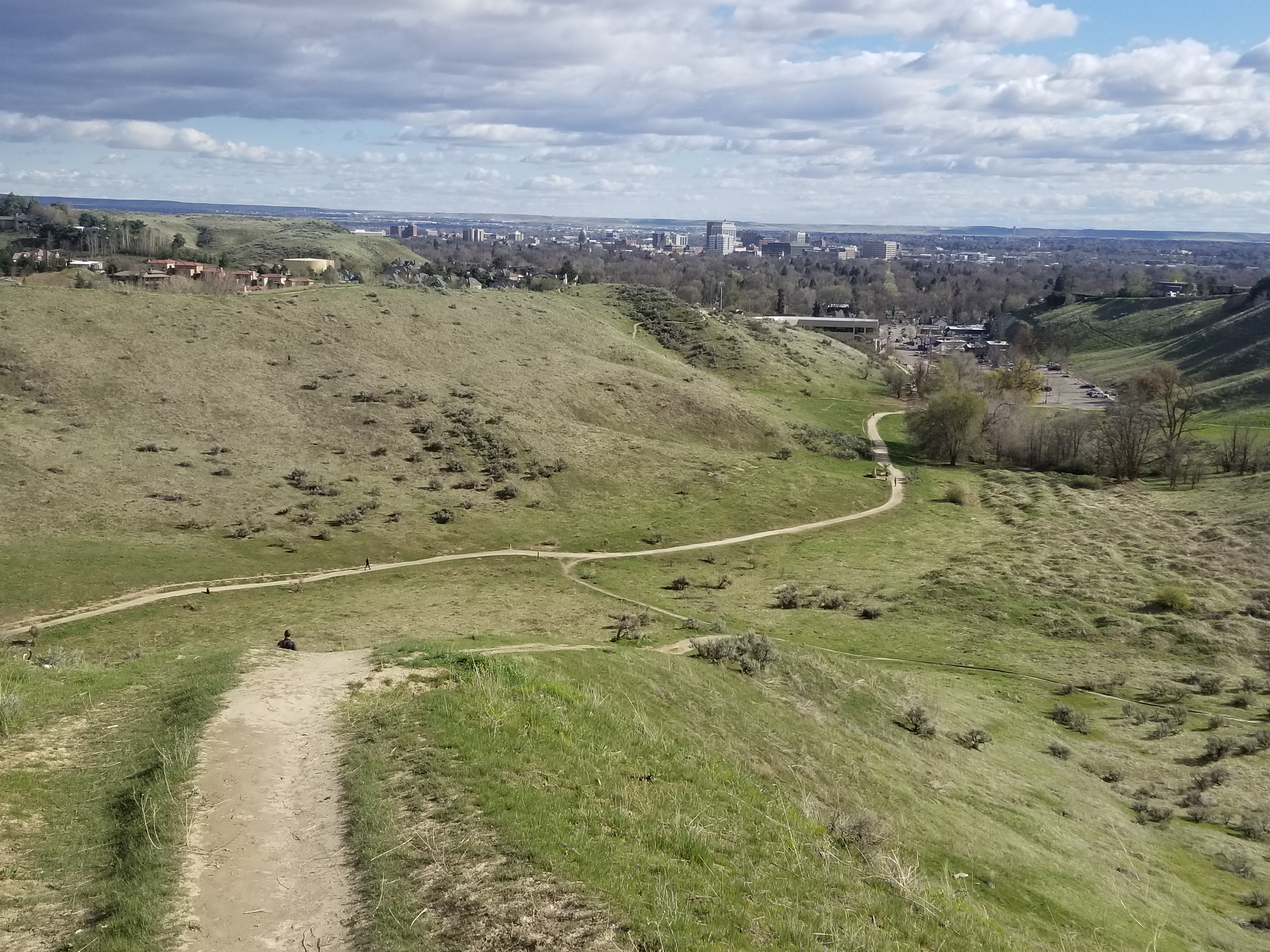
Another good shoulder-season hike in the Boise Foothills
is to do the Rocky Canyon-Orchard Gulch-Five Mile Creek loop. This is a moderate to strenuous 5.5-mile hike in the NE Boise Foothills. The trails are pretty sandy, and once winter comes, they become covered with ice or snow, and still hikeable. 

Wendy and I hiked that loop last Sunday, and the leaves were still golden in many places ... but that will change in the coming weeks as fall transitions to winter. 

Getting there: Take Shaw Mountain Road by Fort Boise to Rocky Canyon Road, and follow Rocky Canyon Road to the end of the pavement. Go up the dirt road about about four miles to the trailhead for Five Mile Creek. Park.  

Hike uphill on Rocky Canyon Road for a long mile to the trailhead for Trail #7 in Orchard Gulch. Follow that trail about 2.5 miles to the junction with the connector trail over to Five Mile Creek. All of the climbing is done now. Hike down to Five Mile Creek Trail, go left and return to the trailhead and your vehicle. Hiking time is 2.5-3 hours.

------------------------------------------------

BBSEF Ski Swap is this weekend, Nov. 5-7! The giant ski equipment and clothing sale is being run for the 70th year!!! Opens at 1 p.m. on Friday at the Expo Building Fairgrounds. Entry fee is $5. 

The Land Trust of the Treasure Valley is looking for volunteers to plant sagebrush and other plants in the Harrison Hollow area on Friday at 10 a.m. Sign up here

- SS

Thursday, March 12, 2020

My outdoor tip: 5 mountain bike rides sure to please, plus fresh powder this weekend

Central Ridge trail, Military Reserve

Bitterbrush in full bloom, Military Reserve Park, Boise Foothills
 
Entering Reynolds Creek canyon, courtesy MTB project
Hi all,

I'm sharing my outdoor article in the Idaho Press on five rock-solid mountain bike rides in the Boise area as my tip of the week.

The weather shows it's going to be mostly rainy this weekend and beyond, however, so please save the mountain biking ideas until the trails dry out after the storms.

In the meantime, you might want to go powder skiing this weekend. There's a good chance of up to 6 inches of new snow at Bogus Basin, Brundage Mountain, and Sun Valley. Pomerelle might really get belted with more than a foot ... you can see the latest snow forecasts at Idaho Daily Snow.

Have fun!
- SS  


Thursday, March 5, 2020

R2R gives green light to lower foothills trails, spring skiing and Snake River canyon


Two adorable children playing in the sand by Red Cliffs Trail on Thursday.
Walkers and bikers sharing the trails on Red Cliffs Trail ...
Love this view looking down into lower Hulls Gulch from Red Cliffs ...
Bikers: Remember to slow down as you enter congested areas ...
Hi all,

Many peeps who love the Boise foothills trails have been out in force, enjoying this latest string of uncommonly warm weather, with highs in the 60s in the afternoons and close to 70 (?) on Friday. Wow! 

I rode my mountain bike to Sidewinder summit on Tuesday night, and it felt like June out there with the trail being bone-dry, and Huck was overheating. Today, I went for a stroll on lower Hulls and Red Cliffs to take pictures, and I was blown away how warm it felt! Sure feels good after a great ski season to hit the trails! My climbing legs feel pretty good considering it's early in the season. 

Checking on the Ridge to Rivers Facebook page, we have as close to a "green light" to use the lower foothills trails below mid-elevation as we're going to get this time of year. There's a good chance of rain in the valley on Saturday afternoon, so keep an eye on the R2R reports and abide by them, please!!!

Quoting from their post on Thursday, March 6:

"Overall, it appears that trails below the mid and upper elevations in the foothills are mostly good to go right now. Conditions above are still the ones in question. It is a good time to work on doing more traversing in the lower foothills from one trail to another or using 8th St. or Rocky Canyon Rd. if you are going to be doing some significant climbing. ...

As the trail crew has been working on both Crestline and Sidewinder for the past few days, both of these trails and also Red Cliffs, Kestrel, and Lower Hulls all remain good to go right now. If you are getting up higher into the foothills over the next couple of days, please think about posting some reports of your own to help others get a better idea of what is going on out there. With rain in the forecast this Saturday, it's a great time to get out and enjoy these next couple of days. Just do it in the right locations! Happy Trails!"

Huck is Mr. Airplane ears on a windy day at Corral's Summit
Other lower Boise foothills trails worth visiting right now would include:
  • Military Reserve Trails 
  • Camelsback Trails 
  • Table Rock trail itself
  • Highlands to the Hollow
  • Corrals Trail 
  • Highlands Trail 
  • Polecat Gulch
  • Seaman's Gulch
Here are some spring skiers getting into the party mode! (Courtesy Arapahoe Basin)
 Two other suggestions for Friday and this weekend:
  • Spring Skiing! Bogus Basin, Tamarack, Brundage and Sun Valley all have lots of snow. Spring skiing on Friday should be amazing everywhere in SW Idaho because of the warm temps approaching 50 degrees at Bogus tomorrow and mid-40s elsewhere! Wow! Break out the spring skiing garb and have fun with it! 
    • Also could go backcountry skiing at Pilot Peak/Sunset Mountain/Freeman Peak or up toward Stanley on Copper Mountain. 
    • Xc skiing and snowshoeing is another possibility at the Idaho City Park n Ski Areas or in McCall or Sun Valley. 
  • Hiking/biking in the Snake River Canyon - Head south of Kuna or Nampa to visit the Morley Nelson Snake River Birds of Prey National Conservation Area. A friend told me that the birds of prey are doing courtship flight down there, so you can hang out and watch the cliffs for birds with your binoculars or do some hiking or biking at Celebration Park or by Swan Falls Dam. The ride to Wees Bar is one of my favorites. 
    Golden eagle on the cliffs in the Morley Nelson Snake River BOPA 
Have a great weekend!
- SS

Thursday, November 14, 2019

Go enjoy the trails while mild weather persists ... Jug Mountain Ranch trails rocked our world!

All grins coming down Doe Joe Trail at Jug Mountain Ranch
Steve Schneider

Jim Giuffre, Wendy and Steve by JMR Reservoir
Hi all,

Well, it's looking as if we're getting a slow start on winter, even though we had a cool and wet September and October.

I checked the short- and long-term weather forecasts, and it appears that we'll have continued warmer-than-usual temperatures in the afternoons and below-normal precipitation for the next couple of weeks. In a long-range 2019-20 winter forecast, NOAA is predicting that most of the western United States will have a warmer-than-normal winter, but the Northwest region, including Idaho, has equal chances for normal precipitation, at least by December. That's the good news!


In the meantime, you might as well enjoy these sunny afternoons, and hit the trails while they're still in prime shape. At least in the Boise Foothills, the trails are dry and perfect for hiking, trail-running and mountain biking. Same goes for the Owyhee Canyonlands.

I went mountain biking at Jug Mountain Ranch last weekend near Lake Fork, and the trails there were in great shape still (slightly lower elevation than McCall), while the trails north of McCall above 5,500 feet were muddy, icy and snowy. Ponderosa State Park trails were mostly doable. And the North Valley Trail in McCall is still in perfect shape.

Courtesy Jug Mountain Ranch
At Jug Mountain Ranch, I rode South Elk-South Boundary Road to Berm & Ernie, and took Berm & Ernie down to the trailhead. That was a super fun loop, with a fun cruise through the timber on the South Elk singletrack trail, a fairly strenuous climb on the South Boundary Road up to the JMR Lookout, and then you lower your seat and cruise down Berm & Ernie. There are a number of rock drops along the way and spots to launch for big air. They rate that trail as a "blue" run or intermediate.

I also rode from the JMR trailhead up the main trail to JMR reservoir, crossed the dam, rode around the reservoir on Shoreline trail, which had a few patches of ice and snow on it, but otherwise, totally fun and doable. Then we climbed up to the JMR Lookout spot, and zoomed down Doe Joe, which is an endless series of switchbacks with bermed corners, but all smooth ... no rocks ... for a sweet ride.

JMR rates Doe Joe as a beginner trail, which seems a little off, but hey, if you're uncomfortable with riding bermed corners, there are other ways down the mountain, too. Doe Joe is a great addition to the JMR trail system, yet another reason to go there. 


Almost all of the trails at JMR are set up for an uphill shuttle service (provided during summer season). But if you don't mind grinding up the hill yourself, you can enjoy some great trails there before the snow comes. JMR officials caution to stay off any muddy trails if you encounter them. And then after winter comes, you can also snow bike at JMR on the xc trails, including some of the main access roads and trails you can ride now.

Highly recommend it!
- SS 

Bonus shot - big buck in Ponderosa State Park

Gorgeous evening on Payette Lake ... Wendy and Huck. Once the sun goes down, the temp drops like a rock.

Thursday, October 31, 2019

Dry Creek hike in Boise Foothills reveals neat ice patterns, fall color

Huck had a blast sniffing for birds and perching on rocks 
Patches of ice formed interesting patterns in the creek. 
Hi all,

I went hiking with Huck on the Dry Creek trail this week to see if the fall colors were still happening -- and they were in places. But it was a surprising dividend to see some cool shapes and designs in the ice forming in the creek.

We've had low temperatures in the teens and 20s this week, so Dry Creek was definitely covered with ice in flatter portions of the streams and in the beaver ponds. It's supposed to get a little warmer in the days ahead, so I recommend getting out to hike Dry Creek or do the Shingle Creek-Dry Creek Loop before the snow comes and the trail gets mucky.

That's my outdoor tip this week ... get out and enjoy the Boise Foothills trails while you can!

Some sections of the creek were almost completely frozen. 
I also am looking forward to attending the Bogus Basin Ski Education Foundation Ski Swap Friday-Sunday at Expo Idaho this weekend. See the web site for details on selling and buying equipment.

BTW, if it's ski swap time, that means the Warren Miller annual ski movie is coming up! It's scheduled for Thursday, Nov. 21 through Sunday, Nov. 24 at the Egyptian Theater.

A hiker and a jogger cruising up the trail with their dogs 
Now back to the Dry Creek hike ... starting from the trailhead on Bogus Basin Road, you can hike up the creek as far as you want ... On Thursday (today), I hiked about two miles or so up the trail to the Shingle Creek junction, and came back. Going on a mid-week day, I saw only 2 other people on the trail during my hike.

The Dry Creek trail is kind of steep up and down threading through some cool granite goblin-like rocks in the first 1/2 mile, but after the trail drops down by the creek, it's a very pleasant walk up the draw. There are numerous places where you could stop and have a picnic.
Dry Creek-Shingle Creek Loop map (courtesy alltrails.com) 

Remains of a stone house next to a large locust tree that settlers planted.  
Tackling the Dry Creek-Shingle Creek Loop is a much more ambitious endeavor. The route covers 13.8 miles and features 2,221 feet of gain. Nothing too extreme, but it's still a substantial hike with multiple strenuous pitches. That one would take about 5 hours or more, depending on your speed of travel.

Take a walk up there and enjoy the sights! I wondered about the history of a stone house up there ... I would like to know more about the settlers who tried to live up there.

Beaver pond complex was just freezing over. 
Be sure to dress in layers for the hike. You'll warm up and shed most of your layers on the way up the trail, and then cool down for the walk back down. I needed a hat and gloves for my hike. The temperature was in the high 30s, so not all that warm. It is supposed to warm up a bit next week in the afternoons.

Have fun!
- SS

Thursday, May 2, 2019

Four spring hikes close to Boise that'll get your legs broken in for the 2019 season!

Nature Girl: Wendy Wilson enjoys the Five Mile Creek-Watchman-Three Bears hike last Saturday.
Hi all,

My outdoor tip of the week focuses on four spring hikes close to home that'll get your legs and lungs warmed up for the 2019 hiking season!

I detailed the hikes in an outdoors article this week in the Idaho Press. Follow the link to read all about the hikes!

The hikes are:
1. Five Mile-Watchman-Three Bears - East Boise Foothills. 6 miles. About 3 hours travel time. Rated moderate to strenuous.
2. Station Creek to Bald Mountain in Garden Valley out and back. 7 miles. About 4 hours travel time. Rated moderate to strenuous.
3. Hillside to the Hollow Trails. Distance: You make the call. Easy and up.
4. Kepros Mountain out and back. Distance: 10 miles. 4+ hours travel time. Rated strenuous.

All of the hikes are featured in Boise Trail Guide: 95 Hiking and Running Routes Close to Home. 

See the Idaho Press article for more information.
- SS 

Thursday, May 17, 2018

Four spring hikes - 2 in the Boise Foothills, 2 in the Owyhees, plus Boise Bike Week!

Jump Creek Falls, near Marsing
Big Jacks Creek canyon as it looks as you're hiking down from the Parker Trailhead. 
Hi all,

After a week of unsettled weather, this weekend looks fabulous with clear skies and temperatures in the mid-70s in the Treasure Valley. There's a 30 percent chance of thunderstorms on Sunday. We've seen that all week, and sometimes the storm happens, sometimes not!

My outdoor tip this week will focus on a couple of handy hikes close to home. But first, I wanted to mention this we are in the midst of Boise Bike Week, sponsored by the Treasure Valley Cycling Alliance. Tomorrow is national Bike to Work Day  So if you need a little extra motivation to get your bike lock and gear together for biking to work, there you go!!! Plus, a bunch of coffee shops are offering a free cup of coffee to people who ride to work ... so there's another boost for ya! See Boise Bike Week Facebook page for details.

Now to the hikes. First, a couple in the Boise Foothills:

Lupine going off big-time on the way to Central Ridge Trail and Bucktail Trail in Military Reserve this week. 
1. Jumpin' Jeepers Figure-8 Loop - 6.75 miles. Rated strenuous as a hike or run with moderate sections. Rated intermediate for biking. Hiking time, 2.5-3 hours; running time, 1:20; riding time, 1:10. This is one of my favorite rides in Military Reserve that connects to Shane's Trail. It's an equally nice run or hike. The name comes from the Boise Police Dept. shooting range at the end of Mountain Cove Road. The unexpected blast from a gun might cause you to jump out of your skin! Thank goodness the city finally moved the firing range! The flowers are still popping along the way ... I saw a field of arrowleaf balsomroot and purple lupine on Wednesday. To start, go to Fort Boise and then the main trailhead on Mountain Cove Road, after the sharp right-hand corner heading west. Take the Toll Road Trail #27A to #20 Ridge Crest and climb to the top of the hill. Turn right on Central Ridge Trail and climb at a moderate pace to Shane's Junction. Take Shane's #26A to the left, and climb to the top of Shane's. You've climbed 1,000 feet over 3+ miles. Give your puppy a drink and a snack. Descend Shane's for less than a mile, turn right on the Shane's Loop and return to the Central Ridge-Bucktail-Shane's jct. Take Bucktail downhill and enjoy the big GS turns as you wind across a big downhill on a large flat. Bucktail drops into the Central Ridge alternative trail. Go right and then left on that and it'll take you back to the trailhead. It's a great view of Idaho's Capital City as you cruise downhill on that sagebrush slope to the trailhead.

2. Camelsback - Kestrel-Crestline-Red Cliffs Loop - Distance: 5 miles. Rated moderate for hikers and runners. Rated intermediate for biking. Hiking time, 2-2.5 hours; Running time: 55 minutes; Biking time: 45 minutes. This is a popular loop with hikers, runners and bikers. Start at Camelsback Park off of Heron and 13th Street in North Boise. Head over to the trailhead in the east side of the park, and follow Owl's Roost Trail on the right by the ponds. Follow Owl's Roost to the Foothills Learning Center area. Turn right at the junction with Kestrel, and climb Kestrel to Crestline, it's about .6 miles of continuous climbing. Turn left onto Crestline, climb a short abrupt hill, and then watch for a left-hand junction with Red Cliffs in less than a half mile. Turn left onto Red Cliffs and enjoy a fun descent for over a mile back to Hulls Gulch. Follow Hulls back toward the Foothills Learning Center, cross 8th Street, and take Chickadee Ridge back to Camelsback Park.

Now, a couple hikes in the Owyhees:

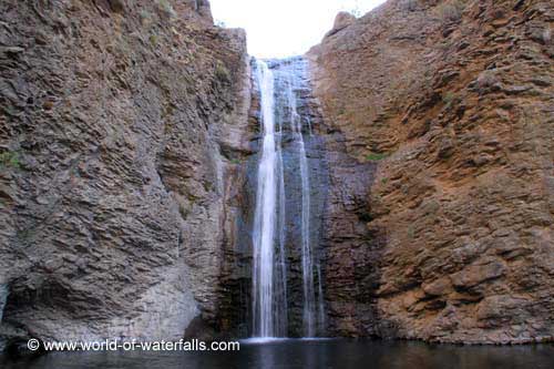
3. Jump Creek Canyon, near Marsing - Follow this link to see a write up in the Nampa Press-Tribune about visiting Jump Creek Canyon. They used my Owyhee Canyonlands guide for reference and driving directions. Be forewarned that there is poison ivy on the trail to the falls. Watch your step and keep the kids close at hand through that small section as you approach the falls. Once you arrive at the BLM recreation site, you'll notice that you can explore some extensive trails above Jump Creek Falls. Give that a go if you're up for hiking a greater distance than the quarter-mile trail to the falls.

4. Big Jacks Creek, Parker Trailhead - Big Jacks Creek is a gorgeous canyon. Go see it and judge for yourself.
Driving map for Parker Trailhead
The hardest part of the whole trip, like many in the Owyhee Canyonlands, is finding the trailhead. A good 4WD vehicle or a high-clearance Subaru is recommended for the drive, once you hit the dirt roads.

How to get there: Take the freeway to Mountain Home. Take the first exit. Follow signs for Idaho State Highway 51 and Bruneau. After you reach Bruneau, take note of your odometer. Stay on Idaho 51 for approximately 25 miles. You'll be watching for a right-hand turn on a good dirt road, called the Wickahoney Road, just past milepost 45. The road is not signed, but it's a BLM public road.

Follow Wickahoney Road 4.9 miles to a T-junction by Wickahoney Creek. Turn right and go 2.8 miles to the Parker Trailhead. Park and hike from there.
Leo Hennessy follows the Parker Trail into the Big Jacks Wilderness

You'll follow a two-track road over to the rim of the canyon, walk over a barbed-wire fence via a wooden step-over gizmo, and descend into Big Jacks Creek. Take your time, take some photos and enjoy the scenery. There's a foot path going down into the canyon; it's marked by rock cairns along the way. Watch for snakes. They could be out.

Once at the bottom, you can explore a little and eat lunch by the campsite area. Return the way you came.
Beautiful campsite at the bottom of Big Jacks. 
----------------------------------------------------------
The BLM is hosting two events this weekend related to the 25th anniversary of the Morley Nelson Snake River Birds of Prey National Conservation Area.

1. Join in on a Naturalist Photo Safari of overlooked and underappreciated components of the NCA ecosystem. On Saturday, it's "Insect Day." On Sunday, there's a plant and geology hike in the canyon. RSVP to Cory Coffman at ccoffman@blm.gov. For the full event schedule, go here.

Have fun!
- SS