Showing posts with label Trail-running. Show all posts

Thursday, March 19, 2020

Go for a walk, run, hike, bike ride close to home to refresh the soul!

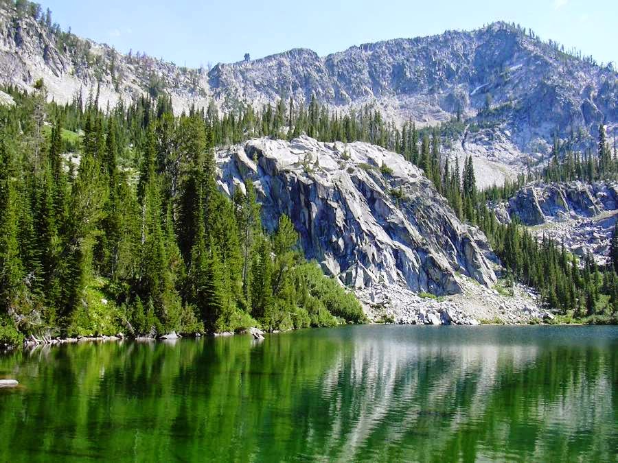
Cool granite rock formations can be seen on the way to Mt. Kepros, one of the Boise Grand Slam Peaks.
Leslie Gulch  in the Owyhee Canyonlands
Hi all,

It's pretty surreal to realize we are in the midst of a global pandemic with the coronavirus (COVID-19). Many forces outside of our control are affecting our lives and communities for coming weeks, months -- no one knows how long. All of the health and safety advice to lay low, stay close to home, avoid large groups of people, etc., seems wise.

We are fortunate to live in Idaho, where we have lots of open spaces, public lands, public access, and extensive trail systems close to home. In a way that perhaps we have never really thought about before, these places should be safe refuges from not only the coronavirus but any other contagious diseases for that matter. 

My recommendation at this time is to maybe spend some of your extra free time to invest in your personal health and fitness and mental well-being right now by getting out on a walk, a hike, a bike ride, maybe even an early spring camping trip to get some fresh air and Vitamin D from pure sunshine. These options seem like healthy choices to me if you go with your friends and family in small groups of less than 10 people.

The Idaho Statesman featured an outdoors article this week recommending the same thing with doctor's approval. 

Mt. Cervidae affords great views of Lucky Peak Reservoir and the Boise National Forest
Where to go?  

My local hiking guidebook, Boise Trail Guide, features 95 hikes and trail-runs close to home. Everyone has their go-to favorite places to hike, but Boise Trail Guide helps you branch out and try something new.

The book also is organized by challenge and difficulty, starting with over 15 flat Greenbelt sections from Eagle to Lucky Peak and other flat walks. And then we increase the fitness challenge with a wide variety of 15+ "Easy Mountain Trails," 25+ "Moderate Mountain Trails," 25+ "Strenuous Mountain Trails," and 5 "Epic Mountain Trails."

Most of the trails in the book are snow-free, but the higher-elevation trails would be places where you could go snowshoeing or backcountry skiing.

Two of the Boise Grand Slam Peaks would be great choices right now when the trails are dry -- Mt. Cervidae and Mt. Kepros. See previous posts for details. Keep a leash handy for your dog because there could be deer or elk in those areas in the greater Boise River Wildlife Management Area.

Talk about social distancing ... the Owyhee Canyonlands, by definition, are remote with solitude pretty much guaranteed. My guidebook on The Owyhee Canyonlands: An Outdoor Adventure Guide details 55 hiking and biking day trips in the Owyhees, plus ideas on camping and tips on roadside points of interest along the 100-mile Owyhee Backcountry Byway.

Snake River canyon looking down at Swan Falls Dam, a key access point
The Morley Nelson Snake River Birds of Prey Area, Swan Falls Dam and Celebration Park would be excellent choices right now for hiking, biking, sight-seeing and just hanging out looking for birds during the spring nesting season.

I wrote about some choice mountain bike rides last week, but another perfect choice is to simply get out and ride the Boise River Greenbelt ... maybe try some sections that you haven't done before or go back to some of your favorites. The Eagle Greenbelt loop is one of my favorites this time of year because of the opportunity to see bald eagles, great blue herons and cormorants in a large rookery near the Boise River Wastewater Treatment Plant on the south side of the river.

Cartwright 3 Summits Loop always delivers!
To up the ante, try jumping on your road bike and start building your mileage for the spring/summer riding season. I've actually been sneaking in road rides mainly on the Cartwright 3 summits loop all winter long, logging that ride maybe once a week in between trips to the mountain for alpine skiing. Biking makes for stronger ski legs, and skiiing top-to-bottom thigh-burning runs makes for stronger biking legs. All good!

My full color road cycling map for the Treasure Valley, the Boise Road Cycling Guide, provides details on more than 30 road rides throughout the valley, plus some a la carte Canyon County rides such as the scenic Lake Lowell loop and the Gem County ride, Big Freezeout-Little Freezeout Loop. 

Other helpful map resources include the Ridge to Rivers interactive trail map and the Boise Trails online site. My books/maps are available at Bandanna (Boise Trail Guide), Idaho Mountain Touring, Boise REI, stevestuebner.com, and amazon.com.

This is a time when you can do more exploring on your own with these information resources close at hand. Have fun!
- SS

Thursday, March 5, 2020

R2R gives green light to lower foothills trails, spring skiing and Snake River canyon


Two adorable children playing in the sand by Red Cliffs Trail on Thursday.
Walkers and bikers sharing the trails on Red Cliffs Trail ...
Love this view looking down into lower Hulls Gulch from Red Cliffs ...
Bikers: Remember to slow down as you enter congested areas ...
Hi all,

Many peeps who love the Boise foothills trails have been out in force, enjoying this latest string of uncommonly warm weather, with highs in the 60s in the afternoons and close to 70 (?) on Friday. Wow! 

I rode my mountain bike to Sidewinder summit on Tuesday night, and it felt like June out there with the trail being bone-dry, and Huck was overheating. Today, I went for a stroll on lower Hulls and Red Cliffs to take pictures, and I was blown away how warm it felt! Sure feels good after a great ski season to hit the trails! My climbing legs feel pretty good considering it's early in the season. 

Checking on the Ridge to Rivers Facebook page, we have as close to a "green light" to use the lower foothills trails below mid-elevation as we're going to get this time of year. There's a good chance of rain in the valley on Saturday afternoon, so keep an eye on the R2R reports and abide by them, please!!!

Quoting from their post on Thursday, March 6:

"Overall, it appears that trails below the mid and upper elevations in the foothills are mostly good to go right now. Conditions above are still the ones in question. It is a good time to work on doing more traversing in the lower foothills from one trail to another or using 8th St. or Rocky Canyon Rd. if you are going to be doing some significant climbing. ...

As the trail crew has been working on both Crestline and Sidewinder for the past few days, both of these trails and also Red Cliffs, Kestrel, and Lower Hulls all remain good to go right now. If you are getting up higher into the foothills over the next couple of days, please think about posting some reports of your own to help others get a better idea of what is going on out there. With rain in the forecast this Saturday, it's a great time to get out and enjoy these next couple of days. Just do it in the right locations! Happy Trails!"

Huck is Mr. Airplane ears on a windy day at Corral's Summit
Other lower Boise foothills trails worth visiting right now would include:
  • Military Reserve Trails 
  • Camelsback Trails 
  • Table Rock trail itself
  • Highlands to the Hollow
  • Corrals Trail 
  • Highlands Trail 
  • Polecat Gulch
  • Seaman's Gulch
Here are some spring skiers getting into the party mode! (Courtesy Arapahoe Basin)
 Two other suggestions for Friday and this weekend:
  • Spring Skiing! Bogus Basin, Tamarack, Brundage and Sun Valley all have lots of snow. Spring skiing on Friday should be amazing everywhere in SW Idaho because of the warm temps approaching 50 degrees at Bogus tomorrow and mid-40s elsewhere! Wow! Break out the spring skiing garb and have fun with it! 
    • Also could go backcountry skiing at Pilot Peak/Sunset Mountain/Freeman Peak or up toward Stanley on Copper Mountain. 
    • Xc skiing and snowshoeing is another possibility at the Idaho City Park n Ski Areas or in McCall or Sun Valley. 
  • Hiking/biking in the Snake River Canyon - Head south of Kuna or Nampa to visit the Morley Nelson Snake River Birds of Prey National Conservation Area. A friend told me that the birds of prey are doing courtship flight down there, so you can hang out and watch the cliffs for birds with your binoculars or do some hiking or biking at Celebration Park or by Swan Falls Dam. The ride to Wees Bar is one of my favorites. 
    Golden eagle on the cliffs in the Morley Nelson Snake River BOPA 
Have a great weekend!
- SS

Thursday, November 7, 2019

New trail to Sweet Connie, Stack Rock provides plenty of entertainment

L-R, Doug Lawrence, Steve, Jim Young and Mack Lyons on Stack Rock. 
The new trail to Stack Rock has a number of open vistas on the sunny side of the ridge. Nice for cold-weather conditions.
Hi all,

Several of my mountain bike buddies and I rode the new trail over to Stack Rock last week, and we thought it was a blast!

The new trail provides long-term public access over to Sweet Connie junction, and it takes you on a loop around Stack Rock.

Total trip mileage was 12.3 miles to do the loop around Stack Rock. Vertical gain was 1,107 feet, but it seemed like more than that. Travel time was more than 2 hours with several stops along the way for photo ops at Stack Rock, and lunch at Sweet Connie.

Tracks from Bogus Basin Road. 
I would rate the ride strong intermediate, moderate to strenuous in terms of difficulty.

The new Forest Service trailhead is closed for the season, but you can still access the trail by riding your bike from a right-side pullout along Bogus Basin Road, or from parking elsewhere and riding from the top of the trail.

David Gordon, Ridge to Rivers trail coordinator, laid out the new trail. Thanks Dave! Nice work! And a trail construction crew, Cuddy Mountain Trails out of Cambridge, Idaho, did the trail construction. Ridge to Rivers handled all construction contract oversight.

The new trail is slightly downhill on the way over to Sweet Connie junction, and it's slightly uphill on the way back. There are a number of entertaining features where you thread through some granite pillars and that sort of thing. It's a great trail for hiking, biking and trail-running, and it's open to horseback riding as well.

My GPS didn't capture the full mileage because of tree cover, stops or something ... it's more like 12.3 miles. 
It's a quick 3 miles or so over to Sweet Connie junction, and then you can decide if you'd like to ride counter-clockwise or clockwise on the lolly-pop loop around Stack Rock. We did it clockwise, which means you're going to climb a very strenuous granny-gear pitch in the approach to Stack Rock. But it's super fun the rest of the way. Both ways are doable.

I have a feeling that the new trail is going to make the Sweet Connie descent to the Bogus Basin trailhead, Peggy's Trail or Hidden Springs even more popular in the future.

Enjoy!
- SS


Thursday, October 31, 2019

Dry Creek hike in Boise Foothills reveals neat ice patterns, fall color

Huck had a blast sniffing for birds and perching on rocks 
Patches of ice formed interesting patterns in the creek. 
Hi all,

I went hiking with Huck on the Dry Creek trail this week to see if the fall colors were still happening -- and they were in places. But it was a surprising dividend to see some cool shapes and designs in the ice forming in the creek.

We've had low temperatures in the teens and 20s this week, so Dry Creek was definitely covered with ice in flatter portions of the streams and in the beaver ponds. It's supposed to get a little warmer in the days ahead, so I recommend getting out to hike Dry Creek or do the Shingle Creek-Dry Creek Loop before the snow comes and the trail gets mucky.

That's my outdoor tip this week ... get out and enjoy the Boise Foothills trails while you can!

Some sections of the creek were almost completely frozen. 
I also am looking forward to attending the Bogus Basin Ski Education Foundation Ski Swap Friday-Sunday at Expo Idaho this weekend. See the web site for details on selling and buying equipment.

BTW, if it's ski swap time, that means the Warren Miller annual ski movie is coming up! It's scheduled for Thursday, Nov. 21 through Sunday, Nov. 24 at the Egyptian Theater.

A hiker and a jogger cruising up the trail with their dogs 
Now back to the Dry Creek hike ... starting from the trailhead on Bogus Basin Road, you can hike up the creek as far as you want ... On Thursday (today), I hiked about two miles or so up the trail to the Shingle Creek junction, and came back. Going on a mid-week day, I saw only 2 other people on the trail during my hike.

The Dry Creek trail is kind of steep up and down threading through some cool granite goblin-like rocks in the first 1/2 mile, but after the trail drops down by the creek, it's a very pleasant walk up the draw. There are numerous places where you could stop and have a picnic.
Dry Creek-Shingle Creek Loop map (courtesy alltrails.com) 

Remains of a stone house next to a large locust tree that settlers planted.  
Tackling the Dry Creek-Shingle Creek Loop is a much more ambitious endeavor. The route covers 13.8 miles and features 2,221 feet of gain. Nothing too extreme, but it's still a substantial hike with multiple strenuous pitches. That one would take about 5 hours or more, depending on your speed of travel.

Take a walk up there and enjoy the sights! I wondered about the history of a stone house up there ... I would like to know more about the settlers who tried to live up there.

Beaver pond complex was just freezing over. 
Be sure to dress in layers for the hike. You'll warm up and shed most of your layers on the way up the trail, and then cool down for the walk back down. I needed a hat and gloves for my hike. The temperature was in the high 30s, so not all that warm. It is supposed to warm up a bit next week in the afternoons.

Have fun!
- SS

Thursday, May 5, 2016

Everyone is going bonkers over wildflowers on Watchman Loop! How to hike it, bike it

Doug and Stueby on Curlew Ridge. We're feeling lucky at this moment. 

Paul Hilding and Doug Lawrence on Watchman
Arrowleaf Balsomroot (courtesy Matt Miller, TNC)
Wendy and Huck on Watchman
Big field of biscuitroot off of Sweet Connie (courtesy Jerry Wiseman)
Lupine (courtesy Marcia Franklin)
Hi all,

I've seen tons of beautiful wildflower and landscape photos being posted in the social media lately, all taken in the Boise Foothills. Indeed, the robust winter we had and copious amounts of precipitation supercharged the soil with moisture, and we're being treated to quite the spring bloom.

The major mega-fauna in the Boise Foothills when it comes to wildflowers is arrowleaf balsomroot, a large native plant found in shrub-steppe plant communities that blooms bright yellow this time of year, alongside long green leaves. Right now, whole mountainsides in the foothills light up bright yellow in the morning or evening light.

The one place where you can see lots of arrowleaf balsomroot in the Boise Foothills is on the Watchman Trail, about half way through the hike, bike ride or trail run, when the trail bends around to a west slope and bam! It's way cool to see.  Be sure to bring your phone/camera!

So in case you aren't familiar with the Watchman hiking, running and biking loops, I'll describe a hiking and running loop starting and finishing at the Five Mile Creek Trailhead, and a longer mountain biking loop that starts and finishes at the end of the pavement on Rocky Canyon Road.
Hiking/running loop starts and finishes at Five Mile Creek trailhead. 

  • Watchman Hiking/Running loop - Distance: Approx. 7 miles; Hiking time: 3-3.5 hours (recreation pace); Running time: 1.5 hours. Rated: moderate to strenuous. Drive up Rocky Canyon Road in East Boise (accessed from Shaw Mountain Road) to the end of the pavement. The Five Mile Trailhead is 2.5 miles up the dirt road from here on the left-hand side. Climb Five Mile Creek Trail along the lovely tree-covered stream to a junction with Orchard Gulch (mile 1.5). Go straight and climb a steeper hill to a creek-crossing and the start of Watchman Trail. Continue on Watchman as it contours around the mountain and climbs to a second draw (wildflower big bang moment!). The trail continues to climb for a half mile, after you cross that creek, and then it's a big descent to the Three Bears-Trail #6 junction. Go left on Three Bears, switchback to the top of the hill and then descend to the Three Bears cutoff at mile 3.8. Go left and descend a steep trail back to Rocky Canyon Road. Go left and return to the trailhead around the corner. 
    Biking loop trip map 
  • Watchman Biking Loop - Distance: 10.2 miles; Riding time: 2 hours or more; Rated: Advanced. A strong intermediate rider could walk technical downhill pitches. Drive up Rocky Canyon Road in East Boise (accessed from Shaw Mountain Road) to the end of the pavement. Park. The ride starts here. Climb Rocky Canyon Road, a bumpy dirt road, for 2.5 miles to the Five Mile Trailhead on the left. Climb the Five Mile Creek Trail along the lovely tree-covered stream to a junction with Orchard Gulch (mile 3.9). Take a breather. Go straight and climb a steeper hill to a creek-crossing and the start of Watchman Trail. Continue on Watchman as it contours around the mountain and climbs to a second draw (wildflower big bang moment!). The trail continues to climb for a half mile, after you cross that creek, and then it's a big descent to the Three Bears-Trail #6 junction. Go left on Three Bears, switchback to the top of the hill. This is a great spot to take a moment to enjoy the views before you start on the big downhill. It's a super-fun singletrack ride down Curlew Ridge. Go straight at the Three Bears cutoff trail (mile 6.3) and follow the trail all the way to Shane's Summit. Between mile 7.5 and mile 8, you'll encounter a steep rocky downhill with multiple routes. Be careful and keep your weight toward the rear! At Shane's Summit, go left, return to Rocky Canyon Road,
    turn right and return to the trailhead. I see many strong runners on the Watchman biking loop, too. 
-----------------------------------------
A couple of trail notes:

  • Be sure to participate in the Ridge to Rivers survey regarding some proposed changes in future trail management. These changes are proposed in a draft 10-year management plan.   
  • The City Club of Boise is hosting a panel discussion on Monday, May 16th, titled, "Hikers, bikers,, horse riders, runners, oh my, can there be civility on the trail?" R2R Trail Manager David Gordon and I will be on the panel along with Drew Stoll, an outdoor consultant who has national and international experience with trail management. 
- SS

Thursday, February 25, 2016

Boise Foothills trails are drying up, ready for hiking, trail-running and mountain biking

Steve at Shane's Summit as the sun was going down last night.
Happy to see the foothills trails dried up and open for use! 
Central Ridge trail 

Runners climbing Ridge Crest Trail in Military Reserve 
Central Ridge near Shane's-Bucktail Jct. 
Mark and Wendy on Crestline Trail 
Hi all,

A string of bluebird days and brisk winds are drying out the trails in the lower half of the Boise Foothills earlier than normal, and that means instead of getting your workout indoors at a fitness center or the Treasure Valley YMCA, you can enjoy an afternoon outing in the foothills, hiking, trail-running or mountain biking right now! For many of us, that's a big Woo-Hoo!

After skiing two powder days at Brundage Mountain last Friday and Saturday, I completed my weekend by returning to Boise and mountain biking one of my favorite loops in the Foothills, riding from Military Reserve up the connector to Crestline, and then climbing Sidewinder to Fat Tire, and then plunging down Trail #5 to Military Reserve and finishing on the sinewy trail along Freestone Creek.

Except for a greasy spot on Fat Tire near the junction with Trail #5, the trails were dry, and it was a delightful ride. My pointer Huck was happy to be out there, too. We've been riding in the foothills this winter on my snow bike on frozen snowy trails, but it's always great to be riding again in the spring. The word is getting out, as there were hundreds of people out and about in the foothills on Sunday, and every day this week.

The Boise Foothills Trail Conditions facebook page indicates that certain trails are still muddy or greasy and should be avoided, including Peggy's Trail and Polecat in NW Boise, and Rock Island and Garden in the Table Rock area. Keep an eye on that page to report what you're finding when you are out hiking, trail-running or mountain biking or see what other peeps are reporting.

For people who live in areas that are still snow-bound such as McCall or Ketchum/Sun Valley, you might want to pay Boise a visit and enjoy some early-spring outings in our beloved foothills. Maps of the foothills trails are available through Ridge to Rivers and more detailed information is available in my guidebooks, Boise Trail Guide: 90 Hiking and Trail-Running Routes Close to Home and Mountain Biking in Boise, 65 rides in the greater Boise area. 

Dress in layers! Try to time your workout in the heat of the day, and it's been cool, in the 50s. I wear a couple of warm, synthetic layers on top, and I've been hiking/riding in shorts. I pack along a wind-proof shell for the way down. I'm seeing runners in T-shirts and shorts.

Here are four other loops that I'd recommend right now for hiking, trail-running or biking, beyond the Sidewinder-Fat Tire-Trail #5 loop that I mentioned above:

1. Highlands-Corrals-Bob's Loop - 8 miles, rated moderate to strenuous as a hike/run, and intermediate to advanced as a ride. Bob's is a challenging rocky trail, but you can always carry your bike around tricky features. Travel time: 3.5 hours, hiking, 1:40 running, and 1:15 on a bike.
Park at the end of Hearthstone via Braemere in the Highlands. The is the trailhead for Bob's Trail and Highland's Trail. Climb Highlands, which might be shady in the bottom, but will quickly get sun as you rise out of the draw up to Corrals Trail, providing grand views of the North End. It's a little less than 2 miles and 400 feet of elevation to Corrals. Turn right on the dirt 2-track and cruise on a moderate uphill, and then downhill into a creek bottom, a fork of Crane Creek. The trail dissolves into singletrack here. Go through a gate, cross the creek, and then climb to Corrals Summit (turn right at the saddle to reach the top). It's 3.5 miles from Highlands jct. to the summit. Now you've climbed 1,325 feet and you're at the peak of the route. Descend on Corrals for about a mile until you reach the Bob's junction by a hairpin corner. Drop down Bob's, a narrow and rocky singletrack alongside a fork of Crane Creek. In a little less than 2 miles, you'll end up at the trailhead.

2. Toll Road-Cottonwood Creek-Eagle Ridge loop in Military Reserve Park. I call it the "Military Reserve Easy Double Loop" in Boise Trail Guide. Distance: 3 miles. Hiking time, 1:30, running time, 35 minutes, riding time, 20-25 minutes. This is an easy route with some challenging features here and there that provides a tour of the lower parts of Military Reserve Park. Park at the main trailhead off of Mountain Cove Road (off of Reserve St.) after you make the sharp right corner. Proceed up the Toll Road Trail #27A for a half mile to a signed junction. Turn right, cross the creek, and stay on the low trail, the Cottonwood Creek trail back toward the trailhead. It's a flat trail that zig-zags through the sagebrush. As you near the trailhead area, 1.3 miles, bear left into the Black Forest and enjoy that cool little trail. It pops out on a concrete apron. Pick up the trail to the left of the concrete and you'll hook up with Eagle Ridge Trail #25. Climb up the paved road a short bit to the top of the hill at mile 2. Bear left on #25 and take Eagle Ridge back to the Cottonwood-Toll Road junction. Return to the trailhead as you wish.

3. Jumpin' Jeepers Figure-8 Loop - 6.75 miles. Rated strenuous as a hike or run with moderate sections. Rated intermediate for biking. Hiking time, 2.5-3 hours; running time, 1:20; riding time, 1:10. This is one of my favorite rides in Military Reserve that connects to Shane's Trail. It's an equally nice run or hike. The name comes from the Boise Police Dept. shooting range at the end of Mountain Cove Road. The unexpected blast from a gun might cause you to jump out of your skin! To start, go to the main trailhead on Mountain Cove Road, after the sharp right-hand corner. Take the Toll Road Trail #27A to #20 Ridge Crest and climb to the top of the hill. Turn right on Central Ridge Trail and climb at a moderate pace to Shane's Junction. Take Shane's #26A to the left, and climb to the top of Shane's. You've climbed 1,000 feet over 3+ miles. Give your puppy a drink and a snack. Descend Shane's for less than a mile, turn right on the Shane's Loop and return to the Central Ridge-Bucktail-Shane's jct. Take Bucktail downhill and enjoy the big GS turns as you wind across a big downhill on a large flat. Bucktail drops into the Central Ridge alternative trail. Go right and then left on that and it'll take you back to the trailhead. It's a great view of Idaho's Capital City as you cruise downhill on that sagebrush slope to the trailhead.

4. Camelsback - Kestrel-Crestline-Red Cliffs Loop - Distance: 5 miles. Rated moderate for hikers and runners. Rated intermediate for biking. Hiking time, 2-2.5 hours; Running time: 55 minutes; Biking time: 45 minutes. This is a popular loop with hikers, runners and bikers. Start at Camelsback Park off of Heron and 13th Street in North Boise. Head over to the trailhead in the east side of the park, and follow Owl's Roost Trail on the right by the ponds. Follow Owl's Roost to the Foothills Learning Center area. Turn right at the junction with Kestrel, and climb Kestrel to Crestline, it's about .6 miles of continuous climbing. Turn left onto Crestline, climb a short abrupt hill, and then watch for a left-hand junction with Red Cliffs in less than a half mile. Turn left onto Red Cliffs and enjoy a fun descent for over a mile back to Hulls Gulch. Follow Hulls back toward the Foothills Learning Center, cross 8th Street, and take Chickadee Ridge back to Camelsback Park.

Have fun!
-SS

Thursday, September 3, 2015

It's time to step up and support the Boise Water, Open Space and Recreation Levy

Bucktail Trail is one of the additions made possible by the foothills open space levy. 
Where else can you get instant access to the hills like you can in Boise?
Now we have a chance to enhance our access even more! 
Steve hiking the Five Mile Creek trail in 1997 with
son Quinn, 4 months old, in the backpack. Now Five Mile is
official city property, leading to one of my favorites,
Watchman Trail ... 
Hiking, biking or running to Stack Rock is another opportunity made
possible by the levy and generous donor Fred Alleman.  
Hi all,

Everyone once in a while, we do something right. That's what happened in May 2001 when residents of Boise passed the first $10 million foothills open space levy by a 60% margin. Foothills recreationists banded together with the Idaho Conservation League, Boise Parks & Recreation former Chairman Chuck McDevitt and Republican Mayor Brent Coles to wage an awesome city-wide grass-roots campaign that put us across the finish line in a winning position.

I was running the Southwest Idaho Mountain Biking Association (SWIMBA) at the time along with Tom Baskin. We saw the foothills levy as the single most significant thing our group could work on to increase trail access, acquire new open space reserves, and make connections between trails at the foot of the valley with BLM and Forest Service lands above.

Wendy and Dave Kordiyak enjoying the new trails in Polecat Reserve.
Polecat Reserve and the trailheads on Cartwright Road and N. Collister
were made possible by the foothills levy. 
I still remember the night when I went to a meeting about the levy with Mayor Coles, and he told about 20 of us with great vigor that he wanted to partner with recreation and conservation forces to pass the levy. He wasn't sure he could get the Boise Chamber of Commerce to go along with us, but he was going to go for it anyway. We applauded mightly and agreed with him. Let's go for it!

Shortly afterwards, SWIMBA organized a free beer and pizza party at Noodles downtown and packed the house. Baskin and I made big speeches, imploring the rank and file of the hiking, biking and running community to step up and support the levy. If there was ever a time to get involved, the time was now!

Suddenly we had several hundred volunteers who plugged in to work on the campaign in many different capacities, and ultimately, we got the voters to the polls and passed the levy. It was one of the most gratifying things I've ever been a part of. I still feel being part of the campaign team was the single most important thing I've done in my life.

The $10 million levy fund is almost depleted after the City of Boise purchased more than 10,800 acres of land and easements worth more than $37.7 million in the last 14 years. So Mayor Bieter and the City Council have put a new $10 million levy on the ballot for Nov. 3 -- that's less than two months away! It's called the Boise Water, Open Space and Recreation Levy.

Once again, it's time for recreationists and conservation folks to band together to pass the new levy. Wendy and I are hosting a house party next Wednesday, Sept. 9 5:30-8 p.m. to raise funds, inform folks about the campaign, and sign up people to help. There will be free beer, wine, food and music courtesy of the Land Trust of the Treasure Valley, Conservation Voters for Idaho, the Trust for Public Lands and Steve and Wendy.
Areas shown in dark green were purchased
with funds from the open space levy.
(click to enlarge) 
This is an open invitation event to hikers, dog-walkers, bikers, trail-runners, horseback riders -- recreationists of all kinds -- to party with your friends, drink some cheer, shake a leg, learn about the campaign, contribute as you feel appropriate, and plug-in if you wish.

The cool thing about the open space levy is that it's a two-year measure ... it raises property taxes by $2.39 a month for two years to raise the $10 million, and then it sunsets. A very small price to pay for such a huge benefit. Here's a presentation from the city with more details.

When I go hiking or biking on the Bucktail Trail in Military Reserve, tying the park's trails to Shane's Loop, I remember how that was one of the first purchases made after the $10 million levy passed. Back in 2000, I took the TV news people to the fenceline at the north edge of Military Reserve Park and talked about the potential to connect to Shane's. The whole Polecat Reserve was another key purchase. The Five-Mile Creek reserve and Watchman Trail were a HUGE addition. Stack Rock, Eastside, Hillside to the Hollow, the new trails in Daniels Creek and Dry Creek. The list goes on ...

Many of us use the foothills trails several times a week. Think about how cool it would be to add even more open space reserves and trails in the foothills or the Boise River corridor to enhance the recreation experience for us, our children and our grandchildren.

This is a big opportunity for everyone in Boise to step up to improve our community's quality of life for future generations. We have to get people to the polls on Nov. 3. Let's seize the day and make it happen!

If you can't make our party, here's the campaign web site and how to donate.
-- SS

Friday, April 17, 2015

Pick up the new Boise Trail Guide to tap into 90 hiking & trail-running trips close to home!

The Station Creek hike in Garden Valley would be primo right now. 
Five Mile Creek in the East Foothills is a great trail to explore just about anytime ... 
Get the kids out hiking before they even know they're hiking ... 
Jennie Lake is one of 15 new hikes added to the book.  
Ultrarunner Dennis Ahern on the way up to Observation Peak in the Sawtooth Wilderness ... 
Hi all,

Hikers and trail-runners can rejoice in the launch of the 2nd edition of Boise Trail Guide, which has been one of my most popular books of all-time. Now it features 90 -- count 'em, 90! -- hiking and running routes close to home. Woo-hoo!

Even the fact that it's possible to feature 90 hiking/running routes in the greater Boise area shows how lucky we are to have such a huge diversity of trails and terrain that we can explore close to home, whether it's on the Boise River Greenbelt, in the Boise Foothills, the Owyhees, the Boise National Forest or Idaho State Parks.

We are BLESSED, people! I tried to maximize your enjoyment by serving up the most trails featured in a single hiking and running guide in Boise history!

The first shipment of books have arrived from the printer. Rediscovered Books, Idaho Mountain Touring, Shu's Idaho Running Company and Bandanna Running & Walking in Boise, and the Pulse Running and Fitness Shop in Meridian all have books in stock. Boise REI and Sierra Trading Post will be carrying the book in the coming days. It's also available at Amazon.com and at SteveStuebner.com.

As always, on my web site, you can buy the book in paperback ($19.95), or as a color ebook ($24.95), or you can buy individual trail descriptions and maps for 99 cents each, or for discounted prices in lots of five, 10, 25, etc. You can do this for any of my guidebooks at SteveStuebner.com.

For this weekend, I'd recommend:
  • All Greenbelt and Parks Trails. The new edition features 15 Greenbelt Loops and Parks Trails, showing folks how to navigate every stitch of the Greenbelt system from Eagle to Lucky Peak, including multiple loop possibilities using pedestrian and street bridges. Recently, in this blog, I've featured the Eagle Island State Park loops (5 miles) and the Marianne Williams Park - Barber Park nature trail loop
  • Nearly all 17 of the Easy Mountain Trails. These trails typically cover short distances in loops where possible without much vertical gain. They're easy trips like the Red Fox-Owl's Roost Loop out of Camelsback Park, Bruneau Dunes State Park, Jump Creek Canyon and Succor Creek State Park hikes. A few short hikes in the Idaho City Park n' Ski Areas and Crooked River are probably still snowed in. 
  • Many of the 23 Moderate Mountain Trails. These trips span from moderate hikes in the Eagle Foothills and Hidden Springs, to the Polecat Gulch loops in NW Boise, and Central Foothills favorites like the Crestline-Hulls Loop, the new Highlands-Corrals-Bob's Loop, and moderate trails at Bogus Basin and in the Boise National Forest, like the Station Creek Loop. That'd be perfect this weekend. 
  • Many of the 26 Strenuous Mountain Trails. Some of these are snowed-in still, but most would be snow-free. There are more than 20 foothills favorites in here, plus a long Hillside to the Hollow Loop, Watchman Loop, Orchard-Five Mile Loop, Around the Mountain at Bogus, Cervidae Peak, and Hike to Jennie Lake ... too early for that, though.  
  • Most of the 7 Epic Mountain Trails. The Boise Ridge Climber's Special, Stueby's Death March, Race to Robie Creek course, Homestead - Trail #8 - Trail E Loop would be all doable. You'd still run into snow in the other epics in the Sawtooth Wilderness and the Boise National Forest. 
Have a great weekend!
- SS