Showing posts with label fall hikes. Show all posts

Thursday, October 26, 2023

Three Boise Foothills hikes provide elevated views of the city to see fall colors


Hi all, 

An Arctic blast of cold weather hit us this week, plus some snow in the mountains, so it's going to be a chilly weekend even in Boise. 

The cold weather also assists in accelerating the change in seasons and magnifying fall colors in the Boise Valley. For my outdoor tip of the week, I'm recommending three hikes close to home where you can enjoy some fetching views of the City of Trees and the wide variety of colors visible as far as the eye can see! All of these are kid-friendly. 

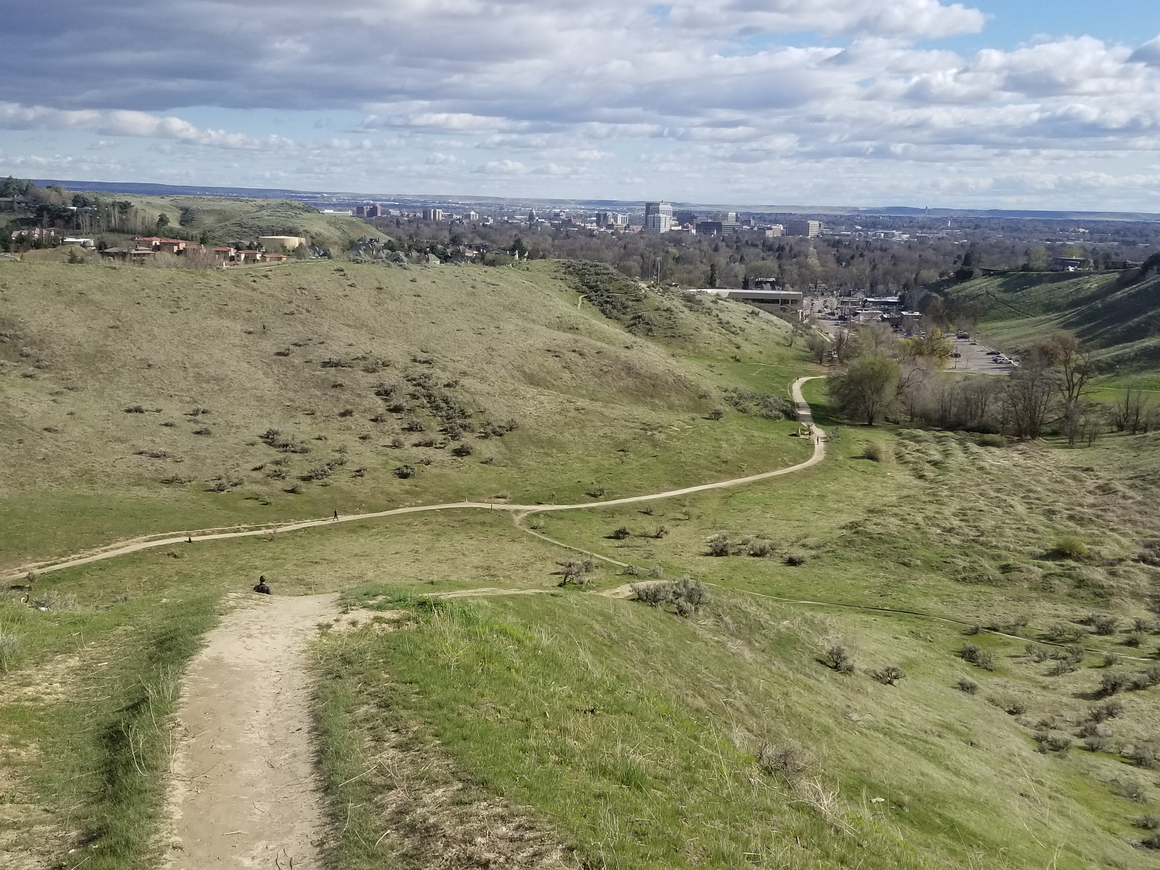
Hike #1 - Buena Vista Trail, Hillside to the Hollow. Difficulty: Moderate. Start either at the Harrison Hollow trailhead by Healthwise or behind Hillside Junior High along Hill Road. Buena Vista Trail has a very nice and moderate contour as it winds across the outer-front of the Boise Foothills, and it feels like you can reach out and touch the community below. Yet, you're at least 500 vertical feet above the city, so it's a great vantage point! If you do an out-and-back walk on Buena Vista, you'd cover several miles over an hour or so. 

Spring shot of Harrison Hollow looking down at the city.

Hike #2 - Central Ridge Trail, Military Reserve Park. 
Difficulty: Moderate. Start at the Military Reserve trailhead where Mountain Cove Road bends sharply to the right going west into the foothills. There's a large parking area on the right and a trail map. You can start by walking along the Mountain Cove trail along Freestone Creek for about a mile or so. Then, you can turn to the right and climb up on Central Ridge to that initial summit. Then walk south down the backbone of Central Ridge back toward the trailhead. On Central Ridge Trail, it looks like you're going walk right into the State Capitol building and downtown Boise. Kind of a cool selfie opportunity before you drop down to the trailhead. Travel time for this one would be 1-1.5 hours at a leisurely pace.

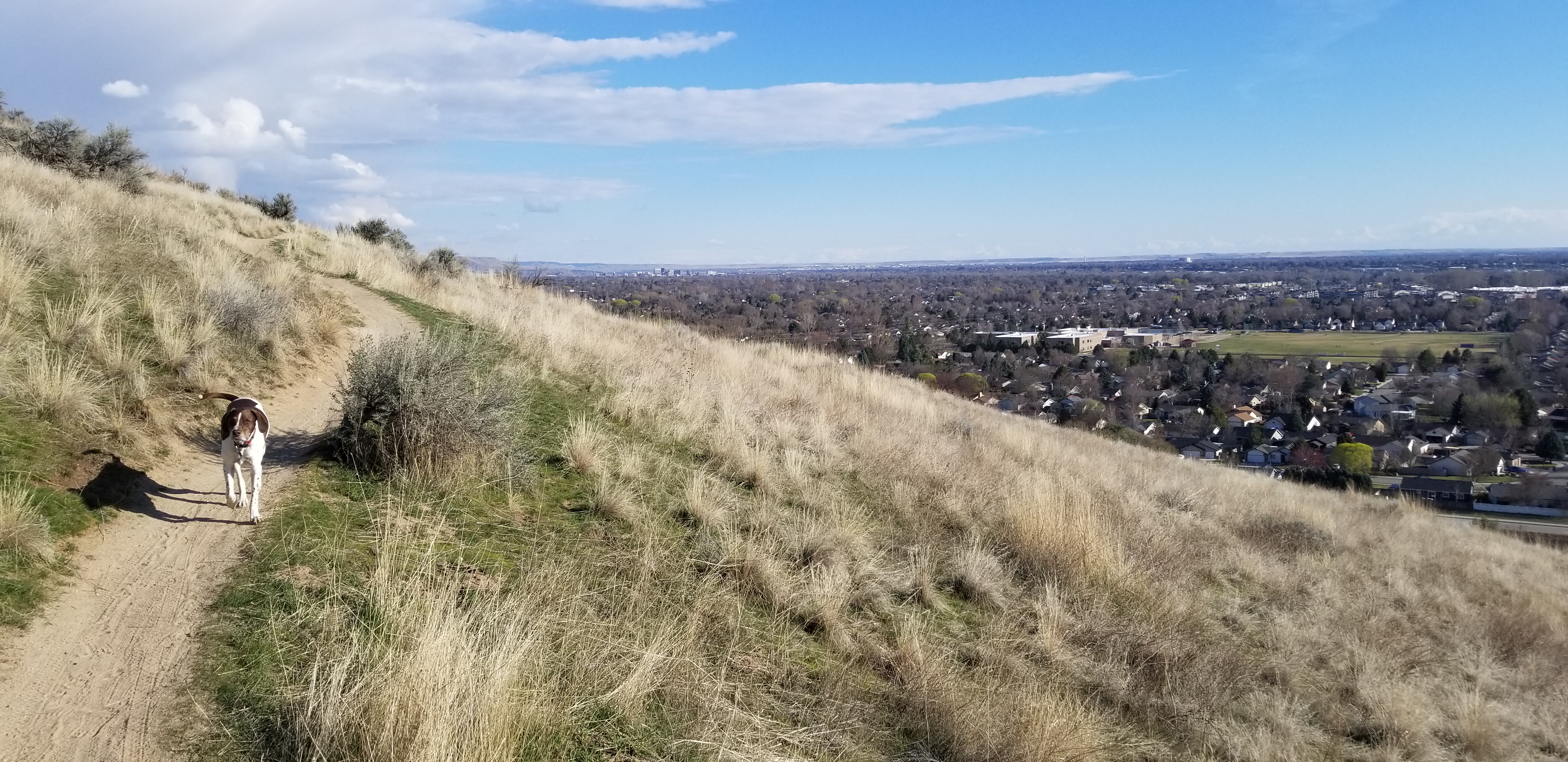
Great views of the city from Valley View Trail 

Hike #3 - Seaman's Gulch Loop. 
Difficulty: Moderate. Start at the Seaman's Gulch Trailhead off of Seaman's Gulch Road and Hill Road in West Boise. You have the option of hiking a short loop for 1 mile, or you can hike a longer loop for 3 miles with more views. In my Boise Trail Guide, I called this route "Seaman's Gulch Double Loop." The trails contour nicely across the landscape; you never have to work too hard to climb uphill. 

Short loop: Follow the left-hand fork of Trail #110 and climb to an initial ridge. Bear left at the top on Phlox Trail #112. That'll bring you back to the trailhead. 

Longer loop: Follow the same directions to start with, but once you reach the initial ridge, take Valley View Trail #111 as it wraps around the front of the Boise Foothills, super close to the edge of the city. Once the trail loops around the hills, it ties into Phlox Trail on a ridgetop, and you can head back to the trailhead on Phlox. The longer loop is 3 miles and features 500+ feet of vertical gain. Travel time is 1.5 hours. Take your time and enjoy it! 

All three of these hikes and 92 more are featured in my Boise Trail Guide: 95 Hiking and Running Routes Close to Home. The book is available at stevestuebner.com, Idaho Mountain Touring, Boise REI, and Rediscovered Books. 

Melissa Dawn will be giving away a free copy of Boise Trail Guide on 94.9 FM The River tomorrow (Friday) morning at approximately 7:40 a.m. Tune into my radio gig, and you can call in to win the book.

Have a great weekend! 
- SS 

Thursday, October 1, 2020

Five fall hikes in SW Idaho that really shine this time of year!

Charcoal Gulch, Boise National Forest (courtesy Visit Idaho) 

Hi all, 

When I see beautiful bluebird days like we've been having lately, I start yearning to visit Silver City in the Owyhees, upper Dry Creek in the Boise Foothills, Charcoal Gulch in Idaho City, and some of my favorite trails around McCall. 

For my outdoor tip this week, I'll recommend five fall hikes below. All of these hikes are in my two hiking guides, Boise Trail Guide: 95 Hiking and Running Routes Close to Home or Owyhee Canyonlands - An Outdoor Adventure Guide

The weather looks absolutely stellar for the next 7-10 days in the Boise area and Central Idaho! Cool nights -- freezing cold in the high-mountain elevations -- warm afternoons in the 70s and low 80s, and comfortable evenings while it's still light. Nothing better! 

Before you go, for fall hiking, remember to pack a few more things such as a good rain/wind coat, a few extra upper layers, a good hat, skull cap? water, snacks and camera (your phone) and hiking poles. 

The Mountain Coaster! (Courtesy Bogus Basin) 
And now, for the hikes: 

1. Bogus Basin Mountain Recreation Area - It's the last weekend at Bogus where they'll be operating lifts, food and beverage. You can hike Deer Point to Elk Meadows and do a 5-mile around the hike or do the full 10-mile Around the Mountain hike, or something less or more. 

2. Charcoal Gulch, Idaho City - Take a drive to Idaho City and go for a nice colorful hike on the Charcoal Gulch Trail, just on the outskirts of town. Find the trail by the Idaho City Airport (ever been there?) on the south side of town. There's a little trailhead on the north side of the airport. Take the Buena Vista Trail along the edge of the mountain, and then you'll see the junction for Charcoal Gulch. There are aspens and pines along the way, plus a small creek.  

Silver City 

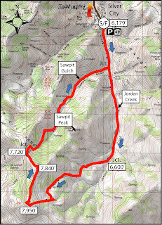
3. Silver City Sawpit Mountain Loop - It's an 8-5-mile loop that circumnavigates a timbered mountain with a bald pointy cap that looms over Silver City in the high-elevation community in the Owyhees. It's rated moderate to strenuous. The fall colors in Silver City should be starting to happen anytime! I wrote about this hike last fall for Idaho Press Outdoors. Please see my story for directions and details. 

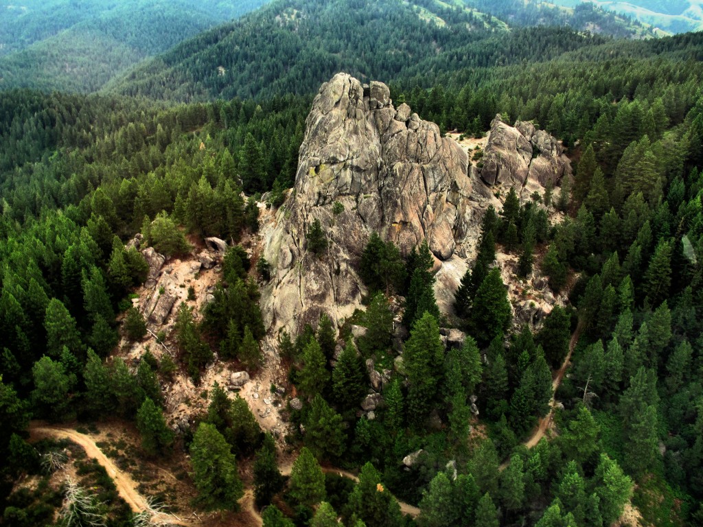
4. Freddy's Stack Rock Trail - Stack Rock is a signature granite pyramid-shaped rock on a timbered ridge to the west of Bogus Basin Mountain Resort. It's a 9.5-mile hike or bike ride from the trailhead to do the loop around Freddy's Stack Rock Trail. I would rate the hike/ride as moderate to strenuous because of a number of continuous uphills along the way, the distance and 2,600-vertical-foot gain/loss. You're walking/riding in the pines throughout the route, except when you get to Stack Rock, so that makes it scenic and intimate. Take a lunch to enjoy on Stack Rock. 

Image result for stack rock
Photo courtesy of Tom Lopez


Backstory: Approximately 1,300 acres of the Stack Rock area came into public ownership courtesy of a $1 million donation by Boise resident Fred Alleman and additional funds from the Boise Foothills Levy Committee. The land was purchased from the Terteling family in December 2009 for $1.32 million to make it available for public use. 

Directions: Park in the Forest Service parking lot and take the new trail over to Stock Rock/Sweet Connie junction to get started. Watch for the big parking lot on the right about Mile 12. 

You'll see a number of nifty bridges on the Dry Creek Trail ... keeping your feet dry.

5. Dry Creek out and back, Boise Foothills - Dry Creek is always a pretty hike, but especially right now, it should be great. The trailhead is off of Bogus Basin Road, several miles up from Boise, on the right side, as the road begins a series of hairpin switchbacks. You'll see other cars at the trailhead. It's a big day to hike to the top of the Boise Ridge via Dry Creek (7.5 miles, 2000+ vertical feet), so just take your time and go as far as you want. 


Have fun!
- SS 

Thursday, September 24, 2015

Explore five hikes in the Owyhee Mountains; Colors should be fab in Silver City!

Wendy and Huck in  a January hike in Brown's Canyon 
Wendy soars in a brisk wind on top of a mountain above Toy Pass
Great skyline views from the mountains above Toy Pass
The quakies should be golden in Silver City 
High on the saddle overlooking Silver City and surrounding area ... 
Sheep Creek canyon ... you'll have it to yourself. 
Gearing up for our ride in Silver City. 
Hi all,

It looks as if it's going to be a beautiful late September weekend in SW Idaho, with daytime highs in the low 80s and night-time temps in the high 40s or low 50s, depending on elevation. It'll be a great weekend for hiking, biking or camping in the Owyhee Canyonlands.

I've been thinking a lot about the Owyhees lately because of the 285,000-acre Soda Fire, and the subsequent recreation closure of multiple trailheads in the Owyhee Front. I also am giving a REI clinic on exploring the Owyhees next Wednesday at 7 p.m. (still openings available at press time), and I've been checking into the extent of the burn zone to share with folks who want to know!

So for my outdoor tip this week, I'll detail five places to go outside of the burn zone. Keep these in mind for the coming weeks in October as well. All of the trips are drawn from The Owyhee Canyonlands: An Outdoor Adventure Guide. 

Also, Avimor is hosting their fall Demo Days event from 10 a.m. to 4 p.m. on Saturday. There will be show-me rides, food, music and beer. The event provides a great chance to demo various new mountain bikes on the market. George's peeps said that demo trucks from Trek and Specialized will be there with 2016 models for people to test out. Idaho Mountain Touring, Ridgeline Sports, Broken Spoke, Kore North and Boise Bike Wrench will be there with more bikes to demo as well!

Now, back to the Owyhees ... See the burn map below for a big-picture view of the Soda Fire burn zone (click to enlarge):
Soda fire perimeter
Generally, the Owyhee Front between U.S. 95 and Reynolds Creek Road all lies inside the burn zone and the Bureau of Land Management is asking for recreationists to stay off these lands this fall. These areas include Jump Creek Canyon, Wildcat Canyon, Squaw Creek, and Wilson Creek. Areas around Silver City were left unscathed.

In Eastern Oregon, the fire spread to points east of the Succor Creek Road, but none of it crossed Succor Creek itself or the road, leaving everything to the west in good shape, including Three Fingers, Sage Creek, Painted Canyon, Carlton Canyon, the Honeycombs, Leslie Gulch, etc.

So here are my 5 recommendations for the weekend:
1. Hike or bike in Silver City - Try the Silver City Sawpit Peak Loop (8.5 mile hike; strenuous) or the Skyline Mine Tour (16.8 miles; advanced). Travel to Silver City via Nampa; take Idaho 45 to Walter's Ferry. Go left at the fork after crossing the Snake River and watch for the signed turnoff for Silver City on the right. It's about 20 miles to Silver City on paved and dirt roads. A high-clearance 4WD vehicle is best for the last 5 miles or so to the old mining burb. Even if the hike or ride sound like more than you'd like to bite off, go to Silver City and enjoy the yellow aspens and walk around town. You can take a hike up Jordan Creek south of town for several miles and climb to the ridge on two-track roads to a great overlook. This is the route for the Sawpit Peak Loop, but then it continues to wrap clockwise around the big mountain, descending back to Silver City via Sawpit Gulch. See detailed instructions in the Owyhee guidebook. There are multiple car-camping opportunities just north of Silver City.


2. Brown's Canyon Overland Tour - This is a nice, new 5.2-mile loop that circumnavigates the slot canyon hike in Brown's Canyon. You can look into the slot canyon without having to navigate the poison ivy, nettles, deep-water pools and thick brush. The hike starts and finishes in the Oreana area, west of Grand View. Rated moderate; travel time: 3+ hours. Getting there: Take I-84 to the Simco Road exit. Turn right on Simco Road and proceed to the state highway. Turn right at the highway and proceed to Grand View. Turn right on ID 78 in Grand View and then take the second left-hand turn to Oreana. Make a note of your odometer. Drive through the little town and go past the old church on the Oreana road until it takes a hard left. Make the corner and then take an immediate right on Alder Creek Road (no sign). Follow the road six miles to BLM Road 700. Turn right on 700 and drive to an old corral at a two-way junction. The hike  starts here. Continue west on BLM 700 and climb a moderate grade to a bluff that overlooks Browns Canyon. At mile 1.4, bear right on a two-track and drop into Brown's Creek draw. Walk down the draw until it begins to closeup in a blond slot canyon. Work to the left side of the draw and walk overland on the blond rocks staying above the draw. The canyon opens up at mile 2.0. Walk down the draw until the canyon closes up again, and then walk on the left rim of the canyon above the slot canyon. Walk around the small canyon when you come to that, and stay on the left rim until the slot canyon ends. Turn right on the dirt road at the end of the canyon at mile 3.6. Follow the road to a two-way junction at mile 4.0, turn right at a fence gate, and follow the two-track road BLM #710 back to the trailhead. Ending mileage is 5.2 miles. This hike would be great for kids and family. Bring sturdy shoes, plenty of water and a lunch.

3. Toy Pass - Two optional hikes take off from Toy Pass in the Owyhee Front, starting at 5,875 feet. Perfect for the fall! One hike is 5.3 miles exploring the mountain to the east of the pass, and the other is 4.5, exploring the small knob on the west side of the pass. Take I-84 to the Simco Road exit. Turn right on Simco Road and proceed to the state highway. Turn right at the highway and proceed to Grand View. Turn right on ID 78 in Grand View and then take the second left-hand turn to Oreana. Drive through the little town and go past the Basque church, then bear right on the signed Bachman Grade Road. Follow the well-maintained dirt road to the top of Toy Pass (about 13.5 miles). Park at the pass, and decide which mountain you'd like to climb from there.

4. Mary's Creek Canyon, south of Bruneau - Follow directions in a previous blog post on finding the Mary's Creek trailhead. This area is part of the Sheep Creek Wilderness on BLM land. The full loop is 8.75 miles, walking along the rim of Mary's Creek Canyon, dropping into the Sheep Creek Canyon, and then looping back to the trailhead. Travel time: 4-5 hours. You could do this as a backpacking trip and camp in Sheep Creek canyon. Be sure to pack your own drinking water and plenty of food.

5. Big Jack's Creek - The hike into Big Jack's from the Parker Trailhead is well east of the Soda burn zone, and it's a quick and easy way to get into the Big Jack's Wilderness, south of Bruneau. The directions, map and photos for this hike can be found in a previous blog post. It's 2.5 miles out and back. Rated moderate to strenuous (steep downhill into canyon; steep back out). Good hike for hikes and families.

Have fun!
- SS