Showing posts with label fall colors. Show all posts

Thursday, October 19, 2023

Last blast of gorgeous fall weather this weekend! Time to get after it!

Payette Rim Trail in McCall 

Hi all,

We've been blessed with gorgeous fall weather recently, and my main outdoor tip this week is to get out and ENJOY IT NOW! 

The weather is making a sharp turn next week toward colder and potentially winter-like conditions in the mountains. So this weekend is the time to capitalize on an outdoor outing, whatever works for you! 

I rode the Payette Rim Trail loop this afternoon in McCall to soak in the colors and enjoy a ride that always gets my heart, lungs and legs pumping! The aspen trees and the tammies are turning golden simultaneously right now, so that's a pretty sight to see in the fall low-angle sunlight.

Tammies glowing everywhere! 

After climbing for the first half of the ride, you drop into a singletrack trail that winds along through a series of flattish tree-lined benches above Payette Lake. Today, the sun had warmed from 38 degrees F in the morning to 70 or 75 at that moment. Pure blue sky above the Payette Crest Mountains and a mirror of that cobalt blue sparkled below on Payette Lake and Little Payette Lake.

As I descended on the rocky, snaky singletrack, the tammies and aspens were most brilliant approaching Bear Basin. Those colors should hold through the weekend. 

There's the moose. 

I jumped a bull moose on my ride today! That was a charge! A big black moose, but only a 2-year-old or so, didn't have a big rack. I flushed it out of the woods as I came down the trail. It ran across the trail and doubled-back to look at me like critters often do. We stared at each other for a few minutes and then he wandered off. Glad I didn't run into momma and her calf!         

Fetching views of Payette Lake from the trail.

All of the hiking and mountain bike trails in the greater McCall area would be a great call this weekend, as would be the Ridge to Rivers Trails in the Boise Foothills, Wilson Creek in the Owyhees, the Sawtooths in Stanley or the Wood River Trails in Ketchum.

You will encounter rocky features on the Rim Trail. 

A few Outdoor notes: 

  • Chemical treatment to eradicate quagga mussels on the Snake River in Twin Falls has run its course, and now the Idaho State Department of Agriculture and partner agencies will be closely monitoring and testing the water to see if they eradicated the mussels. Some portions of the Snake River below Auger Falls have re-opened. See the ISDA quagga page for the latest information.         
  • The McCall ski swap is this weekend Oct. 20-21 at the Payette Lakes Middle School. 
  • Boise Ski Swap is on Nov. 3-4 at the Expo Center at the Western Idaho Fairgrounds.
  • See my post about Idaho El Nino winters and Idaho Winter Preview on Opensnow.com 

- SS 

Thursday, October 5, 2023

Fall colors are popping in the Idaho Mountains! Time for a scenic drive!

Aspen groves light up the mountains in Upper Reynolds Creek, Owyhee Mountains. 
Photo taken Oct. 5 by Steve Stuebner. 

Hi all,

Fall colors are popping everywhere in the mountains right now. What better way to enjoy the colors than to take a scenic drive? Better yet, combine the drive with a hike or mountain bike ride to see things more up close and soak in the scenery. 

I recently traveled from McCall to Boise, and the aspen trees are lit up, the cottonwoods are turning yellow, and the shrubs are glowing orange, yellow and red, particularly at higher elevations.

Courtesy Anna Gorin on Facebook. Road to Packer John Mountain in Smith's Ferry.

To enjoy the colors, I'm recommending five scenic drives. Click on the links to see the scenic byway detailed descriptions via VisitIdaho:

1. Payette River Scenic Byway - Take Idaho 55 north to McCall to enjoy fall colors along the North Fork of the Payette River and in the Boise and Payette National Forest. Once in McCall, keep going north on Warren Wagon Road toward Upper Payette Lake and Burgdorf Hot Springs to see even more brilliant colors. Bring a swimsuit and towel to enjoy the natural geothermal hot water at Burgdorf. The hot springs won't be accessible by vehicle much longer until snow shuts the road and turns it into a snowmobile highway. That usually happens in late November. Stop for lunch in McCall -- there's a great sushi place as well as multiple other venues with sandwiches and burgers.

Sawtooth Valley (courtesy explore.org)

2. Ponderosa Pine Scenic Byway - Idaho 21 and the Banks-to-Lowman Highway. I saw full mountainsides glowing red this week from tip to tail near Grand Jean and Lowman.

3. Sawtooth Scenic Byway - The Sawtooth Valley is at a higher elevation and thus, the colors are happening big-time right now. Following Idaho State Highway 75 through Ketchum-Sun Valley and then over Galena Summit into the Sawtooth Valley should be spectacular. Do the big loop by combining the Ponderosa Pine Scenic Highway on Idaho 21 from Boise with the Sawtooth Scenic Byway on the way home, going from Stanley to Ketchum and then back to the Treasure Valley via U.S. 20. Stop for lunch in Ketchum. There are many great restaurants to choose from. I personally like the Pioneer, Whiskey Jacques, and Lefty's.

Wood River Valley aglow (courtesy VisitSunValley) 

4. Owyhee Uplands Backcountry Byway - Take a big drive from Grand View to Jordan Valley, Oregon on this scenic byway on backcountry dirt and gravel roads. It's about 100 miles and full day's drive to cover the byway. Beyond the BLM online guide, we provide all the details on this scenic drive in our popular guidebook, The Owyhee Canyonlands - An Outdoor Adventure Guideby yours truly and fine arts photographer Mark Lisk. There are restaurants and services in Grand View and Jordan Valley. Make sure you top off your gas tank before venturing off into the Owyhees!

Wendy along Jordan Creek in Silver City.

5. Take a scenic drive to Silver City in the Owyhee Mountains. The aspen trees are turning color in the quaint mining ghost town, located near Murphy. There are places to go hiking and mountain biking in Silver City. Details are available in The Owyhee Canyonlands - An Outdoor Adventure GuideTo reach Silver City, go south of Nampa on Idaho 45 to the Snake River and junction with Idaho 78. Turn left to head for Murphy and watch for a signed right-hand turn to Silver City. It's paved road for a while, and then it turns to dirt. Pack a lunch and enjoy the day!

Have fun!
- SS

Thursday, October 27, 2022

Try this trio of Boise foothills hikes with fetching, elevated views of the city - nice to see fall colors!

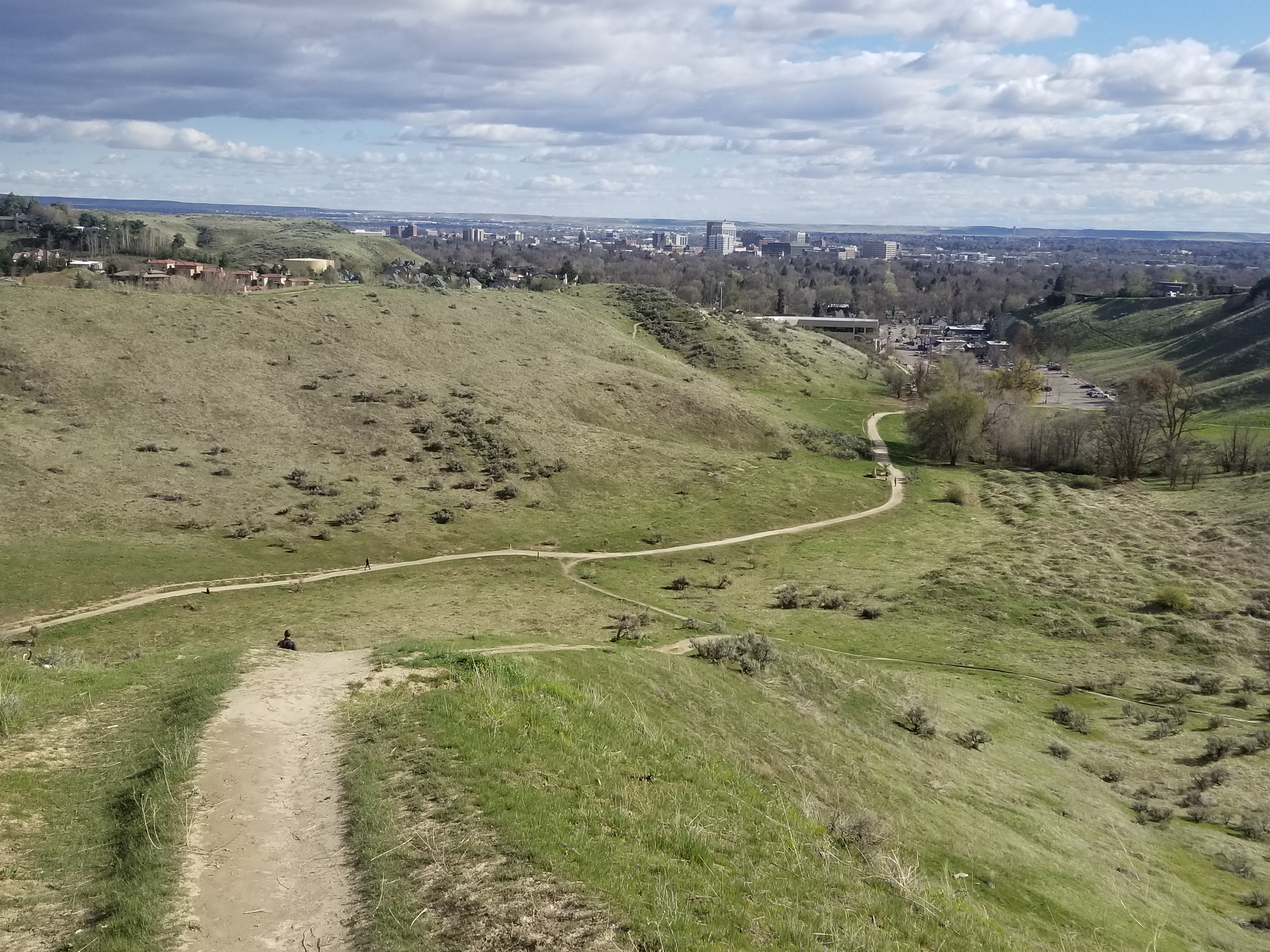
View of Boise from Central Ridge Trail in Military Reserve Park.

Hi all, 

After a nice cool and wet week to turn the page toward fall seasonal norms, the weather this weekend looks quite nice for some weekend outings! Afternoon high temps will be about 57 degrees F and sunny - a bit chilly but you can dress for it.  

Now that the fall colors are beginning to happen in the Boise Valley, for my outdoor tip of the week, I'm recommending three hikes close to home where you can enjoy some fetching views of the City of Trees and the wide variety of colors visible as far as the eye can see! All of these are kid-friendly. 

Full Sail Trail heading over to Buena Vista (courtesy BoiseTrails.com)

Hike #1 - Buena Vista Trail, Hillside to the Hollow.
Difficulty: Moderate. Start either at the Harrison Hollow trailhead by Healthwise or behind Hillside Junior High along Hill Road. Buena Vista Trail has a very nice and moderate contour as it winds across the outer-front of the Boise Foothills, and it feels like you can reach out and touch the community below. Yet, you're at least 500 vertical feet above the city, so it's a great vantage point! If you do an out-and-back walk on Buena Vista, you'd cover several miles over an hour or so. 

Spring shot of Harrison Hollow looking down at the city.

Hike #2 - Central Ridge Trail, Military Reserve Park.
Difficulty: Moderate. Start at the Military Reserve trailhead where Mountain Cove Road bends sharply to the right going west into the foothills. There's a large parking area on the right and a trail map. You can start by walking along the Mountain Cove trail along Freestone Creek for about a mile or so. Then, you can turn to the right and climb up on Central Ridge to that initial summit. Then walk south down the backbone of Central Ridge back toward the trailhead. On Central Ridge Trail, it looks like you're going walk right into the State Capitol building and downtown Boise. Kind of a cool selfie opportunity before you drop down to the trailhead. Travel time for this one would be 1-1.5 hours at a leisurely pace.

Great views of the city from Valley View Trail 

Hike #3 - Seaman's Gulch Loop.
Difficulty: Moderate. Start at the Seaman's Gulch Trailhead off of Seaman's Gulch Road and Hill Road in West Boise. You have the option of hiking a short loop for 1 mile, or you can hike a longer loop for 3 miles with more views. In my Boise Trail Guide, I called this route "Seaman's Gulch Double Loop." The trails contour nicely across the landscape; you never have to work too hard to climb uphill. 

Short loop: Follow the left-hand fork of Trail #110 and climb to an initial ridge. Bear left at the top on Phlox Trail #112. That'll bring you back to the trailhead. 

Longer loop: Follow the same directions to start with, but once you reach the initial ridge, take Valley View Trail #111 as it wraps around the front of the Boise Foothills, super close to the edge of the city. Once the trail loops around the hills, it ties into Phlox Trail on a ridgetop, and you can head back to the trailhead on Phlox. The longer loop is 3 miles and features 500+ feet of vertical gain. Travel time is 1.5 hours. Take your time and enjoy it! 

All three of these hikes and 92 more are featured in my Boise Trail Guide: 95 Hiking and Running Routes Close to Home. The book is available at stevestuebner.com, Idaho Mountain Touring, Boise REI, and Rediscovered Books. 

Ken and Melissa will be giving away a free copy of Boise Trail Guide on 94.9 FM The River tomorrow (Friday) morning at approximately 7:40 a.m. Tune into my radio gig, and you can call in to win the book at 208-287-2949. 

Have a great weekend! More moisture forecast next week! More snow for the mountains! 
- SS 

Thursday, October 15, 2020

Take a "Leaf-Peeping" Fall Foliage vacation in New England


Fall colors are beginning to burst from the top of Mt. Kearsarge near New London, N.H. 

Kancamagus Highway, White Mountains, NH (courtesy New England Tourism)

Hi all,

I visited my son, Quinn, at Colby-Sawyer College in New London, NH, last weekend, and I was hoping that my trip would be well-timed to experience the fall colors building to a peak in New England. 

As things turned out, it was close to the peak! Midway upstate in New Hampshire, where we visited our cousins in Waterville Valley, the leaves were a bit past the peak in the White Mountains. In New London, a bit to the west and south, the colors were beginning to burst with color, but yet-to-peak fully. Still, I felt blessed to experience the grandeur of fall colors while climbing several mountains with Quinn. Always great fun to hang out with Quinn! I also got to see my sister, Sue, who is president of Colby-Sawyer, and take some pretty walks in New London, a charming little town.   

For this week's outdoor tip, I'd like to recommend some popular places to see and go as part of a New England fall folliage vacation. Tuck this idea away for post-Covid life, if that ever occurs! 

If you haven't heard, New England is considered a national tourist destination for fall colors. A unique mix of sugar maple trees, hickories, paper birches and tulip poplars create an amazing kaleidoscope of colors, including varying shades of red, yellow, orange and purple! 

And here's a new one for you ... people who travel to see fall folliage are known as a "Leaf-Peeper." The overall practice is known as "Leaf-Peeping." 

From Wikipedia: Leaf peeping is an informal term in the United States and Canada for the activity in which people travel to view and photograph the fall foliage in areas where leaves change colors in autumn,[1] particularly in northern New England[2][3] and the upper Midwest, as well as the provinces of Ontario and Quebec.[4][5] An organized excursion for leaf peeping is known as a foliage tour or color tour.

Last Friday, Quinn and I climbed Mt. Kearsarge, kind of the local mountain for Colby-Sawyer students, staff and faculty. The college holds a Mountain Day event each fall, where everyone climbs to the top of Mt. Kearsarge (elev. 2,923 feet), and enjoys a picnic aftewards. This year it was an on-your-own version of Mountain Day, and that happened to coincide with my visit with Quinn. It's a steep trail with lots roots and rocks to climb over, but once on top of the granite slabs at the summit, it's a great 360-degree view of the surrounding countryside. 

On Saturday morning, we ventured to Waterville Valley to climb a mountain and visit my cousins who have a ski house in the 'hood. Quinn and I were going to hike a national forest trail to the top of two peaks, but as we neared the trailhead, we saw 200-300 cars parked on either side of the paved road. So we're like, no thanks! We decided to climb the Waterville ski area instead -- a 2,000-foot vertical climb over several miles, hiking up the grassy slopes next to thick and colorful trees.

From the summit of Waterville, it seemed the leaves were just a bit past the peak ... 

Top of Waterville Valley ski area. Nice day for a hike! 

I get a kick out of Quinn wearing his river hat on a hike. It was an uncommonly warm, fall day.  

They actually mow the ski slopes at Waterville presumably to enable them to open as early as possible with natural and man-made snow. But that made the hiking and footing quite nice.

Now, here are some other recommendations for fall foliage destinations/tours:

  • Drive the Kancamagus Scenic Highway in the White Mountains. This route is considered to be one of the best scenic drives for fall foliage in New England. The route is 35 miles long. Find a cool B&B or AirBnb to stay in near the route! 
  • Drive the Mountain Washington Auto Road to reach the highest summit in New England on Mount Washington (elev. 6,288 feet). It's also one of the coldest and windiest spots in the whole region, so plan for that! There are hiking trails nearby from the summt. 
  • Take the cog railway to the top of Mountain Washington. The train climbs the mountain at a 25 percent grade in places. It takes an hour round-trip, according to the web site. 
  • Here's a guide to 15 scenic drives for fall foliage in New England. 

Courtesy Mt. Washington Cog Railway

Hope that whets your appetite! If not, check out these photos! 

Courtesy Great Train Escapes

Courtesy Stellar Travel 


Thursday, September 24, 2020

Take a scenic drive to see fall colors bursting in Idaho's Mountains

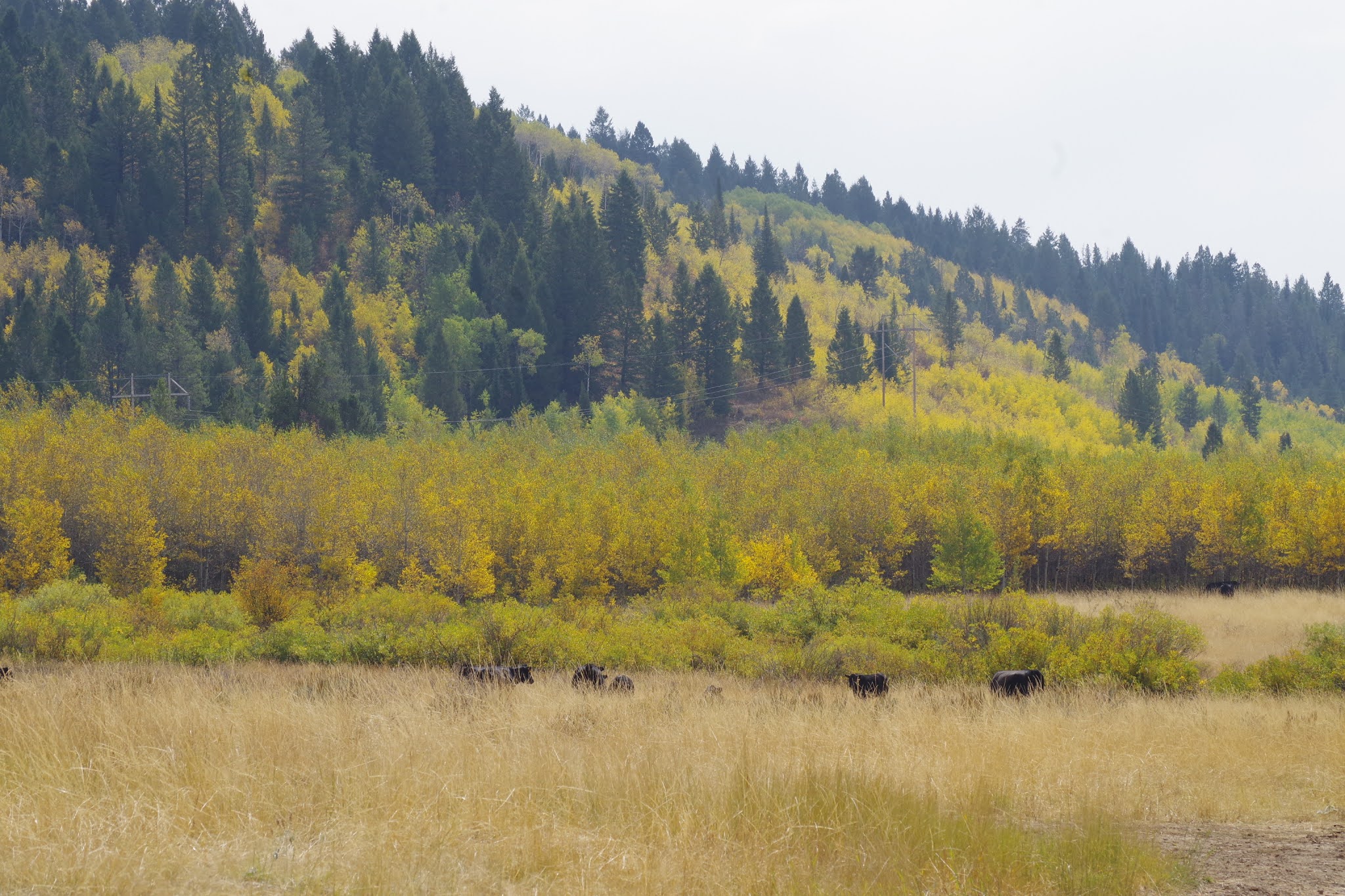
Caribou-Targhee National Forest, taken on Tuesday.  

Big-toothed maple trees glowing between Soda Springs and Lava Hot Springs 

Hi all, 

This week for my outdoor tip, I'd recommend taking a scenic drive to enjoy fall colors, which are really starting to pop in the higher elevations! 

I had a business trip to Southeast Idaho this week, and I was surprised and amazed how beautiful the colors were, especially as I went from Lava Hot Springs, south of Pocatello, toward Soda Springs. The big-toothed maple trees in the Portneuf Mountains, Bannock Mountains and other ranges in Southeast Idaho are turning deep red. Aspens are turning yellow, and cottonwoods are also beginning to take on a golden glow. The time is now! 

Visit Idaho lists two scenic drives in SE Idaho. I'd recommend the Oregon Trail - Bear Lake Scenic Highway , which goes from Lava Hot Springs to Soda Springs, Montpelier then Bear Lake. All interesting and scenic spots, a bit off the beaten track. 

With fires burning in the South Hills, the City of Rocks to Oakley scenic byway is out of the question. Fall colors may be popping in the Ketchum-Sun Valley area and Stanley. My friend Cheryl Bennett posted a few pics on a horseback ride this week in the East Fork Big Wood area, and the aspens and cottonwoods were turning a brilliant yellow. 

Courtesy Cheryl Bennett 

Here's a post I did last year on five Idaho scenic drives, which features a number of scenic drives in SW Idaho and N. Idaho. 

Clearwater River country 

Here are scenic drives in Southern Idaho ... see VisitIdaho.com for more information.  

Cobb Peak in the Pioneer Mountains, courtesy Cheryl Bennett 

Thursday, October 31, 2019

Dry Creek hike in Boise Foothills reveals neat ice patterns, fall color

Huck had a blast sniffing for birds and perching on rocks 
Patches of ice formed interesting patterns in the creek. 
Hi all,

I went hiking with Huck on the Dry Creek trail this week to see if the fall colors were still happening -- and they were in places. But it was a surprising dividend to see some cool shapes and designs in the ice forming in the creek.

We've had low temperatures in the teens and 20s this week, so Dry Creek was definitely covered with ice in flatter portions of the streams and in the beaver ponds. It's supposed to get a little warmer in the days ahead, so I recommend getting out to hike Dry Creek or do the Shingle Creek-Dry Creek Loop before the snow comes and the trail gets mucky.

That's my outdoor tip this week ... get out and enjoy the Boise Foothills trails while you can!

Some sections of the creek were almost completely frozen. 
I also am looking forward to attending the Bogus Basin Ski Education Foundation Ski Swap Friday-Sunday at Expo Idaho this weekend. See the web site for details on selling and buying equipment.

BTW, if it's ski swap time, that means the Warren Miller annual ski movie is coming up! It's scheduled for Thursday, Nov. 21 through Sunday, Nov. 24 at the Egyptian Theater.

A hiker and a jogger cruising up the trail with their dogs 
Now back to the Dry Creek hike ... starting from the trailhead on Bogus Basin Road, you can hike up the creek as far as you want ... On Thursday (today), I hiked about two miles or so up the trail to the Shingle Creek junction, and came back. Going on a mid-week day, I saw only 2 other people on the trail during my hike.

The Dry Creek trail is kind of steep up and down threading through some cool granite goblin-like rocks in the first 1/2 mile, but after the trail drops down by the creek, it's a very pleasant walk up the draw. There are numerous places where you could stop and have a picnic.
Dry Creek-Shingle Creek Loop map (courtesy alltrails.com) 

Remains of a stone house next to a large locust tree that settlers planted.  
Tackling the Dry Creek-Shingle Creek Loop is a much more ambitious endeavor. The route covers 13.8 miles and features 2,221 feet of gain. Nothing too extreme, but it's still a substantial hike with multiple strenuous pitches. That one would take about 5 hours or more, depending on your speed of travel.

Take a walk up there and enjoy the sights! I wondered about the history of a stone house up there ... I would like to know more about the settlers who tried to live up there.

Beaver pond complex was just freezing over. 
Be sure to dress in layers for the hike. You'll warm up and shed most of your layers on the way up the trail, and then cool down for the walk back down. I needed a hat and gloves for my hike. The temperature was in the high 30s, so not all that warm. It is supposed to warm up a bit next week in the afternoons.

Have fun!
- SS

Thursday, October 17, 2019

Fall colors are bursting in the mountains! Time for a scenic drive in Idaho!

The tamarack trees are peaking in Smith's Ferry and Valley County! This photo was taken Wed., Oct. 16. 
Hi all,

I've been burning up the highways in Idaho lately, mostly for work, but I can tell you that the colors are really starting to peak along Idaho 55 between Boise and McCall.

The same is true in North Idaho on scenic U.S. 12 between Lewiston and Missoula, and I'm sure the colors are peaking on the Ponderosa Pine Scenic Byway between Boise and Stanley, and on the Sawtooth Scenic Byway as well. The colors along the Thousand Springs Scenic Byway between Hagerman and Twin Falls are happening, too!

Along Idaho 55, the tamarack trees are peaking this week! The shrubs are going wild as well with lots of brilliant yellows, crimson reds and bright orange hues as well.   

Even if the weather is crummy this weekend, particularly on Saturday, I'd recommend you take a scenic drive when you get a chance to enjoy the brilliant fall colors Idaho-style! Plus, you can bet that the big front moving through on Saturday is going to blow a lot of the leaves off the trees, so there's a bit of an imperative to get out to see the colors when you can!

Here are my recommendations - click on the links to see the scenic byway detailed descriptions via VisitIdaho:

North Fork Payette River near Banks 
1. Payette River Scenic Byway - Take Idaho 55 north to McCall to enjoy fall colors along the North Fork of the Payette River and in the Boise and Payette National Forests. Even making a shorter drive from Boise to Smith's Ferry would yield big dividends right now. The colors are magnificent around Banks and the North Fork, and in Smith's Ferry, there are lots of tamarack trees to view.

2. Ponderosa Pine Scenic Byway - Idaho 21 and the Banks-to-Lowman Highway should be promising, but you don't have to go all the way to Stanley. You could take an out-and-back cruise to Idaho City, or maybe make a reservation at The Springs to take a leisurely hot springs soak. You also could drive a big loop by taking ID 55 to Banks, take the Banks to Lowman road to Lowman, and then circle back to Boise via Idaho City on Idaho 21. Might be a little snow at Beaver Creek Summit!

Fall colors bursting from trees near Lowell, Idaho 
3. Sawtooth Scenic Byway - Take U.S. 20 to Fairfield and head for Sun Valley when the weather gets better. The colors in the Wood River Valley and the Sawooth Valley should be fantastic, but you may not have that much time left, particularly after the weather hits this weekend! Stop for lunch in Ketchum. There are many great restaurants to choose from. I personally like the Pioneer, Whiskey Jacques, and Lefty's.

Selway River, near Lowell 
4. If it might work for your schedule, try the scenic drive on U.S. 12 from Lewiston to Missoula, the Northwest Passage Scenic Byway. It roughly follows the historic route of Lewis & Clark and the Corps of Discovery. I was up there last weekend, and the colors were brilliant along the Clearwater River and along the Lochsa River.

Fall colors lighting up Box Canyon (courtesy Southern Idaho Tourism) 
5. Thousand Springs Scenic Byway - Follow U.S. 30 from Hagerman to Twin Falls. Potential side trips include Hagerman fishing ponds, Miracle Hot Springs, Hagerman Fossil Beds museum, Snake River Grill and more! Click here for details. Here's a post about three other scenic drives in the Magic Valley.

Have fun!
- SS

Thursday, September 27, 2018

Explore five scenic drives in Southwest Idaho where you're guaranteed to see fall colors

Scenic vistas of the Sawtooth Mountains (courtesy iexplore.com) 
Upper Payette River along the Ponderosa Pine Scenic Byway
Classic scene at the Rainbow Bridge on Idaho 55, Payette River Scenic Byway
Idaho scenic byway routes in Southern Idaho
North Fork Owyhee River canyon 
Silver City - hiking up Jordan Creek with Wendy
Hi all,

Fall colors are beginning to pop everywhere right now. What better way to enjoy the colors than to take a scenic drive?

I recently traveled to Salmon and back via Idaho 93, Idaho 75, Idaho 21 and the Banks to Lowman highway, and I saw aspen trees and cottonwoods turning yellow, and the shrubs are glowing orange, yellow and red, particularly at higher elevations.

To enjoy the colors, I'm recommending five scenic drives. Click on the links to see the scenic byway detailed descriptions via VisitIdaho:

1. Ponderosa Pine Scenic Byway - Idaho 21 and the Banks-to-Lowman Highway. I saw full mountainsides glowing red this week near Grand Jean and Lowman.

2. Sawtooth Scenic Byway - The Sawtooth Valley is at a higher elevation and thus, the colors are happening big-time right now. Following Idaho State Highway 75 through Ketchum-Sun Valley and then over Galena Summit into the Sawtooth Valley should be spectacular. Do the big loop by combining the Ponderosa Pine Scenic Highway on Idaho 21 from Boise with the Sawtooth Scenic Byway on the way home, going from Stanley to Ketchum and then back to the Treasure Valley via U.S. 20. Stop for lunch in Ketchum. There are many great restaurants to choose from. I personally like the Pioneer, Whiskey Jacques, and Lefty's.

3. Payette River Scenic Byway - Take Idaho 55 north to McCall to enjoy fall colors along the North Fork of the Payette River and in the Payette National Forest. Once in McCall, keep going north on Warren Wagon Road toward Upper Payette Lake and Burgdorf Hot Springs to see even more brilliant colors. Bring a swimsuit and towel to enjoy the natural geothermal hot water at Burgdorf. The hot springs won't be accessible by vehicle much longer until snow shuts the road and turns it into a snowmobile highway. That usually happens in late November. Stop for lunch in McCall -- there's a great sushi place as well as multiple other venues with sandwiches and burgers.

4. Owyhee Uplands Backcountry Byway - Take a big drive from Grand View to Jordan Valley, Oregon on this scenic byway on backcountry dirt and gravel roads. It's about 100 miles and full day's drive to cover the byway. Beyond the BLM online guide, we provide all the details on this scenic drive in our popular guidebook, The Owyhee Canyonlands - An Outdoor Adventure Guideby yours truly and fine arts photographer Mark Lisk. There are restaurants and services in Grand View and Jordan Valley. Make sure you top off your gas tank before venturing off into the Owyhees!

5. Take a scenic drive to Silver City in the Owyhee Mountains. The aspen trees are turning color in the quaint mining ghost town, located near Murphy. There are places to go hiking and mountain biking in Silver City. Details are available in The Owyhee Canyonlands - An Outdoor Adventure GuideTo reach Silver City, go south of Nampa on Idaho 45 to the Snake River and junction with Idaho 78. Turn left to head for Murphy and watch for a signed right-hand turn to Silver City. It's paved road for a while, and then it turns to dirt. Pack a lunch and enjoy the day!

Have fun!
- SS

Thursday, November 10, 2016

10 outdoorsy ideas to pursue on a beautiful November weekend in SW Idaho

Boise River Greenbelt in the fall (courtesy LifewithLolo)
Paddling to see fall colors on Payette Lake (courtesy Pete Zimowsky) 
Leslie Gulch would be a great call this weekend 
Fall biking is all the rage right now ... perfect riding conditions
Fisher-Williams Trail in the White Clouds 
Steelhead fishing is hot now! 
Hi all,

The weather looks fab for the weekend, with temperatures in the 60s and a very small chance of rain in the Boise and SW Idaho area on Saturday morning ... It's amazing to have this kind of weather in November, but it looks like this will be the last weekend of warm temps before things turn to cooler and wetter weather next week, so you might as well get out and enjoy it!

This week, I'm throwing out some outdoorsy ideas close to home to appeal to folks who like to hike, bike, run, paddle, camp or fish ...

1. Go for a sunny walk, run or bike ride on the Boise River Greenbelt. Wait for the weather to warm up in the afternoon and enjoy it! Make a point to stop by the new Esther Simplot Park near the Whitewater Park and check out the many pathways and trails in the park.  

2. Go hiking/running/biking in the Boise Foothills and enjoy the last remaining fall colors. Going to the creeks and gulches is where you'll see the colors in the shrubs and trees. I recommend Polecat Gulch, Dry Creek, Corrals, Hulls Gulch, Hulls Gulch Interpretive Trail, Military Reserve Park, Five Mile Creek, and Orchard Gulch. My book, Boise Trail Guide: 90 Hiking and Running Routes Close to Home, would be a handy reference for any of these trails.

3. Go kayaking/rafting/SUPing on the Payette River. Banks to Beehive would be the best bet. Wear a wetsuit if you're SUPing.

4. Go steelhead fishing on the Salmon, Snake or Clearwater rivers and catch a monster steelhead ... See a new blog post I wrote for VisitIdaho about this fall ritual.

5. Go fall mountain biking! I wrote about five of my favorite rides statewide in a new blog post for VisitIdaho. The blog features Around the Mountain at Bogus, Loon Lake Loop in McCall, Fisher-Williams Loop in the White Clouds, Gold Hill Switchback Special near Sandpoint, and Farragut State Park north of Coeur d'Alene.

It's all fun riding the China Ditch Trail in Reynolds Creek canyon
Pictured here are Paul Hilding, Mark Anderson, Steve Schneider and Jim Giuffre 
6. Ride the Northwest Passage Loop in the Wilson Creek area in the Owyhee Front. This is a 16.2-mile ride that takes about 4 hours to complete. Be sure to take your time, pack a lunch and enjoy the scenery. My blog post has all the details. The ride also is featured in my book, "The Owyhee Canyonlands - An Outdoor Adventure Guide."

7. Top off the tires in your road bike and go for a nice long afternoon ride. I'd recommend: a) Hill Road to points west (Eagle or Star). Loop it with Floating Feather or Beacon Light Road. b) Ride to Hilltop Summit and back; c) Cartwright Loop; d) City to Farm. All of these rides and more are detailed in my road guide, "Boise Road Cycling Guide."

Wees Bar petroglyphs (nice pic by SummitPost) 
8. Hike/run or ride to Wees Bar on the Snake River by Swan Falls. It's 12.2 miles out and back to Wees Bar, where you can see Native American petroglyphs on big boulders on the banks of the Snake River. Trailhead is across Swan Falls Dam. The route is detailed in Boise Trail Guide

9. Hike or ride from Mores Creek Summit to see how the Pioneer Fire may have affected your favorite backcountry ski lines on Pilot Peak or Sunset Peak. Go to Idaho City and continue on Idaho 21 to Mores Creek Summit to reach the trailhead. I'm hoping to do this myself very soon!

10. Go hiking or camping at Succor Creek or Leslie Gulch. It's a perfect time to visit these destinations in the Owyhees. Take U.S. 95 south from Marsing to a signed turnoff for Leslie Gulch. Succor Creek is best reached via Homedale. Both areas are detailed in my Owyhee Canyonlands guide.

Trail note: SWIMBA is hosting a trail-work day at the Eagle Bike Park to work on a re-route of Treasure View Traverse. See this link for details.

Have fun!
- SS