Showing posts with label Boise National Forest. Show all posts

Thursday, March 2, 2023

Take a scenic drive to see wildlife on Banks to Lowman Road

Be sure to watch the elk from a respectful distance. 

Hi all, 

It's early March, but this weekend is going to feel more like winter than spring. 

With weekend temps barely reaching 40 in Boise, and a chance of light snow, it might be a nice change of pace to take a leisurely scenic winter drive.  

March is a great time of year to visit the Wildlife Canyon Scenic Byway, a.k.a. the Banks to Lowman Highway, watch for deer and elk on the mountainsides (or on the road), maybe go for a short walk, take a nice soothing hot springs soak and then cap it off with a hearty meal in Crouch at the Dirty Shame Saloon.

All of these things are doable in a day trip Boise. The Banks to Lowman road covers 33 miles tip to tail. And most likely, you'll be going out and back.  

How to get there: Take Idaho 55 north from Boise to Banks. Turn right. Now you're on the Wildlife Canyon Scenic Byway. 

Courtesy Boise National Forest

Large groups of elk and deer are typically visible along the two-lane scenic road. Be sure to give the animals a wide berth. Don't spook them or cause them to burn extra energy. It's a vulnerable time of year for them. Deer and elk are drawn to the big, open south-facing slopes on the north side of the canyon because they are snow-free. In the coming weeks, tiny shoots of green grass will begin to sprout.

Be sure to bring your binoculars. You also may see bald eagles, golden eagles and red-tailed hawks flying around. Pack a lunch, snacks and water for the day trip. 

Courtesy Boise National Forest 

Several choices are available for hot springs to visit as part of your trip: 
  • Hot Springs Campground - Just east of the town of Garden Valley, the hot pools are down by the river's edge. Not sure if the campground is plowed. Call the Boise National Forest for more information. 
  • Pine Flats Hot Springs is a beautiful spot along the South Fork of the Payette River that serves as a Forest Service campground in the summertime. The hot springs pools are small, and there's a hot shower you can stand underneath too.  
  • Kirkham Hot Springs is probably the most popular roadside hot springs in Idaho, given its proximity to Boise. There are some nice hot pools next to the river. Bring a swimsuit. Be sure to Pack out what you pack in and leave the area nicer than you found it. 
  • Bonneville Hot Springs is about 20 miles toward Stanley on Idaho 21, east of Lowman. It has some nice larger hot pools and an old wooden shake with a bathtub inside. Because of snow, you'll need to hike in less than a mile to the springs from the highway.   
A couple of other places where you can see wildlife in a scenic drive would be on the Salmon River Road, going upstream from Riggins, or going downstream from North Fork near the town of Salmon. Both areas are promising for seeing bighorn sheep, elk, deer and maybe even mountain goats. 

Have fun! 
- SS

Thursday, May 20, 2021

2021 camping season is kicking into gear on National Forest lands! 8 Tips on best camping practices

Camping season is upon us!

Hi all, 

It's been a great spring for camping in the Owyhee Canyonlands and BLM lands and river sites in SW Idaho. Now that the snow has melted out in the lower elevations in the Boise, Payette and Sawtooth National Forests, Forest Service officials are opening numerous campgrounds this weekend (May 21-23) and next for the traditional camping opener over the Memorial Day long weekend coming up May 28-31.  

The weather actually looks quite rainy and cold in McCall and Stanley this weekend, but the weather looks more promising for Memorial Day weekend, so perhaps you can plan your next outing and pick a fun spot for friends and family.

The Boise National Forest just released a list of campground opening dates online. The Payette National Forest also has opening dates here. The Sawtooth National Forest camping link is here with opening dates. Generally, camp sites at low to mid-elevation are open now, and higher-elevation sites in Stanley and the Sawtooth Valley will be opening soon. 

Check out this new statewide Forest Service interactive map! It's a handy resource for locating campgrounds and other national forest amenities.

Many Idaho State Park campgrounds are open now and will be soon. See this link for information on reserving a campsite an Idaho state park. Local favorites include Three Island State Park, Bruneau Dunes State Park, Lake Cascade State Park and Ponderosa State Park. See the IDPR web site for more information. 

Research BLM campsites here. There are many hidden jewels on BLM lands.

So it's time to plan a trip! Pull all the camping stuff together, tents and sleeping bags, food, water, clothes, etc. Or perhaps you have everything packed in an RV? Research a campsite that provides the kinds of amenities you want such as hiking or biking trails nearby or water hookups? Fishing? River or stream access? Grand views? There are literally hundreds of camping locations to enjoy in Idaho. 

What kind of setting do you want for your camping experience?

Tip #1 - Know where to go. Research where you're going to go camping before you go. Make a reservation online, if necessary, and you'll have your trip dialed in. If you're going to pursue a campsite in a campground where no reservations are necessary, go early to get your spot. 

Tip #2 - Make a Plan B. Your favorite campsite might be taken or the campground could be full. You'll need an alternative plan if things get busy. If last year is any indication, it's going to be a busy summer with major competition for campsites in Idaho. Going mid-week or in off-peak times will be a great way to avoid the crowds.

Tip #3 = Make a Plan C. Plan B might be taken too. 

Tip #4 - Remember to Pack-it-in/Pack-it-out. Bring your own garbage bags and pack out your garbage. Many public lands camping areas have no dumpsters or trash service. 

Tip #5 - Leave no Trace. Leave a clean campground when you leave. Pack out all of your things and garbage and make sure you haven't left any micro-trash on site ... things like small wrappers or twist-ties or what not. 

Tip #6 - Snuff out your campfire completely before you leave. Pour water on the fire and make sure you don't leave hot coals behind. More than 80% of the wildfires in Idaho are typically caused by humans. 

Tip #7 - When nature calls, dispose of human waste properly. Use the outhouse or dig a cat-hole and bury your waste. Bring a little shovel for digging a proper hole. Walk 200 feet away from any water sources. See video for more detail.


Tip #8 - Bring your own firewood. There might not be much firewood available at your camping spot, depending on location. 

Thanks to Tread Lightly and the Boise National Forest for the videos!

Have fun out there!
- SS

Thursday, May 13, 2021

Station Creek, Cottonwood Creek National Forest hikes are tailor-made for a warm weekend in Boise


Wendy and Huck enjoy the view on top of the first ridge on the Station Creek Trail.

Hi all, 

It appears we're in for a bit of a heat wave this weekend, comparably speaking, with high temperatures in the low to mid-80s Friday-Sunday in the Boise Valley. It'll be in the 60s and 70s in the mountains around McCall, Stanley and Sun Valley.

Getting out early on Boise Foothills trails will be the charm this weekend, or heading to slightly higher elevations would be a good idea, too! 

To that point, I'm recommending two hikes in the Boise National Forest -- Station Creek and Cottonwood Creek -- for my outdoor tip of the week, plus I'll recommend a few other destinations that'd be perfect right now (below). 

Station Creek Hike

Station Creek Trail is a beauty, coarsing through a continuous layer of green on the forest floor, while stately ponderosa pine trees provide shade in the canopy overhead as you're climbing the mountain. Arrowleaf balsamroot is blooming in bright yellow along the way. It's a 7-mile out-and-back hike to the top of Bald Mountain, or roughly 5 miles out and back if you hike to the first ridge overlook. Hiking time: 3-5 hours round-trip. Rated: Moderate (strenuous in a few places)

If you go to the top of 5,122-foot Bald Mountain, you'll climb 2,000 vertical feet along the way. That's a very reasonable climb for most people who are in decent shape. Just take your time, breathe, and enjoy the scenery!

The trailhead is located directly across the Banks-Lowman Highway from the Garden Valley Ranger Station - hence the name, Station Creek! 

The well-maintained trail will take you to the top of the first ridge, and then there is a more faint elk trail that follows the lay of the land to the top of Bald Mountain. It's easy to find your way. 

Be sure to pack plenty of water and bring a lunch/snacks for the summit!


Steve and Huck on top of Bald Mountain with its trademark weird thingy on top.

Wendy enjoys the walk on a classic ponderosa pine ridge.

Bald Mountain, just shy of a mile-high ... good early-season hike

Cottonwood Creek 

Prior to some wildfires that swept through the Cottonwood Creek drainage, the Cottonwood Creek trail used to be quite the gem. It had a million creek crossings, but in between, it was much like Station Creek. Since the fires, the trail has gotten more brushy and falling into disrepair. Nevertheless, the first several miles are doable. But the full enchilada, which is more like 10 miles to the top of Thorn Butte, is not recommended. 

Still, if you haven't been up along Arrowrock Reservoir to the Cottonwood Creek Trailhead, it's worth the trip just to check out the countryside. 

Directions: Take Idaho 21 to the high bridge over Lucky Peak and turn right. Go about 15 miles along Lucky Peak and Arrowrock reservoirs to a junction with USFS Road #377. Go left and follow the road 3 miles to the Cottonwood Creek trailhead. There's a small parking area there. 

Possible side trip: In this area, you're close to the Mount Heinen trailhead, if you're feeling more ambitious and want to tackle a challenging 10-mile climb to the Heinen summit. See my post about this hike, it's one of the four Boise Grand Slam Peaks

Cottonwood Creek guard station

Beaver pond on Cottonwood Creek

Some other recommendations ... 

  • Any of the Boise Grand Slam peaks would be great right now. 
  • 80 degrees means it's time to get tuned up on the river! Middle Fork Payette, South Fork Payette and Main Payette would be great right now. I noticed that Cabarton is only running about 650 cfs. Mid-summer flows are usually 1500-1800 cfs. 
  • Salmon River is running 20,000 cfs at Whitebird ... if it's going to come up any higher, that might happen this weekend with the warmer temps. But not much of a peak!
  • Go past the Cottonwood Creek turnoff on the Arrowrock/Middle Fork Road and continue up to the Sheep Creek trail. That's a great hike, just quite the drive to get there. 

FYI - Steve and Mike Cooley, recently retired from George's Cycles, will appear on the KTVB-TV Viewpoint program on Sunday, talking about road biking and mountain biking in the early days of Boise becoming a bike town. 

Have fun!
- SS

Thursday, November 8, 2018

IDPR names a new yurt "The Hennessy" to honor non-motorized trails expert Leo Hennessy

Ribbon-cutting occurred today for The Hennessy Yurt, named for Leo Hennessy, cutting the ribbon, who started the
Idaho City Park'n Ski Yurt system for IDPR back in the 1990s and built it into what it is today with help from many volunteers and the Boise National Forest. L-R, Madonna Lengerich, John Wallace, Acting Idaho City District Ranger,
Leo, Keith Hobbs of IDPR, Innis Wright, Linda Moore, and Leslie Tengleson is on the far right, with Forest, their
trusty dog, looking on. Photo courtesy Jennifer Okerlund, IDPR
Hi all,

I'm so glad to see that the Idaho Parks and Recreation Department is naming a new yurt after Leo Hennessy, long-time non-motorized trails coordinator for the agency for 30+ years. They're calling it "The Hennessy" yurt. 

Leo's partner Leslie Tengleson and I have been talking for several months about doing something special in recognition of Leo's many contributions to the improvement of trails and recreation in Idaho. At one point, we were thinking about naming a trail after him. But to have a yurt named after him is PERFECT! 

There was a ribbon-cutting for The Hennessy yurt today. It replaces the Whispering Pines yurt, which was burned by the Pioneer Fire two years ago. As IDPR Operations Administrator Keith Hobbs said, "No other name seemed appropriate, aside from “The Hennessy,” named in honor of the man who brought the Idaho City Backcountry Yurt Program to fruition. This program exists as it does today due to the tireless efforts of one man, Leo Hennessy."

Leo checks out the Owyhee Canyonlands on a backpack trip.
He used to carry Spam for food, but over time, he
improved his backcountry cooking motif. 
"Leo has dedicated his career to the state of Idaho, the Idaho Department of Parks and Recreation and non-motorized trails enthusiasts statewide. In his three (plus) decades of service, he has been an inspiration to all that it means to manage recreation in Idaho – personalizing every moment and sharing his passion with those lucky enough to work alongside him… or join him on an adventure," Hobbs says.

"Leo is a testament to the magic that occurs when the central focus of your career is sincerely loving what you do and we are all the beneficiaries. Experiences like this (the backcountry yurt system), the 72-mile Trail of the Coeur d’Alenes and the latest Ashton-to Tetonia Trail are all projects that Leo worked to bring to fruition. A life’s work … to benefit others and ensure recreational access."

I've worked with Leo on trail projects since the 1980s. We're both U of Montana alums, but didn't know each other in college. Leo was there when we formed the Southwest Idaho Mountain Biking Association (SWIMBA) in 1992, and he helped with countless trail-maintenance and new trail construction projects in the Boise Foothills over the years. He was active with the nonprofit "Nordic Voice" cross-country ski group that supported the beginning of the Idaho City Park 'n Ski Trails system and the construction of all the yurts built out there from Day 1.

Uh-oh ... Leo rescues a snowshoer buried in
in the snow. 
Back in the day, we had a fabulous working relationship with Boise REI when I was leading SWIMBA. We would line up crew leaders for new trails projects, including Leo, Boise REI would sign up dozens of volunteers, Ridge to Rivers provided the tools and we'd knock out projects in a day or several days. Tim Breuer was the Ridge to Rivers trail coordinator at the time, and he also was a great trail advocate. 

Tom Chelstrom, former Boise REI store manager, recalls that, "We did so many projects together that they all run together. I remember working together on Ridge to Rivers Trails, working alongside his daughter, Jennie, building the first yurts, he was just always there, always happy, having a good time, coaching people and being a cheerleader for all of those projects." 

Leo also was active with the now-defunct Idaho Trails Council back in the 1990s when I was president of that statewide group. He supported the late Roger Williams in his quest to create the Idaho Centennial Trail and make that a Lasting Legacy project for the Idaho Centennial Commission. Leo pushed Forest Service rangers to get engaged in the ICT project, sign the trail, and make sure it was cleared and ready for public use each year. Sadly, his efforts in that regard did not bear fruit with all of the national forests and rangers in Idaho. Some of them didn't cooperate or do anything, and today, that shows in a glaring way. 

That's why people like Leo are so rare among our public agencies. You need great, proactive land managers and recreation managers to get things done. Rangers with the Forest Service and the BLM come and go. Leo was there for the long-haul. He knew he was fortunate to have a job that he loved, and he never took that for granted. He worked together with eager recreation groups like SWIMBA, Nordic Voice and the Idaho Trails Council to leverage public dollars and resources to get things done. Build partnerships. Make it fun. He knew how to do that, and his following grew over time. 

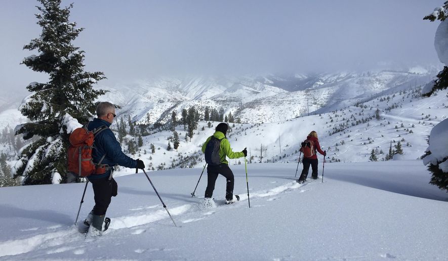
Snowshoe adventure in the Boise National Forest. 
I remember when Leo was researching the possibility of building yurts in the Idaho City Park 'n Ski Trails system. He discovered that Oregon was building new yurts at a very high rate of speed because as soon as they put them in, they were popular and booked for the season. He thought there would be enough rental demand to pay for the yurts with rental revenue, and perhaps build more. Turns out, he was right! We built the yurts with volunteer labor with assistance from IDPR and the Idaho City Ranger District, and it was fun to go stay at a yurt that you had helped build, and tell your friends about it. 

Leo also was very generous with his personal time after his kids were grown. He started leading hiking and snowshoeing trips through the Idaho Outdoors Yahoo Group, and pretty soon, if you went on one of those trips, there might be 25 people or more signed up. Those groups gave rise to the Facebook Meet Up groups and the Idaho Hiking Club. 

He fell for Leslie on a group outing to the Trail of the Coeur d'Alenes and the Route of the Hiawatha, and he made many other friends in his outdoor trips on weekends. Brenda Adams is a good friend of Leo's who met him as a frequent volunteer.

"All of the accolades for Leo are well-deserved," Adams says. "Nothing in a yurt is there by accident, the time and thought put into every aspect, from the positioning of each window to the placement of the dustpan, is considered and deliberate. Leo is obsessed with making every yurt visitor’s experience as optimal as possible. This attention to detail has paid off, and we have Leo to thank for these beautiful,comfortable wilderness yurts.

Brenda Adams, left, and Leo at Stargaze Yurt, which has one of the best views of the Sawtooths from the deck. 
"Leo loves the outdoors but he also loves seeing other people enjoy outdoor activities and has been extraordinarily generous in planning and executing shared adventures that are challenging, inspiring and downright fun," she continues. "Anyone who has been on a few of his trips is familiar with the phrase, “It was a ‘Leo trip’” - usually uttered with a groan and a laugh as you recall thrashing through the off-trail underbrush on a “not dangerous, just a little risky “ side trip to some incredible canyon or peak. The man has an encyclopedic knowledge of Idaho terrain and an uncanny ability to navigate through it."

Madonna Lengerich is another long-time friend who's helped Leo on projects for 30+ years. Madonna remembers getting the Idaho Legislature to approve the Park 'n Ski sticker program to pay for the grooming of the parking lots in 1979. Thanks Madonna!

Leo shared a cool mountain bike ride with us that circumnavigates the Silver City basin. 
Just think about the thousands of people who will stay at The Hennessy Yurt in the future, and enjoy some fantastic views of the Boise National Forest amid the Gold Fork xc trail system.

"We will be forever thankful for Leo’s contributions to non-motorized recreation in Idaho," Hobbs  says. "There is no more fitting tribute than to name the Hennessy Yurt in Leo’s honor and officially open it alongside you all today."

Leo plans to retire sometime this year. I hope you get a chance to meet him before he moves on to his private retired life. But I suspect that he'll stay involved in any type of project that improves non-motorized trails in Idaho. And I expect that he will travel the world to fulfill a very lengthy bucket list of hiking trips in spectacular locations that he hasn't had time to visit in his busy working life.

Hats off to you, Leo, my friend, for all you have done to make Idaho a better place for everyone! You deserve a "Take Pride in Idaho" award, and hopefully a private party where we can roast you in fine fashion!

Be sure to visit IDPR's yurt page to reserve a yurt if you haven't done so for this winter. All of them are 2-3 miles from the highway, accessible for xc skiers or snowshoers. Enjoy!
- SS      

Thursday, August 23, 2018

Smoke-free weekend? Sawtooth Salmon Festival or visit South Fork Salmon River

South Fork Salmon River Road is about as wide as a driveway. Great place for a secluded road bike ride.
Caution: Vehicles should go slow around blind corners! 
Chinook spawning on the Salmon River near the Sawtooth Hatchery. Those fish take my breath away!
They travel 800+ miles to reach Stanley from the Pacific Ocean. SS photo.  
Hi all,

Smoke from all the wildfires has been depressing to me, but it appears that we might get a break this weekend! I hope that's the case!

For this week's outdoor tip, I wanted to share a few details about the Sawtooth Salmon Festival going on Saturday, Aug. 25, in Stanley this weekend, and some thoughts about road biking, camping and sight-seeing in the South Fork Salmon River area and Warm Lake area.

The Sawtooth Salmon Festival is a long-standing event, sponsored by Idaho Rivers United, for people to come up to Stanley and see Chinook salmon spawning, learn about how Chinook and sockeye salmon runs are doing right now (not well), enjoy live music, drink beer from Sockeye Brewing, and of course, you can vector off to go hiking, biking or camping in arguably the most scenic part of Idaho.

Tours of the Chinook spawning grounds will occur every two hours at 11 a.m., 1, 3 and 5 p.m. on Saturday. According to the fish counts at Lower Granite Dam, 38,500 Chinook salmon have crossed through the dam and are heading upriver to Idaho. The 10-year average to date is 80,800. There should be some Chinook salmon spawning down below Sunbeam Dam in shallow gravels, where it's easy to see the magnificent fish. About 1,000 Chinook have returned to the Sawtooth Hatchery, a few miles south of Stanley. That's another place where I've seen a lot of Chinook swimming in the gravels, directly below the Sawtooth Hatchery, north of Stanley.

If you go, this is a great teachable moment for your kids to observe salmon spawning and learn about the salmon life cycle. The way the Idaho salmon and steelhead fish numbers have been crashing lately, you have to wonder how long the fish can survive. The lower Snake and Columbia dams cause most of the mortality to our salmon and steelhead runs, in both directions, while we have hundreds of miles of pristine spawning habitat in the Salmon River and its tributaries that are awaiting the adult fish to arrive and spawn the next generation.

To paraphrase what someone once said about this situation, we have a 5-star hotel for salmon and steelhead in Central Idaho -- some of the best habitat remaining in the whole Columbia River Basin. The lights are turned on, but most of the bedrooms are empty. Sad tale, indeed.

Near the top of the climb, the forest has transitioned into an old burn zone. 
Now, on to the South Fork Salmon River ... Wendy and I went over to the South Fork Road from McCall via Lick Creek Road last Saturday to put in some training miles on our road bikes. We're training for Cycle Oregon. The smoke wasn't too bad. The South Fork paved road is exactly 31 miles from Lick Creek to the Warm Lake highway. It's a single-lane paved surface with pullouts, so it's kind of tight for a vehicle, but perfect for a bike.

What struck me during our ride was how quiet, desolate and beautiful it was back there on the South Fork. Perhaps the smoke was keeping everyone closer to home. I'm sure a ton of people were out and about earlier this month during the Yellow Pine Harmonica Festival. But we did not see hardly a soul  back there until we got within a mile or so of Warm Lake.

Deep green pools are visible as you ride along the South Fork 
Before early October, when rifle deer season starts, consider checking out the South Fork for a quiet camping spot next to a beautiful river, go hiking, mountain biking, hot-springing or do a road bike ride. I found the ride to be especially nice in the first 15 miles, where we rode through big green ponderosa pines and Douglas firs, and pedaled close enough to the South Fork that we could see the river. Later, you ride in a giant burn zone, and it seems like a bomb went off back there and stripped away all the forest cover. It's still super raw many years after those forest fires.

I was looking for spawning salmon, but I didn't get out and peer into the deep pools. I stayed on my bike because we had a lot of miles to clock. Our plan was to go over to Warm Lake and back for a 65- mile ride. It took us longer than expected to cover the first 31 miles to Warm Lake. There are several big climbs to Profile Summit, and it's generally uphill going from Lick Creek to Warm Lake. My GPS said I'd burned 2900 calories by the time we reached North Shore Lodge! We were ready for a burger! Seemed like I drank 3 quarts of water during lunch.

A couple of happy anglers at Warm Lake.
The main cafe, cabins and picnic tables by the North Shore Lodge. 
North Shore Lodge is a great destination, BTW. They've got a beach, docks, a place to launch your boat, a bar and cafe, cabins for rent, supplies -- just a great place located there right on the shoreline of Warm Lake. People were having a great time chilling next to the lake, hanging by the beach, having a beer on the outdoor deck of the cafe, or hanging out by the cabin. We sure enjoyed our time chilling there, and topped it off with a big huckleberry ice cream cone.

At that point, our truck seemed like a world away! I knew Wendy couldn't ride all the way back, she had some hot spots on her feet (new riding shoes), and I didn't really feel like doing the whole thing either. Lucky for us, some hot-springers offered to take us half-way down the South Fork, and then we had an easy 16-mile ride mostly downhill to the truck.

Hard-core road riders that do the 90-mile version of the Cascade 4 Summit Challenge ride do most of the South Fork road after they scale Big Creek Summit. If you're super fit, riding the South Fork both directions is totally doable in a day. For more casual road riders, you might try riding one-way from Warm Lake to Lick Creek, it's much easier that way. Place a shuttle rig at Lick Creek Road, or have a friend run a sag wagon and pick you up. Maybe they could soak in a hot springs, go fishing or hiking while you're out on the ride.

If you'd like to explore the South Fork Salmon River area, consult a Boise National Forest and Payette National Forest map to plan your trip. The South Fork actually is split between the Boise and Payette forests. Maybe you have online mapping software. The developed campgrounds back there are Buckhorn, Camp Creek, Poverty Flat, and Penny Spring. From the Lick Creek side, you're only 15 miles from Yellow Pine, which is definitely worth a visit. Salmon spawning season is just beginning on the South Fork, according to IDFG, and if you'd like to see some fish spawning, look for them in the Stolle Meadows area.

I feature a fun mountain bike loop on the South Fork in my Mountain Biking in McCall book. It's called the Teapot Mountain Loop. It's a narrow two-track four-wheeler trail, 11 miles in length that circumnavigates Teapot Mountain. The ride features 2,100 feet of gain. Travel time is 1.5-2 hours. The ride goes from Buckhorn Creek to Jakie Creek and then you circle back on the South Fork road.

Hope we all have a weekend with no smoky skies!
- SS

Thursday, May 3, 2018

Station Creek hike is a primo option in May - it's bursting with wildflowers and very green

On top of 5,122-foot Bald Mountain with its weird lightning-rod thingy marking the summit. 
Arrowleaf balsomroot was blooming from near the trailhead to the top of the mountain, depending on aspect 
The trail climbs next to Station Creek to begin with, and then switch-backs over to the ridge
for a sweet ridge walk under the stately ponderosa pines
Bald Mountain, the destination, looms off in the distance ... 
Hi all,

Every once in a while, I like to revisit my favorite hikes for a little inspiration and fresh pictures. Knowing that wildflowers are popping with gusto right now in the lower elevations, I thought it'd be a great time to revisit the Station Creek Trail in Garden Valley and climb Bald Mountain. I saw flowers from the trailhead all the way to the top of the peak.

As I did the hike today, I thought that Bald Mountain would be a worthy addition to the Boise Grand Slam Peaks, if there were such a thing as a 5-base hit. Even if the terminology is off, climbing Bald Mountain is very similar to climbing Mt. Cervidae or Kepros Peak, but it's much more scenic in a forested setting with large ponderosa pine trees, grassy benches, shade and wildflowers.

Huck takes in the view of Garden Valley at the top of the initial ridge ... 
The Station-Creek to Bald Mountain hike is 3.5 miles one-way, or 7 miles round trip. The hike features more than 2,000 feet of vertical gain, starting at a base elevation of 3,170 feet across from the Garden Valley Ranger Station, and climbing to the 5,122-foot Bald Mountain Summit. There are some extra up and downs along the way. Hiking time for me was a little less than 4 hours at a pretty brisk pace. Pack a lunch for the top.

This is a very kid-friendly hike, especially for kids 8 and up. They'll probably beat you to the top. Another thing to note about this hike is that it's probably the best hike in the Boise National Forest close to Boise because it's got a good trail, there's no downfall, and the whole area is beautiful and green -- it's a rare spot in the Boise NF that hasn't been burned.       

The weather forecast this weekend in Garden Valley looks pretty ideal for Friday and Saturday, with highs in the high 70s. Sunday looks a little unstable with chances of showers and thunder-showers.

The Station Creek hike is featured in my book, the Boise Trail Guide: 90 Hiking & Running Routes Close to Home. I rate it "moderate" to "strenuous" in terms of difficulty -- but moderate overall. It's got some steep sections as you approach the first initial ridge, and then another super-steep section as you approach the top of Bald Mountain. All doable. 
Scott Mountain off in the distance to the north ... it's an 8,000-footer with plenty of snow on top. 
The trailhead is about 1 hour to 1:15 from Boise via Idaho 55 and the the Banks to Lowman Road. Take ID 55 to Banks, turn right to Garden Valley. Proceed past the town of Garden Valley to the big airstrip and Garden Valley Ranger Station. The Station Creek Trailhead is directly across the road from the ranger station. The road to the trailhead will veer off to the left of the highway before you reach the ranger station. There's public parking at the trailhead but no rest room. 

At the top of the first ridge (mile 2.1), you can go right and follow a faint foot trail to Bald
Mountain for a bigger view and a more complete experience. It's worth the extra work to get there. Return to the ridge junction and cruise back to the trailhead. 


A faint foot trail leads from the first ridge over to Bald Mountain, just a delightful walk ... 
After the hike, you can hit a local hot springs and/or have a burger in Crouch at the Longhorn Saloon. There are many places to camp in the area, particularly along the Middle Fork Payette Road north of Crouch, or you could stay at a Bed & Breakfast, the Garden Valley Hotel, or rent a private cabin. Check out the Garden Valley Chamber of Commerce web site for more information.

Have fun!
- SS 

Wednesday, September 20, 2017

Three yurts in Idaho City Park n' Ski system are open for rent! Make reservations now!

Fresh powder near Stargaze Yurt
Getting ready to shred some *pow* with Quinn 
Hi all,

After lots of hard work by Idaho Parks and Recreation officials and volunteers, three of the popular yurts in the Idaho City Park n' Ski system are available for rent as of today! Make reservations as soon as you can! 

The three yurts that will be open this winter are Stargaze, Skyline and Rocky Ridge.

You can make reservations online by going to: https://idahostateparks.reserveamerica.com or by calling 1-888-922-6743. Agents are available 7 days a week, Monday-Friday from 8 a.m. to 7 p.m. Mountain Time, or Saturday and Sunday, 9 a.m. to 5 p.m. The online system is handy because you can see what dates are booked, and which ones are not.

The Boise National Forest is working on salvage logging in the area at the current time. It's not clear exactly what xc ski and snowshoe trails will be open in the Idaho City Park n' Ski system, says Leo Hennessy, non-motorized trail coordinator for IDPR, but the access trails to all three yurts will be open for sure by the time winter season kicks in.

Leo also expects that the Gold Fork Loop and Skyline Loop will be groomed for winter xc skiing, snowshoeing and snow-biking this winter. It's also possible that the Banner Ridge and Elkhorn Loops may be open later in the winter. Loggers are cutting fire-killed trees in there right now.

It's great news that the three yurts will be open for the public to enjoy this winter after the wildfire closures in the aftermath of the Pioneer Fire.

Since I posted this blog on Wednesday morning, many of the open dates for the Idaho City yurts have been reserved. There are still some mid-week openings on the online calendar.

But rest assured, if you'd like to go yurting this winter, there are more options!

  • Sun Valley Trekking has many different yurts and wall tents available for rent in the Smoky Mountains north of Ketchum/Sun Valley and they also have locations in the Pioneer Mountains and in the Sawtooths. 
  • Galena Lodge has four yurts that you can rent in the forested mountains adjacent to miles upon miles of xc ski and snowshoe trails. If you like to xc ski, Galena Lodge is manna from heaven. 
  • Sawtooth Mountain Guides - The Williams Peak yurt is very hard to book because a lot of dates are booked a year in advance. But what the heck, see what they've got available! I see some open dates in December ...  

- SS

Thursday, August 24, 2017

Five fall car-camping destinations sure to please in the Boise National Forest

Top of Whitehawk Mountain with Quinn (elevation 8,500 feet) 
Early-morning fog hovered over the tall -grass meadows in Bear Valley ...
We awoke to a chorus of sandhill cranes every morning ... 
Ah, the Middle Fork Salmon River ... Huck wanted to catch fish
Hi all,

Last weekend was quite the scene for the solar eclipse on Monday ... what a thrill to see that from the top of a mountain like so many others did in Idaho ... I took my son Quinn to Bear Valley to see the eclipse on Whitehawk Mountain (elev. 8,450 feet), which was right in the bull's eye for 100% totality.

We went up to Bear Valley on Saturday morning to get a choice car-camping spot near the lookout road in a tall-grass meadow that's full of sandhill cranes. There weren't hardly any people up there on Saturday, and a few more dribbled in on Sunday. Bear Valley is a sweet spot for car-camping that's only about 1.5-2 hours from Boise. The #582 road from Lowman was freshly graded as of last week. At elevation 6,700 feet, Upper Bear Valley is nice and chilly at night, and warm during the day.

Side trips: You can hike, bike or run to the top of Whitehawk Mountain, or drive to other potential trails in the vicinity. Being close to Boundary Creek, we had to scoot over to the Middle Fork Salmon (45 minutes), visit Dagger Falls and fish the Middle Fork. We spent most of Sunday over there, mesmerized by the pristine beauty of the pure water rolling downriver from Boundary Creek. Almost strange to be there, and not be launching on the river!

On Monday, we biked to the top of Whitehawk Mountain (tough, continuous climb, about 4-5 miles, 2,000 feet of gain). Get into a low gear and grind it out! When Quinn was 12, I dragged him to the top of Whitehawk Mountain on his mountain bike, and he toughed out the climb, stopping for breaks, and made it to the summit. I was really proud of him, because it was his first mountain summit on a bike. Now at 19, Quinn is in top shape. He totally dusted me on the climb to the top, which is fine with me! That's the way it should be!

Anyway, for my outdoor tip of the week, I'm recommending five fall camping spots for you, your friends and family, including Upper Bear Valley. Even though the kids are back in school, there's still 4-6 weeks of fall camping remaining before the weather turns winter-like in October or November. Gather up your camping stuff and get the kids out in the mountains while you can! Remember to dress warm, and hopefully the Stage 1 fire restrictions will be lifted so you can have a camp fire!

2. Dagger Falls Campground - There's only a few camping spots at Dagger Falls, but most people are camping across the way at Boundary Creek, getting ready for Middle Fork trips. When we visited Dagger Falls last Sunday, there was only 1 party camping there. You can see Dagger Falls Rapids from the campground, and the Middle Fork is just a hop, skip away! Side trip: Go hiking on the Middle Fork or fish the nice holes between rapids in the top 1.5 miles of the river. USFS web site.
Getting there: Take Idaho 21 past Banner Summit to Boundary Creek turnoff on the left. Follow signs to Boundary Creek and Dagger Falls.

3. Deadwood Reservoir - The long drive to Deadwood Reservoir -- many miles of dirt road from the Banks to Lowman Road -- deters a fair number of people from visiting Deadwood Reservoir, but it's a super cool place to go where you can camp on the waterfront, go swimming, fishing, and bring your SUPs, kayaks, blow-up toys, whatever! USFS web site.

This Forest Service video gives you a sense of the setting at Deadwood Reservoir


There are multiple official fee campgrounds around the lake to choose from. Side trips: Several hiking and biking trails vector off from the lake on the west side and south side. Getting there: Take Forest Road #555 from the Banks to Lowman Road to the reservoir. Take your time.

4. North Fork Boise River - This is a car-camping mecca along the North Fork, with potential hiking and biking opportunities in the neighborhood. Black Rock Campground is the main developed campground in the area, but there are scores of primitive sites available for self-support car-camping. Barber Flat is a choice spot, and so is Deer Park, farther to the east. Can't go wrong! Side trips: Fishing on the North Fork, try adjacent logging roads for walking or biking. Getting there: Go to Idaho City and take Forest Road #327 over the Rabbit Creek grade into the North Fork canyon.

Nothing like hanging out by the campfire in the fall! 
5. Middle Fork Boise River - This is another car-camping mecca relatively close to home. The Middle Fork is worth visiting because the fishing is markedly better than on the North Fork. There are many car-camping spots to choose from, plus developed campgrounds such as Badger Creek, Troutdale, and Neinmeyer. Side trips: Fishing, hiking on the Sheep Creek Trail or Cottonwood Creek Trail, explore old logging roads that you may encounter.

With Quinn on top of Whitehawk Mountain the first time we went up there together! 
There you have it! It really already feels like fall if you head into the mountains right now. It can get downright chilly at night! That's a nice break from the 90 degree weather in Boise.

If you'r looking for something to do Friday night, Aug. 25? The Land Trust of the Treasure Valley is hosting their annual dinner and fund-raiser in the Dry Creek Valley in Hidden Springs. I support the Land Trust for all of the benefits that they've brought to our community, including the purchase of Harrison Hollow, easements in Dry Creek and Shingle Creek, and access to Stack Rock. They are a worthy organization to support big-time!
- SS

Thursday, May 18, 2017

Morel-picking season is upon us! Where to find them in the Boise National Forest

Fresh-picked morels 
Wendy was excited about our haul last year ... we picked in the Teepee Springs fire zone
Hi all,

Finally, a really nice weekend is coming our way weather-wise! Highs are predicted to be in the 70-degree range in Boise and in the lower elevations in the mountains! Blue sky and perfect weather for just about anything!

I've been seeing some pictures of morel mushrooms on Facebook, so clearly the morel-picking season has begun in the lower elevations. Now we'll have some sunshine in the forest for morels and other forest-dwelling fungi, plants and wildflowers to pop! Bring it on!

Morel-picking for private use is legal without a permit in the national forests in Idaho. Consumption is limited to 5 gallons per day. Commercial pickers are required to pay a fee. In the wake of the Pioneer Fire, the Boise National Forest is asking people who are picking for personal use to carry a brochure and map with them. The map details the locations where people can pick in the fire zone for personal use and for commercial use. There are many areas in the fire zone that will be closed to morel picking as well. Check out the map.

Blue hash marks are for person use, green for commercial pickers. 
Word has it that morels are sprouting around the Lowman area, according to the Boise National Forest. Lowman has an elevation of 3,750 feet. As things warm up, and the snow melts, morels will popping up at higher elevations. They haven't been seen too much around Idaho City yet, but it's still early.

It's also fine to pick morels anywhere else in the Boise National Forest, Payette National Forest or other forests in Idaho.

What's so special about morels? If you like to eat mushrooms, morels are a delicacy. They are positively delicious, especially sauteed in butter and garlic, and mixed with eggs or served with steak, mixed into soups -- there's just all kinds of applications.

Basidiospores at a microscopic level. The spores
fly from one mushroom to start a new fruiting
body nearby in the forest floor. I have a chapter
about the wonders of mycelia and morels in my
book, "Idaho Microbes."    
Morels are fun to pick because they're very distinctive ... they have a conical shape, kind of like a Christmas tree, but with honeycombs inside. My suggestion is to walk very slow through the woods, and stare at the ground, looking for morels. Once you see some, you'll find more. The grow prolifically the spring after a forest fire, but you can get into quite a few of them even several years after a fire.

I seem to find them more under fir trees than pine trees on open ground. If there's a lot of beargrass growing on the slope, it's not a good site for morels. Sometimes you'll find groups of morels popping up underneath the brush. Once you find a fertile area for morels, you'll keep coming back to those spots for more.

This also should be a great weekend for spring camping. Here's a previous post about some spring camping spots I'd recommend. Pick up a copy of my Owyhee Canyonlands - An Outdoor Adventure Guide for tips on 55 hikes and mountain bike rides in the Big Wide Open, plus a guide to the Owyhee Uplands Backcountry Byway.

Have fun!
-SS

Thursday, May 4, 2017

Climbing Mount Heinen, the toughest of the Boise Grand Slam Peaks, is a rewarding trip

Looking back at Mt. Heinen on the north side ... very steep approach from this side. 
Jack, Joanie and Steve on top of Mt. Heinen 
Celebrating the completion of Steve's Grand Slam on top of Mt. Heinen with Jack, Joanie and Judy 
Hi all,

I've been pecking away at the two remaining Boise Grand Slam peaks this spring to complete my Grand Slam, and by climbing Mt. Heinen with three friends on Saturday, I did it! 

At 6,390 feet, Mt. Heinen is the tallest of the Grand Slam peaks, and definitely one of the most strenuous hikes. But we hiked it on a gorgeous sunny day last Saturday, with temps in the mid-60s, and it felt wonderful to be out hiking in wildflowers, green grass and relatively warm weather! 

Just for background, the Boise Grand Slam was created by Tom Lopez, a retired lawyer and the author of Idaho: A Climbing Guide. The concept is to give Treasure Valley residents an early goal of hiking the Grand Slam peaks to begin getting in shape for the summer backpacking and mountain climbing season. 

Joanie with her pup in the snow field on the north side of Heinen. Hiking poles were very handy on this trip. 
The other three peaks are Mt. Cervidae (closest to Boise and shortest, but still hard -- 2 miles straight up, 2,000 feet of climbing), Mt. Kepros (10 miles and over 2,000 vertical feet), and Lucky Peak/Shaw Mountain, the top of the eastern flank of the Boise Foothills.   

There are multiple approaches to Mt. Heinen. We drove up to the Cottonwood Creek Trailhead in the Boise National Forest, about 1.5 hours from town, next to Arrowrock Reservoir. We hiked one steep ridge up to the main ridgetop leading to Heinen Peak, and hiked another steep ridgeline back to the trailhead. It was a great adventure tour with no real trail most of the way, but pretty easy route-finding staying on the ridges. 

My friends Joanie Faucie, Jack Van Valkenburg and Jody Thorne went with me. We made for a good group, all hiking at about the same pace. We brought lots of water, a lunch, wind breaker, hiking poles and GPS for the trip. It took us about 4.5 hours to do the whole hike. Mileage was 7+ miles. Vertical gain over 3,300 feet. It'd rate the trip strenuous. 

Our route took us up a ridge above Garden Gulch, through the forest and then on a main ridge heading for Mt. Heinen.
From Cottonwood Creek Trailhead, we went back down the road toward Arrowrock Reservoir for a short bit, crossed the creek and climbed up a ridge above Garden Gulch. Be sure to respect the private property in the vicinity by the creek bottom. Once on the ridge, we climbed steadily through grass sagebrush terrain and wildflowers until we reached the timber zone, and then we had to navigate a little brush to reach the top ridgeline. Once on that ridge, we ran into a couple that was hiking to Heinen from the South Ridge, or Irish Creek Campground by the reservoir. This route is 4.5 miles one-way, with 3,880 feet of gain. Our route was more direct, but perhaps more punishing. 

It was super pleasant on the ridge, and an easy walk up to Heinen. We had almost no wind up top, so we could hang out and eat our lunch. There are two rocky peaks on Heinen that seem to be the same elevation, but the peak furtheast west is the one with the USGS marker on top, and a water bottle containing some note paper for hiker notes. I signed my name. 

The descent off the north side of Heinen was super-steep! There was a snow field that we slid down on our boots laterally, and then we hiked down the face of the mountain over the ridge we planned to descend. It was a delightful walk downhill along the backbone of a steep ridge, with major elk habitat in the dense timber, and open brush, or bird and deer habitat on the sunny side of the ridge. Huck flushed three big blue grouse on the way down, and at least two on the way up. 

Matt Clark of the Idaho Trails Association says he calls climbing Heinen, a Heineken-type of hike because you earn your beer -- and your dinner -- on that one! I sure was glad to have a hot tub to jump into when I got home, with a PBR in hand. 

See more pics on my Facebook page. 

Have fun! 
- SS