Showing posts with label Boise Trail Guide. Show all posts

Thursday, October 26, 2023

Three Boise Foothills hikes provide elevated views of the city to see fall colors


Hi all, 

An Arctic blast of cold weather hit us this week, plus some snow in the mountains, so it's going to be a chilly weekend even in Boise. 

The cold weather also assists in accelerating the change in seasons and magnifying fall colors in the Boise Valley. For my outdoor tip of the week, I'm recommending three hikes close to home where you can enjoy some fetching views of the City of Trees and the wide variety of colors visible as far as the eye can see! All of these are kid-friendly. 

Hike #1 - Buena Vista Trail, Hillside to the Hollow. Difficulty: Moderate. Start either at the Harrison Hollow trailhead by Healthwise or behind Hillside Junior High along Hill Road. Buena Vista Trail has a very nice and moderate contour as it winds across the outer-front of the Boise Foothills, and it feels like you can reach out and touch the community below. Yet, you're at least 500 vertical feet above the city, so it's a great vantage point! If you do an out-and-back walk on Buena Vista, you'd cover several miles over an hour or so. 
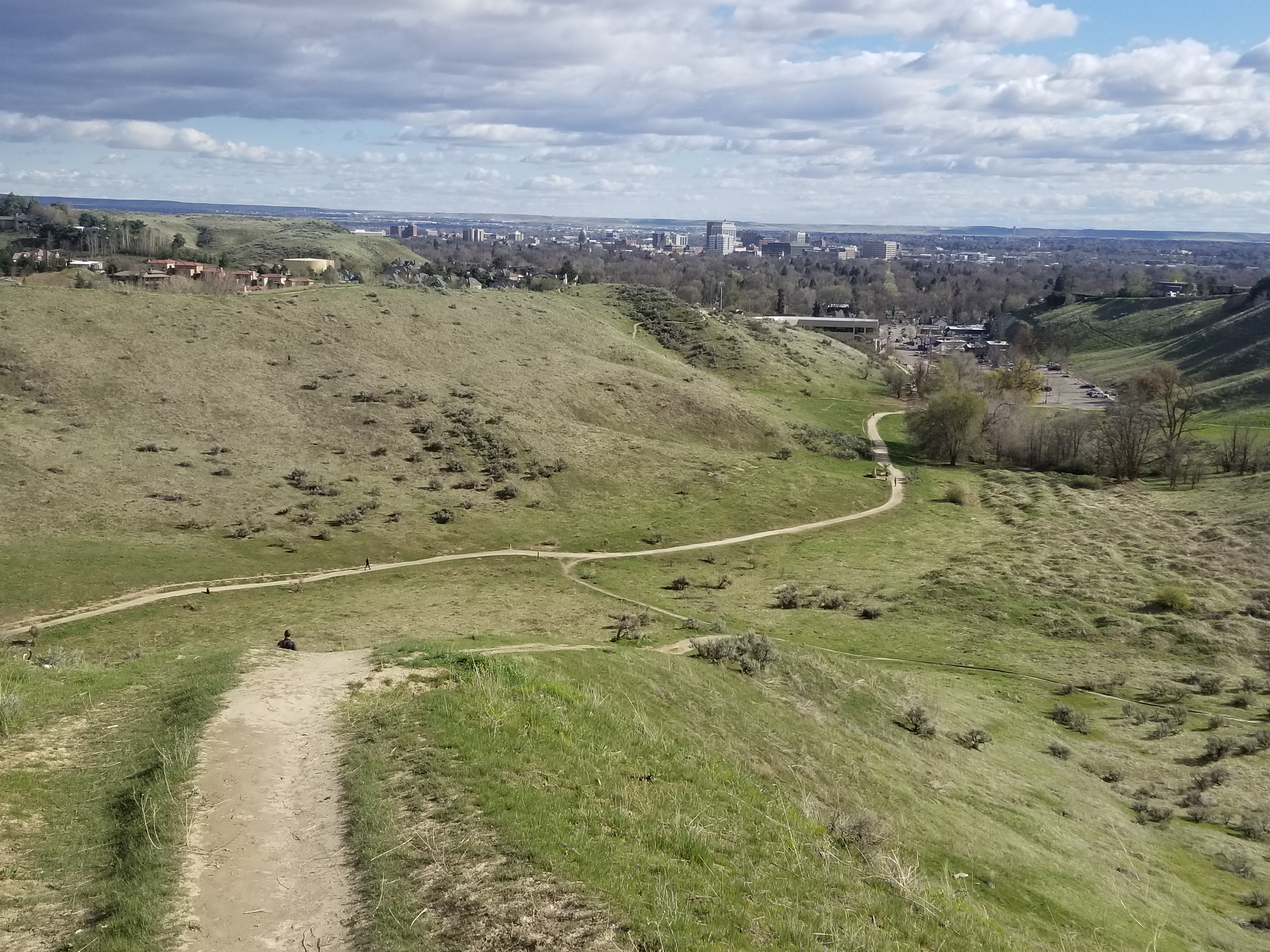
Spring shot of Harrison Hollow looking down at the city.

Hike #2 - Central Ridge Trail, Military Reserve Park. 
Difficulty: Moderate. Start at the Military Reserve trailhead where Mountain Cove Road bends sharply to the right going west into the foothills. There's a large parking area on the right and a trail map. You can start by walking along the Mountain Cove trail along Freestone Creek for about a mile or so. Then, you can turn to the right and climb up on Central Ridge to that initial summit. Then walk south down the backbone of Central Ridge back toward the trailhead. On Central Ridge Trail, it looks like you're going walk right into the State Capitol building and downtown Boise. Kind of a cool selfie opportunity before you drop down to the trailhead. Travel time for this one would be 1-1.5 hours at a leisurely pace.
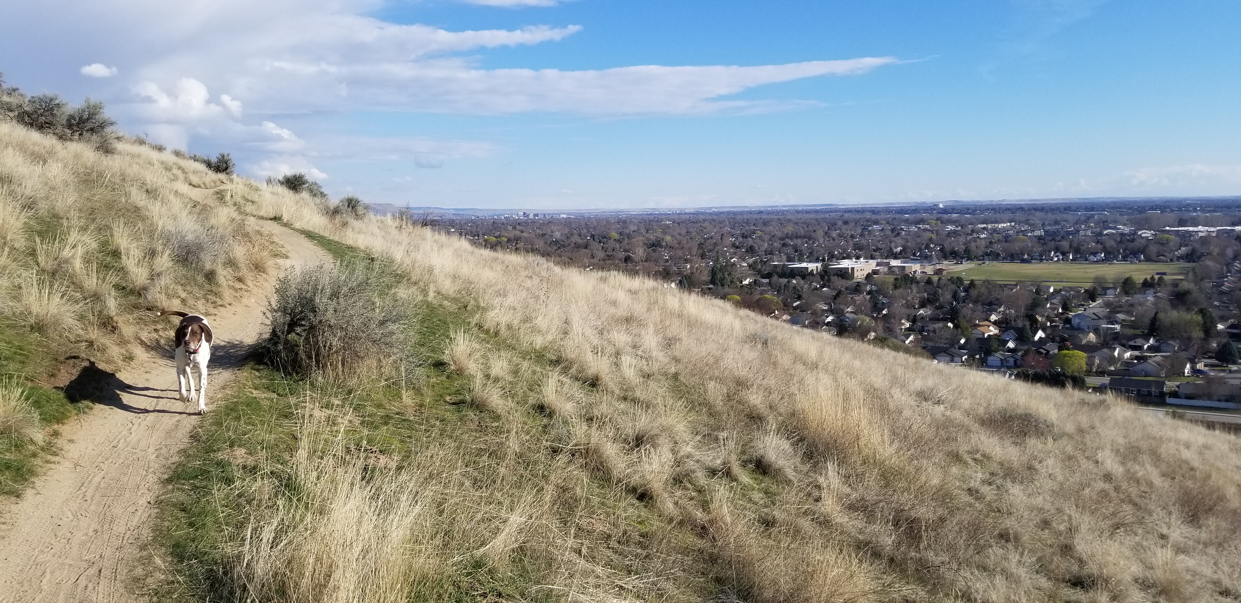
Great views of the city from Valley View Trail 

Hike #3 - Seaman's Gulch Loop. 
Difficulty: Moderate. Start at the Seaman's Gulch Trailhead off of Seaman's Gulch Road and Hill Road in West Boise. You have the option of hiking a short loop for 1 mile, or you can hike a longer loop for 3 miles with more views. In my Boise Trail Guide, I called this route "Seaman's Gulch Double Loop." The trails contour nicely across the landscape; you never have to work too hard to climb uphill. 

Short loop: Follow the left-hand fork of Trail #110 and climb to an initial ridge. Bear left at the top on Phlox Trail #112. That'll bring you back to the trailhead. 

Longer loop: Follow the same directions to start with, but once you reach the initial ridge, take Valley View Trail #111 as it wraps around the front of the Boise Foothills, super close to the edge of the city. Once the trail loops around the hills, it ties into Phlox Trail on a ridgetop, and you can head back to the trailhead on Phlox. The longer loop is 3 miles and features 500+ feet of vertical gain. Travel time is 1.5 hours. Take your time and enjoy it! 

All three of these hikes and 92 more are featured in my Boise Trail Guide: 95 Hiking and Running Routes Close to Home. The book is available at stevestuebner.com, Idaho Mountain Touring, Boise REI, and Rediscovered Books. 

Melissa Dawn will be giving away a free copy of Boise Trail Guide on 94.9 FM The River tomorrow (Friday) morning at approximately 7:40 a.m. Tune into my radio gig, and you can call in to win the book.

Have a great weekend! 
- SS 

Thursday, October 27, 2022

Try this trio of Boise foothills hikes with fetching, elevated views of the city - nice to see fall colors!

View of Boise from Central Ridge Trail in Military Reserve Park.

Hi all, 

After a nice cool and wet week to turn the page toward fall seasonal norms, the weather this weekend looks quite nice for some weekend outings! Afternoon high temps will be about 57 degrees F and sunny - a bit chilly but you can dress for it.  

Now that the fall colors are beginning to happen in the Boise Valley, for my outdoor tip of the week, I'm recommending three hikes close to home where you can enjoy some fetching views of the City of Trees and the wide variety of colors visible as far as the eye can see! All of these are kid-friendly. 

Full Sail Trail heading over to Buena Vista (courtesy BoiseTrails.com)

Hike #1 - Buena Vista Trail, Hillside to the Hollow.
Difficulty: Moderate. Start either at the Harrison Hollow trailhead by Healthwise or behind Hillside Junior High along Hill Road. Buena Vista Trail has a very nice and moderate contour as it winds across the outer-front of the Boise Foothills, and it feels like you can reach out and touch the community below. Yet, you're at least 500 vertical feet above the city, so it's a great vantage point! If you do an out-and-back walk on Buena Vista, you'd cover several miles over an hour or so. 

Spring shot of Harrison Hollow looking down at the city.

Hike #2 - Central Ridge Trail, Military Reserve Park.
Difficulty: Moderate. Start at the Military Reserve trailhead where Mountain Cove Road bends sharply to the right going west into the foothills. There's a large parking area on the right and a trail map. You can start by walking along the Mountain Cove trail along Freestone Creek for about a mile or so. Then, you can turn to the right and climb up on Central Ridge to that initial summit. Then walk south down the backbone of Central Ridge back toward the trailhead. On Central Ridge Trail, it looks like you're going walk right into the State Capitol building and downtown Boise. Kind of a cool selfie opportunity before you drop down to the trailhead. Travel time for this one would be 1-1.5 hours at a leisurely pace.

Great views of the city from Valley View Trail 

Hike #3 - Seaman's Gulch Loop.
Difficulty: Moderate. Start at the Seaman's Gulch Trailhead off of Seaman's Gulch Road and Hill Road in West Boise. You have the option of hiking a short loop for 1 mile, or you can hike a longer loop for 3 miles with more views. In my Boise Trail Guide, I called this route "Seaman's Gulch Double Loop." The trails contour nicely across the landscape; you never have to work too hard to climb uphill. 

Short loop: Follow the left-hand fork of Trail #110 and climb to an initial ridge. Bear left at the top on Phlox Trail #112. That'll bring you back to the trailhead. 

Longer loop: Follow the same directions to start with, but once you reach the initial ridge, take Valley View Trail #111 as it wraps around the front of the Boise Foothills, super close to the edge of the city. Once the trail loops around the hills, it ties into Phlox Trail on a ridgetop, and you can head back to the trailhead on Phlox. The longer loop is 3 miles and features 500+ feet of vertical gain. Travel time is 1.5 hours. Take your time and enjoy it! 

All three of these hikes and 92 more are featured in my Boise Trail Guide: 95 Hiking and Running Routes Close to Home. The book is available at stevestuebner.com, Idaho Mountain Touring, Boise REI, and Rediscovered Books. 

Ken and Melissa will be giving away a free copy of Boise Trail Guide on 94.9 FM The River tomorrow (Friday) morning at approximately 7:40 a.m. Tune into my radio gig, and you can call in to win the book at 208-287-2949. 

Have a great weekend! More moisture forecast next week! More snow for the mountains! 
- SS 

Thursday, April 28, 2022

Middle Fork Payette-Garden Valley hikes opening up for spring!

Station Creek winds through ponderosa pines on the way up a long ridge. 

Hi all, 

Wendy and I thought we'd hike the lovely Station Creek Trail in Garden Valley last Saturday to enjoy a 6-mile day hike in a forested setting. 

We were delighted to see the lower-elevation mountains in Garden Valley greening up for springtime recreation. We didn't encounter any snow on our hike up Station Creek Trail to the initial high point and saddle, or on the way up to Bald Mountain - another mile farther and an extra 500 feet of elevation gain. 

We dodged small squalls that were happening from time to time, but generally, it was a perfect day for spring hiking, with cool temps in the high 40s to low 60s, depending on the moment. 

If Station Creek Trail is in prime shape for hiking, then I'd also recommend two other nice hikes nearby - One Spoon and Lightning Ridge Trails. I've blogged about all three before. 

Steve and Huck on top of Bald Mountain ... elk sign everywhere! 

So that's my outdoor tip of the week - go check out any one of those three trails and enjoy hiking in a forested setting with creek water flowing below, wildflowers and shrubs beginning to bloom, and maybe even some morels popping up if you're lucky! 

The Trailhead for Station Creek is directly across from the Banks-Lowman Highway from the Garden Valley Ranger Station. It takes about an hour to get there from Boise. You can stop at the Garden Valley Chevron for any last-minute supplies before you head for the trailhead. 

Travel time on the Station Creek is about 5-6 hours, out and back. It's shorter if you just go to the initial high point about 2 miles up the trail. I rate the hike "moderate to strenuous" because there are some short, strenuous pitches.

Lunch on a big slab of granite near the top of the One Spoon hike with Wendy, Mark and Laurie. 

One Spoon Trail - Click on a previous post where I wrote about hiking One Spoon, including a map and driving directions, and also tips on floating the Middle Fork Payette River, Tie Creek section. The hike is 6 miles round-trip with up to 2,600 feet of vertical gain. You'll walk through ponderosa pine trees and see lots of cool big granite rocks along the way.  

Lightning Ridge affords vast views of the Boise National Forest

Lightning Ridge Trail - Wendy and I hiked Lightning Ridge Trail last spring. This trail goes for quite a ways, so the distance is kind of up to you. We went about three miles up the trail to an initial high point, turned around and came back to the trailhead. 

Difficulty: Moderate to strenuous

Driving directions: Take ID 55 to Banks. Go left in Banks and take the Banks to Lowman Road to the Crouch turnoff. Head up the Middle Fork Payette River Road (USFS #698) to a marked junction with USFS Road #611, the Lightning Creek Road, on the right. Follow the dirt road about five miles to the trailhead where an earthen barrier prevents further vehicular traffic. 

Have a great time exploring these trails! Bring a lunch and plenty of water for your day trip.   

Both Station Creek and One Spoon are featured in my guidebook, "Boise Trail Guide: 95 Hiking and Running Routes Close to Home." 

- SS 

Friday, January 21, 2022

Five winter hiking/walking ideas in SW Idaho for this picture postcard weekend!

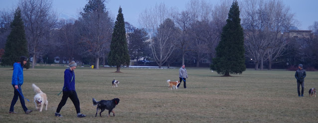
Lots of room to roam with your puppies at Ann Morrison Park in Boise. 

Hi all, 

A storm front is expected to clear out the valley fog and inversion for a day or so while the mountains got freshened with 4-5" of new snow Thursday night and we got 2-3" in the valley floor. 

Please see my outdoor article in the Idaho Press about five places to go winter hiking in SW Idaho ... 

  • Ann Morrison Park
  • Hyatt Hidden Lakes
  • Eagle Island State Park
  • Eagle Greenbelt Loop
  • Snake River trail from either the east trailhead, west of Swan Falls Dam, or starting at Celebration Park. 
See the full article here: https://www.idahopress.com/community/room-to-roam/article_8235b4b8-63aa-5323-b22e-bd9eca47ce56.html

All of these hikes are featured in Boise Trail Guide: 95 Hiking and Running Routes Close to Home. 

You can pick up a copy of Boise Trail Guide at Boise REI, Idaho Mountain Touring and Rediscovered Books. 

Have a great weekend!

- SS 


Thursday, January 14, 2021

Boise Foothills trails are wet and slurpy - 7 alternative destinations where you can avoid the mud!

It's fun to look for birds, ducks and waterfowl at the Hyatt Hidden Lakes Reserve in west Boise. 

Hi all,

Well it's been wet and soggy in Boise lately, and even though we're going to be drying out over the next week to 10 days under a High Pressure weather system, most of the Boise Foothills trails will continue to be muddy in the afternoons when temperatures rise well above freezing into the mid-40s.

Photos from the Ridge to Rivers Facebook page tell the story. Come on people!  


Please! If the trail is muddy, try one of my alternative destinations below ... 

My outdoor tip this week focuses on five-plus destinations where you can walk, trail-run or perhaps even mountain bike on all-weather trails in Boise and the Eagle areas. These are trails that have been graveled for winter or mud-season use or they are sandy, graveled trails naturally. All of these trails are featured in my Boise Trail Guide: 95 Hiking and Running Routes Close to Home. Hint: I will give away a free book on 94.9 FM the River Friday morning with Ken and Deb at about 7:40 a.m.


Overview of one of the ponds at Hyatt Hidden Lakes Reserve.
The area doubles a stormwater runoff filtering system. 

1. Hyatt Hidden Lakes Reserve - This is a great walking destination in west Boise off of Chinden and Marigold, McMillan and Maple Grove. Running is OK here, but no bikes or dogs. Wendy and I went there yesterday and counted 20 species of birds and ducks in an hour. You'll hear the familiar call of red-winged blackbirds as you walk into the 44-acre reserve, and there are multiple species of waterfowl in the ponds surrounded by cat-tails and wetland vegetation. We saw Canada geese, northern shovelers, common mergansers, common coots, ring-necked ducks, lesser scaup, buffleheads, and great blue herons in the ponds or on the shore next to the ponds. This is a great place to see wildlife and enjoy a casual walk while doing so. The trails are sandy and graveled for all-season use. Bring your binoculars and camera! Note: No dogs are allowed in the park to benefit the wildlife.    

The trailhead in Eagle Island State Park is by an old dairy farm,
with the Boise Front and Bogus Basin the background. 

Huck sniffs for birds on my walk in Eagle Island State Park. Trails are easy and scenic. 

2. Eagle Island State Park - The river trail along the north and south channels of the Boise River are sandy and rocky, so this is a nice place to go for a walk during mud-season. People are also tubing and boarding on the snowy hill provided in the park for those activities. You can do a 5-mile loop by hiking both channels of the river inside park. Watch for bald eagles, Great blue herons, mallards, geese, kingfishers and other species on your walk. Bring your binoculars. Hopefully you have an annual parks pass ($10 per vehicle per year) to avoid the day use fee! The park is west of Eagle on Idaho 44. Follow signs to the park.

Fabulous quiet place for a walk or trail-run in East Boise. 
3. Bethine Church Riverwalk + walking trail to Barber Park on the south side of the Boise River - Take a beautiful walk going east from the Cottonwood Apartments off of River Run and ParkCenter Boulevard out to Barber Park. It's about 3 miles one-way. You can shuttle a vehicle out to Barber Park or do an out-and-back (recommended). Watch for bald eagles, Great blue herons, wood ducks, mallards, geese, kingfishers and other species on your walk. Keep track of your species. Carry binoculars, a camera, water and snacks.

Nice quiet spot for reading or contemplation.
You can walk your bike through the area, but no biking is allowed. 

Try the all-weather trails recommended by Ridge to Rivers in the Boise Foothills.

4. Mountain Cove Trail in Military Reserve Park. The trail runs for a little less than a mile parallel to Mountain Cove Road, next to Freestone Creek. The trail also connects to Central Ridge, Bucktail, Shanes and more in the Military Reserve complex, but those trails are likely to be muddy right now, so don't count on doing a big loop.     

5. Red Fox - Owl's Roost - a 2.2-mile loop from Camelsback to the Foothills Learning Center, suitable for all abilities. Hulls Grove Trail next to Owl's Roost is another all-weather alternative in that area.

Hulls Ponds from Red Fox Trail near Camelsback Park 

6. Shoshone-Bannock Tribes Trail #19A  (Table Rock/Castle Rock area) Flat and easy trail for all abilities. 

7. Red-Winged Blackbird #35A (Camelsback Park area) - Flat and easy trail for all abilities. It runs from the Hulls ponds to Chickadee Ridge through a wetlands environment. 

Have fun! 
- SS 

Thursday, October 31, 2019

Dry Creek hike in Boise Foothills reveals neat ice patterns, fall color

Huck had a blast sniffing for birds and perching on rocks 
Patches of ice formed interesting patterns in the creek. 
Hi all,

I went hiking with Huck on the Dry Creek trail this week to see if the fall colors were still happening -- and they were in places. But it was a surprising dividend to see some cool shapes and designs in the ice forming in the creek.

We've had low temperatures in the teens and 20s this week, so Dry Creek was definitely covered with ice in flatter portions of the streams and in the beaver ponds. It's supposed to get a little warmer in the days ahead, so I recommend getting out to hike Dry Creek or do the Shingle Creek-Dry Creek Loop before the snow comes and the trail gets mucky.

That's my outdoor tip this week ... get out and enjoy the Boise Foothills trails while you can!

Some sections of the creek were almost completely frozen. 
I also am looking forward to attending the Bogus Basin Ski Education Foundation Ski Swap Friday-Sunday at Expo Idaho this weekend. See the web site for details on selling and buying equipment.

BTW, if it's ski swap time, that means the Warren Miller annual ski movie is coming up! It's scheduled for Thursday, Nov. 21 through Sunday, Nov. 24 at the Egyptian Theater.

A hiker and a jogger cruising up the trail with their dogs 
Now back to the Dry Creek hike ... starting from the trailhead on Bogus Basin Road, you can hike up the creek as far as you want ... On Thursday (today), I hiked about two miles or so up the trail to the Shingle Creek junction, and came back. Going on a mid-week day, I saw only 2 other people on the trail during my hike.

The Dry Creek trail is kind of steep up and down threading through some cool granite goblin-like rocks in the first 1/2 mile, but after the trail drops down by the creek, it's a very pleasant walk up the draw. There are numerous places where you could stop and have a picnic.
Dry Creek-Shingle Creek Loop map (courtesy alltrails.com) 

Remains of a stone house next to a large locust tree that settlers planted.  
Tackling the Dry Creek-Shingle Creek Loop is a much more ambitious endeavor. The route covers 13.8 miles and features 2,221 feet of gain. Nothing too extreme, but it's still a substantial hike with multiple strenuous pitches. That one would take about 5 hours or more, depending on your speed of travel.

Take a walk up there and enjoy the sights! I wondered about the history of a stone house up there ... I would like to know more about the settlers who tried to live up there.

Beaver pond complex was just freezing over. 
Be sure to dress in layers for the hike. You'll warm up and shed most of your layers on the way up the trail, and then cool down for the walk back down. I needed a hat and gloves for my hike. The temperature was in the high 30s, so not all that warm. It is supposed to warm up a bit next week in the afternoons.

Have fun!
- SS

Thursday, September 12, 2019

Here's 5 hiking loops to enjoy during the Hyde Park Street Fair

Boise city scape from the trails to the Camelsback Summit.
Exhibitors getting set up for the weekend!
Boise Byrds biking group heading out for a ride.
Hi all,

Everyone knows the Hyde Park Street Fair is a rockin' good time, and it's happening Friday-Sunday of this weekend, Sept. 13-15.

It's always a hoot to hang out with your friends at the street fair, run into other peeps you know, shop the booths and enjoy the music. See the Boise Weekly article for all the details. It's the 40th anniversary of the Hyde Park Street Fair! 1979 man - Wow!

For my outdoor tip of the week, I'm recommending five hiking-biking-running loops that start and finish at Camelsback Park to maybe knock out before you go to the fair, knowing that you might be enjoying an alcoholic beverage or two ...

This list is kid-friendly and family-friendly, starting with the easy and building from there.

Trail to the top of Camelsback hill
1. Kiddie hike to Camelsback summit - Distance: 1/4 mile; Difficulty: Easy. There are several trails climbing to the top of Camelsback Summit from different sides of the park. One of them marches straight up the face of the hill in a series of steps. Take your young kids to the top to get a great view of the park and the city. When the music is playing, and the park full of colorful people, it'll be way cool to take in the event from up there. Best for kids 2-5 years old. Tip: there's a sand pit on the east side of the Camelsback hill, accessible from the trailhead on the east side of the tennis courts, where little kids love to play.

Walkers and runners headed out on Red Fox Trail.

2. Red Fox - Owls Roost Loop - Distance 2.3 miles; Difficulty Easy. Hiking time: 45 minutes (brisk pace) to 1 hour. This is the shortest and flattest loop from Camelsback Park venturing into the foothills. But it's very scenic going up Red Fox #36 Trail and coming back on Owls Roost (watch for great horned owls in there). Start from the trailhead on the east side of the tennis courts, and hike up Red Fox Trail 1 mile. Cross 8th Street, and take Kestrel a short ways to the Owls Roost junction. Turn right and return to Camelsback on Owls Roost.

3. Kestrel - Red Cliffs Loop -Distance: 5 miles, starting from Camelsback; 3 miles, starting from the Foothills Learning Center. Difficulty: Moderate. Hiking time: 2+ hours from Camelsback; 1+ hours on the short loop. Vertical gain: 606 feet. This hike is a great little workout close to home. Take Owls Roost out of Camelsback about 1 mile to the Kestrel junction. Turn right and climb Kestrel on the ridge up to Crestline Trail. Go left on Crestline a short ways and then turn left on Red Cliffs to return to the Learning Center and Camelsback. Great views from those trails, too, once you're on Crestline, and on the way back on Redcliffs.

4. Crestline - Hulls Gulch Loop - Distance: 7.25 miles, starting from Camelsback; 5 miles from the
Foothills Learning Center; Difficulty: Moderate with strenuous pitches. Hiking travel time: 2.5-3 hours; Running travel time: 1.5 hours; Vertical gain: 868 feet. Crestline-Hulls is a classic loop in the Central Foothills. It may be one of the most popular loops, if not THE most popular loop, because it’s a great tour in a scenic setting. Starting from Camelsback, take Owls Roost Trail about 1 mile to Kestrel. Turn right on Kestrel. The climb up Kestrel is steep in places and fairly continuous on the ridge, but once you're on Crestline, the gradient is very gradual and moderate on a wide sandy trail all the way to Hulls Gulch. The rocky singletrack trail going down Hulls creates a little more entertainment, but it's no big deal for hiking. Just watch your step! 

5. Corrals - Hulls Gulch - Loop - Distance: 8+ miles, starting from Cameslback. Difficulty: Moderate with strenuous sections. Vertical gain: 1,000 feet. This one requires a shuttle if you're hiking. It's a piece of cake if you're riding this route on a mountain bike. But it's a great tour from Corrals, over Corrals Summit to Bob's Trail then over to 8th street, cross 8th, and down Hulls Gulch back to Camelsback. You could hike up Highlands Trail from the bottom of Bob's in the Highlands to catch Corrals Trail, or start at the Corrals Trailhead 1.2 miles up Bogus Basin Road from Highlands Elementary. Proceed on Corrals Trail over the summit to Trail #1 to 8th Street. Cross 8th Street and descend on Hulls Gulch. Best for mountain biking, but it's a great hike or trail-run too! 

Have fun! 
- SS

Thursday, February 28, 2019

Five destinations close to home for hiking all-weather trails in greater Boise area

It's fun to look for birds, ducks and waterfowl at the Hyatt Hidden Lakes Reserve in west Boise.
Wendy is a bird expert, so it's cool to learn about songbirds when you go on a walk with her. 
Dogs have a great time in Harrison Hollow, chasing each other in the dog-friendly reserve.
The Harrison Hollow trail is one of the most popular all-weather trails in Boise.  
Hi all,

Well it's been a wet and soggy February in Boise ... they're calling it "Februburied" in the mountains, and I'm sure many people have seen the pics of people's homes getting buried in snow in Cascade, McCall and Wood River Valley areas ... quite the epic month in terms of precipitation.

The weather is forecast to clear this weekend. Sunshine is forecast in the Boise area on Friday-Monday, with high temperatures in the mid-40s and lows in the mid-20s for the beginning of March. I don't know about you, but I'm ready to soak up some sunshine!

My outdoor tip this week focuses on five-plus destinations where you can walk, trail-run or perhaps even mountain bike on all-weather trails in Boise and the Eagle areas. These are trails that have been graveled for winter or mud-season use or they are sandy, graveled trails naturally. All of these trails are featured in my Boise Trail Guide: 95 Hiking and Running Routes Close to Home. Hint: I will give away a free book on 94.9 FM the River Friday morning with Ken and Deb at about 7:40 a.m.

While you're out enjoying these trails, watch for birds and wildlife. After Feb. 1, birds of prey and even crows begin engaging in courtship flight, which can be really cool to see as the males and females try to impress each other prior to mating. Songbirds are moving back into the valley after migrating south, so you'll start seeing robins, red-winged blackbirds, gold finches and other songbirds on your outings.

Overview of one of the ponds at Hyatt Hidden Lakes Reserve. The area doubles a stormwater runoff filtering system. 
Now, for the destinations with all-weather trails:

1. Hyatt Hidden Lakes Reserve - This is a great walking destination in west Boise off of Chinden and Marigold, McMillan and Maple Grove. Running is OK here, but no bikes. Wendy and I went there yesterday and counted 20 species of birds and ducks in an hour. You'll hear the familiar call of red-winged blackbirds as you walk into the 44-acre reserve, and there are multiple species of waterfowl in the ponds surrounded by cat-tails and wetland vegetation. We saw Canada geese, northern shovelers, common mergansers, common coots, ring-necked ducks, lesser scaup, buffleheads, and great blue herons in the ponds or on the shore next to the ponds. Also saw several species of sparrows, lesser goldfinches, Oregon juncos, and house finches. This is a great place to see wildlife and enjoy a casual walk while doing so. The trails are sandy and graveled for all-season use. Bring your binoculars and camera! Note: No dogs are allowed in the park to benefit the wildlife.   

The general scene in the Harrison Hollow gulch ... the trail is easy for all abilities. 
2. Harrison Hollow all-weather trail - This is a great place for dog-lovers to take a walk and let your dog run around and play with other dogs. The trailhead is next to Harrison Hollow restaurant and Healthwise off of Bogus Basin Road. The all-weather trail goes for about a mile. The trail up the ridge spine to the east of the hollow is quite sandy and qualifies for all-weather use most of the time. Please pick up after your pets while you're out enjoying Harrison Hollow. Harrison Hollow Trail #57 (see trail on R2R interactive map) 

The trailhead in Eagle Island State Park is by an old dairy farm, with the Boise Front in the background. 

Huck sniffs for birds on my walk in Eagle Island State Park. Trails are easy and scenic. 
3. Eagle Island State Park - The river trail along the north and south channels of the Boise River are sandy and rocky, so this is a nice place to go for a walk during mud-season. People are also tubing and boarding on the snowy hill provided in the park for those activities. You can do a 5-mile loop by hiking both channels of the river inside park. Watch for bald eagles, Great blue herons, mallards, geese, kingfishers and other species on your walk. Bring your binoculars. Hopefully you have an annual parks pass ($10 per vehicle per year) to avoid the day use fee! The park is west of Eagle on Idaho 44. Follow signs to the park.

Fabulous quiet place for a walk or trail-run in East Boise. 
4. Bethine Church Riverwalk + walking trail to Barber Park on the south side of the Boise River - Take a beautiful walk going east from the Cottonwood Apartments off of River Run and ParkCenter Boulevard out to Barber Park. It's about 3 miles one-way. You can shuttle a vehicle out to Barber Park or do an out-and-back (recommended). Watch for bald eagles, Great blue herons, wood ducks, mallards, geese, kingfishers and other species on your walk. Keep track of your species. Carry binoculars, a camera, water and snacks.

Nice quiet spot for reading or contemplation. You can walk your bike through the area, but no biking is allowed. 
5. Try a sample of the all-weather trails recommended by Ridge to Rivers in the Boise Foothills.
The Shoshone-Bannock trail is over at the foot of Castle Rock and Table Rock and the others are over by Camelsback Park in the North End of Boise. 
·         Shoshone-Bannock Tribes Trail #19A  (Table Rock area)   
·         Red Fox Trail #36 (Camelsback Park area) 
·         Gold Finch #35 (Camelsback Park area) 
·         Owls Roost #37 (Camelsback Park area) 
·         Hulls Pond Loop #34 (Camelsback Park area) 
·         The Grove #38 (Camelsback Park area) 
·         Red-Winged Blackbird #35A (Camelsback Park area) 

Please give the rest of the Ridge to Rivers trails a break until the trails dry out in warmer and drier weather yet to come! See latest conditions on the Ridge to Rivers Facebook page. 

Have fun! 
- SS  

Thursday, October 4, 2018

State Parks special! Five fall hikes in SW Idaho - Bruneau Dunes, Dry Creek and more

On a clear day, you can see a long ways across the Snake River Plain from the top of Bruneau Dunes 
Hi all,

Sure nice to get some moisture today, we certainly need it, but a continued unstable weather pattern will bring us more moisture on Saturday as well. That leaves Friday and Sunday as the best days to get outside and play this weekend.

I gave a presentation on my favorite fall/winter hikes close to home last night at Boise REI, so it seemed like a good idea to share a few of those gems with you for my outdoor tip of the week.

I touched on 25+ hikes from my Boise Trail Guide and Owyhee Canyonlands guides, so that's WAY too much info. to share here, so I'll shake the dice and deliver five of them ... suitable for this weekend:

  • Bruneau Dunes State Park, south of Mountain Home - Take the kids and go play in the sand. Take your camping stuff if you're so included (check on space with IDPR). Easy to do in a day trip or overnight. Bruneau Dunes has a 470-foot high sandy mountain inside the park. Take a hike on the ridge of the dune. People also try to ski and snowboard the dunes. It's always a cool place to explore. 
    These were our GPS tracks of doing a loop around the dunes (light green line)
  • Eagle Island State Park in west Eagle - Take a 5-mile hike in the park to tour both channels of the Boise River. The trails in the park are generally well-drained with gravel along the river. Hiking time: 2 hours; Vertical rise: 55 feet (essentially flat). Rated: Easy. Make sure you buy one of those $10 annual park passes with your vehicle registration so you have a free pass to get into any state parks in Idaho. Well worth it!! 


  • Huckleberry Trail in Ponderosa State Park - If you happen to be in McCall, the "Huck" is especially colorful right now. Wendy and I did the loop 2 weeks ago, and it was really starting to light up! It's about 3.5 miles to do the loop. 400 feet of vertical gain. Hiking time: 2 hours. Biking time is 45 minutes to 1+ hours, depending on your speed. The trail has lots of rocks and roots, but the views are wonderful -- you look out on Payette Lake as you tour of the peninsula. You can climb to the top of Osprey Point at the mid-point for a nice overview of Payette Lake and the surrounding mountains. Do this hike on Sunday. The air will be crisp in McCall -- a high of 52 is forecast. 
    Wendy enjoyed the fall colors on the Huckleberry Trail in Ponderosa State Park. 
  • Charcoal Gulch, Idaho City - Take a drive to Idaho City and go for a nice colorful hike on the Charcoal Gulch Trail, just on the outskirts of town. Find the trail by the Idaho City Airport (ever been there?) on the south side of town. There's a little trailhead on the north side of the airport. Take the Buena Vista Trail along the edge of the mountain, and then you'll see the junction for Charcoal Gulch. There are aspens and pines along the way, plus a small creek.  
    Charcoal Gulch Trail weaves through ponderosa pine trees and aspens near Idaho City. (Courtesy Visit Idaho) 
  • Dry Creek out and back, Boise Foothills - Friday afternoon or Sunday should be a good day to go for a walk on Dry Creek. The colors should be getting good up there, too! The trailhead is off of Bogus Basin Road, several miles up from Boise, on the right side, as the road begins a series of hairpin switchbacks. You'll see other cars at the trailhead. It's a big day to hike to the top of the Boise Ridge via Dry Creek (7.5 miles, 2000+ vertical feet), so just take your time and go as far as you want.
    Steve rides one of the nice bridges across the Dry Creek
    Trail in the upper Boise Foothills. 
  • Bonus #6: Head up to Bogus Bogus, ride the chairlift and go for a bike ride or hike from the top of Deer Point lift. I saw that they are running the lifts on Saturdays and Sundays through October. The promotion this weekend is that if parents buy their college student a season pass ($160), the whole family gets to ride the chairlift for free.   
---------------------------------------------
A few notes:

  • Our friends at the Idaho Foundation for Parks and Lands wanted me to share that they have raised enough money to pay for restoring the Plantation pedestrian bridge on the Boise River Greenbelt. It may be installed by next spring! 
  • The Idaho Whitewater Association will be doing a litter pickup project along the Payette River on Saturday. See Facebook event for more information.

Thursday, April 26, 2018

Wildflowers are blooming! Some tips on where to hike and see wildflowers in Boise

The bitterbrush is starting to flower big-time in the lower foothills. 
Wendy takes a breather next to arrowleaf balsomroot in bloom 
Indian Paintbrush blooming in the Owyhees 
Bitterroot blooming in the rocky soil in the Owyhees 
Hi all,

After a beautiful week of sunshine and warming weather, wildflowers are popping up everywhere in the lower Boise Foothills and the Owyhees.

We're seeing the bright yellow bouquet of arrowleaf balsomroot, bitterbrush blooming with mustard-colored flowers, as well as sky pilots, aase's onion and lupine. Out in the Owyhees, you'll see the bright red Indian paintbrush, showy daisies and many more.

Dust off your wildflower guide and take a hike to refresh your memory of our local wildflowers. Here are a number of recommended trails in the Boise Foothills and the Owyhees where you're like to see a diversity of early flowers in full display:

Courtesy HartImages.com
Boise Foothills - All of the lower trailheads are adorned with flowers right now ... west to east, I'd recommend: Seaman's Gulch Loop, Polecat Gulch, Peggy's Trail, Hillside to the Hollow, Owl's Roost-Kestrel-Crestline-Red Cliffs, multiple trails in Military Reserve, including Toll Road Trail, Cottonwood Creek, Central Ridge, Bucktail and Shane's Trail. Table Rock and Homestead trails also are a good bet.

See my Boise Trail Guide - 95 Hiking and Running Routes Close to Home or the Ridge to Rivers map for more detail.

Owyhee Canyonlands - Lower-elevation trails are best for wildflowers right now, including Little Jacks Creek, Between the Creeks, Shoofly Quick Loop, Mud Flat Road/Owyhee Canyonlands Scenic Byway, Browns Canyon, Jump Creek Canyon, Wildcat Canyon, Leslie Gulch, and Succor Creek Natural Area. 

Click on the hyperlinks to see directions and details about these hikes. All of those routes also are featured in my Owyhee Canyonlands guide.

Have fun!
- SS