Showing posts with label Biking in Boise. Show all posts

Thursday, April 12, 2018

Biking season is coming on! Five easy greenbelt bike rides to shake off the cobwebs

The heron and cormorant rookery along the Eagle Greenbelt is a sight to behold. 
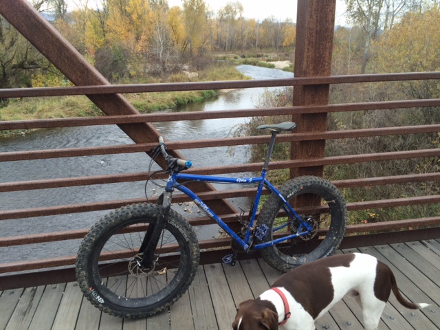
Eagle Greenbelt pedestrian bridge. I took my snow bike out there. 
Drew on his three-wheeler on a greenbelt ride with Dad in west Boise 
Biking on the Greenbelt through Municipal Park 
Here's a fun group pausing for a pic by the ParkCenter pedestrian bridge 
Hi all,

Spring weather is trying to get some traction in the Treasure Valley, but wet and cool wintry weather has made it challenging, even almost half way through April! On Friday and Saturday of this weekend, the weather forecast looks promising for sunshine on Friday with a high of 50, and partly cloudy to cloudy conditions on Saturday, but no real chance of rain, with temperatures hovering around 60. Sunday could be rainy and wet.

For my outdoor tip of the week, I'm recommending some easy bike rides as inspiration to dust-off the bike in your garage, wipe off the cobwebs and get that baby into good running condition.

Here are five easy rides that provide a tour of discreet sections of the Boise River Greenbelt from Eagle to Lucky Peak. All of these rides would be great for families and kids, and all ages and abilities. Pick a route that strikes your fancy.

1. Eagle Greenbelt Loop - Distance: About 7 miles. Best bike for the ride: mountain bike or cross bike. Tread: pavement and dirt. Start at the greenbelt parking area by Glenwood and Marigold next to the Boise River. Ride west, taking the underpass at Glenwood, and continue through a housing area next to the river. Stay on the south side of the river at the pedestrian bridge and continue past the gravel pits, Boise Wastewater Treatment Plant and the heron rookery to Eagle Road. Go right on the shoulder of Eagle Road and ride on the paths next to the busy highway. Pick up the greenbelt in several hundred yards and ride east. Cross the pedestrian bridge and then you'll be riding on a paved pathway on the north side of the river. Follow that path through several dirt sections and then on pavement through a couple of subdivisions. Cross the pedestrian bridge to the south side of the river, turn left and return to the start at Glenwood.

2. Glenwood to Esther Simplot Park - Distance: 7 miles out and back. Best bike for the ride: road bike or any kind of bike. Tread: pavement. This ride could be done as a loop if they're able to restore the pedestrian bridge by Plantation, but in the meantime, it's an out-and-back ride on the Garden City side of the greenbelt. Start by the Glenwood and Marigold greenbelt parking area. Ride east on the Greenbelt for a mile to the bridge washout site. Follow the paved path on a detour around some private property on Remington Street and return to the greenbelt going east. You'll pass under the Veterans Parkway bridge and continue another mile to Esther Simplot Park. There's a pedestrian bridge there where you can cross over and tour around the park as you wish. Watch kayakers or surfers on the play wave. Return to Glenwood to finish the ride.

3. Bridge to Bridge Loop - Distance 9-mile loop. Best bike for the ride: road bike or any kind of bike. Tread: pavement. This is cool route because you can ride on both sides of the river for the loop, and enjoy the pedestrian bridges on the book-ends of the route. Start in Esther Simplot Park. Pick up the greenbelt pathway over by the Boise River and pedestrian bridge. Ride either on the south or north side of the river and go east toward downtown. Enjoy all the underpasses and ride along the river to the ParkCenter pedestrian bridge. Cross the bridge and return to Esther Simplot Park.

4. Municipal Park to Marianne Williams Park - Distance: 9.5 mile loop or about 8 miles out-and back. Bike bike for the ride: road bike or any kind of bike. Tread: pavement. This is a pretty route going through Warm Springs Golf Course and riding along the river on the north side, and a tour of residential paths on the way back. Start at Municipal Park and ride east on the greenbelt. In Warm Springs Golf Course, ignore the right-hand spur going over to the pedestrian bridge. Continue on the north side of the river out to Marianne Williams Park. Follow signs for a temporary detour around a pathway that's closed due to construction. Ride over to Eckert Road. Turn right and ride to Barber Park. Go west on the paved pathway through the park and continue going west through a number of subdivisions. Eventually the pathway busts out of the housing and onto the side of ParkCenter Boulevard. Turn right on River Run Drive next to Baggley Park and follow the bike lane along River Run back to the main greenbelt. Keep going west to Broadway. Take the highway bridge across the river and drop into the path going east on the north side of the river to return to Municipal Park.

5. Eckert Road to Lucky Peak - Distance 10 miles out and back. Best bike for the ride: road bike or any kind of bike. Tread: pavement. This ride can be a little more challenging depending on the wind, but it's fun to go out to Discovery Park next to Lucky Peak, and this is the eastern end of the greenbelt. Start in Harris Ranch and park by Lucky 13 or in Barber Park. Take the greenbelt along Eckert Road and then go east on the greenbelt out to Lucky Peak. You'll have to detour around the path east of Idaho State Parks because that pathway is still under reconstruction. Past that area, you'll pass under the huge Idaho 21 bridge, go by Diversion Dam and then cruise along next to the river on the final approach to Discovery Park. It can be windy in this area. Bring a picnic lunch to enjoy at Discovery Park and retrace your steps to the start.

The whole Boise River Greenbelt and 30 more road-biking routes are detailed in the Boise Road Cycling Guide, a fold-out waterproof and tear-proof map with rides in the Boise Valley, Meridian, Kuna, Nampa and Emmett. Boise Road Cycling Guide is available for retail sales at George's Cycles, Idaho Mountain Touring, Boise REI, Bob's Bicycles and stevestuebner.com.

Have fun!
- SS

Thursday, August 13, 2015

Super fun biking events coming up! Tour de Fat Saturday! Food and wine road ride, too!

I donated to BBP to get that nice Double D bra at Tour de Fat 

Elena, right, looks charming in her flower hat 
Hi all, 

Imagine 20,000 bicycle wheels rolling down the streets of downtown Boise for the 2014 Tour de Fat parade. Were you there? I was dressed up as Captain America with a red cape and not much else. Ten-thousand cyclists -- all dressed up in some kind of wild and wacky costume, some of them quite clever -- showed up and set a record for the biggest participation in the Tour de Fat event in Boise since it started 14 years ago. 

Now here's your chance to make the 2015 Tour de Fat even bigger than ever! The goal is to have at least 12,000 participants in the parade and raise $90,000 for your favorite cycling non-profits -- Treasure Valley Cycling Alliance, Southwest Idaho Mountain Biking Association (SWIMBA) and Boise Bicycle Project (BBP). Get your costume together, drag your friends and everyone in your household down to the parade, and partake in the state's largest bike event! Do this while sporting a really big grin, show off your cool costume and drink plenty of beer to help the cause.
One of the many cool things
you'll see at Tour de Fat 
Bicyclists for as far as you can see in the Tour de Fat parade ... that's so cool! 
Spending $$ on beer = $$ for better cycling opportunities in our community. The funds go directly to new trails, cycling-advocacy activities, bike donations to children and families in need, and bike education. Over the last 14 years, the event has raised approximately $400,000 for the non-profits mentioned above. That's HUGE people. Let's keep growing this event! 

See the 2015 Tour de Fat web site for the music lineup and event details. Hint: The parade starts 
at 11 a.m. at Ann Morrison Park. Have fun!

Also on Saturday, the 43rd annual Bogus Basin Hill Climb is happening for ambitious road cyclists. Start time is 9:30 a.m. You can register online. Not sure who's showing up, but the really strong riders can ride to Bogus in roughly an hour or less. Total animals! My best time in my 20s was 1 hour, 20 minutes. It's always a great workout to ride to Bogus, and it's a hoot to ride back downhill! 

Here's a bike-racing calendar in case you'd like to plan for future events. 

I'll be in Coeur d'Alene on Saturday, picking up my packet for a week of road rides in the Idaho Panhandle courtesy of RideIdaho. This is the first year I've participated in RideIdaho. It's a fully supported ride that covers about 400 miles in a week. This year's route starts and finishes in Coeur d'Alene, doing a big triangle across the Panhandle into Western Montana, and then up to Moyie Springs and Bonner's Ferry before going south to Lake Pend Oreille, Sandpoint and Coeur d'Alene. 
Hope we don't run into too much smoke from the fires! 

The Treasure Valley Food Coalition is sponsoring a 50-mile food and wine ride called "Fruitful Fields" on Sunday, Sept. 20th in SW Idaho. The loop ride will begin at Hat Ranch Winery on Plum Road at 9:00 a.m. and take cyclists on a tour of farms and wineries throughout Canyon County. Along the way, you will taste fresh, local fruit, grilled (lamb) merguez sausage, grilled fingerling potatoes, local cheese and crackers, and sample some of Idaho’s award-winning wines.  

Upon returning to Hat Ranch Winery, you will be treated to a catered luncheon from Three Girls Catering, featuring local meats and produce while Hat Ranch pours wine for tasting. All participants will receive a reusable jute shopping bag filled with local produce, tokens to use at the Boise Farmer’s Market, and coupons for the Boise Co-Op.

The bike route will take you along the Snake River, past Lake Lowell, and through the rolling farmland, vineyards and orchards of Canyon County. Three rest stops along the way will provide tastings, water, medical reserve corps volunteers and pink porta-potties! The event costs $65. Register on the Treasure Valley Food Coalition web page. 

Have fun and have a great ride!
- SS 

Thursday, April 10, 2014

Spring road biking season is here! Bike events, great spring rides to inspire your participation

Riding to Swan Falls, Morley Nelson Snake River Birds of Prey National Conservation Area 
Riding on Cartwright Road, a hilly country road in the Boise Foothills 
Boise River Greenbelt
A pack of roadies on Hill Road 
City to Farm ... no traffic! 
Hi all,

The cool and sunny spring weather has been fantastic for doing just about anything outdoors ... and the weekend forecast looks great. It's a perfect time to shake the cobwebs off the road bike and get out and ride!

Let's review the roadie bike events coming up this summer, and then I'll suggest some nice spring roadie rides.

Key events coming up ... 
  • Boise Bike Week - Set for the week of May 13-18, Boise Bike Week already has a bunch of activities scheduled on the calendar. Activities include fun rides, kids rides, women's rides, road rides, mountain bike rides, tips on bike maintenance, ride to work day, etc. Thanks to the Treasure Valley Cycling Alliance and Boise Weekly for co-sponsoring this fun-filled annual kickoff to the biking season in our communities.  
  • Bob LeBow Blues Cruise - The Blue Cross of Idaho Foundation for Health is teaming up with Terry Reilly Health Services this year to create a bigger and better Bob LeBow Blue Cruise. The ride will be on Saturday, June 28. There will be courses for all abilities and distances, great aid stations and a big lunch to follow the ride. 
  • Four Summit Challenge - Set for July 26, there's plenty of time to train for the popular Four Summit Challenge in Cascade. The main course follows Warm Lake Road over Big Creek Summit to Warm Lake and then up to the top of Landmark Summit to the end of the paved road, before turning around and cycling back to Cascade. This event is getting bigger and better every year. I'm hoping to do it this year. 
  • Ride Idaho - Scheduled for Aug. 2-9, Ride Idaho will tour the Magic Valley area, including scaling the road to Pomerelle Ski Area, touring the scenic Thousand Springs region, lower Wood River Valley, Carey and Declo. Ride Idaho carries your camping gear and you ride 400 miles in a week with 350 riders to tour parts of Idaho that perhaps you've never seen before, at least not from your bike. 
Here are some spring rides to get your legs in shape (all of these are drawn from the Boise Road Cycling Guide by yours truly, the best and only road-biking map available for roadie rides in SW Idaho):
  • Boise River Greenbelt from Municipal Park to Lucky Peak - 9 miles one way, 18 miles out and back. About 1 hour travel time. Surface is flat most of the way, with a few short hills here and there. You may have a tailwind going out, but you'll pay for that on the way back. Wind is always a factor. 
  • City to Farm Loop - 16.2 miles; ride time is about 1 hour. Fun tour of the transition zone between the city of Boise and rural agricultural lands in the outskirts of SW Boise, with many ranchettes along the way. Riding surface is mostly flat. Wind will be a factor. Start at Five Mile and Overland Roads. Go south on Five Mile, right on Lake Hazel, left on Cloverdale, right on Columbia, left on Eagle, right on Hubbard, right on Locust Grove, right on Lake Hazel, left on Five Mile and return to the start. 
  • Country Ride - Feel more ambitious? This one is 35 miles, and 2-plus hours. Start at Cloverdale and Lake Hazel. This one tours the country side in SW Boise and skirts around Kuna before returning to the start. Go south on Cloverdale, right on Poen, right on Swan Falls, left on Kuna Cave, right on Robinson, right on Bennett, straight on King, left on Cloverdale and return to the start. 
  • Cartwright Three Summits Loop - 17.7 miles, 1.5 hours. This is one of my favorite rides cuz it's close to my house. You'll climb and descend 1,591 feet along the way. This one is much more challenging because of the steep hills. Start at the junction of Bogus Basin Road and Hill Road. Climb Bogus Basin to Cartwright, go left and climb Cartwright over the first little hill, and then a second huge wall of a hill, and then ride through the Dry Creek Valley and the Hidden Springs area before climbing over Seaman's Gulch Road to conquer the third summit. Turn left on Hill Road and return to the start. 
  • Hill Road to Eagle or Star - Start at Bogus Basin Road and Hill, or wherever you want to tie into Hill Road, and zip out west to Eagle or Star. It's 40 miles out and back to Star. Wind is a major factor. Ride Hill to Horseshoe Bend Road. Go right, go a mile, then left on Floating Feather. Follow Floating Feather out to Eagle Road, or continue west to Star. Vary your route by going north another mile to Beacon Light. A cool alternative in Eagle: Go north on Eagle Road to the end of the pavement on Willow Creek Road. 
  • Ride to Swan Falls Dam - Start/finish in Kuna. 42 miles, 3+ hours travel time, 1,710 feet of elevation gain/loss. Nice place to ride without much traffic. Take Swan Falls Road south of Kuna (the turn is off of main street in Kuna as you come into town from the west) and go 21 miles to the dam. Besides the hill-climb, the ride features lots of up and down through the giant swells of sagebrush out to the edge of the Snake River canyon. Then you plunge downhill to the dam and grassy picnic area, have your lunch and retrace your tracks back to Kuna. Watch for hawks, eagles and owls. You'll see plenty of ground-squirrels running across the road. 
  • Greenbelt in Municipal Park to Hilltop Summit - 27 miles round-trip. 2.5 hours. 1,214 vertical feet. Take the Greenbelt out to Discovery Park and then jump on Idaho 21 to Hilltop Summit. Wind is always a factor on this ride. But it will work your quads for sure. Nice moderate gradual climb to Hilltop. Watch for deer and elk.     
Be sure to dress in layers and pack a good rain/wind shell. 

Have fun!
-SS


Thursday, October 4, 2012

Enjoy super-smooth new greenbelt pathways in Marianne Williams Park in East Boise

Aerial view of Marianne Williams Park (looking east to west). 
Hi all,

This week's tip focuses on a new park in East Boise called Marianne Williams Park that has a number of sweet new pathways to enjoy, including a brand new super-smooth 1.5-mile greenbelt section from Bown Crossing to Eckert Road. The park also has a beautiful nature trail along the Boise River.

Below, I'm also highlighting several events coming up, including a two-day ride on the full length of the Weiser River Trail, and a fun, season-ending SWIMBA event.
My GPS tracks on the Greenbelt and Nature Trail loop. 
If you've grown tired of riding over the many cracks and bumps on the old greenbelt as you're riding out to Lucky Peak Dam or Discovery Park -- riding parallel to the highway east of Warm Springs Golf Course -- you can take a small detour on the new greenbelt pathway in M.W. Park and enjoy the sweet ride out to the Eckert Road pathway. Then, you head north a half mile and rejoin the greenbelt near Lucky 13, and continue your ride.

I noticed that several roller-bladers have discovered the new pathway, but for the most part, the paths are pretty quiet in M.W. Park because the park hasn't officially opened yet. Boise Parks & Recreation officials say the 70-acre park will open next summer after several buildings and rest rooms have been built and completed. Some landscaping remains to be put in place as well.

Another very cool opportunity for hikers, runners and anglers has been created with a new nature trail in the park. The trail runs alongside the Boise River, on the north side, for more than a mile, and then it joins the paved greenbelt for a half-mile before landing at the Bown Crossing area and the East ParkCenter Bridge. Combine this new trail with the existing nature trail from the Barber Park area, and you have a new 3.5-mile loop that you can enjoy. A Figure-8 loop could be done as well if you're walking or running from Municipal Park out to Barber Park. Or, you could run or walk on the greenbelt in M.W. Park and loop back on the nature trail.

BPR officials say the nature trail will be open to walking and running only when the park opens.

Families with young kids will find plenty of pathways to enjoy on an easy-going bike ride in M.W. Park. Besides the greenbelt pathway, there are a number of wide sidewalks that you can ride on that loop around a large pond and fountain. Cap off the outing by stopping in at one of several eateries in Bown Crossing for a meal and beverage.
Park master plan by the Land Group
Many thanks to the Larry and Marianne Williams family for donating the land for the park. It's a huge addition to the "Ribbon of Jewels" -- the wonderful series of parks that we have adjacent to the Boise River that are tied to together by the Boise River Greenbelt.

If you're ever wanted to ride the whole length of the 84-mile Weiser River Trail, there's a great group ride going on this weekend that presents a perfect opportunity to ride the trail downhill from the north end near New Meadows to the town of Weiser over two days. They're calling it the "October Trek."

Weiser River Trail officials will haul your personal and camping gear to the overnight spot at Mundo Hot Springs,  3 miles north of Cambridge. Mundo Hot Springs is brand new ... a grand opening was held in late September. The photos I've seen make it look very similar to Gold Fork Hot Springs near Donnelly.

The two-day ride will cover a little over 40 miles each day. That's a perfect pace for recreational cyclists of all abilities, and you can enjoy all the sights along the way. Just so you know, the top part of the Weiser River Trail runs downhill as it winds through the Weiser River canyon between New Meadows and Council. But once you're out of the canyon, the trail is mostly flat, even though it runs slightly downhill, you'll have to pedal the whole way. I would rate the difficulty as moderate.

Contact Craig Kjar, event director for the October Trek, at 571-7447 or email octobertrek@gmail.com.

Next week, on Oct. 13, SWIMBA is hosting a member-appreciation event and pub crawl from Joe's Crab Shack to the Dutch Goose and back. Costumes are encouraged! "Classic lounge wear" is the theme. Think Dean Martin. These guys know how to have fun! See you there.

-SS

Thursday, August 9, 2012

Get up early for a quick workout before work to beat the heat ... you'll feel SO much better

Hi all,

With this blasted hot weather settled over the lowlands of SW Idaho for weeks on end, we're left with really no choice but to get up early for a quick morning workout before the "work" day begins during the work week.

I've been trying to do that several times a week, and I've noticed that the parking lots at foothills trailheads are surprisingly busy at 6:30 a.m.! Fine minds think alike!

This week, for my tip of the week, I'm recommending several biking/running loops that take an hour or less. If you're hiking, allow more time. All of these routes are featured in my Boise Trail Guide and Mountain Biking in Boise. To make a quick escape, take a few moments in the evening to gather up your gear and replenish the water in your pack, so you're ready to roll in the morning ...

Table Rock trails
1.  Table Rock - The out-and-back South Face "grunt route" to the top of Table Rock is short and abrupt, guaranteed to make you sweat, with almost 1,000 feet of climbing. Distance is about 3 miles. Take Trail #15 from the Old Pen Trailhead by the Bishop's House and climb to Table Rock. If you have time, you can loop back on Trails #16 and #17. Or just go out and back.

2. Military Reserve - There are many short options in Military Reserve Park, but my current favorite is what I call Jumpin' Jeepers Figure 8 Loop. Distance is 6.75 miles; climbing is about 1,000 feet. Take  Central Ridge Trail #22 to the top of the first hill, and continue to Shane's Junction. Ride to the top of Shane's and do the loop back to Central Ridge and Bucktail junction. Take Bucktail downhill and slalom back to the top of Trail #20 and descend the switchbacks to Toll Road Trail and cruise back to the trailhead.

2a. Two Coyote Loop - My friend Maggie Lawrence loves this route. It's 6.5 miles (705 feet of climbing). Running time is about 1:15; Riding time is about an hour. Hike or ride along Freestone Creek to the police firing range area. Climb up to Bucktail and follow that to Shane's Junction. Go left on Shane's and take that to Trail #26, go left and cruise downhill over to a dirt road. Take the dirt road downhill back to the police firing range area and return on the trailhead via Freestone. Maggie and the Boise B's named that Two Coyote because they saw two of those pups on their run.

3. Corrals-Bobs Loop - Highlands neighborhood special. This one is a little longer at 8.4 miles and 1,230 feet of vertical gain. Riding/running time is more like 1.5 hours. Go up Bogus Basin Road to the Corrals Trailhead. Ride Corrals to the summit, descend to Bob's, and rip down Bob's, watching for the rare person coming uphill. A quicker alternative here is to drive to the Corrals Trailhead, and do an out and back to the top of Corrals or add the climb on Scott's Trail for spice.
Boise B's on Corrals morning run in the winter ... 
4. Crestline-Hulls Loop - North Ender special. Starting from Camelsback, this one is 10 miles (1,600 feet of gain), but if you start from the trailhead by the Foothills Learning Center, it's less than 8 miles. Quickest way is to ride up Kestrel to Crestline, and return to the trailhead on Hulls. My friend Molly said that takes her a little over an hour to run that one.

5. Polecat Gulch Loop -  The full loop is just over 6 miles (800+ feet of climbing), and I typically ride it in 45 minutes to an hour. Running time would be an hour or less, depending on your pace. The trailhead is off of Cartwright Road, near the junction with Pierce Park. Excellent choice for people who live in NW Boise or Hidden Springs.

6. Hillside to the Hollow Loop - There's a quick loop in Hillside to the Hollow (the island of open space between 36th Street and Bogus Basin Road). Start at the 32nd Street trailhead, climb to the top of the mountain, keep going east and then take the trail that wraps around the frontside of the mountain and returns to the trailhead. If you leave nearby, just ride or run from home, and you can notch that loop is less than an hour.

7. Squaw Creek Loop - The long loop is 6.25 miles and over 1,600 feet of climbing. This route is most convenient for folks in the Harris Ranch and SE Boise areas. It can be shortened by climbing the Homestead Trail out and back. The trailhead is off of Council Springs Road, near Lucky 13.

Eagle Cycle Park (courtesy Mari Briggs)
8. Eagle Cycle Park - For west Boise residents and Eagle folks, these trails are very close to home. Take old Horseshoe Bend Road north from ID 55 to the Eagle Cycle Park Trailhead. Here's one suggested loop that's 6.5 miles (800 feet of climbing). Ride uphill on Rabbit Run and follow that to the end; go back on Twisted Sister, do another loop on D's Chaos, and finish by looping the Junk Yard Trail. All of these twisty singletracks are fun, and you won't experience any climbing that lasts very long. Fun place to run and ride.

9. For the road cyclists out there, the best recommendation I have is the Cartwright-Pierce Park Loop (fastest option) for a quick morning workout. That one usually takes less than an hour, while the full
Three Summits Loop (aka the "Dump Loop") is more like an 1:15 for me.

There you have it! Hopefully you've got some comp time or flexible schedule that allows coming into work a little later than 8 a.m.!  Even if you work at home, it's best to get started early to enjoy a cooler environment. It is getting kind of smoky out there, however, because of all the fires burning in Idaho and Eastern Oregon.

If you've got a favorite early-morning route that I've overlooked here, please pipe up in the comments below and let us know what we're missing!

PS - If you'd like more detailed descriptions and maps, all of these routes are available a la carte for 99 cents each on my web site, www.stevestuebner.com.

- SS

Thursday, February 25, 2010

Dust-off the road bike, take an early spring ride

On my way to Cartwright Road

Riding on the City to Farm ride ... no cars anywhere


Hi all,
The weather is warming slightly where temperatures are edging into the 50s. Saturday is supposed to be wet, but Sunday should be a beautiful day for a spring road bike ride.


I'll recommend two possibilities from the Boise Road Cycling Guide:


1. Cartwright Road Three Summits Ride (guaranteed great workout)
Difficulty: strenuous
Distance: 17.7 miles
Recreation pace: 1.5-2 hours


Start: Junction of Hill Road and Bogus Basin Road
Go north on Bogus Basin Road to Cartwright Road. Go left.
Take Cartwright over two summits.
Mile 4.4 - Right on Cartwright
Mile 6.4 - Left on Dry Creek Road.
Mile 8.4 - Left on Seaman's Gulch Road.
Mile 12.2 - Left on Hill Road Parkway
Mile 12.6 - Left on Hill Road at Gary Lane
Mile 14.5 - Left on Hill at Castle
Mile 17.7 - Finish


2. City to Farm Loop (Scenic ride on the outskirts of Boise)
Difficulty: Moderate
Distance: 16.2 miles
Recreation pace: 1 hour


Start: Overland & Five Mile Road. Park by Ken's Bicycle Warehouse in the 5-Mile Plaza.
Go south on Five Mile
Mile 3 - Right on Lake Hazel
Mile 4 - Left on Cloverdale
Mile 5 - Right on Columbia
Mile 6 - Left on Eagle Road
Mile 6.5 - Right on Hubbard
Mile 8.1 - Right on Locust Grove
Mile 10.1 - Right on Lake Hazel
Mile 13.1 - Left on Five Mile
Mile 16.2 - Finish

Be sure to dress in layers. The temperature might vary 10 degrees during your ride, depending on where you start. Bring an outer shell, which can be shed in the heat of the afternoon.
If you don't have a road bike, go to the Boise Bike Swap at Cole Village shopping center either today or Saturday. Hours are 5:30 to 9:30 p.m. tonight, and 10 a.m. to 4 p.m. on Saturday. Get there early to get a good bike! Admission is $1. Ages 13 and under get in free.

Enjoy!

- SS