Showing posts with label Owyhee Canyonlands. Show all posts

Wednesday, January 25, 2023

The Shoofly Oolites - A Geologic Wonderland in the Owyhee Canyonlands!

The author poses for a pic at the Shoofly Oolites. (courtesy Steve Schaps)

Guest Column
By Steve Schaps

The Shoofly Oolites are a geologic wonderland located about 60 miles southeast from Boise near Grand View, Idaho, at the foot of the Owyhee Canyonlands.

This location is probably the closest you can come to hiking on the surface of Mars. The hike is 1-3 miles in length. 

It is both dog friendly and kid friendly, so you can bring either one or both. This is a great place to bring kids or grandchildren. It’s about an hour’s drive from Boise, and a far less snowy or icy drive than if you were heading to the mountains to the north.

One of the main reasons to visit the Shoofly Oolites is the educational opportunity for kids and adults to learn about this geologic wonderland.

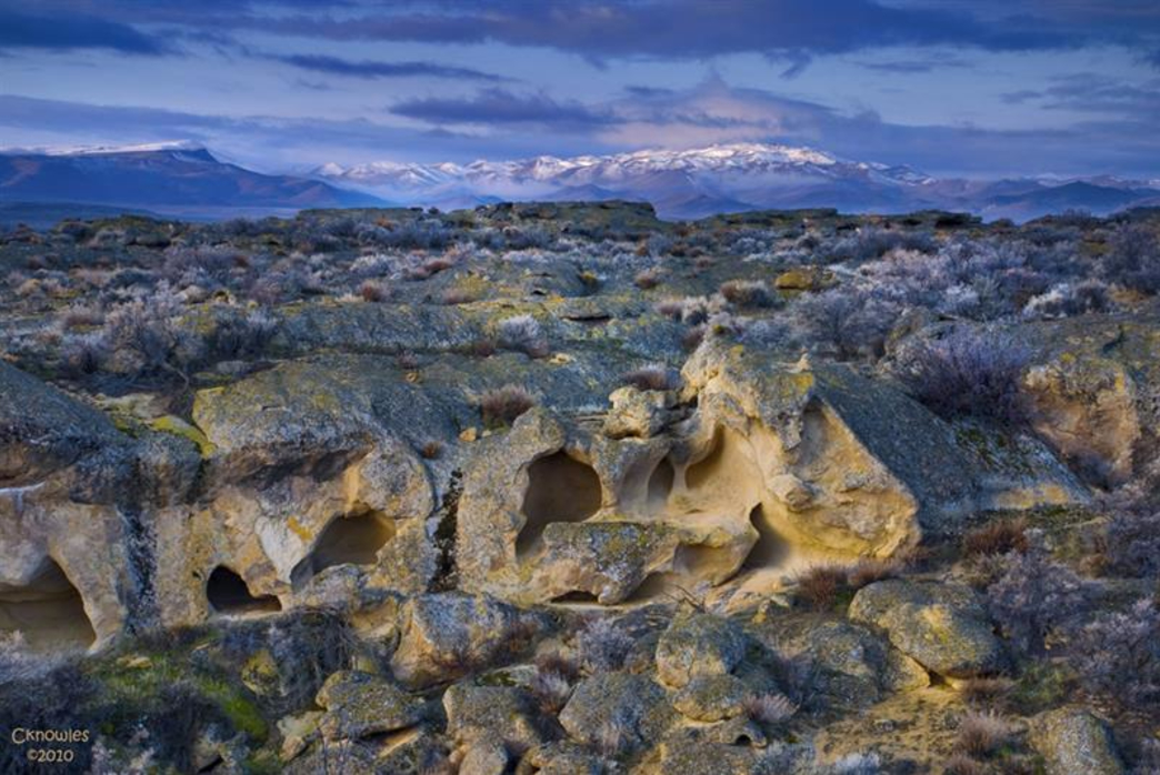
Oolites, known as “Egg Rocks,” are rocks made up of small round calcium carbonate deposits (not sand), which look like tiny BB-sized eggs. The Shoofly Oolites are one of the largest outcrops of Oolites in North America and possibly the largest freshwater Oolite accumulations on earth.

These Oolites were deposited in beach/shoal environments along the sides of ancient Lake Idaho around 2-5 million years ago in the Pliocene Era. Lake Idaho was in a large closed basin like the Great Salt Lake is today. It stretched from Eastern Oregon across most of the Snake River Plain, from Boise to the foothills of the Owyhee Mountains.

Most of the Treasure Valley’s groundwater and farm fields are in Lake Idaho deposits. It’s one of the reasons that the area has such abundant groundwater and agricultural resources.

Courtesy Steve Schaps 

The Shoofly Oolites are unusually thick, very homogeneous, and create an interesting area for a hike and geologic field trip. You can take home a few pieces of Oolite rocks, if you like. Bring a big. They are a bit crumbly.

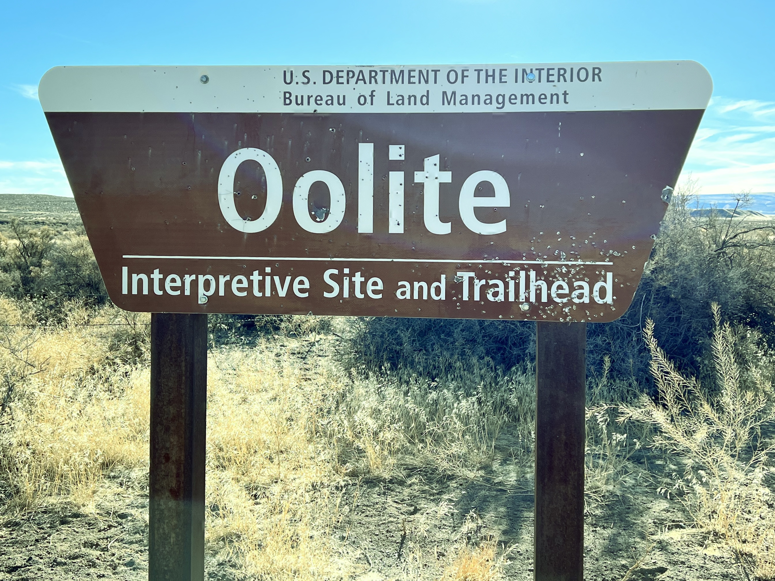
The Oolite road-side stop is managed by the Bureau of Land Management. It includes a few educational interpretive signs and a parking area.

There are lots of weird and interesting rock formations to see. The kids love this part … there are all kinds of caves, holes, arches and bathtub features to explore. A game of hide and seek, anyone?   

The Idaho Museum of Mining and Geology will be leading a geologic field trip to the Shoofly Oolites on April 16. Go to https://www.idahomuseum.org/ for more information.

There’s also a historic cemetery located one-half mile up the road that you can also explore.

How to get there:

·      Take I-84 east toward Mountain Home

·      Go right at Exit 74, Simco Road.

·      Follow Simco Road south for about 20 miles.

·      Turn right on Idaho Highway 167 and follow that to Grand View. Stock up on gas or any supplies at the Grand View quick stop.

·      Go left on Highway 78 and go east for about 2 miles to a Y-junction.

·      Veer right on Mud Flat Road, the Owyhee Backcountry Byway, a paved road to begin with, and follow that for about 9.5 miles. The Oolite BLM site is on the right. GPS coordinates are 42.837128/-116.121980.

Courtesy Steve Schaps 


Steve Schaps has a bachelor's and master's degree in Geoscience. He worked for over 30 years as a geophysicist in Houston, Texas. He's retired now. He's lived in Idaho for six years. Steve is also a volunteer at the Idaho Museum of Mining and Geology. 

Thursday, May 12, 2022

Weather drying out in the Bruneau Desert this weekend; Three trips worth exploring!

Courtesy Roots Rated web site CKnowles. 

Hi all, 

What an amazing week it's been! The freak snowstorm on Monday dropped 18" of new snow at Bogus Basin, and backcountry skiers flocked to the ski area to enjoy the fresh *pow.*

I found myself cutting up giant tree limbs and branches that fell off big maple trees around our house for the next 2 days! Did 4 runs to the Ada County Landfill on Tuesday morning. All of the tree services were booked out for weeks! Got 'er done! 

The weather looks wet in the mountains in this weekend (more backcountry skiing?), but there should be some weather windows to enjoy the Boise foothills trails at least by Sunday, when a high temperature of 82 degrees is forecast. 

I rode the Cartwright 4 Summits road ride yesterday (the dump loop), and the bitterbrush was beginning to bloom with some sunshine in the afternoon. Arrowleaf balsamroot is blooming everywhere as well along with some lupine and other flowers. 

Courtesy Roots Rated site/CKnowles

I'm not seeing any rain in the forecast in the Bruneau or Grandview areas this weekend, and they may see a high temp of 85 degrees on Sunday, so I'll share a few ideas to try in that direction.  

1. BLM Shoofly Oolite Interpretive trail - This is a great spot for young kids and families and anyone who'd like to explore some cool rock formations and learn more about the region's geology (ever heard of the ancient Lake Idaho?). How to get there - Go to Grandview, go left on ID 78, then right on the Owyhee Backcountry Byway. The Oolite site is 10.3 miles up the byway, on the right-hand side of the road. 

West Fork Shoofly Loop

2. West Fork Shoofly Quick Loop - This is a little discovery hike that I pioneered when researching the Owyhee book. Click on the link to an earlier blog post with all the details. The trailhead is located 18 miles off of the Owyhee Backcountry Byway, turning left off the main road onto a two-track road (AWD vehicles OK) that leads over to a trailhead in the Little Jacks Wilderness. Distance: 5.5 miles; travel time: 3 hours; 850 feet of vertical gain. The hike requires some navigation so be sure to print out the map before you go. 


3. Bruneau Overlook - If you've never been to the Bruneau Overlook, it's a spectacular sight to behold. Definitely worth the trip. Click on the link for driving directions. It's easy to get there, and you don't need a 4WD vehicle to navigate the good gravel road. Bring a lunch and plenty of water and enjoy the views. You can walk along the rim to see more of the canyon if you want. 


BTW - For trip-planning purposes, you might want to know that the weather gods are expecting that we will have continued wetter-than-normal weather, and cooler-than-normal weather in May.


Have fun! 
- SS 

Thursday, December 2, 2021

With sunny afternoons through Sunday, enjoy low-elevation trails like the Wilson-Reynolds Loop in the Owyhees

Entrance to Reynolds Creek canyon from the north. Took this pic in the spring.


Hi all, 

One more week of this unseasonably warm weather in December before winter weather is forecast to descend on Idaho next week.

So you might as well continue to enjoy low-elevation trails in the Boise Foothills or the Owyhee Front.  Please keep tabs on the Ridge to Rivers Facebook page for the latest trail conditions ... trails that are on north slopes or in permanent shade are going to be muddy and should be avoided. 

Trails in the Snake River canyon, such as this recent post detailing trips to an old homestead or Celebration Park to Halverson Lake would work well as would these must-do hikes in the Owyhees - Leslie Gulch and Mary's Creek/Sheep Creek.   

The China Ditch Trail ... Courtesy Idaho Hiking Club

Another sweet hiking loop is the Wilson Creek-Reynolds Creek Loop, which is featured in both my Boise Trail Guide and Owyhee Canyonlands guidebooks. It's 7.5 miles round-trip, travel time about 3.5 hours, vertical gain 750 feet, and it's super scenic. I saw that the Idaho Hike Club hiked it earlier this week. 

Here's a description in All Trails as well. 

My writeup on the hike:  

General remarks: This is a great hike/trail run in the foothills of the Owyhee Mountains, about 45 minutes from Boise. The trail weaves through rock formations on the way over to Reynolds Creek, and then you'll hike along on top of the China Ditch Trail - an old Chinese-built irrigation ditch high above the creek. The red rock canyon is spectacular. Bring your camera, plenty of water and a lunch.

Example of the cool rock formations you'll see going over to Reynolds Creek canyon.

Getting there
: From downtown Boise, hook up with I-184 west and head for Nampa. Take the Franklin Road exit (City Center) in Nampa, and turn left. Follow Franklin to the intersection with 11th Street. Turn right and take 11th into downtown Nampa. Follow signs for Idaho 45 south. Take ID 45 to Walters Ferry at the Snake River and turn right on ID 78, heading for Marsing. In a couple miles, turn left on Wilson Creek Road. Proceed up the paved road until it turns to dirt and pull into a dirt parking area on the left for BLM Trails #300 and #400. The hike/run starts here.

Directions: To begin, pick up Trail #300 out of the parking lot. Ignore trails branching off to the left in the first mile. At mile .9, you’ll cross a road and continue on the singletrack trail. The trail climbs one last hill and then widens into a two-track and descends to a T-junction at a dirt road (mile 1.8). Go right for a short bit, and turn left on Trail #410, a sandy wash going downhill towards Reynolds Creek. At mile 2.3, go right on Trail #310 and proceed for a half mile to a junction with Trail #600, the "China Ditch” trail. Go right and walk upstream along Reynolds Creek canyon for about a long mile. After walking next to vertical rock walls, the trail opens up on the right at the junction with Trail #510, #601 and #610. Go right on #510 and climb out of the canyon. At mile 4, bear right at a Y junction on #510 and stay on #510 to BLM dirt road #37154. Go right and follow the road to the junction with Trail #400. Go left on #400 at mile 5.28 and head back to the trailhead. At the top of the first hill, you can either stay on Trail #400 or branch off on #300. Both ways head over to the Wilson Creek Road and the trailhead.

Hiking notes: Even though the route is 7+ miles, the elevation gain is pretty minimal, so the hike may be suitable for kids 8 and over. My kids enjoyed the hike, especially throwing rocks into the creek on the China Ditch trail.

Wondering what's going on with the winter storms predicted next week? See my post in opensnow.com for the Idaho Daily Snow for details. 

- SS  

Make sure you bring the kids! This was Quinn and Drew a few years ago!


Thursday, November 4, 2021

Revisiting hiking trails that shine during shoulder season - Sage Creek and Orchard-5 Mile Loop

Wendy enjoys the quiet walk in Sage Creek canyon in the Owyhee Canyonlands.

Hi all, 

Revisiting trails that you love is kind of like getting re-acquainted with an old friend.

For Wendy's birthday, we zipped out to Sage Creek on Wednesday in the Owyhee Canyonlands for a delightful afternoon. Sage Creek canyon is close to Succor Creek State Park. It's accessed by a well-graveled all-weather road. So it's a cool, off-beat place to go in late fall, winter and spring.

I discovered Sage Creek canyon when researching my Owyhee Canyonlands guidebook some years ago. It's a moderate walk into a scenic, incised canyon that's chock full of geologic other-worldly shapes and features. It's always a treat to visit the canyon in my book.

Towering reddish-orange rhyolite spires, fins, caves and phallic-type rocks jut into the sky as you're walking up the draw. You'll see darker and more recent basalt rock features along the way as well.  

Wall of blonde volcanic ash in Sage Creek canyon.

Lots of cool geologic features to explore.

But several miles into the canyon from the trailhead, you come to a unique area that's full of volcanic rock and ash flows. The ash flows are blond-colored, green and chalk-colored, and they're very erosive ... you can carve off outside layers with your fingernail. There are some balance-rock features in the area as well.

To just sit there and observe all of those features is quite breath-taking. Be sure to bring a lunch and plenty of water and snacks. Allow for 3-4 hours to explore. 

It's about 4 miles or so to explore the full interior of Sage Creek while you're climbing along the creek-bottom on a general incline. It's an easy kid-friendly, out-and-back hike even if you go only a couple of miles into the canyon. If you have plenty of time, you can try to cover the whole canyon experience. The upper canyon ends when you approach the McIntyre Ridge Road.

Huck flushed a couple of chukars in the canyon.

How to get there:
Take I-84 to the ID 55 exit in Nampa, heading west toward Marsing. After about 5 miles or so on ID 55, turn right on Chicken Dinner Road to Homedale Road. Go left on Homedale Road and follow that into the town of Homedale. Follow State Highway 19 west of Homedale, and then Highway 201 in Oregon, to a signed turnoff for Succor Creek State Park on the left. Head south on the dirt road. It's about 12 miles to the unsigned right-hand turnoff for the Sage Creek Trailhead. There is a lone scrubby cottonwood tree at the turnoff. If you have a 4WD rig, follow the primitive two-track road over several creek-crossings to the trailhead .9 miles from the Succor Creek Road. Or just park and hike that portion. Either way works. 

You may need muck boots or just your hiking boots for the hike. If it's wet and the creek is running with water, you'll want your muck boots. Yesterday, our hiking shoes worked well. 

Selfie with Steve and Wendy on the descent into Five Mile Creek canyon.

Another good shoulder-season hike in the Boise Foothills
is to do the Rocky Canyon-Orchard Gulch-Five Mile Creek loop. This is a moderate to strenuous 5.5-mile hike in the NE Boise Foothills. The trails are pretty sandy, and once winter comes, they become covered with ice or snow, and still hikeable. 

Wendy and I hiked that loop last Sunday, and the leaves were still golden in many places ... but that will change in the coming weeks as fall transitions to winter. 

Getting there: Take Shaw Mountain Road by Fort Boise to Rocky Canyon Road, and follow Rocky Canyon Road to the end of the pavement. Go up the dirt road about about four miles to the trailhead for Five Mile Creek. Park.  

Hike uphill on Rocky Canyon Road for a long mile to the trailhead for Trail #7 in Orchard Gulch. Follow that trail about 2.5 miles to the junction with the connector trail over to Five Mile Creek. All of the climbing is done now. Hike down to Five Mile Creek Trail, go left and return to the trailhead and your vehicle. Hiking time is 2.5-3 hours.

------------------------------------------------

BBSEF Ski Swap is this weekend, Nov. 5-7! The giant ski equipment and clothing sale is being run for the 70th year!!! Opens at 1 p.m. on Friday at the Expo Building Fairgrounds. Entry fee is $5. 

The Land Trust of the Treasure Valley is looking for volunteers to plant sagebrush and other plants in the Harrison Hollow area on Friday at 10 a.m. Sign up here

- SS

Thursday, October 14, 2021

Two must-do hiking trips in the Owyhee Canyonlands, plus Black Magic Canyon near Shoshone

Leslie Gulch - an otherworldly place! (photo by SS)

Hi all, 

It's been cold this week and snowy in the mountains, but it's warming up this weekend with high temperatures forecast in the high 60s in the valleys, maybe low 70s in the middle of the afternoon. 

For my outdoor tip of the week, I'm recommend three must-do desert hiking trips destinations in SW Idaho - Leslie Gulch and Mary's Creek/Sheep Creek in the Owyhee Canyonlands, and Black Magic Canyon near Shoshone. 

All three of these destinations should be perfect this weekend. 

1. Black Magic Canyon is a totally unique experience in a incised basalt canyon formed by the Big Wood River below Magic Reservoir. The jumble of black rocks inside the canyon have formed interesting shapes from wind, water and time. 

The Twin Falls Times-News provides an excellent write-up about visiting the canyon along with some great scenic pics by photographer Drew Nash and video. 

Fall and winter are the best times to visit this gem when it's dry. In the spring and summer months, it fills with water runoff and the unique rock formations are not visible.  

Photo by Drew Nash, Fly Photography


Please see the Times-News article for directions to Black Magic Canyon. Coming from the Treasure Valley, you'll want to take I-84 to the Gooding exit and take US 26 to Shoshone. Then, head north on US 93 and following the directions from there.

Southern Idaho Tourism also has a write up on the canyon as does Trip Advisor


We did a hike after a recent small burn ... interesting contrast! (photo by SS)

2. Leslie Gulch is a popular destination on the Oregon side of the Owyhee Canyonlands because it's one of the most scenic areas in the whole canyonlands complex. There are camping areas and rest rooms in Leslie Gulch, several different hiking opportunities and a hot springs near the boat ramp on Owyhee Reservoir. I detailed one hike in my Owyhee Canyonlands book that goes up Juniper Gulch to great overview on Yellowjacket mountain. It's 5.5 miles out and back. 

The area features a lot of rock formations that might remind you of Southern Utah -- redrock spires, hoodoos, honeycombs and more. It's just a cool place to see and explore. If you want to see less people, go during the work week. 

Here's a previous post on Leslie Gulch with details on how to get there and more. 

3. Another worthy destination this weekend would be to visit Mary's Creek and Sheep Creek Canyon, south of Bruneau. Sheep Creek canyon would be dry or maybe you'd see a few puddles right now. So that means you can hike down the canyon and explore. Mary's Creek and Sheep Creek are tributaries of the Bruneau River. They also are part of the Owyhee Canyonlands Wilderness. 


Mary's Creek in the springtime. See my truck by the trailhead?

Sheep Creek canyon in the springtime.

Here's a previous post that I did about this hike with driving directions to the trailhead. Enjoy! 

Map of Mary's Creek hike to trail dropping into Sheep Creek canyon. It's possible to drive that two-track jeep trail to the canyon rim if you've got a good 4WD high-clearance vehicle.

- SS

Thursday, April 1, 2021

Super Duper spring weekend coming up! Two hikes and Wilson Creek bike ride in the Owyhee Canyonlands + Spring Skiing!

Stopping to check out the cool rock formations along Bingo's Trail, #500,
heading over to Reynolds Creek Canyon. Paul Hilding enjoys the views. 


Hi all, 

Similar to last week's weather, we are seeing warm afternoon temperatures rising a bit more each day to a big crescendo on the weekend. This week, that situation is especially true, with a high temperature of 75 forecast on Friday, 80 degrees on Saturday and 77 on Sunday! WOW! 

Looks like a great weekend to do just about anything outdoors! 

For my outdoor tip of the week, I'm recommending a two hikes and a mountain bike ride in the Owyhee Canyonlands, the last weekend of spring skiing at Tamarack Resort (closing at the end of day, Sunday, April 4), the next-to-last weekend of spring skiing at Bogus Basin, Brundage Mountain and Sun Valley (all closing April 11), and lower Boise Foothills trails.

A few key points from Ridge to Rivers when visiting Boise Foothills trails: 

A few key points to remember:
1) The trails are busy with lots of folks looking for the same experience you are - happiness and relaxation in the Foothills. As such spring time is the perfect opportunity to take the Happy Trails Pledge: https://www.ridgetorivers.org/happy-trails/
2) As you venture higher into the Foothills, you will still encounter sections of muddy trail. Remember to travel through these, not around them so that you don't widen the trails. And please turn around if you encounter longer stretches of mud - there are lots of dry opportunities available in the lower and mid-Foothills.
3) Trail crews and Adopt-A-Trail groups are out maintaining trails now. Please slow down and say hello when you encounter these folks - they are working hard for you.
Enjoy the beautiful spring weather!

Lower-elevation trails in the Owyhee Canyonlands are in great shape right now. A lot of people have been flocking to Wilson Creek for hiking and biking, which is a fine idea. Here's a blow-by-blow description riding the Wilson Creek Northwest Passage Loop, starting from the lower trailhead on Wilson Creek Road. This trail is a strong intermediate/advanced ride, 16.25 total mileage, ride time is 3+ hours, depending on length of stops for lunch, snacks and scenic locations.

Two other locations that I'd recommend in the Owyhees are Succor Creek State Park and climbing Three Fingers nearby. Both of these areas are featured in my guidebook to the Owyhee Canyonlands.

Succor Creek State Park is a popular spot, about 30 minutes from Homedale, Idaho, for families and kids to do a little hiking, exploring caves, checking out the creek and hanging out. You can camp there overnight. Get there early if you want a spot!

Things look quite interesting as you approach Succor Creek State Park. 

Drew had fun with us exploring Succor Creek. Note how the creek is at flood stage. 


Climbing Three Fingers is an easy hike for families and kids. This could be a side trip while you're camping at Succor Creek park, or a day trip destination. You'll continue driving past Succor Creek park for several miles up a hill, and then turn right at an unsigned right-hand junction. Follow that dirt road toward the top, and you'll see a two-track road appear on the left side of McIntyre Ridge Road. This is your two-track trail leading to the top of Three Fingers mountain.

Distance is 2.4 miles round-trip. 833 feet of vertical gain. Time required is about 1.5 hours, depending on how long you hang out on top. We found that it's possible to hike into the trough of the middle finger area for a cool place to hang out and enjoy the view. There was a little notebook inside a canister in that area. Make a note about your group so you can enjoy seeing that in a few years from now.

The two-track trail to Three Fingers 

Great views of "The Big Wide Open" from the top of Three Fingers. 

Three Fingers when dressed in velvety green (courtesy Summit Post) 

Have fun and enjoy the sunshine! Don't forget the sun screen!
- SS