Showing posts with label Station Creek Trail. Show all posts

Thursday, April 28, 2022

Middle Fork Payette-Garden Valley hikes opening up for spring!

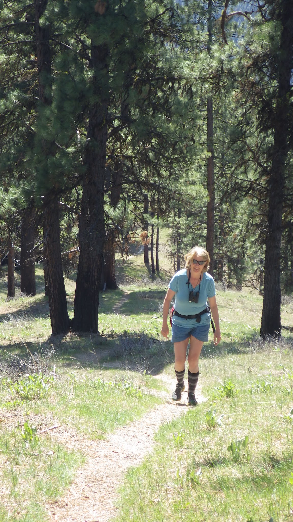
Station Creek winds through ponderosa pines on the way up a long ridge. 

Hi all, 

Wendy and I thought we'd hike the lovely Station Creek Trail in Garden Valley last Saturday to enjoy a 6-mile day hike in a forested setting. 

We were delighted to see the lower-elevation mountains in Garden Valley greening up for springtime recreation. We didn't encounter any snow on our hike up Station Creek Trail to the initial high point and saddle, or on the way up to Bald Mountain - another mile farther and an extra 500 feet of elevation gain. 

We dodged small squalls that were happening from time to time, but generally, it was a perfect day for spring hiking, with cool temps in the high 40s to low 60s, depending on the moment. 

If Station Creek Trail is in prime shape for hiking, then I'd also recommend two other nice hikes nearby - One Spoon and Lightning Ridge Trails. I've blogged about all three before. 

Steve and Huck on top of Bald Mountain ... elk sign everywhere! 

So that's my outdoor tip of the week - go check out any one of those three trails and enjoy hiking in a forested setting with creek water flowing below, wildflowers and shrubs beginning to bloom, and maybe even some morels popping up if you're lucky! 

The Trailhead for Station Creek is directly across from the Banks-Lowman Highway from the Garden Valley Ranger Station. It takes about an hour to get there from Boise. You can stop at the Garden Valley Chevron for any last-minute supplies before you head for the trailhead. 

Travel time on the Station Creek is about 5-6 hours, out and back. It's shorter if you just go to the initial high point about 2 miles up the trail. I rate the hike "moderate to strenuous" because there are some short, strenuous pitches.

Lunch on a big slab of granite near the top of the One Spoon hike with Wendy, Mark and Laurie. 

One Spoon Trail - Click on a previous post where I wrote about hiking One Spoon, including a map and driving directions, and also tips on floating the Middle Fork Payette River, Tie Creek section. The hike is 6 miles round-trip with up to 2,600 feet of vertical gain. You'll walk through ponderosa pine trees and see lots of cool big granite rocks along the way.  

Lightning Ridge affords vast views of the Boise National Forest

Lightning Ridge Trail - Wendy and I hiked Lightning Ridge Trail last spring. This trail goes for quite a ways, so the distance is kind of up to you. We went about three miles up the trail to an initial high point, turned around and came back to the trailhead. 

Difficulty: Moderate to strenuous

Driving directions: Take ID 55 to Banks. Go left in Banks and take the Banks to Lowman Road to the Crouch turnoff. Head up the Middle Fork Payette River Road (USFS #698) to a marked junction with USFS Road #611, the Lightning Creek Road, on the right. Follow the dirt road about five miles to the trailhead where an earthen barrier prevents further vehicular traffic. 

Have a great time exploring these trails! Bring a lunch and plenty of water for your day trip.   

Both Station Creek and One Spoon are featured in my guidebook, "Boise Trail Guide: 95 Hiking and Running Routes Close to Home." 

- SS 

Thursday, May 13, 2021

Station Creek, Cottonwood Creek National Forest hikes are tailor-made for a warm weekend in Boise


Wendy and Huck enjoy the view on top of the first ridge on the Station Creek Trail.

Hi all, 

It appears we're in for a bit of a heat wave this weekend, comparably speaking, with high temperatures in the low to mid-80s Friday-Sunday in the Boise Valley. It'll be in the 60s and 70s in the mountains around McCall, Stanley and Sun Valley.

Getting out early on Boise Foothills trails will be the charm this weekend, or heading to slightly higher elevations would be a good idea, too! 

To that point, I'm recommending two hikes in the Boise National Forest -- Station Creek and Cottonwood Creek -- for my outdoor tip of the week, plus I'll recommend a few other destinations that'd be perfect right now (below). 

Station Creek Hike

Station Creek Trail is a beauty, coarsing through a continuous layer of green on the forest floor, while stately ponderosa pine trees provide shade in the canopy overhead as you're climbing the mountain. Arrowleaf balsamroot is blooming in bright yellow along the way. It's a 7-mile out-and-back hike to the top of Bald Mountain, or roughly 5 miles out and back if you hike to the first ridge overlook. Hiking time: 3-5 hours round-trip. Rated: Moderate (strenuous in a few places)

If you go to the top of 5,122-foot Bald Mountain, you'll climb 2,000 vertical feet along the way. That's a very reasonable climb for most people who are in decent shape. Just take your time, breathe, and enjoy the scenery!

The trailhead is located directly across the Banks-Lowman Highway from the Garden Valley Ranger Station - hence the name, Station Creek! 

The well-maintained trail will take you to the top of the first ridge, and then there is a more faint elk trail that follows the lay of the land to the top of Bald Mountain. It's easy to find your way. 

Be sure to pack plenty of water and bring a lunch/snacks for the summit!


Steve and Huck on top of Bald Mountain with its trademark weird thingy on top.

Wendy enjoys the walk on a classic ponderosa pine ridge.

Bald Mountain, just shy of a mile-high ... good early-season hike

Cottonwood Creek 

Prior to some wildfires that swept through the Cottonwood Creek drainage, the Cottonwood Creek trail used to be quite the gem. It had a million creek crossings, but in between, it was much like Station Creek. Since the fires, the trail has gotten more brushy and falling into disrepair. Nevertheless, the first several miles are doable. But the full enchilada, which is more like 10 miles to the top of Thorn Butte, is not recommended. 

Still, if you haven't been up along Arrowrock Reservoir to the Cottonwood Creek Trailhead, it's worth the trip just to check out the countryside. 

Directions: Take Idaho 21 to the high bridge over Lucky Peak and turn right. Go about 15 miles along Lucky Peak and Arrowrock reservoirs to a junction with USFS Road #377. Go left and follow the road 3 miles to the Cottonwood Creek trailhead. There's a small parking area there. 

Possible side trip: In this area, you're close to the Mount Heinen trailhead, if you're feeling more ambitious and want to tackle a challenging 10-mile climb to the Heinen summit. See my post about this hike, it's one of the four Boise Grand Slam Peaks

Cottonwood Creek guard station

Beaver pond on Cottonwood Creek

Some other recommendations ... 

  • Any of the Boise Grand Slam peaks would be great right now. 
  • 80 degrees means it's time to get tuned up on the river! Middle Fork Payette, South Fork Payette and Main Payette would be great right now. I noticed that Cabarton is only running about 650 cfs. Mid-summer flows are usually 1500-1800 cfs. 
  • Salmon River is running 20,000 cfs at Whitebird ... if it's going to come up any higher, that might happen this weekend with the warmer temps. But not much of a peak!
  • Go past the Cottonwood Creek turnoff on the Arrowrock/Middle Fork Road and continue up to the Sheep Creek trail. That's a great hike, just quite the drive to get there. 

FYI - Steve and Mike Cooley, recently retired from George's Cycles, will appear on the KTVB-TV Viewpoint program on Sunday, talking about road biking and mountain biking in the early days of Boise becoming a bike town. 

Have fun!
- SS