 |
| Wendy enjoys the view while Huck sniffs for critters on the top of Hillside to the Hollow |
 |
| Walking up the wash in Sage Creek, Owyhee Canyonlands |
 |
| My son Drew enjoyed climbing around the rocks in Sage Creek. |
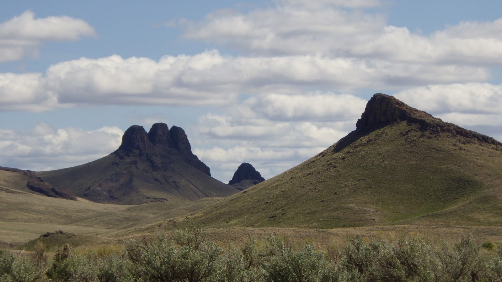 |
| Three Fingers from a distance in the Owyhee Canyonlands |
The weather has been getting nicer every day this week, and now temperatures are nudging 60 degrees in the heat of the afternoon -- perfect temps for hiking, mountain biking and trail-running in the Boise Foothills and the Owyhees. The high Friday is 65, Saturday 61 and Sunday 63. I say go for it!
1. Hillside to the Hollow - This is a nice little gem at the edge of the city that can be accessed from a parking area next to Healthwise off of Bogus Basin Road, Hillside Junior High by the tennis courts, or several other streets off of Hill Road. Start by Healthwise and hike up the canyon known as Harrison Hollow. This is a very gradual hike for a mile to a saddle. Continue going uphill at the saddle and head west toward the high point of the Hillside-to-the-Hollow complex. Once on top, you'll feel as if you can reach out and touch the city below. Great views up there! This is a relatively easy hike done at a relaxed pace. It's about 1.5 miles to the top, and 450 vertical feet of climbing. Rated moderate. Good for kids.
2. Kestrel - Red Cliffs Loop - This is a great trail for a casual foothills walk with your friends, family, dogs, whatever. You’ll get a nice workout, but you can moderate your speed on the climb up Kestrel according to your preference. Distance: 5 miles. Vertical gain 660 feet. From a running perspective, this is a popular standby. Start at Camelsback Park. Take Owl's Roost Trail, a moderate, slightly uphill cruise to a steeper climb up Kestrel Trail to Crestline. You can crank up the hill as fast as your lungs and legs will allow. After one more steep climb 100 yards after joining the Crestline Trail, the trail levels off for a bit and then it dives downhill to Red Cliffs. At the bottom of Red Cliffs, circle back over to the Foothills Learning Center and retrace your tracks on Owl's Roost back to Camelsback Park.
 |
| Steve with Quinn in the backpack on the Five Mile Creek Trail. |
4. Sage Creek - This is a cool hike out in the Owyhees near Succor Creek State Park. Follow the driving and hiking directions in this blog post. It's 2.5 miles out and back to explore Sage Creek. It's a beautiful redrock canyon with balance-rock formations and several areas with volcanic tuff layers that are chalky white and green. There is no official trail. Just walk up the canyon and enjoy the scenery. Very kid friendly.
5. Hike to Three Fingers Mountain - Three Fingers is an easy hike to the top of a basalt-capped mountain in the big wide open country of the Owyhee Canyonlands. Distance: 2.4 miles out and back. Hiking time: 1.5 hours. Elevation gain: 833 feet. Rated easy to moderate. The hardest part of this trip is getting to the trailhead, and that's not too hard. A 4WD rig is recommended. Follow the directions in this blog post, which provides driving directions to the trailhead, and also directions on the hike. This hike is located near Succor Creek State Park, so if you feel like taking your car-camping stuff, by all means, do that and stay overnight at the park. There is a rest room in the park and more hiking nearby. This one is also kid friendly.
------------------------------
A couple of announcements for next week:
1. I will be talking about my new edition of Boise Trail Guide: 95 Hiking and Running Routes Close to Home at Idaho Mountain Touring next week during First Thursday. The event starts at 6 p.m. IMT will have beverages and snacks on hand. I'll give a brief presentation, and I'll be glad to sign copies of Boise Trail Guide and Owyhee Canyonlands available for sale at IMT.
2. Backcountry Hunters and Anglers are hosting a major national meeting in Boise April 12-15. On Friday, April 13, they'll host "Beers, Bands and Public Lands," featuring local breweries and live music in the Grove. There are more than 1,000 people coming to the their North American rendezvous, so it should be a fun time in the Grove. It costs $20 for the brewfest. See BHA Rendezvous web site for more information.
Have fun!
- SS


No comments:
Post a Comment