Showing posts with label hiking in Boise. Show all posts

Thursday, September 22, 2022

Super duper weekend ahead! Three local hikes to explore in Boise, plus National Public Lands Day!

Boise Foothills trails are "the bomb" right now! Cool conditions and trails are in great shape! 
Pic of Harrison Hollow by SS

Hi all, 

After a really nice and cool week of September fall weather, it looks like we'll be shooting up into the 80s this weekend in the Boise Valley and 60s-70s in the mountains. Prime time to do just about anything outdoors while the primo fall weather lasts! 

The smoke has cleared from wildfires too in most locations, so that is a bonus! 

For my outdoor tip of the week, I'm recommending two hikes in the Boise Foothills and one at Bogus Basin for the weekend. (see below)  

First, a couple of outdoor notes

It's National Public Lands Day on Saturday, Sept. 24. You can visit National Park system properties in Idaho like Hagerman Fossil Beds National Monument, Craters of the Moon National Monument or City of Rocks for no charge. Volunteers are needed for Idaho Department of Parks and Recreation National Public Lands Day projects at City of Rocks, Castle Rocks, Harriman State Park. Follow the web link to sign up.   

South Fork Willow Creek property ... future open space? 
(Courtesy LTTV) 

The Land Trust for the Treasure Valley just announced today they need to raise $100,000 to acquire 320 acres in the Boise Foothills for protection as open space and wildlife habitat. The property, known as the South Fork Willow Creek property, is east of Avimor and bounded by the BLM on two sides. The property also has potential for recreation and walking and biking trails. If you'd like to donate, go here! 

My boater friends would appreciate the latest outdoor dispatch from Steve Dent with KIVI-TV about a group of experienced whitewater paddlers and firefighters who paddle-rafted the entire North Fork of the Payette River from top to bottom. They broke up the 15-mile continuous Class 5 white-knuckle run into sections. They completed their goal without suffering any major injuries - not to say they didn't have an occasional swimmer! Kudos to them for doing it safely! 


Courtesy Steve Dent, KIVI-TV YouTube channel 

Now, the hikes! All of these hikes are featured in my book, "Boise Trail Guide: 95 Hiking and Running Routes Close to Home." 

Table Rock trail (courtesy Outdoor Project) 

1. Castle Rock - Table Rock "Foothills on the Rocks" - full tour, 4.35 miles; Hiking time 1.5 hours; Vertical gain: 950 feet. Start/finish at the Old Pen parking lot next to the Bishop's House in East Boise. 

Take Castle Rock Trail #19 and climb .5 miles to the top of Castle Rock, a spiky basalt rock cap overlooking Quarry View Park. Turn right at the top and take the Quarry Trail along the edge of the rocks and pick up Trail #15 and cruise over toward Table Rock. The trail gets progressively steeper as you approach the south face of the mountain butte. Once on top, head over to the cross to check out the view of the Boise Valley. 

Circle back on Trail #16, a singletrack trail around the edge of the Quarry bear right on Trail #17. Thread through the giant boulders and rejoin Trail #15 to retrace your steps to the Bishop's House trailhead. 
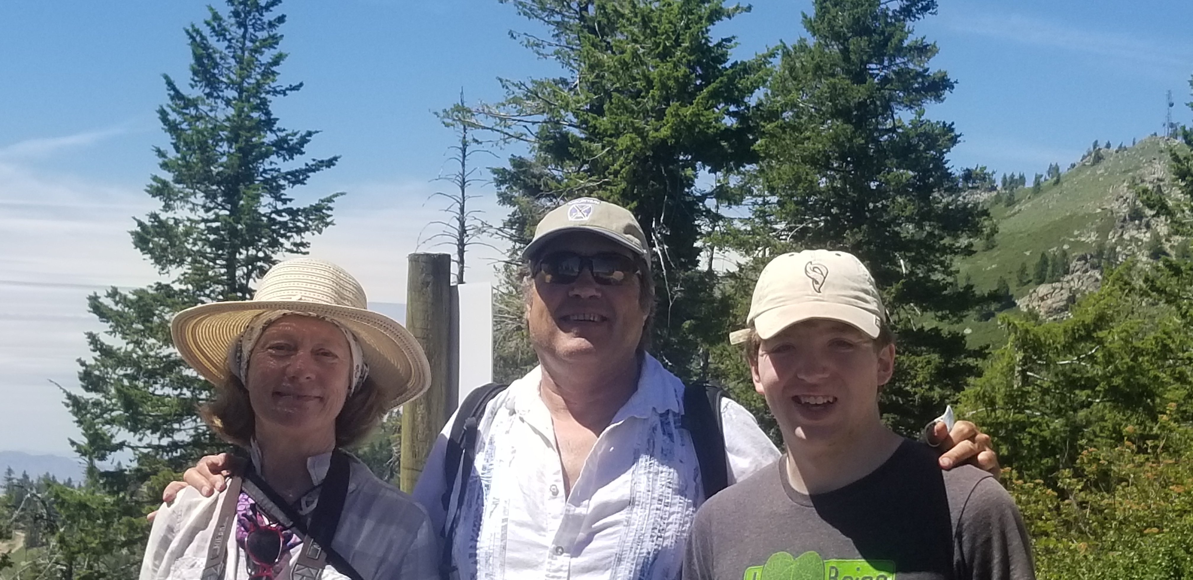
Hiking to the top of Bogus Basin with Wendy and Drew 

2. Quickest Way to Heaven at Bogus Basin - This is the name of a fun hike at Bogus in my Boise Trail Guide. It literally is the fastest way to the top on foot. Distance: 3 miles; hiking time, 1.5 hours; vertical gain: 750 feet. 

Drive to the Pioneer Lodge. Climb to the top of Morning Star chairlift and turn left on Lodge Trail #140. Follow the two-track around to the Superior side of the mountain. After one mile, you'll come to a junction where a right-turn takes you to the summit of Bogus, Shafer Butte, elevation, 7,582 feet. Bring a lunch and favorite beverage to enjoy the moment on top! 

Wendy and I went hiking last Sunday afternoon at Bogus, and we were pleased to see the BBQ is open by the lower lodge, with burgers, beers, and more! They were open till 5 p.m. Perfect way to cap off a fun day on the trails at Bogus!   

Courtesy Michelle Parsons 

3. Polecat Gulch Finger Loop - See a previous post with directions, pics and a map of this 6-mile moderate and scenic hike. Access is via N. Collister or Cartwright Road. Please note that the direction of travel for the full Polecat Loop is clockwise. R2R's has signs indicating the proper direction. From the N. Collister trailhead, you'll climb an initial hill to the top of a ridge, and then you'll see a left-hand turn for the Polecat Loop. The whole trail is narrow singletrack hiking, biking and running trail, following a series of finger ridges in the Northwest Boise foothills. One-way travel for the whole loop. 

Have fun! 
- SS 


Wednesday, March 17, 2021

Steep hike to Cervidae Peak close to snow-free; first Grand Slam peak to melt out

Got the first Grand Slam peak notched for 2021!

Hi all, 

Over the last few weeks, with cool, dry and breezy spring weather, the trails are beginning to dry out, especially in the lower Boise foothills and Owyhee front country. I blogged about Ridge to Rivers green-lighting some lower Boise foothills trails last week. 

This week, I thought I'd check on the snow level on Cervidae Peak, typically the first of the Boise Grand Slam peaks to melt out. The summit of Cervidae is 5,009 feet, and today, the peak was mostly snow-free, with patches of snow on top. The trail itself was dry as a bone, with a few long patches of snow covering the trail on the ridgelines within a mile of the top.

Airplane ridge with great views in all directions.

It's always an ass-kicker of a hike since it goes straight up a ridgeline for 2,000 vertical feet over 2.2 miles. Over 500 feet of climbing per mile = STEEP! But that also means it'll provide a great workout, and get your hiking legs warmed up for the season. No pain, no gain!

How to get there: The trailhead is on a road-side dirt pull-out (right-side) past Spring Shores Marina on the road to Lucky Peak and Arrowrock. A two-track road opposite of the parking area is your trail. The hike today took me a little over an hour to the top, and slightly longer on the way down. Maybe my time was a little slower because I was stopping to marvel at the beauty and take pics. 

Lucky Peak was absolutely still and smooth as a glass pane lake-wide today. The deep blue-green color of the water contrasts with blah-looking brown landscape that has yet to green-up.  

Lucky Peak on a calm spring day ... L.P. Nursery is off to the right on the flat.

Viewing the other Grand Slam peaks from the top of Cervidae, it appears the other three are snow-bound for now. Kepros will open up next, then Shaw Mountain, then Heinen. That's the order I would recommend for knocking out those hikes this spring. All of them are delightful through May, until it starts to get hot. Wildflowers on Kepros last year were PHENOMENAL! Let's hope we see that again! 

Arrowleaf Balsomroot going off on Kepros last May. With Quinn Stuebner. 


For background on the Boise Grand Slam peaks, you can check on out my previous blogs on the other individual Grand Slam peaks - Kepros, Heinen and Shaw Mountain/Lucky Peak. You can climb Lucky Peak via the BLM road accessed from Highland Valley Road, via Rocky Canyon Road or Homestead Trail above Harris Ranch. 

The Grand Slam peaks also are featured in my Boise Trail Guide: 95 Hiking & Running Routes Close to Home.  

Tom Lopez, a retired attorney who lives in Boise, was the person who pioneered the Boise Grand Slam peaks as a way to tune-up the legs for a summer of hiking in the Sawtooths and other mountain ranches that are snow-bound right now. Tom's book, Idaho: A Climbing Guide, is the best source of information for climbing Idaho mountain summits statewide. I highly recommend it. 

Mt. Heinen is the hulk of a mountain off in the distance. Still quite a bit of snow. 

The weather in SW Idaho is supposed to be crummy on Friday, but it looks good on Saturday and Sunday with mostly clear skies and high temperatures in the mid-50s. Perfect weather for spring hiking! 

Be sure to keep an eye on the Ridge to Rivers Facebook page for updates on trail conditions. 

Also, if you take your dog to Cervidae, be sure to carry a leash in case there are any mule deer or elk in the area. The trail lies inside the Boise River Wildlife Management Area. Thank you.
- SS

Thursday, September 12, 2019

Here's 5 hiking loops to enjoy during the Hyde Park Street Fair

Boise city scape from the trails to the Camelsback Summit.
Exhibitors getting set up for the weekend!
Boise Byrds biking group heading out for a ride.
Hi all,

Everyone knows the Hyde Park Street Fair is a rockin' good time, and it's happening Friday-Sunday of this weekend, Sept. 13-15.

It's always a hoot to hang out with your friends at the street fair, run into other peeps you know, shop the booths and enjoy the music. See the Boise Weekly article for all the details. It's the 40th anniversary of the Hyde Park Street Fair! 1979 man - Wow!

For my outdoor tip of the week, I'm recommending five hiking-biking-running loops that start and finish at Camelsback Park to maybe knock out before you go to the fair, knowing that you might be enjoying an alcoholic beverage or two ...

This list is kid-friendly and family-friendly, starting with the easy and building from there.

Trail to the top of Camelsback hill
1. Kiddie hike to Camelsback summit - Distance: 1/4 mile; Difficulty: Easy. There are several trails climbing to the top of Camelsback Summit from different sides of the park. One of them marches straight up the face of the hill in a series of steps. Take your young kids to the top to get a great view of the park and the city. When the music is playing, and the park full of colorful people, it'll be way cool to take in the event from up there. Best for kids 2-5 years old. Tip: there's a sand pit on the east side of the Camelsback hill, accessible from the trailhead on the east side of the tennis courts, where little kids love to play.

Walkers and runners headed out on Red Fox Trail.

2. Red Fox - Owls Roost Loop - Distance 2.3 miles; Difficulty Easy. Hiking time: 45 minutes (brisk pace) to 1 hour. This is the shortest and flattest loop from Camelsback Park venturing into the foothills. But it's very scenic going up Red Fox #36 Trail and coming back on Owls Roost (watch for great horned owls in there). Start from the trailhead on the east side of the tennis courts, and hike up Red Fox Trail 1 mile. Cross 8th Street, and take Kestrel a short ways to the Owls Roost junction. Turn right and return to Camelsback on Owls Roost.

3. Kestrel - Red Cliffs Loop -Distance: 5 miles, starting from Camelsback; 3 miles, starting from the Foothills Learning Center. Difficulty: Moderate. Hiking time: 2+ hours from Camelsback; 1+ hours on the short loop. Vertical gain: 606 feet. This hike is a great little workout close to home. Take Owls Roost out of Camelsback about 1 mile to the Kestrel junction. Turn right and climb Kestrel on the ridge up to Crestline Trail. Go left on Crestline a short ways and then turn left on Red Cliffs to return to the Learning Center and Camelsback. Great views from those trails, too, once you're on Crestline, and on the way back on Redcliffs.

4. Crestline - Hulls Gulch Loop - Distance: 7.25 miles, starting from Camelsback; 5 miles from the
Foothills Learning Center; Difficulty: Moderate with strenuous pitches. Hiking travel time: 2.5-3 hours; Running travel time: 1.5 hours; Vertical gain: 868 feet. Crestline-Hulls is a classic loop in the Central Foothills. It may be one of the most popular loops, if not THE most popular loop, because it’s a great tour in a scenic setting. Starting from Camelsback, take Owls Roost Trail about 1 mile to Kestrel. Turn right on Kestrel. The climb up Kestrel is steep in places and fairly continuous on the ridge, but once you're on Crestline, the gradient is very gradual and moderate on a wide sandy trail all the way to Hulls Gulch. The rocky singletrack trail going down Hulls creates a little more entertainment, but it's no big deal for hiking. Just watch your step! 

5. Corrals - Hulls Gulch - Loop - Distance: 8+ miles, starting from Cameslback. Difficulty: Moderate with strenuous sections. Vertical gain: 1,000 feet. This one requires a shuttle if you're hiking. It's a piece of cake if you're riding this route on a mountain bike. But it's a great tour from Corrals, over Corrals Summit to Bob's Trail then over to 8th street, cross 8th, and down Hulls Gulch back to Camelsback. You could hike up Highlands Trail from the bottom of Bob's in the Highlands to catch Corrals Trail, or start at the Corrals Trailhead 1.2 miles up Bogus Basin Road from Highlands Elementary. Proceed on Corrals Trail over the summit to Trail #1 to 8th Street. Cross 8th Street and descend on Hulls Gulch. Best for mountain biking, but it's a great hike or trail-run too! 

Have fun! 
- SS

Thursday, May 11, 2017

Five easy Boise Foothills trails for Greenbelt walkers who might dare to try the dirt!

Hiking on Red Fox Trail above the Hulls Ponds 
My son Quinn on a hike in Military Reserve 
You feel as though you could reach out and touch Boise from the Seaman's Gulch Trails 
Hi all,

The weekend weather doesn't look that promising -- it's expected to be unsettled and cool, with a 70 percent chance of rain on Friday, 50% chance on Saturday, and then a slight chance of rain forecast Sunday morning. So Sunday looks to be the best day, but at this time of year, who knows? You have to go with the flow!

With most of the Boise River Greenbelt closed right now, I bet that a lot of walkers and runners are wondering about the best trails to try in the Boise Foothills? For my tip of the week, I'm going to recommend 5 easy trails to consider at a variety of trailheads across the foothills.

All of the routes are featured in my Boise Trail Guide - 90 Hiking and Running Routes Close to Home. I organized the book as a step-by-step guide to hiking and running in the greater Boise area, starting with flat Greenbelt sections stretching from Eagle to Lucky Peak, and then stepping it up a notch to Easy Mountain Trails, which have short distances and a small elevation gain. And then after you master those, you step up to Moderate Mountain Trails, which are longer and have more elevation gain. And then you might graduate to Strenuous Mountain Trails -- great workouts that involve some pain -- or Epic Mountain Trails, which would take you to the limit!

Boise Trail Guide is your ticket to discovering the splendor and diversity of the hiking and running opportunities in the SW Idaho region. The guide takes even native Idahoans to trails they've never experienced before ...

So let's get right to it ... 5 Easy Mountain Trails to get you started. All of these are kid-friendly:

  • Eagle Bike Park - A number of the trails at the Eagle Bike Park are open to hiking and trail-running, including Rabbit Run, Junk Yard, D-Chaos and Twisted Sister. These are short, singletrack trails that tour around the west foothills near Idaho 55. Take Old Highway 55 north of State Street to get to the park. It's also a fantastic place to bike, with flow trails, a pump track and big-air opportunities for expert riders, and features for kids to practice and build their skills. 
  • Seaman's Gulch - Located on Seaman's Gulch Road, heading toward the Ada County Landfill, you'll see a trailhead for the Seaman's Gulch trails by a giant water tank on the east side of the road. The short singletrack trails here take you out for a fantastic view of the city. Distance is 1-3 miles. Less than 500 feet of gain. 
  • Harrison Hollow - Take the trail up the draw to get a feeling for Harrison Hollow. It's about 1 mile up the canyon to a saddle with several more trails. There also are trails on the ridges heading back to the trailhead, or you can return the way you came. This is a dog-friendly area. Please pick up after your pets. 
  • Camelsback Park - Owl's Roost - Red Fox Loop. 2.2 miles. Start at Camelsback, pick up Red Fox in the east side of the park and follow Red Fox out to the crossing of 8th Street. Go across the dirt road, and hike past the Foothills Learning Center on Kestrel to a right-hand turn for Owl's Roost. This trail will take you back to Camelsback. Excellent hike for kids in the backpack. There will be lots of people on these trails ... it's a popular area. 
  • Miltiary Reserve - Go to Fort Boise area in Boise and find Reserve Street. Go north into the foothills and turn left on Mountain Cove Road. Proceed about 3/4 of a mile to trailhead after a sharp right-hand turn in the paved road. At this trailhead, you can take Toll Road Trail up to a right-hand turn and creek-crossing. Cross the creek, and pick up Cottonwood Creek trail going back toward the trailhead on the other side of the creek. This is a scenic low-key hike, great for kids and dogs.
 ------------------------------------

Notes: Next week is Boise Bike Week, May 13-20. The Treasure Valley Cycling Alliance and Boise Bike Project always serve up a bevy of events during this time. See their web site or facebook page for details. 

Thursday, February 9, 2017

Drip drip drip ... outdoor tips for the weekend despite the soggy weather; sunny days ahead!

Elk in Garden Valley along the Banks to Lowman Road (courtesy Buzzfeed.com) 
Pine Flats Hot Springs next to the South Fork Payette River 
Hi all,

I suppose you could try to ski this weekend, but it seems the conditions might be pretty weird depending on how much it rains or snows after the rain goes away. We've been receiving a big deluge of rain mid-week with snow levels over 8,000 feet on Thursday, which really screws up the snow in the mountains! Plus, flooding is expected Friday in multiple locations -- cross your fingers that there aren't any major mud slides! Avalanche danger is very high as well. Be safe!

The good news is that it's supposed to be sunny and clear on Saturday and Sunday in Boise, with temperatures in the 40s during the day. So for this weekend, I'm recommending a low-key Greenbelt loop in East Boise or a scenic drive to see wildlife in Garden Valley and maybe hit a hot springs as part of the trip.

Marianne Williams Park-Barber Park Loop - Foothills trails are going to be duck soup, so I'm recommending that you take a 4-mile hike starting and finishing in Bown Crossing, with optional coffee, lunch or beer afterwards. Pick up the Greenbelt on the north side of the Boise River in Marianne Williams Park and follow that pathway east to the nature trail. Go right on the nature trail and continue to the Eckert Road bridge. Cross the river, and walk west through Barber Park on dirt pathways back to Bown Crossing. Be sure to wear your snow boots for the walk! The dirt trail will be muddy or slushy. Carry some water, take your time, bring the bino's and look for birds and wildlife along the way.

Garden Valley Wildlife Tour - Take Idaho 55 north to Banks and drive east on the Banks to Lowman Road through a deer and elk winter range to see wild turkeys, elk and deer. Bring your camera and bino's. You should see quite a few animals, particularly between the Garden Valley airstrip and Pine Flats Hot Springs.

Potential primitive hot springs to visit on the trip include Skinny Dipper, Pine Flats, Kirkham Hot Springs, or Bonneville Hot Springs, 25 miles east of Lowman. See the Idaho Hot Springs site for details. Circle back through Idaho City on the way home via Idaho 21, if you wish, to make a big driving loop. If you do that, the Springs in Idaho City would be another potential hot springs stop. Advance reservations are required.

Let me know if you see some wild game!

Just so you know ... river season is upon us! I posted a snowpack map on my Facebook page today, noting the big numbers, and then I checked on Idaho river flows, and the Owyhee River is flowing 8,000 cfs at Rome, Oregon, and the Bruneau is running at 2,000 cfs. Several people said they're hiking in to run Five Mile Rapids on the Bruneau ... hard core! I bet there will be some people running the Owyhee, too! The Payette was just barely rising, 2500 cfs ... that might be different tomorrow!

Have fun!
- SS

Thursday, September 5, 2013

Here are some fun hikes, bike rides close to home; plus, Avimor Bike Demo Day and Ride for the Red

Took my boys out on the Five Mile-Orchard Loop on Father's Day  
At the Orchard-Five Mile saddle ... big views everywhere ... 
Sweet trail ... Orchard Gulch 
Five Mile Creek didn't have much water in it last time I was there ... pack water for your pets.  
Doug Lawrence on Eastside 
Paul Hilding and Doug on Eastside 
Doug finishes the Mr. Big steep-ass climb 
Hi all,

After all the moisture this week -- Yay! -- the trails should be nice and tacky this weekend, and the temperatures will be in the low 80s in the Boise Valley. So it should a great weekend to get out on some local outings close to home.

I'm recommending a couple of sweet hikes and bike rides, and also, I'd suggest heading out to the Avimor Bike Demo Days on Saturday or Ride for the Red on Sunday. More about those events in a moment.

First, the hikes. Both of these are a little off the beaten track in the NE foothills, and they're very scenic.

1. Five Mile Creek - Orchard Gulch Loop - This one is 5.35 miles. Allow about 2.5 hours hiking time. It's rated moderate to strenuous in my Boise Trail Guide: 75 Hiking & Running Routes Close to Home
Take Rocky Canyon Road to the end of the pavement, and keep going for about 2.5 miles to a parking area and trailhead for Five Mile Creek. Park here. Climb Five Mile Creek Trail for about two miles, and you'll come to a junction for Orchard Gulch connector trail. Climb a steep hill to a saddle, and then drop into Orchard Gulch. Find a spot in the shade for lunch. And then finish hiking down the draw and you'll come to Rocky Canyon Road. It's about a mile back to the car.

2. Five Mile Creek - Watchman - Three Bears Loop - This is a much longer hike, about twice as long at 10.2 miles if you do the whole thing. (It's an awesome bike ride, too.) But I'll recommend something that's a little shorter, and nice for hiking. Follow the same directions to the Five Mile Creek trailhead as the hike above. Climb Five Mile Creek past the Orchard connector, and you'll merge with Watchman Trail. Following the Watchman Trail as it winds around the upper tier of the foothills. It's very scenic and enjoyable. At the end of a long downhill, bear left at the junction with Trail #6, and head for Three Bears. After a short climb and another downhill, you'll come to a junction with Three Bears on the ridge. Go left and do the steep descent on Three Bears back to Rocky Canyon Road. Go left and the Five Mile trailhead is about 100 yards to the left.

Here's a video of the Five Mile Creek - Watchman - Three Bears Loop ...


Here are a couple of bike rides that are real smooth right now. Both of them are featured in my guide Mountain Biking in Boise

1. Eastside Loop - I've been amazed at how popular the Eastside Trail #120 is this summer. We rode it last Saturday, and it was super-smooth. The standard Eastside Loop is done by going up Bogus Basin Road about 12 miles to a large vehicle pullout on the left. Park here. Ride your bike on the pavement almost to the Bogus Basin base area, and then go left on Eastside Trail. Along the way, you'll see some optional big-air or technical features that you can either ride or bypass. I'd rate this ride as strong intermediate/advanced. It's about 10+ miles. The only thing I don't like about the ride is you go slightly downhill on Eastside, and then you have to climb back to the parking area on a pretty steep trail. There are a couple of options for climbing back to the parking lot. On Saturday, we took Eastside to Mr. Big, descended a short section on Mr. Big, and then did a steep, arduous climb on Mr. Big to Freddy's Stack Rock/Sweet Connie junction, turned left, and rode that back to the parking lot connector and finished the climb to the parking lot.

2. Freddy's Stack Rock Loop - This one is 9.5 miles. I'd rate this strong intermediate/advanced. Drive to the same parking area as the trailhead for Eastside. Drop into the singletrack next to the parking lot and descend to Eastside Trail #120. Bear left on the singletrack. At mile 2.5 from start, you'll come to a junction with Mr. Big and Freddy's Stack Rock Trail. Go straight on Freddy's #125. In another half mile, you'll come to the Freddy's loop junction. Here, you can decide to do the loop clockwise, or counter-clockwise. I recommend clockwise. At mile 4, you'll reach Stack Rock. Take a break and have a snack. Follow the loop around the rock, and return to the Eastside parking lot. Allow 2.5-3 hours for the ride.
----------------------
See the SWIMBA web site for information about Avimor Bike Demo Days. Should be a lot of activity with the Knobby Tire race going on, plus the demo day, BBQ and beer. I got there in the afternoon last year, and none of the 29ers were available to demo. So show up early! Avimor has a lot of cool trails to explore. Worth driving up there to check them out, if you haven't already.

On Sunday, George's and the American Red Cross are sponsoring Ride for the Red, a group road ride from Barber Park in east Boise to Celebration Park next to the Snake River, south of Nampa. You can sign up to ride 50, 75 or 100 miles. Should be a very interesting course. Registration closes on Friday.

Have fun!
- SS

Thursday, August 9, 2012

Get up early for a quick workout before work to beat the heat ... you'll feel SO much better

Hi all,

With this blasted hot weather settled over the lowlands of SW Idaho for weeks on end, we're left with really no choice but to get up early for a quick morning workout before the "work" day begins during the work week.

I've been trying to do that several times a week, and I've noticed that the parking lots at foothills trailheads are surprisingly busy at 6:30 a.m.! Fine minds think alike!

This week, for my tip of the week, I'm recommending several biking/running loops that take an hour or less. If you're hiking, allow more time. All of these routes are featured in my Boise Trail Guide and Mountain Biking in Boise. To make a quick escape, take a few moments in the evening to gather up your gear and replenish the water in your pack, so you're ready to roll in the morning ...

Table Rock trails
1.  Table Rock - The out-and-back South Face "grunt route" to the top of Table Rock is short and abrupt, guaranteed to make you sweat, with almost 1,000 feet of climbing. Distance is about 3 miles. Take Trail #15 from the Old Pen Trailhead by the Bishop's House and climb to Table Rock. If you have time, you can loop back on Trails #16 and #17. Or just go out and back.

2. Military Reserve - There are many short options in Military Reserve Park, but my current favorite is what I call Jumpin' Jeepers Figure 8 Loop. Distance is 6.75 miles; climbing is about 1,000 feet. Take  Central Ridge Trail #22 to the top of the first hill, and continue to Shane's Junction. Ride to the top of Shane's and do the loop back to Central Ridge and Bucktail junction. Take Bucktail downhill and slalom back to the top of Trail #20 and descend the switchbacks to Toll Road Trail and cruise back to the trailhead.

2a. Two Coyote Loop - My friend Maggie Lawrence loves this route. It's 6.5 miles (705 feet of climbing). Running time is about 1:15; Riding time is about an hour. Hike or ride along Freestone Creek to the police firing range area. Climb up to Bucktail and follow that to Shane's Junction. Go left on Shane's and take that to Trail #26, go left and cruise downhill over to a dirt road. Take the dirt road downhill back to the police firing range area and return on the trailhead via Freestone. Maggie and the Boise B's named that Two Coyote because they saw two of those pups on their run.

3. Corrals-Bobs Loop - Highlands neighborhood special. This one is a little longer at 8.4 miles and 1,230 feet of vertical gain. Riding/running time is more like 1.5 hours. Go up Bogus Basin Road to the Corrals Trailhead. Ride Corrals to the summit, descend to Bob's, and rip down Bob's, watching for the rare person coming uphill. A quicker alternative here is to drive to the Corrals Trailhead, and do an out and back to the top of Corrals or add the climb on Scott's Trail for spice.
Boise B's on Corrals morning run in the winter ... 
4. Crestline-Hulls Loop - North Ender special. Starting from Camelsback, this one is 10 miles (1,600 feet of gain), but if you start from the trailhead by the Foothills Learning Center, it's less than 8 miles. Quickest way is to ride up Kestrel to Crestline, and return to the trailhead on Hulls. My friend Molly said that takes her a little over an hour to run that one.

5. Polecat Gulch Loop -  The full loop is just over 6 miles (800+ feet of climbing), and I typically ride it in 45 minutes to an hour. Running time would be an hour or less, depending on your pace. The trailhead is off of Cartwright Road, near the junction with Pierce Park. Excellent choice for people who live in NW Boise or Hidden Springs.

6. Hillside to the Hollow Loop - There's a quick loop in Hillside to the Hollow (the island of open space between 36th Street and Bogus Basin Road). Start at the 32nd Street trailhead, climb to the top of the mountain, keep going east and then take the trail that wraps around the frontside of the mountain and returns to the trailhead. If you leave nearby, just ride or run from home, and you can notch that loop is less than an hour.

7. Squaw Creek Loop - The long loop is 6.25 miles and over 1,600 feet of climbing. This route is most convenient for folks in the Harris Ranch and SE Boise areas. It can be shortened by climbing the Homestead Trail out and back. The trailhead is off of Council Springs Road, near Lucky 13.

Eagle Cycle Park (courtesy Mari Briggs)
8. Eagle Cycle Park - For west Boise residents and Eagle folks, these trails are very close to home. Take old Horseshoe Bend Road north from ID 55 to the Eagle Cycle Park Trailhead. Here's one suggested loop that's 6.5 miles (800 feet of climbing). Ride uphill on Rabbit Run and follow that to the end; go back on Twisted Sister, do another loop on D's Chaos, and finish by looping the Junk Yard Trail. All of these twisty singletracks are fun, and you won't experience any climbing that lasts very long. Fun place to run and ride.

9. For the road cyclists out there, the best recommendation I have is the Cartwright-Pierce Park Loop (fastest option) for a quick morning workout. That one usually takes less than an hour, while the full
Three Summits Loop (aka the "Dump Loop") is more like an 1:15 for me.

There you have it! Hopefully you've got some comp time or flexible schedule that allows coming into work a little later than 8 a.m.!  Even if you work at home, it's best to get started early to enjoy a cooler environment. It is getting kind of smoky out there, however, because of all the fires burning in Idaho and Eastern Oregon.

If you've got a favorite early-morning route that I've overlooked here, please pipe up in the comments below and let us know what we're missing!

PS - If you'd like more detailed descriptions and maps, all of these routes are available a la carte for 99 cents each on my web site, www.stevestuebner.com.

- SS

Thursday, April 19, 2012

Here are 5 kid-friendly hikes near Boise for Unplug and Be Outside Week

My boys Drew and Quinn at Camelsback Park

Red Fox Trail above Hulls Ponds

A Dad and two kids hike in Surprise Valley on the way to Oregon Trail Reserve

Hi all,

It's Earth Day on Sunday, and a full week of activities kick off Saturday for Unplug and Be Outside week in the Treasure Valley. So I thought I'd suggest five kid-friendly and family friendly hikes close to home for the upcoming weekend. After kind of a soggy week, the weather this weekend looks fabulous! Temps in the 80s! OMG!

First I'd like to wish all of the Race to Robie Creek runners and walkers the best of luck participating in the "toughest half-marathon in the Northwest" on Saturday. Hat's off to you.

The whole point of Unplug and Be Outside is to get your kids outside (leave the headphones and cell phone at home, please), and discover the wonders of nature. When you're out doing whatever activities you choose this weekend, look for little "teachable moments" when you can teach your kids little tidbits about nature. Maybe you can identify a wild flower, a shrub, a plant or a tree. Show them how to remember that species.

Take a sample of water from a pond or a creek and put it in a jar at home. See what's swimming around in the water and learn about it. Put it under a microscope if you have one.

Spend some time just sitting on a hillside and watch the clouds go by. Look for birds of prey flying above. If you look close, you're likely to see a kestrel, a red-tailed hawk or maybe even a cooper's hawk. Bring a pair of binoculars, a bird book and a wildflower book on the hike to help with identification.

Here are the kid-friendly hikes, all drawn from my book: Boise Trail Guide: 75 Hiking and Running Routes Close to Home.

1. Owl's Roost-Red Fox Loop. This is an easy 2.2-mile loop in the Central Foothills, starting and finishing from Camelsback Park (13th and Heron) in Boise. Rated easy. This one is great for infants or toddlers in the backpack or young kids who might be able to walk that far. Start from behind the tennis courts in the east side of the park or on the north end of 9th Street. Go north on Red Fox Trail, cross 8th Street, and come back on Owl's Roost. You'll find Owl's Roost next to the Foothills Learning Center.

2. Castle Rock - Table Rock Loop. This hike is called "Foothills on the Rocks" in my guidebooks. It's best done on foot because the trails are quite steep in a few places, especially in the approach to Table Rock on the south face. Trip distance is 4.35 miles. Travel time is 1.5-2 hours. Rated strenuous. Take Warm Springs Avenue east to the Old Penitentiary. Park behind the Bishop's House at the public trailhead. Take Castle Rock Trail #19 to the top of Castle Rock. If you have small kids, this can be your destination and loop back to the trailhead. Otherwise, take Trail #15 from the top of Castle Rock and climb to the top of Table Rock. Enjoy the view. Do a loop of Table Rock on Trails #16 and #17 and then retrace your steps back to the trailhead. It's a good workout.

3. Surprise Valley - Oregon Trail Loop. It's 2.6 miles and 1 hour hiking time. Rated easy. Start from Trinity Presbyterian Church in Surprise Valley (don't park there on Sunday morning). The church is on the right side as you drive into the Surprise Valley area on Surprise Way, off of Boise Avenue or Amity. Go behind the church and pick up the public trail that runs along the base of the basalt cliff, follow that for a mile or so, and then go up the Kelton Ramp, a rocky two-track where Oregon Trail wagons descended into the Boise Valley. Once on top of the rim, you can follow a trail that stays close to the rim, or several others on the flat portion of the Oregon Trail Reserve Park, and complete the loop.

Learning about Oregon Trail history is the teachable moment on this trail. This is what one of the interpretive signs says: Standing here, you are only a short hike away from original Oregon Trail ruts. Pioneers by the thousands walked and rode through this very country. Turning wagon wheels represented more than simply a people moving West; as the wheels turned so did the pages of our history, uniting our nation from coast to coast."

4. Military Reserve Double Ridge Loop. The loop is 3.7 miles long. About 2 hours travel time with small kids. Rated moderate to strenuous. Take Reserve Street north from Fort Street, and turn left on Mountain Cove Road. Follow the road for over a mile around a corner and park at the trailhead. Take Central Ridge Trail #22 and climb up on the middle ridge in Military Reserve Park for a mile or so. At the top of the ridge, turn right on Ridge Crest Trail #20A and go downhill to Cottonwood Creek. Go left at the bottom of the hill, cross the creek, and go left on Eagle Ridge Trail #25. Follow that trail to the toe of the ridge, and drop down to the trails by the flood control cells next to Reserve Street. Turn right and hike back to the trailhead. If you want to shorten this route for young kids, do a short loop on the Toll Road Trail #27A and Cottonwood Creek Trail #27 (total distance is slightly over 1 mile).

5. Seaman's Gulch Loops. This is a sweet and easy loop off of Seaman's Gulch Road in NW Boise. On the way to the Ada County Landfill, you'll see a trailhead, rest room and parking area on the right next to a large brown water tank. There are two short loop hikes you can do here. The loop on Trail #110 is one mile, and the loop on Valley View Trail #111 is three miles. I recommend Valley View -- it has a great bird's eye view of the city up on the hill. Rated easy.

All of these hikes and many more are featured in my book Boise Trail Guide: 75 Hiking and Running Routes Close to Home.

For tips on hiking with children, the Statesman featured Boise dad and Outside correspondent Mike Lanza this week. Mike had some great tips on getting your kids started out early in the outdoors ... and how to get them started out right ...

Beyond the hikes, check out the activities for Unplug and Be Outside week. On Saturday, they've got golf clinics, a scavenger hunt at the World Center for Birds of Prey, rock climbing at a climbing gym and a story trail at the Foothills Learning Center. There are all kinds of activities going on all week!

BTW - I will be teaching a flatwater kayaking clinic at Sierra Trading Post in Meridian on Monday and Thursday nights of next week, if you'd like to know more about places where you can paddle in a non-threatening environment in SW Idaho and what crafts to use for these kinds of paddling adventures.

For more information on kid-friendly activities, see the Be Outside Children in Nature web site and Be Outside videos.

Have fun!
- SS

Steve shares his weekly outdoor tips with Ken and Tim on 94.9 FM The River each Friday morning in Boise at approximately 7:10 a.m. If you miss the program, you can hear the segments on River Interactive.com. Detailed descriptions and color maps of Steve's hikes, bike rides and paddling trips are available for 99 cents each atwww.stevestuebner.com, plus the full ebooks and hard-copy guidebooks.

Thursday, September 16, 2010

Hulls Gulch National Recreation Trail is a sweet treasure close to Boise

Upper Hulls Gulch ... the trail is at the bottom of the draw

Watch for wildlife along the way

Main trailhead 3 miles up 8th Street

Hi all,

Lower Hulls Gulch is probably the most popular trail in the Boise Foothills, a place where people go hiking, biking, jogging, dog-walking, bird-watching, you name it.

But 3 miles up the hill is the best part of the Hulls Gulch, and you'll rarely see anyone up there. It's called the Hulls Gulch National Recreation Trail, and it's also known as the Hulls Gulch Interpretive Trail because of the educational signs about geology and nature that you'll see along the way. It's great for kids and families, and really, just about anyone.

The BLM developed the trail many years ago, and it was closed to mountain biking in the late 1980s to set a QUIET tone for the upper watershed, where hikers, runners and school kids can tour the area without fear of confronting speeding cyclists.

There are three ways to experience the trail, all with different mileage and experience:

1. Standard route - Drive 3 miles up North 8th Street after it turns to dirt and you'll come to a large parking area with rest rooms. This is the primary trailhead for the Hulls Gulch National Recreation Trail. It's a 6.5-mile hike to do the full tour of the trail to the upper watershed of Hulls Gulch, where the trail loops around the headwaters, passes by a waterfall (most impressive in the spring), and and returns to the trailhead. You should allow 2.5-3 hours for the trip (not including the drive). Mary Beth Anderson did a nice job detailing this route in her blog.

2. Upper Trailhead - Go past the main parking area and drive several more miles up 8th Street to the Upper Trailhead, which is well-marked. The road is rough with big holes and water dips. You'll need a high-clearance 4WD rig to make it up there. The upper loop is 2.5 miles to the tour the upper watershed. Here's a nice little description about that section from trailsandtread.com. This hike would take about an hour and a half.

3. Lower and Upper Hulls Gulch Trail - Strong runners and hikers will enjoy this approach, which I detailed in my guidebook, Boise Trail Guide: 75 Hiking and Running Routes Close to Home. It's 11.5 miles from the Hulls Gulch Trailhead by the Foothills Learning Center to the top of the Hulls Gulch National Recreation Trail and back. Hiking time would be about 5 hours; running time 2.5 hours.

While you're out on the trail, watch for wildlife, songbirds, hawks flying overhead and animal tracks. See if your kids can identify tracks and scat.

A fourth option would be to shuttle a vehicle if you have young children or seniors along who may not be able to climb very well. You could start at the Upper Trailhead and work your way downhill to the main trailhead. This trip would be about 3 miles downhill.
FYI - If you don't have Boise Trail Guide, you can download a detailed description and map of Hulls Gulch National Recreation Trail for 99 cents at www.stevestuebner.com.

Have fun!
- SS