Showing posts with label spring biking. Show all posts

Thursday, April 13, 2023

Lower Boise Foothills trails finally open for hiking and biking! 3 hikes/rides to explore!

A bearded Steve at the summit of Shane's Trail on an April mountain bike ride.

Hi all, 

With the dramatic turn from winter to spring weather for a couple of choice days last weekend - featuring high temperatures in the mid-70s - the trails in the lower Boise Foothills dried up and now they're ready for hiking, biking and trail-running. Finally! 

In many years, the trails in the Boise Foothills have dried up in late February to early March, but because of the long, cold snowy and icy winter we had in 2022-23, spring is coming late! 

And that's OK! 

Boy, it felt great to get out and ride my mountain bike on Saturday morning! It was still on the cool side, but when I saw that Ridge to Rivers had given the lower trails the green light, I was ready! I rode from Camelsback Park to Crestline and Sidewinder and took Red Cliffs back. The trails were bone-dry the whole way. 

I saw hikers, mountain bikers and runners everywhere. As the day got warmer, I have a feeling that the trails got even more busy! 

Central Ridge trail in Military Reserve

Man, it felt good to climb, get my lungs and heart pumping in the red zone, and enjoy another one of my favorite gravity sports on the way down!  

Remember that it's only mid-April, and we'll be subject to more rain and even some snow.  Pay attention to the Ridge to Rivers trail reports on Facebook if you're in doubt. 

For my outdoor tip of the week, I'm recommending three hiking and biking loops in the foothills. After a snowy surprise Thursday morning, it's supposed to be a really nice weekend Friday-Sunday with High Pressure aloft, mostly clear skies and warmer temps each day through Sunday. High temps are 56 degrees on Friday, 65 Saturday and 75 on Sunday. Now we're talking! 

And then the weather goes to hell on Monday-Tuesday of next week. So get out and enjoy it this weekend when you can!

Sharing the trails respectfully with others is important in the foothills. Thank you! 

Before we get into the rides/hikes, a couple of reminders: 

1. Be a good trail ambassador! "Be Kind" when you're out using the trails, share the trails respectfully with others, and smile and say "hi" when you pass by people. A little bit of courtesy goes a long way! 

2. If you're mountain biking, remember that all uphill traffic has the right of way. If you're coming down and you see people coming up, stop, step off the trail and let them pass by, no matter if they're walking, running or biking.

3. If you come up behind someone and need to pass, say something like "coming up" and let them know you're coming so they can step off the trail for you to pass.  

4. Polecat Gulch is changing back to counter-clockwise direction this year. You'll see the signage out there. I preferred riding it clockwise, but oh well. I do like how the one-way direction on Polecat has reduced conflicts and, no doubt, collisions. It's a tight, narrow singletrack in places on steep side-hills without much in the way of sight lines. The one-way trails are safer. 

5. Stay off muddy trails. I already covered that above, but I'm saying it again. If things are wet, go for a road ride or ride the Greenbelt. 

Now for the recommended hikes/rides: 

1. Best for hiking: Kestrel-Red Cliffs Loop -  Camelsback - Kestrel-Crestline-Red Cliffs Loop - Distance: 5 miles. Rated moderate for hikers and runners. Rated intermediate for biking. Hiking time, 2-2.5 hours; Running time: 55 minutes; Biking time: 45 minutes. This is a popular loop with hikers, runners and bikers. Start at Camelsback Park off of Heron and 13th Street in North Boise. Head over to the trailhead in the east side of the park, and follow Owl's Roost Trail on the right by the ponds. Follow Owl's Roost to the Foothills Learning Center area. Turn right at the junction with Kestrel, and climb Kestrel to Crestline, it's about .6 miles of continuous climbing. Turn left onto Crestline, climb a short abrupt hill, and then watch for a left-hand junction with Red Cliffs in less than a half mile. Turn left onto Red Cliffs and enjoy a fun descent for over a mile back to Hulls Gulch. Follow Hulls back toward the Foothills Learning Center, cross 8th Street, and take Chickadee Ridge back to Camelsback Park.

Map of Kestrel-Red Cliffs loop from Steve's book, "Boise Trail Guide" 

2. Best for hiking or biking: 
Jumpin' Jeepers Figure-8 Loop - 6.75 miles. Rated moderate with strenuous sections. Rated intermediate for biking. Hiking time, 2.5-3 hours; running time, 1:20; riding time, 1:10. This is one of my favorite rides in Military Reserve that connects to Shane's Trail. It's an equally nice run or hike. The name comes from the Boise Police Dept. shooting range at the end of Mountain Cove Road. The unexpected blast from a gun might cause you to jump out of your skin! (It's an archery range now, thank goodness!). 

To start, go to the main trailhead on Mountain Cove Road, after the sharp right-hand corner. Take the Toll Road Trail #27A to #20 Ridge Crest and climb to the top of the hill. Turn right on Central Ridge Trail and climb at a moderate pace to Shane's Junction. Take Shane's #26A to the left, and climb to the top of Shane's. You've climbed 1,000 feet over 3+ miles. Give your puppy a drink and a snack. Descend Shane's for less than a mile, turn right on the Shane's Loop and return to the Central Ridge-Bucktail-Shane's jct. Take Bucktail downhill and enjoy the big GS turns as you wind across a big downhill on a large flat. Bucktail drops into the Central Ridge alternative trail. Go right and then left on that and it'll take you back to the trailhead. It's a great view of Idaho's Capital City as you cruise downhill on that sagebrush slope to the trailhead.

Map of Jumpin' Jeepers Figure 8 Loop from Steve's book, "Boise Trail Guide"

3. Best for hiking or biking: Polecat Gulch Loop - NW Foothills. This area was a key new 834-acre open space reserve purchased by the City of Boise in 2002 with funds from the 2001 Foothills Levy. It opened up a great system of trails in an area that had been previously unaccessible because its private land status. The trails in Polecat are more moderate than many in the foothills, so that's another draw. This area also is home to albino mule deer. I've seen them myself!

How to get there: Take Hill Road to N. Collister in NW Boise. Turn north on N. Collister and proceed to the Polecat Trailhead at the end of the road. There is a restroom in the parking lot.

The Polecat Gulch "finger" loop as I call it in my guidebooks, Boise Trail Guide and Mountain Biking in Boiseis approximately 6 miles long. It circumnavigates the whole gulch. I call it a finger loop because the trail snakes around little ridges that extend like a finger from the top of the gulch. It takes about an hour to do the loop on a bike, 1.25 hours for trail-runners, and several hours if you're hiking.

Huck's about to take flight on a windy spring day in the Boise Foothills.

There you have it! 

A couple of other things going on this weekend: 
  • Spring skiing at Bogus Basin. Lift tickets are available online if you don't have a season pass. 
  • Rivers are rising, if you haven't noticed! Experienced kayakers and surfers are enjoying the play waves at the Boise Whitewater Park and the Payette River would be fun, too. The South Fork and Main Payette are definitely running at boatable levels and rising! 
- SS 

Thursday, April 29, 2021

Just when you're feeling cocky on the bike, try these 5 tough climbs to test your legs and lungs!

Stueby's Death March with Chris and Quinn (after they've caught their breath)

Hi all, 

We're all loving the spring hiking, running and riding conditions right now, with wildflowers bursting with color in the lower portion of the Boise foothills and the head-high bitterbrush blooming and casting an ever-sweet aroma all around the trails. 

I've been trying to ride several times a week on my mountain bike, weather permitting, and I've been feeling pretty comfortable with mid-foothills rides lately. So today, I thought I'd crank it up a notch and do the upper part of Stueby's Death March (from Mountain Biking in Boise) from the Fat Tire Traverse junction over to Trail #4. 

My original plan was to ride Crestline-Sidewinder-Fat Tire-Trail #5 loop, approaching from the Military Reserve side, so starting the ride with that nasty little connector trail that climbs from Military Reserve to Crestline. I felt good on the climb to Sidewinder and the cross-mountain cruise on Fat Tire Traverse over to the Trail #5 ridge, so I turned left and decided to go for it! 

This is how you really feel after that gut-buster climb.

For those unfamiliar, Stueby's Death March typically started in Military Reserve and you climb the super-steep Trail #5 from the bottom. But it's nicer to approach from Sidewinder and Fat Tire Traverse. Bless you if you can clean that first, nasty Trail #5 hill. Anyway, to complete the Death March, you continue climbing Trail #5 above the Fat Tire jct., clean a couple of reasonable hills, and bear left at the jct. with Fimrite's Trail #6. Now you're going to climb 300 yards on a gravely slippery rocky sandy trail over to Trail #4. It's hard enough that it's quite steep, and then slippery to boot! Gotta stay on your line while you're gasping for air! 

Today, I managed to clean that baby without spinning out or falling off my line. It was a gorgeous day, and I was feeling strong and focused. So that was my little victory for the day. And then the payoff is a fun swishy downhill on Trail #4 back to Sidewinder, and then pick your way down from there. Fast and fun! I took Trail #4 down to Crestline and cruised on the Freeway back to the Military Reserve connector trail, and finished out my loop ride in about two hours total. 

The ride features about 2,000 feet of vertical gain. About 12+ miles the way I rode it today. 

Stueby's Death March map

 Some other challenging rides in the Boise Foothills that will test your legs and lungs include: 

  • Climbing Hard Guy to the Boise Ridge Road
  • Scaling the south side of Table Rock (junior training hill)
  • Ride up Hulls from Camelsback to the motorcycle parking lot, ride over to Bob's and climb Corral's backwards, finishing out on Corrals and Highlands Trail.
  • Homestead Trail over to Trail #11 and back to Council Springs trailhead 
  • Highlands-Corrals-Scott's-8th Street then down on Trail #4 or down Hard Guy, Shingle or Dry Creek

If you'd like to see more classics out of my library, my last version of Mountain Biking in Boise is available via ebook on stevestuebner.com.

Cool jumble of granite rocks in the eastern Boise Foothills near Trail #11

Remember to follow the new trail regulations in the Boise Foothills, featuring one-way trails. It's all detailed on the Ridge to Rivers web site.

Thursday, April 1, 2021

Super Duper spring weekend coming up! Two hikes and Wilson Creek bike ride in the Owyhee Canyonlands + Spring Skiing!

Stopping to check out the cool rock formations along Bingo's Trail, #500,
heading over to Reynolds Creek Canyon. Paul Hilding enjoys the views. 


Hi all, 

Similar to last week's weather, we are seeing warm afternoon temperatures rising a bit more each day to a big crescendo on the weekend. This week, that situation is especially true, with a high temperature of 75 forecast on Friday, 80 degrees on Saturday and 77 on Sunday! WOW! 

Looks like a great weekend to do just about anything outdoors! 

For my outdoor tip of the week, I'm recommending a two hikes and a mountain bike ride in the Owyhee Canyonlands, the last weekend of spring skiing at Tamarack Resort (closing at the end of day, Sunday, April 4), the next-to-last weekend of spring skiing at Bogus Basin, Brundage Mountain and Sun Valley (all closing April 11), and lower Boise Foothills trails.

A few key points from Ridge to Rivers when visiting Boise Foothills trails: 

A few key points to remember:
1) The trails are busy with lots of folks looking for the same experience you are - happiness and relaxation in the Foothills. As such spring time is the perfect opportunity to take the Happy Trails Pledge: https://www.ridgetorivers.org/happy-trails/
2) As you venture higher into the Foothills, you will still encounter sections of muddy trail. Remember to travel through these, not around them so that you don't widen the trails. And please turn around if you encounter longer stretches of mud - there are lots of dry opportunities available in the lower and mid-Foothills.
3) Trail crews and Adopt-A-Trail groups are out maintaining trails now. Please slow down and say hello when you encounter these folks - they are working hard for you.
Enjoy the beautiful spring weather!

Lower-elevation trails in the Owyhee Canyonlands are in great shape right now. A lot of people have been flocking to Wilson Creek for hiking and biking, which is a fine idea. Here's a blow-by-blow description riding the Wilson Creek Northwest Passage Loop, starting from the lower trailhead on Wilson Creek Road. This trail is a strong intermediate/advanced ride, 16.25 total mileage, ride time is 3+ hours, depending on length of stops for lunch, snacks and scenic locations.

Two other locations that I'd recommend in the Owyhees are Succor Creek State Park and climbing Three Fingers nearby. Both of these areas are featured in my guidebook to the Owyhee Canyonlands.

Succor Creek State Park is a popular spot, about 30 minutes from Homedale, Idaho, for families and kids to do a little hiking, exploring caves, checking out the creek and hanging out. You can camp there overnight. Get there early if you want a spot!

Things look quite interesting as you approach Succor Creek State Park. 

Drew had fun with us exploring Succor Creek. Note how the creek is at flood stage. 


Climbing Three Fingers is an easy hike for families and kids. This could be a side trip while you're camping at Succor Creek park, or a day trip destination. You'll continue driving past Succor Creek park for several miles up a hill, and then turn right at an unsigned right-hand junction. Follow that dirt road toward the top, and you'll see a two-track road appear on the left side of McIntyre Ridge Road. This is your two-track trail leading to the top of Three Fingers mountain.

Distance is 2.4 miles round-trip. 833 feet of vertical gain. Time required is about 1.5 hours, depending on how long you hang out on top. We found that it's possible to hike into the trough of the middle finger area for a cool place to hang out and enjoy the view. There was a little notebook inside a canister in that area. Make a note about your group so you can enjoy seeing that in a few years from now.

The two-track trail to Three Fingers 

Great views of "The Big Wide Open" from the top of Three Fingers. 

Three Fingers when dressed in velvety green (courtesy Summit Post) 

Have fun and enjoy the sunshine! Don't forget the sun screen!
- SS

Thursday, April 12, 2018

Biking season is coming on! Five easy greenbelt bike rides to shake off the cobwebs

The heron and cormorant rookery along the Eagle Greenbelt is a sight to behold. 
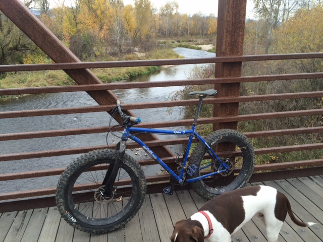
Eagle Greenbelt pedestrian bridge. I took my snow bike out there. 
Drew on his three-wheeler on a greenbelt ride with Dad in west Boise 
Biking on the Greenbelt through Municipal Park 
Here's a fun group pausing for a pic by the ParkCenter pedestrian bridge 
Hi all,

Spring weather is trying to get some traction in the Treasure Valley, but wet and cool wintry weather has made it challenging, even almost half way through April! On Friday and Saturday of this weekend, the weather forecast looks promising for sunshine on Friday with a high of 50, and partly cloudy to cloudy conditions on Saturday, but no real chance of rain, with temperatures hovering around 60. Sunday could be rainy and wet.

For my outdoor tip of the week, I'm recommending some easy bike rides as inspiration to dust-off the bike in your garage, wipe off the cobwebs and get that baby into good running condition.

Here are five easy rides that provide a tour of discreet sections of the Boise River Greenbelt from Eagle to Lucky Peak. All of these rides would be great for families and kids, and all ages and abilities. Pick a route that strikes your fancy.

1. Eagle Greenbelt Loop - Distance: About 7 miles. Best bike for the ride: mountain bike or cross bike. Tread: pavement and dirt. Start at the greenbelt parking area by Glenwood and Marigold next to the Boise River. Ride west, taking the underpass at Glenwood, and continue through a housing area next to the river. Stay on the south side of the river at the pedestrian bridge and continue past the gravel pits, Boise Wastewater Treatment Plant and the heron rookery to Eagle Road. Go right on the shoulder of Eagle Road and ride on the paths next to the busy highway. Pick up the greenbelt in several hundred yards and ride east. Cross the pedestrian bridge and then you'll be riding on a paved pathway on the north side of the river. Follow that path through several dirt sections and then on pavement through a couple of subdivisions. Cross the pedestrian bridge to the south side of the river, turn left and return to the start at Glenwood.

2. Glenwood to Esther Simplot Park - Distance: 7 miles out and back. Best bike for the ride: road bike or any kind of bike. Tread: pavement. This ride could be done as a loop if they're able to restore the pedestrian bridge by Plantation, but in the meantime, it's an out-and-back ride on the Garden City side of the greenbelt. Start by the Glenwood and Marigold greenbelt parking area. Ride east on the Greenbelt for a mile to the bridge washout site. Follow the paved path on a detour around some private property on Remington Street and return to the greenbelt going east. You'll pass under the Veterans Parkway bridge and continue another mile to Esther Simplot Park. There's a pedestrian bridge there where you can cross over and tour around the park as you wish. Watch kayakers or surfers on the play wave. Return to Glenwood to finish the ride.

3. Bridge to Bridge Loop - Distance 9-mile loop. Best bike for the ride: road bike or any kind of bike. Tread: pavement. This is cool route because you can ride on both sides of the river for the loop, and enjoy the pedestrian bridges on the book-ends of the route. Start in Esther Simplot Park. Pick up the greenbelt pathway over by the Boise River and pedestrian bridge. Ride either on the south or north side of the river and go east toward downtown. Enjoy all the underpasses and ride along the river to the ParkCenter pedestrian bridge. Cross the bridge and return to Esther Simplot Park.

4. Municipal Park to Marianne Williams Park - Distance: 9.5 mile loop or about 8 miles out-and back. Bike bike for the ride: road bike or any kind of bike. Tread: pavement. This is a pretty route going through Warm Springs Golf Course and riding along the river on the north side, and a tour of residential paths on the way back. Start at Municipal Park and ride east on the greenbelt. In Warm Springs Golf Course, ignore the right-hand spur going over to the pedestrian bridge. Continue on the north side of the river out to Marianne Williams Park. Follow signs for a temporary detour around a pathway that's closed due to construction. Ride over to Eckert Road. Turn right and ride to Barber Park. Go west on the paved pathway through the park and continue going west through a number of subdivisions. Eventually the pathway busts out of the housing and onto the side of ParkCenter Boulevard. Turn right on River Run Drive next to Baggley Park and follow the bike lane along River Run back to the main greenbelt. Keep going west to Broadway. Take the highway bridge across the river and drop into the path going east on the north side of the river to return to Municipal Park.

5. Eckert Road to Lucky Peak - Distance 10 miles out and back. Best bike for the ride: road bike or any kind of bike. Tread: pavement. This ride can be a little more challenging depending on the wind, but it's fun to go out to Discovery Park next to Lucky Peak, and this is the eastern end of the greenbelt. Start in Harris Ranch and park by Lucky 13 or in Barber Park. Take the greenbelt along Eckert Road and then go east on the greenbelt out to Lucky Peak. You'll have to detour around the path east of Idaho State Parks because that pathway is still under reconstruction. Past that area, you'll pass under the huge Idaho 21 bridge, go by Diversion Dam and then cruise along next to the river on the final approach to Discovery Park. It can be windy in this area. Bring a picnic lunch to enjoy at Discovery Park and retrace your steps to the start.

The whole Boise River Greenbelt and 30 more road-biking routes are detailed in the Boise Road Cycling Guide, a fold-out waterproof and tear-proof map with rides in the Boise Valley, Meridian, Kuna, Nampa and Emmett. Boise Road Cycling Guide is available for retail sales at George's Cycles, Idaho Mountain Touring, Boise REI, Bob's Bicycles and stevestuebner.com.

Have fun!
- SS

Thursday, February 1, 2018

Hike the Hyatt Hidden Lakes Reserve or dust off the road bike for a weekend ride

Ducks on the pond! There are some large, scenic ponds in the Hyatt Hidden Lakes Reserve and lots of habitat for waterfowl. 
Hi all,

I've been working on updating Boise Trail Guide: 90 Hiking & Running Routes Close to Home for the next printing, and I wanted to share a sweet hiking and birding spot in West Boise that I'll be featuring in the next edition of the guide. With weather projected to be in the mid-50s this weekend, this would be a nice low-key outing.

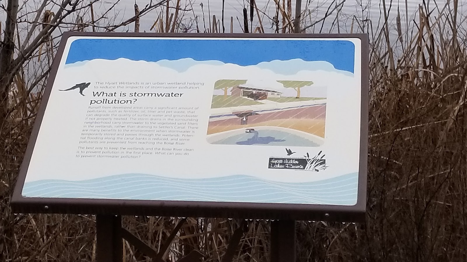
It's called Hyatt Hidden Lakes Reserve. It's a hidden gem located near the junction of Maple Grove and McMillan. The 54-acre reserve has large ponds and wetlands areas that have the dual purpose of filtering stormwater runoff and serving as a home to large numbers of birds, waterfowl and small critters.

There are more than 10 interpretive signs in the reserve.
The park is set up perfectly for birding -- for pros and amateurs. There’s a pathway in the upper bench of the park where you can look down on the ponds with your binoculars, and there are places where you can get much closer, depending on your preference.

Managed by Boise Parks & Recreation, the park was dedicated in 2012. The Hyatt Family donated 22 acres of the property to the city, and the rest was acquired. In December 2008, the Boise Public Works Department received a $1.3 million EPA grant to create an innovative stormwater treatment pilot project at the site. The project has turned out to be a great success from a water-quality and wildife-enhancement standpoint, so hat’s off to the city and its partners. It's my understanding that ACHD and Nampa-Meridian Irrigation District also were involved in the project.

This is also a place to learn ... there are multiple interpretive sites that provide educational information about stormwater, wildlife habitat, wetlands as nature’s filtering systems and more. Please note that there’s no fishing, boating, swimming, wading or bikes allowed in the park to protect wildlife.

The Golden Eagle Audubon Society will be participating in the Great Backyard Bird Count at Hyatt Hidden Lakes Reserve on Monday, Feb. 19 from 10 a.m. to noon. This would be a good opportunity to learn about birding from the pros.

The Hike: Start from either the parking area next to Marigold or McMillan. There’s a main loop that tours the ponds below, and an upper trail that connects back to the main loop. If you travel both trails, you’ll cover about 1.5 miles. Hikers and runners who want to do more mileage can double or triple the loop. There's a long sidewalk along Maple Grove to Marigold that can be added to your loop.

Another tip for the weekend would be to dust off your road bike and go for a ride on the Greenbelt, Hill Road, City to Farm Loop in SW Boise, Swan Falls or any number of rides that you do in the Boise Valley.

Check out my Boise Road Cycling Guide, which has 30 detailed rides for beginners, intermediates and experts in the valley. It's a two-sided, color, waterproof map that you can find at most any bike shop in Boise and Boise REI. The rides include routes in Emmett, Meridian and Nampa as well as the Boise area.

At Bogus Basin, there's a fun event going on Saturday called the Goggle Tan Tour. The beer starts flowing at 11 a.m. Bogus Basin will have a BBQ going on the patio by the lower lodge as well. Entry is free. It's a traveling show, and this is their fourth stop. There will be live music, ski beach games, "badass give-aways" including goggles from Smith Optics, and beer.

Brundage has Diva Day happening on Saturday, with $30 discounted lift tickets for women 18 and over, free yoga practice, live music, and Happy Hour giveaways in Smoky's Bar & Grill. Sounds fun, too!

Have a great weekend! Go Patriots!
- SS

Thursday, April 10, 2014

Spring road biking season is here! Bike events, great spring rides to inspire your participation

Riding to Swan Falls, Morley Nelson Snake River Birds of Prey National Conservation Area 
Riding on Cartwright Road, a hilly country road in the Boise Foothills 
Boise River Greenbelt
A pack of roadies on Hill Road 
City to Farm ... no traffic! 
Hi all,

The cool and sunny spring weather has been fantastic for doing just about anything outdoors ... and the weekend forecast looks great. It's a perfect time to shake the cobwebs off the road bike and get out and ride!

Let's review the roadie bike events coming up this summer, and then I'll suggest some nice spring roadie rides.

Key events coming up ... 
  • Boise Bike Week - Set for the week of May 13-18, Boise Bike Week already has a bunch of activities scheduled on the calendar. Activities include fun rides, kids rides, women's rides, road rides, mountain bike rides, tips on bike maintenance, ride to work day, etc. Thanks to the Treasure Valley Cycling Alliance and Boise Weekly for co-sponsoring this fun-filled annual kickoff to the biking season in our communities.  
  • Bob LeBow Blues Cruise - The Blue Cross of Idaho Foundation for Health is teaming up with Terry Reilly Health Services this year to create a bigger and better Bob LeBow Blue Cruise. The ride will be on Saturday, June 28. There will be courses for all abilities and distances, great aid stations and a big lunch to follow the ride. 
  • Four Summit Challenge - Set for July 26, there's plenty of time to train for the popular Four Summit Challenge in Cascade. The main course follows Warm Lake Road over Big Creek Summit to Warm Lake and then up to the top of Landmark Summit to the end of the paved road, before turning around and cycling back to Cascade. This event is getting bigger and better every year. I'm hoping to do it this year. 
  • Ride Idaho - Scheduled for Aug. 2-9, Ride Idaho will tour the Magic Valley area, including scaling the road to Pomerelle Ski Area, touring the scenic Thousand Springs region, lower Wood River Valley, Carey and Declo. Ride Idaho carries your camping gear and you ride 400 miles in a week with 350 riders to tour parts of Idaho that perhaps you've never seen before, at least not from your bike. 
Here are some spring rides to get your legs in shape (all of these are drawn from the Boise Road Cycling Guide by yours truly, the best and only road-biking map available for roadie rides in SW Idaho):
  • Boise River Greenbelt from Municipal Park to Lucky Peak - 9 miles one way, 18 miles out and back. About 1 hour travel time. Surface is flat most of the way, with a few short hills here and there. You may have a tailwind going out, but you'll pay for that on the way back. Wind is always a factor. 
  • City to Farm Loop - 16.2 miles; ride time is about 1 hour. Fun tour of the transition zone between the city of Boise and rural agricultural lands in the outskirts of SW Boise, with many ranchettes along the way. Riding surface is mostly flat. Wind will be a factor. Start at Five Mile and Overland Roads. Go south on Five Mile, right on Lake Hazel, left on Cloverdale, right on Columbia, left on Eagle, right on Hubbard, right on Locust Grove, right on Lake Hazel, left on Five Mile and return to the start. 
  • Country Ride - Feel more ambitious? This one is 35 miles, and 2-plus hours. Start at Cloverdale and Lake Hazel. This one tours the country side in SW Boise and skirts around Kuna before returning to the start. Go south on Cloverdale, right on Poen, right on Swan Falls, left on Kuna Cave, right on Robinson, right on Bennett, straight on King, left on Cloverdale and return to the start. 
  • Cartwright Three Summits Loop - 17.7 miles, 1.5 hours. This is one of my favorite rides cuz it's close to my house. You'll climb and descend 1,591 feet along the way. This one is much more challenging because of the steep hills. Start at the junction of Bogus Basin Road and Hill Road. Climb Bogus Basin to Cartwright, go left and climb Cartwright over the first little hill, and then a second huge wall of a hill, and then ride through the Dry Creek Valley and the Hidden Springs area before climbing over Seaman's Gulch Road to conquer the third summit. Turn left on Hill Road and return to the start. 
  • Hill Road to Eagle or Star - Start at Bogus Basin Road and Hill, or wherever you want to tie into Hill Road, and zip out west to Eagle or Star. It's 40 miles out and back to Star. Wind is a major factor. Ride Hill to Horseshoe Bend Road. Go right, go a mile, then left on Floating Feather. Follow Floating Feather out to Eagle Road, or continue west to Star. Vary your route by going north another mile to Beacon Light. A cool alternative in Eagle: Go north on Eagle Road to the end of the pavement on Willow Creek Road. 
  • Ride to Swan Falls Dam - Start/finish in Kuna. 42 miles, 3+ hours travel time, 1,710 feet of elevation gain/loss. Nice place to ride without much traffic. Take Swan Falls Road south of Kuna (the turn is off of main street in Kuna as you come into town from the west) and go 21 miles to the dam. Besides the hill-climb, the ride features lots of up and down through the giant swells of sagebrush out to the edge of the Snake River canyon. Then you plunge downhill to the dam and grassy picnic area, have your lunch and retrace your tracks back to Kuna. Watch for hawks, eagles and owls. You'll see plenty of ground-squirrels running across the road. 
  • Greenbelt in Municipal Park to Hilltop Summit - 27 miles round-trip. 2.5 hours. 1,214 vertical feet. Take the Greenbelt out to Discovery Park and then jump on Idaho 21 to Hilltop Summit. Wind is always a factor on this ride. But it will work your quads for sure. Nice moderate gradual climb to Hilltop. Watch for deer and elk.     
Be sure to dress in layers and pack a good rain/wind shell. 

Have fun!
-SS


Thursday, March 13, 2014

Boise Foothills trails dry up fast, ready for hiking, biking, trail-running; Have fun!

Let the spring riding season begin! Bucktail Trail in Military Reserve 
Happy Puppy on Military Reserve Connector! 
Hi all,

Wow, living on the edge of the desert, it's amazing how quickly the Boise Foothills trails can dry out when we get a combination of wind and sun after all the moisture we had in February.

I checked the Ridge to Rivers web site and trail blog yesterday, and they gave the green light to go enjoy the trails. I went for a quick ride from Camelsback Park, up Owls Roost to Kestrel, up Crestline to Sidewinder Summit, and I was amazed how the trails had dried out so quickly! Like in a matter of a couple days since Monday's soaking rain and hail.

This is exciting to me as I love to get a quick workout in the foothills whenever possible. I'm sure many of you feel the same way. There were tons of people hiking, dog-walking, running and biking in the foothills yesterday evening.

So for this week's tip, I'd recommend getting out on the foothills trails to enjoy a nice hike, dog-walk, bike ride or trail-run. I'll provide a list of recommended loops, starting with some easy kid-friendly routes and building to more challenging ones.

Before you go, pay heed to these words of advice from R2R:

  • Walk, run or ride through the isolated puddles out there if they cover the whole width of the trail. If you go around on the edges, you end up widening the trail. 
  • Be sure to yield to uphill traffic of all kinds. Mountain bikers need to come to a stop when encountering uphill traffic, move off to the side of the trail, see hello, and let people pass. 
  • Be aware that you may encounter some trail sections that suffered significant damage from heavy runoff 3-4 weeks ago. You will see evidence of this on Corrals, Bob's, Central Ridge in Military Reserve and on the Five Mile Creek trail. R2R crews are out there working on repairing these sections or installing water dips or water bars. They are working on Bob's at the present time, and then will move to Central Ridge, Corrals and Five Mile, in that order. 
Now, for the recommended loops. All of these are featured in detail in my books, Boise Trail Guide: 75 Hikes and Running Routes Close to Home, and Mountain Biking in Boise
  • Red Fox-Owls Roost Loop - Rated easy. 2.3 miles total distance. About one-hour travel time on foot. 30-minutes or less for runners and bikers. Great for young kids! Start at Camelsback Park, pick up the trailhead east of the tennis courts. Go up Red Fox and return on Owls Roost or vice-versa. You will need to cross 8th Street by the Foothills Learning Center to complete the loop. Be sure to have your dogs leashed on the sections of trail that require it, and pick up after your pet. 
  • Try the Polecat Finger Ridge Loops - Rated easy to moderate. Long loop is 5 miles; Doe Point out and back is 2.5 miles. 1 hour riding time on a bike; 1-2 hours hiking time. Take Cartwright Road west from Bogus Basin Road over two summits and then watch for the Polecat parking area on the left. This is the main trailhead, but a new one will be built off of N. Collister in the near future. Proceed up the trail to the first junction on right, and follow that to do the Polecat Loop. Go straight if you want to take the shorter route to the top of Doe Point.   
  • Climb Table Rock from the Bishop's House by the Old Pen. Rated strenuous for hikers and runners; Advanced intermediate ride for mountain bikers. Pick up Trail #15 at the trailhead and climb to the top of Table Rock. It's less than 2 miles to the top, but the climb gets progressively steeper as you approach the summit. It's a super-steep granny gear climb on a bike for the last half mile. Once on top, look for Trail #16 on the backside of Table Rock and take that around the quiet side of the bluff back to Trail #15 and return to the trailhead. 
  • Kestrel-Red Cliffs Loop - Rated moderate. Distance is 5 miles if you start from Camelsback Park. Hikers can shorten the route by parking at the Jim Hall Foothills Learning Center on 8th Street. 600-feet of elevation gain. For this one, you can do the loop clockwise or counter-clockwise. To do it the easy way, take Owls Roost or Red Fox to the Foothills Learning Center. Pick up Kestrel Trail, climb Kestrel to Crestline, go left on Crestline and go less than a mile to a left-hand turnoff for Red Cliffs. Follow Red Cliffs on a fun curvy descent back to the Foothills Learning Center. It's a little stepper if you start on Red Cliffs and come back on Kestrel.    
  • Cross-Foothills Loop - This one is best for trail-runners and mountain biking. Distance is about 10 miles. Riding time is less than 2 hours. Running time would be similar, depending on how fast you run. Start by climbing Bogus Basin Road to the Corrals Trailhead 1.2 miles from the stop sign at Highlands School and Curling Drive. Take Corrals to Corrals Summit, descend over to 8th Street, cross the road, and drop into Hulls Gulch. At the Hulls-Crestline junction at the creek, cross the creek and take Crestline almost to the trailhead, and turn left on Military Reserve Connector trail, climb to Central Ridge and descend to the Toll Road trailhead. 
  • Rocky Canyon - Five Mile -Watchman Loop - This ride is still one of my all-time favorites in the Boise Foothills. It's a great workout; the scenery is fantastic on Watchman and Curlew Ridge, and it's a great length for my pointer, Huck. Distance is 10.2 miles from the end of the pavement on Rocky Canyon Road. Travel time is 1.5-3 hours, depending on how fast you ride. Vertical gain is 1,906 feet. Climb Rocky Canyon less than 3 miles to Five Mile Creek Trailhead on the left. Climb Five Mile Creek past the Orchard Gulch junction and you'll come to the Watchman Trail. Most of the climbing is over now, and you can enjoy a really fun ride from here. Follow Watchman to the junction with Trail #6, go left to follow Three Bears Trail on Curlew Ridge to Shane's Summit. Go left and drop out on Rocky Canyon Road, and return to the trailhead at the end of the pavement. 

Jump Creek Road closed temporarily. BTW, I saw that the BLM is doing some construction work on the access road to Jump Creek canyon, near Marsing. This is a popular spring destination, but the road will be closed for repairs from March 24 - May 19, according to an article in today's Idaho Statesman

Steve talks about his outdoor tips every week with Ken and Misty on 94.9 FM The River on Friday at approximately 7:30 a.m. More information about hiking, running, biking and paddling in SW Idaho can be found on Steve's website at stevestuebner.com.

Thursday, February 28, 2013

Time to dust off the road bike and go for a spin in the countryside around Boise

Cartwright Road ... excellent hill-climbing adventure (courtesy Lactic Acid)
The Greenbelt is a good place to warm up ... 

Out in the hinterlands in SW Boise, there isn't much traffic ...
good place to avoid cars and trucks.
The Cartwright 3 Summits loop starts  by Bogus Basin Road,
heading east you climb over 3 summits, pass by Hidden Springs and the landfill, and
return to the start on Hill Road. Pierce Park is an early bail-out option as needed. 
Several options here for Greenbelt riders, going from Municipal Park
to Discovery Park and back, or doing a Boise River - Federal Way loop ... 
Hi all,

It's the first weekend of March, and Saturday is supposed to be a gorgeous day, with temperatures in the high 50s. It's a perfect time to dust off the road bike and go for a nice long ride!

For my tip of week, I'm recommending a mix of road rides to get your cycling legs in shape. Mountain biking in the foothills is tempting, but many of the trails are muddy and not suitable for biking, hiking or running right now. Check the Ridge to Rivers web site for the latest details. 

Why ride?

  • It's a great workout. 
  • It's a rush. With skinny tires, road bikes zoom down the road really fast. 
  • Pause and feel the warm sunshine on your face. It feels wonderful. 
  • Get a few friends together and make it a social outing. 
Here's an incentive to get psyched about road biking this spring. How about training for the BLUE CRUISE of Idaho? It's sponsored by the Blue Cross of Idaho Foundation for Health, among others, and they have distances for any ability -- 15 miles, 30, 50 and 100. I'm hoping to do the 50-miler or the century ride. The ride occurs on Saturday, June 22.

The Blue Cross of Idaho Foundation for Health will give back to the community with proceeds from the BLUE CRUISE by working with the Boise Bicycle Project, Boise Parks & Recreation and ProHelmet to give away 125 bikes and helmets to kids in need who are 12 and under. That's another reason to participate! 

Here's a mix of road biking suggestions for this weekend and beyond from my Boise Road Cycling Guide:
  • Start out nice and easy - take the Greenbelt out to Discovery Park from Municipal Park near Idaho Fish and Game's Nature Center. It's 9 miles one-way, 18 miles out and back. If that seems too far, try going from Municipal Park to Eckert Road by Lucky 13, and loop back via Barber Park and ParkCenter. That one is 10 miles total.
  • Spin it on Hill Road - Saw a ton of riders on Hill Road last Sunday as I was coming back from McCall in the late afternoon. Hill Road has a good shoulder, and you can ride as far as you want, going west. From Boise, you can ride west to Eagle, or keep going to Star for those who have been riding all winter. It's 40 miles out and back to Star. Wind will be a factor.
  • City to Farm Loop - This is a cool ride starting at Overland & Five Mile and exploring Boise's agricultural roots, golf courses and subdivisions in Southwest Boise. This one is 16.2 miles and takes about an hour. You go south on Five Mile to Lake Hazel, turn right and go to Cloverdale, go south on Cloverdale to Columbia, right on Columbia for one mile, then south on Eagle to Hubbard, right on Hubbard for one mile, right on Locust Grove for two miles to Lake Hazel, go right and cut over to Five Mile, and go north on Five Mile to the start/finish.
  • City to Farm modified - I rode a 25-mile version of City to Farm yesterday from the same starting point. The great thing about riding in this area is that there is almost NO TRAFFIC. I took Five Mile south to Lake Hazel, turned right on Lake Hazel for one mile to Cloverdale, Cloverdale south to Hubbard, left on Hubbard to Ten Mile, and rode that beautiful open valley to South Cole. Then I went south on Cole to Kuna-Mora, right on Kuna-Mora to Cloverdale, and retraced my tracks back to the start/finish. The NW wind was a real bear yesterday for the way back, but I don't think it's going to be that windy on Saturday. 
  • Cartwright - Three Summits Loop - Once you've worked in your legs (and butt) on the flats, it's time to climb. This loop is about 18 miles and takes about 1.5 hours at a recreational pace. It's also fondly called the "Dump Loop," because it goes by the Ada County landfill. It features several in-your-face steep climbs on Cartwright. It's easier to ride clockwise, than counterclockwise. Start at Hill and Bogus Basin Road. Go west on Hill to Seaman's Gulch. Go right and climb Seaman's Gulch past the landfill over to Hidden Springs. Turn right on Dry Creek Road and enjoy a spin through that valley and then climb the first big hill on Cartwright to Pierce Park. Go left and climb the next hill (short but kind of steep), and then enjoy a really fast downhill past the Owyhee Motorcycle Park. Gear down for the last hill to the initial Cartwright summit, and zoom down past the LDS church to Bogus Basin Road, turn right to the start/finish.
Here are a couple of bonus rides (with video) for consideration:
  • Lake Lowell Loop - 26 miles. It's a pretty easy ride with no significant hills (380 feet of verticle climbing the whole ride), and you circumnavigate Lake Lowell and enjoy the bird life. Start and finish at the Lake Lowell Boat Ramp. See the Boise Road Cycling Guide for directions.
  • Big Freezeout - Little Freezeout Loop. This one is about 40 miles, and it involves more than 1,000 feet of climbing/descending, but none of the hills are steep, just kind of rounded. Starts and finishes in Star. Because of the heavy commuter traffic on Idaho 16, I'd only do this one on a Saturday or Sunday. Beautiful tour of the Emmett Valley.
A quick word about the Boise Road Cycling Guide if you haven't seen it. It's a full color, two-sided foldout map with Olympian Kristin Armstrong on the cover. The map features more than 30 rides in the Boise Valley. It's waterproof and tear-proof. It costs $12.50, and it's available at nearly all of the cycling stores in town, and it's available on my web site, www.stevestuebner.com. It's the only road biking map available for the Boise area.

Have a great ride!
- SS