Showing posts with label Sage Creek. Show all posts

Thursday, November 4, 2021

Revisiting hiking trails that shine during shoulder season - Sage Creek and Orchard-5 Mile Loop

Wendy enjoys the quiet walk in Sage Creek canyon in the Owyhee Canyonlands.

Hi all, 

Revisiting trails that you love is kind of like getting re-acquainted with an old friend.

For Wendy's birthday, we zipped out to Sage Creek on Wednesday in the Owyhee Canyonlands for a delightful afternoon. Sage Creek canyon is close to Succor Creek State Park. It's accessed by a well-graveled all-weather road. So it's a cool, off-beat place to go in late fall, winter and spring.

I discovered Sage Creek canyon when researching my Owyhee Canyonlands guidebook some years ago. It's a moderate walk into a scenic, incised canyon that's chock full of geologic other-worldly shapes and features. It's always a treat to visit the canyon in my book.

Towering reddish-orange rhyolite spires, fins, caves and phallic-type rocks jut into the sky as you're walking up the draw. You'll see darker and more recent basalt rock features along the way as well.  

Wall of blonde volcanic ash in Sage Creek canyon.

Lots of cool geologic features to explore.

But several miles into the canyon from the trailhead, you come to a unique area that's full of volcanic rock and ash flows. The ash flows are blond-colored, green and chalk-colored, and they're very erosive ... you can carve off outside layers with your fingernail. There are some balance-rock features in the area as well.

To just sit there and observe all of those features is quite breath-taking. Be sure to bring a lunch and plenty of water and snacks. Allow for 3-4 hours to explore. 

It's about 4 miles or so to explore the full interior of Sage Creek while you're climbing along the creek-bottom on a general incline. It's an easy kid-friendly, out-and-back hike even if you go only a couple of miles into the canyon. If you have plenty of time, you can try to cover the whole canyon experience. The upper canyon ends when you approach the McIntyre Ridge Road.

Huck flushed a couple of chukars in the canyon.

How to get there:
Take I-84 to the ID 55 exit in Nampa, heading west toward Marsing. After about 5 miles or so on ID 55, turn right on Chicken Dinner Road to Homedale Road. Go left on Homedale Road and follow that into the town of Homedale. Follow State Highway 19 west of Homedale, and then Highway 201 in Oregon, to a signed turnoff for Succor Creek State Park on the left. Head south on the dirt road. It's about 12 miles to the unsigned right-hand turnoff for the Sage Creek Trailhead. There is a lone scrubby cottonwood tree at the turnoff. If you have a 4WD rig, follow the primitive two-track road over several creek-crossings to the trailhead .9 miles from the Succor Creek Road. Or just park and hike that portion. Either way works. 

You may need muck boots or just your hiking boots for the hike. If it's wet and the creek is running with water, you'll want your muck boots. Yesterday, our hiking shoes worked well. 

Selfie with Steve and Wendy on the descent into Five Mile Creek canyon.

Another good shoulder-season hike in the Boise Foothills
is to do the Rocky Canyon-Orchard Gulch-Five Mile Creek loop. This is a moderate to strenuous 5.5-mile hike in the NE Boise Foothills. The trails are pretty sandy, and once winter comes, they become covered with ice or snow, and still hikeable. 

Wendy and I hiked that loop last Sunday, and the leaves were still golden in many places ... but that will change in the coming weeks as fall transitions to winter. 

Getting there: Take Shaw Mountain Road by Fort Boise to Rocky Canyon Road, and follow Rocky Canyon Road to the end of the pavement. Go up the dirt road about about four miles to the trailhead for Five Mile Creek. Park.  

Hike uphill on Rocky Canyon Road for a long mile to the trailhead for Trail #7 in Orchard Gulch. Follow that trail about 2.5 miles to the junction with the connector trail over to Five Mile Creek. All of the climbing is done now. Hike down to Five Mile Creek Trail, go left and return to the trailhead and your vehicle. Hiking time is 2.5-3 hours.

------------------------------------------------

BBSEF Ski Swap is this weekend, Nov. 5-7! The giant ski equipment and clothing sale is being run for the 70th year!!! Opens at 1 p.m. on Friday at the Expo Building Fairgrounds. Entry fee is $5. 

The Land Trust of the Treasure Valley is looking for volunteers to plant sagebrush and other plants in the Harrison Hollow area on Friday at 10 a.m. Sign up here

- SS

Thursday, March 20, 2014

Spring has sprung in the Owyhees! Exploring Sage Creek a good bet for the weekend

Our kids mess around in the rocks above the draw ... 
Hiking into Sage Creek from the trailhead.
One of many caves you'll see in there.
Balanced-rock features are everywhere in the middle of the canyon.
Hi all,

The slighter warmer, spring-like weather has been excellent for hiking, running and biking in the Boise Foothills. People are loving it, and they're out there in big numbers! And for good reason, spring is a perfect time to get out hiking, biking and running! March-June also is the perfect window of opportunity to explore the Owyhee Canyonlands before it gets blazing hot in July and the rattlesnakes emerge.

This week, I'd like to feature a couple of cool hikes in the Owyhees in the Sage Creek area, near Succor Creek State Park. Sage Creek is featured in our new guidebook, the Owyhee Canyonlands: An Outdoor Adventure Guide. It's a low-elevation destination, with tons of unusual and colorful volcanic rock and ash formations, and it's a kid-friendly and family friendly hike.

This is what I said in the book: "Sage Creek is a hidden jewel chock full of spectacular volcanic rock and ash formations in the creek-bottom and on the mountainsides as you hike along the creek ... One of the key highlights in Sage Creek is that you'll encounter multiple balanced rock features, some of them obvious phallic-type symbols, as well as spires, cliffs, fins and caves."
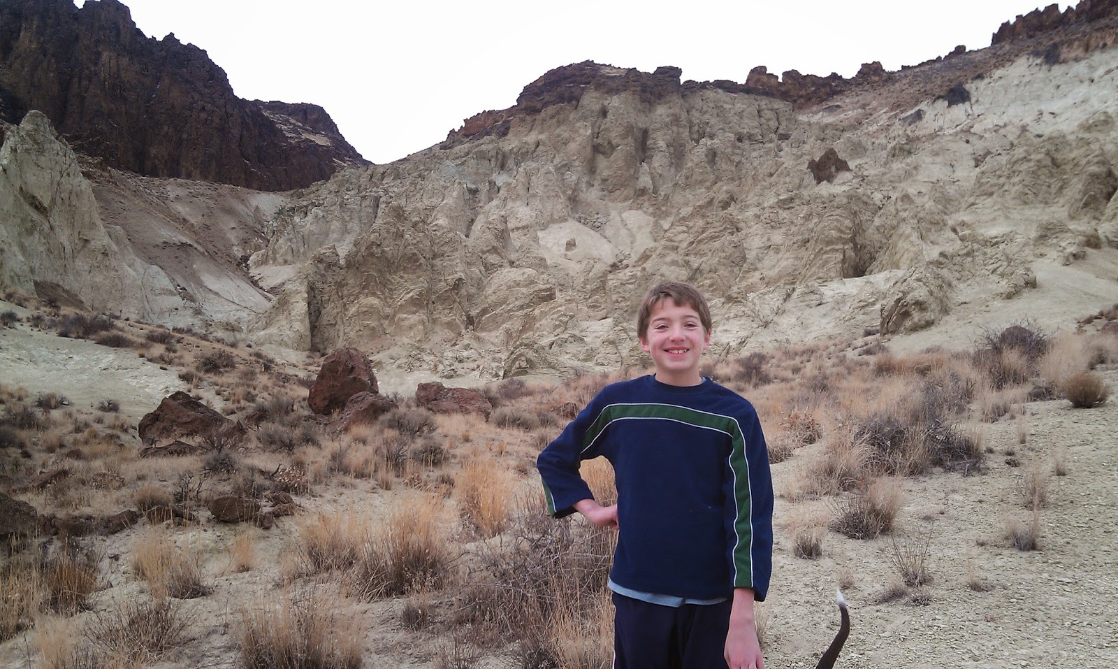
My son, Drew, loved the hike. 
Our guide features a 2.5-mile exploration out-and-back hike, cruising up the bottom of Sage Creek (rated easy for all abilities), and a 6-mile hike up to the top of McIntyre Ridge from Sage Creek (rated moderate to strenuous), with nearly 2,000 feet of climbing. Both of them are great!

How to get thereTake I-84 to the ID 55 exit in Nampa, heading west toward Marsing. Go west on ID 55 and  and Turn right on Chicken Dinner Road, then left on Homedale Road, and go to Homedale. Follow State Highway 19 west of Homedale, and then Highway 201 in Oregon, to a signed turnoff for Succor Creek State Park on the left. Head south on the dirt road. It's 12.1 miles to the unsigned right-hand turnoff  for the Sage Creek Trailhead. There is a lone scrubby cottonwood tree at the turnoff. Follow the primitive two-track road over several creek-crossings to the trailhead .9 miles from the Succor Creek Road.   
Nice rhyolite cliffs with Wendy in the foreground. 
Road access challenge: 4WD high-clearance vehicle is required to reach the trailhead; multiple creek crossings are involved. It's possible, however, to take a 2WD vehicle to the Sage Creek road junction, and hike from there. Add .9 miles to the trip if you start from Succor Creek Road. 

Hike #1 - 2.5-miles out and back
Cruise up the creek-bottom of Sage Creek, picking your way up the draw as you like. Hike at least a mile upstream to see the balanced rock features on the mountainsides above the draw as well as many other interesting rock formations. The volcanic ash flows in the area have turned different shades of white, orange and green over time. These formations are very erosive ... you can scratch the ash with your fingernails. Wear shoes that can get wet ... I doubt there's much water in the creek-bottom, but you will encounter some pools along the way.   
Hiking down-canyon back to the trailhead.
Hike #2 - 6-mile loop
From the end of the road, hike up-canyon and cross the creek to the left side. At mile .2, climb up the left-hand draw. It's a super-cool hike through many rock formations as you ascend the draw. It's about 2 miles to the top of the saddle near McIntyre Ridge. Climb to the top of McIntyre Ridge if you'd like. This area overlooks Succor Creek State Park to the east and Three Fingers Rock and many other features to the west. On the way down, descend the ridge to the left of the draw you climbed up, and enjoy a cool hike down into the draw. You'll pass by the "official" balanced rock on your way into the draw. Turn right at the bottom of the draw, and hike back to the trailhead.

Family pic in Sage Creek. November 2012. Kind of rare to get our 4 kids together for a family hike!
L-R, Drew, Tom with our pointer Huck, Wendy, Elena, Quinn, Steve 
Camping notes: You could camp in the bottom of Sage Creek. Quiet spot. Self-support camping. You also could camp at Succor Creek State Park, which has a public rest room, very close by, but that will be much more crowded. If you'd like to explore some other areas, Succor Creek Road connects to Leslie Gulch, Three Fingers Rock and many other areas worth checking out in our guidebook. 

If you're looking for ideas about what to do over Spring Break next week, check out my blog from last year with many ideas for recreation and camping close to home

Have fun! 
-SS