Showing posts with label walking. Show all posts

Thursday, May 4, 2023

Support Valley County Pathways in its quest to build a valley-wide trail system from Cascade to McCall

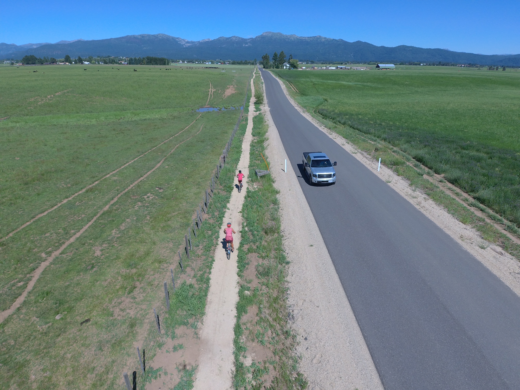
New "singletrack sidewalk" trail along Heinrich Lane, south of McCall 

Hi all,

On the fourth and final day of Idaho Gives, I'd like to encourage you to support Valley County Pathways, a nonprofit group I've been leading for almost 20 years.  

Our vision is to build a 70-mile, valley-wide trail system from Cascade to McCall and New Meadows, where we could connect to the Weiser River Trail. 

Put another way, our quest is to build a trail system that matches the grandeur of Long Valley.

For this year's Idaho Gives campaign, our goal is $15,000. We've received a pledge from a trail supporter who will match all of our contributions up to $15,000, for a total potential of $30,000. 


Our new video tells our story. 

We are inspired by the Boise River Greenbelt, the Wood River Trail and the Trail of the Coeur d'Alenes. Those long-distance trails are the pride of their communities, and anyone and everyone can enjoy them. 

My feeling is we have 10 years to get a valley-wide trail system in place in Valley County, or we may never get it done. We need to act now! And that takes money! 

I got started with Valley County Pathways in 2004, not long after the first $10M open space measure passed for the Boise Foothills. I was heavily involved in that open space campaign, and I still feel like it's one of the most important things I've done in my life. It was so cool to be part of a broad grass-roots effort that got embraced by the whole Boise community. 

From that experience, I learned that we can shape and enhance our communities and landscapes with new trails, open spaces and wildlife habitat with a LOT of DEDICATION and HARD WORK! 

I've been trying to walk the talk for 30 years. In 1992, I was the founding president of the SW Idaho Mountain Biking Association (SWIMBA), when Ridge to Rivers was just getting started. We all wanted to improve our trail systems. SWIMBA partnered with Boise REI and R2R to build Shane's Trail, Sidewinder, Trail #1 over to Bob's, Redtail Ridge, and Seaman's Gulch trails in the 1990s. 

Erin and Ed Roper ride in the grand opening of trails in McCall, a VCP event. 

At the same time, I was producing new trail guides like Mountain Biking in Boise, Mountain Biking in McCall, and Mountain Biking in Idaho (80 rides statewide).  

So I was a pretty well-traveled trail guy when I started working full-time for Tamarack Resort in government affairs in 2003. I knew there was an abandoned railroad line that ran through the middle of the valley, and I saw the abundance of public land along the western shoreline of Lake Cascade. I read that the Bureau of Reclamation recommended a walking/biking trail around Lake Cascade in a resource management plan, and my eyes just about popped out of my head! 

We started Valley County Pathways at a time when the Rails to Trails movement was taking off big-time nationwide. 

Eleanor Putman speaks at the trail dedication in 2006
on the north end of the Crown Point Trail.  

But it turned out that the old rail line from McCall to Cascade had been abandoned in 1979, pre-dating national legislation that gave railroad companies tax incentives to gift rail lines to nonprofit groups for conversion to recreation trails. The old railroad line in Valley reverted to private ownership in many locations, so that has made our work much more difficult. 

A few landowners, including the Putman Family and the Whiteman Family, have gifted old RR line property to Valley County Pathways, for which we're eternally grateful.

Long story short, since 2004, we have built the bookends of a trail system in Cascade and McCall. Now we're working on bridging the gaps in the middle of the valley. 

Hugh Fulton, right, and Damon Yerkes on the Boulder Creek Trail. 

Currently, we are partnering with Valley County Parks and Recreation to craft a 5-year and 10-year build-out plan for the valley-wide trail system. We know the price tag will exceed $5M.      

I'm super excited about the whole thing. 

There's a ton of state and federal money available right now for trail projects. We need private funds to provide match for projects, provide steady upkeep on our trails, and to assist with trail construction. We also partner with our friends with the Central Idaho Mountain Biking Association, the West Central Mountains Economic Development Council, the McCall Chamber of Commerce, the City of McCall Parks and Recreation Department, the City of Donnelly, and the community of Cascade to stretch our trail dollars as far as possible. 

I don't usually ask people to donate to any particular cause in my blog, but this is a case that's dear to my heart. Please do what you can for Valley County Pathways! 

Thank you! 
- SS 
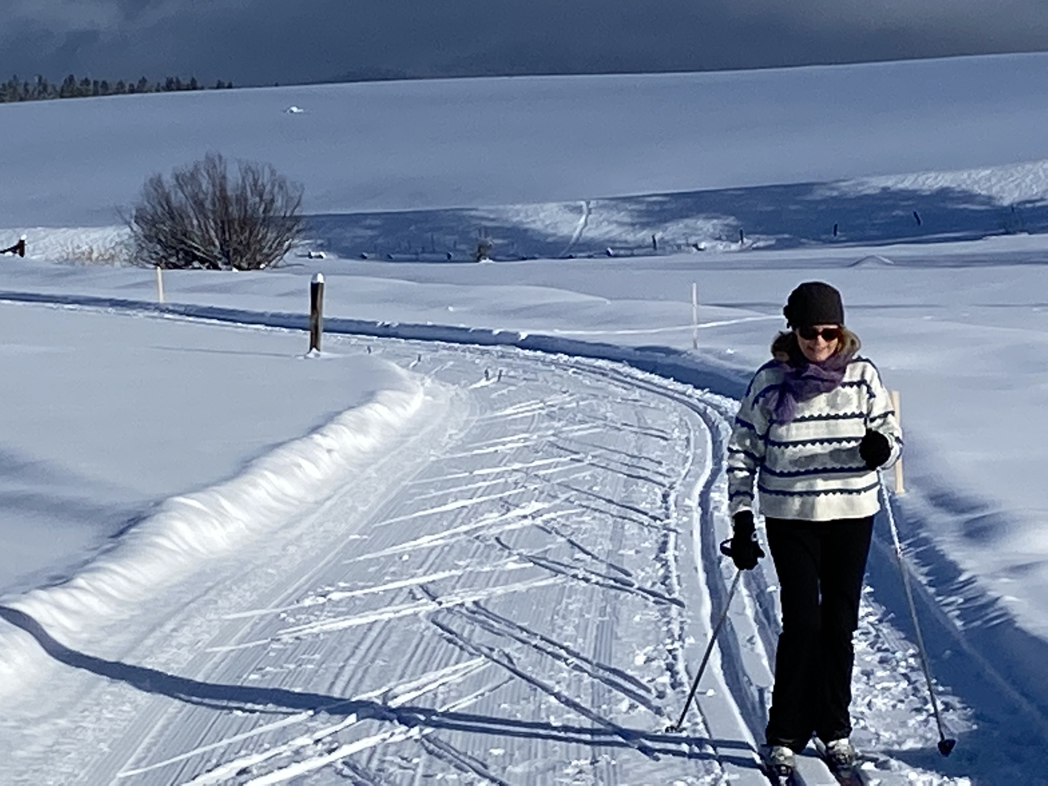
The North Valley Rail-Trail doubles as a xc ski, snowshoe and snow bike trail. 


Thursday, March 5, 2020

R2R gives green light to lower foothills trails, spring skiing and Snake River canyon


Two adorable children playing in the sand by Red Cliffs Trail on Thursday.
Walkers and bikers sharing the trails on Red Cliffs Trail ...
Love this view looking down into lower Hulls Gulch from Red Cliffs ...
Bikers: Remember to slow down as you enter congested areas ...
Hi all,

Many peeps who love the Boise foothills trails have been out in force, enjoying this latest string of uncommonly warm weather, with highs in the 60s in the afternoons and close to 70 (?) on Friday. Wow! 

I rode my mountain bike to Sidewinder summit on Tuesday night, and it felt like June out there with the trail being bone-dry, and Huck was overheating. Today, I went for a stroll on lower Hulls and Red Cliffs to take pictures, and I was blown away how warm it felt! Sure feels good after a great ski season to hit the trails! My climbing legs feel pretty good considering it's early in the season. 

Checking on the Ridge to Rivers Facebook page, we have as close to a "green light" to use the lower foothills trails below mid-elevation as we're going to get this time of year. There's a good chance of rain in the valley on Saturday afternoon, so keep an eye on the R2R reports and abide by them, please!!!

Quoting from their post on Thursday, March 6:

"Overall, it appears that trails below the mid and upper elevations in the foothills are mostly good to go right now. Conditions above are still the ones in question. It is a good time to work on doing more traversing in the lower foothills from one trail to another or using 8th St. or Rocky Canyon Rd. if you are going to be doing some significant climbing. ...

As the trail crew has been working on both Crestline and Sidewinder for the past few days, both of these trails and also Red Cliffs, Kestrel, and Lower Hulls all remain good to go right now. If you are getting up higher into the foothills over the next couple of days, please think about posting some reports of your own to help others get a better idea of what is going on out there. With rain in the forecast this Saturday, it's a great time to get out and enjoy these next couple of days. Just do it in the right locations! Happy Trails!"

Huck is Mr. Airplane ears on a windy day at Corral's Summit
Other lower Boise foothills trails worth visiting right now would include:
  • Military Reserve Trails 
  • Camelsback Trails 
  • Table Rock trail itself
  • Highlands to the Hollow
  • Corrals Trail 
  • Highlands Trail 
  • Polecat Gulch
  • Seaman's Gulch
Here are some spring skiers getting into the party mode! (Courtesy Arapahoe Basin)
 Two other suggestions for Friday and this weekend:
  • Spring Skiing! Bogus Basin, Tamarack, Brundage and Sun Valley all have lots of snow. Spring skiing on Friday should be amazing everywhere in SW Idaho because of the warm temps approaching 50 degrees at Bogus tomorrow and mid-40s elsewhere! Wow! Break out the spring skiing garb and have fun with it! 
    • Also could go backcountry skiing at Pilot Peak/Sunset Mountain/Freeman Peak or up toward Stanley on Copper Mountain. 
    • Xc skiing and snowshoeing is another possibility at the Idaho City Park n Ski Areas or in McCall or Sun Valley. 
  • Hiking/biking in the Snake River Canyon - Head south of Kuna or Nampa to visit the Morley Nelson Snake River Birds of Prey National Conservation Area. A friend told me that the birds of prey are doing courtship flight down there, so you can hang out and watch the cliffs for birds with your binoculars or do some hiking or biking at Celebration Park or by Swan Falls Dam. The ride to Wees Bar is one of my favorites. 
    Golden eagle on the cliffs in the Morley Nelson Snake River BOPA 
Have a great weekend!
- SS

Thursday, January 10, 2019

Gonna feel like early spring weather this weekend - 4 ideas for outdoorsy fun

This weekend might be a good time to go see bald eagles and cormorants on the Eagle Greenbelt, south side, Boise River. 
My son Drewby hiking Browns Canyon with us in the springtime. 
It's always a treat to ski Sun Valley in the sunshine. 
Bear Basin in the sunshine. Great xc ski and snowshoe trail system in McCall. 
Hi all,

It's been quite a parade of snow storms in the mountains in the last few weeks, but that's made it feel pretty gray and dreary in the Treasure Valley. For the first time in a while, it's going to be sunny and a little warmer in this weekend, Friday-Sunday, so it's time to get outside to cure a little cabin fever.

It'll be sunny in the mountains and in the valley, according to the National Weather Service, so you really can have your pick as to whether you'd like to head out in either direction.

Here are four options that I'd recommend:

1. Go walking, running or biking on the Boise River Greenbelt. High temperatures are supposed to be in the low 40s this weekend, so it won't be exactly balmy. Wait until the afternoon to head out to enjoy the warmest part of the day. 

That said, please avoid using the Ridge to Rivers Trails this weekend. Table Rock Trails are closed because of muddy conditions, and the rest of the trails are getting hammered when they're soft in the afternoon. Temperatures are expected to freeze at night, so if you got out really early, it'd be OK, but generally, it'd be better to go do something on the Greenbelt. Idaho Fish and Game also just closed trails in the Boise River Wildlife Management Area, including the Homestead Trail next to Harris Ranch.

2. Go spring skiing at Bogus Basin, Tamarack Resort, Brundage Mountain Resort or Sun Valley. Get a bunch of friends together or do a family outing. Conditions are great everywhere!

3. Go xc skiing, snowshoeing or snowbiking at Bogus Basin, Idaho City Park and Ski Areas, McCall area or Sun Valley area. Once again, conditions are excellent in all four locations.

4. Go hiking in the Owyhee Canyonlands. Stick to the good roads to do a little adventuring in the Owyhees. Succor Creek, Sage Creek, Leslie Gulch and Mary's Creek would be the best bets right now. Maybe Browns Canyon near Oreana would be good, too. All of these hikes are featured in my Owyhee Canyonlands guidebook.

There you have it! Enjoy the sunshine!
- SS   

Thursday, August 3, 2017

Come walk, run or bike in McCall for the Mountain Pathways Celebration on Saturday

Hi all,

Valley County Pathways and St. Luke's McCall are teaming up on a new event, the Mountain Pathways Celebration, on Saturday, Aug. 5th, from 8 a.m. to noon. Please come if you're in the 'hood! 

This is a family friend, kid-friendly non-competitive event with a Bounce House at the Start/Finish and live music from a local DJ pro. 

We want to celebrate pathways in the greater McCall, Valley County and West Central Mountains region by hosting an event on McCall city pathways and the North Valley Trail. You can walk, run or bike for 1, 2.5, 5 or 10 miles. Entry fee is $5/person. You can pre-register online. Same-day registration is OK, too.  

For the 5-mile course, we'll shuttle people out to the south end of the North Valley Trail in the outskirts of McCall, so they can experience the full sweep of the beautiful trail along the tree-lined old railroad line, pass by the Activity Barn, McCall Airport and Smokejumper Base, and then cruise into downtown McCall on city pathways to the Start/Finish area behind City Hall. 

The event is a fund-raiser for Valley County Pathways, a non-profit group that's been working on developing a system of valley-wide trails that would connect the communities of Cascade, Donnelly, Lake Fork and McCall. 

Trail of the Coeur d'Alenes 
We all know how cool it is to experience long-distance pathways in beautiful settings such as the Trail of the Coeur d'Alenes in North Idaho, the Boise River Greenbelt, and the Wood River Trail from Bellevue to Ketchum/Sun Valley. 

In the early- and mid-2000s, when I was working in government affairs for Tamarack Resort, I joined a number of citizens who wanted to put together a plan for long-distance trails in Long Valley. We wrote the first Master Plan in 2005. Since February of this year, I've been working on updating the Master Plan, with a new map and fresh priorities. The plan was approved by Valley County P&Z in March, and Valley County Commissioners in July. Big milestone for VC Pathways! We had 108 letters of support! 

The West Central Mountains' America's Best Community campaign asked us to update the Master Plan, and they see further pathway development as a big priority for the region in a 21-point economic revitalization plan. Now that our plan is approved, we can move forward with working on future pathways in high-priority areas throughout the valley. 

Back to the Mountain Pathways Celebration event ... the trail is nearly flat the entire way with a couple of short uphills and downhills. Very kid friendly for all ages. Seniors too!

We want folks to have fun at this event! Costumes are encouraged. We'll have music at the 
Start/Finish area, coffee, fruit and muffins. We'll have multiple aid stations with fun activities or treats. Scavenger hunts are planned for kids. 

Here's another reason to come ... we have some great raffle items from McCall businesses, including:  
  • Hala Hoss SUP $1,100.00 value, donated by River Gear, a paddle shop in Cascade. 
  • Yeti cooler, $199 value from May Hardware
  • Cheap Thrills ½ day Wave-Runner rental $175 value
  • Four passes to open skating at Manchester Ice Center
  • Two gift certificates for three movie rentals at Sunset Video
  • Two ½-day SUP rental from McCall Sports Exchange
  • Two $25 G.C.’s to McCall Jewelry 
  • Lift tickets to Tamarack Resort
  • Ski tune packages from Kurt Wolf 
  • Full-day mountain bike rental from Gravity Sports
We'd also like to thank our event co-sponsors Mida Gold and McCall Parks & Recreation for their support.

Prizes: Bring a prize to share at the event ... toys or stuffed animals for kids, used recreation gear, hats, whatever you think someone else might want!

To make things go smooth on the course, we plan on starting the walkers/runners first, and the cyclists afterwards. 

Bring your own water bottle, please! You can refill at our aid stations. 

For more information, go to valleycountypathways.org.  

Thursday, October 27, 2016

New Esther Simplot Park adds yet another precious pearl in Boise's Ribbon of Jewels


Inlet from Quinn's Pond connects to Esther Simplot Park 

New Pathway next to Esther Simplot Pond I 
Greenbelt through the park was open today (Thursday). Park does not
officially open until next Wednesday. Entrance roads won't open till next week. 
Primitive trails next to Esther Simplot Pond II will remain primitive. Cool! 

Greenbelt split by Veterans Pond ... this has been closed for 1.5 years
Greenbelt spur next to Quinn's Pond and Esther Simplot Park
Greenbelt comes over to the park from the 36th Street pedestrian bridge 
Hi all,

I live in Northwest Boise, so the new Esther Simplot Park is located close to home. I used to walk my dog around the old gravel pit ponds that have been enhanced with grassy mounds, picnic shelters, pathways and waterways, and I must say, I am IMPRESSED!

The Grand Opening for Esther Simplot Park, 614 N. Whitewater Blvd., in Boise, will occur at 1 p.m. on Wednesday, Nov. 2nd. Hope to see you there!

The 55-acre park, generously funded by the Simplot Foundation, officially opens on Wednesday. They had the Greenbelt open through the park today, so you can get a sneak peak if you happen to be walking or biking in the 'hood.

For dog owners, one immediate reason to visit the park is that they will have an off-leash policy in effect from Nov. 2 through March 31 to keep the geese at bay. Make sure your dog has a city dog license. Pets still have to be leashed in the parking area. Make sure you pick up after your pet.

New pathways - There must be several miles of paths that wind through the park, including the more primitive paths that circumnavigate the pond farthest to the west, so it will be a popular place for walkers, runners and bicyclists. Plus, the pathways connect to the Greenbelt and nature trail in Veteran's Park, so really, it'll be possible to do 5-mile loops in that area no problem.

Park features map courtesy Boise Parks & Recreation (click to enlarge)
Great paddling - It's also going to be way cool to paddle around the different ponds that are all in close proximity to the park or in the park, starting with Quinn's pond, and then Esther Simplot Pond 1, and Esther Simplot Pond II, and Veteran's Pond. Hope we can link them all up someday. Not the greatest weather for paddling right now, but you can bet some hard-cores will be out there next week on SUPs, kayaks or canoes.

Esther Simplot Park is located along Whitewater Park Boulevard between State Street and Main Street in Boise. There is a fair amount of parking inside the park, but it'll be best to walk there or bike there if possible. It's immediately accessible from the Boise River Greenbelt by the 36th Street pedestrian bridge.

It's also next door to our friends at Idaho River Sports, where folks can rent or buy SUPs, kayaks or canoes, and accessories. They've waited for this day to come for a long time. Heck, we've all waited for this day to come ... construction began in February 2015.

Many thanks to the Simplot Family and Boise Parks & Recreation for creating a beautiful park. Esther Simplot Park is yet another pearl in the Ribbon of Jewels, Boise's wonderful series of parks that border the Greenbelt as it winds through the city.
- SS

Friday, April 17, 2015

Pick up the new Boise Trail Guide to tap into 90 hiking & trail-running trips close to home!

The Station Creek hike in Garden Valley would be primo right now. 
Five Mile Creek in the East Foothills is a great trail to explore just about anytime ... 
Get the kids out hiking before they even know they're hiking ... 
Jennie Lake is one of 15 new hikes added to the book.  
Ultrarunner Dennis Ahern on the way up to Observation Peak in the Sawtooth Wilderness ... 
Hi all,

Hikers and trail-runners can rejoice in the launch of the 2nd edition of Boise Trail Guide, which has been one of my most popular books of all-time. Now it features 90 -- count 'em, 90! -- hiking and running routes close to home. Woo-hoo!

Even the fact that it's possible to feature 90 hiking/running routes in the greater Boise area shows how lucky we are to have such a huge diversity of trails and terrain that we can explore close to home, whether it's on the Boise River Greenbelt, in the Boise Foothills, the Owyhees, the Boise National Forest or Idaho State Parks.

We are BLESSED, people! I tried to maximize your enjoyment by serving up the most trails featured in a single hiking and running guide in Boise history!

The first shipment of books have arrived from the printer. Rediscovered Books, Idaho Mountain Touring, Shu's Idaho Running Company and Bandanna Running & Walking in Boise, and the Pulse Running and Fitness Shop in Meridian all have books in stock. Boise REI and Sierra Trading Post will be carrying the book in the coming days. It's also available at Amazon.com and at SteveStuebner.com.

As always, on my web site, you can buy the book in paperback ($19.95), or as a color ebook ($24.95), or you can buy individual trail descriptions and maps for 99 cents each, or for discounted prices in lots of five, 10, 25, etc. You can do this for any of my guidebooks at SteveStuebner.com.

For this weekend, I'd recommend:
  • All Greenbelt and Parks Trails. The new edition features 15 Greenbelt Loops and Parks Trails, showing folks how to navigate every stitch of the Greenbelt system from Eagle to Lucky Peak, including multiple loop possibilities using pedestrian and street bridges. Recently, in this blog, I've featured the Eagle Island State Park loops (5 miles) and the Marianne Williams Park - Barber Park nature trail loop
  • Nearly all 17 of the Easy Mountain Trails. These trails typically cover short distances in loops where possible without much vertical gain. They're easy trips like the Red Fox-Owl's Roost Loop out of Camelsback Park, Bruneau Dunes State Park, Jump Creek Canyon and Succor Creek State Park hikes. A few short hikes in the Idaho City Park n' Ski Areas and Crooked River are probably still snowed in. 
  • Many of the 23 Moderate Mountain Trails. These trips span from moderate hikes in the Eagle Foothills and Hidden Springs, to the Polecat Gulch loops in NW Boise, and Central Foothills favorites like the Crestline-Hulls Loop, the new Highlands-Corrals-Bob's Loop, and moderate trails at Bogus Basin and in the Boise National Forest, like the Station Creek Loop. That'd be perfect this weekend. 
  • Many of the 26 Strenuous Mountain Trails. Some of these are snowed-in still, but most would be snow-free. There are more than 20 foothills favorites in here, plus a long Hillside to the Hollow Loop, Watchman Loop, Orchard-Five Mile Loop, Around the Mountain at Bogus, Cervidae Peak, and Hike to Jennie Lake ... too early for that, though.  
  • Most of the 7 Epic Mountain Trails. The Boise Ridge Climber's Special, Stueby's Death March, Race to Robie Creek course, Homestead - Trail #8 - Trail E Loop would be all doable. You'd still run into snow in the other epics in the Sawtooth Wilderness and the Boise National Forest. 
Have a great weekend!
- SS

Thursday, April 3, 2014

Just 15 days before Race to Robie Creek! Here are some training tips from Robie Cr. runners

Not far from the start ... (courtesy Idaho Statesman)
Are these guys going the wrong way? 
Near Aldape Summit 
Gotta love the encouraging signs along the way 
Near the finish
Course map, from Boise Trail Guide  (click to enlarge)
Hi all,

There's just a little over 2 weeks to go before the 37th annual Race to Robie Creek on Saturday, April 19. Have you been training? Are you ready?

I'm certainly no expert on long-distance running, so I asked a variety of veteran runners who have raced Robie Creek many times for their tips on training and race-day advice. Hope this helps with your training workouts for the "toughest half-marathon in the West!" I've been seeing a ton of people walking, running and biking on Rocky Canyon Road, getting ready for the big event. This year's race theme is "Killer Queen Robie."

BTW: Rocky Canyon Road is clear of snow all the way to Aldape Summit. There's some snow on the road on the other side of the pass, but I bet that will melt soon if it dries out and warms up.

These tips come from Boise Trail Guide: 75 Hiking and Running Routes Close to Home and recent interviews with people in the know:

Mike
Mike Carlson, former head coach, Boise Run/Walk
1. The 13.1-mile course climbs 2,100 feet over the first 8.6 miles to Aldape Summit and descends 1,700 feet over the remaining 4.5 miles.
2. Watch where you put your feet: You might find snow, ruts and/or mud spots on Aldape Summit on race day, especially during the first mile of descent.
3. The best way to prepare for any event is to simulate in training what you’ll be doing on race day. So if you’re training for Robie Creek that means you must train on hills. And what better hills to train on than those on the race course!
4. Run long in the hills once a week if you’re accustomed to running hills, or once every other week if you aren’t.
5. Practice good up and downhill running form. Run vertically (no forward lean) uphill and run perpendicularly to the grade on the downhill (slight full-body lean). Take three steps per second to maximize
efficiency and minimize the pounding.
6. Strengthen your inner core, leg muscles and tendons to improve your balance.
7. In April, the weather can vary greatly, but it’s typically fairly warm and often humid. Train in warm conditions—indoors or during the warmest part of the day—to prepare.
8. Good shoes and insoles will serve you well on the descent from Aldape Summit. Make sure your shoes and insoles aren’t worn out, but are broken in.

Andrija
Andrija Barker-McCurry, formerly of Bandanna Running and Walking
1. Don’t ignore the downhills. Everyone trains for the climb but it seems no one trains for the downhill aspect of Robie Creek. The uphill works your engine, but it is the downhill that beats up your body.
2. Don’t get too technical, thinking you should only train on the course or similar terrain. Boost your maximum oxygen uptake by throwing in interval work. Example: Run 200 meter repeats on your local track. 200 meters moderate to hard followed by 200 meters walk or jog recovery. Also, hill repeats. Run uphill hard for 30-60 seconds, turn around and jog down.
3. Remember nutrition. It is not what you eat the night before, or even the morning of – the weeks leading up to the race are the ones that count.
4. Recognize that Robie is not your local nine o’clock 5k. It is vital to eat enough the morning of to correctly fuel your effort. My favorite is a hearty bowl of oatmeal, a banana, a small glass of juice and a piece of toast. Eat three hours before the race and then have a small snack or a GU 15-20 minutes before race time.
5. Nutrition during the race can be confusing. Glycogen depletion usually begins to take affect when you run over ninety minutes. So, plan on taking a GU or the like and a small amount of liquid if you are running over 90 minutes. If you’re out there over two hours, plan on at least two GU’s plus liquid.

Erv
Erv Olen, 65, who ran the Race to Robie Creek 22 times (My friend Erv died of cancer in 2008, very sad deal)
1. Start training at least four months before the race (January 1st).
2. Run hills one day every other week. Start with 6 miles (3 up, 3 down), and work up to 12+ miles. I suggest running on the Robie Creek course.
3. Gradually increase weekly long runs to 16 miles.
4. Include weekly speed work. Alternate the following workouts: Start with 4 each 400 meters on a track at 5K pace with 200 meter slow jog in between. Build up to 6 each 1/2 mile intervals at 5K pace. Do hill sprints about 300 meters each. Start with 4 and work up to 8. Let heart rate get down to 100 beats per minute before repeating.
5. Every other week, do tempo runs. Start with 3-4 miles, work up to 6-8 miles. Run pace should be 15 seconds per mile slower than 10K pace.
6. Stretch well before and after workouts. Do easy runs in between hard days. It helps to do weight work 2 or 3 days a week. One rest day a week is a good thing.

Maggie
Marguerite Lawrence, a frequent Race to Robie Creek participant
1. When training on Rocky Canyon Road, I recommend for the longer runs (8-10 miles), running a shuttle part way up the hill so you don’t have to run all the downhill on your way back.
2. For safety reasons, I don’t recommend running solo on weekdays in Rocky Canyon; however, on weekends in March and April, there are many other runners out there.
3. I run the summit two weeks before the race.


Mike "Shu" Shuman, owner of Shu's Idaho Running Company.
Race-day tips:
Shu in action 
1.  Carry your own water. Yes, there are water stops, but if you have trained carrying water it certainly will not hinder you. There have been many times while running Robie that I have wanted a drink or needed to Gu and not been anywhere near a water stop. Remember, when running Robie Creek you are pitting yourself against the mountain and she isn't forgiving. Therefore, you need to be as prepared as possible, so Carry Water!
2.  Take off your rings before leaving home. One of the most common things I hear from people that are in the "pack" is that their hands swell.  Mine always do. So, get rid of the jewelry!  If your hands do start to swell keep them above your head for awhile.  If you are a walker this seems to happen more often so
remember to keep your arms bent and in a pumping position instead of letting them hang at your sides so your blood doesn't pool in your hands.
3.  Wear gloves. The temperatures on Robie can go from one extreme to the other. Regulating your temp by putting gloves on or taking them off is a very easy thing to do.  I have had to put them on and off several times in the same race!
4.  If you get to the point to where you feel like you can't take another step running or walking (and you will get to that point) turn around and walk backward for a little while. It really helps because you are using different muscles and you give others a little time to rest. Another benefit to doing this is people will ask you what in the world you are doing.  Then you can tell them. Just by taking your mind off how you feel and talking to someone helps because you aren't so focused on your pain. This is a physical and mental break!
5. Be Rocky!!!  As you head up Shaw Mountain Rd. at about the 5th turn there is a family that always plays
the Rocky theme. Enjoy it while you are still fresh enough to do so! Laugh, dance and have fun.
6.  One of the best tips I would give to anyone about running Robie Creek is Don't Be Shy!!! Talk to the
other people around you. Just think, those people near you have covered the same distance you have in
about the same amount of time you have so they are probably feeling about the same way you are. Start a
conversation. Ask how they trained for the event. Share about how you trained. Conversation helps the
time go by faster and make the running easier because you aren't thinking about it.  Besides, you might just
learn something from that person and they could be a potential running partner some day.
7.  Send a change of clothes up in the Toad Mobile. The finish line and party are very crowded and it is
difficult to find people at times.  You want to change when you get there, not look for the person that has
your clothes. Put in clothes for warm and cold weather. You never know what it will be like at the
park.  Pack extra shoe and socks and a pair of sandels can feel great too. Be sure to mark you bag in a way
that will make it easy for you to find it.  ALL BLACK BAGS LOOK ALIKE!  Put bows on it or something!
8.  Enjoy yourself!  The memories of the pain does fade. Guess what? You'll get hooked and wonder what
you are doing back there next year!


What did we forget? Do you have other tips or suggestions? Please provide in the comments, section.

Have a great Race to Robie Creek!
- SS


Thursday, January 31, 2013

Gotta love that snow-plow service on the Greenbelt; great for walking, running, biking

Thanks to the plowing crew at Boise Parks & Recreation, the Greenbelt is mostly clear of snow ...
It's certainly cleaner and drier than our driveway ... 
And many side streets in Boise 
Boise State pathway still has some snow ... 
Wait until the afternoon to head out for your Greenbelt adventure, let the ice melt ... 
Boise State walk bridge 
Hi all,

Well, I don't know about the rest of you, but I've been feeling a little cabin-fever creeping up on me lately ... especially during the multi-week deep-freeze in January. It didn't feel right to do anything but cocoon around the fireplace, try to stay warm and try not to fall on your butt or head when walking across slippery black ice in your own fricking driveway. Mother Nature hit us hard these past weeks!

So I found myself pedaling with glee on the Boise River Greenbelt today, enjoying an outdoor cycling experience in 45 degree weather, with partial sunshine. It felt almost like 60, considering what we've been used to with temps in the single digits and teens.

Here's the audio from Steve's appearance on 94.9 FM the River this morning, discussing winter riding on the Greenbelt ...

The pathway was wet in many places, even standing water in places, but practically no snow anywhere on the pavement. Frankly, the pathway is more clear of ice and snow than lots of side streets in Boise! It's certainly more clean than my own driveway :) Thanks to Boise Parks & Recreation for taking such great care of our Greenbelt and thanks to Boise taxpayers for footing the bill!


In the next 10 days, the forecast calls for temps near or above 40 in the afternoon in the heat of the day. That means more melting and totally decent weather conditions for biking, walking, running, walking the dog, taking the babies for a stroller walk, whatever! Well ... I wouldn't go out on roller blades quite yet ... too many puddles and standing water. Also, wait for the day to warm up. Don't go out early in the morning unless you have to commute ... it'll be slick and icy.

For future reference, here are the city's guidelines on Greenbelt winter upkeep:


1. Boise Parks & Recreation plows 20 miles of the Greenbelt path throughout the winter except the natural area between Barber Park and ParkCenter. 
2. Plowing begins when approximately 1” or more of snow falls. 
3. Snow-plow service runs seven days a week, except for Christmas and New Year’s day. 
4. De-icer is used on bridge approaches, bridges, and certain sections of the path that have a steep incline (Orchard/Garden Street) and areas that are habitually in the shade. Staff de-ice using a mag chloride product that is environmentally friendly.


I'd recommend bundling up and heading out to whichever section of the Greenbelt that you like to hike/run/ride. For a longer workout, going from Municipal Park out to Lucky Peak is a great bike ride. It's 18 miles roundtrip to Discovery Park at the base of Lucky Peak Dam. 

Another option is to do a loop ride in the inner city section of the Greenbelt. Today, I rode from Veterans Park to Warm Springs Golf Course and the ParkCenter pedestrian bridge, crossed over to the south side, and rode back via ParkCenter, Boise State, Ann Morrison Park, across the walk bridge, and back. Distance is about 12 miles.  Travel time is 45 minutes to an hour at an active recreational pace. 

My guidebooks, Mountain Biking in Boise and the Boise Trail Guide detail numerous Greenbelt hiking, running and biking sections that you can enjoy. See more details at stevestuebner.com

I wasn't able to confirm whether Garden City has been plowing its sections of the Greenbelt, so I can't confirm whether the pathway is open and clear of snow between Lake Harbor and Glenwood, or from Glenwood to the end of the pathway several miles to the west. 

Dress in layers for your Greenbelt outing. You'll need to wear long underwear with a pair of light rain pants or sweat pants. My riding shoes got soaking wet today, so you might want to wear warm socks! A couple layers on top and a wind shell will take care of your upper body. Carry a headband or a skull cap to keep your ears warm. It may or may not be needed, depending on when you go. 

An outdoor bike ride sure beats riding the trainer or spin bike indoors, staring at walls! But it will be wet out there while the snow melts ... fenders are a great feature!  
   
Have fun!
- SS