|
| Nice light on Sweet Connie (courtesy MTB Project) |
 |
Cool stock pond that you'll see riding the new trails that connect to Sweet Connie
in Daniels and Dry Creek over to Hidden Springs |
 |
| Back of Beyond Three Fingers! Gorgeous scenery up-canyon! |
 |
| Back of Beyond Three Fingers ... |
 |
| Paul Hilding rides through the red rocks |
Hi all,
I wrote about
five high-elevation hikes suitable for the fall recently, so this week I'm dishing up five must-do mountain bike rides for the fall. The mountains are becoming colorful with the huckleberry bushes and other shrubs turning deep red, and yellow and orange quaking aspen waving in the breeze.
Several of these rides are "levy specials," meaning the rides are possible because of the $10 million foothills open space levy that Boise voters passed back in 2001. Boise Parks & Recreation staff did a masterful job of stretching those dollars and selecting the best open space areas for acquisition, including some of the trails that I'll describe.
A new
$10 million open space levy is on the Nov. 3 ballot, as I wrote last week. Thanks to everyone who came to our party last week. We raised more than $4,000 for the campaign. Consumed the big keg full of tasty craft beer, too! Thanks
Highlands Hollow! Go to the official
Boise Water and Open Space levy campaign site to endorse the campaign and find out how you can help.
Most of these rides are featured in
Mountain Biking in Boise, available at most bike shops. It's available as an
ebook on my web site and individual digital rides go for 99 cents each.
Now, the rides!
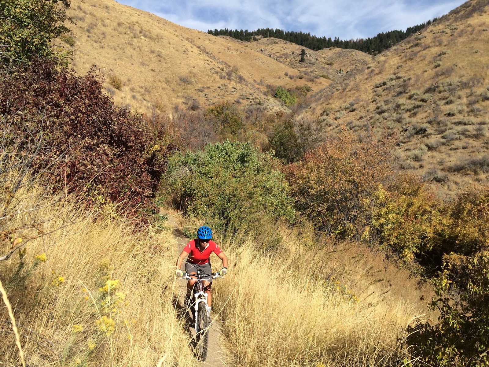
1.
Sweet Connie from the top, levy special - With the new trails just opened up in Northwest Boise, it's possible to ride Sweet Connie from Stack Rock all the way to Hidden Springs and Cartwright Road. Rated: Advanced; Mileage: 15-20; 2,500-foot descent. Sorry, I don't have a full GPS map of this ride ... only the lower portion. Here's a link to a
map on MTB project showing Sweet Connie coming down the foothills to the pullout on Bogus Basin Road. For the full enchilada, take Eastside from the left-side pullout on Bogus Basin Road about 12 miles from Boise, and ride out to Stack Rock. At Stack Rock junction, bear left to peel off on Sweet Connie down the foothills. Ride about 5 miles to the junction with the new trails in Daniels Creek and Dry Creek. Turn hard right where Sweet Connie heads over to Bogus Basin Road, and follow the new trail over to a big stock pond and then snakes down through sagebrush and rocks to Cartwright Road and Hidden Springs area. A shuttle will be necessary to fetch your rig at the Eastside Trailhead. This
video of Eastside to Sweet Connie gives you an idea of what to expect in the upper end.
 |
Map of new trails in Daniels Creek and Dry Creek that connect to Sweet Connie
The short route from Polecat to Hidden Springs is about 10 miles. |
2.
Back of Beyond Three Fingers Loop - This is one of my favorite rides in the Owyhees on the Oregon side, near Carlton Canyon and Painted Canyon. The scenery is gorgeous -- you'll see neat canyons, hoo doos and other rock features, similar to what you see at Leslie Gulch. Distance is 22 miles. Rated strong intermediate/advanced. Tread: All two-track roads. Travel time: 3.5-5 hours. Bring plenty of water and a lunch.
Getting there: Go to
Succor Creek State Park, and continue south 6 miles to an unsigned dirt road on the right at the top of a grade. This is McIntyre Springs Road. Go right and follow the dirt road 3 miles to an unsigned two-track on the left. This is your trailhead. Follow the directions on the map below. The scenery is gorgeous on this ride -- you'll see neat canyons, hoo doos and other rock features. Detailed directions are in my book, the
Owyhee Canyonlands - An Outdoor Adventure Guide. Bring a BLM map, topo map and a GPS for best navigation.
 |
Map for Back of Beyond Three Fingers Loop. After
you do the ride, climb to the top of Three Fingers! |
 |
| Wendy and Huck take a breather on the Watchman Trail |
3.
Ride the Watchman Loop, Levy Special - This is a super sweet ride in the NE Foothills of Boise. When the city purchased the land around Five Mile Creek and Orchard Creek, the Ridge to Rivers crew built Watchman Trail, which provides great view of the foothills and the city, while touring several creek-bottoms. Distance: 10.2 miles. Rated advanced (strong intermediates could do it). Riding time: 2-3 hours. Tread: Dirt road, mostly singletrack once you're off Rocky Canyon Road.
Getting there: In east Boise, take Reserve Street to Shaw Mountain Road and then follow that to the top of the hill. Turn left on Rocky Canyon Road and follow that to the end of the pavement. Park. The ride starts here. Ride up Rocky Canyon Road 2.5 miles to the Five Mile Creek Trailhead. Turn left and climb the trail along the nice creek for a mile or so. At mile 3.9, pass the junction to Orchard Gulch. Go straight and climb a steep rocky pitch to the Watchman Junction. Now the trail contours more across the hills for several miles. When the trail descends fast, go left at the Trail #6 junction on Three Bears. Follow Three Bears all the way down Curlew Ridge to Shane's Jct. That downhill is a hoot! Go left at Shane's, return to Rocky Canyon Road, go right and ride back to your vehicle.
 |
Watchman Loop map. You can add some singletrack by starting in Military
Reserve and climbing over to Shane's and Rocky Canyon Road. |
4.
Corrals-Hard Guy-Dry Creek Loop, Levy Special - This is one of my all-time favorites. It's a tough climb up Hard Guy, but a hoot of a downhill coming down Dry Creek. There's some new bridges up there. Still, it's usually a wet shoes ride. Rated: Advanced. Distance: 22 miles. Travel time: 4-6 hours. Tread: dirt road and mostly singletrack. Vertical gain/descent: 3,513 feet. Connect with Corrals Trail on the right, 1.8 miles up Bogus Basin Road. Proceed on Corrals to the Hard Guy Jct on the left at mile 3.2. Climb Hard Guy to the Boise Ridge Road. It's five miles of tough climbing on singletrack, some of it sandy. Turn left on the ridge road and ride two miles to the Dry Creek junction (mile 10.3). Descend into Dry Creek on the singletrack and enjoy the shady ride in the trees and water crossings. You'll hit Bogus Basin Road at mile 17.7. Ride the pavement back to town. This is a levy special because there's public easement now all the way down Dry Creek thanks to the Grossman Family and the Land Trust for the Treasure Valley.
 |
| Lower Dry Creek |
 |
| Upper Dry Creek |
 |
| Hard Guy-Dry Creek Loop is one of the major primo rides in Boise |
 |
| Polecat Loop Trail |
5.
Polecat Gulch, Levy Special - Polecat Gulch was one of the first open space aquisitions that the city made after the first levy passed, creating a much-need open space reserve and public trail system in NW Boise. Now there's a public trailhead on the south and north ends of Polecat Reserve. The Polecat Loop is 5.75 miles around the perimeter. Rated: Intermediate. You can mix in some additional loops when you're there to increase the mileage by several miles.
Getting there: Take Hill Road west to N. Collister in NW Boise. Go up Collister about a mile or so to the trailhead. Ride up Polecat Gulch, take your first left, and climb up on top of the finger ridges that lord above the gulch. It takes about an hour to follow the Polecat Loop Trail around the reserve and then it's a fun downhill down the gulch to the trailhead.
 |
| Polecat Gulch Loop |
There you have it! Have fun!
- SS