Showing posts with label mountain biking in Idaho. Show all posts

Thursday, October 3, 2019

Put on the big boy pants and cap the mountain bike season with a big ride!

Jim Giuffre and Doug Lawrence heading down on the Bear Pete Trail. 
Mark and Roberto on last year's ride to Mark's cabin. 
Hi all,

It's that time of year when it's perfect conditions for fall mountain biking. Cool temperatures keep the sweat factor to a minimum. Fall colors create a beautiful backdrop while you slalom through the forest or the sagebrush. But winter weather is coming soon, so it's important to capitalize on these last sunny days in October for some epic rides.

Many of you have been riding since March or April, you're in great shape, and you're ready to do some big miles on an Idaho classic ride. That's my outdoor tip of the week -- I'm recommending some of my favorite fall Idaho classics. Put on your big boy or big girl pants and go for it!

My post this week is inspired by my plan to do the "Ride to Mark's Cabin" on Saturday, Oct. 5 with a bunch of fun people. It's a 40-mile route starting from Bogus Basin, out the Boise Ridge Road to Harris Creek saddle, down to Placerville for lunch, and then over another mountain range via Ophir Creek to drop into the South Payette via Wash Creek. Mark's cabin is at the bottom of the descent, where plenty of beer and ribs await for dinner! 

It appears we're going to have excellent weather on Saturday, with partly cloudy skies and a high temperature near 60. Sunday should be an even better day for a ride, with highs in the low 70s. 

Here are some other classics to try:

1. Around the Mountain - Eastside - Sweet Connie - Chukar Butte to Hidden Springs. Shuttle Required. I'm not sure how many miles this one is, but definitely 20+ miles. Your legs will feel cooked by the time you reach the bottom of Chukar Butte! This is one of the best downhills in the trail system! See the Boise Trails site for a map of Sweet Connie and the rest.

Nice light on Sweet Connie (courtesy MTB Project) 
2. Corrals- Hard Guy-Dry Creek Loop - This is one of my all-time favorites. It's a tough climb up Hard Guy, but it's one hoot of a good time coming down the Dry Creek trail. Rated: Advanced. Distance: 22 miles. Travel time: 4-6 hours. Tread: dirt road and mostly singletrack. Vertical gain/descent: 3,513 feet. Connect with Corrals Trail 1.8 miles up Bogus Basin Road on the right. Proceed on Corrals to the Hard Guy Jct on the left at mile 3.2. Climb Hard Guy to the Boise Ridge Road. It's five miles of strenuous granny gear climbing on singletrack, some of it sandy and super steep. Turn left on the Boise Ridge Road and ride two miles to the Dry Creek junction (mile 10.3). Descend into Dry Creek on the singletrack and enjoy the shady ride in the trees and water crossings. You'll hit Bogus Basin Road at mile 17.7. Ride the pavement back to town.
Hard Guy-Dry Creek Loop is one of the major primo rides in Boise


3. Five fall rides I recommended in a Visit Idaho post - Around the Mountain, Loon Lake, Fisher-Williams, Gold Hill in Sandpoint and the Lynx Trail in Farragut State Park, north of Coeur d'Alene. See the post for details and photos.

Mark Anderson takes in the views on the Bear Pete Trail. 
4. Bear Pete Trail, near McCall - This is great ride in fall colors. Once you get on top of Bear Pete Mountain, you're riding a singletrack at 8,000 feet and you can see forever! Everyone loves this ride because it does test you, and sometimes hike-a-bike is required! Distance: 17.5 miles. Vertical gain: 3,500 feet. Rated advanced (strenuous). Travel time: full day. Bear Pete Trail is located north of McCall via Warren Wagon Road. Past Upper Payette Lake, watch for a turnoff to Cloochman Saddle. This road takes you to the trailhead. You also should plant a vehicle at the north end of Bear Pete, north of Burgdorf Hot Springs, if you don't want to ride a long dirt road slog back to your vehicle at the trailhead. At the saddle, climb trail #142 Bear Pete and grind for a couple of miles to the ridgetop. You'll ride up and down along the high mountain ridge for several hours. There are a few junctions but stay on the main trail. On the north end, the trail plunges downhill to Forest Road #246, the road to Burgdorf Hot Springs. You made it! Bring your swimsuits and take a soak at Burgdorf after the ride! Always a good call!

Back of Beyond Three Fingers! Gorgeous scenery up-canyon! 
5. Back of Beyond Three Fingers Loop - This is still a little-known super scenic mountain bike ride in the Owyhees, near Carlton Canyon and Painted Canyon. The scenery is gorgeous -- you'll see neat canyons, hoo doos and other rock features, similar to what you see at Leslie Gulch. Distance is 22 miles. Rated strong intermediate/advanced. Tread: All two-track roads. Travel time: 3.5-5 hours. Bring plenty of water and a lunch. Getting there: Go to Succor Creek State Park, and continue south 6 miles to an unsigned dirt road on the right at the top of a grade. This is McIntyre Springs Road. Go right and follow the dirt road 3 miles to an unsigned two-track on the left. This is your trailhead. Follow the directions on the map below. The scenery is gorgeous on this ride -- you'll see neat canyons, hoo doos and other rock features. Detailed directions are in my book, the Owyhee Canyonlands - An Outdoor Adventure Guide. Bring a BLM map, topo map and a GPS for best navigation.

Map for Back of Beyond Three Fingers Loop. After
you do the ride, climb to the top of Three Fingers!

There you have it! Have a great weekend! 
- SS 

Thursday, June 7, 2018

Five premium mountain bike rides to get your adrenaline and fun meter in the red zone

Flowers are blooming in Ponderosa State Park right now along the super fun Huckleberry Trail 
Lunch break at Loon Lake 
Friends Barb and Paul on Jug Mountain Ranch singletrack 
Hi all,

The weather is supposed to cool off markedly this weekend, particularly on Sunday when it's supposed to hit only 65 degrees as high in the Boise Valley. In McCall, Stanley and Sun Valley, it will be much cooler with rain and snow in the high elevations predicted.

But neverthless, for this week's outdoor tip, I'm recommending five premium mountain biker rides in Boise and McCall that are in good shape and ready to ride as of today ... the McCall trails will get wet this weekend, but the weather is supposed to snap back to warm temperatures by Tuesday and Wednesday. The summer season is upon us, and the kids are out of school!

The rides:


Typical view of Around the Mountain Trail on the backside of Bogus ... super fun! 
1. Around the Mountain at Bogus Basin - Distance 10 miles, riding time 1.5 hours, 1,500' vertical gain. This was voted as the best ride in Idaho by IMBA ... I'm not sure I agree with that, but it's definitely in the top 10. Bogus Basin is open for summer operations. See their web site for more information.

2. Eastside-Stack Rock-Sweet Connie-Chukar Butte to Boise - I'm not sure of the distance of this ride but I'd guess it's close to 20 miles if you end up at in Hidden Springs on Dry Creek Road at the bottom of Chukar Butte. Vertical drop has to be about 3,000-feet plus. This is a huge long downhill that's much improved with the trail-enhancement work that'd been done on Sweet Connie. Shuttle to the Eastside trailhead, ride Entrance Exam to Eastside to Stack Rock then take Sweet Connie downhill to Chukar Butte and go right on Chukar Butte over to Hidden Springs. This is probably one of the coolest downhill rides that you can do in the Boise area.

3. Jug Mountain Ranch, Lake Fork - The trails at Jug are opening up for lots of fun and enjoyment. See the latest list of JMR trails at this link. They've built a new beginner downhill trail called "Doe-Joe." I'm looking forward to riding it. It looks like Doe-Joe connects to Berm & Ernie, which is a super-fun flowy trail with banked corners. Another great loop is to take South Elk over to the South Boundary Road, climb that to Murphy Jct., climb to the Jug Reservoir, ride the Shoreline Trail around the lake, then take Vendelay downhill to Harper's Hollow and finish out on North Elk back to the trailhead.
JMR trail system map (courtesy JMR)
4. Loon Lake Loop - I checked with the McCall Ranger District and the trail has been cleared to the Secesh River. You may encounter a few downed trees on the way back along the Secesh River to the trailhead. Distance: 10 miles. Difficulty: Strong intermediate. Travel time: 2-3 hours. Bring a lunch and enjoy a picnic at Loon Lake. Here's the MTB project writeup on the larger Loon Lake Loop.
Here's a writeup and video on the 10-mile loop in my blog.

5. Huckleberry Trail Loop at Ponderosa Park - Distance 6 miles; riding time 1+ hour; vertical gain, 750 feet, Difficulty: Strong intermediate. Park staff built more singletrack a couple of years ago so you can hike, run or mountain bike around the whole park peninsula. The trail has tree roots and rocks on it, and it has lots of up and down, so it's a good training ride for more challenging national forest rides in the McCall area. MTB project didn't do the whole loop, but they have a description of most of the trail.

BTW, 10 Barrel Brewing is sponsoring a downhill bike race on Sunday, called "Bogus to the Barrel." Cash prizes are at stake. There must be some talent coming into town to compete for the cash! Might be fun to watch somewhere along the course, or to participate in ...

Have fun biking!
- SS

Thursday, August 18, 2016

Save the date: McCall Mountain Bike Festival coming up Aug. 27-28; 5 classic McCall rides

Latest smoke map from NASA 
Jug Mountain Ranch will be hosting the first high school mountain bike
race of the season on Saturday, the 27th. 500 riders are expected. 
Beautiful scene from Ponderosa State Park 

Along the Huckleberry Trail on west side of the peninsula

Huck surveys the scene at Osprey Point in Ponderosa Park 
Jim Giuffre on 20 Mile Trail 

Steve on 20 Mile Trail 
Bear Grass on the way to Loon Lake 
Always a happy day at Loon Lake 
Hi all,

It sure is nice to see a more moderate weather forecast for temperatures in the 80s next week (highs of 70s in the mountains) and hopefully less-smoky skies with some wind to blow the valley clear. Many thanks to the firefighters working hard on the 81,450-acre Pioneer Fire.

The great folks at the Central Idaho Mountain Biking Association (CIMBA) are hosting another Mountain Bike Festival in McCall on Aug. 27-28, so I'm giving folks a week's notice to plan to visit the McCall area for a wonderful weekend of biking! Bring your SUPs or preferred watercraft and double-dip!

CIMBA is serving up group rides on Saturday and Sunday, bike demos during the weekend, and BBQ, beer and music on Saturday night! Free shuttles will be running Sunday for riding the Goose Creek Loop, a challenging 14-mile ride. Meet at Depot Park at 9:30 a.m. Sunday to sign waivers and load bikes. Rigs leave at 10 a.m. JMR is hosting the first Idaho high school mountain bike race of the season on Saturday, the 27th called the Jug Jamboree. They are expecting 500 racers to participate.

On Saturday, group rides include the Payette Rim Trail, an awesome ride close to town, East Fork of Lake Fork Trail, an excellent ride in a higher-elevation setting, a 10-mile ride on McCall Pathways and the North Valley Trail south of McCall with yours truly, and $25 discounted lift tickets for mountain biking at Brundage Mountain. On Sunday, there's the Goose Creek ride mentioned above and a group ride at Bear Basin, the premier place to take kids mountain biking in McCall. Fun for all abilities! Please watch the CIMBA web site and Facebook page for more details.

In the meantime, I'll recommend some classic McCall-area rides that people would enjoy, no matter what. As we move into September, fall weather is fabulous for riding these trails. My guide, Mountain Biking in McCall, has 40 rides in the Valley County area, including all of these rides.
  • New Huckleberry Loop at Ponderosa State Park - This is my favorite before-dinner ride when I get to McCall late afternoon. It takes a little over an hour to loop around the peninsula of Ponderosa State Park on lakeshore trails on the east and west sides of the park. If you haven't tried this loop yet, you've got to do it! Start at the junction of the Pilgrim Cove Road and the park boundary. Be aware that the trail has rocks and roots as you go along, and some steep uphill and downhill pitches, so there are some challenging sections for those just learning how to ride singletrack. It's good practice, however. Rocks and roots are part of the trail experience just about everywhere in the Payette National Forest.
  • Bear Basin Trails - Easiest mountain trails close to McCall for kids and families. Fun for adults too! The main trailhead is west of McCall near the top of the hill on the right-hand side on Idaho 55 before you get to the Little Ski Hill. There's a trail map at the trailhead. And most of the trails are well-marked. There are fewer rocks and roots on the Bear Basin trails than the Huckleberry Trail. 
  • 20 Mile Trail out and back - This is a fun singletrack that slowly descends the 20 Mile Creek drainage in the first few miles and then gets steeper and more technical as you climb toward Duck Lake and Lick Creek Summit. Ride up 20 Mile trail as long as you want, turn around and return to the trailhead. Upper Payette Lake is located across the road for a quick dip. 
  • Loon Lake Loop - This is a super-fun beautiful ride that I love to do whenever I have a little more time. The Loon Lake short loop, starting from the Chinook Campground trailhead, past Burgdorf Hot Springs, on the forest road to Secesh Meadows and Warren, is 10 miles long. Rated strong intermediate. Takes 2-4 hours, depending on riding speed and how long you hang out at Loon Lake for lunch. There are technical rock and root features on the trails in places. 
  • Bear Basin - Brundage Lookout - Elk Trail - #488 Loop - This is a longer ride, 18 miles, rated advanced. The ride features over 2,500 feet of gain to climb the Bear Basin Road up to Brundage Lookout, then down Elk Trail to a point near the bottom of Brundage, and then you go left on Growler and climb up to a shoulder of the ski mountain where Forest Road #488 takes off for 4.5 miles back to Bear Basin Road. To start, I usually park at the buck fence on Bear Basin Road next to the east trailhead for Bear Basin Trails. 
All of these rides are fantastic! And there's many more to choose from! Be sure to attend the McCall Mountain Bike Festival to meet new people, learn about local trails from the locals, and enjoy a fun BBQ and party Saturday night!
-----------------------
Bogus Basin Hill Climb is Saturday. Are you ready?
-----------------------
Because of damage from the Pioneer Fire, Idaho Department of Parks and Recreation officials are expecting that public access to the six yurts in the Idaho City Park n' Ski Area complex northeast of Idaho City will be closed in the winter of 2016-17. The Whistling Pines yurt was destroyed by the fire, several outhouses have burned, and some of the canvas coverings on the other yurts were damaged as well. See story by Chadd Cripe in the Statesman for more detail. Refunds are being issued thru Aug. 30, and it sounds like IDPR will not be taking any reservations this winter because of the uncertainty of the situation.
------------------------
Boise rally for three-time Olympic gold medalist Kristin Armstrong is set for 1 p.m. on Sunday at Municipal Park. Should be fun! So great to see Kristin excel in her last Olympics ... she's GOLD all the way.
- SS

Thursday, March 7, 2013

Mountain biking in the Owyhees is a real treat; Boise Foothills trails are drying out, too

"Bingo's Trail" has a number of rock hoodoos along the way 
You might see wild horses in the Wilson Creek area. 
Approaching Reynolds Creek canyon 
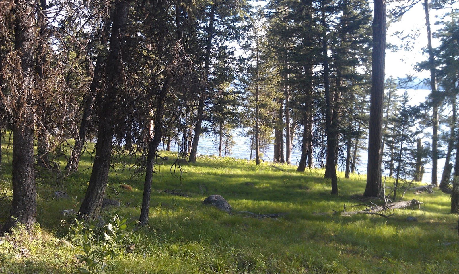
China Ditch Trail 
Hi all,

I've been stoked about going mountain biking this spring, so I headed out into the Wilson Creek area in the front side of the Owyhees last weekend to check on the conditions. Much to our delight, the trails were dry and ready to ride. We saw a number of mountain bikers, hikers and horseback riders out there, so we weren't the only ones with spring fever.

The weather this weekend looks equally fine for mountain biking in the Owyhees. Sunday looks wonderful with temperatures almost hitting 60! Low-elevation trails in the Boise Foothills are starting dry out, too. Check the latest conditions on the Ridge to Rivers web site. With temperatures in the 60s next week, people will be swarming in the foothills. Not so in the Owyhees.

My friend Paul Hilding and I rode a loop in Wilson Creek that he's been riding with some mountain biking buddies of mine for several years. We followed the Google Earth GPS tracks of Doug Lawrence, and with the aid of a BLM map with the trail and road numbers on it, we had a successful ride. I checked with Chris Cook, who's spent a lot of time in the Owyhees GPS'ing trails, and the route we rode is called "Northwest Passage," combined with "Bingo's Trail" and the "China Ditch Trail." All told, it was a 16.2-mile ride with a little over 2,000 vertical feet of climbing and descending. It took us about 4 hours to complete the loop. We made quite a few stops for snacks and photos.

(Here is the live audio about this trip on 94.9 FM The River. Steve talks about his outdoor tips each Friday with Ken and Tim at about 7:10 a.m.)

We will be including this loop in the forthcoming guidebook on the Owyhee Canyonlands that I'm working on with photographer Mark Lisk. But I'll provide all the details here for a successful ride.

I would rate this ride "advanced" and "strenuous" because of the distance, technical challenges and endurance needed to complete the ride. I'll describe a route for intermediate riders below.

Hilding loves the ride. "I think it's my favorite loop of all the riding I've done in Idaho so far," says the former San Diego resident. "I really like the fact that the loop is nearly all singletrack, and it's really scenic, especially with the hoodoos on Bingo's Trail, and then the awesome canyon in Reynolds Creek and China Ditch Trail. It's a pretty killer ride."
The Northwest Passage loop is highlighted in red ... ride it counter-clockwise  (click to enlarge).
Getting there: Take Interstate 84 to the Nampa City Center exit (Franklin Road). Turn left and head into downtown Nampa. Follow signs for Highway 45 south heading for Murphy. Go south on 12th Avenue and take Idaho 45 south to Walters Ferry and the Snake River. Turn right after crossing the river and head for Marsing. Watch for Wilson Creek Road on the left in about 3 miles. Turn left. Proceed up Wilson Creek Road for about 2 miles to the Wilson Creek Wayside. Park. The ride starts here. Be sure to bring plenty of water and food for the ride. I carried water for my dog, and I'm glad I did. Water is sparse in the loop except for Reynolds Creek.

To begin, peel out of the parking lot and pick up BLM Road 37131 and head west next to some giant powerlines.

Mile .4 - Bear left on a narrow, faint singletrack and ride across sagebrush flats to a stock tank area.
Mile 1.9 - Bear left at stock tank area, pass through gate (close it behind you) and ride straight ahead on two-track road.
Mile 2.0 - Bear right onto Trail #200, a singletrack, and ride up-canyon in a small draw.
Mile 2.6 - Trail #200 parallels BLM Road 37150 as they climb at a steep gradient out of that little canyon up to a ridge.
Mile 4.6 - Approach 4-way junction. Go straight on #200 singletrack.
Mile 4.7 - Rejoin road for a short bit; mile 5.0 bear left on #200 singletrack.
Mile 5.25 - Come to junction with Trail #262 on a ridge overlooking Stewart Gulch. Take a hard left on Trail #150. The trail goes through a small canyon and leads to Wilson Creek.
Mile 6.5 - Drop into steep canyon and climb out (mile 6.7). Now it's downhill toward Wilson Creek.
Mile 7.7 - Begin steep descent into Wilson Creek.
Mile 8.1 - Come to a T-junction at the creek. Cross the creek, pick up singletrack on the other side, then take a hard right on Trail #100 and climb up to the Wilson Creek Road.
Mile 9.2 - The trail emerges on Wilson Creek Road by a vehicle pullout. Directly across the dirt road, take Trail #500 and ride downhill over to Reynolds Creek. People call this "Bingo's Trail." It's a hoot. Lots of fun S-turns riding downhill.
Mile 9.7 - Bear left on Trail #500.
Mile 11.25 - Junction with BLM Road 37154. Turn right and follow the road briefly, then bear left on singletrack going up steep slope.
Mile 11.4 - Go left on Trail #510 and climb over to Reynolds Creek canyon.
Mile 11.8 - At the next junction, bear left and head for the canyon. The trail eventually drops very steeply into Reynolds Creek canyon. People call this steep section "Jacob's Ladder." You decide whether it's rideable. 
Mile 12.1 - Junction with Reynolds Creek/China Ditch Trail #600. Go left, down canyon. Gear down and weave through the rocks. Great place to stop for lunch and take pictures of the redrock canyon.
Mile 13.2 - Veer left on Trail #310 and leave China Ditch Trail.
Mile 13.6 - Cross two-track and stay on singletrack trail. More rock work makes this a sweet sinewy singletrack.
Mile 14.5 - Approach junction with Trail #310 and #311. Go right on #311 and follow that sandy singletrack downhill through the sagebrush.
Mile 15.2 - Cross through barbed wire gate and close it behind you.
Mile 15.7 - Ride around gate. You can see the place where you parked to start the ride. Take BLM Road #37154 directly west to the trailhead.
Mile 16.25 - Final ride mileage at trailhead.   
Here's Steve with his pointer Huck on the Wilson Creek ride.
 Intermediate ride: This route could be hiked or run as well. Follow directions above to Wilson Creek Road. Keep going up the Wilson Creek road to a trailhead on the left. Take Trail #300 from the trailhead in an easterly direction across the sagebrush hills, heading over to Reynolds Creek and the China Ditch Trail (most spectacular part of ride).  

Trail #300 comes to an end on BLM Road #37154. Go right and climb the road. Veer right on Trail #500 when you see that emerge on the left side of the road. Follow Trail #500 to #510 and climb over to Reynolds Creek Canyon. Bear left on Trail #600 in Reynolds Creek and follow the China Ditch Trail along the creek. Great spot for lunch and photos. After a mile on the China Ditch Trail, veer left on Trail #310. Take #310 to BLM Road #37154, go left for a short distance, then right on Trail #300 and return to the trailhead. This route is about 7.5 miles long. It's very similar to the Reynolds Creek Loop described in my book, the Boise Trail Guide. 

There you have it! Thanks to Chris Cook, Dan Meeker and Dave Beck for pioneering "Northwest Passage!"

There's a longer ride with more vertical gain in my guidebook book Mountain Biking Idaho called the "Wilson Creek-Mini Moab Loop." That ride climbs the Wilson Creek road to the top of Wilson Butte, and then takes a topsy-turvy rocky two-track back down the mountain over towards Reynolds Creek. It's possible to mix in a side trip to the China Ditch Trail on the way back.
- SS

Thursday, June 18, 2009

New edition of Mountain Biking in Boise to hit the streets next week

Ian Fitzgerald of Eagle flies into the sky at the Idaho Velopark (Mari Briggs photo)

Five Mile Creek

Bob's Trail, Josh Roper photo

Orchard Gulch off of Rocky Canyon Road
Practice good trail etiquette

Oregon Trail

Scaling Hard Guy

Lots of elbow room on Avimor trails

Idaho Velopark Stage Fright jump line

Hi all,

After many months of work, I'm happy to report that the 5th edition of Mountain Biking in Boise will be released for retail sales in the middle of next week. The book also is available for sale on my web site.

Many new trails have been added to the Boise and Eagle Foothills trail network over the last 5-6 years since the last edition. Volunteers from the Southwest Idaho Mountain Biking Association (SWIMBA), the Idaho Velopark and Boise REI have stepped up to create more trails, more fun, more challenge and more pure adrenaline than we've ever had before. My hats off to all of the people who made this happen.

The new book features 65 rides and maps, a photo gallery of action images, and tips on riding technique, trail etiquette and bike maintenance. The book has 25 more rides than the last edition, including rides in the Eagle Foothills, the Idaho Velopark, Avimor, new Ridge to Rivers Trails and new trails around Bogus Basin. All told, the trail system in the foothills has expanded from 80 miles to 200+ miles of trails, much of it singletrack.

We're blessed to have so many public trails right out our backdoor in Boise. It's a world-class trail system -- one of the best in a city of our size anywhere in America, in my opinion. We need to do everything possible to tread lightly and be an ambassador for the sport of mountain biking when you're out there on the trail.

Go out of your way to yield to other users and say hello ... it's a wonderful thing to see all of the people out there hiking, walking their dogs, running, biking and horseback riding in the foothills, in addition to the motorbikes and ATVs in the upper reaches of the foothills. Everyone is out there to have fun and enjoy the fresh air and the surrounding environment. Do your part to preserve the resource.

The new book will be available at Treasure Valley bike shops, book shops and outdoor stores. Book-signing events will be announced soon.

In the coming days, my web site will feature sample rides from the book, videos of more than a dozen trails, and a fun slide show of previous book covers and associated trivia ... -- SS