Showing posts with label Bear Pete Trail. Show all posts

Thursday, October 3, 2019

Put on the big boy pants and cap the mountain bike season with a big ride!

Jim Giuffre and Doug Lawrence heading down on the Bear Pete Trail. 
Mark and Roberto on last year's ride to Mark's cabin. 
Hi all,

It's that time of year when it's perfect conditions for fall mountain biking. Cool temperatures keep the sweat factor to a minimum. Fall colors create a beautiful backdrop while you slalom through the forest or the sagebrush. But winter weather is coming soon, so it's important to capitalize on these last sunny days in October for some epic rides.

Many of you have been riding since March or April, you're in great shape, and you're ready to do some big miles on an Idaho classic ride. That's my outdoor tip of the week -- I'm recommending some of my favorite fall Idaho classics. Put on your big boy or big girl pants and go for it!

My post this week is inspired by my plan to do the "Ride to Mark's Cabin" on Saturday, Oct. 5 with a bunch of fun people. It's a 40-mile route starting from Bogus Basin, out the Boise Ridge Road to Harris Creek saddle, down to Placerville for lunch, and then over another mountain range via Ophir Creek to drop into the South Payette via Wash Creek. Mark's cabin is at the bottom of the descent, where plenty of beer and ribs await for dinner! 

It appears we're going to have excellent weather on Saturday, with partly cloudy skies and a high temperature near 60. Sunday should be an even better day for a ride, with highs in the low 70s. 

Here are some other classics to try:

1. Around the Mountain - Eastside - Sweet Connie - Chukar Butte to Hidden Springs. Shuttle Required. I'm not sure how many miles this one is, but definitely 20+ miles. Your legs will feel cooked by the time you reach the bottom of Chukar Butte! This is one of the best downhills in the trail system! See the Boise Trails site for a map of Sweet Connie and the rest.

Nice light on Sweet Connie (courtesy MTB Project) 
2. Corrals- Hard Guy-Dry Creek Loop - This is one of my all-time favorites. It's a tough climb up Hard Guy, but it's one hoot of a good time coming down the Dry Creek trail. Rated: Advanced. Distance: 22 miles. Travel time: 4-6 hours. Tread: dirt road and mostly singletrack. Vertical gain/descent: 3,513 feet. Connect with Corrals Trail 1.8 miles up Bogus Basin Road on the right. Proceed on Corrals to the Hard Guy Jct on the left at mile 3.2. Climb Hard Guy to the Boise Ridge Road. It's five miles of strenuous granny gear climbing on singletrack, some of it sandy and super steep. Turn left on the Boise Ridge Road and ride two miles to the Dry Creek junction (mile 10.3). Descend into Dry Creek on the singletrack and enjoy the shady ride in the trees and water crossings. You'll hit Bogus Basin Road at mile 17.7. Ride the pavement back to town.
Hard Guy-Dry Creek Loop is one of the major primo rides in Boise


3. Five fall rides I recommended in a Visit Idaho post - Around the Mountain, Loon Lake, Fisher-Williams, Gold Hill in Sandpoint and the Lynx Trail in Farragut State Park, north of Coeur d'Alene. See the post for details and photos.

Mark Anderson takes in the views on the Bear Pete Trail. 
4. Bear Pete Trail, near McCall - This is great ride in fall colors. Once you get on top of Bear Pete Mountain, you're riding a singletrack at 8,000 feet and you can see forever! Everyone loves this ride because it does test you, and sometimes hike-a-bike is required! Distance: 17.5 miles. Vertical gain: 3,500 feet. Rated advanced (strenuous). Travel time: full day. Bear Pete Trail is located north of McCall via Warren Wagon Road. Past Upper Payette Lake, watch for a turnoff to Cloochman Saddle. This road takes you to the trailhead. You also should plant a vehicle at the north end of Bear Pete, north of Burgdorf Hot Springs, if you don't want to ride a long dirt road slog back to your vehicle at the trailhead. At the saddle, climb trail #142 Bear Pete and grind for a couple of miles to the ridgetop. You'll ride up and down along the high mountain ridge for several hours. There are a few junctions but stay on the main trail. On the north end, the trail plunges downhill to Forest Road #246, the road to Burgdorf Hot Springs. You made it! Bring your swimsuits and take a soak at Burgdorf after the ride! Always a good call!

Back of Beyond Three Fingers! Gorgeous scenery up-canyon! 
5. Back of Beyond Three Fingers Loop - This is still a little-known super scenic mountain bike ride in the Owyhees, near Carlton Canyon and Painted Canyon. The scenery is gorgeous -- you'll see neat canyons, hoo doos and other rock features, similar to what you see at Leslie Gulch. Distance is 22 miles. Rated strong intermediate/advanced. Tread: All two-track roads. Travel time: 3.5-5 hours. Bring plenty of water and a lunch. Getting there: Go to Succor Creek State Park, and continue south 6 miles to an unsigned dirt road on the right at the top of a grade. This is McIntyre Springs Road. Go right and follow the dirt road 3 miles to an unsigned two-track on the left. This is your trailhead. Follow the directions on the map below. The scenery is gorgeous on this ride -- you'll see neat canyons, hoo doos and other rock features. Detailed directions are in my book, the Owyhee Canyonlands - An Outdoor Adventure Guide. Bring a BLM map, topo map and a GPS for best navigation.

Map for Back of Beyond Three Fingers Loop. After
you do the ride, climb to the top of Three Fingers!

There you have it! Have a great weekend! 
- SS 

Wednesday, July 10, 2019

The high country beckons! Three kid-friendly mountain hikes near McCall

Bear Pete Trail at the Josephine Lake overlook.
We ski-daddled along the snowy Bear Pete ridge in our hiking boots.
Hi all,

Summer is kicking into high gear, with temperatures now in the 90s in the Boise Valley. And the snow is melting fast in the mountains, so it's time to head into the high country for hiking and summer fun.

For my outdoor tip of the week, I'm recommending three hikes in the greater McCall area (elevation 5,000 feet). All of these hikes would be suitable for kids and families.

Be sure to pack plenty of water, snacks/lunch, rain coat and bug spray. Also, it's a good idea to bring a Payette National Forest or McCall area Adventure map to stay on track. Most of these areas are out of cell range except Boulder Lake.

Jim Pace takes a gander at Buckhorn Mountain off in the distance at Boulder Lake.
1. Hike to Boulder Lake - Rated easy to moderate. Distance: 4 miles - 2 miles out, 2 miles back. Vertical: 700 feet of gain. This is a scenic hike that offers a little more mountain "wow" factor than the trails in Ponderosa Park and Bear Basin. Nice place to swim, go fishing or have a picnic. Trailhead is off Elo Road by Boulder Mountain Reservoir. See details on Payette National Forest web site. Bring a lunch and enjoy the setting! 

You walk by multiple meadows on the 20 Mile Trail ... old burn areas and some mature forest that didn't burn.
2. 20 Mile Trail - This is more of a forested hike into a beautiful glacial-sculpted canyon. Much of this area burned years ago, but the lodgepole pines are growing back as thick as dog hair. Rated easy. Distance 5.5 miles to 20 Mile Lakes junction and back. Vertical: 260 feet of gain. The 20 Mile trail is in great shape. No downfall. That makes things super pleasant. If you want to go farther, go uphill on the trail to 20 Mile Lakes for a bigger view of the surrounding mountains. Getting to the trailhead: Take Warren Wagon Road north past Upper Payette Lake and watch for 20 Mile Trailhead on the right side of the road.

Looking up the canyon toward Lick Creek Summit.
For an even bigger adventure, leave a shuttle vehicle at the 20 Mile trailhead and get a ride to the Duck Lake Trailhead by Lick Creek Summit. You can do a through-hike from Duck Lake down the full length of 20 Mile Trail ... it's only 10.5 miles! 710 feet of gain and 1,640 feet of descent. Plan for a full-day to do the shuttle and hike.  

Wendy walks through a gallery of dead whitebark pines on the way up the mountain.
3. Bear Pete Trail to Josephine Lake overlook - Hiking this route is a quick way to get into the alpine zone from the trailhead at Cloochman Summit, not far from Secesh Summit. Rated moderate. Short strenuous climbs in a few spots. Distance: 5.5 miles out and back. Vertical: 1,400 feet of gain. Drive north of McCall on Eastside Drive to North Beach area, then continue north on Warren Wagon Road past Upper Payette Lake to a signed left-hand turn to Cloochman Saddle. High-clearance vehicle recommended. Park at the trailhead by the saddle. Hike uphill on Bear Pete Trail and enjoy the rainbow of wildflowers as you climb through alpine meadows to an overlook of Josephine Lake at just over 8,000 feet. Big views looking into French Creek, Bear Pete Mountain, and the Payette Crest. The full length of Bear Pete Trail is 17.5 miles ... I have mountain biked it both directions. Hard-core trail runners would love doing the whole thing. 3,125 vertical!

Bear grass coming on!
------------------------------
Notes

The Grand Opening for the new Payette Lake singletrack trail is on Saturday, from 2-8 p.m., sponsored by the Central Idaho Mountain Biking Association (CIMBA). Burgers, dogs, and Salmon River Brewery will be pouring beer. This is a fund-raising event. CIMBA does a ton of great things for trails in the greater McCall area, including overseeing the development of the new trail on the west side of Payette Lake. Here's a link to the new trail on MTB Project.

- SS

Thursday, September 28, 2017

Fall is the time to push your limits on the mountain bike - 5 rides suited to the task

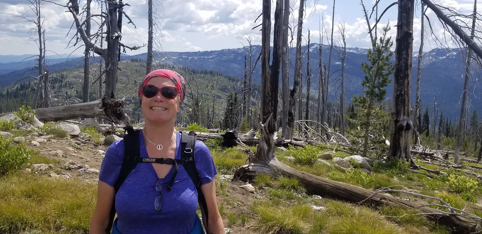
Doug Lawrence on Bear Pete Trail at 8,000 feet. Bear Pete is a classic fall ride. 
Looking south deep into the Owyhee Canyonlands from the Silver City Skyline Tour, above Silver City  
Hi all,

I love the cool weather in the fall ... it's really the best time of the year for active outdoor adventures of any kind. You don't sweat nearly as much on the climb, and it's a beautiful time of year to enjoy fall colors.

This week, I'm recommending five advanced and strenuous mountain bike rides in Boise, Silver City and McCall. Everyone has been riding all spring and summer, and the fall is a great time to push your legs perhaps farther than they've gone this year and knock off some big rides. Get some friends together and go get 'em!

1. Dry Creek - Hard Guy - Dry Creek Loop - For advanced rides, Dry Creek is a favorite destination. You just need some time to ride it! It's a tough climb up Hard Guy but the payoff is big riding down Dry Creek and the new bridges, etc. Distance: 20 miles. Vertical gain: 3,500 feet. Rated advanced (strenuous climb). Travel time: 3-5 hours. Start at the Dry Creek Trailhead on Bogus Basin Road. Climb Dry Creek through the rocks to a creek crossing and junction with the trail spur to Hard Guy about 1.5 miles up the trail. This portion of the trail has been improved recently. Climb Hard Guy to the Ridge Road. Take your time and conserve energy. Take a break on top! Go left and ride 2 miles to the Dry Creek junction. Turn left off the Ridge Road on a singletrack that wraps around a ridge and hairpins into the densely timbered headwaters of Dry Creek. Stay right at the Shingle Creek junction. Proceed with caution. There can be downfall and various hazards on the way down the trail. It's 7 miles of fun and adventure descending Dry Creek. Ride through the rocky features and return to Bogus Basin Road. Whew! Time for a beer!

Dry Creek has multiple bridges installed for crossing the creek. Courtesy Idaho Statesman. 
2. Corrals-Scott's-8th Street-Ridge Road-Trail #4-Sidewinder-Crestline-Red Cliffs Loop -Here's another big foothills tour that'll take you to the top of the Boise Ridge climbing via Corrals, Scott's and 8th Street, and then descending on the wide, sandy, dished-out Trail #4 motorcycle trail until you reach Sidewinder, and then it's a fast and smooth downhill from there. Distance: About 18 miles. Vertical gain: 3,600 feet. Rated advanced (strenuous). Travel time: 2.5-3.5 hours. Ride up Bogus Basin Road or the Highlands Trail to Corrals. Climb Corrals to Scott's, go left, and climb the steep singletrack to 8th Street. Ride another 1.5 miles on 8th Street to a junction for Trail #4 on the right. Follow Trail #4 connector over to Trail #4 and hang on for the tricky descent. Keep your weight back and plane through the sand! Trail #4 eventually returns to Sidewinder summit. Descend on Sidewinder to Crestline and then go right on Red Cliffs to complete your ride. Take Red Fox and Chickadee Ridge to Camelsback and you're done! Again, time for a beer!

3. Silver City Skyline Tour in the Owyhees - It's rated strenuous/advanced in my book, The Owyhee Canyonlands - An Outdoor Adventure Guide. Distance: 16.8 miles, 2,750 feet of vertical gain. I love the ride because it provides a rooftop tour of the mountains surrounding Silver City, and it's nifty that you start and finish in downtown Silver City. Be sure to bring plenty of food and water. The old hotel in Silver City might be open (on weekends) for drinks after the ride. After the ride, there are lots of places to camp just outside of Silver City or along Jordan Creek, you make the call. 

Directions: Drive to Silver City and park off to the side of Main Street near the old hotel. To get there, go south of Nampa on ID 45 to Murphy. Watch for signs for Silver City on ID 78 as you're heading for Murphy, and follow the paved and dirt road to the historic mining town. 

Mile 0 - Ride back toward New York Summit from Silver City. 
Mile 1.2 - Turn right on BLM Road F483. This is your main route for the first half of the ride.
Mile 2.4 - Bear right on Road F483 at Y junction and climb.
Mile 4.7 - Reach junction with service road to the top of War Eagle Mountain. It's a short, but steep sidetrip to check out the summit. Check out the old buldings and mine shafts at the Poorman Mine near this junction ... it's a short sidetrip.
Mile 5.9 - Back at War Eagle junction. Bear right on Road F483 and cruise on your middle ring to the ridges and mountains to the south.
Mile 6.7 - Bear right at Y junction next to livestock watering area. Bear right again shortly afterward and climb a steep hill with lots of mobile rocks.
Mile 7.9 - Come to sweet overlook to the left of the main road. Cruise over to the trees to enjoy views looking out toward Triangle and the big wide open country of the Owyhees.
Mile 8.4 - Pass through barbed-wire gate.
Mile 9.2 - Bear right.
Mile 9.4 - Ignore trail going downhill on the right. Stay on the ridge.
Mile 9.6 - Pass through barbed-wire gate.
Mile 11.1 - Bear right and pass through gate. Going downhill now on ATV track.
Mile 11.8 - Come to 4-way junction. Take a hard right and climb super-steep ATV trail to a saddle at 12.6. Parts of the climb are rideable; some parts not. Go left at the junction and climb a little more until trail flattens out.
Mile 14.0 - Come to 4-way junction. Turn right and descend into Long Gulch on a jeep trail. It's a fun descent back to Silver City. There are a number of creek crossings.

Mile 16.8 - Arrive in downtown Silver City. You made it!     

Riding Elk Trail at Brundage Mountain ... great views of nearby Granite Mountain! Courtesy Visit Idaho
4. Bear Basin-Brundage Lookout-Elk Trail-Growler-488 Road Loop - We're moving on to the McCall area now. I did this ride a couple of weeks ago and it worked out splendid! This is a cool tour of the Bear Basin area on a climb to the top of Brundage Lookout, then you descend Brundage ski area on Elk Trail, and then take a trail and a road back to Bear Basin. Great tour! Distance: 18.2 miles. Vertical gain: 2,600 feet. Rated advanced (strenuous in places). Start by taking Bear Basin Road about 1.5 miles to a wooden fence by the east portal to the Bear Basin non-motorized trails. Park. The ride starts here (by all means, ride from town if you want!). Climb Bear Basin Road 9 miles to the top of Brundage Mountain. The road gets pretty soft and sandy near the top. Just grind out the climb. Once at the lookout, ride over to the Bluebird Chair and pick up the top of Elk Trail. Descend Elk Trail about 6 miles to a point near the bottom of the ski area. You'll see a trail on the left at a split called Growler. Go left on Growler and climb the singletrack through open slopes and deep woods until you climb a super-steep section in the woods and pop out into the open on Temptation. Take Growler across the grassy trail and then bear right as the singletrack continues to climb. You'll see an unmarked two-track road taking off laterally from the ski area. This is Forest Road #488. It's downhill all the way back to Bear Basin now -- enjoy it! Watch for tight corners in a few spots, but generally, you can let it rip on the wide gravel road. Head into McCall and grab a burger and a beer!

Mark Anderson above Josephine Lake.
Almost there! 
5. Bear Pete Trail - The McCall locals always do at least an annual pilgrimage to tackle Bear Pete Trail, and I often gather up some buddies to do the same thing. Everyone loves the ride because it does test you, makes you work hard, and sometimes hike-a-bike is required! The cool thing about Bear Pete is that it starts at a high elevation and after you make the big climb to the top of Bear Pete Mountain, you'll be riding at 8,000 foot elevation on the mountain for a number of miles, going up and down, with huge views off to the west (French Creek) along the way. Distance: 17.5 miles. Vertical gain: 2,500 feet. Vertical gain: 3,500 feet. Rated advanced (strenuous). Travel time: full day. Bear Pete Trail is located north of McCall via Warren Wagon Road. Past Upper Payette Lake, watch for a turnoff to Cloochman Saddle. This road takes you to the trailhead. You also should plant a vehicle at the north end of Bear Pete, north of Burgdorf Hot Springs, if you don't want to ride a long dirt road slog back to your vehicle at the trailhead. At the saddle, climb trail #142 Bear Pete and grind for a couple of miles to the ridgetop. You'll ride up and down along the high mountain ridge for several hours. There are a few junctions but stay on the main trail. On the north end, the trail plunges downhill to Forest Road #246, the road to Burgdorf Hot Springs. You made it! Bring your swimsuits and take a soak at Burgdorf after the ride! Always a good call! There are a number of places where you could camp along the Brundage Road, if necessary.

The Idaho Whitewater Association is looking for helpers for their 2nd annual ID 55 highway cleanup effort on Oct. 7th. See their Facebook event invite for more information.

Have fun!
- SS

Thursday, September 29, 2016

Fall is the perfect time to tackle five advanced mountain bike rides in SW Idaho

Mark Anderson and Jim Giuffre on Bear Pete Trail 
Steve riding at 8,000 feet on Bear Pete Mountain in the Payette National Forest.
Coming down on Bear Pete ... yay! 
Elk Trail at Brundage Mountain winds through the trees like a snake. Very fun! 
Watchman in the spring 
Get a group together and tackle these fall rides! 
Dry Creek Trail 
Heading off to climb the Boise Ridge 
Dry Creek
Hi all,

Well it's been kind of warm mid-week, but it's supposed to cool off into the 70s by Saturday and Sunday. Personally, I love the cool weather in the fall ... it's really the best time of the year for active outdoor adventures. You don't sweat nearly as much on the climb, and it's a beautiful time of year to enjoy fall colors.

This week, I'm recommending five advanced and strenuous mountain bike rides in Boise and McCall. Everyone has been riding all spring and summer, and the fall is a great time to push your legs perhaps farther than they've gone this year and knock off some big rides. Get some friends together and go get 'em!

1. Watchman Loop - This is still one of my all-time favorite rides in the Boise Foothills. The creeks are mostly dried up now, but the colors are happening, and the unique skyline tour of the foothills that Watchman provides is always worth the price of admission. Distance: 15 miles. Vertical gain 2,500 feet. Rated advanced. Travel time: 3 hours Start in Military Reserve. Take the trail along Freestone Creek to Ridgecrest #20 and climb to Central Ridge Trail. Climb Central Ridge to the Bucktail junction. Go straight and climb a short distance and then contour over to Rocky Canyon Road on Shane's. Climb Rocky Canyon Road to the Five Mile Trail and Creek. Climb Five Mile to Watchman. Follow Watchman across the foothills and go left at the junction with Three Bears/Curlew Ridge/Trail #6 and follow Three Bears down the spine of Curlew Ridge (super fun downhill with one technical section) back to Shane's Junction. Descend back to the bottom of Military Reserve however you like ... I always have to ride Bucktail and cruise the super-cool GS turns.

2. Dry Creek - Hard Guy - Dry Creek Loop - For advanced rides, Dry Creek is a favorite destination. You just need some time to ride it! It's a tough climb up Hard Guy but the payoff is big riding down Dry Creek and the new bridges, etc. Distance: 20 miles. Vertical gain: 3,500 feet. Rated advanced (strenuous climb). Travel time: 3-5 hours. Start at the Dry Creek Trailhead on Bogus Basin Road. Climb Dry Creek through the rocks to a creek crossing and junction with the trail spur to Hard Guy about 1.5 miles up the trail. This portion of the trail has been improved recently. Climb Hard Guy to the Ridge Road. Take your time and conserve energy. Take a break on top! Go left and ride 2 miles to the Dry Creek junction. Turn left off the Ridge Road on a singletrack that wraps around a ridge and hairpins into the densely timbered headwaters of Dry Creek. Stay right at the Shingle Creek junction. Proceed with caution. There can be downfall and various hazards on the way down the trail. It's 7 miles of fun and adventure descending Dry Creek. Ride through the rocky features and return to Bogus Basin Road. Whew! Time for a beer!

3. Corrals-Scott's-8th Street-Ridge Road-Trail #4-Sidewinder-Crestline-Red Cliffs Loop -Here's another big foothills tour that'll take you to the top of the Boise Ridge climbing via Corrals, Scott's and 8th Street, and then descending on the wide, sandy, dished-out Trail #4 motorcycle trail until you reach Sidewinder, and then it's a fast and smooth downhill from there. Distance: About 18 miles. Vertical gain: 3,600 feet. Rated advanced (strenuous). Travel time: 2.5-3.5 hours. Ride up Bogus Basin Road or the Highlands Trail to Corrals. Climb Corrals to Scott's, go left, and climb the steep singletrack to 8th Street. Ride another 1.5 miles on 8th Street to a junction for Trail #4 on the right. Follow Trail #4 connector over to Trail #4 and hang on for the tricky descent. Keep your weight back and plane through the sand! Trail #4 eventually returns to Sidewinder summit. Descend on Sidewinder to Crestline and then go right on Red Cliffs to complete your ride. Take Red Fox and Chickadee Ridge to Camelsback and you're done! Again, time for a beer!

4. Bear Basin-Brundage Lookout-Elk Trail-Growler-488 Road Loop - We're moving on to the McCall area now. I did this ride a couple of weeks ago and it worked out splendid! This is a cool tour of the Bear Basin area on a climb to the top of Brundage Lookout, then you descend Brundage ski area on Elk Trail, and then take a trail and a road back to Bear Basin. Great tour! Distance: 18.2 miles. Vertical gain: 2,600 feet. Rated advanced (strenuous in places). Start by taking Bear Basin Road about 1.5 miles to a wooden fence by the east portal to the Bear Basin non-motorized trails. Park. The ride starts here (by all means, ride from town if you want!). Climb Bear Basin Road 9 miles to the top of Brundage Mountain. The road gets pretty soft and sandy near the top. Just grind out the climb. Once at the lookout, ride over to the Bluebird Chair and pick up the top of Elk Trail. Descend Elk Trail about 6 miles to a point near the bottom of the ski area. You'll see a trail on the left at a split called Growler. Go left on Growler and climb the singletrack through open slopes and deep woods until you climb a super-steep section in the woods and pop out into the open on Temptation. Take Growler across the grassy trail and then bear right as the singletrack continues to climb. You'll see an unmarked two-track road taking off laterally from the ski area. This is Forest Road #488. It's downhill all the way back to Bear Basin now -- enjoy it! Watch for tight corners in a few spots, but generally, you can let it rip on the wide gravel road. Head into McCall and grab a burger and a beer!

5. Bear Pete Trail - The McCall locals always do at least an annual pilgrimage to tackle Bear Pete Trail, and I often gather up some buddies to do the same thing. Everyone loves the ride because it does test you, makes you work hard, and sometimes hike-a-bike is required! The cool thing about Bear Pete is that it starts at a high elevation and after you make the big climb to the top of Bear Pete Mountain, you'll be riding at 8,000 foot elevation on the mountain for a number of miles, going up and down, with huge views off to the west (French Creek) along the way. Distance: 17.5 miles. Vertical gain: 2,500 feet. Vertical gain: 3,500 feet. Rated advanced (strenuous). Travel time: full day. Bear Pete Trail is located north of McCall via Warren Wagon Road. Past Upper Payette Lake, watch for a turnoff to Cloochman Saddle. This road takes you to the trailhead. You also should plant a vehicle at the north end of Bear Pete, north of Burgdorf Hot Springs, if you don't want to ride a long dirt road slog back to your vehicle at the trailhead. At the saddle, climb trail #142 Bear Pete and grind for a couple of miles to the ridgetop. You'll ride up and down along the high mountain ridge for several hours. There are a few junctions but stay on the main trail. On the north end, the trail plunges downhill to Forest Road #246, the road to Burgdorf Hot Springs. You made it! Bring your swimsuits and take a soak at Burgdorf after the ride! Always a good call! There are a number of places where you could camp along the Brundage Road, if necessary.

Have fun!
- SS