Thursday, September 29, 2011

Late-season river trips in Idaho offer solitude, great fishing


Greg and Jan 20 years later in the grotto with their wedding T-shirts on ...
Parrott's Grotto
The water gets deeper and swifter in the Impassible Canyon
Fish on!
The snag that almost landed on Greg
Whew!
Yee-haw! Hello Middle Fork!
Final approach to Indian Creek ... really excited now
Taking off for the Middle Fork, banking by the Sawtooth Mountains
Ready to roll at 7:45 a.m. at the Stanley airstrip with all of our gear
Hi all,

Idaho's blessed with world-class rivers, and because of their popularity, it's tough to get a permit in the middle of the summer. But in the fall, after Labor Day weekend, it's easy to grab a launch permit -- if one is required at all -- and you can enjoy the September weather, solitude and great fishing.

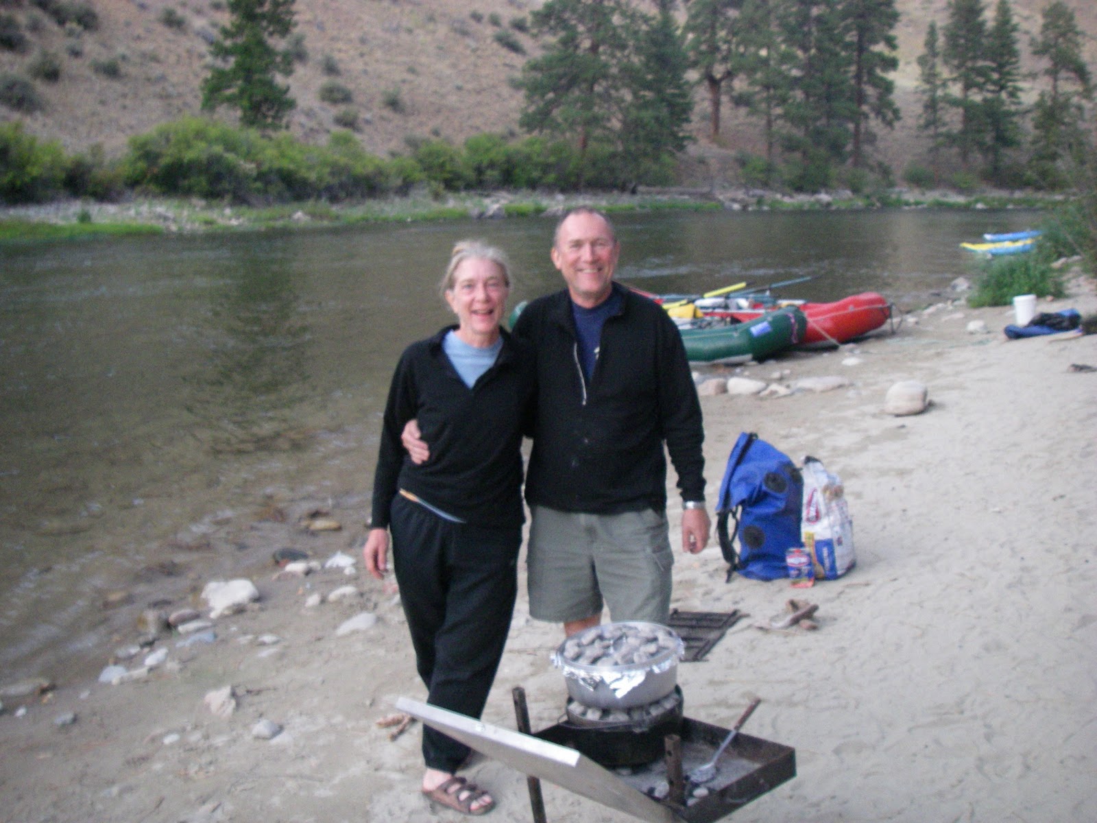
Some friends of mine got married 20 years ago in Parrott's grotto on the Middle Fork of the Salmon River. We had hoped to do a wedding reunion trip in July, but no one in our group drew a permit from the lottery system, so we planned a September trip instead. You just have to hang loose and wait for the permits to become available on the www.recreation.gov web site, and snag one.

The hard part is finding a date that works for working people with kids in September. You've got to find someone to supervise the kids so they can stay in school -- that can be a tough one -- get time off work, etc. Plus, there might be other complications. So even though we had 18 people on the wedding party trip, our reunion trip consisted of just four people -- the honored guests, Greg Harley and Jan Sutter, my partner Wendy and me. That's cool ... I love small groups ... it makes things SO much simpler.

Considering all of the fall multi-day trip options in Idaho, the Middle Fork and the Main Salmon rivers involve the most logistics and expense. Floating Hells Canyon near Cambridge, the Lower Salmon Gorge near Whitebird or the South Fork of the Snake River east of Idaho Falls are easier to pull off, and no advance reservations are required. You just fill out a self-issue permit at the boat launch, arrange for a vehicle shuttle and go.

Besides the hassle of getting an advance permit on the Middle Fork, you also need to decide whether you're going to fly into Indian Creek (25 miles downriver to avoid low water and lots of rocks), and then arrange for a vehicle shuttle ($225 from Stanley to the takeout). We choose to fly into Indian Creek with McCall Air Taxi from Stanley to make things easier for our group. Most of the private groups we saw on the river started from the top, at Boundary Creek, because the water was a little higher this year (1.8 feet on the gauge). They ran small boats and packed lightly. One nimble group from Hailey floated in self-support inflatable kayaks backpack-style with no rafts to carry camp gear.

Admittedly, we chose the deluxe route. We wanted to eat like kings and queens on the wedding reunion trip (lots of Dutch oven meals), we packed champagne for the grotto, and the rafts allowed us to bring plenty of warm clothes for hanging out in the evenings and mornings.

(FYI - I've run the Middle Fork many times in late season at 1.8 feet or less without incident, but you have to focus like a laser beam on your line through rock-choked shallow areas, and be ready to leap out of the boat and push off rocks, which can lead to injuries. A friend of mine floated the Middle Fork the week before we went this year, and his boatmen were so weak and inexperienced, they just gave up on trying to steer around rocks after a while, and just drifted until they got stuck. They were totally exhausted by the time they reached Indian Creek.)

Back to the weather ... the first couple of days, the mornings were downright chilly, with temperatures just above freezing before sunrise. And then, when the sun popped over the high mountains guarding the river canyon, it warmed up in a hurry. There's at least a 30-degree temperature swing between 10 a.m. and 11 a.m. By noon, the temperatures were in the 80s, and the fish were biting on dry flies. Wa-hoo!

I have to mention one bone-chilling incident we experienced at Marble Creek Camp on Day 1. A 60-foot dead snag fell over in the afternoon after we reached camp and almost landed on Greg, who was hanging out in his lawn chair, reading on his Kindle. He was looking up at the tree and said to Wendy, "Hey, did you see that widowmaker up there?" Seconds later, the tree came crashing down, and Greg was quick enough to leap out the way!


A Shoshone-Bannock woman had given us a blessing before we launched at Indian Creek. Let me tell you, we all felt that her blessing may have made a difference, and we certainly felt blessed after that incident. The tree could have injured Greg or worse, and it could have landed on our camp table, wrecked dry boxes, etc. We were lucky!

On our last full day on the river, we pulled into Parrott's Cabin at 2 p.m. in the afternoon. We hiked up to the hidden grotto with the champagne and felt the mist of the tiny waterfall cascading over the rocks and into the cavern. It brought back a lot of great memories from 20 years before, and many other visits before and since. Best of all, Greg and Jan were all giddy and grinning from ear to ear. We soaked in the moment and had a big group hug.

And then a group of families showed up to see the grotto with their kids. The parents had taken their kids out of school for a week to enjoy the Middle Fork in September. Good for them, I thought! One of these years, I might do the same thing.

A few more notes on the Idaho's best multi-day trip rivers to run in the fall:

  • Main Salmon wilderness section - Float from Corn Creek to Carey Creek, about 80 miles. Six days is best at low flow. After chukar partridge season opens on Oct. 1, this section can be productive for fall bird hunting. We saw a lot of chukars on the Middle Fork. Pick up a launch permit on recreation.gov.
  • Lower Salmon Gorge - Float from Hammer Creek to Hellar Bar or arrange for a jet boat ride from the Salmon River confluence to Pittsburg Landing. Most people do this trip in 4 or 5 days in the fall. More days equal more leisure time. Wait until steelhead season opens, and it's a great cast-and-blast trip. Great section for chukar hunting as well. Only self-issue permit needed, available at the launch site.
  • Hells Canyon - Put in at Hells Canyon Dam and float to Pittsburg Landing, about 35 miles. The cast-and-blast trip in Hells Canyon used to be kind of a secret. Nowadays, it's very popular. I will be doing my 22nd annual trip this fall in Hells Canyon in mid-October. Only self-issue permit needed, available at the launch site. Watch out for poison ivy and rattlesnakes.
  • South Fork Snake River - Put in at Palisades Dam or other points downstream and float to Heise. Fly fishing for large native cutthroat trout and brown trout on this river is quite tricky because it's fished so hard nearly every day by a string of outfitters and private boaters. Most people zip through the standard canyon run in a day. Take your time, start at Palisades, and enjoy camping along the way in large cottonwood groves. Do your research about the best flies to use. The fish are picky.
If you don't have your own river boat, there are numerous outfitters who offer trips on the rivers I've mentioned here. Go to www.ioga.org to look for an outfitter that suits your needs and budget. Outfitters will know what flies and lures work best for fishing, and they also offer bird-hunting trips. Look for hot deals!


Have fun!
- SS
Greg and Jan made a chicken casserole and blueberry cobbler at Shelf Camp on Day 2

Thursday, September 15, 2011

Add a bright light to the emergency supplies in your mountain bike pack for safety

Roberto Negron on top of Mars Ridge, Sun Valley area

Roberto and Mark Anderson check out the Sun Valley Adventure Map
CatEye EL-135

MiNewt.250 cordless
Hi all,

Well, we all do stupid things once in a while or have unforeseen mechanical breakdowns in totally remote places when we're out trying to enjoy the great outdoors. And then you find out just how prepared you are for adversity or emergency.

I had a little incident last Friday night that revealed a weakness in my emergency equipment cache in my Camelbak pack. Four of us had been slogging up Eves Gulch Trail on mountain bikes for WAY longer than expected. I found myself cresting a high ridge divide between Adams Gulch and the Warm Springs drainage, some 2,000 feet above the valley floor, and it was well past 8:30 p.m. Darkness was settling in. Great.

And I didn't have a light. Never thought about bringing one! We were out for a "before-dinner" ride with Roberto Negron, who owns a condo along Warm Springs in Sun Valley. We wanted to drop over to the Warm Springs side of the mountains to complete the loop. Roberto had never gone this way.

These things happen when you're doing exploratory rides, but the rest of us didn't realize we were doing an exploratory ride until we were in a pickle. I was just cruising along with the group -- Roberto, Mark Anderson and Jim Hine -- and didn't really think to put up a fuss. We all were shocked at how many switchbacks we had to climb in Eve's Gulch to reach the West Fork of Warm Springs. We just kept climbing and climbing.

Finally, we crested the ridge, and realized we were even with the tops of the mountains around us. Oh boy. It's going to be a LONG way down. We found the 4WD jeep trail that descends the West Fork. Initially I was psyched because typically a road is easier to navigate than a narrow singletrack, even in the dark. But it turned out to be a particularly gnarly 4WD road that had larger-than-baby-head mobile rocks in the ruts and no decent tread to ride. Mark Anderson started to whine about the darkness, and he typically never complains about anything.

"I felt it was really dangerous," Anderson says. "When it's that hard to see in the dark, you fall off your bike and you lose your confidence. I just didn't realize how bad it would be without a light."

And then Roberto pulled out a CatEye Opticube LED light, mounted it on his handlebars, and turned it on. Cool! The light was bright enough to illuminate the trail so Roberto could see where he was going and Mark rode next to him. I rode behind Roberto ... I couldn't see much, but my night eyes were better than Mark's. Jim Hine was like a cat. He took off ahead of us and relied on his night eyes. I thought we'd find him in a ditch somewhere with a broken collarbone.

Eventually, the 4WD road gave way to a much larger dirt road and the agony of negotiating that nasty thing went away. A full moon came over the ridge, and we could see fine on the way back to Roberto's condo.

But a lesson we all learned was the importance of carrying an emergency light in your pack. "I'm going to put one in my Camelbak and never take it out," Mark said.

I'm going to do the same thing.

Roberto's light is a CatEye HL-EL135. I bought one at George's for $22 yesterday. It runs on two AA batteries. That's an inexpensive piece of emergency equipment. We all carry an extra tube, Allen wrenches, patch kit, first-aid kit, snack food, etc. I also carry a space blanket in case I'm stuck overnight in the woods. Now you know you need a light, too, if you didn't already.

Actually there are many different lights available to choose from. People who are regular night riders typically have a beefy light with a hefty battery pack. A friend of mine, Brett Magnuson, told me he carries a NiteRider MiNewt.250 for emergencies and for 24-hour racing. Those units look really compact, light and spiffy, but they're a little more pricy, $130 retail. Obviously Brett has multiple needs for his light -- racing and recreation -- so it's worth the money to him.

Feel free to look around at Boise's bike shops or online to find the right emergency light for you.

I must say that even though Roberto took us on a wild goose chase, he certainly made up for it. He had bought ribs for us earlier in the day, and two of our ride buddies who skipped out on the "before-dinner ride" grilled up the ribs with tons of BBQ sauce at the condo. Needless to say, we were starving when we arrived, and we gobbled down the ribs like cave men. A cooler full of beer quenched our thirst. And then two more days of riding lay ahead.

It's all a big adventure!
-SS

P.S. If you climb Eve's Gulch, just turn around and go back to Adams Gulch on the singletrack. The descent into Warm Springs sucks day or night.

Thursday, September 8, 2011

Try this cool road biking ride: Big Freezeout-Little Freezeout Loop in Star, Idaho

The Emmett Valley, with Squaw Butte looming in the distance
Trip map from GPS tracks (click to enlarge)
Hi all,

This week's topic is a neat road biking loop from my map, the Boise Road Cycling Guide. My mountain bike was in the shop, so I thought I'd try a road biking ride that I've been wanting to notch for some time. It's called the Big Freezeout-Little Freezeout Loop, starting and finishing in Star, Idaho.

I would recommend this ride on WEEKENDS ONLY! Idaho Highway 16 is a very busy commuter road with folks from Emmett coming and going during the week, but on the Sunday when I did the ride, the road was relatively quiet and didn't affect my experience in a negative way.

The Big Freezeout-Little Freezeout Loop is a cool ride because it's a pretty fast route without that many hills (1,039 vertical feet of gain/loss), and it's very scenic, providing an agricultural tour of dry grazing lands, and irrigated farm lands in the Emmett Valley and next to the foothills north of Star and Middleton. Another benefit is that there is almost no traffic on the roads you take in the Emmett Valley, and very little traffic on Little Freezeout heading back toward Middleton and Star.

It's really fun and relaxing to me to crank up the iTunes, cruise down the road and let the road bike roll, while gaining some fitness along the way.

I took a helmet cam video of most of the ride to provide some feeling for the scenery along the way.

All told, the loop was 43 miles, according to my GPS. It took me about 3 hours to do the ride, on a nice carbon fiber road bike I demo'd from Idaho Mountain Touring. I'm in the market for a road bike, so I've been sampling various kinds to find the right fit. This particular bike wasn't geared well for steep climbs such as riding to Bogus or the Cartwright loops because it has only two chain rings on the front crank, but it was very well suited for the Freezeout-Little Freezeout Ride.

Directions: (see map for macro view)
  • Start/finish: I parked at Star Elementary, north of Idaho 44 on Star Road.
  • Go north on Star Road from the school, turn right on Floating Feather, and then left on Pollard Lane. Pollard merges with Idaho 16 in a few miles north of Star.
  • Take Idaho 16 north to Emmett for about 10 miles. You'll pass by Firebird Raceway on the left and cross over Freezeout Pass.
  • As you scream downhill into the Emmett Valley, watch for Cherry Lane and turn left.
  • Take Cherry Lane a few blocks, turn left on Substation Road, then right on Sales Yard Road. Sales Yard beelines across the valley, passing by the Emmett Airport and what appeared to be a par-3 golf course.
  • Turn left on Star Lane, which eventually merges with South Slope Road. Follow South Slope tucked up against the foothills and enjoy the winding road until it intersects with Little Freezeout after a small climb. You also can access South Slope Road via Mill Road.
  • Go left on Little Freezeout. There's a fairly short but steep climb to the top of Little Freezeout. Then it's a very gradual downhill back into the Treasure Valley.
  • In about five miles, watch for Goodson Road on the left. Ride that to Middleton Road and turn right. From here, you can ride into Middleton if you need to replenish your water supplies (I did), and then take Foothills Road to Star or Idaho 44 to Star. I rode 44, which has a good shoulder, and I was ready to finish the ride.
  • It was about 6-7 miles to Star from Middleton, and then you turn left on Star Road to return to the elementary school.
There you have it!

The Boise Road Cycling Guide, a two-sided waterproof and tear-proof color map, features 30+ rides in the north and south sides of the Boise Valley. It also has a number of a la carte rides located in Canyon County and SW Idaho. The Big Freezeout-Little Freezeout Loop is one of them. A couple of others you might try this fall include the Lake Lowell Loop, Snake River Canyon Scenic Loop (tie in the ride with a wine tour if you can) or the Big Ride -- a 150-mile jaunt from Boise to Lowman to Banks to Boise. That's a whopper.

FYI - Idaho Parks & Recreation is hosting an annual volunteer work day at the Idaho City Park n' Ski yurts on Saturday. Join Leo Hennessy from IDPR for a day of fresh air, hard work and fun preparing the yurts and trails for fall and winter. Volunteers will help mark the trails, haul wood and landscape. Volunteers can camp free at the Beaver Creek Cabin campground on Friday and Saturday, or just come up for the work day. If you want to carpool, meet at 7:30 am on Saturday in the parking lot adjacent to Highway 21 at the entrance to Sandy Point State Park for an informal car pool to the staging area, the Beaver Creek Cabin. The cabin is located about 19 miles north of Idaho City and 1 mile off Highway 21 on the Beaver Creek Cabin Road. The turnoff from Hwy 21 is between mile marker 57 & 58. Dress for cool weather and bring water, gloves, and lunch. All other tools will be provided.

If you would like to participate, email Judy Ditto at: judy.ditto@idpr.idaho.gov . Include your name, email, number of people in your party, and if you plan to meet the carpool.

Leo Hennessy will be leading the volunteer work day, and there will be a fun evening by the campfire Saturday night to swap stories about summer outdoor outings. Here's your chance to hear about Leo's "3-hour tours" that became epic adventures ...

Have fun!
- SS

Thursday, September 1, 2011

Here are 6 last-minute ideas for camping away from crowds on Labor Day weekend

Ah, a campfire completes the camping experience

Don't forget the s'mores!

Bear Valley Creek offers fishing and hiking
Try mountain biking to the top of Whitehawk Lookout

Bear Valley in the foreground, with the Sawtooths in the background
Hi all,

We've got beautiful weather coming up here for Labor Day weekend, and it's the last unofficial weekend to take the family camping. So I'm serving up some last-minute ideas on where to go where you might not run into mobs of people.

If you DO want to run into tons of people, you'll find them at Redfish Lake near Stanley, Stanley Lake, the North Fork of the Boise area, the Middle Fork of the Boise area, Ponderosa State Park in McCall or the giant beaches along the Salmon River upstream of Riggins.

Before I list my recommendations, I'd like to remind folks to bring some extra clothes and warm sleeping bags this weekend. The wonderful cool weather that passed through SW during the middle of this week is still somewhat at play, especially in the early morning hours. Bring a winter stocking cap to be on the safe side.

Be aware that many of my recommendations are more self-support-type camping areas with no services, meaning you'll need to bring your own water. Outhouses may or may not be present, so bring a small garden hand shovel for digging rabbit holes just in case.

Now, here are some off-the-beaten path camping recommendations:
  • South Fork of the Boise River, between Featherville and Big Smoky Creek guard station. The best way to access this area is to drive to Fairfield on U.S. 20, and go north to Couch Summit on Forest Road 227, drop over the summit, and look for a cool spot off the main forest road. Activities in the area include fishing on the South Fork, mountain biking on Big Smoky Creek Trail (possible 3-mile ride one-way to Skillern Hot Springs), or hiking. Big Smoky Creek is great for hiking or biking, and the Willow Creek Trail, west of Big Smoky Guard station, is a great place for hiking. It's part of the Idaho Centennial Trail. A Sawtooth National Forest map from the Fairfield Ranger District and a Boise National Forest map would be helpful for this trip.
  • Graham, located in the Boise National Forest to the west of the Sawtooth Wilderness. Take Idaho 21 to the Edna Creek Road, which is the main route to Atlanta. Turn left on Forest Road 385, and then right on Forest Road 312 on Pikes Fork. This is your long bumpy road to Graham. A high-clearance 4WD vehicle is recommended. Two campgrounds exist near Graham, Graham Bridge and Johnson Creek. There's a sweet hiking and biking trail from Johnson Creek campground along the North Fork of the Boise River. You also could hike Johnson Creek into the Sawtooth Wilderness.
  • Black Canyon area along the West Fork of the Bruneau River. This one is fairly obscure and you should have plenty of elbow room. Take ID 51 south of Bruneau to Grasmere. Turn left and take the main dirt road to Black Canyon. You'll need a BLM Sheep Creek map for navigation as there are many minor side roads that peel off to the left and right. The Black Canyon cliffs are spectacular. Find a suitable camping spot to your liking and go for it. You can go mountain biking on the secondary roads in the area, and you can hike along the West Fork.
  • Seafoam Area north of Cape Horn. A fair number of people know about this area but you'll see fewer people the farther you go to Seafoam and Rapid River campground. Take Idaho 21 toward Stanley. After going over Banner Summit, watch for a turnoff on the left for Forest Road 008, which goes to Lola Creek Campground and Beaver Creek Campground. Keep going on 008 to Seafoam guard station, and then consider camping at Rapid River Campground. With a high-clearance 4WD vehicle, you could drive to a small campground at Josephus Lake. From here, you can hike to a bunch of lakes tucked inside the Frank Church-River of No Return Wilderness. A Frank Church Wilderness map (south half) is needed for this trip.
  • Landmark to Yellow Pine. There are a number of cool camping areas in this area, east of Cascade, in the Boise National Forest. Take ID 55 to Cascade. Go right on the north end of town to Warm Lake. Most campers go to Stolle Meadows and Warm Lake. Stay on the Warm Lake Road heading east and drive up the next pass to Landmark guard station. Penn Basin is a cool camping area right by that junction. If that doesn't suit your fancy, head north on Forest Road 413 along Johnson Creek and look for a good camping spot. There are a ton of unofficial camping spots along here, especially as you get closer to Yellow Pine, which has a bar and food. Explore side roads and trails for hiking or biking. A Boise National Forest map works well for this trip.
  • Southern end of Bear Valley. Most people camp near Elk Creek Guard Station and Bear Valley Campground in this area, but the southern end of Bear Valley Creek is absolutely beautiful and doesn't get much use until rifle hunting season kicks into gear. Drive to Lowman and take the Clear Creek Road #582 over a big pass to Bear Valley. Look for your own personal Shangri La from here. Side trips include going to Lost Lake from Clear Creek Summit, fishing Bear Valley Creek, or biking or driving to Whitehawk Mountain, an official lookout on the west side of the valley. I dragged my son Quinn up there on a mountain bike a couple years ago when he was 11, and he made it to the top. A Boise National Forest map works for this trip.
There you have it. Consult with the Statesman's Southwest Idaho Camping Guide, available at most outdoor stores in Boise, if you'd like to search for more ideas.

National forest and BLM maps can be obtained from REI, Idaho Mountain Touring, the Benchmark, and the Forest Service-BLM service center at their state headquarters off of Vinnell Way near Walmart, Edwards 21 and Overland-Maple Grove junction.

Have fun!
-SS

Steve shares his weekly outdoor tips with Ken and Tim on 94.9 FM The River each Friday morning in Boise at approximately 7:10 a.m. If you miss the program, you can hear the segments on River Interactive.com. Detailed descriptions and color maps of Steve's hikes, bike rides and paddling trips are available for 99 cents each atwww.stevestuebner.com, plus the full ebooks and hard-copy guidebooks.