Showing posts with label Station Creek. Show all posts

Thursday, June 1, 2023

Spring green up and wildflowers are spectacular right now! Three hikes where you'll enjoy nature's beauty in Boise

Quinn Stuebner on the trail to Mt. Kepros, lit up by lupine and arrowleaf balsamroot. 

Hi all,

After the super long and cold winter, the spring green up and wildflower display in the hills surrounding the Treasure Valley has been spectacular! 

I hope you've been out to see it! If you're looking for more destinations with flowers in bloom, here are six suggestions close to home in the Boise area: 


  • 5 Mile - Watchman Loop, Boise Foothills - 6-10-15 miles. Difficulty: Moderate to strenuous. Hiking time: 2.5-3 hours if you hike up 5 Mile to Watchman and drop out back to Rocky Canyon Road by the 5 Mile parking area on the Three Bears spur. It's a beautiful walk with water in 5 Mile Creek for the puppies. 


  • Watchman - Three Bears bike rideThis is still one of my all-time favorite rides in the Boise Foothills. After you make the initial climb to Watchman, when you come around a corner into the next draw, the whole mountainside is blooming with arrowleaf balsamroot. Gotta see it. 
  • Start and finish at the bottom of Rocky Canyon Road for the 10-mile version of this ride. Or start from Military Reserve Park for a longer version that clocks in at 15 miles. Vertical gain 2,500 feet. Rated advanced. Travel time: 3 hours. Start in Military Reserve. Take the Mountain Cove Trail along Freestone Creek to Ridgecrest #20 and climb to Central Ridge Trail. Climb Central Ridge to the Bucktail junction. Go straight, climb a short distance and then contour over to Rocky Canyon Road on Shane's. Climb Rocky Canyon Road to the Five Mile Trail and Creek. Climb Five Mile to Watchman. Follow Watchman across the foothills and go left at the junction with Three Bears/Curlew Ridge/Trail #6 and follow Three Bears down the spine of Curlew Ridge (super fun downhill with one technical section) back to Shane's Junction. Descend back to the bottom of Military Reserve however you like ... I always have to ride Bucktail and cruise the super-cool GS turns.

    Courtesy Matt Clark 

  • Station Creek Trail, Garden Valley - This is also one of my all-time favorite hikes in SW Idaho. Just saw some pics on Facebook from Boise friend Matt Clark, and the green meadows under the Ponderosa pine trees are aglow with color with multiple wildflower species in bloom! The Station Creek hike is featured in my book, the Boise Trail Guide: 90 Hiking & Running Routes Close to Home. I rate it "moderate" in terms of difficulty. It's a sweet singletrack that climbs 1,300 feet over several miles to the top of the ridge overlooking the broad valley. It's a 4.5-mile hike round-trip. Travel time is 2+ hours. Pack a lunch for the top. If you have time, I highly recommend climbing Bald Mountain, located just above the ridge. You'll add maybe 45 minutes to an hour to the trip, round-trip. Plus, always better views from the top of peaks. 

    The trailhead is about 1:15 from Boise on the Banks to Lowman Road. Take ID 55 to Banks, turn right to Garden Valley. Proceed past the town of Garden Valley to the Garden Valley Ranger Station. Station Creek Trail is directly across the road from the station. There's parking there but no rest room. 

    On the way down from Mt. Kepros peak ... the trailhead is way the heck off to the south! 

  • Hike Mt. Kepros, one of four Boise Grand Slam peaks. It's a 10-mile, moderate to strenuous hike, but worth the effort. Travel time: 4-6 hours. Doing the hike in May and early June, the flowers are spectacular! Trailhead is off of Black's Creek Road, east of Boise on the freeway. See details on directions and highlights along the way in my post on hiking Mt. Kepros.   

---------------------------
Outdoor notes:

Noteworthy events going on this weekend:

  • Big water blowout on the Salmon River in Riggins, Saturday, June 3. The Salmon is running 47,000 cfs as of Thursday at Whitebird. Gonna be big! 
  • Eagle Rec Fest at Eagle Island State Park, Saturday, June 3. Free entry to the park! Great place to take the kids for some fun activities! Plus there's 5 miles of trails at the park, ponds and other things for the kids to play on. 
  • Snake River Raptor Fest - Saturday, June 3, 12-5 at the Indian Creek Winery in Kuna. 
Have fun! 
- SS 

Thursday, October 29, 2020

Still have 1 week of nice weather ahead! Three Spring Hikes that are just as Fine in the Fall!

The initial climb into the canyon. Shoofly Quick Loop 

Station Creek 

Hi all, 

Boy, the afternoons are getting nicer every day, with temperatures nudging the high 60s to even low 70s in the heat of the day. That weather is supposed to hold through the middle of next week, so you might as well try to get out while you can! 

Speaking of weather, I'd like to share my first post of the season for OpenSnow.com. In the post, I talk about the La Nina forecast for this winter, which is great news for skiers and riders in Idaho. In La Nina years, Idaho's mountains average 100-110 percent of normal precipitation, so if that turns out to be true, that means we could have a ton of snow, which bodes well for powder hounds and a great river season in 2021. The long-term temperature outlook favors a cold winter in N. Idaho, and slightly warmer than normal temps in S. Idaho. See my post for the full details and graphics. 

And BTW, in case you haven't heard the radio ads, the BBSRA Ski Swap has been canceled. But McU Sports, Greenwoods Ski Haus, Idaho Mountain Touring and Play it Again Sports will be holding their own used/new ski and snowboard equipment sales in their retail stores, Nov. 6-8. Check with the retailers on the specifics, but in general, you'll be able to bring in used items to sell at the stores, and you'll be able to shop for used and new items, including ski/snowboard gear and clothing. 

Now, for the hikes ... These are some of my personal favorites ... I've written about them before, talked about them before on the radio, and they're in my guidebooks, Boise Trail Guide: 95 Hiking and Running Routes Close to Home, and Owyhee Canyonlands - An Outdoor Adventure Guide

Station Creek Trail 

1.  Station Creek Trail in Garden Valley - Arguably the nicest hike close to Boise in the Boise National Forest. See this post for details. 

Airplane ridge on the way to Mt. Cervidae

2. Mount Cervidae - one of the Boise Grand Slam Peaks that's really doable almost year-round. See this post for details. 

You'll go by an old cabin at the junction of the East Fork and West Fork of Shoofly Creek.

3. Shoofly Quick Loop - This is a cool adventure hike in the Owyhee Canyonlands. The trailhead isn't too far Grand View. You can check out the BLM Oolite Interpretive Area along the way. See this post for details. 

Interesting plateaus and canyons in that "Between the Creeks" area.  

Shoofly Quick Loop map 

Have fun and be safe out there! 
- SS 


Thursday, May 2, 2019

Four spring hikes close to Boise that'll get your legs broken in for the 2019 season!

Nature Girl: Wendy Wilson enjoys the Five Mile Creek-Watchman-Three Bears hike last Saturday.
Hi all,

My outdoor tip of the week focuses on four spring hikes close to home that'll get your legs and lungs warmed up for the 2019 hiking season!

I detailed the hikes in an outdoors article this week in the Idaho Press. Follow the link to read all about the hikes!

The hikes are:
1. Five Mile-Watchman-Three Bears - East Boise Foothills. 6 miles. About 3 hours travel time. Rated moderate to strenuous.
2. Station Creek to Bald Mountain in Garden Valley out and back. 7 miles. About 4 hours travel time. Rated moderate to strenuous.
3. Hillside to the Hollow Trails. Distance: You make the call. Easy and up.
4. Kepros Mountain out and back. Distance: 10 miles. 4+ hours travel time. Rated strenuous.

All of the hikes are featured in Boise Trail Guide: 95 Hiking and Running Routes Close to Home. 

See the Idaho Press article for more information.
- SS 

Wednesday, April 12, 2017

Five early spring kid-friendly hikes in the Boise Foothills, Boise N.F. and the Owyhees


Bruneau River Canyon, courtesy Chad Case 
Shoofly Quick Loop, Owyhee Canyonlands 
On top of the Owyhee Plateau before dropping into the West Fork of Shoofly Creek. 
Hi all,

If the weather forecast holds, it should be a pretty nice weekend for early spring hiking. It's supposed to be mostly sunny on Saturday with highs in the upper 50s, and even warmer on Sunday, with highs in the mid-60s.

I've picked out five of my favorite hikes that would work well at this time of year (you shouldn't run into any snow), they're all kid-friendly, and they're in diverse locations in the Boise Foothills, Boise National Forest and the Owyhee Mountains. Two of the hikes are drawn from my Boise Trail Guide: 90 Hiking and Running Routes Close to Home, and three are pulled from my hiking and biking guide on the Owyhee Canyonlands.

Indian Paintbrush in Shoofly Creek
All of these hikes can be done as a day trip. Dress in layers, bring a shell or light jacket for wind-protection and warmth, pack a lunch and plenty of water, take your hiking shoes, and head for the hills! Hiking poles are recommended for the Shoofly hike and Station Creek.

1. Five Mile Creek-Orchard Gulch, Boise Foothills - Distance: 5.35 miles. Hiking time: 2.5 hours. Elevation gain: 1,149 feet. Rated moderate to strenuous. Drive up Rocky Canyon Road 2.5 miles to the Five Mile Creek Trail junction. Go slow and watch out for Robie Creek runners and mountain bikers. Park by the trailhead. It's a beautiful hike up Five Mile Creek on a singletrack trail. There are several creek crossings. Look for animal tracks. It's about 1.5 miles to Orchard junction (signed). Go right and climb to a small pass, where you'll drop into Orchard Gulch. Follow the trail down several switchbacks and hike back to Rocky Canyon Road. It's 1.2 miles of gradual downhill on the dirt road back to the Five Mile Trailhead.


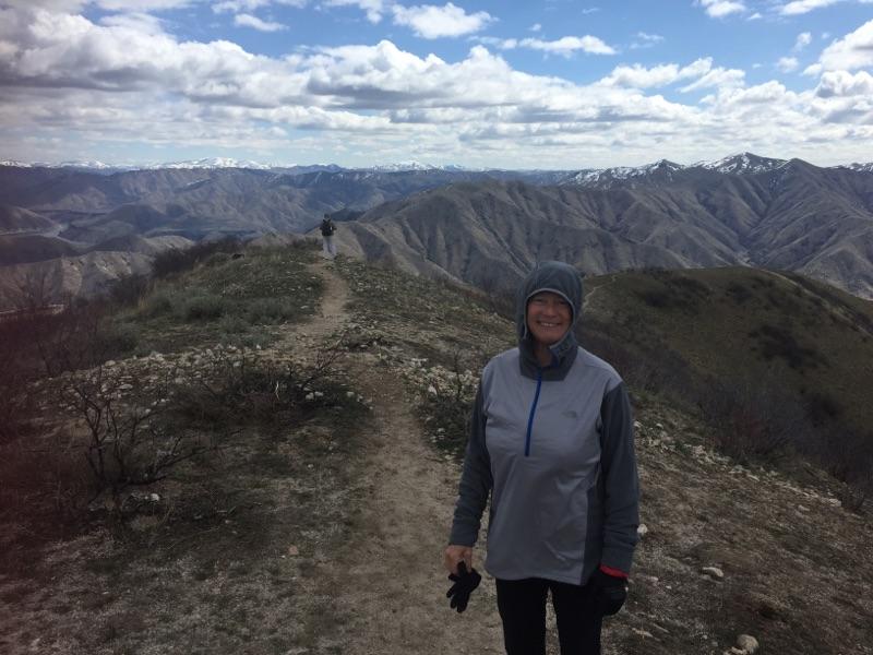
Great views of the Boise National Forest from the Station Creek Trail 
Top of Bald Mountain in Garden Valley
2. Hike Station Creek Trail to the top of Bald Mountain, Boise National Forest - Distance: 7.2 miles. Hiking time: 3.5-4 hours. Elevation gain: 2,000 feet. Rated moderate to strenuous. This is one of the best hikes with an actual trail in the Boise National Forest close to Boise. It takes about an hour to drive to the trailhead. Take Idaho 55 to Banks. Turn right and follow the Banks to Lowman Road to the Garden Valley Ranger Station. Look for a primitive road on the left side of the highway, directly across from the ranger station. That leads to the Station Creek Trail. It's a sweet hike on a singletrack trail through ponderosa pine trees to the top of the ridge. Ignore the short-loop junction on the way up the hill. Once on top of the ridge (mile 2.1), you'll see Bald Mountain looming off to the right (east). It's another 1.5 miles one-way to the top of the mountain, but not that much elevation gain. Easy-going stroll to the peak. There's a goofy looking steel four-legged thing on top of the peak. Do a selfie on top, and retrace your tracks back to the trailhead.

3. Bruneau River Overlook - This is more of a driving tour, than a hike, but there are places to hike once you reach the overlook. The reason to go there is to see the jaw-dropping chasm of the Bruneau River and rushing water below. Allow several hours to reach the overlook. Take I-84 to Mountain Home. Take the first exit and go south to the town of Bruneau. Make note of your odometer reading or zero your trip odometer. Go south on the Hot Springs Road. It's paved for several miles and then turns to dirt. 8.5 miles from Bruneau, go left on the Clover Creek-Three Creek Road. This is a good-quality gravel BLM road. Proceed south on the road to a signed right-hand turn (mile 15.7) for the Bruneau River Overlook. It's three miles to the canyon. Bring your camera and your binoculars. Look for eagles and hawks. You might even see some whitewater boaters running Five Mile Rapids below. There are several two-track roads next to the overlook that you can explore for some short hikes. Watch your footing next to the canyon! It's a long ways down!

Three Fingers from a close distance ... the road cut provides a trail to the top 
4. Hike to Three Fingers Mountain - Three Fingers is an easy hike to the top of a basalt-capped mountain in the big wide open country of the Owyhee Canyonlands. Distance: 2.4 miles out and back. Hiking time: 1.5 hours. Elevation gain: 833 feet. Rated easy to moderate. The hardest part of this trip is getting to the trailhead, and that's not too hard. A 4WD rig is recommended. Follow the directions in this blog post,  which provides driving directions to the trailhead, and also directions on the hike. This hike is located near Succor Creek State Park, so if you feel like taking your car-camping stuff, by all means, do that and stay overnight at the park. There is a rest room in the park and more hiking nearby.

The Big Wide Open, Owyhee Canyonlands in Eastern Oregon. Norman Nelson soaks in the view. 
5. West Fork Shoofly Quick Loop - Distance: 5.5 miles. Hiking time: 3 hours. Vertical gain: 846 feet. Rated moderate. This is a pretty easy hike that takes you into the Jacks Creek Wilderness. It requires a little bit of route-finding, so be sure to bring a map. I pioneered this hike when I was working on the Owyhee Canyonlands guidebook, and it turned out to be a keeper. Follow the directions in my blog post, which provides driving directions and hiking directions. You might want to bring a GPS to make sure you're on track. You'll climb up onto the Owyhee Plateau and see the Shoofly Canyon in the "Between the Creeks" area, another favorite hike that's longer and has a different trailhead.

My friend John Robison did this hike with his wife and twin daughters when they were 15 months. This is what he said about the hike: "Great hike! The directions were spot-on! The last two miles of side-hill hiking were not ideal ... I would rate the hike as "moderate" because of this. Having hiking poles definitely helped."

There you have it! Hope you can get out and enjoy the sunshine this weekend!
- SS

Thursday, October 22, 2015

Try these five scenic, kid-friendly fall hikes in the Boise National Forest close to home

Peace Rock Roadless Area, north of Garden Valley

Peace Rock Trailhead. The trail also is open to mountain biking and motorcycles. 
Cottonwood Creek Trail in the higher elevations ... 
Wendy on Station Creek Trail 
Bald Mountain, optional high point from the Station Creek Trail. Well worth it! 
Hi all,

The weather looks fabulous for just about anything outdoors this weekend, with highs in the mid-60s and lows around 40 in the Garden Valley or Idaho City areas, so I am recommending five scenic hikes in the Boise National Forest that you'll enjoy.

Remember that rifle deer season is still open in the Garden Valley and Idaho City areas, so wear bright colors and put bright colors on your dogs as well.

My top five hikes for this weekend:

1. Peace Creek Trail, Peace Creek Roadless Area, north of Crouch - This is a little-known gem near the Silver Creek Plunge. The Boise National Forest has a little blurb and map on the hike. I'd rate the hike moderate at the beginning and strenuous overall. It's five miles from the trailhead to a high point, and five miles back for a total of 10 miles. Vertical gain is over 3,000 feet to the top. Peace Rock Roadless Area is a wilderness study area. It's very scenic with big white granite slopes and rocks everywhere, mixed with big ol' ponderosa pine trees and aspens. Great place to go if you don't run into hunters. Getting there: Take Idaho 55 to Banks. Turn right and go to Garden Valley. Take Forest Road #698 north of Crouch along the Middle Fork Payette River to a junction with Forest Road #671, heading for Silver Creek Plunge, a hot springs resort. Go just past the resort, and you'll see the trailhead for Peace Creek. Take a Boise National Forest map or a Topo map with you. It used to be possible to hike from the high point in this hike back down to the Peace Creek Valley but that trail has fallen off the grid. So it's an out-and-back hike. Pack a lunch and bring plenty of water. Good for kids 8 and older. Stop at Silver Creek Plunge for a nice soak after your hike. Bring your swim suits.
Trip map for Peace Creek hike (Click to enlarge)

2. Cottonwood Creek, near Arrowrock Reservoir - This hike is in my book, Boise Trail Guide: 90 Hiking and Running  Routes Close to Home. Rated moderate for a casual out-and-back hike along Cottonwood Creek. It's 10 miles one-way to Thorn Butte Lookout on the Cottonwood Creek Trail, so it's generally too far to hike for a day trip, so just head up the Cottonwood Creek trail as far as you want and enjoy the day. Bring a lunch and water. Getting there: Take Idaho 21 toward Lucky Peak Reservoir. Turn right after crossing the Mores Creek bridge. Drive 15 miles along the bumpy dirt road next to Lucky Peak and Arrowrock. Turn left on Forest Road #377 and go three miles to the Cottonwood Creek Trailhead on the right. FYI: The trail crosses the creek multiple times on the hike, so be ready for that. The creek is running low, so the crossings shouldn't be a problem. Feel free to take the kids on this one.

3. Station Creek Trail - This is another one of my favorites, close to Garden Valley. See previous blog post for details. Rated moderate. The trailhead is directly across the Banks-to-Lowman Road from the Garden Valley Ranger Station. There's an optional climb to the top of Bald Mountain when you get to the top of the first ridge. It's worth the extra distance. The hike is kid-friendly for children 8 and over.
Map for Charcoal Gulch Trail ... The loop
is best done for biking or running. Best part
of the hike is in Charcoal Gulch. 
4. Hike Charcoal Gulch Trail in Idaho City. This one is pretty close to town next to the Idaho City airport, so hopefully you won't run into any hunters on this hike. You might see some road hunters at the top of the hike. Rated easy to moderate. Kid-friendly. Its two miles uphill on the Charcoal Gulch Trail to the top of the hike, and two miles back. Four miles total. You'll hike in a forested setting with views of quaking aspens here and there. Bring a lunch and enjoy the day. Getting there: Take Idaho 21 to Idaho City. Turn left on Main Street and follow it several blocks to a junction with Bear Run Road and Centerville Road. Go left on the Centerville Road, Forest Road #307, for a quarter-mile to Buena Vista Road. Turn left and follow Buena Vista past the airstrip to the parking and trailhead.
It's possible to bike to Stargaze as well but it's pretty steep! 
Brenda and Leo on the deck of Stargaze Yurt. Great 360 degree views! 
5. Hike to Stargaze Yurt - Here's an easy to moderate kid-friendly hike with great views of the surrounding countryside. You'll take Idaho 21 past Idaho City and Mores Creek Summit to Beaver Creek Summit. Park at the summit and follow the Park n' Ski Trail up to Stargaze Yurt and a high point overlooking the Boise National Forest. It's 1.4 miles to the yurt from the road. You'll be hiking in a forested setting with pockets of quaking aspen trees here and there. Bring a lunch and enjoy the day. If you've never stayed at Stargaze, you'll know why it's one of everyone's favorite yurts because of the high perch and good skiing in the winter.

You'll note that I did not recommend hiking from Mores Creek Summit because it's likely that deer hunters will be ever-present on the Pilot Peak Road or Sunset Lookout Road. Ditto with Banner Ridge trails.

Have fun!
-- SS