Showing posts with label winter hiking. Show all posts

Thursday, January 12, 2023

Five all-weather trails to enjoy when the foothills trails are muddy in Boise

Steve on top of the Bruneau Dunes. The state park is south of Mountain Home. 

Hi all, 

You've seen those horrible pics from Ridge to Rivers about people mucking up the trails and causing lasting damage! 

Sometimes I wonder if people are doing that on purpose, or if they just don't know there are alternative places to go walking, running or biking in the winter. 

When you see conditions
like this, turn around and 
head for an all-weather trail. 


Ridge to Rivers has a list of all-season trails that you can consult at times like this. 
All-weather trails have extra sand and gravel on the surface to absorb moisture and provide a pretty bomb-proof compacted surface. 

The weather this weekend will be on the warm side for mid-January, with a high of 49 degrees on Friday, 52 degrees Saturday, and 47 degrees Sunday. There's a chance of rain each day. 

So the lower R2R Trails are going to be muddy and best left alone! 

Here are some alternatives where you can go on a walk and not worry about causing damage on a muddy trail. You can enjoy yourself GUILT-FREE!

1. Boise River Greenbelt - Pick a loop walk/ride or an out-and-back and enjoy the views of the Boise River while you get some fresh air on a paved trail. Pick a part of the Greenbelt that may you haven't visited before! 

2. Eagle Greenbelt Loop - Do a loop walk/ride starting from Bardenay on the west end of the Eagle Greenbelt and go east three miles to the pedestrian bridge, cross the bridge and circle back around to the start. You'll have to walk/ride along Eagle Road to connect to the north channel greenbelt to finish the loop. There's an ample shoulder and places to avoid traffic.

Watch for bald eagles when you're walking/riding along the Boise River.  

3. Eagle Island State Park - There are trails along both channels of the Boise River in Eagle Island State Park that have suitable sandy/rocky surface for walking. People ride horseback out there too. 

4. Harrison Hollow All-Weather Trail in Boise Foothills - It's a short out-and-back hike but a very pleasant one on the Harrison Hollow All-Weather Trail. One mile out to the end of the all-weather section in the bottom of the gulch; one mile back. Park at the trailhead near Highlands Hollow Restaurant. 

5. Bruneau Dunes State Park - Climb to the top of Bruneau Dunes and enjoy a big view of the Snake River Plain.   

Have fun! 
- SS 


Thursday, January 18, 2018

My outdoor tip this week: Two of my favorite winter hikes on the Boise River Greenbelt

This pic was taken in March when birds were beginning to occupy nests in the heron rookery along the Eagle Greenbelt.
The rookery is one of the highlights of the trip in terms of wildlife watching. There's also a bald eagle nest in the area.
Take your hike in the evening and you'll see some amazing sunsets while geese fly overhead.
Walking/running trail on the south side of the Boise River, west of Barber Park. 
Boise River near Eckert Road bridge and Barber Park. 
Bald eagle perches in a cottonwood tree along the Eagle Greenbelt (off in the distance).
Hi all,

The warm weather we had mid-week inspired people to play golf and ride bikes in the Boise Valley, but winter is snapping back into swing starting tonight and tomorrow (Friday), especially in the mountains. We'll have rain in the valley tomorrow while it snows at Bogus Basin, Tamarack Resort and Brundage.

All three were getting hammered with snow on Thursday night. Powder day on Friday! Brundage and Tamarack had 10 inches of new overnight, and Bogus got 6 inches. Yay!

The skies are expected to clear for some potential bluebird skiing at Bogus on Saturday and Sunday, either downhill or cross-country.

Sunshine also is predicted for the Boise Valley this weekend, calling for blue skies and temperatures in the low 40s. So after skiing three days in a row at Brundage last weekend, I'm recommending a couple of my favorite winter hikes along the Boise River for this weekend ... staying closer to home.

Summer-view map of the Marianne Williams-Barber Park-Bown Crossing Loop 
The first hike is in East Boise, a 4-mile loop from Marianne Williams Park in Harris Ranch to Barber Park and the dirt/gravel walking trail on the south side of the river going back to Bown Crossing. You can connect to Marianne Williams Park by crossing the East ParkCenter Bridge. But before you do that, be sure to stop and get some coffee, beer or whatever in Bown Crossing. You're also close to Lucky 13 in Harris Ranch on the east side. Make it a fun outing combined with some food and drink.

Here's one of my previous blogposts with the full skinny on the loop from Marianne Williams Park in Harris Ranch to Barber Park and Bown Crossing.

Eagle Greenbelt loop has multiple options with the pedestrian bridge at the head of Eagle Island. 
My second recommendation is to do a 6-mile loop on the Eagle Greenbelt on foot or bike. There's always a good chance of seeing wildlife in this lesser-used area of the Greenbelt. The tour takes you from the start near Eagle Road to the pedestrian bridge spanning the Boise River at the head of Eagle Island. Then, you head west and follow the riverside trail back to Eagle Road. You'll need to walk or bike along the road for a short reach back to the north channel, and complete your loop. I recommend starting and finishing at Bardenay Restaurant, so you can get a meal and a beverage there after your outing.

Both of these hikes among a total of 90 are featured in my Boise Trail Guide. The book is available in most outdoor stores in the Boise area, on my web site, and on Amazon.com.

Have fun!
- SS

Thursday, January 4, 2018

Five outdoorsy ideas for the weekend - Free xc ski day, Mountain Coaster, Gateway tubing hill and more

Kids are having a blast on the Gateway Parks tubing hill at Eagle Island State Park in Eagle
Wendy skiing at Ponderosa State Park with Huck when he was a little puppy! He used to try to bite our ski tips. 
A lot of the foothills trails are icy ... get some traction devices for safety! 
Hi all,

These are challenging times for the winter outdoor enthusiast because of the lack of snow in recent weeks. It's hard to get excited about downhill skiing when limited slopes have been hit hard over the holidays, and there hasn't been any new snow to improve the base. Nordic skiing and snowshoeing conditions are much better in select places. DO YOUR BEST SNOW DANCE! WE NEED MORE SNOW!

In this week's outdoor tip, I'm recommending several activities that will allow you to make the best of the current situation:

1. Try xc skiing or snowshoeing on National Free XC Ski Day on Saturday, Jan. 6. Ponderosa State Park will have rental gear available for use and their trails will be open free of charge. They may even have some free instruction. Contact the park for details. The Idaho City Park n' Ski Areas will be open for free access (no fees charged in the parking lots for this one day only). You'll need to bring your own xc skis or snowshoes. Leo Hennessy with IDPR recommends snowshoeing the Banner Ridge Trail or the trail to Stargaze Yurt. The Skyline loop is groomed for xc skiing, but Leo said there are bare spots, and it has rained on top of the snow, making for a hard, slick trail. I'd agree with him and take your snowshoes. Lake Cascade State Park won't be participating this year because of lack of snow and icy conditions.

Reason to do this activity: Getting into xc skiing or snowshoeing is a great way to enjoy the mountains in the winter without burning a hole in your wallet. I've been doing both since I was a teen-ager.

Courtesy Kent Proesch YouTube 
2. Ride the Mountain Coaster at Bogus Basin. Hey, it's a brand new novelty, right? Everyone has to try it -- skiers and non-skiers/riders alike! The Glade Runner descends 4,330 feet at speeds of up to 25 mph. You conntrol your own speed. The track winds through the woods, climbing to over 40 feet in the air at times. The cost for single riders is $15 and $25 for two. I haven't ridden it yet, but I've heard good things. 

Courtesy Idaho Mountain Touring 
3. Pick up a pair of Yaktrax ice-grippers and go hiking or running on the Boise Foothills trails when they're frozen. Many of the trails are super icy right now, so it's pretty treacherous to do either activity without some traction devices. I checked out three models of Yaktrax at Idaho Mountain Touring - the Yaktrax Pro model ($30), which has metal coils that provide grip on the ice, Yaktrax Run models ($40), which are a combination of coils on the heels and studs on the ball of your feet, and Yaktrax Diamond Grips ($45), a more robust set that provides more grip on ice than the Pro model.

Trails are getting muddy the afternoon in Military Reserve ... be sure to get out early or later at night after things freeze! 
Check the Ridge to Rivers web site or Boise Foothills Trail Conditions Facebook page to get the latest information on trail conditions ... Lately, I noticed that they are seeing Table Rock trails turning muddy by late morning, and they are closed by noon on a daily basis right now. Ridge to Rivers also showed pictures of people hiking muddy trails in Military Reserve today (Jan. 4). Make sure you get out early and hike when things are frozen.

Gateway Parks tubing hill ... 
4. Take the kids tubing at Gateway Parks at Eagle Island State Park and/or go hiking along the river. There's fun little hill at the park where Gateway created two different tracks for tubing. It costs $15 for 2 hours of tubing. I went by there today and see a steady stream of people riding the magic carpet to the top for a fun ride down.

While at the park, there are some nice trails along the south and north channels of the Boise River. Bring your boot traction devices as mentioned above regarding the foothills trails. But I found the trails at Eagle Island to be mostly snow- and ice-covered and good for walking, all things considered.

5. Catch an inspiring film at the 15th annual Wild and Scenic Film Festival at the Egyptian Theater on Friday night. The film festival is sponsored by the Idaho Sierra Club chapter. Eleven adventure and conservation films will be featured. Should be fun!

There you have it! Have a fun weekend!
- SS

Thursday, November 30, 2017

Three kid-friendly pre-winter hikes - Browns Canyon, Eagle Island Park, Polecat Gulch

Browns Canyon in the winter sun ... not much light in the canyon! 
We took Huck to Browns Canyon when he was a puppy
Drew did great on the Browns Canyon hike 
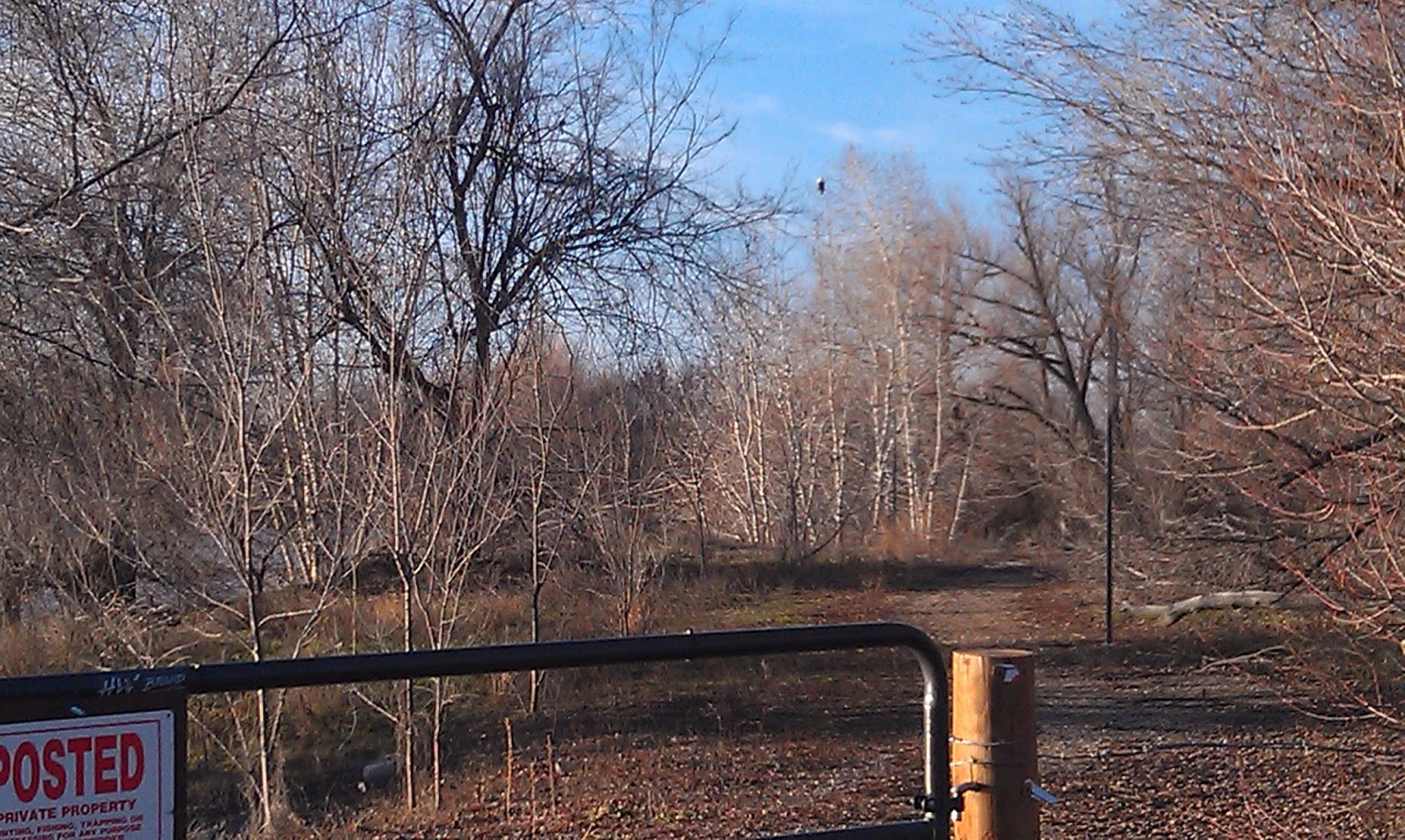
Redrock canyon, sagebrush and aspens 
Hmmm, where do we go now? 
Hiking the two-track back to the trailhead out in the open Owyhee country
Hi all,

These semi-cloudy cold days with temperatures in the low 40s don't seem all that appealing for outdoor recreation -- at least on the surface. But actually, once you get moving on a hike, a run or a bike ride, you'll warm up inside and enjoy your outing.

It is important to dress properly in layers and bring a warm hat and gloves/mittens so you stay comfortable, and peel layers as necessary as you warm up inside.

For this week's outdoor tip, I'm recommending three kid-friendly hikes -- Brown's Canyon in the Owyhees, Eagle Island State Park and Polecat Gulch in the Boise Foothills. Get the kids dressed up in appropriate clothes and take them out to explore the great outdoors in SW Idaho. Pack a lunch, snacks and bring plenty of water.

Remember that there's a "Cold Moon," a full moon that's supposed to appear 10%+ larger than normal this weekend, peaking on Saturday night/Sunday morning. It's supposed to appear as a full moon three days in a row -- Friday, Saturday and Sunday. That'll be a treat or maybe the coyotes will make too much noise and keep you up all night ...

For these outings, try to get out on Friday or Saturday morning. That's when the weather will be best. There's a 50 percent chance of rain on Saturday afternoon and Sunday in the valley. Just FYI. Most of these trips would be doable with a good rain coat.

1. Brown's Canyon Overland Tour, Owyhee Front, near Oreana. Distance: 5.2 miles. Difficulty: Moderate. Travel time: 3+ hours. This is an interesting hike in the sagebrush and rocks of the Owyhee Front until you come across Brown's Canyon, a hidden jewel. In my Owyhee Canyonlands guidebook, I detail a hike inside the slot canyons of Brown's Canyon, and a hike that goes around the slot canyon (thereby avoiding cold, deep-water pools) but you can still see it from above.

How to get there: Take I-84 East to Simco Road. Turn south on the highway to Grand View. Turn right on Idaho 78 in Grandview and head for the tiny old town of Oreana. There's a sign on the highway for a left-hand turn into town near MP 43. Make a note of your odometer. Drive down the hill straight into town, go past the old church (2.25 miles from the highway) and go straight on the Oreana Loop Road until it takes a hard left. Make the corner and take an immediate right on Alder Creek Road. Follow the bumpy dirt road six miles to a signed right-hand turnoff for BLM Road 700. Proceed down the grade to an old corral at a two-way junction. Park. The hike starts here.

The Hike: Go west on BLM Road 700 and climb a moderate grade over to a bluff that overlooks Browns Canyon. At mile 1.4, bear right on a two-track and drop down to the Browns Creek draw. This is a pretty area that's full of shrubs and aspens. The first slot canyon with blondish rock begins at mile 1.7. Cross over to the left side of the draw, as you go downstream, and walk overland through the blond rocks staying above the canyon. You'll break out into an open sage flat at mile 2.0. When the next slot canyon begins, climb up the slope to the left until you reach the top of the rim, and then hike along the rim as close as you feel comfortable to check out the slot canyon as you move along. In a half mile, the canyon breaks open by a draw, and you'll need to lose elevation. Hike into the bottom of the gully and climb back on top of the rim. There's a nice overlook when you reach the top again at mile 3. Continue on the left side of the canyon until you come to the dirt road crossing, and then turn right onto the dirt road at mile 3.6.  Follow the road to mile 4.0 at a two-way junction. Turn right again at a fence gate, and follow the two-track road (BLM Road #710)  back to the trailhead. Feel free to explore Antelope Springs along the way. It's another tight canyon.  

2. Eagle Island State Park - There's a nice 5-mile hike in the park that I detailed in Boise Trail Guide: 90 Hiking and Running Routes Close to Home. This particular hike tours both channels of the Boise River while also cruising around the outskirts of the park. You could easily do a shorter route in the park by just touring the North Channel of the Boise River. Start from the parking area by the pond and circumnavigate the park. I did the hike in a counter-clockwise direction. See the GPS tracks on the map below.


Getting there: Take State Street west of Eagle Road to a signed turnoff for Eagle Island State Park. There is a park entrance fee unless you have a statewide season pass via your vehicle registration. I always buy that pass ... it's a real bargain!

3. Polecat Gulch - Hike a 3-mile loop around Polecat Gulch in the NW Foothills of Boise. The loop takes about 1.5 hours, depending on walking speed. The hike described takes you on a tour of the finger ridges on the Polecat Loop Trail in sage and grassland habitat. You might see mule deer on this hike or even the albino deer! I rate this hike easy to moderate. Trailhead is at the north end of N. Collister, off of Hill Road. Go north on Collister to the trailhead parking area and rest room at the end of the road.

Hike up the main Polecat trail up the bottom of the draw to Quick Draw Trail, climb Quick Draw to the Doe Ridge trail. Go to the top of Doe Ridge (enjoy the views of NW Boise) and follow that trail over to the north side of the Polecat Trail complex. Turn right on to the Polecat Loop trail above the Cartwright Road trailhead and follow the loop trail along a steep hillside above the Terteling Ranch and Cartwright Road. Follow the trail as it wraps around the mountain and then drops back to the Quick Draw-Polecat junction. Go left or down-canyon on the Polecat Trail to return to the trailhead.

Have a great weekend! - SS