 |
| Have you climbed Three Fingers in the Owyhees? |
Hi all,
Boy, it's getting downright nippy this weekend! Fall is definitely getting a grip on Idaho! I'm seeing a possibility of snow showers in McCall and Stanley on Saturday, and low temperatures in the single digits! Sounds like a great forecast for elk hunting in the mountains.
But if you were interested in going out for a nice hike, I'd recommend heading for the Owyhee Canyonlands. I'm seeing high temperatures in the 50s for Homedale, which is just 30 minutes from Succor Creek State Park, and a high of 60 in Grand View, at the beginning of the Owyhee Backcountry Byway.
Picking just a few of my favorite hikes from my Owyhee Canyonlands adventure guide, I'd recommend Browns Canyon near Oreana, visiting Succor Creek State Park, Climbing Three Fingers near Succor Creek, or visiting Leslie Gulch, one of the most scenic locations in the Owyhee Canyonlands tucked inside the Oregon border.
 |
| Browns Canyon |
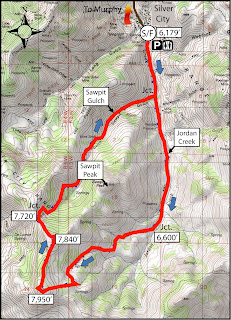
1. Brown's Canyon Overland Tour, Owyhee Front, near Oreana. Distance: 5.2 miles. Difficulty: Moderate. Travel time: 3+ hours. This is an interesting hike in the sagebrush and rocks of the Owyhee Front until you come across Brown's Canyon, a hidden jewel. In my Owyhee Canyonlands guidebook, I detail a hike inside the slot canyons of Brown's Canyon, and a hike that goes around the slot canyon (thereby avoiding cold, deep-water pools) but you can still see it from above.How to get there: Take I-84 East to Simco Road. Turn south on the highway to Grand View. Turn right on Idaho 78 in Grandview and head for the tiny old town of Oreana. There's a sign on the highway for a left-hand turn into town near MP 43. Make a note of your odometer. Drive down the hill straight into town, go past the old church (2.25 miles from the highway) and go straight on the Oreana Loop Road until it takes a hard left. Make the corner and take an immediate right on Alder Creek Road. Follow the bumpy dirt road six miles to a signed right-hand turnoff for BLM Road 700. Proceed down the grade to an old corral at a two-way junction. Park. The hike starts here.
 |
| Drewby liked Browns Canyon |
The Hike: Go west on BLM Road 700 and climb a moderate grade over to a bluff that overlooks Browns Canyon. At mile 1.4, bear right on a two-track and drop down to the Browns Creek draw. This is a pretty area that's full of shrubs and aspens. The first slot canyon with blondish rock begins at mile 1.7. Cross over to the left side of the draw, as you go downstream, and walk overland through the blond rocks staying above the canyon. You'll break out into an open sage flat at mile 2.0. When the next slot canyon begins, climb up the slope to the left until you reach the top of the rim, and then hike along the rim as close as you feel comfortable to check out the slot canyon as you move along. In a half mile, the canyon breaks open by a draw, and you'll need to lose elevation. Hike into the bottom of the gully and climb back on top of the rim. There's a nice overlook when you reach the top again at mile 3. Continue on the left side of the canyon until you come to the dirt road crossing, and then turn right onto the dirt road at mile 3.6. Follow the road to mile 4.0 at a two-way junction. Turn right again at a fence gate, and follow the two-track road (BLM Road #710) back to the trailhead. Feel free to explore Antelope Springs along the way. It's another tight canyon.
 |
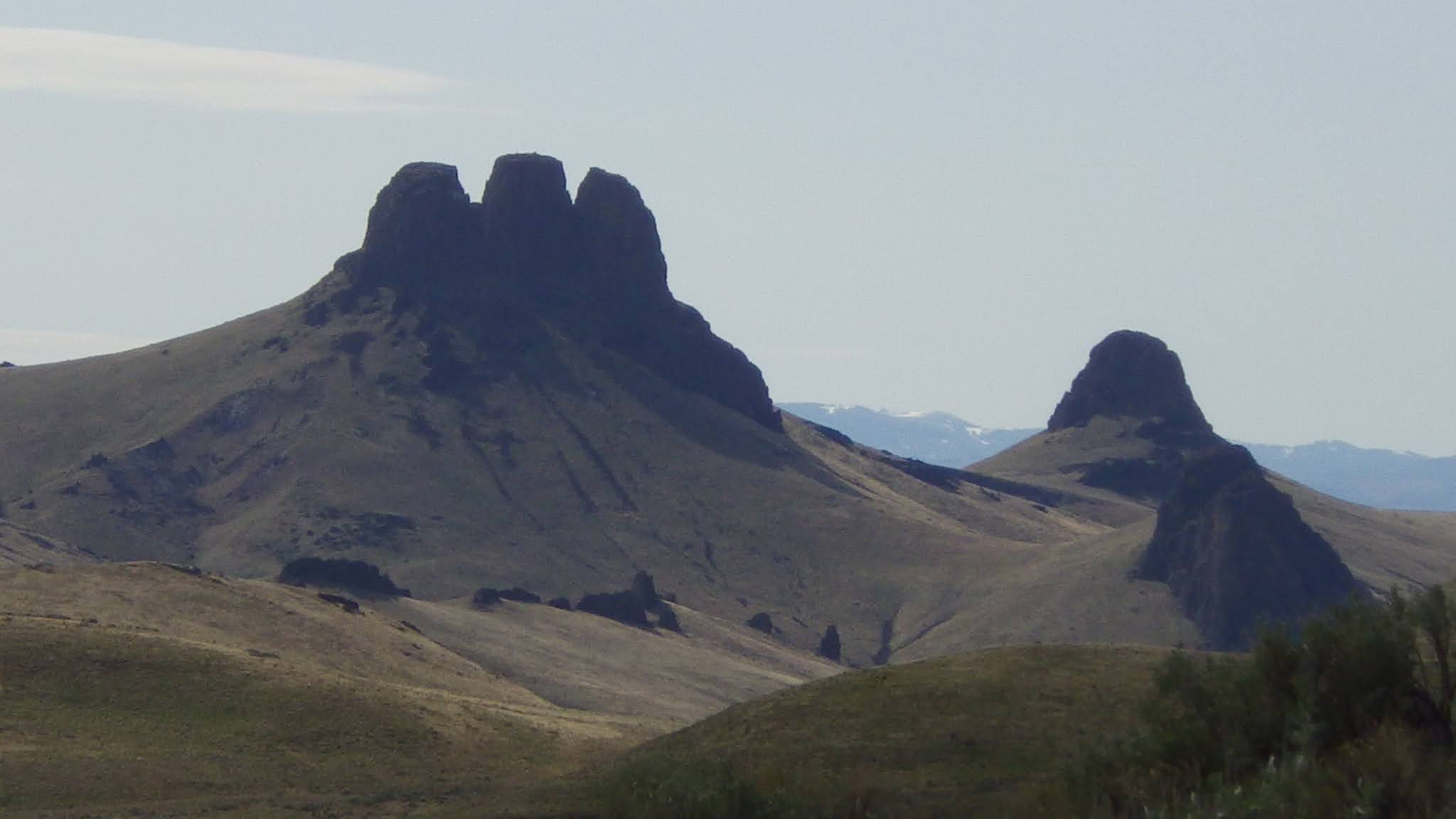
| Wendy at Succor Creek |
2. Visit Succor Creek State Park - Succor Creek State Park lies in the bottom of an incised canyon, surrounded by cool rock features left over from rhyiolite and basalt lava flows that occurred many millions of years ago. There aren't many official trails in the area, but cross-country hiking is a great way to explore it. Kids will enjoy the caves, in particular, and playing around by the creek.

Hike to Three Fingers
 |
| Bones for Huck to sniff |
The second thing was that someone has placed a silver canister at the summit of the first finger containing a number of notebooks inside. Several summit journals contain people's thoughts over the last 10 years. That's pretty cool. I made a few notes in one of the notebooks.
- SS