Showing posts with label Hulls Gulch National Recreation Trail. Show all posts

Wednesday, September 13, 2017

Five September hikes close to Boise - guaranteed to please!

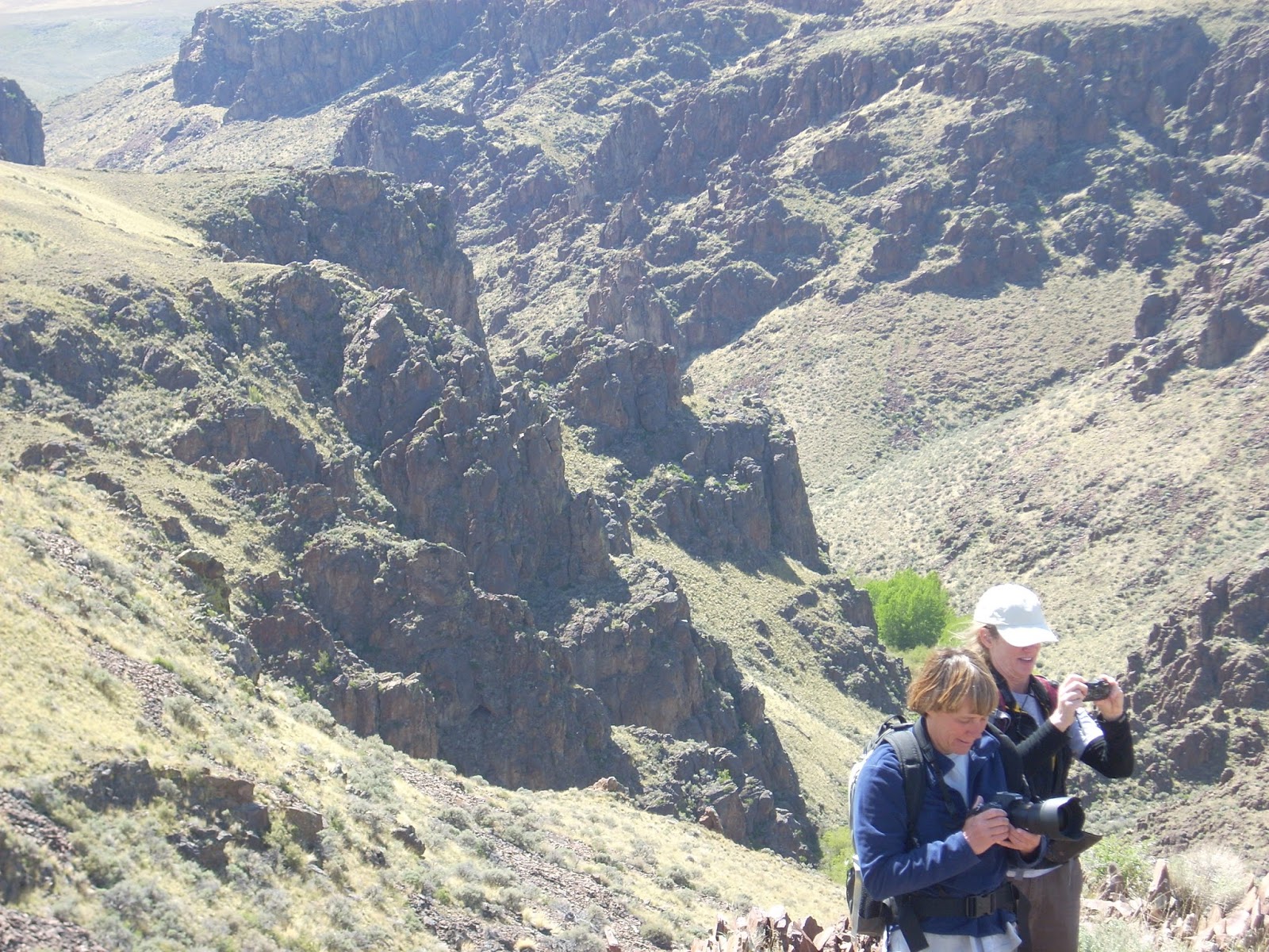
Amy and Robin apparently thought this spot was photogenic! Between the Creeks in the Owyhees. 
Wendy getting ready to take flight on top of a mountain above Toy Pass in the Owyhees 
Hi all,

It's SO NICE to see the hot weather moderating and the skies clearing of smoke! The Boise forecast is calling for highs in the 60s on Friday and Saturday, and 70s on Sunday. That's almost unbelievable considering the string of HOT weather we've had nearly continuously through July and August ...

So my recommendation is to enjoy the cool temperatures and plan a hike this weekend in the Boise Foothills or the Owyhees. All of these hikes are detailed in my guidebooks, Boise Trail Guide: 90 Hiking & Running Routes Close to Home, and The Owyhee Canyonlands, an Outdoor Adventure Guide. 

Here are my recommendations for five hikes guaranteed to please:

1. Hulls Gulch National Recreation Trail - Distance: about 5 miles or less. Difficulty: Moderate. Time travel: You make the call. Take the kids and the dog and go for a hike on the Hulls Gulch National Recreation Trail, starting from the BLM motorcycle parking lot about 3 miles up Eighth Street from the North End of Boise. Take the singletrack trail up the gulch, pausing to learn tidbits about geology and nature from the interpretive signs. Eventually, you'll come to a fork on the trail, go right to see the headwaters. Maybe the creek will be running? Turn around and return the way you came.

Exploring granite outcroppings above Hulls Gulch 
2. Dry Creek Trail - Distance: You make the call. Difficulty: Moderate to strenuous. Time Travel: You make the call. It's a stout hike to hike on the Dry Creek Trail from the trailhead on Bogus Basin Road to the top of the Boise Ridge, but you really don't have to go that far. Just walk up the creek as far as you'd like, and enjoy the day in the cool, creekside, shady environment. Pack a lunch and enjoy the day! For the hard-cores, it's 6.8 miles to the top of the trail, if you want to do a 15-mile day and power walk it.

3. 5 Mile Creek-Watchman-Three Bears Loop - Distance: 6 miles. Difficulty: Moderate to strenuous. Time Travel: 2.5-3 hours. Drive up Rocky Canyon Road from the end of the pavement to the Five Mile Trailhead on the left. The hike starts here. The loop brings you right back to your rig. Pretty cool. Hike up Five Mile Creek several miles to the Orchard Junction, keep going straight along the creek, and the trail turns into Watchman at the top of the steep hill. Follow Watchman as it contours around the mountain, visits another creek, and then descends to the top of the Three Bears grade. Make sure you go left at the junction with Trail #6. Take a breather at the top of the grade, and then it's all downhill to Three Bears junction at the saddle, go left and drop down to Rocky Canyon Road. Go left on the road, and your car is around the corner.

Three Bears Trail heading back to Rocky Canyon Road rounds out the Five Mile-Watchman Loop 
4. Between the Creeks Loop, Owyhee Canyonlands - Distance: 8 miles. Difficulty: Moderate to strenuous. Travel time: 5 hours. See my blog post for photos and details of this hike ... it's one of my all-time favorite hikes in the Owyhees, especially because it's relatively close to Boise. Allow 1.5 hours to reach the trailhead, depending on how fast you drive. The scenic hike takes you on an upland tour of West Shoofly Creek and East Shoofly Creek on top of a plateau, hence the name, "Between the Creeks." The rhyolite canyons are craggy and beautiful.

Top of the mountain to the west of Toy Pass
5. Toy Pass, Owyhee Canyonlands - Should be beezy and cool up on Toy Pass this weekend, making for great hiking conditions. Two optional hikes take off from Toy Pass in the Owyhee Front, near Oreana, starting at 5,875 feet. One hike is 5.3 miles exploring the mountain to the east of the pass, and the other is 4.5 miles, exploring the small knob on the west side of the pass. Take I-84 to the Simco Road exit. Turn right on Simco Road and proceed to the state highway. Turn right at the highway and proceed to Grand View. Turn right on ID 78 in Grand View and then take the second left-hand turn to Oreana. Drive through the little town and go past the Basque church, then bear right on the signed Bachman Grade Road. Follow the well-maintained dirt road to the top of Toy Pass (about 13.5 miles). Park at the pass, and decide which mountain you'd like to climb from there. There are some nice car-camping spots on the south side of the pass, heading toward Triangle.
- SS

Wednesday, June 7, 2017

With return of cool weather, let's go hiking and biking in Boise & the Owyhees

Back of Beyond Three Fingers Mountain Bike Loop 
Browns Canyon 
Drewby liked the Browns Canyon Overland Tour ... we stayed out of the brush! 
We took Huck on a hike in Browns Canyon when he was 8 weeks old ... 
Hi all,

After a brief blast of heat, bringing many of Idaho's rivers to peak flow, we're going to have some cool weather this weekend, creating ideal conditions for hiking or biking in the low country. There's still a lot of snow up high, and it was a major bummer to see Idaho 21 get closed between Grand Jean and Stanley because of a road-washout ... that will take time to repair! Maybe they'll at least open one lane with a flagger?

This week, I'm recommending one hike in the Boise Foothills, one super-cool hike in the Owyhees, and two fun mountain bike rides in the Owyhees. The window on desert trips is closing soon, so get out and enjoy it. Watch for snakes. All of these trip are drawn from either Boise Trail Guide: 90 Hiking and Running Routes Close to Home, or the Owyhee Canyonlands: An Outdoor Adventure Guide.

Here are my recommendations:

  • Hulls Gulch Interpretive Trail - The creek in Hulls won't be running for too much longer, so
    Wendy in Upper Hulls Gulch 
    now is a great time to hike the trail with live water, which also attracts insects, birds, reptiles and wildlife. Drive up north 8th Street to the motorcycle parking lot. There's a trailhead for the Hulls Gulch Interpretive Trail here. The trail is open to hiking only, so you won't have to worry about encountering people on bikes. The trail climbs for several miles, crosses the creek multiple times. When you come to a fork in the trail, go right to see the waterfall in the headwaters of Hulls Gulch ... as long as the creek is running. Rated moderate. Travel time: allow 2 hours or so. 
  • Ride the Wilson Creek Loop in the Owyhees - A lot of people love this ride. Roughly 16 miles. Rated strenuous. About 4 hours riding time, including breaks and stopping for lunch. See details in this blog post.  
  • Hike Browns Canyon slot canyon or overland tour - Two different hikes are detailed in my Owyhee guide. One takes you into the interior of Browns Canyon, where you may encounter stinging nettles, poison ivy and deep water in the creek ... clothing attire can be challenging! But an adventure for sure! The overland tour circumnavigates the slot canyon, allowing you to enjoy the scenery from above and stay dry. The overland tour is 5.2 miles, rated moderate, with 3+ hours hiking time. The slot canyon hike is 2.8 miles, rated strenuous canyoneering, travel time 3+ hours. 
Directions to Browns Canyon trailheadGetting there: Take I-84 west to the Nampa city center exit. Drive into downtown Nampa. Follow signs for Idaho 45 to Murphy. Follow Idaho 45 to Walter's Ferry, cross the Snake River, turn left on Idaho 78 and drive to Oreana. You'll see a signed turnoff to Oreana on the right near Milepost 43. Go right and make a note of your odometer. Drive into town. Go past the church (2.25 miles from the highway) and go straight on the Oreana Loop Road until it takes a hard left. Make the corner and then take an immediate right on Alder Creek Road. Follow the bumpy dirt road six miles to a signed right-hand turnoff for BLM Road 700. Proceed down the grade to an old corral at a two-way junction. Park. The hike starts here. 

This trail is closed in the spring because of sage grouse lekking activity nearby. 
DirectionsGo west on BLM Road 700 and climb a moderate grade over to a bluff that overlooks Browns Canyon. At mile 1.4, bear right on a two-track and drop down to the Browns Creek draw. This is a pretty area that's full of shrubs and aspens. The first slot canyon with blondish rock begins at mile 1.7. Cross over to the left side of the draw, as you go downstream, and walk overland through the blond rocks staying above the canyon. You'll break out into an open sage flat at mile 2.0. When the next slot canyon begins, climb up the slope to the left until you reach the top of the rim, and then hike along the rim as close as you feel comfortable to check out the slot canyon as you move along. In a half mile, the canyon breaks open by a draw, and you'll need to lose elevation. Hike into the bottom of the gully and climb back on top of the rim. There's a nice overlook when you reach the top again at mile 3. Continue on the left side of the canyon until you come to the dirt road crossing, and then turn right onto the dirt road at mile 3.6.  Follow the road to mile 4.0 at a two-way junction. Turn right again at a fence gate, and follow the two-track road (BLM Road #710)  back to the trailhead. Feel free to explore Antelope Springs along the way. It's another tight canyon. Camping: If you'd like to stay out overnight, you could camp at the trailhead or near Browns Canyon.  
  • Back of Beyond Three Fingers Loop - This is one of my favorite mountain bike rides in the Owyhees on the Oregon side, near Carlton Canyon and Painted Canyon. The scenery is gorgeous -- you'll see neat canyons, hoo doos and other rock features, similar to what you see at Leslie Gulch. Distance is 22 miles. Rated strong intermediate/advanced. Tread: All two-track roads. Travel time: 3.5-5 hours. Bring plenty of water and a lunch. Getting there: Go to Succor Creek State Park, and continue south 6 miles to an unsigned dirt road on the right at the top of a grade. This is McIntyre Springs Road. Go right and follow the dirt road 3 miles to an unsigned two-track on the left. This is your trailhead. Follow the directions on the map below. The scenery is gorgeous on this ride -- you'll see neat canyons, hoo doos and other rock features. Detailed directions are in my Owyhee book. Bring a BLM map, topo map and a GPS for best navigation.

Trailhead is off the McIntyre Springs Road and near the Three Fingers hike ...  

There you have it! Have fun! 
- SS 

Thursday, September 16, 2010

Hulls Gulch National Recreation Trail is a sweet treasure close to Boise

Upper Hulls Gulch ... the trail is at the bottom of the draw

Watch for wildlife along the way

Main trailhead 3 miles up 8th Street

Hi all,

Lower Hulls Gulch is probably the most popular trail in the Boise Foothills, a place where people go hiking, biking, jogging, dog-walking, bird-watching, you name it.

But 3 miles up the hill is the best part of the Hulls Gulch, and you'll rarely see anyone up there. It's called the Hulls Gulch National Recreation Trail, and it's also known as the Hulls Gulch Interpretive Trail because of the educational signs about geology and nature that you'll see along the way. It's great for kids and families, and really, just about anyone.

The BLM developed the trail many years ago, and it was closed to mountain biking in the late 1980s to set a QUIET tone for the upper watershed, where hikers, runners and school kids can tour the area without fear of confronting speeding cyclists.

There are three ways to experience the trail, all with different mileage and experience:

1. Standard route - Drive 3 miles up North 8th Street after it turns to dirt and you'll come to a large parking area with rest rooms. This is the primary trailhead for the Hulls Gulch National Recreation Trail. It's a 6.5-mile hike to do the full tour of the trail to the upper watershed of Hulls Gulch, where the trail loops around the headwaters, passes by a waterfall (most impressive in the spring), and and returns to the trailhead. You should allow 2.5-3 hours for the trip (not including the drive). Mary Beth Anderson did a nice job detailing this route in her blog.

2. Upper Trailhead - Go past the main parking area and drive several more miles up 8th Street to the Upper Trailhead, which is well-marked. The road is rough with big holes and water dips. You'll need a high-clearance 4WD rig to make it up there. The upper loop is 2.5 miles to the tour the upper watershed. Here's a nice little description about that section from trailsandtread.com. This hike would take about an hour and a half.

3. Lower and Upper Hulls Gulch Trail - Strong runners and hikers will enjoy this approach, which I detailed in my guidebook, Boise Trail Guide: 75 Hiking and Running Routes Close to Home. It's 11.5 miles from the Hulls Gulch Trailhead by the Foothills Learning Center to the top of the Hulls Gulch National Recreation Trail and back. Hiking time would be about 5 hours; running time 2.5 hours.

While you're out on the trail, watch for wildlife, songbirds, hawks flying overhead and animal tracks. See if your kids can identify tracks and scat.

A fourth option would be to shuttle a vehicle if you have young children or seniors along who may not be able to climb very well. You could start at the Upper Trailhead and work your way downhill to the main trailhead. This trip would be about 3 miles downhill.
FYI - If you don't have Boise Trail Guide, you can download a detailed description and map of Hulls Gulch National Recreation Trail for 99 cents at www.stevestuebner.com.

Have fun!
- SS