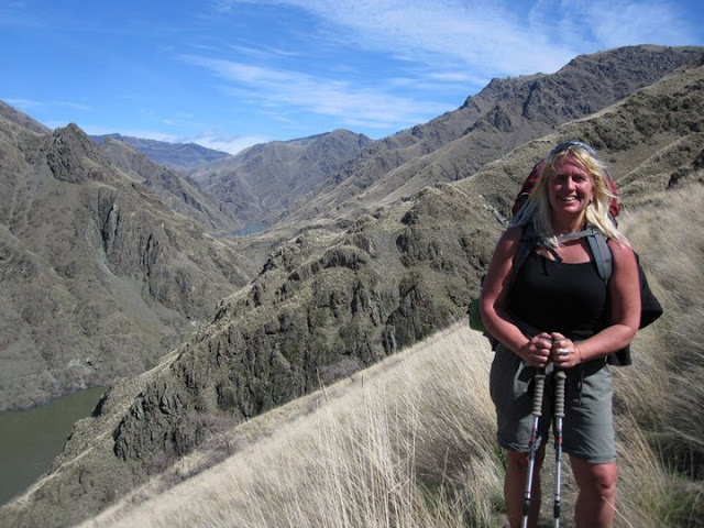
If you've got a suitable 4x4, truck camping in hard-to-reach places can be gratifying!
Hi all,
The 4th of July long weekend is coming up! Many people have already made plans, but in case you haven't and need some inspiration, I am recommending 10 must-see, must-do activities not only for this weekend, but for the whole summer season:
1. Float a river (day trip) - we're blessed with so many options here, but the summer season is now open on the Boise River! See details about floating the Boise River, renting a raft, etc. Warm summer weather also gets people jazzed about floating the Payette River, either the Main Payette, South Fork Payette or Cabarton run on the North Fork. Check with Cascade Raft & Kayak, Bear Valley Rafting, Idaho Whitewater Unlimited and the Payette River Company about guided trips. The Payette's calmer sections are great for stand-up paddle boarding (SUP), sit-on-top kayaking and canoeing. See my post about 10 premium locations to go kayaking or SUP'ing in SW Idaho.
Float a river! This is on the Cabarton stretch of the Payette River.
2. Climb a mountain - The pinnacle is to climb Mount Borah, but there are so many other options in Idaho, with dozens of peaks over 10,000 feet and 8 peaks over 12,000 feet. See Idaho mountain expert Tom Lopez's list of recommended mountain peaks. McCall mountain expert John Platt also has an extensive list of peaks and mountains that he's climbed.
4. Take your kids fishing - See the list of Idaho Fish and Game's Family Fishing Waters to find some great recommendations close to home.
5. Go backpacking in the Sawtooths, White Clouds, Pioneers or Big Lost Mountain Range. Snow levels are at roughly 7,500-8,000 feet in the Sawtooths, creek crossings are high and hazardous, See Michael Lanza's recommended hikes in the Sawtooths in his blog, the Big Outside. See a recommended major loop in the White Clouds in Backpacker mag. For a great hike in the Pioneers, see my blog post about hiking Broad Canyon. For the Big Lost range, see this overview in Summit Post.com.
6. Sleep under the stars in a dark sky venue like Bear Valley in the Boise National Forest, the Owyhee Canyonlands or outside of Stanley.
Catch a trout on the Middle Fork Salmon River.
7. Fly into the Middle Fork of the Salmon River and go fly-fishing for native cutthroat trout. Air taxi services in Boise, Cascade or McCall can take you into the Middle Fork in less than an hour. All fishing is catch and release.
Climbing up a short hill to finish the Fisher-Williams Loop (courtesy Salsa cycles)
9. Go SUP'ing, boating or swimming in a refreshing, natural Idaho mountain lake like Payette Lake, Redfish Lake, or Priest Lake. See my post on 10 perfect paddling destinations for kayaking and SUPs in SW Idaho for ideas.
10. Go car camping in the Middle Fork Boise River area, North Fork Boise River area, the Middle Fork of the Payette River area or Bear Valley. There are some reservable fee campgrounds and some dispersed camping areas. See the Boise National Forest, Payette National Forest or Sawtooth National Forest web sites for more information.
For further enrichment on Idaho bucket list trips, see an Idaho bucket list post from Boise State radio, and a post that I did listing another 30 bucket list trips that they didn't cover.
Remember: Be smart about Fire Safety this weekend ... we put out a post yesterday from Recreate Responsibly Idaho reminding folks that no fireworks are allowed on public lands, no exploding shooting targets, and be sure to put out your campfire before you leave the site ... make sure it is completed out, cold to the touch. - SS
Denise Lauerman enjoys a spring backpack trip in Hells Canyon.
Hi all,
Spring is just four days away on Sunday, March 20, so the actual spring season according to the official American calendar is upon us. The trails and roads in the low country are beginning to dry out - in between rain storms - and the weather is warming up into the 60s at times. That gets people antsy for an outdoor adventure.
For my outdoor tip of the week, I'm recommending three sweet hikes that shine in the spring in SW Idaho:
- Snake River National Recreation Trail in Hells Canyon, starting from Pittsburg Landing.
- Rapid River Trail in Riggins.
- Mary's Creek and Sheep Creek in the Bruneau River country.
The weather forecast for this weekend looks sunny on Friday with a high near 60, cloudy and rainy on Saturday, and then clearing and sunny on Sunday with a high of 50. That's the forecast for Boise and Riggins. Even if this weekend doesn't work to visit these destinations, you could wait and visit one of them at another time.
Snake River National Recreation Trail. A few years ago, I wrote about hiking or backpacking 6 miles (one way) from Pittsburg Landing to the Kirkwood Historic Ranch. A friend of mine, Denise Lauerman, and two of her friends backpacked to Kirkwood, and spent a couple of nights camping in Hells Canyon before returning to the trailhead in Pittsburg Landing.
"It was a great trip -- I can't wait to go back," Denise said.
Hells Canyon, the deepest gorge in North America at over 7,000 feet, stradles the Idaho-Oregon border for more than 100 miles. The mighty Snake River flows through the heart of Hells Canyon and continues on to Lewiston. Hells Canyon is usually the warmest spot in Idaho, and it's also drier than many areas, so it's a good bet for a spring trip. Ditto in the fall. In the middle of the summer, it gets sizzling hot; hence, the name. The austere black rocky canyons also have contributed to the name.
The trip starts with a 4.5-hour drive from Boise to Pittsburg Landing, the trailhead, via ID 55 to New Meadows, U.S. 95 to Whitebird, and then a well-maintained, steep gravel road from Whitebird over Pittsburg Saddle to the trailhead at Lower Pittsburg Landing. Signs will guide you the whole way from Whitebird. Four-wheel-drive is not required.
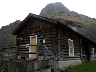
Kirkwood Museum
It's 6 miles from the trailhead to Kirkwood Ranch. Denise and her friends drove in on a Friday, backpacked to Kirkwood in the afternoon (allow 2.5-3 hours travel time) and base-camped on the grass next to the Kirkwood Museum, where former Idaho Gov. Len B. Jordan and his wife, Grace, ran a sheep ranch in the 1930s.
The museum is definitely worth visiting. Behind the ranch, there is a two-track gravel road that climbs Kirkwood Creek for more than 3,000 feet to a high saddle. This is a great side-hiking opportunity that Denise and her friends climbed on Day 2, seeing all kinds of cool wildlife and landscapes along the way.
On Day 3, they side-hiked to Suicide Point along the Snake River, came back to Kirkwood, strapped on their backpacks, and hiked out. Suicide Point provides great views of the river canyon.
This is a beautiful hike along Rapid River when things are greening up and coming to life in Riggins. Here's a description from All Trails. Full length is 8.6 miles out and back. You may not be able to go to the top of the hike, but you could likely hike a couple of hours to a high point that works for you. The trail winds along the river and then climbs up on a high ridge. Great views of the surrounding area.
Trailhead is next to the Rapid River Hatchery on the south end of Riggins. Watch for signs on U.S. 95 to the hatchery.
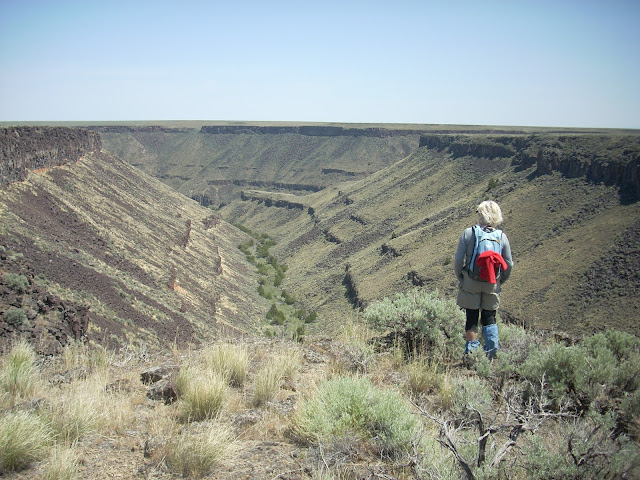
Barb Cochran looks into Mary's Creek canyon, a tributary of Sheep Creek.
Mary's Creek and Sheep Creek
Mary's Creek is one of the easiest places to access in the Jarbidge-Bruneau Wilderness. You can do a 8.75-mile loop hike from the Mary's Creek Trailhead to Sheep Creek canyon and back. The route I recommend in my Owyhee Canyonlands book takes you along the edge of Mary's Creek canyon, which features large black lava rock, and then you drop quickly into Sheep Creek canyon (rhyolite and basalt) where you can have lunch or camp out next to the creek. And then retrace your tracks back to the trailhead.
You also can camp at the Mary's Creek trailhead or in other BLM dispersed camping areas off the Roland Road.
Getting there: Take I-84 to Mountain Home, then Idaho 51 to Bruneau. Head south on Idaho 51 toward Duck Valley. It's about 40 miles from Bruneau to the signed turnoff for Roland Road on the left side, just past the old bar and junk yard in Grasmere. Go left on Roland Road and take that good-quality gravel road 5.2 miles to Mary's Creek Wilderness trailhead.
Dan and Michelle Noakes at the Idaho-Canada border ... the end of the ICT on the Upper Priest River by a cool waterfall.
Hi all,
Dan Noakes emailed me yesterday, saying that he had just completed the Idaho Centennial Trail. He shared a video trailer with a few nuggets from the super-challenging 900-mile journey. I took a quick look at the video, and it was a visual feast.
The stream-crossings that he captured on video looked scary and epic, including one where he's doing a belly-crawl across a skinny lodgepole pine tree over the top of a rushing stream. And then there's this segment where he's saying "I'm so cold, I'm so cold," running with his pack on through the forest to avoid hypothermia. Take a look ...
Dan wrote me because I wrote a guidebook about the Idaho Centennial Trail for the Idaho Trails Council in 1998. We didn't have a lot of budget, but it was a first attempt to provide a detailed guide to navigating the trail, albeit with horrible big-picture maps that were scaled to page size and reprinted from BLM and Forest Service maps.
The value of the book is that folks can learn about the history of how the trail was created through the inspiration of ICT pioneers Roger Williams and Syd Tate, who hiked the length of Idaho in the mid-1980s. It was the first time that anyone had done that, to anyone's knowledge, and it served as inspiration to create an official Idaho Centennial Trail route during the Idaho Centennial year in 1990. Williams and Tate took 86 days to complete the journey, hiking at a pace of 14 miles a day. By the end, they each had lost 20 pounds and Tate had a big long beard. "Our legs looked like a weight-lifters and the top half looked like a prisoner of war," Williams said.
Stateline Trail on the Idaho-Montana border
ICT route (courtesy IDPR)
Left route is an alternative
route for motorcyles and bikes
The final ICT route ended up being a little different than the one that Williams and Tate did. It was selected by a committee of ITC people and Forest Service and BLM staffers. But the route overall did fulfill the vision that Williams charted from the get-go -- he wanted it to go through the "Best of Idaho," meaning the Sawtooth Wilderness, the Frank, the Selway-Bitterroot, the Stateline Trail, and the Cabinet Mountains in the Idaho Panhandle.
Noakes, 33, ripped through the 900-mile route in 52 days. He started on May 21 on the Idaho-Nevada border and finished the trek at the Idaho-Canada border on the Upper Priest River trail last week. His wife, Michelle, hiked the last section with him from Clark Fork to the Canadian border. Michelle helped with water and food drops, and Noakes had a friend join him for another segment of the hike. But for much of the route, he hiked alone. Did you know that the ICT hike features 90,000 feet of elevation gain/loss?
Noakes' father got him into backpacking when he was 11 years old. They often hiked the John Muir Trail. "He ingrained in me the spirit of backpacking," Noakes says. "I always wanted to check off a through-hike."
He found out about the Idaho Centennial Trail through a Google search, just looking for big through-hikes. He thought, it's only 900 miles, shouldn't be too big of a deal ... but when he was out in the big wide open Jarbidge and Bruneau desert, hiking the two-tracks next to those big canyons, and realizing how far he had to go, "I realized this was going to be a big deal. It was the real deal."
Noakes planned to hike at least 20 miles a day; sometimes more if he felt he could go farther. He carried a light-weight pack of just over 30 pounds with all of his gear -- clothes, cook stove, food, water, sleeping bag, sleeping pad, tent, etc. He wore Altra Timp hiking shoes, and went through several pairs during the big adventure.
To plan the trip, Noakes ran across Clay Jacobson's web site, Idaho Centennial Trail.org, which provides a ton of useful information, including the names of the people who have done the thru-hike in recent years. Thomas Ord told him where to do the water drops in the desert section. Another hiker gave him the complete GPX file to the ICT, the trail tracks for the whole route.
There's still just a handful of people who have completed the trail since it was designated in 1990. It's not that well-known, or heavily publicized, and the difficulty level is pretty extreme in the Frank Church-River of No Return Wilderness and the Selway-Bitterroot Wilderness because of heavy blowdown and trail-finding. That's a sad commentary, compared how things were 30 years ago, when the trails in those wilderness areas were some the most well-maintained anywhere in the state.
Fortunately, Noakes had a good GPS that had the ICT route built-in, and he forged ahead, knowing he was going in the right general direction. He hoped to rejoin the trail when it became visible again. "I lost the trail many, many times," he says. "The trail is non-existent at some points."
Segments of Marble Creek, upper Kelly Creek and Windy Creek had a lot of downfall, but at least things improved after a few hours of walking, he said. The Idaho Trails Association and Frank Church-Selway Bitterroot Foundation have been working on opening up Marble Creek for several years. But once he got into the Selway-Bitterroot Wilderness section, he said, the route-finding and hiking were miserable.
"That section was the hardest for me. Every day, it was cold, rainy and wet, and the blowdown trees were epic. The challenges in the Selway would make a grown man cry. But what makes it so great, is that after you get through there, you think, dang, I did this. You feel a real deep sense of accomplishment."
Michelle met him at Wilderness Gateway Campground on U.S. 12 next to the Lochsa, and Dan must have been SO happy to see her! Imagine how that experience may help in other aspects in life, when he'll feel his patience tested by whatever, and he'll know that he's experienced far more difficult things on his ICT hike. "I was in pain pretty much the whole time," he says.
When Noakes arrived at Moose Creek Ranger Station in the middle of the Selway-Bitterroot Wilderness, he sniffed a campfire burning and went directly to it. Some pilots were hanging out by the airstrip, and they warmed him up. That was one of his favorite moments of the hike.
He also really enjoyed the Stateline Trail between Idaho and Montana, going north from Hoodoo Pass to Wallace. "The could be some of the greatest backpacking in that area," he says. "But when I was there, I was walking on snow most of the time." He took a break in Wallace, wandered into the public library in town, and ran across my ICT guide. He hadn't seen it before the trip. He loved reading about Syd and Roger's vision and adventure.
In terms of wildlife, Noakes saw a big wolf on a hillside on a stormy day. He wasn't able to get any pics or video. He saw a lot of wolf tracks along the way, a few elk, 1 moose and 1 bear. He heard from another ICT hiker that the guy had gotten charged by a black bear. That would be scary.
Noakes, who's a professional video animator for his company, Motifize.com, plans to release a new video segment about his big adventure each Monday until he's exhausted his video from the trip. The first segment will run on Monday, July 23, on his YouTube channel and continue each week. I know I'll be watching.
"There's something magical about the Idaho Centennial Trail," he says. "I think if you experience it, it might change you for the better. For a lot of people, it could be a life-changing experience, and here it is, right in our backyard."
Kelly Creek country ... it's located in a roadless area that is not official wilderness, but wilderness just the same.
When I did the ICT book, I suggested that every Idahoans should consider making it a lifetime project to experience all the segments of the ICT. Not everyone can do it in one fell swoop, especially if they're working a full-time job, raising kids, etc. Noakes agrees. "Everybody needs to experience the ICT at some point in their lives."
While other long-distance trails can be tackled as well, such as the Appalachian Trail, the Pacific Crest Trail, or the Continental Divide Trail. But the ICT is probably one of the most challenging and primitive thru-hikes anywhere in the U.S. You won't see many trail signs. You'll frequently lose the trail. You'll have to deal with a ton of blow-down timber across the trail. You'll have to navigate super-challenging stream crossings. But it will make you a more skilled outdoors person, and perhaps a better and stronger person overall.
I am hoping to do it in the next 5 years while I still can! Hope you can plan a trip on the ICT too! Thanks to Dan Noakes for the inspiration!
- SS
Relaxing on big granite rocks on the shore of Big Lookout Lake
Heart Lake
Big Rainbow Lake
My new pack ... much lighter than the old Kelty!
Wendy hikes toward the top of the pass
Hi all,
After spending quite a bit of time on the river this summer, I had a strong itch to go backpacking last weekend. I wanted to go somewhere relatively close by, as both Wendy and I had work stuff going on through Friday afternoon, but we still wanted to get out of town Friday night. We decided to head for the Trinity Lakes, a sweet lakes basin under the shadow of towering Trinity Mountain Lookout (elevation 9,451 feet).
We figured that the Trinities would probably be relatively clear of smoke, being well south and west of the leading edge of the Pioneer Fire. And that turned out to be true!
It'd been 20 years since I've been up to the Trinities, quite honestly, and I forgot how long it takes to get there, even if you go through Prairie, the most direct route via 3 hours of dirt roads. Wendy and I took Black's Creek Road to Prairie on Friday evening, and enjoyed the scenic drive along the South Fork of the Boise River. It was about 8 p.m. as we pulled into Prairie, and I figured we'd better look for a campsite somewhere along the forest road because we had some lamb steaks to BBQ. We were still an hour from the Trinities, and it'd be dark by then. We spied a nice outhouse by the Prairie Airstrip and car-camped by a picnic bench on the end of the airfield.
Our campsite on the Prairie Airfield
We drove east to the Fall Creek Road the next morning and scaled a steep dirt road to Big Trinity Lake, the trailhead. The dirt road becomes a steep and gnarly 4WD road for the last couple of miles. I was wishing I'd taken my Ford F-250 instead of my Honda Pilot as I slowed rolled over razor-sharp rocks in the final ascent into the Trinity Lakes area, holding my breath all the way. Even so, it's rare to be able to drive to a trailhead at 8,200 feet, which of course, puts you in prime position to access the lakes basin without that much climbing.
There are a number of super-cool car-camping spots around Big Trinity Lake for future reference. The trailhead to the Trinity Lakes is on the east side of the lake, even though the topo map shows it on the west side. Not true!
Our plan was to scale the pass on the well-worn singletrack trail and decide which lakes to visit after we got a closer view. It's about 1 mile from the trailhead to the top of the pass, gaining about 500 feet. From that perch, Green Island Lake looked swampy and poor for fishing. We decided to head into Big Lookout Lake and make a base camp there. It's about 2.5 miles total to Big Lookout from the trailhead. The lake was crystal clear, and nice and deep for fishing and swimming. There were several campsites around the edge of the lake, and that's a good thing because most of them were full.
Topo map for Trinity Lakes area (click to enlarge)
Take a Boise National Forest map with you
for road navigation.
Wendy liked the quick access. "The Trinities are my new favorite place for a short hike into a whole basin of lakes, there's nothing quite like it," she said.
We've taken our kids to Josephine Lake and Snowslide Lake in McCall, and they're short hikes, but they don't take you into a whole basin of lakes like the Trinities. There are eight high mountain lakes named on the map, but truthfully, several of them are ponds, like Little Lookout Lake.
I brought my fly rod and spin cast set up to fish for trout, and that was fun. I caught a nice cutthroat in Big Lookout Lake, and some smaller fish, but the fish seemed finicky. I could see that a float tube would be "the kind" to really slay the fish up there to access the deep spots in the middle of the large lakes.
Wendy and I toured Heart Lake and Big Rainbow Lake Sunday morning before we hiked out to the trailhead. Those lakes were only a mile or so from Big Lookout, but they were both very big and beautiful. I could see base camping at either one of them.
I must mention how cool it was to see two dad-and-daughter pairs camping at Big Lookout Lake. One of the dads hauled his 2 1/2-year-old daughter up to that lake, carrying a backpack with his sleeping bag and hers, a tent, their food and clothes, etc. He told us that he had to carry his daughter most of the way to the lake ... all while carrying a 45-pound pack. That's devotion! It's nice to see young people out backpacking and camping in spite of what we hear -- that our children don't want to venture into the outdoors anymore.
On our drive home, we took Forest Road #172 to Featherville (much smoother road) and took mostly paved roads back to Boise. It's still about 3 hours going that direction, but much easier on your vehicle. Plus, you can stop at the restaurant in Pine and get a milk shake!
As we move into September, I would expect that the number of people flocking to the Trinities will dissipate. And there's plenty of nice weather left for backpacking!
- SS
It's a bummer to watch the Pioneer Fire burning up valuable resources in the Boise National Forest northeast of Idaho City. The fire had burned approximately 50,500 acres as of today's report on Inciweb, and it's continuing to run toward the northeast toward Lowman, sending big smoke plumes into the Garden Valley area, Stanley area, the Sawtooths and points east from there. The Whispering Pines yurt, accessible from the popular Gold Fork Park n' Ski Area, has been destroyed by the fire, and the status of two other yurts is questionable. KTVB-TV did a good report on the situation.
Because of the fire and smoke impacts in that area, I'm recommending five classic hiking and backpacking trips in the McCall area in the Payette National Forest for my outdoor tip of the week.
The McCall area should be clear of smoke this weekend, being well west of the Pioneer Fire. Check the Mile High Marina web cam to make sure.
As many of you know, the McCall area is surrounded by many high mountain lakes, some of them accessible by 4WD. See a previous blog post about kid-friendly lakes in the McCall area accessible by vehicle.
All of the hikes listed below could be done as a day trip or overnight backpack trip. Bear in mind that it's always a higher quality experience to take your backpack and stay overnight, if you can.
1. Snowslide Lake - It's a steep two-mile hike on a rocky trail to Snowslide Lake, but it's a lovely forested lake with a bunch of small brook trout available for kid fishing. My son Drew and I had a great day up there with Huck and Wendy recently. Saw a large group of families backpacking there for the weekend. Once at the lake, it's possible to hike farther up the trail to a pass and climb Snowslide Peak (elevation 8,522). It took us about an hour to reach the lake at a swift pace. Take Lick Creek Road out of McCall to reach the trailhead for Snowslide on the right side of the road. Pick up a Payette National Forest map or look it up online on Caltopo.com.for navigation.
2. Upper Hazard Lake - It's slightly less than two miles to Upper Hazard from the main Hazard Lake campground and trailhead. By walking to Upper Hazard, you'll leave most of the people behind, and you can enjoy a pretty spot ringed by rugged peaks. Hard Creek Lake is nearby if you'd like to try fishing another lake while you're in the 'hood. This hike is considerably easier than the steep hike to Snowslide. Hazard Lake is accessed via the Goose Lake Road on the way to Brundage Mountain.
3. Box Lake - It's about 3.5 miles to Box Lake from the trailhead on the left side of Lick Creek Road. It's a steep hike for several miles and then you hike across a flower-filled an Edelweiss-like meadow and see the lake in a hanging valley below. Gorgeous spot! Good fishing, too, and possible side hike to the top of Beaver Dam Peak (8,600 feet).
4. 20 Mile Lakes - There are four nice lakes to explore in the 20 Miles Lakes area. It's a 5-plus mile hike into the lakes. The last couple of miles off the 20-mile Trail are very steep to take you up to the lakes basin. Because of the distance, it's best to backpack into 20 Mile Lakes and stay overnight. There is good fishing up there. Pick a lake for your base camp and then day hike to the other lakes and see how the fishing is. The trailhead is accessed from Warren Wagon Road in McCall. The trailhead is located directly across from Upper Payette Lake. It's all pavement to the trailhead, which is a nice feature.
5. Blackmare Lake - This is more off-the-beaten path than the rest. Blackmare is accessed from the Kennally Creek Trailhead in the southern end of the Payette forest. Take Paddy Flat Road east from Idaho 55 to the end of the road. It's possible to car-camp at the trailhead, and there's an outhouse located there. It's about five miles one-way to the lake via the Needles Trail. We hiked a loop going up by Square Top at the Needles Summit and then dropped into the beautiful basin where Blackmare Lake sits. I caught some fish. We stayed overnight and then climbed to a saddle above Blackmare, where there are a couple of small ponds, crossed the ridge, and then bushwacked back to the trail, shortening the hike considerably back to the Kennally Creek trailhead.
There you have it! Consider these trips for future reference as well!
- SS
Here's an Idaho home-grown boy enjoying the wild country ...
Hi all,
I've been wanting to go backpacking with my son, Quinn, who's 17 and a senior at Boise High this fall, but it's been tough to schedule considering his busy schedule as a student-athlete and worker bee. Finally, last weekend, the stars aligned and we blasted off to backpack into the Red Mountain Lakes with my friend Norm Nelson, who loves to go backpacking anywhere, anytime.
I chose Red Mountain Lakes because it was the 4th of July weekend, and I knew the well-known trails and high mountain lakes in the Sawtooths and White Clouds would be likely over-run with people. And by god, we made the right call! We never saw another human until the 2nd day when we scaled Red Mountain (elev. 8,722') to enjoy the vast views in all directions, and we ran into a nice couple who were on a day-hike to the peak and lakes.
Trip map. It's 3.5 miles one-way and 1,600 feet of climbing
to get into the Red Mountain Lakes.
In all honesty, I hadn't been to the Red Mountain Lakes for probably 20 years. I remembered that when I had been there before, I had caught fish continuously in one of the lakes. Plus, the area has appeal because it's one of the closest high lakes basins close to Boise. It's maybe a 2-hour drive to the trailhead, northeast of Lowman on the road to Bear Valley. Forest Road 515 takes you right to the trailhead along Clear Creek.
It's a 3.5-mile hike to the first lake. Once you get into the lakes basin, you can fish 4-5 different lakes by Red Mountain, plus, you're super close to the little-known Cat Lakes. Norm swears that he caught two big trout in one of the Cat Lakes, but he failed to take a picture as proof ... I also recommend climbing up to the top of Red Mountain to enjoy the spectacular views of the rooftop of the Boise National Forest
Right now, the wildflowers are peaking on the trail leading to Red Mountain Lakes. We saw an incredible kaleidoscope of colors in the knee-high flowers thriving in the openings below the semi-burned timber ... I could identify red Indian paintbrush, purple lupine, Sego lilies, scarlet gilia, yarrow and yellow daisies. Seems like the elk have an abundance of feed this summer!
Steve enjoying the flowers
Ah the simplicity of backpacking ... After pulling together a week-long trip on the Salmon River with 18 people, 6 rafts and two kayaks in June, it was so nice to get back to the basics of backpacking. All you need are a few clothing items, your sleeping bag, tent, food, backpacking stove, fishing stuff, water, and a water purifyier of some kind. Quinn borrowed a super light pack from a friend that worked great for him. I used my old Kelty XL internal frame pack, but that thing is due to be replaced. Seems like it weighs 5 pounds before you put anything in it!
Norm and I brought fly rods, and I put together a spin cast set up for Quinn. I brought a bunch of Thomas lures for him to try, and he slayed the fish. Thomas lures work great for catching trout in rivers, and I figured they'd do well in the lake. Quinn couldn't get enough of the fishing. He found a hot spot in the lake, and fished it all day long! Wo-hoo!
Now that the snow has melted, there's an endless number of places to go backpacking in Idaho right now. Pore over your maps of the Boise National Forest, Sawtooth National Recreation Area and Payette National Forest and look for high lakes basins. Another good resource is caltopo.com. There are literally hundreds of lakes to choose from. My next trip is going to be in the Pioneers, which are another off-the-beaten-path destination with good fishing and 12,000 spectacular peaks. Maybe you saw my blog about hiking into Betty Lake and Goat Lake last year?
If at all possible, take your kids with you. It's super cool to share the wonders of the Idaho backcountry with your kids. They can't help but to be impressed with the beauty of the mountains and the awesome sights of the endless sea of mountains in Central Idaho. Plus, if the fish are biting, they won't want to leave!
Don't forgot your bug stuff ... the mosquitoes were an issue in camp, and the horseflies were out in force as well. Good bug stuff will keep them at bay. Bring lightweight long pants and a long shirt to help protect yourself.
And if you can't get out of town this weekend, go watch the Twilight Criterium in downtown Boise on Saturday. The kids ride with Kristin Armstrong starts at 2 p.m., and a whole slew of races follow throughout the day and evening.
Staircase isn't going to get huge this year, but the runoff is happening now!
South Fork Boise is expected to turn on after Memorial Day weekend.
The Cabarton run won't have boatable flows until 2nd week of June ...
Black Creek Rapids on the Salmon River. The Salmon is peaking early this year ...
Hi all,
Unseasonably warm weather this spring is melting the mountain snowpack earlier than normal, which means that the higher-elevation backcountry trails will be opening up sooner than normal, and our whitewater rivers will peak sooner than normal ... in fact, some of them are peaking right now!
You've heard farmers talk about how everything is early this year -- early snowmelt, early planting, the onset of irrigation season, etc., etc. Everything is about a month ahead of normal. The same is true in the mountains. I was struck how quickly the snow was melting in the upper story of the mountains when I was up in Cascade and McCall last week. The snow level was about 7,000 feet.
Morels! Yum yum!
And in case, you haven't heard, it's morel-picking season, too! All of the rain in the forecast in the coming weeks should prolong the morel season.
So this week's outdoor tip is a reminder that the early snowmelt offers an opportunity to squeeze in more camping, hiking, biking, backpacking, whitewater or flatwater boating trips than you might be able to do otherwise. Maximize on outdoor fun!
For river floaters, it's important to get out there and enjoy the rivers right now! Here are the latest conditions and forecasts:
Payette River - The South Fork is running about 2,000 cubic feet per second, with a 500 cfs bump from the Deadwood River. Good flows for the South Fork Canyon and Staircase section. The Middle Fork has already peaked, and it's at a great level right now for SUPs, IKs, small rafts, canoes and kayaks. Main Payette is 3,500 cfs at Banks, the equivalent of a typical summer flow. The North Fork Payette is running low right now, but it's expected to come up to 1,300 cfs or more by the mid-June.
South Fork Boise River - The Bureau of Reclamation will ramp up the South Fork to 1,600-1,700 cfs after Memorial Day weekend.
Salmon River - The Salmon is running about 25,000 cfs at Whitebird. It's probably not going to get much bigger unless it really rains hard in the next couple of weeks. The National Weather Service does predict an above-average chance of wet weather in the next 10-14 days.
Middle Fork Salmon River - It's running at 4 feet at the moment, and expected to climb toward 5 feet next week, if they get more rain. The Middle Fork is expected to hit 2 feet on the gauge by mid-July. August trips will be rocky and low.
Lochsa River - Recent wet weather brought the Lochsa up to 5+ feet on the gauge. Go get it while you can! There isn't much snow left in the Selway high country.
Camping - Car-camping in the North Fork of the Boise River areas near Idaho City and in the Middle Fork of the Boise River areas is doable anytime. The Boise National Forest will be opening campgrounds in those areas next week prior to Memorial Day weekend.
Car-camping in the Middle Fork Payette River area or in the Stolle Meadows area near Cascade is all free of snow and available for dispersed, self-support camping. Check with the Forest Service on full-service campgrounds.
Most of the Lake Cascade State Park campgrounds are open now. Camping areas in Ponderosa State Park are still closed. Lower-elevation sites like Three Island Crossing and Bruneau Dunes State Park are great for spring camping, and day use sites like Eagle Island State Park and Thousand Springs are great places to visit, too!
Nearby Forest Service trailheads - Lower-elevation trails are open now, such as Cottonwood Creek trail near Arrowrock Reservoir, Station Creek trail near Garden Valley, the One Spoon trail near Crouch, and the Eagle's Nest Trail near Cascade. Check with the local ranger district offices to check on trail conditions before you go.
In the Wood River Valley, the Croy Creek trails near Hailey are open, Greenhorn-Mahoney Loop is open, Adams Gulch trails are open, and higher-elevation trails are still closed. See the Blaine County Summer Trails Link for more information. Most trails in the Sawtooth Valley are still closed but there are a few exceptions near Redfish Lake.
In the McCall area, I've heard that the Bear Basin Trails, Payette Rim Trail and the Jug Mountain Trails are open. Trails in Ponderosa State Park are open as well. Higher-elevation trails are still closed by snow.
Looking ahead to June, you might want to plan some backpacking trips in the high country ... things should be melted out by then, and you can get a jump on your summer season!
I wanted to share some highlights from a sweet camping, hiking and fishing trip that we did several weeks ago in the backside of the Pioneer Mountains. Mid-week, I was already in the neighborhood, working on a story about several ranchers doing some progressive stuff in the Pahsimeroi Valley, so I came into the Pioneers from the Mackay side of Trail Creek Road. My friends Norm and Tim Nelson carpooled from Boise with Wendy and drove up via Sun Valley and Trail Creek Road to the East Fork of the Big Lost River. We met at the Broad Canyon trailhead in Copper Basin.
As I drove up East Fork, the Pioneers looked stunningly impressive and beautiful, and as always, I was excited about exploring a new spot in the Idaho backcountry. Previous to this trip, I had only explored the Pioneers from the Hailey side of the mountains.
The allure of the Pioneers is that they're generally off-the-beaten path, and the steep-faced mountains and peaks are not only super spectacular, but lofty! Many of the giant peaks in the Pioneers are in the 11,000-12,000-foot range, meaning that you have the chance to climb to the rooftop of Idaho! In the Sawtooths and Frank Church Wilderness, the tallest peaks are in the 10,000-foot range.
Broad Canyon turned out to be an excellent pick because it's got a great base camp at the trailhead, we had the whole place to ourselves for a 2.5-day weekend, and the snow was clear enough that Wendy and I were able to hike a circuit from the trailhead to Betty Lake, Goat Lake and Baptie Lake. Tim also bagged Standhope Peak (11,878 feet) from the rocky divide between Betty and Goat lakes.
The loop hike to the high lakes covered about 12 miles and featured 3,500 vertical feet of climbing and descending, so it's a BIG day to pull that off. It took us about 9 hours, including rest stops and lunch. We met Tim at the divide above Goat Lake and hiked back to camp together.
If I'd do it again, I'd backpack to Baptie Lake on Day 1, make a base camp, and then hike up to Goat Lake and Standhope Peak the next day, and walk out on Day 3.
There are many other hiking, camping and fishing trips in the East Fork and Copper Basin area. Here are several:
Take the Lake Creek Trail to a high basin with multiple lakes -- Big Lake, Rough Lake, Round Lake and Long Lake. Looks intriguing. It's about 4.5 miles from the trailhead to Big Lake.
Explore Bellas Canyon to Bellas Lakes. It's about 3 miles to Bellas Lakes from the trailhead. This would be a good one for the kids.
Camp in the Copper Basin area and ride mountain bikes on the Copper Basin loop road. This would be a 23-mile loop on a gravel road with 1,200 feet of gain.
Fly fish the East Fork, North Fork or Main Fork of the Big Lost River. There are some nice cutthroat trout in there, plus some rainbows, cutbows, and grayling. Stop in Lost River Outfitters in Ketchum on your way to learn what flies/nymphs work best.
Wildhorse Canyon is a fairly popular destination. The drainage takes you up to the backside of 12,009-foot Hyndman Peak.
------------------------------
Events coming up this weekend:
Ride Sun Valley Festival - June 27-29. Great chance to check out Sun Valley-area trails with experienced ride leaders, plus a women's clinic with Rebecca Rusch, racing events, movies, beer parties and more. See the event schedule for details.
Terry Reilly/Bob LeBow Blue Cruise - Big road biking event that benefits several charities. Distances of 3, 10, 25, 35, 62 and 100 miles.
Pedal 4 the People - Huffy toss and log pull Friday night, grand finale party Saturday night at Crooked Fence Barrel House.
Read all about Steve's outdoor trips in Idaho, including hiking, mountain biking, backpacking, camping, trail-running, whitewater boating, canoeing, SUP’ing, skiing and snowshoeing.
I love being outdoors and hanging out in the mountains. It's my favorite place to be. I love to explore new places and experience different outposts in the Idaho backcountry.