Showing posts with label Owyhee Canyonlands an Outdoor Adventure Guide. Show all posts

Thursday, January 29, 2015

No new snow ... might as well try winter hiking in the Owyhee Canyonlands

Moon rise in Leslie Gulch (courtesy todaysphoto.com) 
Leslie Gulch is a paradise for hiking and scenery
The view coming into Succor Creek State Park 
Some of the caves at Succor Creek Park 
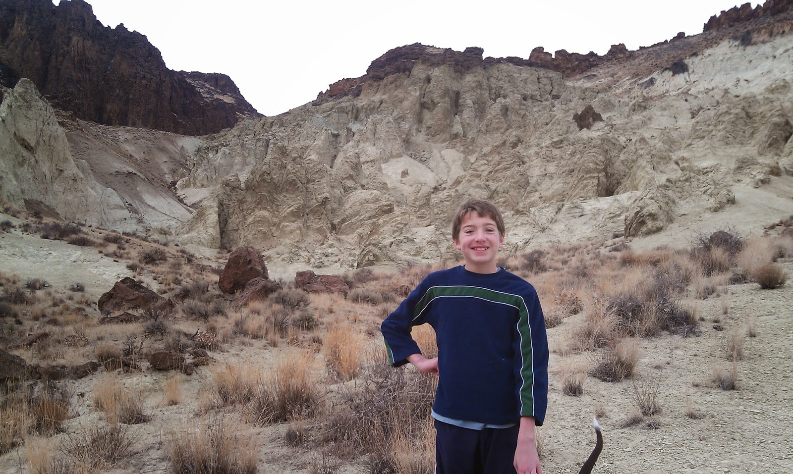
View from the upper deck of Succor Creek, looking across at McIntyre Ridge.
That's Steve walking with son Drew a few years ago ...  
My boys Drew and Quinn on the China Ditch Trail in Reynolds Creek 
Hi all,

Winter weather seems to have turned into the "off" mode lately, and it's been getting pretty darn balmy in the afternoon, with temperatures at least in the mid-40s, if not higher. Seems like the higher you go, the warmer it gets. And this is still January?

So if you're sick of skiing the groomers, and you're not heading up to the McCall Winter Carnival, consider taking the family or your friends out to the Owyhee Canyonlands for a little hiking adventure! This week, I'll recommend several hikes close to home. All of them come from my latest guide, The Owyhee Canyonlands: An Outdoor Adventure Guide. 

Please note that the trails in the lower Boise Foothills are extremely muddy and they're getting hammered in a bad way. See the latest trail update. Please stay off muddy trails!

Before we get into the hikes, remember to dress in layers for your hiking adventure. It might be chilly in the morning, but by the afternoon, you'll be peeling layers. Bring a light backpack for extra clothes, food and water. Also remember a hat and mittens.

Just so you know, all of these hikes listed below can be accessed with a Subaru-type vehicle. Venturing off into secondary roads in the Owyhees without a full-on 4WD could be a bad move right now. The ground is pretty soft because of the freezing and thawing and recent rainfall.

The hikes:

  • Wilson Creek-Reynold Creek Loop - This is a 7.4-mile hike in the Owyhee Front, south of Nampa, about 45 minutes from Boise. You take ID 45 south of Nampa toward Murphy. Cross the Snake River, turn right and head for Marsing. Watch for Wilson Creek Road on the left. Take Wilson Creek Road to the BLM trailhead for Trail #300 on the left side of the road. Follow Trail #300 over to a junction with a dirt road. Go left on Road #410 and follow that over to the China Ditch Trail #600 in Reynolds Creek canyon. This is the best part of the hike. Go upcanyon on Trail #600 and enjoy the redrock canyon of Reynolds Creek. Good place for lunch. When the canyon opens up, you'll see a junction with Trail #510, which heads back over to the junction with Trail #400. Take that trail back to the parking lot.
  • Succor Creek State Park - Multiple hikes can be done from Succor Creek State Park, just across the border in Eastern Oregon. It's a great place for kids and families. It has a rest room, and you could camp overnight there if you want. There is hiking to the east behind the camping area, or you can explore caves across the road, or hike above the caves to McIntyre Ridge and get a great view of the whole area. Getting there: Take I-84 west to the ID 55 exit in Nampa. Follow ID 55 west toward Marsing. Turn right on Chicken Dinner Road, and then left on Homedale Road to go to Homedale. Drive through town and go west on Highway 19 and Oregon 201 to a signed turnoff for Succor Creek State Park on the left. It's 16 miles of gravel road to the park.
  • Leslie Gulch - It should be a nice weekend to explore Leslie Gulch, one of the most scenic parts of the Owyhee Canyonlands, considering it's the end of January. By going now, you can beat the rush of people who normally go there in late March, April and May. You could go there for a day trip or camp overnight, your choice. Getting there: Take I-84 west to the ID 55 exit in Nampa. Follow ID 55 west to Marsing. West of Marsing, turn left on U.S. 95 and go south about 16 miles to a signed turnoff for Leslie Gulch. Follow signs to reach the park. It's 22 miles from the highway. Allow two hours from Boise to get there. In Leslie Gulch, you can hike around on the cool rock honeycombs with the kids, or a do a little more serious hike up Juniper Gulch to the top of Yellow Jacket.  

Have fun!
- SS


Thursday, January 22, 2015

Pick up a fat bike and ride! 5 tips on where to rent bikes and ride in Southwest Idaho

Dave Williams rides a fatty in the Snowy 45 at Jug Mountain Ranch
The cross-country ski trails loop around Jug Mountain Reservoir. Very scenic 
There have been times this winter when fat biking is perfect on foothills trails.
That's not the case right now except when they're frozen in the early morning. 
Hi all,

With High Pressure dominating aloft and the ever-familiar layer of yucky inversion fog blanketing the Boise Valley for the next 10 days, it's paramount for your mental health to head into the mountains and go for an adventure.

This week, I'm recommending that you try FAT BIKING as your travel mode of choice. The snow is freezing hard at night and warming up in the afternoon in SW Idaho. It's key to hit the trails when they're frozen hard in the early morning for the most efficient ride. The weather is perfect for that right now.

Below, I'll recommend five places to ride close to home in Southwest Idaho, and where to rent a fat bike.


But first ... why ride a FAT BIKE? Personally, I was sold after riding Jug Mountain Ranch last winter with a bunch of guys from Boise and McCall. We got out in the morning when the corduroy-groomed xc trail was hard and firm, and we rode up to Brundage Reservoir and then looped around back to the clubhouse via a mix of singletrack and xc trail. I loved bouncing up and down on the big tires ... it just makes you giggle. Fat bikes climb slow, but they're super stable on the downhill, and they're basically the bike of choice on snow and ice.

Here's what Ryan LaBar said about fat biking in Bike magazine: "Before these mutant bikes became available, the cold, dreary, daylight-choked winters of the midwest had to be dealt with by skiing, snowshoeing, sitting on the couch drinking beer and eating nachos or, God forbid, actually riding the trainer. 

"Not to say that these activities aren’t fun (except maybe riding the trainer), but, really, nothing compares to the escape from “reality” that shredding trails on two wheels gives you.ile fatbiking on the snow is generally much slower than riding dry trails, the lower friction and alien texture of snow–when conditions are good–replicates the sensation of ripping trails at full speed. It is a blast. Shallow pitches become technical descents, crashing doesn’t hurt nearly as much and power sliding corners has never been easier or more fun."

I bought a custom-built fatty in December from Vibe Cycles in December, and I'm really enjoying it. The bike weighs only 27.5 pounds because it has carbon rims, 45Nrth Van Helga tubeless tires, a carbon front fork and carbon handlebars. It rides great.

So ... how to get started? Rent a fat bike from a local bike store and go ride! See how you like it!

  • Meridian Cycle rents fat bikes for $50/day. 
  • Idaho Mountain Touring rents for $50 for 1/2 day, $75 for a full day. 
  • World Cycle rents for $80 for a 24-hour period. 
  • Ken's Bicycle Warehouse rents for $50/day. 
  • Eastside Cycles rents for $50 for 1/2 day, $85 for 24 hours.     

Check with the bike shops on the type of bike they're renting and size(s) available.

Now, where to ride? Here are five sure-fire places to ride this weekend:

  • Rocky Canyon Road - Watchman Trail Loop East Boise Foothills - Start from the end of the pavement on Rocky Canyon Road, ride up to the Five Mile Trail junction, go left and climb Five Mile to the Watchman Junction. Caution: Rocky Canyon Road is super icy in places. I rode the Five Mile Trail last Saturday, and it was in perfect shape ... either snow- and ice-covered or sandy. Take Watchman down Curlew Ridge to Shane's and back to Rocky Canyon. Hit it early when the trails are frozen. Total distance is 10 miles. 
  • Skyline Trail - Summit Trail - Beaver Trail - Elkhorn - Ralph's - Skyline Loop - This is a big loop in the Idaho City Park n' Ski Trail system, starting from the Gold Fork parking lot and then climbing Skyline Trail to the Summit Trail, drop over to the Beaver Trail and do a long climb to the Elkhorn Trail, Banner Ridge and so forth. Loop back to Skyline on Elkhorn and Ralph's to finish the ride. Approximate distance 15 miles. Here is a video of fat bikers touring the park n' ski trails. Idaho City Park N' Ride from Aileen Frey on Vimeo.
  • Middle Fork Payette River snowmobile road - Ride the groomed snowmobile trail about 9 miles one way to the Silver Creek Plunge hot springs pool. 
  • Jug Mountain Ranch, Lake Fork, Idaho - Fat bikes are welcome to ride on the JMR xc trails. Dogs are cool too. Great place to ride. Start from the clubhouse and do a big loop up to Jug Mountain Reservoir and back to the clubhouse. Did I say it's a great place to ride? BTW, JMR is hosting the Snowy 45 fat bike relay race on Feb. 28.  
  • Roads and trails in the Owyhee Mountains - It's been an unusually wet winter in the Owyhees this year, but often times, the trails and roads out there can be great for winter riding, especially when they're frozen or dry and sandy. My friend Eileen Frey highly recommends the Wickahoney Loop, south of Bruneau. I'd recommend the Wilson Creek loop or the Barking Spider loop in my Owyhee Canyonlands guidebook. Both of those are pretty close to home.  

Another place that totally rocks for fat biking in Grand Targhee. All 15K's of their Nordic trails are open to fat biking, and they have two miles of snow-packed singletrack trails. From a resort perspective, everyone says that Targhee is setting the pace for accommodating fat biking. How about a long weekend skiing and fat biking at Targhee in blue sky conditions! Book my room now!!!

Watch the Fat Bike Boise Facebook page for posts from riders reporting on conditions throughout the SW Idaho region and beyond.

Have fun!
- SS

Thursday, May 1, 2014

Here are three off-the-beaten-trail spring camping tips in the Owyhee Canyonlands

The Owyhee Uplands Backcountry Byway can be fun for mountain biking, too ...
Photo courtesy Tad Jones 
Big picture map of the byway
Toy Pass and vicinity ... Silver City is by the snow-packed mountains 
Wendy rides the wind currents on top of the mountains near Toy Pass 
Steve near the mouth of Mary's Creek 
Mary's Creek confluence in Sheep Creek 
You should see wildflowers this weekend ... Bring your plant guide! 
Hi all,

Well, the weather looks positively fabulous this weekend, so a lot of people have been asking me for some good ideas about spring camping in the Owyhees. First, you need to pick up our Owyhee Canyonlands guidebook for the most in-depth information. But here in my outdoor tip of the week, I'll share three ideas from the book that are family friendly and pretty easy to find.

In today's Idaho Statesman, the IdahoOutdoors team highlighted some excellent scenic drives, hiking and camping destinations in the Owyhees, including Leslie Gulch, Succor Creek State Park, and Jordan Craters. The only issue is those places will be pretty popular and busy this weekend, so you might want to try something that's a little more off the beaten path.

Here are three that aim to please:
1. Drive the Owyhee Uplands Backcountry Byway and find your own custom spot to make camp. I recommend starting on the byway by Grand View, (Gus's gas stop has copies of our Owyhee Canyonlands guidebook), and driving south into the Owyhees to the top of the first summit. Turn left on the dirt road heading over to Little Jack's Creek, and find a cool spot to camp and hike. Be sure to take a BLM map with you so you can navigate the dirt roads. The backcountry byway has many other options for camping such as the Antelope Springs Road, Deep Creek junction, Nickel Creek Table and the North Fork of the Owyhee BLM campsite, the only developed campsite on the 100-mile byway. The byway is suitable for 2WD vehicles. Side roads may require 4WD.

2. Toy Pass - We've got 2 hikes from the Owyhee Canyonlands guidebook that start and finish at Toy Pass. This spot is at 5,875-foot elevation, south of Oreana. You drive to Toy Pass, do a day hike from the pass to the mountains on either side of the road, and then go look for a campsite afterwards. There's a sweet campsite in a pullout on the south side of Toy Pass, and there are other places to camp on the road farther south toward Triangle on BLM land. Again, bring a BLM map with you to navigate the roads. To reach Toy Pass, take ID 78 east from Walters Ferry, south of Nampa, go past Murphy and watch for a road sign for Oreana. Turn right and drive 2 miles into the tiny town. Bear right at Our Lady, Queen of Heaven Catholic Church at the corner, and take the Bachman Grade Road to Toy Pass. It's about 13.5 miles to the top. This road is suitable for 2WD vehicles. Side roads may require 4WD.

3. Mary's Creek/Sheep Creek Wilderness. Mary's Creek is an easy-to-access tributary of Sheep Creek Canyon, which is one of the BLM wilderness areas in the Owyhee Canyonlands. There is a self-support camping area at the "trailhead" next to Roland Road. You could camp there, and then do the Mary's Creek Loop, hiking into the bottom of spectacular Sheep Creek Canyon, and then hike back. You also could backpack into Sheep Creek Canyon and camp there. The full loop detailed in our guidebook is 8.75 miles, with 1,400 feet of vertical gain/loss. Scenic hike and nice spot to camp. To reach Mary's Creek, take ID 51 south of Bruneau about 40 miles to a signed turnoff for the Rowland Road by the old bar and junk yard at Grasmere. Turn left on Rowland Road and follow that 5.2 miles to the Mary's Creek trailhead. There's a BLM kiosk at the trailhead.

Watch for wildflowers while you're out there ... and bring a plant guide to help with identification. Here's one guide that I highly recommend -- the Backpack Guide to Idaho Range Plants.

There you have it! Enjoy the sunshine no matter what you do!
-SS

Thursday, April 24, 2014

Get your kids outside to play! It's Unplug and Be Outside Week, plus used paddling gear sales!

Take your kids hiking before they even know they're hiking ... 
The foothills trails may be wet this weekend because of all the rain;
see alternative recommendations below. 
Hi all,

Every year, I tout the Unplug and Be Outside Idaho events because they're a great opportunity to get your kids outside and away from the trappings of their computers, ipads, cell phones, video games, Xbox's, Play Stations, Wii's and more.

Consider this: Over the past 30 years, the obesity rate in children 6-11 years old has quadrupled. There is a connection between the number of hours spent in front of the TV and childhood obesity. The average American child spends more the 30 hours a week in front of the screen (TV, computers, and video games). The impact of TV and other screen-time can have a harmful effect on a child’s health and well-being.

Get them outside and let them be kids! 

This year, the weather forecast is kind of wet -- in fact it's downright soggy! -- so the "Healthy Kids Day" events at the Treasure Valley YMCA locations on Saturday, April 26, may work out just great. The YMCA opens the doors of its facilities to the public for free from 7 a.m. to 8 p.m. You can go swimming, play basketball, dodge ball, racquetball, use the weight machines, ride the spin bikes, enjoy the waterslides in the pools ... the list goes on and on. The Nampa Recreation Center also is opening their doors for free from 8 a.m. to 7 p.m., with many of the same amenities inside.

Unplug and Be Outside Idaho events have been running through this week, and they end on Saturday.

More events that sound fun for kids:

  • Earth Fest at the MK Nature Center at the Idaho Department of Fish and Game's state office headquarters on Walnut Street in Boise. Runs from 10 a.m. to 2 p.m. Earth Fest includes kid activities, games, crafts and kite-making workshops. All free.  
  • Dance, cheer and tumble at the Motions Dance Studio in Meridian, 10:30 a.m. to 2:30 p.m.
  • Take a walk on the Story Trail at the Foothills Learning Center on north 8th street in Boise. Wander the 1/4-mile trail with your kids, look for plants and animals, and read "Hoo, Hoo ... Lives in Hulls Gulch?" 493-2530.  
  • Kids golf clinics at Lakeview Golf Club in Meridian. 2-3 p.m. for kids aged 5-9, and 3-4 p.m. for kids aged 10-16. Phone number is 888-4080. 
  • Free large bucket of range balls at Ridgecrest Golf Club and Centennial Golf Course in Nampa. 
  • Take Me Fishing trailer provided by IDFG will be parked at Ed's Pond in Emmett. They offer all the fishing gear you need and provide tips on the right kinds of fishing lures to use to catch fish. 
  • Speaking of fishing, IDFG has recently stocked many of the ponds in the valley. Take your kids fishing and catch some fresh trout for dinner! Here's a list of family fishing waters in SW Idaho. 
Normally, I'd recommend a list of kid-friendly hikes in the local area that you can enjoy. But because of the weather forecast, I'd stay clear of foothills trails until they dry out. Some alternatives for walks include any portion of the Boise River Greenbelt, the Eagle Greenbelt on the north side of the river or Rocky Canyon Road.
For future reference, here are five kid-friendly hikes that I recommended last year ... and here is a list of family friendly hikes that Ridge to Rivers recommends. 
-------------------------
On Saturday, there are two used paddling gear sales happening in Boise that offer great deals on life jackets, kayaks, whitewater rafts, canoes, SUP's and much more! If you're a paddler in need of gear, go to these sales and go early to find the best selection. Plus, if you have stuff to sell, you can do that too! 
  • The annual used equipment sale at Idaho River Sports benefits the Idaho Whitewater Association. IRS is located on the new Whitewater Boulevard near the Boise River, Greenbelt and the whitewater park.  
  • Alpenglow Mountainsport also is hosting a used equipment sale, one they do every year. The sale promises to be bigger than ever, shop officials say, and they also announced that their shop is now an official AIRE dealer. AIRE craft are very affordable, and AIRE has a bomb-proof guarantee in case any repairs are needed. Alpenglow is located in the McU Sports Highlands store on Bogus Basin Road.   
---------------------------------
This also is the weekend of the annual Leslie Gulch campout, led by Leo Hennessy. A lot of people are bailing out because of the lousy weather forecast, but Leo said he'll be there at Leslie Gulch all weekend, starting tomorrow and running through Saturday and Sunday. I would recommend waiting until Saturday, because tomorrow there is 100% chance of rain. 

If you want to go, just drive out to Leslie Gulch and look for Leo at the Slocum Creek campground, near the boat ramp on Owyhee Reservoir. How to get there: Take I-84 to the last exit in Nampa. Take ID 55 to Marsing. Go through Marsing, then turn south on U.S. 95 and follow that for a number of miles to a signed turnoff for Leslie Gulch. Follow signs on the gravel road to Leslie Gulch. It's a beautiful area with many unique rock formations. More information can be found in my guidebook Owyhee Canyonlands - An Outdoor Adventure Guide.  

Have fun!
- SS 

Thursday, March 20, 2014

Spring has sprung in the Owyhees! Exploring Sage Creek a good bet for the weekend

Our kids mess around in the rocks above the draw ... 
Hiking into Sage Creek from the trailhead.
One of many caves you'll see in there.
Balanced-rock features are everywhere in the middle of the canyon.
Hi all,

The slighter warmer, spring-like weather has been excellent for hiking, running and biking in the Boise Foothills. People are loving it, and they're out there in big numbers! And for good reason, spring is a perfect time to get out hiking, biking and running! March-June also is the perfect window of opportunity to explore the Owyhee Canyonlands before it gets blazing hot in July and the rattlesnakes emerge.

This week, I'd like to feature a couple of cool hikes in the Owyhees in the Sage Creek area, near Succor Creek State Park. Sage Creek is featured in our new guidebook, the Owyhee Canyonlands: An Outdoor Adventure Guide. It's a low-elevation destination, with tons of unusual and colorful volcanic rock and ash formations, and it's a kid-friendly and family friendly hike.

This is what I said in the book: "Sage Creek is a hidden jewel chock full of spectacular volcanic rock and ash formations in the creek-bottom and on the mountainsides as you hike along the creek ... One of the key highlights in Sage Creek is that you'll encounter multiple balanced rock features, some of them obvious phallic-type symbols, as well as spires, cliffs, fins and caves."
My son, Drew, loved the hike. 
Our guide features a 2.5-mile exploration out-and-back hike, cruising up the bottom of Sage Creek (rated easy for all abilities), and a 6-mile hike up to the top of McIntyre Ridge from Sage Creek (rated moderate to strenuous), with nearly 2,000 feet of climbing. Both of them are great!

How to get thereTake I-84 to the ID 55 exit in Nampa, heading west toward Marsing. Go west on ID 55 and  and Turn right on Chicken Dinner Road, then left on Homedale Road, and go to Homedale. Follow State Highway 19 west of Homedale, and then Highway 201 in Oregon, to a signed turnoff for Succor Creek State Park on the left. Head south on the dirt road. It's 12.1 miles to the unsigned right-hand turnoff  for the Sage Creek Trailhead. There is a lone scrubby cottonwood tree at the turnoff. Follow the primitive two-track road over several creek-crossings to the trailhead .9 miles from the Succor Creek Road.   
Nice rhyolite cliffs with Wendy in the foreground. 
Road access challenge: 4WD high-clearance vehicle is required to reach the trailhead; multiple creek crossings are involved. It's possible, however, to take a 2WD vehicle to the Sage Creek road junction, and hike from there. Add .9 miles to the trip if you start from Succor Creek Road. 

Hike #1 - 2.5-miles out and back
Cruise up the creek-bottom of Sage Creek, picking your way up the draw as you like. Hike at least a mile upstream to see the balanced rock features on the mountainsides above the draw as well as many other interesting rock formations. The volcanic ash flows in the area have turned different shades of white, orange and green over time. These formations are very erosive ... you can scratch the ash with your fingernails. Wear shoes that can get wet ... I doubt there's much water in the creek-bottom, but you will encounter some pools along the way.   
Hiking down-canyon back to the trailhead.
Hike #2 - 6-mile loop
From the end of the road, hike up-canyon and cross the creek to the left side. At mile .2, climb up the left-hand draw. It's a super-cool hike through many rock formations as you ascend the draw. It's about 2 miles to the top of the saddle near McIntyre Ridge. Climb to the top of McIntyre Ridge if you'd like. This area overlooks Succor Creek State Park to the east and Three Fingers Rock and many other features to the west. On the way down, descend the ridge to the left of the draw you climbed up, and enjoy a cool hike down into the draw. You'll pass by the "official" balanced rock on your way into the draw. Turn right at the bottom of the draw, and hike back to the trailhead.

Family pic in Sage Creek. November 2012. Kind of rare to get our 4 kids together for a family hike!
L-R, Drew, Tom with our pointer Huck, Wendy, Elena, Quinn, Steve 
Camping notes: You could camp in the bottom of Sage Creek. Quiet spot. Self-support camping. You also could camp at Succor Creek State Park, which has a public rest room, very close by, but that will be much more crowded. If you'd like to explore some other areas, Succor Creek Road connects to Leslie Gulch, Three Fingers Rock and many other areas worth checking out in our guidebook. 

If you're looking for ideas about what to do over Spring Break next week, check out my blog from last year with many ideas for recreation and camping close to home

Have fun! 
-SS