Showing posts with label Mountain Biking Idaho. Show all posts

Thursday, August 22, 2019

Bogus Basin mountain bike festival, hiking Granite Mountain and house party for Lauren McLean

Riding at Bogus Basin is a pleasant alternative with cooler weather, shade and great trails! 
Hi all,

If you haven't been mountain biking at Bogus Basin this summer, this weekend looks like the perfect time to go.

Bogus is hosting a Mountain Bike Festival from 10 a.m. to 6 p.m. on Saturday. Chair #1 will be running to take folks to the top of Deer Point. There are guided rides for men, women and kids, professional riders competing in the "Whip-Off" big air challenge, demo bikes, raffles and more.

The event costs $45 through Friday, and $50 on Saturday. Register here

The goal, according to organizers, is to celebrate mountain biking by "bringing our passion-filled mountain bike community together." Meet new riding friends, meet local shops and services, get out and ride the trails and enjoy what should be a nice cool mountain day. Participating bike organizations and shops include SWIMBA, Central Idaho Mountain Biking Association (CIMBA), George's, Idaho Mountain Touring, Reed Cycles, Boise REI, World Cycle, Eagle Bike Shop, McU Sports, Rolling H Cycles, and Kore North Bicycles.

I love the trails at Bogus. If you haven't gotten to know the trail system up there, you need to. IMBA rated the Around the Mountain Trail at Bogus the best in the state of Idaho! 


------------------------
Granite Mountain summit and USFS lookout. Elevation 8,500 feet.
Hike Granite Mountain

I went for a fun hike to the top of Granite Mountain last Saturday while I was in McCall. Here's a link to my Facebook pics. I'd rate the hike "moderate." It was 3+ miles to the top of Granite Mountain from the trailhead off the Goose Lake Road. Travel time was about 4+ hours round-trip.


The views on top are fantastic. There's a manned Forest Service lookout tower on top. You can see the Wallowas and Seven Devils to the west, Meadows Valley and the Little Salmon canyon leading down to Riggins, the northwest corner of "the Frank," the Payette Crest off to the east, and Brundage Mountain, and Long Valley to the south.

Granite Mountain is the giant hulk of mountain that looms to the west of McCall when you approach the mountain community. Brundage provides snowcat powder skiing trips on Granite, and I have had some legendary times up there on the mountain.
--------------------------
House party for Lauren McLean 

The political race for Mayor of Boise is under way. I have known Lauren McLean since the first $10 million open space campaign 1999-2001, and she has been a proven champion of open space and trails for the Boise Foothills ever since. I still feel that winning that initial open space campaign was a transformative event for the City of Boise, and now there's huge community support for open space, trails, conservation and water quality.

Mayor Bieter has had four terms to lead Boise, and I think a lot of people feel they are ready for a change.

My partner Wendy Wilson and I are co-hosting a house party on Thursday, Aug. 29, for Lauren at our home at 3209 N. 39th Street in NW Boise. Sam Sandmire and Cary Hattabaugh, Diane Ronayne, Zack Waterman, Nicole LeFavour, Suki and Bill Molina, and Elena Lansing are co-hosting. 

We are inviting folks to come hear Lauren speak about her priorities for the City of Boise moving forward, even if you haven't made up your mind. We are inviting outdoorsy and conservation types. Shiny Shoe Bob is playing music, and we'll have food, wine and beer.

If you're interested in coming to the house party, please RSVP to wwwilderness3920@gmail.com. 

Please see our Facebook invite for more information.    
- SS

Thursday, June 27, 2013

Ride Sun Valley Bike Festival coming up, plus some ideas on how to escape 100-degree blast furnace

Ride Sun Valley! 
Cool off at Lake Cascade State Park! 
Trinity Lakes 
Harriman State Park ... Mesa Falls is nearby! 
Loon Lake would be refreshing this time of year ... 
Hi all,

Well, the 4th of July is coming up next week, and extreme heat is descending on the Boise Valley after a nice respite of cool weather. Five days of 100-plus heat are forecast in the Boise area, beginning Friday. Geez! This week, I'll share some thoughts about where you could go to beat the heat, but first, I'll tout some events coming up.

The Ride Sun Valley Bike Fest kicks off on Friday with an enduro event and opening party at Sawtooth Brewery on Friday night, and then there is a full slate of events going on through next week that promise to please cyclists of all kinds.

The Ketchum-Sun Valley area will be a nice place to cool off as well. One event that looks fun is the SRAM Gold Rusch Tour, a series of mountain bike rides for women led by Sun Valley's own Rebecca Rusch, known as "the queen of pain." She's a three-time world-champion in mountain bike endurance events and four-time winner of the Leadville 100 mountain bike race. Reba's Ride Camp runs from July 2-7. There is no charge. Seems like an awesome opportunity.

On July 1-2, demo bikes are available from Cannondale, GT, Mongoose, Ellsworth and Scott, among others. The bikes are available at no charge to ride on Sun Valley's 400+ miles of singletrack from 8 a.m. to 5 p.m. each day. Another great opportunity.

On Wednesday, July 3rd, there's a criterium race in Ketchum starting at 3 p.m. in the afternoon. That would be fun to watch! And from Monday, July 1 through Friday, July 5th, there are a bunch of "local stoker" rides on the creme de la creme of Sun Valley's singletrack trails. For folks who want to ride the best singletrack that Ketchum-Sun Valley has to offer, here's a chance to explore those rides with local ride leaders.

Next Saturday, July 6th, the USA Cycling Marathon Mountain Bike National Championships will be held at Bald Mountain ... good chance to watch the strongest riders in the nation compete on the 45-mile course featuring over 5,000 feet of climbing and descending. Plus, there's the MASSV Music Fest on July 5 and 6 at the base of Bald Mountain.

I've got to tip my hat to the folks in the Ketchum-Sun Valley area for packing an incredible amount of fun, food and music into a week's worth of quality activities. If you're looking for lodging, check out the Visit Sun Valley web site for the best deals that fit your budget. You also could camp in the Sawooth National Recreation Area nearby.

Cool off in the Payette River and learn about river safety ... On Saturday, June 29, the Idaho Whitewater Association is hosting a safety clinic on the Main Payette River from Banks to Beehive Bend. Put-on the Main Payette between 10 a.m. and 2 p.m. Participate in clinics on boat-flipping (and flipping back over), first-aid and throw bag safety.

Here are a few recommendations for cool-off trips during the 4th of July week:
  • Head up to Bogus Basin, where it's always 10-15 degrees cooler than it is in the valley, and go hiking or biking on tons of trails at the ski area or nearby in the Eastside, Stack Rock area. 
  • Go camping in the Trinity Mountains near Prairie in the Boise National Forest. It's a high-elevation area with a number of high mountain lakes near the end of the road. 
  • Head for Lake Cascade State Park in Cascade. Ponderosa State Park is likely booked for the whole holiday week, but Lake Cascade State Park will have some openings. The north unit of the park along Lake Cascade west of Donnelly has a number of nice campgrounds right on the shores of Lake Cascade. You can go canoeing or lake kayaking on the lake, bike the Crown Point Trail (great for kids and families), go tubing or kayaking at Kelly's Whitewater Park, or hike/ride the Eagle's Nest Trail (click on free download). 
  • Go camping, hiking and biking in the Payette National Forest, north of McCall. Areas like Upper Payette Lake, Squaw Meadows, Burgdorf Hot Springs, Loon Lake and others will be much cooler than the Treasure Valley. Be sure to bring your bug juice as the mosquitoes will be out in force in the evening.  
  • Go camping in Eastern Idaho, visit Harriman State Park and Mesa Falls or go fishing on the Henrys Fork or the South Fork of the Snake River. 
  • Rent a cabin in the Boise or Payette national forest and dip your toes into a nearby creek. Go to recreation.gov to check on availability. The cabins are inexpensive and make a great base camp, especially with kids. 
  • Go kayaking, rafting or canoeing on the Payette River
  • Float the Boise River
  • Go backpacking to a high mountain lake in the Sawtooths, White Clouds, Boise National Forest, Payette National Forest, Sawtooth NRA or Frank Church-River of Return Wilderness. Go swimming in the high mountain lake ... it'll be refreshing, I guarantee it. 
  • Escape to the Oregon Coast. 
  • Head up to Priest Lake or Lake Pend Oreille in North Idaho. 
  • Go Ice Skating at Idaho Ice World. Ha! That'll keep you cool. 
There you have it!
- SS 


Thursday, March 7, 2013

Mountain biking in the Owyhees is a real treat; Boise Foothills trails are drying out, too

"Bingo's Trail" has a number of rock hoodoos along the way 
You might see wild horses in the Wilson Creek area. 
Approaching Reynolds Creek canyon 
China Ditch Trail 
Hi all,

I've been stoked about going mountain biking this spring, so I headed out into the Wilson Creek area in the front side of the Owyhees last weekend to check on the conditions. Much to our delight, the trails were dry and ready to ride. We saw a number of mountain bikers, hikers and horseback riders out there, so we weren't the only ones with spring fever.

The weather this weekend looks equally fine for mountain biking in the Owyhees. Sunday looks wonderful with temperatures almost hitting 60! Low-elevation trails in the Boise Foothills are starting dry out, too. Check the latest conditions on the Ridge to Rivers web site. With temperatures in the 60s next week, people will be swarming in the foothills. Not so in the Owyhees.

My friend Paul Hilding and I rode a loop in Wilson Creek that he's been riding with some mountain biking buddies of mine for several years. We followed the Google Earth GPS tracks of Doug Lawrence, and with the aid of a BLM map with the trail and road numbers on it, we had a successful ride. I checked with Chris Cook, who's spent a lot of time in the Owyhees GPS'ing trails, and the route we rode is called "Northwest Passage," combined with "Bingo's Trail" and the "China Ditch Trail." All told, it was a 16.2-mile ride with a little over 2,000 vertical feet of climbing and descending. It took us about 4 hours to complete the loop. We made quite a few stops for snacks and photos.

(Here is the live audio about this trip on 94.9 FM The River. Steve talks about his outdoor tips each Friday with Ken and Tim at about 7:10 a.m.)

We will be including this loop in the forthcoming guidebook on the Owyhee Canyonlands that I'm working on with photographer Mark Lisk. But I'll provide all the details here for a successful ride.

I would rate this ride "advanced" and "strenuous" because of the distance, technical challenges and endurance needed to complete the ride. I'll describe a route for intermediate riders below.

Hilding loves the ride. "I think it's my favorite loop of all the riding I've done in Idaho so far," says the former San Diego resident. "I really like the fact that the loop is nearly all singletrack, and it's really scenic, especially with the hoodoos on Bingo's Trail, and then the awesome canyon in Reynolds Creek and China Ditch Trail. It's a pretty killer ride."
The Northwest Passage loop is highlighted in red ... ride it counter-clockwise  (click to enlarge).
Getting there: Take Interstate 84 to the Nampa City Center exit (Franklin Road). Turn left and head into downtown Nampa. Follow signs for Highway 45 south heading for Murphy. Go south on 12th Avenue and take Idaho 45 south to Walters Ferry and the Snake River. Turn right after crossing the river and head for Marsing. Watch for Wilson Creek Road on the left in about 3 miles. Turn left. Proceed up Wilson Creek Road for about 2 miles to the Wilson Creek Wayside. Park. The ride starts here. Be sure to bring plenty of water and food for the ride. I carried water for my dog, and I'm glad I did. Water is sparse in the loop except for Reynolds Creek.

To begin, peel out of the parking lot and pick up BLM Road 37131 and head west next to some giant powerlines.

Mile .4 - Bear left on a narrow, faint singletrack and ride across sagebrush flats to a stock tank area.
Mile 1.9 - Bear left at stock tank area, pass through gate (close it behind you) and ride straight ahead on two-track road.
Mile 2.0 - Bear right onto Trail #200, a singletrack, and ride up-canyon in a small draw.
Mile 2.6 - Trail #200 parallels BLM Road 37150 as they climb at a steep gradient out of that little canyon up to a ridge.
Mile 4.6 - Approach 4-way junction. Go straight on #200 singletrack.
Mile 4.7 - Rejoin road for a short bit; mile 5.0 bear left on #200 singletrack.
Mile 5.25 - Come to junction with Trail #262 on a ridge overlooking Stewart Gulch. Take a hard left on Trail #150. The trail goes through a small canyon and leads to Wilson Creek.
Mile 6.5 - Drop into steep canyon and climb out (mile 6.7). Now it's downhill toward Wilson Creek.
Mile 7.7 - Begin steep descent into Wilson Creek.
Mile 8.1 - Come to a T-junction at the creek. Cross the creek, pick up singletrack on the other side, then take a hard right on Trail #100 and climb up to the Wilson Creek Road.
Mile 9.2 - The trail emerges on Wilson Creek Road by a vehicle pullout. Directly across the dirt road, take Trail #500 and ride downhill over to Reynolds Creek. People call this "Bingo's Trail." It's a hoot. Lots of fun S-turns riding downhill.
Mile 9.7 - Bear left on Trail #500.
Mile 11.25 - Junction with BLM Road 37154. Turn right and follow the road briefly, then bear left on singletrack going up steep slope.
Mile 11.4 - Go left on Trail #510 and climb over to Reynolds Creek canyon.
Mile 11.8 - At the next junction, bear left and head for the canyon. The trail eventually drops very steeply into Reynolds Creek canyon. People call this steep section "Jacob's Ladder." You decide whether it's rideable. 
Mile 12.1 - Junction with Reynolds Creek/China Ditch Trail #600. Go left, down canyon. Gear down and weave through the rocks. Great place to stop for lunch and take pictures of the redrock canyon.
Mile 13.2 - Veer left on Trail #310 and leave China Ditch Trail.
Mile 13.6 - Cross two-track and stay on singletrack trail. More rock work makes this a sweet sinewy singletrack.
Mile 14.5 - Approach junction with Trail #310 and #311. Go right on #311 and follow that sandy singletrack downhill through the sagebrush.
Mile 15.2 - Cross through barbed wire gate and close it behind you.
Mile 15.7 - Ride around gate. You can see the place where you parked to start the ride. Take BLM Road #37154 directly west to the trailhead.
Mile 16.25 - Final ride mileage at trailhead.   
Here's Steve with his pointer Huck on the Wilson Creek ride.
 Intermediate ride: This route could be hiked or run as well. Follow directions above to Wilson Creek Road. Keep going up the Wilson Creek road to a trailhead on the left. Take Trail #300 from the trailhead in an easterly direction across the sagebrush hills, heading over to Reynolds Creek and the China Ditch Trail (most spectacular part of ride).  

Trail #300 comes to an end on BLM Road #37154. Go right and climb the road. Veer right on Trail #500 when you see that emerge on the left side of the road. Follow Trail #500 to #510 and climb over to Reynolds Creek Canyon. Bear left on Trail #600 in Reynolds Creek and follow the China Ditch Trail along the creek. Great spot for lunch and photos. After a mile on the China Ditch Trail, veer left on Trail #310. Take #310 to BLM Road #37154, go left for a short distance, then right on Trail #300 and return to the trailhead. This route is about 7.5 miles long. It's very similar to the Reynolds Creek Loop described in my book, the Boise Trail Guide. 

There you have it! Thanks to Chris Cook, Dan Meeker and Dave Beck for pioneering "Northwest Passage!"

There's a longer ride with more vertical gain in my guidebook book Mountain Biking Idaho called the "Wilson Creek-Mini Moab Loop." That ride climbs the Wilson Creek road to the top of Wilson Butte, and then takes a topsy-turvy rocky two-track back down the mountain over towards Reynolds Creek. It's possible to mix in a side trip to the China Ditch Trail on the way back.
- SS

Thursday, August 16, 2012

Go north to Idaho's lakes country to get out of the smoke & go boating, hiking or biking

Priest Lake under a full moon
Hi all,

I think it's safe to say that people are getting really tired of the smoke-filled Boise Valley, and this weekend, they'll be looking for ways to find some clean air. In my mind, this is a perfect excuse to head north to the Idaho Panhandle, where there are a bounty of recreation opportunities to enjoy, and the air is clear, so I've heard from locals in Coeur d'Alene.

You might groan and think, gawd, that's just too far to go! And I'd come back and say, hey, it's not that far, and you've got only a week or so before the kids have to head back to school. Why not take a few days and go somewhere like Priest Lake, where you can hang out on the beach, even camp by the beach,  and go boating on the lake, canoeing in Upper Priest Lake, mountain biking through giant cedar groves or hiking in the Selkirk Mountains. Or, pick up a Panhandle National Forests map and go on a waterfall tour.

Here's one of my previous blogs that details all of the great camping, mountain biking and canoeing opportunities in the Priest Lake area. Wendy and I went mountain biking on the Lakeshore Trail along main Priest Lake, and rode the Navigation Trail to Upper Priest Lake and cruised along the shoreline. We also canoed from our beach campsite at Beaver Creek Campground, paddled up the channel between main Priest and Upper Priest, and toured the upper lake for the day. Pete Zimowsky from the Statesman wrote a very thorough report about that paddling trip in today's paper.

Another more challenging mountain biking ride near Priest Lake is the Upper Priest River Trail. It's 20.4 miles out and back, all singletrack, and you'll end up at a waterfall and swimming hole at the Idaho-British Columbia border, a perfect place to cool off. This one is featured in my book Mountain Biking Idaho. It's one of my all-time favorite rides. The cedar trees are gigantic.  

Several other possibilities in the Idaho Panhandle:
The Taft Tunnel (courtesy Spokesman Review)

  • Ride the Route of the Hiawatha, a cool, gravel rail-trail that can be accessed from Wallace if you're taking the I-90 or from St. Maries, if you're driving up through Idaho. There are a whole series of dark tunnels and railroad trestles on the trail. Distance is 14 miles up, 14 miles back. There's a shuttle available if you don't want to ride uphill. Be sure to bring a bright light! (Camping headlamps are worthless). This ride is written up in Mountain Biking Idaho. Here's an informative video about the whole experience. 
  • Ride the Trail of the Coeur d'Alenes anywhere between Wallace and Heyburn State Park. If you're driving up through Idaho, access the trail from the west side at Heyburn, and cruise on the paved trail to Harrison for ice cream and continue along Lake Coeur d'Alene and then the Coeur d'Alene River, enjoy the scenery and all of the bird life along the way. 
  • The Trail of the Coeur d'Alenes 
  • Pick up a copy of  Mountain Biking Idaho and check out some outstanding rides in the Coeur d'Alene and Sandpoint areas. Canfield Butte next to Coeur d'Alene has a ton of singletrack trails to explore, and Farragut State Park also has some great trails, one of them right next to Lake Pend Oreille. In the Sandpoint area, you can ride a twisty singletrack (more than 40 switchbacks!) to the top of Gold Hill, cruise around Schweitzer Mountain Ski Area, or try a long expert ride like the Bernard Peak Loop (18.5 miles, 2,650 feet of vertical gain/loss.) 
If you go up north, I recommend taking I-84 to Tri-Cities, Wash., Highway 395 to I-90, and then you're home free, in Ritzville, Wash., just an hour from Spokane, and 1.5 hours from Coeur d'Alene. This route is at least an hour faster than driving through Idaho (I've done it in 6+ hours). Save time by driving part of the way in the evening, and the rest in the morning, and then you'll have for an outing the first afternoon. 

If you'd rather stay closer to home, head up to McCall and go beaching, camping, hiking, biking and boating. Here's a blog I wrote recently with 10 reasons to go to McCall. The morel picking season is long over, but you can probably still find some huckleberries.  


If you're stuck in town, don't forget the Tour de Fat event on Saturday in Ann Morrison Park ... The parade starts at 10 a.m. (be sure to dress up in some kind of wacky costume), and then the beer begins to flow ... buy beer and your proceeds go toward the Southwest Idaho Mountain Biking Association (SWIMBA), the Boise Bicycle Project and other great charities.

Have fun!
- SS

Thursday, July 14, 2011

Go mountain biking in Sun Valley this weekend; enjoy the Ride Sun Valley Bike Festival

Ride Sun Valley! (Courtesy Sun Valley Chamber)

The trails are amazingly smooth and contoured (Courtesy Sun Valley Chamber)

Post card views around every bend (Courtesy Sun Valley Chamber)

I love to ride through aspens ... this was in Lamb's Gulch in Croy Canyon

Part of our crew on the Little Basin-Big Basin ride near Stanley. Those young boys can ride!

Crossing Big Basin Creek is a bit chilly
Hi all,

Cycling enthusiasts are faced with a vexing choice this weekend -- do you stay in town to watch the Boise Twilight Criterium or head up to Sun Valley to participate in the Ride Sun Valley Bike Festival and watch the USA Cycling National Mountain Biking Cross-Country Championships?

That's a tough decision, but in my mind, the participatory-nature of the Sun Valley bike festival makes it a pretty easy choice that tips in favor of heading up to Sun Valley. Former Olympic road and mountain bike racer Greg Randolph, a.k.a. "Chopper," who is now heading up the Sun Valley Chamber of Commerce, has put together a super cool week of events for the bike festival. Maybe you've read Greg's advice column in Bike mag.

The Ketchum-Hailey-Sun Valley area has more than 400 miles of singletrack and 32 miles of paved trails. We know we're blessed in Boise with more than 200 miles of trails that stretch from Bogus Basin to the Greenbelt. Imagine if our trail system were doubled in size ... then maybe you can begin to imagine the huge sweep of trails that lace the mountains in the Wood River Valley. Check out an interactive trail guide produced by the Blaine County Recreation District and you'll be amazed.

But you have to experience it yourself to truly understand what a fantastic place it is to ride. I was up there last weekend for my son's baseball tournament, and I snuck away multiple times to ride some new trails west of Hailey in Croy Canyon and the Greenhorn-Mahoney Loop north of Hailey. We wrapped it all up with a gorgeous ride with four teenagers on the Little Basin-Big Basin Loop near Stanley on Sunday.

Chopper is making it easy this week by leading a series of show-me rides every day through Sunday. Here's the schedule for the weekend:

Friday, July 15

RIDE SUN VALLEY LOCAL STOKER - Departs at 9:00 a.m. Free to public space limited.

Cold Springs-Warm Springs. 16 miles, 2,400’ vertical, 3.5 hours. Ride from SV Visitor Center climb back side of Baldy via Cold Springs and rip around to the Warm Springs side via Warm Springs Trail. Apples BBQ awaits for riders at conclusion.

Saturday, July 16

RIDE SUN VALLEY LOCAL STOKER - Departs at 9:00 a.m. Free to public, space limited.

Easley Hot Springs aka Curly’s Trail. 11 miles, 1,500 feet, 2 hours. Break out your longer travel for one the valley’s classic brake warpers. Make two laps if you are feeling cheeky. Shuttle to and from Baker Creek.

Sunday, July 16

RIDE SUN VALLEY LOCAL STOKER - Departs 9:00 a.m. Free to public, space limited.

Fox Peak to Ketchum via East Fork Baker Creek. 22 miles, 2,100’+ vertical, 4.5+ hours. This is the mother of all Local Stokers! Strenuous, technical, long, hard, super awesome. Ride from Baker Creek back to Ketchum on over 22 miles of railer singletrack. Pack extra energy food.

The thing I love about riding in the Wood River Valley is that the trails twist through shady aspen groves, pine and fir forests, punctuated by wildflowers that are popping everywhere right now. It's postcard gorgeous around every bend. And the gradient of the trails is much more moderate than they are in the Boise Foothills, especially in the lower part of the rides. Many of the trails are pure butter-smooth singletrack, and they're a hoot to ride.

I rode the Fox Peak to Adams Gulch ride featured on Sunday for my book Mountain Biking Idaho, and that one is a truly a premium ride. It starts with a moderate climb up the Baker Creek Road, and East Fork Baker Road to one of my favorite ski huts of all time, the Tornak Hut and sauna, which looks out at a stunning display of the rocky Boulder Mountains. You ride a bit more toward Fox Peak, and then it's a wickedly fun downhill spanning several thousand vertical feet to Adams Gulch. Even if you can't do that ride Sunday, you have to do it sometime.

About 650 of the best mountain bikers across the nation are competing in the cross-country mountain bike races. Here is the schedule. Many of the events are located on Bald Mountain, including the downhill courses. You can check in on the action in the River Run area (the turnoff is just before you enter Ketchum on Idaho 75) and see where it might be best to watch your favorite event. The races run through Sunday.

If you have time, go home via Idaho 21 in Stanley and ride the Fisher-Williams Loop or Little Basin-Big Basin Loop a.k.a. "Potato Mountain Loop" on your way home. Both of those rides are a total blast.

To find a place to stay in the Wood River Valley this weekend, check here for the options that may work best for you. If you want to camp, there are many places north of Ketchum where you can pitch at tent or park your camper in the Sawtooth National Recreation Area. I camped in a no-fee dispersed campsite north of Baker Creek last weekend.

In Hailey, you have to stop at the Power House and have a beer and a sandwich. It's a unique spot because it's a bike shop, bar and restaurant all wrapped into one venue. They have wifi. I was in there last weekend doing some online work, and their password made me chuckle ... "beer&bike." That says it all!

Have fun!
- SS

Thursday, July 7, 2011

Try renting a yurt in the Idaho City Park n' Ski Area, relax and go hiking and biking


Brenda Adams and Leo Hennessy on the deck at Stargaze Yurt.

Brenda approaches Stargaze on a new singletrack.

Leo grinds up the two-track to Stargaze Yurt on Forest Road 394B.

The fire pit and picnic table by Whispering Pines Yurt.
Park n' Ski Area overview trail map.

Hi all,

Everyone knows about renting the Idaho City Park n' Ski Area yurts in the winter, but not so much in the summer. To give folks an incentive, the Idaho Department of Parks and Recreation has dropped the price of yurt rentals by $30 for weekends and week days, meaning that rents are $60/night for weekends and $45 for week nights. The yurts sleep six.

In my view, the IDPR yurts provide a great venue for a family friendly weekend in the woods. You have six to choose from. All of them are close to hiking and biking trails, and in the summer, you can actually drive to within 100-300 yards from the yurts, making it easy to pack in your camping gear and super easy for parents to take young children.

No muss, no fuss: The yurts are set up with a double-burner stove, cooking utensils, pots, plates and silverware, so you don't have to bring that stuff from home. Just bring sleeping bags, food, water and beverages. Everything you pack in should be packed out. If the bugs are bad outside, you can hang out in the yurt. If it's raining, you can chill in the yurt. Bring lawn chairs, and find shady spots near the yurt or on the yurt deck to enjoy the views.

Summer prices are good from July 1 - Nov. 15. Here's the web link for reservations.

Next, I'll detail some hikes and bike rides that you can explore close to the yurts below:
  • Banner Ridge, Elkhorn and Skyline Yurts are all on the east side of Idaho 21. They provide immediate access to a complete system of singletrack and two-track trails adjacent to the yurts.
  • If you're staying at Banner or Elkhorn, try the easy singletracks called the Cougar Loop or Lehn's Loop. These were trails that IDPR built with volunteer help. Lehn's Loop is 2.4 miles, and Cougar is 3.3 miles. Both trails follow rolling terrain through shady timbered areas without any long major climbs. Good place to take the kids. See this guide for complete details. The loop also is detailed in my Falcon guide Mountain Biking Idaho.
  • A longer and more challenging ride is the Elkhorn-Alpine Loop. This loop is 7.5 miles long, featuring 4WD dirt roads and grassy two-tracks. The Alpine portion of this loop is the most scenic and intimate. I've seen elk and black bear riding my book on this loop. See this guide for complete details. The loop also is detailed in my Falcon guide Mountain Biking Idaho.
  • If you're staying at the Skyline Yurt, there are two possibilities immediately adjacent to the yurt. Hike or ride the Skyline Loop, 5.5 miles from Idaho Highway 21. It's a grassy two-track the whole way. Less than 1,000 feet of vertical climbing, but it is a climb to the yurt from the highway, and it's a fun and fast downhill back to the highway.
  • Another possibility from Skyline, especially for bikers, is to ride Ralph's Trail and Twister to the north and connect over to trails by the Elkhorn Yurt, such as Lehn's Loop and Cougar Loop. See this guide for complete details.
  • If you'd like to stay at Stargaze Yurt, the newest addition to the Idaho City Park n' Ski yurt system, we scouted a new trail in that area last week. It's a 7-mile mountain bike loop (could be hiked) that starts and finishes at Beaver Creek Summit on Idaho Highway 21. The ride starts at the Stargaze Trailhead on Forest Road 394. Bear right on Road #394B and climb a steep two-track dirt road to the yurt junction on a saddle (mile 1.1). Even if you have to walk the steep sections of the climb, it's not very far, and the rest is easy. Take a side trip to Stargaze Yurt and check out the view. Next follow the two-track road from the saddle out to the west to mile 2.3 and go right on a faint two-track. That little trail cuts over to a more major dirt road, which is a snowmobile trail in the winter. Turn right on the dirt road at mile 3.2. Bear right at a signed junction (mile 6.1) to return to Idaho 21 (mile 6.6), turn right and ride the paved road to the trailhead (mile 7). See map above.
  • If you're staying at Whispering Pines Yurt in the Gold Fork area, you could ride or hike the road up to Whispering Pines and then take the Moose Trail back to the parking area. There also are a few short trails nearby. See this guide for more details. Whispering Pines, by the way, has excellent shade afforded by large ponderosa pine trees.
  • Rocky Ridge Yurt, accessed from the Whoop 'em Up trailhead area, has a couple of trails nearby that lead over to Edna Creek Road and Beaver Creek Cabin areas. The Crooked River Trail can be accessed from Beaver Creek Cabin or Edna Creek Road. It's a sweet hiking or biking singletrack that goes downhill along Crooked River for several miles. Turn around and come back. See this guide for more details.
Be sure to print out the maps from the IDPR web site and bring them with you. A map from the Boise National Forest would be helpful as well. And don't forget your bug juice ... because of the big snows we had last winter and spring rain, it's very wet and moist out there in the forest, and the bugs can be fierce!

Other useful resources would be a birding book and wildflower guide.

Have fun!
-SS

Thursday, March 10, 2011

Bike or hike to Wees Bar on the Snake River

Petroglyphs at Wees Bar are believed to be 800 years old. (Courtesy everytrail.com)
Canyon view looking down at Swan Falls Dam
Many pairs of golden eagles nest in the Snake River canyon
Map to Wees Bar from the Boise Trail Guide
Hi all,

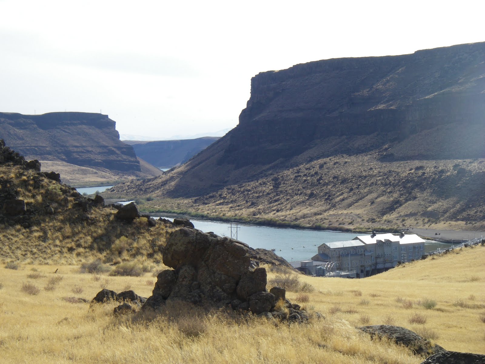
Well, we're a little stuck in between winter and spring right now, but with temperatures reaching into the mid-50s, the weather is suitable to do a little exploring in the Morley Nelson Snake River Birds of Prey National Conservation Area by Swan Falls.

This week I'm recommending going hiking, biking or running from Swan Falls Dam to Wees Bar, where one can view a variety of cool Native American petroglyphs, on the south side of the Snake River. It's 12.2 miles to Wees Bar from the dam round-trip. The biking trip is detailed in my guide, Mountain Biking Idaho, and the hiking and trail-running trips are detailed in my book, the Boise Trail Guide: 75 Hiking and Running Routes Close to Home.

It's not clear how wet it's going to be this weekend, so the trails to Wees Bar may be relatively dry or they may be a bit wet. The area around Swan Falls is typically quite dry, compared to most other areas in SW Idaho at this time of year, so it could be a good bet.

When you're on the way to Swan Falls or you're on the trail, be sure to watch for birds of prey activity. About 800 pairs of hawks, eagles, falcons and hawks nest in the birds of prey area. Bring a pair of binoculars or a spotting scope. Springtime is mating season. That means you can see the birds flying together in courtship. The aerial maneuvers can be quite impressive. Some birds nest in the cliffs, so you can check out nesting areas as well. Watch for large blotches of white in the rocks for bird nests or perching activity.

Here's a video about raptors in the the birds of prey area.

To reach Swan Falls Dam, take Interstate 84 to the Meridian Road Exit. Go south on Meridian Road to Kuna. In Kuna, follow the signs to the birds of prey area. You'll turn left on a paved road going dead south to the Snake River canyon rim. The BLM has a nice road-side stop with a rest room where you can hike out to the rim and watch for soaring birds of prey and enjoy a major view of the canyon. That's worth a stop.

Here's an overview map of the roads in the area.

Proceed on the paved road to Swan Falls Dam. It's a nice place for a picnic if nothing else.

To reach the trail to Wees Bar, cross the river on the dam walkway, and pick up a dirt singletrack trail to the left, heading upstream. Turn right at the first fork and follow the two-track uphill for a short distance. At mile .9, turn right on a two-track, and then at mile 1.1, turn right again to follow the main two-track that runs alongside the Snake River to Wees Bar.

At mile 3.2, you'll pass by an old ranch site. At mile 4.5, the trail bends to the left to climb around a small butte. Pass through a narrow slot in a gate and keep heading west. At mile 6, the trail becomes braided and many large boulders appear in the flood plain area called Wees Bar. Look around for the petroglyphs (ancient Native American inscriptions) on the rock.

Take a break, watch for birds of prey in the cliffs above, and retrace your tracks to the trailhead and Swan Falls Dam.

If the trail to Wees Bar seems too wet, you can bike or hike along the dirt road on the north side of the river, or drive it with a 4WD until you're ready to get out and walk and look around. There are a number of places where you can can car-camp along this road.

When the weather warms up, it's also possible to kayak, canoe or raft the Snake River down to Celebration Park. It's about 10 miles to do that float trip, and a 12-mile vehicle shuttle.
--SS

Thursday, July 8, 2010

Twin Falls singletrack nirvana

Ross Blanchard enjoys the singletrack

Chip Dillman from Twin Falls

Fred's Mountain at the top of the Singletrack Nirvana ride

(Click to enlarge)
Hi all,

It's getting hot, so it's time to head to higher elevations for mountain biking adventures.

One of the most unsung mountain biking destinations in Idaho lies in the South Hills, south of Twin Falls and Kimberly. After my book Mountain Biking Idaho came out in the late 1990s, a lot of people came up to me and said, "I can't believe how nice those trails are in the South Hills. They are so SWEET!"

I definitely felt the same way when I rode them. Some local riders in Twin Falls showed me their favorite rides in the South Hills. I featured two of them in the book:

1. Third Fork - Heart Attack Loop - 13.7 miles, advanced intermediate, 2-3 hours riding time.
2. South Hills Singletrack Nirvana - 26.8 miles, advanced/expert, 5-6 hours riding time.

Google Books digitized Mountain Biking Idaho (don't ask me how they get away with such thievery), so here is a web link to the book. Search for page 120-127 and you'll see maps, detailed directions to the trailhead and photos.

The best way to do the trip is to go camping in the South Hills on a Friday night, ride the first ride on Saturday and the long ride on Sunday. What's way cool about the rides is that they are singletrack the whole way. They course through aspen forests next to beautiful streams. You won't be disappointed.

If you'd like to stay in a hotel, there are several nice places to stay in Twin Falls. Please see the Twin Falls Chamber of Commerce web site for more information.

- SS

Thursday, June 10, 2010

Route of the Hiawatha near Wallace is a sure bet for a unique biking experience

The 15-mile trail is family friendly

Bring bright halogen lights if you have them

Riding the high trestles

Some of the high trestles are more than 200 feet high

One of the shorter tunnels (photos courtesy Lookout Pass Ski & Recreation Area)

Hi all,

I've always felt that the Route of the Hiawatha Rail-Trail near Wallace, Idaho, is one of the neatest rail-trails imaginable. I've ridden it several times since it was opened in the mid-1990s, and I even had the opportunity to do an early test ride on the trail before it was open to the public. Every time I rode it, I thought it was an invigorating and beautiful biking adventure.

The reason it's so cool is you ride through 10 unlit tunnels, including the 1.7-mile-long St. Paul Pass tunnel, and seven high trestles as part of the 15-mile trail. If you take a shuttle, the ride is completely downhill, and it's totally family friendly.

This week, USA Today published an article about the top 10 rail-trails in the United States, and the Route of the Hiawatha was listed as numero uno!

So when you're planning your vacations or long weekend getaways this summer, try to work in a long weekend in the Wallace or St. Maries area and ride the Route of the Hiawatha. The trail is managed by Lookout Pass Ski Resort, located on the Idaho-Montana border on I-90. Lookout Pass provides shuttles, trail passes, etc. The ride is featured in my Falcon Guide Mountain Biking Idaho.

Here's a video about the trail and the railroad history. Believe it or not, former Sen. Larry Craig, R-Idaho, had a big hand in obtaining federal funds to develop the old railroad line into a rail-trail. There was a very progressive recreation officer working for the St. Joe National Forest at the time when the trail was only an idea, and she worked closely with lots of people in Wallace and St. Maries to create the trail and a new tourism draw in a town that was reeling from the decline of the mining industry. It's always sweet to see a dream project become a reality.

You stay in the Wallace Inn (formerly the Best Western) or other lodging properties in Wallace while you're in the neighborhood, and check out the Oasis Bordello Museum, or you can camp at the foot of the trail by traveling from St. Maries up the placid and scenic St. Joe River (fly fishing is good!) and pitch a tent in the national forest. Bring a canoe if you'd like to paddle the St. Joe as a side trip opportunity.

Be sure to bring BRIGHT and POWERFUL lights for riding in the dark tunnels, if you have them. Lookout Pass has lights available for rent for $5, plus they have bikes and helmets available for rent, if you don't want to take your own. I've found that night-riding mountain biking lights work great.

More experienced bike riders will enjoy the challenge of riding the Route of the Hiawatha from the Pearson Trailhead, near Avery, in the St. Joe drainage. It's 13 miles uphill at only a 2 percent grade, and then 1.7 miles of riding through the St. Paul Pass tunnel on the Idaho-Montana border, for a total of 15 miles. Then you can turn around and cruise downhill back to Pearson, for a 30-mile ride. It took me less than an hour to climb the trail, and about a half hour to zoom down it, pedaling all the way.

While you're in the 'hood, take some time to ride the Trail of the Coeur d'Alenes, a fairly new paved trail along the Coeur d'Alene River. You can access the 71-mile trail in Mullan, just up the hill from Wallace, and ride downriver to Harrison and Heyburn State Park, if you want to ride the whole thing.

If you bring the kids, you have to stop at Silverwood Theme Park, north of Coeur d'Alene, where you can enjoy 65 rides, including roller-coasters, insanely steep and fast rides, and water slides. Silver Mountain in Kellogg also has a new indoor water park that the kids would enjoy.

As you can surmise, it'd be easy to spend a week in the Silver Valley-Coeur d'Alene area for a great and affordable Idaho staycation. Have fun!

- SS

Thursday, October 1, 2009

Hike or Bike to Sunset Mountain or Pilot Peak

9.5 miles up-and-back to Sunset Mountain Lookout

7.9 miles up-and-back to Sunset Peak

Steve and Quinn when he was 10 months old

Dad towed him up the mountain in a Kelty baby trailer

Sunset Mountain Lookout (elev. 7,869')

Well, the weekend forecast is definitely "iffy," with temps in the 40-50s in the mountains -- maybe much lower than that -- but here's a trip for hard-cores who might not mind getting wet or even getting into some snow ...

Drive up Idaho 21 past Idaho City to Mores Creek Summit, and either hike/bike up to the top of Sunset Mountain Lookout (directly south of the highway) or hike/bike to the top of Pilot Peak, followed by an optional big 14-mile downhill cruise back to Idaho City (shuttle required).

Sunset L.O. and Pilot Peak are great destinations in the summer or winter. It's a 5-mile trip to the top of Sunset, and 3.8 miles to Pilot, so it's a steeper climb to reach Pilot Peak. You have to climb over 2,000 vertical feet to summit either one. Both of the routes are featured in Boise Trail Guide: 75 Hiking & Running Routes Close to Home and in Mountain Biking Idaho.

Both of them are equally fun. Great views of the Boise National Forest open up as you gain elevation, culminating in a great view at the summit. This weekend, the view may be obscured by weather ... who knows? To this powder hound, it's profoundly invigorating to cruise through a few inches of fresh snow, thinking about the promise of a great ski season ahead with tons of fresh *pow*.

Note: If you want to climb Pilot Peak and take the optional descent into Idaho City, it's a 20.8 mile ride through ponderosa pine and Douglas-fir forests; 14+ miles of it is downhill. Click on Mountain Biking Idaho and look up page 62-67 for a detailed description.

Stop in Idaho City on your through and check out the frontier downtown. Great food and drink and genuine hospitality.

- SS