Showing posts with label Hiking Idaho. Show all posts

Thursday, October 12, 2023

Anna Gorin has got Idaho mountain fever! She's up to 160 Idaho summits and counting ... someone to watch!

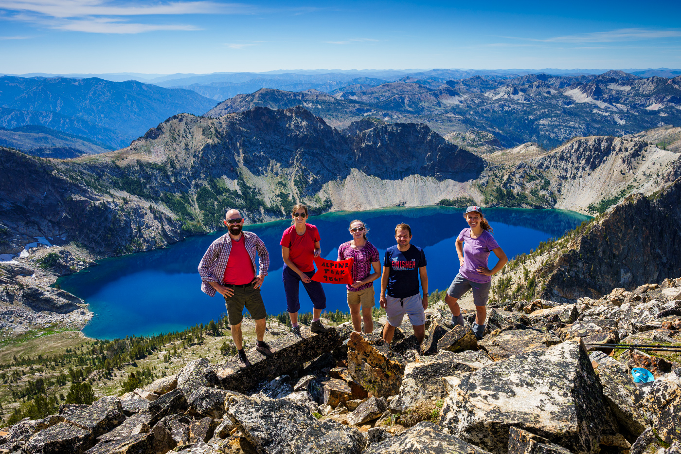
Alpine Peak, Sawtooth Mountains, with Sawtooth Lake below. (all photos by Anna Gorin)

Hi all,

Anna Gorin has Idaho mountain fever. 

A Boise photographer in her young 30s, she pursues big hikes in the Idaho mountains, bagging peaks at a blistering pace. She might climb three mountain peaks in a week, or even a day. She’s scaled 53 mountain peaks so far in 2023, and in 2021, she notched more than 70 Idaho peaks. Overall, she’s notched over 160 high points in Idaho.  

“I love getting out in nature and seeing beautiful views, plus the accomplishment of climbing to the summit,” Gorin says. “I love the alpine scenery, alpine meadows full of glowing wildflowers, and the snow-capped mountains make my heart sing.”

Gorin is on track to join the lists of the most accomplished peak-baggers in Idaho who have climbed more than 300 high points or more. Who knows, at this rate, she might even reach 500.

“Anna not only has a talented photographer’s eye for composition but also a climber’s eye for finding the best lines up mountains, said Tom Lopez, a prolific mountain-climber and author of “Idaho: The Climbing Guide.”   

Galena Peak - what a view! (Courtesy Anna Gorin)

Like me, Lopez has noticed that Anna Gorin is making significant tracks in Idaho's high country. For my outdoor tip of the week, I wanted to introduce Anna Gorin as someone to watch in the outdoor scene, if you haven’t noticed already! I recommend people pay attention to Gorin’s trip posts on the Hiking Idaho Facebook group. I’ve enjoyed reading about her trips and seeing her scale mountains on trails I haven’t experienced before, despite the fact that I’ve spent the last 40 years trying to cover every square inch of Idaho’s backcountry.

Gorin’s energy for exploring Idaho’s mountains is infectious just by the quality of the photos in her posts (she carries a good camera with her on trips), and the raging enthusiasm exhibited by her friends in her summit photos. She’s got a core group of 10-15 friends who go frequently. They’re clearly in great shape and having a great time, but you know that they felt their thighs and lungs burning on the climbs just like any other human being. But they had the gumption and perseverance to reach the summit.

Being goofy on Gunsight Mountain (Courtesy Anna Gorin)

They’ve also got the gusto to bag new peaks as often as possible, putting in late night drives on the bookends of trips to reach the mountains from Boise.

“I like to vary it between McCall, Stanley, Ketchum and Fairfield, depending on the weather. I enjoy going to see new places.”

Just on the spur of the moment, Gorin said her top 5 favorite Idaho peaks are:

  •      Standhope Peak in the Pioneer Mountains (elev 11,878 feet). “The view from the top was epic!” she says.
  •      Johnstone Peak in the Pioneers (elev 9,879 feet). “Sometimes the smaller mountains have better views of the peaks above.”  
  •      Elk Ridge in the Soldier Mountains (elev 8,551 feet). “It’s so pretty up there. That one has a great effort-to-reward ratio."
  •      He Devil in the Seven Devils Range, Hells Canyon (elev 9,400 feet). She saw mountain goats up there.
  •      Kelly Peak in the Sawtooths (elev 9,321).  “That peak has extensive views of the southern part of the Sawtooths.”

Gorin grew up in Boise. She didn’t really experience the outdoors that much as a kid. Her parents home-schooled her; the family went to Stanley maybe once a year. She went to Willamette University for college, majoring in art. She launched a photography business after returning to Boise from college, and she’s been doing that for over 10 years now. She does portraits in outdoor settings for clients and landscape photography. See more at annagorin.com

Anna knows where to find the beauty of Idaho ... Packer John Mountain with her beau, John. 
She also is dabbling with mountain biking. 

How she got into hiking:
In her mid-20s, Gorin started hiking in the Boise foothills, scaling Table Rock, riding the Boise River Greenbelt, things like that. She joined some meet up hiking groups and 20-30 age groups to meet people to go hiking with. A friend convinced her to climb Mt. Borah, Idaho’s tallest mountain, in 2017. She had climbed Mt. Olympus in 2012, which she recalled being quite challenging. It was her first official peak.

After summiting Borah, she was blown away by the roof-top view. “This is an amazing mountain," she thought. "There’s nothing else higher anywhere around me. This is so cool!”

“I loved that feeling, and that drove me to climb more mountains,” Gorin says.

Trip planning: She uses a wide variety of resources in planning her trips, including hard-copy national forest and topo maps, interactive Forest Service map, Caltopo maps online, Google Earth, Tom Lopez’s “Idaho: A Climbing Guide,” Lists of John, and mountain-climbing notes from John Platt, who was a person cut from the same cloth as Anna, but probably more of a technical climber than she wishes to be.

Climbing ridge tops has rewards in terms of big views. But it's hard! 

She also uses AllTrails.com, Summit Post, and more online resources. She spends a lot of time planning trips to understand the challenges ahead; she checks on trail conditions; she checks on weather and snow levels before she goes. She recommends lots of advance planning for a safe journey. But even with all the planning, things can become challenging!

“I also enjoy the puzzle of getting places,” she says. “Sometimes it can almost be like a problem-solving game to figure things out or thrash through the brush while cross-country hiking to find our way to the top.”

Next time you’re online, watch for Gorin’s stunning photography of Idaho’s mountains and trip notes. You might just discover some new places to explore!

-    - SS

Fishhook Point, Sawtooth Range (courtesy Anna Gorin) 


Thursday, March 17, 2022

Three Sweet Hikes that Shine in the Spring - Hells Canyon, Rapid River and Mary's Creek/Sheep Creek!

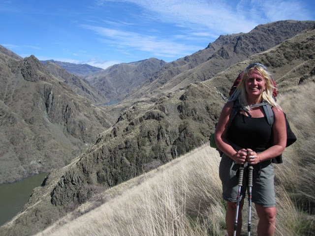
Denise Lauerman enjoys a spring backpack trip in Hells Canyon. 

Hi all, 

Spring is just four days away on Sunday, March 20, so the actual spring season according to the official American calendar is upon us. The trails and roads in the low country are beginning to dry out - in between rain storms - and the weather is warming up into the 60s at times. That gets people antsy for an outdoor adventure. 

For my outdoor tip of the week, I'm recommending three sweet hikes that shine in the spring in SW Idaho:

- Snake River National Recreation Trail in Hells Canyon, starting from Pittsburg Landing. 

- Rapid River Trail in Riggins. 

- Mary's Creek and Sheep Creek in the Bruneau River country.

The weather forecast for this weekend looks sunny on Friday with a high near 60, cloudy and rainy on Saturday, and then clearing and sunny on Sunday with a high of 50. That's the forecast for Boise and Riggins. Even if this weekend doesn't work to visit these destinations, you could wait and visit one of them at another time. 

Snake River National Recreation TrailA few years ago, I wrote about hiking or backpacking 6 miles (one way) from Pittsburg Landing to the Kirkwood Historic Ranch. A friend of mine, Denise Lauerman, and two of her friends backpacked to Kirkwood, and spent a couple of nights camping in Hells Canyon before returning to the trailhead in Pittsburg Landing. 

"It was a great trip -- I can't wait to go back," Denise said.

Hells Canyon, the deepest gorge in North America at over 7,000 feet, stradles the Idaho-Oregon border for more than 100 miles. The mighty Snake River flows through the heart of Hells Canyon and continues on to Lewiston. Hells Canyon is usually the warmest spot in Idaho, and it's also drier than many areas, so it's a good bet for a spring trip. Ditto in the fall. In the middle of the summer, it gets sizzling hot; hence, the name. The austere black rocky canyons also have contributed to the name.

The trip starts with a 4.5-hour drive from Boise to Pittsburg Landing, the trailhead, via ID 55 to New Meadows, U.S. 95 to Whitebird, and then a well-maintained, steep gravel road from Whitebird over Pittsburg Saddle to the trailhead at Lower Pittsburg Landing. Signs will guide you the whole way from Whitebird. Four-wheel-drive is not required.

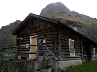
Kirkwood Museum 

It's 6 miles from the trailhead to Kirkwood Ranch. Denise and her friends drove in on a Friday, backpacked to Kirkwood in the afternoon (allow 2.5-3 hours travel time) and base-camped on the grass next to the Kirkwood Museum, where former Idaho Gov. Len B. Jordan and his wife, Grace, ran a sheep ranch in the 1930s.

The museum is definitely worth visiting. Behind the ranch, there is a two-track gravel road that climbs Kirkwood Creek for more than 3,000 feet to a high saddle. This is a great side-hiking opportunity that Denise and her friends climbed on Day 2, seeing all kinds of cool wildlife and landscapes along the way.

On Day 3, they side-hiked to Suicide Point along the Snake River, came back to Kirkwood, strapped on their backpacks, and hiked out. Suicide Point provides great views of the river canyon.

For more information, go to the Hells Canyon National Recreation Area web site. You can purchase maps at the Hells Canyon NRA office in Riggins.

See the full post Hells Canyon hiking 

Rapid River Trail (courtesy Hiking Project

Rapid River Trail in Riggins

This is a beautiful hike along Rapid River when things are greening up and coming to life in Riggins. Here's a description from All Trails. Full length is 8.6 miles out and back. You may not be able to go to the top of the hike, but you could likely hike a couple of hours to a high point that works for you. The trail winds along the river and then climbs up on a high ridge. Great views of the surrounding area. 

Trailhead is next to the Rapid River Hatchery on the south end of Riggins. Watch for signs on U.S. 95 to the hatchery.

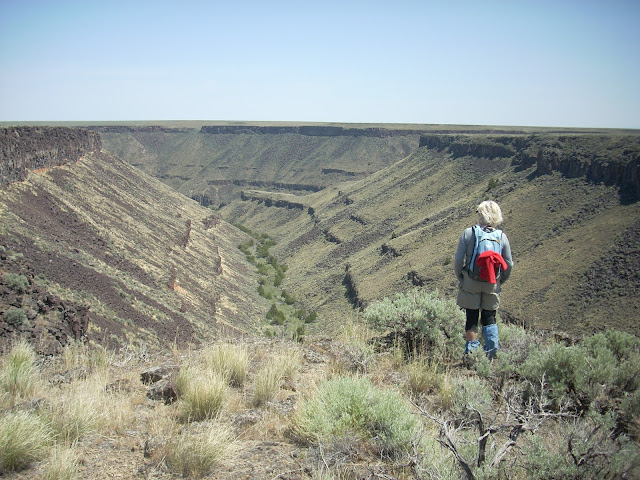
Barb Cochran looks into Mary's Creek canyon, a tributary of Sheep Creek.

Mary's Creek and Sheep Creek
 

Mary's Creek is one of the easiest places to access in the Jarbidge-Bruneau Wilderness. You can do a 8.75-mile loop hike from the Mary's Creek Trailhead to Sheep Creek canyon and back. The route I recommend in my Owyhee Canyonlands book takes you along the edge of Mary's Creek canyon, which features large black lava rock,  and then you drop quickly into Sheep Creek canyon (rhyolite and basalt) where you can have lunch or camp out next to the creek. And then retrace your tracks back to the trailhead. 

You also can camp at the Mary's Creek trailhead or in other BLM dispersed camping areas off the Roland Road.

Getting there: Take I-84 to Mountain Home, then Idaho 51 to Bruneau. Head south on Idaho 51 toward Duck Valley. It's about 40 miles from Bruneau to the signed turnoff for Roland Road on the left side, just past the old bar and junk yard in Grasmere. Go left on Roland Road and take that good-quality gravel road 5.2 miles to Mary's Creek Wilderness trailhead. 

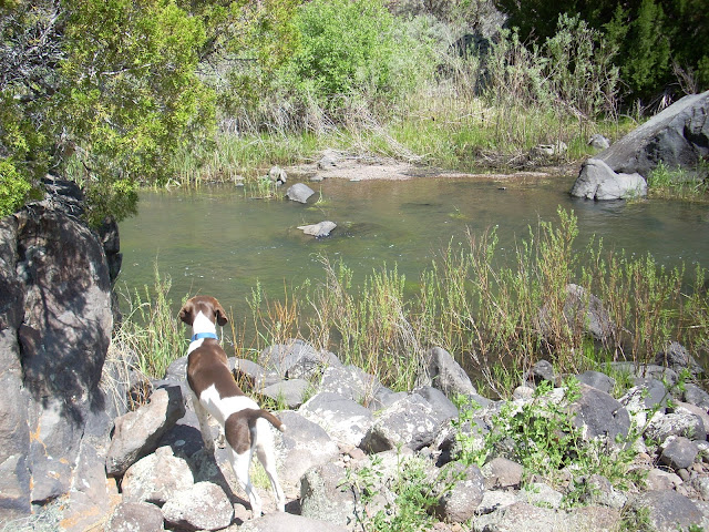
Huck checks out Sheep Creek. 

- SS

Thursday, July 8, 2021

Looking to cool off in the Idaho mountains? Six keeper hikes to explore in the greater McCall area, recommended by local experts

How about your own personal snowfield? Huck liked it!

Hi all, 

Many of you are no doubt heading for the high country, high mountain lakes, mountain towns and shady spots along our wonderful rivers and streams to stay cool during this wicked unrelenting triple-digit heat. 

So if you're visiting the greater McCall area to cool off in the near future, I wanted to call attention to the current issue of Visit McCall magazine, Summer 2021. The McCall Chamber of Commerce partnered with Roger Phillips, yours truly and Scott Merchant to write about some of our favorite hikes in the vicinity.

I wrote about hiking the Bear Pete Trail from Cloochman Saddle to an overlook of Josephine Lake, Phillips wrote about "Goldilocks destinations" - Upper Hazard Lake and Hard Creek Lake, and Merchant wrote about "Wildflower Pilgrimages" to Granite Mountain, Box Lake and Lava Butte Lake.

Here's an online link from the McCall Chamber site that provides the full stories from all three of us ... Just ask an expert! https://visitmccall.org/favorite-hiking-trails-around-mccall-ask-an-expert/ 


Hard-copies of the full-color magazine are available in McCall Chamber office and local stores.

Editor McKenzie Kraemer's intro for the "Walk in the Woods" stories is intriguing: 

"There are about a million benefits to hiking - from the stunning scenery to the cardio boost of an uphill climb - but the underlying appeal, and the thing we always come back to, is that a walk in the woods has a magical way of bringing calm and connection."

My narrative on Bear Pete Trail tells the god-honest truth that I discovered the trail in the mid '90s in my quest to explore all of the bikeable trails in the greater McCall area for my guidebook, Mountain Biking in McCall. Turns out, it's a super hard gut-buster ride to scale the ups and downs of Bear Pete Mountain from the south to the north, or the north to the south, but it's one heck of a fun and adventurous full day's ride. 

I've returned to the southern trailhead at Cloochman Saddle (about 20 miles north of McCall) to hike the trail, which is much easier than trying to bike it. I'd rate the hike as being moderate with strenuous sections to the Josephine Lake overlook or points farther north. But it's definitely doable for most abilities; great for kids. 

One of the biggest benefits of the Bear Pete hike is to experience the feeling of seeing big and massive mountain ranges all around you, giant hunks of granite lording over the upper Payette River watershed on one side, and then an endless sea of mountains reaching to the north, toward the Salmon River - River of No Return, and the 2.3-million-acre Frank Church-River of No Return Wilderness. You are on the edge of wilderness for literally hundreds of square miles in Central Idaho. 

It's a place where I feel small, as a humanoid. 

See the online link to read my story about Bear Pete and get directions to the trailhead. I'll share some more pics below ... 

The Payette Crest looking east from Bear Pete Mountain


Wendy at the overlook of Josephine Lake

Huck sniffs the bear grass ... love it when you can see those white bulbs in bloom

Snow-covered ridgeline above 7,000 feet ... You can see forever up here! 

Thursday, August 22, 2019

Bogus Basin mountain bike festival, hiking Granite Mountain and house party for Lauren McLean

Riding at Bogus Basin is a pleasant alternative with cooler weather, shade and great trails! 
Hi all,

If you haven't been mountain biking at Bogus Basin this summer, this weekend looks like the perfect time to go.

Bogus is hosting a Mountain Bike Festival from 10 a.m. to 6 p.m. on Saturday. Chair #1 will be running to take folks to the top of Deer Point. There are guided rides for men, women and kids, professional riders competing in the "Whip-Off" big air challenge, demo bikes, raffles and more.

The event costs $45 through Friday, and $50 on Saturday. Register here

The goal, according to organizers, is to celebrate mountain biking by "bringing our passion-filled mountain bike community together." Meet new riding friends, meet local shops and services, get out and ride the trails and enjoy what should be a nice cool mountain day. Participating bike organizations and shops include SWIMBA, Central Idaho Mountain Biking Association (CIMBA), George's, Idaho Mountain Touring, Reed Cycles, Boise REI, World Cycle, Eagle Bike Shop, McU Sports, Rolling H Cycles, and Kore North Bicycles.

I love the trails at Bogus. If you haven't gotten to know the trail system up there, you need to. IMBA rated the Around the Mountain Trail at Bogus the best in the state of Idaho! 


------------------------
Granite Mountain summit and USFS lookout. Elevation 8,500 feet.
Hike Granite Mountain

I went for a fun hike to the top of Granite Mountain last Saturday while I was in McCall. Here's a link to my Facebook pics. I'd rate the hike "moderate." It was 3+ miles to the top of Granite Mountain from the trailhead off the Goose Lake Road. Travel time was about 4+ hours round-trip.


The views on top are fantastic. There's a manned Forest Service lookout tower on top. You can see the Wallowas and Seven Devils to the west, Meadows Valley and the Little Salmon canyon leading down to Riggins, the northwest corner of "the Frank," the Payette Crest off to the east, and Brundage Mountain, and Long Valley to the south.

Granite Mountain is the giant hulk of mountain that looms to the west of McCall when you approach the mountain community. Brundage provides snowcat powder skiing trips on Granite, and I have had some legendary times up there on the mountain.
--------------------------
House party for Lauren McLean 

The political race for Mayor of Boise is under way. I have known Lauren McLean since the first $10 million open space campaign 1999-2001, and she has been a proven champion of open space and trails for the Boise Foothills ever since. I still feel that winning that initial open space campaign was a transformative event for the City of Boise, and now there's huge community support for open space, trails, conservation and water quality.

Mayor Bieter has had four terms to lead Boise, and I think a lot of people feel they are ready for a change.

My partner Wendy Wilson and I are co-hosting a house party on Thursday, Aug. 29, for Lauren at our home at 3209 N. 39th Street in NW Boise. Sam Sandmire and Cary Hattabaugh, Diane Ronayne, Zack Waterman, Nicole LeFavour, Suki and Bill Molina, and Elena Lansing are co-hosting. 

We are inviting folks to come hear Lauren speak about her priorities for the City of Boise moving forward, even if you haven't made up your mind. We are inviting outdoorsy and conservation types. Shiny Shoe Bob is playing music, and we'll have food, wine and beer.

If you're interested in coming to the house party, please RSVP to wwwilderness3920@gmail.com. 

Please see our Facebook invite for more information.    
- SS

Thursday, August 15, 2019

Refresh your soul with a double mountain lake hike to Snowslide and Maki Lakes

Huck looks for fish in Snowslide Lake
Wildflowers were magnificent on the pass on the way to Maki Lake. Edelweiss moment.
Hi all,

My tip of the week is about hitting the high mountain lakes in the premium part of the hiking season in August and September ...

See my article in the Idaho Press about hiking to Snowslide and Maki Lakes off of Lick Creek Road in McCall. The article was published on Wednesday, Aug. 14, in the Idaho Press Outdoors section.

Maki Lake also could be named Hidden Lake ... you won't see it until you arrive ... 

Cool to have both lakes to ourselves on a Saturday in August. 


Looking down at Snowslide Lake from the pass above ... granite granite everywhere! 

Thursday, May 4, 2017

Climbing Mount Heinen, the toughest of the Boise Grand Slam Peaks, is a rewarding trip

Looking back at Mt. Heinen on the north side ... very steep approach from this side. 
Jack, Joanie and Steve on top of Mt. Heinen 
Celebrating the completion of Steve's Grand Slam on top of Mt. Heinen with Jack, Joanie and Judy 
Hi all,

I've been pecking away at the two remaining Boise Grand Slam peaks this spring to complete my Grand Slam, and by climbing Mt. Heinen with three friends on Saturday, I did it! 

At 6,390 feet, Mt. Heinen is the tallest of the Grand Slam peaks, and definitely one of the most strenuous hikes. But we hiked it on a gorgeous sunny day last Saturday, with temps in the mid-60s, and it felt wonderful to be out hiking in wildflowers, green grass and relatively warm weather! 

Just for background, the Boise Grand Slam was created by Tom Lopez, a retired lawyer and the author of Idaho: A Climbing Guide. The concept is to give Treasure Valley residents an early goal of hiking the Grand Slam peaks to begin getting in shape for the summer backpacking and mountain climbing season. 

Joanie with her pup in the snow field on the north side of Heinen. Hiking poles were very handy on this trip. 
The other three peaks are Mt. Cervidae (closest to Boise and shortest, but still hard -- 2 miles straight up, 2,000 feet of climbing), Mt. Kepros (10 miles and over 2,000 vertical feet), and Lucky Peak/Shaw Mountain, the top of the eastern flank of the Boise Foothills.   

There are multiple approaches to Mt. Heinen. We drove up to the Cottonwood Creek Trailhead in the Boise National Forest, about 1.5 hours from town, next to Arrowrock Reservoir. We hiked one steep ridge up to the main ridgetop leading to Heinen Peak, and hiked another steep ridgeline back to the trailhead. It was a great adventure tour with no real trail most of the way, but pretty easy route-finding staying on the ridges. 

My friends Joanie Faucie, Jack Van Valkenburg and Jody Thorne went with me. We made for a good group, all hiking at about the same pace. We brought lots of water, a lunch, wind breaker, hiking poles and GPS for the trip. It took us about 4.5 hours to do the whole hike. Mileage was 7+ miles. Vertical gain over 3,300 feet. It'd rate the trip strenuous. 

Our route took us up a ridge above Garden Gulch, through the forest and then on a main ridge heading for Mt. Heinen.
From Cottonwood Creek Trailhead, we went back down the road toward Arrowrock Reservoir for a short bit, crossed the creek and climbed up a ridge above Garden Gulch. Be sure to respect the private property in the vicinity by the creek bottom. Once on the ridge, we climbed steadily through grass sagebrush terrain and wildflowers until we reached the timber zone, and then we had to navigate a little brush to reach the top ridgeline. Once on that ridge, we ran into a couple that was hiking to Heinen from the South Ridge, or Irish Creek Campground by the reservoir. This route is 4.5 miles one-way, with 3,880 feet of gain. Our route was more direct, but perhaps more punishing. 

It was super pleasant on the ridge, and an easy walk up to Heinen. We had almost no wind up top, so we could hang out and eat our lunch. There are two rocky peaks on Heinen that seem to be the same elevation, but the peak furtheast west is the one with the USGS marker on top, and a water bottle containing some note paper for hiker notes. I signed my name. 

The descent off the north side of Heinen was super-steep! There was a snow field that we slid down on our boots laterally, and then we hiked down the face of the mountain over the ridge we planned to descend. It was a delightful walk downhill along the backbone of a steep ridge, with major elk habitat in the dense timber, and open brush, or bird and deer habitat on the sunny side of the ridge. Huck flushed three big blue grouse on the way down, and at least two on the way up. 

Matt Clark of the Idaho Trails Association says he calls climbing Heinen, a Heineken-type of hike because you earn your beer -- and your dinner -- on that one! I sure was glad to have a hot tub to jump into when I got home, with a PBR in hand. 

See more pics on my Facebook page. 

Have fun! 
- SS 

Thursday, September 13, 2012

Boise woman conquers all 9 of Idaho's 12,000-foot peaks in 1 year; who's going to do it next?

She's summited all nine 12ers in Idaho! Irene Vogel on the summit of 12,228-foot Leatherman Peak
Hi all,

I like to climb mountains, and I know a lot of you do, too. But I'm not a technical rock-climber. I had a really close call on the side of Mount Washington in Montana while I was in college that almost got me killed, so I'm much more comfortable bagging peaks that are doable as a walk-up or a hands-and-feet scramble.

I noticed on Facebook this summer that Irene Vogel of Boise was on a quest to climb all nine of Idaho's 12,000-foot peaks -- the highest peaks in the state -- in one year. That's something that I've never done, but it's definitely something I'd like to do, so I thought I'd share her story in case it's something you'd like to do as well.

Vogel made it a goal to climb all of Idaho's 12ers in one year last January. She thought it would be a neat and challenging thing to do the year she turns 40. She had climbed the state's highest peak, 12,662-foot Mt. Borah and 12,228-foot Leatherman Peak the year before, and she had gotten hooked.
Irene on the trail ... Check out her gear 
Both of those climbs were challenging, she says. "It took me 16 hours to climb Leatherman from the Pahsimeroi side," she says. "I loved it but I was totally exhausted. It was really hard."

Two weeks ago, Vogel achieved her goal by summiting Leatherman again, this time in only 3 hours (the climbing part). Eleven of her friends went with her. Each of them brought back a rock for a cairn they built at Vogel's home, with their name on it. "It's been a really cool journey," she says. "I have so much support from friends who went with me on the climbs, and support from friends and family who live here in town. It's been a great experience."
View from the top of Hyndman Peak in the Pioneer Mountains
Getting ready - training. Vogel says she didn't do any specific training for the big climbs, but she did a lot of biking and hiking on Boise foothills trails, road biking, and snowshoeing in the winter. She also worked on three winter ascents in early 2012 -- Cobb Peak and Hyndman Peak in the Pioneers, and Cone Peak in the Boulders. "That got me in shape," she says.

Planning resources: Summitpost.org and Idaho - A Climbing Guide by Tom Lopez. Lopez's book has great information on getting to the trailheads, and details on different scramble routes, and summitpost has helpful notes from other people who have climbed the peaks and posted photos of their journeys.

She didn't quite make it to the top of Hyndman because of winter weather, so that would have to wait.
In May, she climbed 12,197-foot Diamond Peak in the Lemhi Mountains. There was still snow on the mountain (it's recommended as a better winter ascent than summer), and she did the steep ascent with crampons.

Sequence of her 12er ascents: 1. Diamond Peak; 2. Lost River Mountain; 3. Hyndman Peak; 4-5. Donaldson Peak and Mount Church (both can be done in one day); 6. Mount Idaho; 7. Mt. Borah; 8. Mount Breitenbach; 9. Leatherman Peak.

A mountain goat lording over the high country
Vogel had a friend, Jake, who also was working on bagging all of Idaho's 12ers, so she followed his priorities as their weekends allowed. She fit in the other peaks with friends. She and Jake did five of them together, including Leatherman at the end.

She didn't let the smoke from the summer's fires slow her down. She had to deal with some smoky air from time to time, but it didn't bother her lungs. "It might have caused problems for other people, but it didn't bother me," she says. "We had lightning, thunder, sleet, rain, snow, high winds -- weather was a bigger deal."

Storms can come up quickly with little warning at 12,000 feet. The toughest ascent was 12,078-foot Lost River Mountain, Vogel says. The main route to the summit is a "super" gully, described as being "nasty" over a mobile rock scree field. "The snow in the gully was rotten, and we had to climb up the rock scree chute with 45-50 mph winds blowing the whole time," she says. "It was tough on a knife-edge ridge ... I didn't want to get blown off the mountain."
Irene's route up Lost River Mountain amid 45-50 mph winds 
Easiest climb: Mt. Borah "because there's a trail all the way to the top" and Leatherman (this year).

One of the challenges for Vogel is that she's found that she is susceptible to altitude sickness, so she has to force herself to eat snacks on the way up the mountain and hydrate. Her favorite trail foods are trail mix, peanuts, peanut butter pretzels, fruit bars, things like that.

Equipment: She carries a windproof and waterproof jacket for ridgetops and summits. She wears zip-off hiking pants, Asolo hiking boots and gators. Layers of clothing on top that can be peeled. She likes to use hiking poles especially for the way down. For some peaks, she needed crampons or an ice ax. She also wears rubber-coated gardening gloves for ascents. "Rubber is good. It helps with gripping  onto the rocks when you're climbing hand-and-feet on steep slopes."  
Most of the routes up the 12ers are "pretty much straight up" 
For water, she carried a big 4-quart water bladder and an extra water bottle.

All of the climbs are different, she says, but one commonality is "a lot of the climbs are pretty much straight up and all of them have rocks and scree."

Looking at the list of 12ers, you see elevation gains of 4,500 feet, 4,100 feet, 4,200 feet, 5,500 feet, etc. For some, she camped at a trailhead and started out early to head for the summit, returning by late afternoon. For others, she packed into a base camp one day, and climbed the peak the next day.
Heidi-ho! 
Why go to the top? "For me, it's the pristine beauty of it. It's so pretty being able to see all of the different mountain ranges in Idaho from the top." And being at over 12,000 feet, you are on top of the world in Idaho, standing above the many 10,000-foot peaks in Central Idaho. "A lot of people think the Lost River Range is ugly, but I love the stark beauty of it."

Cool tradition: She took a cotton American flag to the summit of each mountain, unrolling it for a photo each time. The flag comes from her grandmother. In each picture at the summit, Vogel held her flag and Vogel would show which peak she had summited in the progression, such as No. 5, No. 8 or whatever, with her fingers.
Irene carries her grandmother's cotton American flag to the top of all the 12ers
Advice for others: Try climbing Mt. Borah, see how you do, and go from there.
  • Bring at least one buddy on all of the trips. 
  • Get in good shape before you begin doing the summit climbs.
  • Listen to your body and know when to turn back if you're not feeling well. 
  • Know when to pull the plug if bad weather sets in. Don't play chicken with lightning. 
  • If you get into a steep rocky area that has no foreseeable scramble route (it's getting too technically challenging and scary), you should turn around and find a better route. 
  • Stay hydrated. Drink lots of fluid and snack food on the way up. Some people may cramp up from dehydration. 
On the rooftop of Idaho. Nice going you guys!  
Vogel has met hiking mates through the Meet Up Boise Trail Heads and the Idaho Hiking Club Facebook groups, and the Idaho Outdoors Yahoo Group. I'm a member of those groups, and there are people making open invites for a wide variety of trips all the time. Leo Hennessy is leading a mountain bike ride in Silver City this weekend through Idaho Outdoors. Check out the web sites and join these groups if you're looking to join group hikes, bike rides, paddling trips, backpack trips, etc.   

I hope you fine Vogel's story inspiring. I know I did. I'm not sure I'll be able to knock off all of the 12ers in one season, but in my opinion, it's a laudable goal to try to notch them all in a lifetime. It's a cool bucket list item for the outdoorsy Idaho soul -- the Idaho equivalent of notching all the 14ers in Colorado (there are over 50 of them).  There are actual speed records for bagging all of Idaho's 12ers -- Dave Bingham and Rob Landis of Hailey did them all in 1 day, 14 hours and 50 minutes. My god! Nick Stover, a former adventure racer in Boise, did them all in 3 days, 11 hours and 16 minutes. Wow! 

You decide what kind of pace you want to set. 

Have fun! 
-- SS 

Thursday, September 3, 2009

Some ideas for Labor Day Weekend ...

Wah Hoo Review

The Big Hitch

I'm sure a lot of people already have plans for Labor Day, but here are some ideas in case you're still on the fence about what to do:

It's going to be crowded in many popular outdoor locations this weekend, so you might as well dive into the crowds in Ketchum/Sun Valley to experience the Wagon Days Celebration. This is a great outing for families. The Blackjack shootout is at 7 p.m. Friday on main street in Ketchum and the Big Hitch parade on Saturday begins at 1 p.m. The parade is billed as the largest non-motorized parade west of the Mississippi. Your kids will love seeing the covered wagons and people decked out in pioneer garb.

Check out the Ketchum/Sun Valley Chamber web site to look for the best deals on hotels, or you can camp out north of Ketchum or even in the Stanley area. Here's the calendar of events for the weekend.

On Friday and Saturday night, the "Wah-Hoo! Review" puts on a knee-slappin' foot-stompin' Wild West performance at the Sun Valley Opera House. You can do a BBQ and performance, or just the performance to save a little money. The performance costs $20 for adults and $15 for kids; BBQ and show costs $40 for adults and $30 for kids. Reservations: 208-622-2135.

While you're in Ketchum, you can ride the chairlift to the top of Bald Mountain and take a l-o-n-g gravity ride down the Cold Springs or Warm Springs trail on your mountain bike. Here's my writeup in Mountain Biking Idaho. It's 11 miles downhill the Warm Springs Trail or the Cold Springs route. If you don't bike, you can hike down. The descent is more than 3,000 vertical feet, so you'll get big views of the Pioneer and Smoky mountains and the Big Wood River Valley.

If you'd like to go mountain biking or hiking in the Wood River Valley, check out this web site for some trail ideas.

Some other possibilities: