
Petroglyphs at Wees Bar are believed to be 800 years old. (Courtesy everytrail.com)
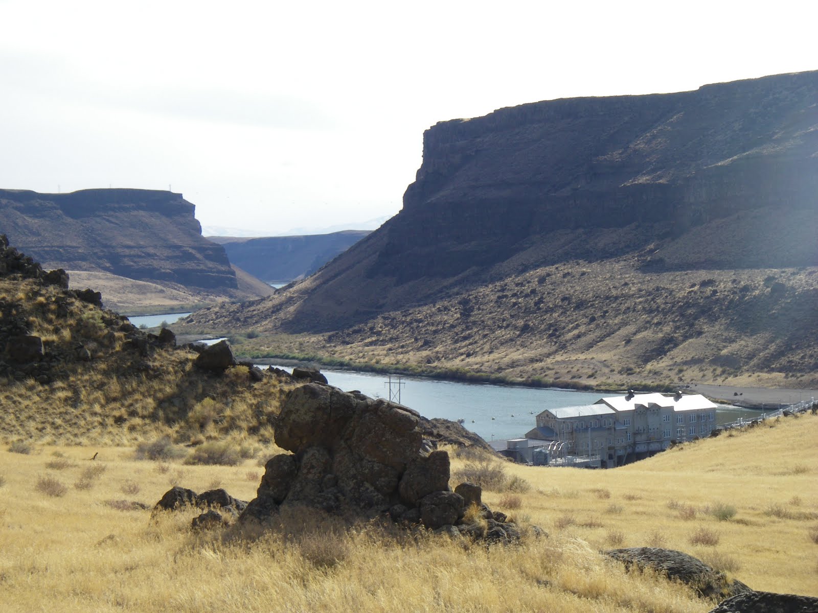
Canyon view looking down at Swan Falls Dam

Many pairs of golden eagles nest in the Snake River canyon

Map to Wees Bar from the Boise Trail Guide
Hi all,Well, we're a little stuck in between winter and spring right now, but with temperatures reaching into the mid-50s, the weather is suitable to do a little exploring in the Morley Nelson Snake River Birds of Prey National Conservation Area by Swan Falls.
This week I'm recommending going hiking, biking or running from Swan Falls Dam to Wees Bar, where one can view a variety of cool Native American petroglyphs, on the south side of the Snake River. It's 12.2 miles to Wees Bar from the dam round-trip. The biking trip is detailed in my guide, Mountain Biking Idaho, and the hiking and trail-running trips are detailed in my book, the Boise Trail Guide: 75 Hiking and Running Routes Close to Home.
It's not clear how wet it's going to be this weekend, so the trails to Wees Bar may be relatively dry or they may be a bit wet. The area around Swan Falls is typically quite dry, compared to most other areas in SW Idaho at this time of year, so it could be a good bet.
When you're on the way to Swan Falls or you're on the trail, be sure to watch for birds of prey activity. About 800 pairs of hawks, eagles, falcons and hawks nest in the birds of prey area. Bring a pair of binoculars or a spotting scope. Springtime is mating season. That means you can see the birds flying together in courtship. The aerial maneuvers can be quite impressive. Some birds nest in the cliffs, so you can check out nesting areas as well. Watch for large blotches of white in the rocks for bird nests or perching activity.
Here's a video about raptors in the the birds of prey area.
To reach Swan Falls Dam, take Interstate 84 to the Meridian Road Exit. Go south on Meridian Road to Kuna. In Kuna, follow the signs to the birds of prey area. You'll turn left on a paved road going dead south to the Snake River canyon rim. The BLM has a nice road-side stop with a rest room where you can hike out to the rim and watch for soaring birds of prey and enjoy a major view of the canyon. That's worth a stop.
To reach Swan Falls Dam, take Interstate 84 to the Meridian Road Exit. Go south on Meridian Road to Kuna. In Kuna, follow the signs to the birds of prey area. You'll turn left on a paved road going dead south to the Snake River canyon rim. The BLM has a nice road-side stop with a rest room where you can hike out to the rim and watch for soaring birds of prey and enjoy a major view of the canyon. That's worth a stop.
Here's an overview map of the roads in the area.
Proceed on the paved road to Swan Falls Dam. It's a nice place for a picnic if nothing else.
To reach the trail to Wees Bar, cross the river on the dam walkway, and pick up a dirt singletrack trail to the left, heading upstream. Turn right at the first fork and follow the two-track uphill for a short distance. At mile .9, turn right on a two-track, and then at mile 1.1, turn right again to follow the main two-track that runs alongside the Snake River to Wees Bar.
At mile 3.2, you'll pass by an old ranch site. At mile 4.5, the trail bends to the left to climb around a small butte. Pass through a narrow slot in a gate and keep heading west. At mile 6, the trail becomes braided and many large boulders appear in the flood plain area called Wees Bar. Look around for the petroglyphs (ancient Native American inscriptions) on the rock.
Take a break, watch for birds of prey in the cliffs above, and retrace your tracks to the trailhead and Swan Falls Dam.
If the trail to Wees Bar seems too wet, you can bike or hike along the dirt road on the north side of the river, or drive it with a 4WD until you're ready to get out and walk and look around. There are a number of places where you can can car-camp along this road.
When the weather warms up, it's also possible to kayak, canoe or raft the Snake River down to Celebration Park. It's about 10 miles to do that float trip, and a 12-mile vehicle shuttle.
--SS


1 comment:
So, after crossing the bridge we turn left? I did this yesterday and couldn't find those petroglyphs.
Post a Comment