Thursday, June 23, 2016

Five fabulous kid- and family-friendly bike rides in Cascade and McCall

Kids do amazingly well on the Bear Basin Trails in McCall 
Barb and Paul ride a boardwalk on the Shoreline Trail at Jug Mountain Ranch 
Dropping into Upper Drain in Bear Basin 
Cindy and Steve Jones on the North Valley Trail, south of McCall 
Hi all,

The weather is warming up and many people from the Treasure Valley will be heading up to Cascade or McCall to stay cool, maybe take a swim and hang out at the cabin or go camping.

Audio from 94.9 FM The River for this segment. 

My own family has a wedding in McCall this weekend, so we're gearing up for that. In the spirit of enjoying the green and forested setting in Valley County, I'm offering up five fabulous kid- and family-friendly bike rides to consider when you're in the neighborhood. I've blogged about many other more expert trails in the area, but this week, it's about kids and families. These trails are just fine for adults, too, especially those who like a relatively low-key experience.  

I'll start with the easiest trails and work up from there. All of the trails except the Strand are featured in my guide, Mountain Biking in McCall.

1. The Strand in Cascade -  Kid-friendly rating ***** The Strand runs parallel to the North Fork of the Payette River from the south Hwy 55 bridge trailhead in Cascade to a point just short of Water's Edge RV Park. It's 2.2 miles one-way. At the north end trailhead, you just turn-around and ride back to the south bridge trailhead. This ride is cool because it runs along the river, where you might see wildlife, and then it also runs by Kelly's Whitewater Park, where you can see kayakers and surfers play in the waves. Plus, there's a nice lawn there and places where you can walk down to the river's edge and watch as close as you want. 
The Strand along the North Fork of the Payette River 
2. Crown Point Trail in Cascade - Kid-friendly rating ***** This trails runs alongside Lake Cascade from the Crown Point camping area 3 miles to the north trailhead at Vista Point Road. It's an out-and-back ride on a mostly flat surface with pine trees bordering the trail on both sides, or really nice lake views off to the west, plus West Mountain towers above on the opposite shore. There are some sweet beaches directly adjacent to the trail, where you could hang out and have a picnic, go swimming or just relax. Getting there: Take Lake Way from ID 55 to a point where it ends by the campground. There's a small parking area by the trailhead for Crown Point Trail. 

Spacious beaches next to the Crown Point Trail look inviting 
3. North Valley Trail - Kid-friendly rating **** The North Valley Trail is a little more challenging than Crown Point Trail because it has some singletrack sections, which might be difficult for young riders. Ideally, I recommend starting on the greenbelt path next to the City of McCall offices on Park Street in downtown McCall, and ride the paved pathway out south to where the path ends by the McCall Smokejumper Base on Mission Street. Go left (south) along Mission Street, pick up the paved pathway in River Ranch, keep riding south, and then follow signs to the North Valley Trail. It's about 1.5 miles or so from downtown to this point, and then it's another 3.5 miles on the North Valley Trail to Heinrich Lane. The trail ends here, so it's five miles back to the start; 10 miles total. The North Valley Trail is very scenic -- it runs by a large wetland pond, where you can see water birds, and it's bordered by pine trees for most of its course. It's a mix of two-track and singletrack on the old RR ROW. 

North Valley Trail is bordered by pines 
4. Bear Basin - Kid-friendly rating **** For kids 8 and up, the Bear Basin Trails are a perfect place to take the family for a low-key ride. The trail map shows green, blue and black trails by difficulty, which is helpful for those riding the area for the first time. I led a big group of my family on an intermediate ride last summer, starting on Baby Bear, dropping into the shadows of big trees on Sleepy Hollow, then climbing Blue Ridge to Upper Drain, a challenging switchback trail with big bermed corners. Even people who have never ridden banked corners do amazingly well when they try it for the first time. If it's too scary for some folks, have them walk down the trail. Upper Drain runs into Grand Traverse (not signed), the first singletrack trail you come to. Go left and return to Baby Bear junction. Try different routes and have fun in Bear Basin! 

5. Jug Mountain Ranch - Kid-friendly rating **** Jug Mountain Ranch continues to add more trails and knock it out of the park in terms of trail design and big fun factor. They've got a shuttle service to make it easy to reach the top of their trail system, or you can climb to Jug Mountain Reservoir and enjoy a super fun gravity ride downhill. The trail everyone is raving about lately is Berm N Ernie. Check out of the video and see what you think! Download their trail map here. One possible short loop is to ride the South Elk Loop, return to the trailhead area and take Basic Training to Mid-Mountain doubletrack, then take the lower part of Berm N Ernie back to the start. Or, take South Elk to the South Boundary Road, climb to the reservoir, ride Shoreline around the lake, descend on Vandelay, Harper's Hollow and finish on North Elk. JMR has a cool overnight shelter at Jug Mountain Reservoir that you can rent. Call (208) 634-5072 for more information. 

Have fun! - SS

Thursday, June 16, 2016

New detailed guide now available for Boulder-White Clouds; Go see North Fork Championships - Big Whitewate Fun!

Matt Leidecker is a professional photographer and explorer.
I recommend his new guide on the Boulder-White Cloud Mountains
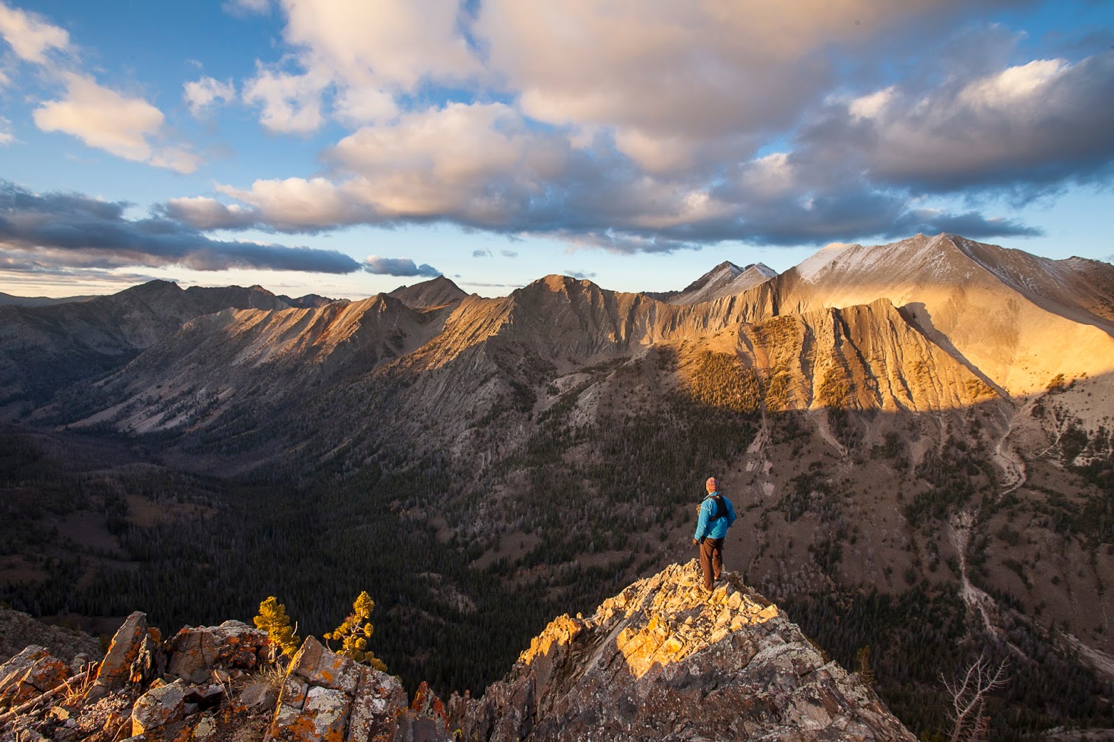
Matt checks out the scenery in the BWC's. He covered 526 miles
and 127,000 verts in researching the guide for hiking and biking.  
Top of Jerry Peak (Matt Leidecker photo)
Sapphire Lake (Matt Leidecker photo)
Castle Divide and Castle Peak (Matt Leidecker photo)
Big Boulder Lakes (Matt Leidecker photo)
Hi all,

After a wonderful week of cool unstable weather, things are smoothing out this weekend, at least on Friday and Sunday. A small chance of rain (20%) is forecast for Saturday, with highs in the 70s in Boise, but I wouldn't let that keep you from going out to watch the North Fork Championships on the single gnarliest section of the North Fork of the Payette River, near Banks, Idaho.

Here's a video teaser about the event.

It's amazing to watch these world-class kayakers leap into the North Fork from the Red Bull boat ramp, right at the top of Jacob's Ladder Rapids, and not only negotiate the steep, chaotic rapids, but also follow a distinct line through slalom gates to win points ... or not. Any slight change in the river currents or a paddle stroke can screw up your line!

The event starts at 1 p.m. Saturday along Jacob's Ladder Rapids, about 8 miles north of Banks, on Idaho 55. Get there early to get a sweet viewing spot on the banks of the river! Tomorrow afternoon, there's a BoaterX race on S-turn rapids on the North Fork, starting at 3 p.m. Six kayakers race through the rapids and the fastest two advance to the next round. Should be wild!

Matt Leidecker 
This week, I also wanted to call attention to Matt Leidecker's new guidebook, Exploring the Boulder-White Clouds - A Comprehensive Guide. Talk about being Johnny on the spot! The Boulder-White Clouds Wilderness was created by Congress last August, and Matt has his book ready for retail sales as the summer recreation season kicks into high gear. Kudos to him!

He's been running a Kickstarter campaign in hopes of raising $4,000 to cover printing costs of the guide, and lo and behold, he's surpassed his goal with $6,252 in contributions -- presales revenues for people who pre-ordered books, maps, note cards, photographs, etc. It's a great concept to fund a guidebook via Kickstarter. It worked also for Mark Lisk and me to cover printing costs for our award-winning book, The Owyhee Canyonlands - An Outdoor Adventure Guide.

As anyone knows who has a Matt Leidecker paddling or hiking/biking guide, he really digs into the subject matter and produces a very comprehensive guide, with all of information you would expect about each trail, high-quality photographs, maps, history and geology. The BWC guide is no exception. He covered 526 miles, climbed 127,000 vertical feet on foot or bike over 50 days of exploration. "I wanted to give people the best overall picture of what's out there," he said in an interview with Boise State Radio.

He has detailed descriptions and maps to every drainage in the Boulder-White Clouds area, inside and outside the wilderness, including the new Jim McClure-Jerry Peak Wilderness between the East Fork of the Salmon River and Trail Creek Road, an area that many hikers haven't explored. I look forward to doing some trips in that area in the future. You can tell from all of Matt's descriptions that he's been there. Besides following trails, he provides off-trail hiking suggestions in places. I also liked a concise wildflower guide in the back of the book with color photos - that's handy!

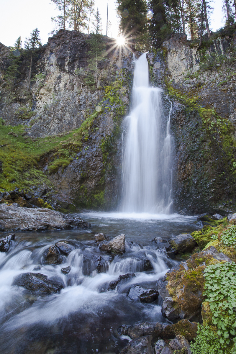
East Pass Falls (Matt Leidecker photo)
BTW, here the big-picture online wilderness maps from Congressman Simpson's office, it will help with trip planning: White Clouds Wilderness, Hemingway Boulders Wilderness, Jim McClure-Jerry Peak Wilderness.

For destination backpacking in the White Clouds, consider heading into the backcountry from the Fourth of July trailhead and hiking to Chamberlain Lakes. Take a side trip to climb Castle Peak! Or, hike the Little Boulder Trail to the Boulder Chain Lakes -- this is a very popular area in July and August. Same goes with the Big Boulder Creek Trail to Walker Lake and then Sapphire and Cove Lakes above there.

While those sterling high mountain lake areas are tough to beat, get a copy of Leidecker's guide to discover some more off-the-beaten path locations in the BWC area. I've always wanted to do the Big Casino-Little Casino loop on my bike (19.4 miles, 3,976 verts), or try to climb the Boundary Creek Trail to the Casino Lakes. I've hiked Boundary Creek just part way up until we hit snow, and the views into the Sawtooths across the valley is spectacular! All of those trails are rated "H" for "Hard."

The other place you have to go in the BWC's is Railroad Ridge! I did a post about driving up there in my Ford F-150 after Wendy had knee surgery several years ago. I also included RR Ridge in my Top 5 car-camping spots last summer. We got there when the wildflowers were peaking, and it was utterly spectacular! I scrambled down to Crater Lake to fly fish, while Wendy hung out and enjoyed the flowers. And then we camped at 11,000-plus feet there on the bare ridge, feeling like we were on top of the world. Very cool place!
Railroad Ridge with flowers going off everywhere! SS photo. 
For more information about where to buy Leidecker's BWC guide, see his web site. The new guide also is available at Idaho Mountain Touring, McU Sports, Boise REI, Backcountry Pursuit, Outdoor Exchange and Lonecone.
- SS

Thursday, June 9, 2016

Trails are open at Bogus! Bogus Creek Lodge is open Sat-Sun; chairlift service starts July 3

Around the Mountain at Bogus! 

Trailhead for Deer Point Trail #91 

Round the Mountain tracks 
Classic view of Around the Mountain ... you'll ride over a few rocks her and there ... 
Hi all, 

It's kind of funny -- it was hot last weekend, and I saw lots of people hiking, running and biking at Bogus Basin Mountain Recreation Area. I went up there to beat the heat, and I rode the Around the Mountain Trail -- rated No. 1 by IMBA in the whole state of Idaho! -- and it was fabulous!  

And now this weekend, when Bogus is opening the Simplot lodge during the day 11 a.m. to 7 p.m., the weather is cooling off, and the highs are forecast in the 60s at Bogus. Nevertheless, my outdoor tip this week is to go up to Bogus and go hiking, running or biking. I'm recommending two awesome loops routes in particular, Around the Mountain and Bogus Basin Contour Special, but there are many other options to enjoy. Bogus has a new trail map that's available at the downtown office. Ridge to Rivers also has a trail map of the Bogus area online

Note that Bogus will have some items available for sale in the lodge such as sunscreen, bike patch kits, energy bars and bike shuttle tickets, in addition to food and drink, a full bar, billiards and darts! Good idea!

Also note that Bogus will fire up the Deer Point chairlift for weekend operations all summer long on Saturday, July 2. That's a totally new thing! Single rides cost $10, all day passes cost $25, and summer season passes cost $99. Hours of operation will be 11 a.m. to 4 p.m. Bogus is building some new easy trails at the bottom of the mountain for kids and to add more trail options from the top of Deer Point lift. That's great to hear! 

Trail closure location (courtesy Land Trust of the Treasure Valley)
One more important note: The popular trail from the big pullout on Bogus Basin Road near MP 13 that leads to Eastside, Stack Rock and Sweet Connie is closed for up to two months because the landowner is logging in the area. You can still access Eastside from the trailhead near Bogus, and then you can connect to Stock rock and Sweet Connie from there. See press release for details. 

Now, here are the details on those two wonderful loops that circumnavigate Bogus Basin from two different vantage points. Both of them are featured in my book, Boise Trail Guide
  • Around the Mountain Trail - Distance: 9.8 miles. Difficulty: Intermediate for biking, moderate to strenuous for hiking and running. Tread: All singletrack. Travel time: 1.5-2 hours biking, 2+ hours running, 4 hours hiking (fast pace). Check out the 360-degree virtual tour of this route on the IMBA web site. The beautiful thing about this hike/run/ride is that it wraps around the forested mountain of Deer Point and continues to snake across the landscape to the Pine Creek side of the mountain and then Superior and then back to the front side. The route has about 1,500 verticle feet of climbing and descent. Start at the base area and pick up the Deer Point Trail #91 near the quad chairlift. Climb that trail a mile and then peel right on Around the Mountain #98. You'll climb for a couple of miles and then go downhill through a series of banked corners and switchbacks and then climb through the forest over to Superior and then you'll end up on a cat track that climbs to the top of Morning Star lift. Descend to the bottom on Morning Star trail or Sunshine. I saw a lot of flowers popping along the route last Sunday, and there was lots of creek water and springs for dogs. 
    Kelley Bachman on Elk Meadows Trail at Bogus 
  • Bogus Basin Contour Special - This one is shorter and easier, but it still circumnavigates the mountain at a higher elevation than Around the Mountain. Distance: 5.75 miles. Difficulty: Strong intermediate for biking; moderate to strenuous for hiking and running. Tread: All singletrack. Travel time: Slightly over an hour biking, 1:10 running, 2.5 hours hiking. For this route, you take Deer Point Trail #91 all the way to the top, two miles and 750 feet of gain. Take Elk Meadows Trail #94 and climb over to the backside and follow Elk Meadows on a highline singletrack underneath the Pine Creek chairlift through fields of flowers. You'll drop out on a two-track road at the end of Elk Meadows, contour over to the Superior side of the mountain and climb the switchbacks to the lodge return trail to the Pioneer Lodge or to the top of Shafer Butte for the best views and best workout. Bring a lunch and enjoy your time up there. Take Tempest or Lodge Trail to the Pioneer Lodge, and then Morning Star or Sunshine to the bottom. Vertical gain is the same as Around the Mountain: 1,497 feet.   
Enjoy the trails at Bogus! 

Also, Saturday is Free Fishing Day statewide. If you'd like to take your young kids fishing, this is the perfect time to do so. Idaho Fish and Game brings their fishing trailer to various ponds that are stocked with fish, and they provide fishing poles and tackle for your kids. More information here
- SS

Thursday, June 2, 2016

Hot weather means it's time to go paddling! Five flat-water paddling tips for the weekend!

New boat-dropoff by Quinn's Pond

New sandy beach next to Quinn's Pond 

People were paddling kayaks and SUPs at Quinn's Pond today 

Dock for swimming and whatnot ... 

Beach will be popular this summer

Greenbelt provides access to the pond, plus you can get there via Whitewater Blvd. 
Hi all,

Just as we turn into June, after an incredibly nice May, a warm front comes our way and brings 95 degree F temps for the weekend. Bam! That means it's time to go swimming and paddling to stay cool ...

Quinn's Pond on Whitewater Boulevard in Boise just re-opened after some renovation work, and it looks great! The new west shoreline of the pond is sloped with a sandy beach and grass for hanging out next to the water. Dogs are allowed. It's also got a primo concrete boat ramp for launching anytime of paddle craft, and next to the Greenbelt, there's a little drive-up drop-off circular drive where people can drop off their boats. Nice planning!

So my top recommendation for the weekend is to visit Quinn's Pond and go swimming, boating or hang out. You can paddle a kayak, an inflatable kayak or a Stand Up Paddle Board (SUP). Rentals and lessons are available at Idaho River Sports. See their lesson calendar. It's packed with opportunities almost every day. Alpenglow Mountainsport also rents SUPs and paddling gear on Bogus Basin Road.

More destinations for flat-water kayaking, canoeing or SUP'ing:  

#2 - Discovery State Park - At the foot of Lucky Peak Dam, the park is a nice place for a picnic and paddling. Launching a SUP or kayak works fine there, too.

Payette River in Cascade 
#3 - Middle Fork Payette River, Tie Creek section - This is a fun paddle on a moving stream. It's 8 miles from the boat-launch at Tie Creek Campground, north of Crouch, to the town of Crouch. You could do a bike or car shuttle. Plus, there's several great places to eat and drink in Crouch afterwards.
This trip is featured in my book, Paddling the Payette.

#4 - Montour section of the Payette River - 3.5 miles, float time: 1.5-3 hours. Bike shuttle works good. Put on the river by the bridge as you enter Montour Wildlife Management Area. The turnoff is 9.3 miles west of Horseshoe Bend on Highway 52. The river moves slowly through a wide river in this section, with cottonwood trees on both banks of the river. When the river flows are lower, the river can get braided in some sand bars before you get to Black Canyon Reservoir. Take out at the little park at the head of the reservoir. Featured in Paddling the Payette

#5 - Cascade to Cabarton - This is a super sweet paddling trip that a lot of people don't know about. It's nine miles of moving flatwater on the Payette River, from the ID 55 south bridge in Cascade to the Cabarton boat launch for the Class III whitewater run. Float time is 3-5 hours. Take your time and enjoy it. You'll see kingfishers, great blue herons, bald eagles, and West Mountain looming above as you float through pasture land. Now is a nice time to go, but anytime all summer works. Featured in Paddling the Payette

Stay cool out there!
- SS  

Thursday, May 26, 2016

Weather looks grand for Memorial Day weekend; Tips on where to go camping!

Classic car camping scenario in the Boise National Forest near Idaho City

Camping along the North Fork Boise River  

Fishing on the Middle Fork is better than the North Fork (Boise NF photo)

Salmon River beach scene - can't go wrong! 
Leslie Gulch is a scenic wonder. Great place to hike and camp. 
Hiking above Succor Creek State Park ... Steve and Drew 
Hi all,

Well, the weather looks great for Memorial Day weekend -- no rain in the forecast -- but it will be on the cool side at night (temperatures near or below freezing), especially in the Stanley and McCall areas, so be sure to bring plenty of warm clothes for the campout.

Memorial Day marks the beginning of the summer camping season for many of us. Assuming you're thinking about where to go camping this weekend, here are my recommendations:

  • Developed campgrounds or self-support dispersed camping sites along the North Fork of the Boise River and Middle Fork of the Boise River will be a great location this weekend. Temperatures are forecast to reach into the 70-degree range in Idaho City, so that'll be perfect for hiking, biking, fishing morel-hunting or hanging out in camp! All of the key access roads to reach the North Fork and Middle Fork are open. The Edna Creek Road to Atlanta also was just opened this week. 
  • Salmon River beach camping near Riggins - This is a great spot for hanging out on the spacious white sandy beaches on the Salmon River, upstream of Riggins along the Salmon River Road. Get there early. These spots are choice, so they are popular! Take your kayaks or rafts and do day trips on the Salmon River while you're in the hood. The Salmon River was running 26,000 cfs as of today ... 
  • Camping in the Owyhees or in the Snake River canyon should be great. Places like Bruneau Dunes State Park, Leslie Gulch, Succor Creek State Park, Celebration Park or the Morley Nelson Snake River Birds of Prey National Conservation Area would all be prime this weekend. See my Owyhee Canyonlands guidebook for details on visiting all of these areas.
  • Stay home and go hiking/riding or running in the Boise Foothills - Trail conditions are perfect in the Boise footies, the flowers are still happening and it's velvety green everywhere. See my Boise Trail Guide for ideas on where to go. 
See the Idaho Statesman's latest camping guide, published on Wednesday, for a rundown on some of their staff members' favorite camping locations in SW and Central Idaho. They also detailed what campgrounds are open or closed at this time of year.

In general, snow levels are at 6,500 to 7,000 feet in the mountains of SW Idaho and Central Idaho. In the Payette National Forest, there is still three feet of snow at Upper Payette Lake campground, and five feet of snow at Lick Creek Summit. Valley County apparently is working on opening the road to Burgdorf Hot Springs as we speak.

In the Sawtooth Valley, the valley itself has been clear of snow for several weeks, but once you get into the forest, you are likely to run into snow quickly. Check with the Stanley Ranger Station 774-3000 if you want more details.

Have a great campout!
- SS  

Thursday, May 19, 2016

May is Prime Time for Morel hunting!

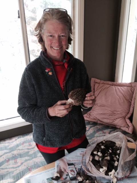
Wendy was really happy to find so many morels! 
This was round one last Saturday morning 

Morels are very distinctive looking, so easy to identify
Chris Florence foraging foraging for morels.
He's a professional who sells morels at Farmer's Markets
Hi all,

For me, it's often hit and miss as to whether I carve out enough time to go morel hunting in May. Timing is everything when it comes to morel hunting, and based on my experience last weekend, I can tell you that morel season is hitting prime time right now.

Looking ahead in the next 10 days, it's supposed to stay kind of wet and cool, which hopefully will prolong the morel hunting season even more.

Wendy and I decided we wanted to get away to our Cozy Cabin in McCall last weekend -- just to get a much-needed change of scenery -- but instead of morel hunting close to town, as we often do, we headed to the burn zone of the Teepee Springs fire, a 95,709-acre blaze that ran from New Meadows to the Salmon River last August.

It's well-known that morels, the fruiting body of the morchella species, love to bloom upon disturbance, particularly from wildfires. "They like areas of disturbance -- that's what causes them to bloom," says Chris Florence, a professional wild food forager whom I wrote about in "Idaho Microbes: How tiny single-celled creatures can harm, and save our world."

"Fires can destroy the root structure of the soil, depending on how hot it burns, and that's when the mycorrhizal layer puts all of its energy into kicking out as many spores as possible to survive," he says.

And from those spores, morels are born.

Teepee Springs fire zone
I checked with the New Meadows Ranger District, asking how best to access the fire zone, and they suggested the Hazard Creek Road. One also could try to access it from the French Creek Road or the Goose Lake Road after more snow melts. The great thing about Hazard is that they'd been logging in there all week, so it wasn't open to the public until the weekend. We were one of the first people in there.

Wendy and I picked around 20 pounds of morels all around burned tree stumps, burned holes in the ground and under burned alderbrush. Some of them were just growing in the fir needles on some moist east slopes.

How to find morels? 

Try to get some intel on what elevation are the morels sprouting? Last week, it seemed to be in the 4,500-5,000 foot range. That means you could go to that elevation above Idaho City, Garden Valley or Cascade in the Boise National Forest. As time goes on, morels will be popping in the Payette National Forest above 5,000 feet. If you see a trillium growing on the forest floor, that's an indication that you might be in the right elevation for morels.

The Clearwater Complex fire zone might be another great place to look for morels.

Forest type: Florence recommends forested areas with fir trees in cooler, moister areas. I've found that east slopes can be better than south and west slopes. Ponderosa pine areas don't seem very productive for morels, in my experience. Look around rotten stumps, old logs, things like that.

Stop and stare: I find that you really have to get low to the ground and look hard for morels. Once you find some, you'll find more. It takes a lot of patience to really go slow and stare at every square yard of soil, but patience and persistence will pay off.

Go with an experienced morel picker: It always helps to go with someone who has a favorite morel-picking spot(s). They can get you started.

How to cook? 

Once you've picked some morels, I recommend sauteing them with butter and garlic and serving on steak, burger, or mixing up a morel and swiss omelette. It's totally deluxe!

Here are some good tips on cleaning and cooking morels.

Have fun!
- SS

Thursday, May 12, 2016

Boise Bike Week is coming up! Tie into TVCA great biking events for One Sweet Ride!

Thanks to the Treasure Valley Cycling Alliance for sponsoring Boise Bike Week! 
Try to ride to work at least one day this week, or all 5 days! 
Go for a co-ed mountain bike ride with the Dirt Dolls on Monday ... 
People might dress up for the Pedal Power parade, much like they do for
the Fat Tire Festival in Boise in August!
Who knows? You might see costume-clad riders on the fun rides! 
Get your kids out for a ride! This is my son Quinn when
he was 7 or 8 years old by the Hulls ponds. 
Larger three-wheeler bikes are becoming more popular ...
This model works great for my son Drew. Check out a
demonstration about adaptive bikes on May 21st. 
Hi all,

It's the month of May, and that means it's time to get on your bike and tie into the many fun biking events coming up during Boise Bike Week, coming up on Monday, May 16 and running through Saturday, May 21! Their theme is "One sweet ride."

Many thanks to the Treasure Valley Cycling Alliance and many other pro-bike organizations and businesses in Boise for dishing up a great list of events! You can find the full calendar of events on the TVCA web site.

Boise Bike Week is a time to promote biking in our community. It's also a time when there's so much going on it creates an incentive for you to get off the couch and:

  • Ride to work as many days as possible that week. Get your bike lock set up handy, get ready for work a little earlier than normal, and enjoy the commute to work in the fresh air.  
  • Tie into free mountain bike rides or road rides to try these activities perhaps for the first time, meet new people, and enjoy some beers afterwards. 
  • Learn about bike safety for kids and adults from the pros. It's vital to know how to navigate the streets safely or get tips on how to ride a mountain bike safely in the hills to avoid injuries or worse. 
  • Getting kids more involved in cycling
  • Participate in a bike parade! That's always a hoot, especially when people dress up. 
  • Learn more about finding the right bicycle for you and your kids. 

Some highlights for you and your friends to plug into the fun:

  • Dirt Dolls co-ed mountain bike ride, Monday, 5:45 p.m., Camelsback Park. All abilities welcome. Go for an hour-long ride and hit the beer party, a kickoff for Boise Bike Week, at Highlands Hollow. The party runs from 6-9 p.m. 
  • Intro to Road Biking ride led by Community Bicycle Rides, 6-8 p.m. Tuesday. Meet at Eastside Cycles in Bown Crossing. Several places to eat and drink afterwards in Bown Crossing. 
  • Wandering Wheels Picnic and Gear Swap, Tuesday, 6-7 p.m. Bring a picnic dinner to Catalpa Park in NW Boise and learn about how cyclists pack their bikes for different kinds of rides and tours. 
  • Ride of Silence, 5:45 p.m. Wednesday, to honor those we've lost in our community from vehicle-bicycle accidents. There have been WAY too many of these accidents in our community. More awareness and publicity about safe cycling and safe driving is essential. Ride starts at Camelsback. 
  • Three riding clinics on Wednesday - Youth starts at Fort Boise at 4:30 p.m.; Ladies only road and mountain bike rides will be led by George's on 3rd Street at 6 p.m.; SWIMBA beginning mountain bike clinic starting in Military Reserve by Fort Boise. 
  • National Bike to Work Day breakfast at the Boise Co-op, Friday, 7-9 a.m. Free coffee and danishes for bike commuters! 
  • Adaptive Bike Fair, Saturday, 10 a.m.- 3 p.m., Fort Boise - Try out all kinds of different bikes at the fair, including upright and recumbent hand cycles, trikes, recumbent trikes, tandem bikes and trikes. I just bought my autistic son, Drew, a three-wheeler in April. I wish I had gotten it sooner! He does great on it!
  • Pedal Power Parade to Grand Finale party at Payette Brewing, 6-10 p.m. Saturday at the new location, 733 S. Pioneer Street. Meet at the State Capital at 4:30-4:45. Ride starts at 5 p.m. The parade will follow a three-mile loop and then end up at Payette Brewing. 
I enjoyed outdoor writer Chadd Cripe's article in the Statesman this week about the different kinds of bikes one could choose from these days -- from trikes to recumbents, from cruisers to electric bikes, fat bikes, mountain bikes and road bikes! 

Another thing you might do for Boise Bike Week, if you're an experienced rider, is get out on your road bike or mountain bike and enjoy a nice long recreation ride. Put in some miles! It's good for building up your fitness and endurance, and it's good for your soul!  

If you're looking for ideas on where to ride, consider my Boise Road Cycling Guide, for 30 road rides throughout the Boise Valley, and Mountain Biking in Boise, 65 rides in the local area (available in ebook only right now; new version coming soon.)

Have fun!
- SS