Showing posts with label Mark Lisk. Show all posts

Thursday, May 1, 2014

Here are three off-the-beaten-trail spring camping tips in the Owyhee Canyonlands

The Owyhee Uplands Backcountry Byway can be fun for mountain biking, too ...
Photo courtesy Tad Jones 
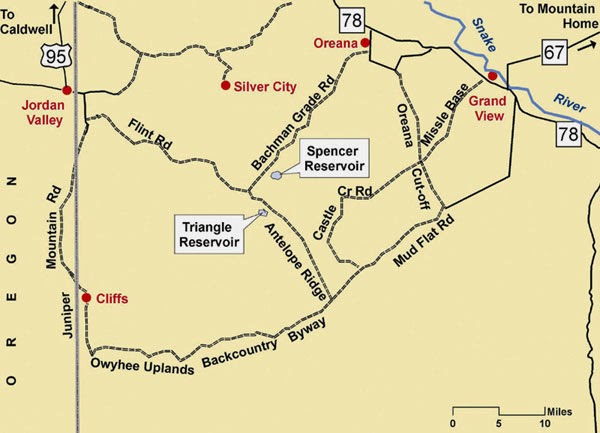
Big picture map of the byway
Toy Pass and vicinity ... Silver City is by the snow-packed mountains 
Wendy rides the wind currents on top of the mountains near Toy Pass 
Steve near the mouth of Mary's Creek 
Mary's Creek confluence in Sheep Creek 
You should see wildflowers this weekend ... Bring your plant guide! 
Hi all,

Well, the weather looks positively fabulous this weekend, so a lot of people have been asking me for some good ideas about spring camping in the Owyhees. First, you need to pick up our Owyhee Canyonlands guidebook for the most in-depth information. But here in my outdoor tip of the week, I'll share three ideas from the book that are family friendly and pretty easy to find.

In today's Idaho Statesman, the IdahoOutdoors team highlighted some excellent scenic drives, hiking and camping destinations in the Owyhees, including Leslie Gulch, Succor Creek State Park, and Jordan Craters. The only issue is those places will be pretty popular and busy this weekend, so you might want to try something that's a little more off the beaten path.

Here are three that aim to please:
1. Drive the Owyhee Uplands Backcountry Byway and find your own custom spot to make camp. I recommend starting on the byway by Grand View, (Gus's gas stop has copies of our Owyhee Canyonlands guidebook), and driving south into the Owyhees to the top of the first summit. Turn left on the dirt road heading over to Little Jack's Creek, and find a cool spot to camp and hike. Be sure to take a BLM map with you so you can navigate the dirt roads. The backcountry byway has many other options for camping such as the Antelope Springs Road, Deep Creek junction, Nickel Creek Table and the North Fork of the Owyhee BLM campsite, the only developed campsite on the 100-mile byway. The byway is suitable for 2WD vehicles. Side roads may require 4WD.

2. Toy Pass - We've got 2 hikes from the Owyhee Canyonlands guidebook that start and finish at Toy Pass. This spot is at 5,875-foot elevation, south of Oreana. You drive to Toy Pass, do a day hike from the pass to the mountains on either side of the road, and then go look for a campsite afterwards. There's a sweet campsite in a pullout on the south side of Toy Pass, and there are other places to camp on the road farther south toward Triangle on BLM land. Again, bring a BLM map with you to navigate the roads. To reach Toy Pass, take ID 78 east from Walters Ferry, south of Nampa, go past Murphy and watch for a road sign for Oreana. Turn right and drive 2 miles into the tiny town. Bear right at Our Lady, Queen of Heaven Catholic Church at the corner, and take the Bachman Grade Road to Toy Pass. It's about 13.5 miles to the top. This road is suitable for 2WD vehicles. Side roads may require 4WD.

3. Mary's Creek/Sheep Creek Wilderness. Mary's Creek is an easy-to-access tributary of Sheep Creek Canyon, which is one of the BLM wilderness areas in the Owyhee Canyonlands. There is a self-support camping area at the "trailhead" next to Roland Road. You could camp there, and then do the Mary's Creek Loop, hiking into the bottom of spectacular Sheep Creek Canyon, and then hike back. You also could backpack into Sheep Creek Canyon and camp there. The full loop detailed in our guidebook is 8.75 miles, with 1,400 feet of vertical gain/loss. Scenic hike and nice spot to camp. To reach Mary's Creek, take ID 51 south of Bruneau about 40 miles to a signed turnoff for the Rowland Road by the old bar and junk yard at Grasmere. Turn left on Rowland Road and follow that 5.2 miles to the Mary's Creek trailhead. There's a BLM kiosk at the trailhead.

Watch for wildflowers while you're out there ... and bring a plant guide to help with identification. Here's one guide that I highly recommend -- the Backpack Guide to Idaho Range Plants.

There you have it! Enjoy the sunshine no matter what you do!
-SS

Thursday, March 20, 2014

Spring has sprung in the Owyhees! Exploring Sage Creek a good bet for the weekend

Our kids mess around in the rocks above the draw ... 
Hiking into Sage Creek from the trailhead.
One of many caves you'll see in there.
Balanced-rock features are everywhere in the middle of the canyon.
Hi all,

The slighter warmer, spring-like weather has been excellent for hiking, running and biking in the Boise Foothills. People are loving it, and they're out there in big numbers! And for good reason, spring is a perfect time to get out hiking, biking and running! March-June also is the perfect window of opportunity to explore the Owyhee Canyonlands before it gets blazing hot in July and the rattlesnakes emerge.

This week, I'd like to feature a couple of cool hikes in the Owyhees in the Sage Creek area, near Succor Creek State Park. Sage Creek is featured in our new guidebook, the Owyhee Canyonlands: An Outdoor Adventure Guide. It's a low-elevation destination, with tons of unusual and colorful volcanic rock and ash formations, and it's a kid-friendly and family friendly hike.

This is what I said in the book: "Sage Creek is a hidden jewel chock full of spectacular volcanic rock and ash formations in the creek-bottom and on the mountainsides as you hike along the creek ... One of the key highlights in Sage Creek is that you'll encounter multiple balanced rock features, some of them obvious phallic-type symbols, as well as spires, cliffs, fins and caves."
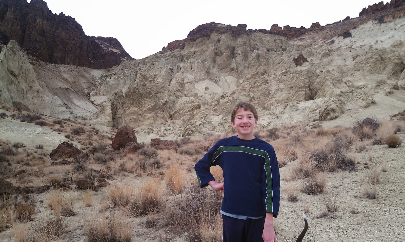
My son, Drew, loved the hike. 
Our guide features a 2.5-mile exploration out-and-back hike, cruising up the bottom of Sage Creek (rated easy for all abilities), and a 6-mile hike up to the top of McIntyre Ridge from Sage Creek (rated moderate to strenuous), with nearly 2,000 feet of climbing. Both of them are great!

How to get thereTake I-84 to the ID 55 exit in Nampa, heading west toward Marsing. Go west on ID 55 and  and Turn right on Chicken Dinner Road, then left on Homedale Road, and go to Homedale. Follow State Highway 19 west of Homedale, and then Highway 201 in Oregon, to a signed turnoff for Succor Creek State Park on the left. Head south on the dirt road. It's 12.1 miles to the unsigned right-hand turnoff  for the Sage Creek Trailhead. There is a lone scrubby cottonwood tree at the turnoff. Follow the primitive two-track road over several creek-crossings to the trailhead .9 miles from the Succor Creek Road.   
Nice rhyolite cliffs with Wendy in the foreground. 
Road access challenge: 4WD high-clearance vehicle is required to reach the trailhead; multiple creek crossings are involved. It's possible, however, to take a 2WD vehicle to the Sage Creek road junction, and hike from there. Add .9 miles to the trip if you start from Succor Creek Road. 

Hike #1 - 2.5-miles out and back
Cruise up the creek-bottom of Sage Creek, picking your way up the draw as you like. Hike at least a mile upstream to see the balanced rock features on the mountainsides above the draw as well as many other interesting rock formations. The volcanic ash flows in the area have turned different shades of white, orange and green over time. These formations are very erosive ... you can scratch the ash with your fingernails. Wear shoes that can get wet ... I doubt there's much water in the creek-bottom, but you will encounter some pools along the way.   
Hiking down-canyon back to the trailhead.
Hike #2 - 6-mile loop
From the end of the road, hike up-canyon and cross the creek to the left side. At mile .2, climb up the left-hand draw. It's a super-cool hike through many rock formations as you ascend the draw. It's about 2 miles to the top of the saddle near McIntyre Ridge. Climb to the top of McIntyre Ridge if you'd like. This area overlooks Succor Creek State Park to the east and Three Fingers Rock and many other features to the west. On the way down, descend the ridge to the left of the draw you climbed up, and enjoy a cool hike down into the draw. You'll pass by the "official" balanced rock on your way into the draw. Turn right at the bottom of the draw, and hike back to the trailhead.

Family pic in Sage Creek. November 2012. Kind of rare to get our 4 kids together for a family hike!
L-R, Drew, Tom with our pointer Huck, Wendy, Elena, Quinn, Steve 
Camping notes: You could camp in the bottom of Sage Creek. Quiet spot. Self-support camping. You also could camp at Succor Creek State Park, which has a public rest room, very close by, but that will be much more crowded. If you'd like to explore some other areas, Succor Creek Road connects to Leslie Gulch, Three Fingers Rock and many other areas worth checking out in our guidebook. 

If you're looking for ideas about what to do over Spring Break next week, check out my blog from last year with many ideas for recreation and camping close to home

Have fun! 
-SS   

Thursday, September 26, 2013

Owyhee Canyonlands Outdoor Adventure guide; McCall Fat Tire Fest; Nat'l Public Lands Day

Browns Creek canyon, Owyhee Front 

We hiked Browns Creek last year when Huck was 8 weeks old ... 
Fetching views at Succor Creek State Park with Steve and Drew 
Hi all,

In case you haven't seen our Kickstarter.com campaign on twitter or Facebook, fine arts photographer Mark Lisk and I are collaborating on a new guidebook for the Owyhee Canyonlands. The book will be titled, The Owyhee Canyonlands - An Outdoor Adventure Guide. We are expecting it to be ready for Christmas sales in late November.

We launched the Kickstarter campaign about 10 days ago, and we've already reached our minimum goal of $6,500 to cover printing and production costs. Woo-hoo! But the campaign still will run for another 19 days, so this is a chance for folks to capture some sweet deals in terms of buying an autographed copy of the hard-copy guide, buying several autographed books for Christmas gifts, getting a combination of an autographed book plus a Mark Lisk 2013 calendar, or an autographed book and a Mark Lisk photo print of your choice.

We have a whole bunch of options if you'd like to check it out at the Kickstarter site. We have a video that explains how the book project came together along with details about the guidebook. We'll have 55 hikes and mountain bike rides in the book, and as our loyal and faithful followers know, I've been providing sneak previews of a number of these hikes and bike rides in my blog over the last couple years. (see below)

The Owyhee Canyonlands are a real treasure here in SW Idaho. There are many hidden slot canyons to explore, super-scenic mountain bike rides you've never ridden before, a few hot springs worthy of visiting, and a whole bunch of trips in the new Owyhee Wilderness areas. The scope of our guide spans from the closest Owyhee Wilderness areas in Big and Little Jacks Creek near Grand View, to the Jarbidge/Bruneau/Sheep Creek canyons south of Bruneau, to many hidden jewels in terms of slot canyons in the Owyhee Front between Grand View and Marsing, to the spectacular Southern Utah-like rock formations of the Leslie Gulch area.

Here are the links to those sneak-peek trips, if you'd like to head out for a desert hike/bike ride this weekend. The cool weather will be perfect! This will give you a taste of what to expect in the guide. Nine-tenths of the challenge in the Owyhees is to learn how to get there, have a sturdy, dependable rig to take you there, and navigate a big wide open area with very few signs or no signs, and no services. Map-reading skills are important!


-----------------------------------

Given the weather in the last few days, it's almost feeling like winter, but it's going to warm up a bit this weekend, so it should be perfect fall weather for mountain biking in McCall. The Central Idaho Mountain Biking Association (CIMBA) and local retailers are hosting the first-ever Fat Tire Festival in McCall, beginning Friday night and going through Sunday.

Here's the calendar of events for the busy weekend. If you've been wanting to learn more about the mountain bike trails in the McCall area, this is a perfect opportunity to do so with local ride leaders. Organizers have laid out a great slate of group bike rides for the weekend, geared to different ability and experience levels.

On Saturday, there's a women's beginner "Zen Ride" going on at the very family friendly Bear Basin Trail network near McCall, rides at Jug Mountain Ranch, Payette Rim Trail, Elk Trail at Brundage and more. From 4-9:30 p.m. that day, there will be a beer garden party at Depot Park downtown, dinner and live music. Perfect way to round out the day.

On Sunday, there will be more guided rides including the fun and challenging the Goose Creek Trail, East Fork of Lake Fork and Bear Basin.

In case you're thirsting for more rides, my guidebook, Mountain Biking in McCall, will keep you busy with 40+ rides to explore in the Valley County area, including all the rides mentioned above.
---------------------------------------
It's the 20th anniversary of National Public Lands Day
Saturday is also the 20th anniversary of National Public Lands Day. The Bureau of Land Management is hosting two volunteer projects -- one in the Morley Nelson Snake River Birds of Prey National Conservation Area, south of Kuna, and another in the Little Jacks Creek Wilderness, southeast of Grand View.

The birds of prey project will involve planting shrubs and perennial grasses below Swan Falls Dam. If you'd like to participate, meet at the picnic area by the dam at 9 a.m. Saturday morning. Bring a lunch, wear sturdy shoes and bring gloves. The work day will be over around 1-2 p.m. Contact Barb Forderhase at the BLM for more information, 384-3485.

The Little Jacks project will involve taking down some barbed-wire fence and building a new trail in the Shoofly Creek area. Volunteers should meet at the Poison Creek picnic area, on the right side of Mud Flat Road, or the Owyhee Backcountry Byway, south of Grand View, at 8:45 a.m. It's a full-day project, with horseback support for hauling trail-building materials. Free T-shirts for volunteers! Contact Dave Draheim at the BLM for more information, 384-3358.

Every Friday morning, I talk about my outdoor tip of the week on 94.9 FM with Ken Bass and Misty Taylor. Up to now, the segments have been airing at 7:10 a.m. This week, they'll move to about 7:40 a.m. Just a head's up! See River Interactive for more details and audio of previous shows.    

Have fun!
- SS