Showing posts with label Fall hiking. Show all posts

Thursday, October 25, 2018

Hike the Sawpit Mountain Loop in Silver City - perfect fall adventure before the snow flies!

Wendy enjoys the fall colors on the Silver City hike.  

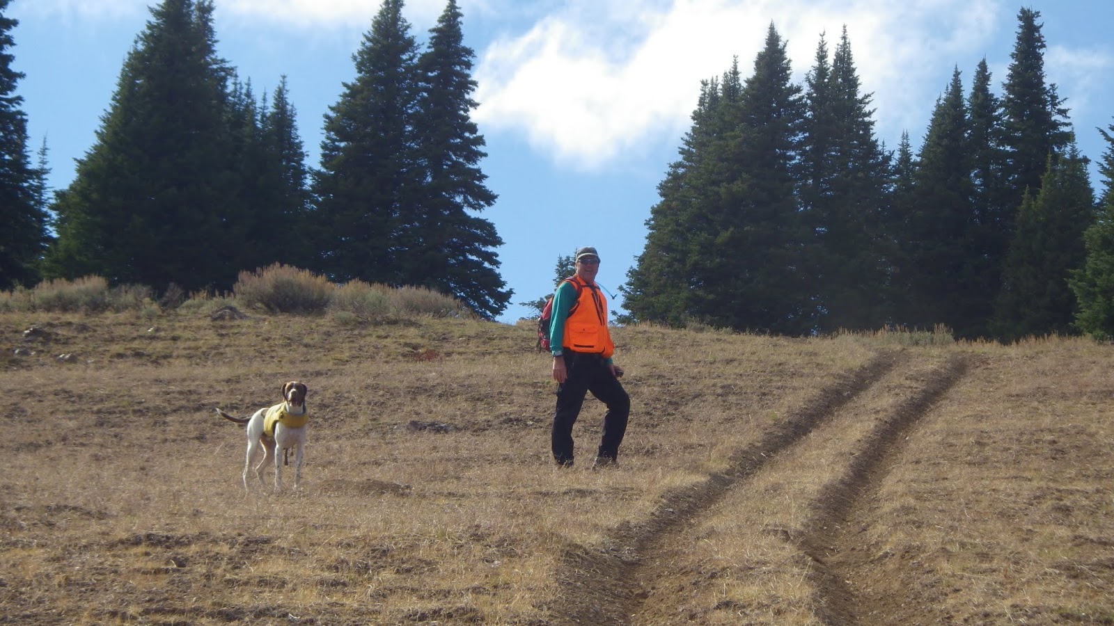
We all wore bright colors because we did the hike during deer hunting season. 

Feeling good at the top of the hike, with big views all around. 

Sawpit Mountain is off to the right. We are beginning our descent from the high ridge back to Silver City on a jeep trail. 

A glimpse of Silver City dwellings ... very charming place.  
Hi all,

The weather looks perfect this weekend for hiking in Silver City, a quaint "ghost" town in the Owyhee Mountains. Temperatures Saturday are supposed to be in the mid-60s in Murphy, and 70 on Sunday. Sweet!

I wrote up one of my favorite hikes in my Owyhee Canyonlands hiking/biking guide called the Sawpit Mountain Loop for the Idaho Press Outdoors section this week. It's great to be writing for the Idaho Press Outdoors in addition to the Statesman Outdoors, Lewiston Tribune Outdoors and Spokesman-Review Outdoors.

Click on this link to read all about the Sawpit Mountain Loop, including blow-by-blow hiking directions and driving directions to Silver City. It's an 8-5-mile loop that circumnavigates a timbered mountain with a bald pointy cap that looms over Silver City in the high-elevation community in the Owyhees. It's rated moderate to strenuous. Be sure to bring plenty of water, a lunch and snacks for your day hike. Fall colors should be glowing.

Enjoy!
- SS

Thursday, November 30, 2017

Three kid-friendly pre-winter hikes - Browns Canyon, Eagle Island Park, Polecat Gulch

Browns Canyon in the winter sun ... not much light in the canyon! 
We took Huck to Browns Canyon when he was a puppy
Drew did great on the Browns Canyon hike 
Redrock canyon, sagebrush and aspens 
Hmmm, where do we go now? 
Hiking the two-track back to the trailhead out in the open Owyhee country
Hi all,

These semi-cloudy cold days with temperatures in the low 40s don't seem all that appealing for outdoor recreation -- at least on the surface. But actually, once you get moving on a hike, a run or a bike ride, you'll warm up inside and enjoy your outing.

It is important to dress properly in layers and bring a warm hat and gloves/mittens so you stay comfortable, and peel layers as necessary as you warm up inside.

For this week's outdoor tip, I'm recommending three kid-friendly hikes -- Brown's Canyon in the Owyhees, Eagle Island State Park and Polecat Gulch in the Boise Foothills. Get the kids dressed up in appropriate clothes and take them out to explore the great outdoors in SW Idaho. Pack a lunch, snacks and bring plenty of water.

Remember that there's a "Cold Moon," a full moon that's supposed to appear 10%+ larger than normal this weekend, peaking on Saturday night/Sunday morning. It's supposed to appear as a full moon three days in a row -- Friday, Saturday and Sunday. That'll be a treat or maybe the coyotes will make too much noise and keep you up all night ...

For these outings, try to get out on Friday or Saturday morning. That's when the weather will be best. There's a 50 percent chance of rain on Saturday afternoon and Sunday in the valley. Just FYI. Most of these trips would be doable with a good rain coat.

1. Brown's Canyon Overland Tour, Owyhee Front, near Oreana. Distance: 5.2 miles. Difficulty: Moderate. Travel time: 3+ hours. This is an interesting hike in the sagebrush and rocks of the Owyhee Front until you come across Brown's Canyon, a hidden jewel. In my Owyhee Canyonlands guidebook, I detail a hike inside the slot canyons of Brown's Canyon, and a hike that goes around the slot canyon (thereby avoiding cold, deep-water pools) but you can still see it from above.

How to get there: Take I-84 East to Simco Road. Turn south on the highway to Grand View. Turn right on Idaho 78 in Grandview and head for the tiny old town of Oreana. There's a sign on the highway for a left-hand turn into town near MP 43. Make a note of your odometer. Drive down the hill straight into town, go past the old church (2.25 miles from the highway) and go straight on the Oreana Loop Road until it takes a hard left. Make the corner and take an immediate right on Alder Creek Road. Follow the bumpy dirt road six miles to a signed right-hand turnoff for BLM Road 700. Proceed down the grade to an old corral at a two-way junction. Park. The hike starts here.

The Hike: Go west on BLM Road 700 and climb a moderate grade over to a bluff that overlooks Browns Canyon. At mile 1.4, bear right on a two-track and drop down to the Browns Creek draw. This is a pretty area that's full of shrubs and aspens. The first slot canyon with blondish rock begins at mile 1.7. Cross over to the left side of the draw, as you go downstream, and walk overland through the blond rocks staying above the canyon. You'll break out into an open sage flat at mile 2.0. When the next slot canyon begins, climb up the slope to the left until you reach the top of the rim, and then hike along the rim as close as you feel comfortable to check out the slot canyon as you move along. In a half mile, the canyon breaks open by a draw, and you'll need to lose elevation. Hike into the bottom of the gully and climb back on top of the rim. There's a nice overlook when you reach the top again at mile 3. Continue on the left side of the canyon until you come to the dirt road crossing, and then turn right onto the dirt road at mile 3.6.  Follow the road to mile 4.0 at a two-way junction. Turn right again at a fence gate, and follow the two-track road (BLM Road #710)  back to the trailhead. Feel free to explore Antelope Springs along the way. It's another tight canyon.  

2. Eagle Island State Park - There's a nice 5-mile hike in the park that I detailed in Boise Trail Guide: 90 Hiking and Running Routes Close to Home. This particular hike tours both channels of the Boise River while also cruising around the outskirts of the park. You could easily do a shorter route in the park by just touring the North Channel of the Boise River. Start from the parking area by the pond and circumnavigate the park. I did the hike in a counter-clockwise direction. See the GPS tracks on the map below.


Getting there: Take State Street west of Eagle Road to a signed turnoff for Eagle Island State Park. There is a park entrance fee unless you have a statewide season pass via your vehicle registration. I always buy that pass ... it's a real bargain!

3. Polecat Gulch - Hike a 3-mile loop around Polecat Gulch in the NW Foothills of Boise. The loop takes about 1.5 hours, depending on walking speed. The hike described takes you on a tour of the finger ridges on the Polecat Loop Trail in sage and grassland habitat. You might see mule deer on this hike or even the albino deer! I rate this hike easy to moderate. Trailhead is at the north end of N. Collister, off of Hill Road. Go north on Collister to the trailhead parking area and rest room at the end of the road.

Hike up the main Polecat trail up the bottom of the draw to Quick Draw Trail, climb Quick Draw to the Doe Ridge trail. Go to the top of Doe Ridge (enjoy the views of NW Boise) and follow that trail over to the north side of the Polecat Trail complex. Turn right on to the Polecat Loop trail above the Cartwright Road trailhead and follow the loop trail along a steep hillside above the Terteling Ranch and Cartwright Road. Follow the trail as it wraps around the mountain and then drops back to the Quick Draw-Polecat junction. Go left or down-canyon on the Polecat Trail to return to the trailhead.

Have a great weekend! - SS

Thursday, October 22, 2015

Try these five scenic, kid-friendly fall hikes in the Boise National Forest close to home

Peace Rock Roadless Area, north of Garden Valley

Peace Rock Trailhead. The trail also is open to mountain biking and motorcycles. 
Cottonwood Creek Trail in the higher elevations ... 
Wendy on Station Creek Trail 
Bald Mountain, optional high point from the Station Creek Trail. Well worth it! 
Hi all,

The weather looks fabulous for just about anything outdoors this weekend, with highs in the mid-60s and lows around 40 in the Garden Valley or Idaho City areas, so I am recommending five scenic hikes in the Boise National Forest that you'll enjoy.

Remember that rifle deer season is still open in the Garden Valley and Idaho City areas, so wear bright colors and put bright colors on your dogs as well.

My top five hikes for this weekend:

1. Peace Creek Trail, Peace Creek Roadless Area, north of Crouch - This is a little-known gem near the Silver Creek Plunge. The Boise National Forest has a little blurb and map on the hike. I'd rate the hike moderate at the beginning and strenuous overall. It's five miles from the trailhead to a high point, and five miles back for a total of 10 miles. Vertical gain is over 3,000 feet to the top. Peace Rock Roadless Area is a wilderness study area. It's very scenic with big white granite slopes and rocks everywhere, mixed with big ol' ponderosa pine trees and aspens. Great place to go if you don't run into hunters. Getting there: Take Idaho 55 to Banks. Turn right and go to Garden Valley. Take Forest Road #698 north of Crouch along the Middle Fork Payette River to a junction with Forest Road #671, heading for Silver Creek Plunge, a hot springs resort. Go just past the resort, and you'll see the trailhead for Peace Creek. Take a Boise National Forest map or a Topo map with you. It used to be possible to hike from the high point in this hike back down to the Peace Creek Valley but that trail has fallen off the grid. So it's an out-and-back hike. Pack a lunch and bring plenty of water. Good for kids 8 and older. Stop at Silver Creek Plunge for a nice soak after your hike. Bring your swim suits.
Trip map for Peace Creek hike (Click to enlarge)

2. Cottonwood Creek, near Arrowrock Reservoir - This hike is in my book, Boise Trail Guide: 90 Hiking and Running  Routes Close to Home. Rated moderate for a casual out-and-back hike along Cottonwood Creek. It's 10 miles one-way to Thorn Butte Lookout on the Cottonwood Creek Trail, so it's generally too far to hike for a day trip, so just head up the Cottonwood Creek trail as far as you want and enjoy the day. Bring a lunch and water. Getting there: Take Idaho 21 toward Lucky Peak Reservoir. Turn right after crossing the Mores Creek bridge. Drive 15 miles along the bumpy dirt road next to Lucky Peak and Arrowrock. Turn left on Forest Road #377 and go three miles to the Cottonwood Creek Trailhead on the right. FYI: The trail crosses the creek multiple times on the hike, so be ready for that. The creek is running low, so the crossings shouldn't be a problem. Feel free to take the kids on this one.

3. Station Creek Trail - This is another one of my favorites, close to Garden Valley. See previous blog post for details. Rated moderate. The trailhead is directly across the Banks-to-Lowman Road from the Garden Valley Ranger Station. There's an optional climb to the top of Bald Mountain when you get to the top of the first ridge. It's worth the extra distance. The hike is kid-friendly for children 8 and over.
Map for Charcoal Gulch Trail ... The loop
is best done for biking or running. Best part
of the hike is in Charcoal Gulch. 
4. Hike Charcoal Gulch Trail in Idaho City. This one is pretty close to town next to the Idaho City airport, so hopefully you won't run into any hunters on this hike. You might see some road hunters at the top of the hike. Rated easy to moderate. Kid-friendly. Its two miles uphill on the Charcoal Gulch Trail to the top of the hike, and two miles back. Four miles total. You'll hike in a forested setting with views of quaking aspens here and there. Bring a lunch and enjoy the day. Getting there: Take Idaho 21 to Idaho City. Turn left on Main Street and follow it several blocks to a junction with Bear Run Road and Centerville Road. Go left on the Centerville Road, Forest Road #307, for a quarter-mile to Buena Vista Road. Turn left and follow Buena Vista past the airstrip to the parking and trailhead.
It's possible to bike to Stargaze as well but it's pretty steep! 
Brenda and Leo on the deck of Stargaze Yurt. Great 360 degree views! 
5. Hike to Stargaze Yurt - Here's an easy to moderate kid-friendly hike with great views of the surrounding countryside. You'll take Idaho 21 past Idaho City and Mores Creek Summit to Beaver Creek Summit. Park at the summit and follow the Park n' Ski Trail up to Stargaze Yurt and a high point overlooking the Boise National Forest. It's 1.4 miles to the yurt from the road. You'll be hiking in a forested setting with pockets of quaking aspen trees here and there. Bring a lunch and enjoy the day. If you've never stayed at Stargaze, you'll know why it's one of everyone's favorite yurts because of the high perch and good skiing in the winter.

You'll note that I did not recommend hiking from Mores Creek Summit because it's likely that deer hunters will be ever-present on the Pilot Peak Road or Sunset Lookout Road. Ditto with Banner Ridge trails.

Have fun!
-- SS